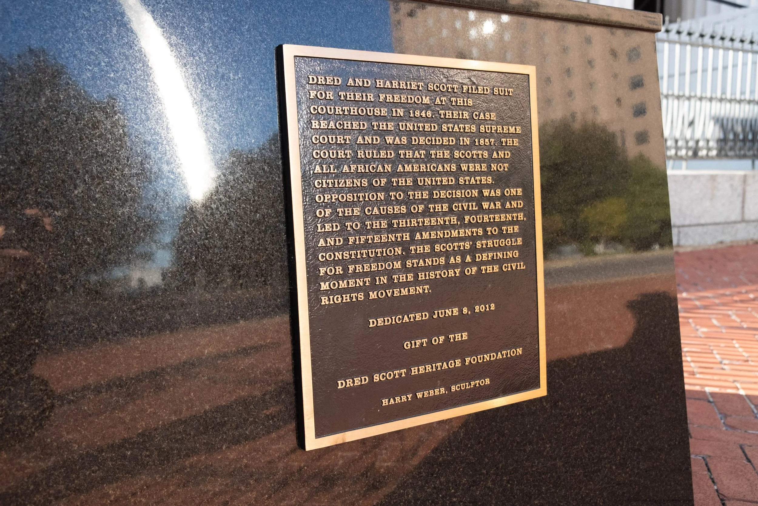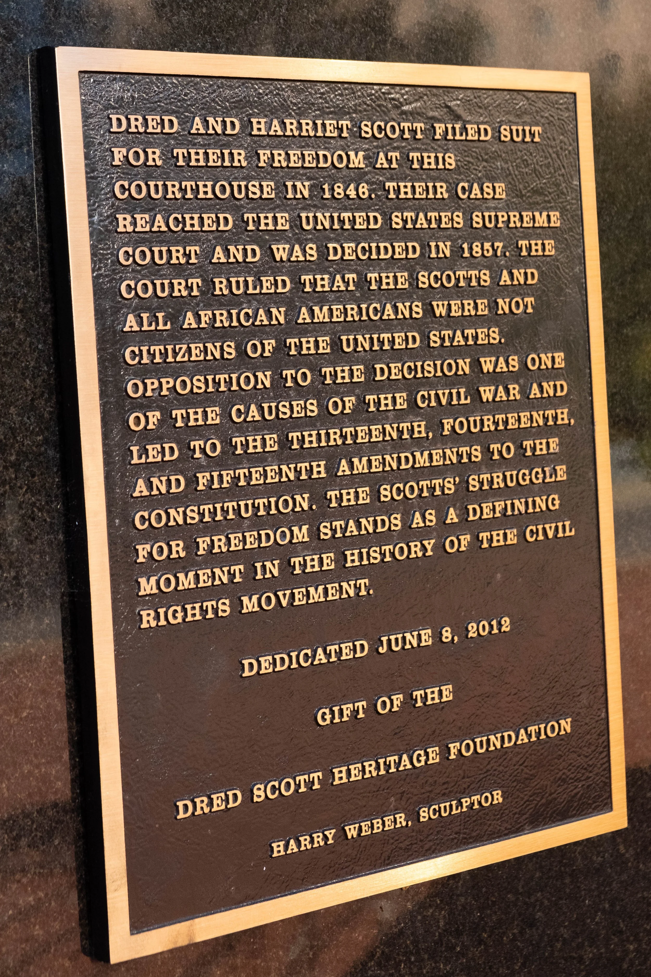
National Parks
When we were dating, we set the lofty goal of visiting all 63 U.S. National Parks.
Today, we’re married, we have a dog, and we’re at 39 parks (and counting).
The catalogue below doesn’t just remind us of the landscapes we’ve had the privilege to explore — showcasing so much breathtaking beauty and diversity — but also of the ways we’ve changed, grown, and evolved throughout the years.
National Parks are one of those things we hold with a great deal of tension. While they have held some of our dearest memories and favorite adventures, they are simultaneously impossible to disentangle from the legacy of violence, colonization, broken treaties, and land theft that led to the establishment of the United States as it is now understood. They can be places where the story of this country is told with honesty or is erased, as we’ve seen with recent actions to remove NPS signs and educational features, many of which discuss the enslavement of Black people; Indigenous sovereignty; LGBTQ+ rights and history; climate change; and the long struggle for equality and justice in this country.
Visiting these places is a political act. We strive to overtly recognize the political aspect of each park and visit the land and the waters with a sense of reverence, awareness, respect, and learning. We use these trips to educate ourselves on the history of each place from perspectives outside those either promoted or removed by the National Park Service (although we’ve been witness to some pretty cool partnerships between NPS and Tribal Nations in several parks that made their mark on us).
This is not and never will be enough to make up for the destructive practices that led to the creation and maintenance of these parks in the first place. And yet still: Our hope is that experiential education via embodied interaction with these spaces is the first step toward reinventing the way we view them, telling more truthful (hi)stories, listening to and following Indigenous leadership and ways of knowing, and forging pathways toward restoring public lands into the stewardship of Indigenous peoples.
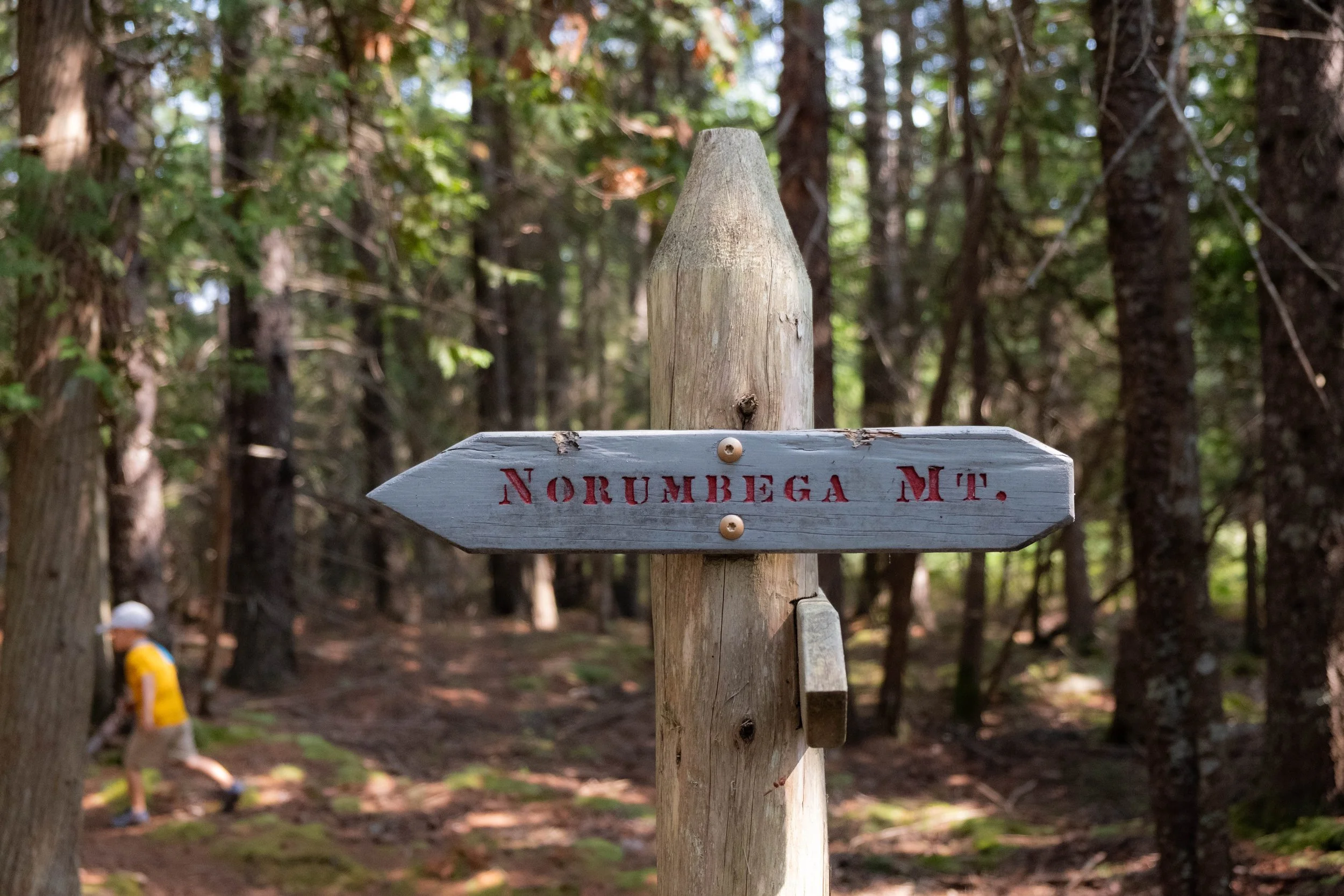
Start Here: Where We’ve Been
On the main National Parks page, I opted to arrange (most of) the posts in ascending order from when we first visited them: Starting with Arches National Park from our first trip together in 2017 and moving forward from there. It’s gotten a little tricky to stick with this as we’ve now visited several parks more than once, but I’ve generally maintained that chronological framework. While I love that arrangement, it’s also fun to list all 63 parks in alphabetical order, resulting in a high-level visual showcasing which spots we’ve visited already and which remain to be seen — essentially, a personalized NPS bingo card.
If a square below is a grey box with no active link, it means we haven’t made it there yet. All other images are linked to the corresponding post about that park.


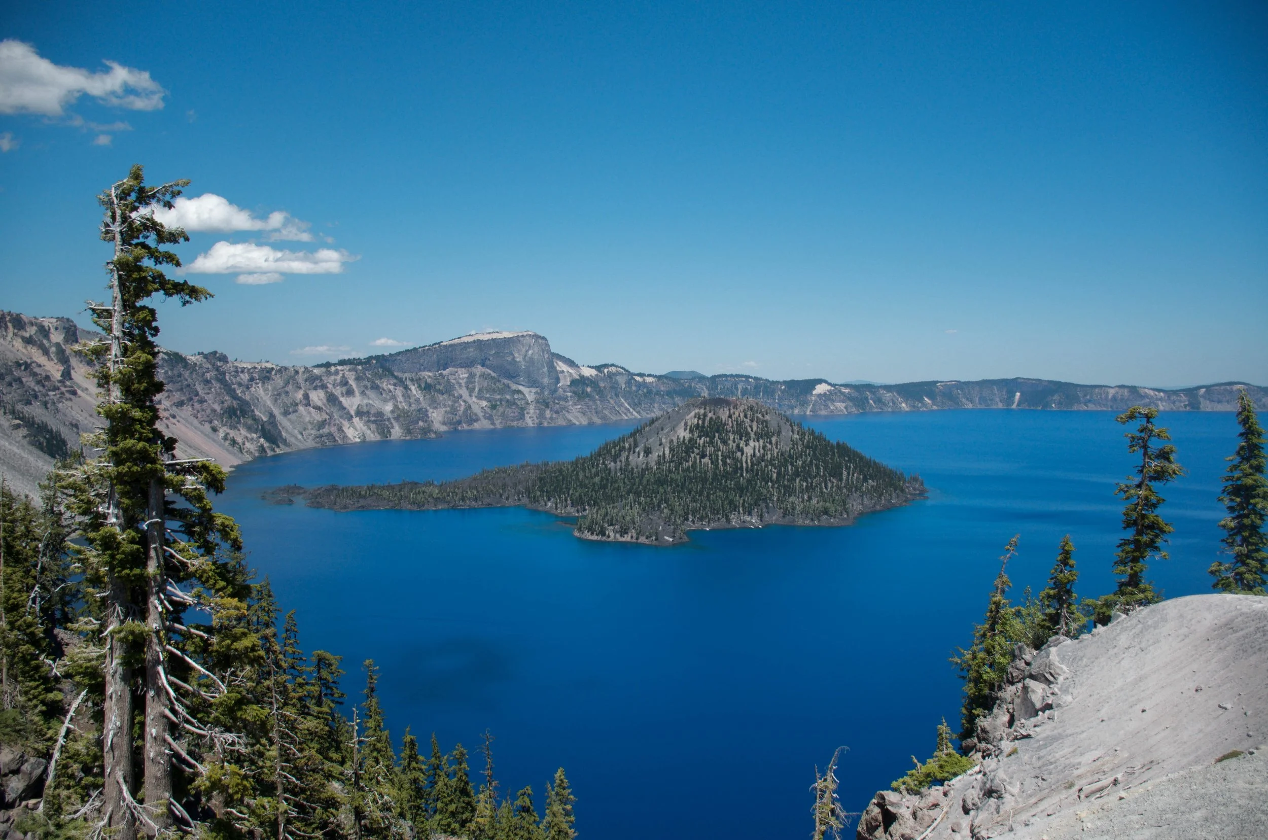

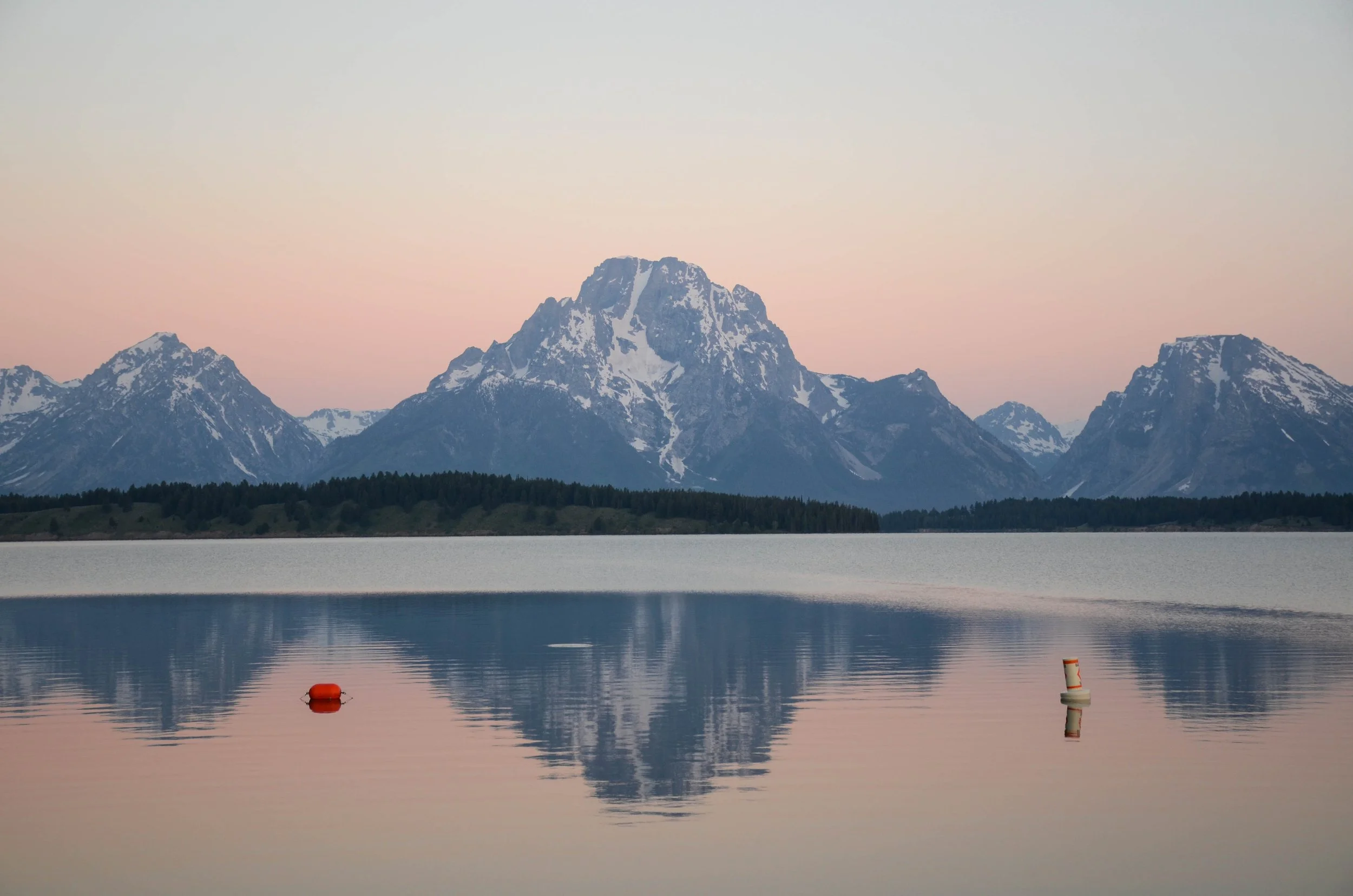
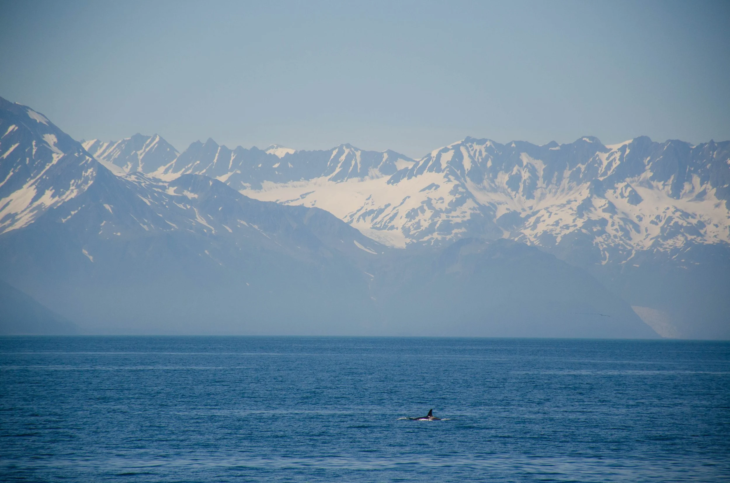
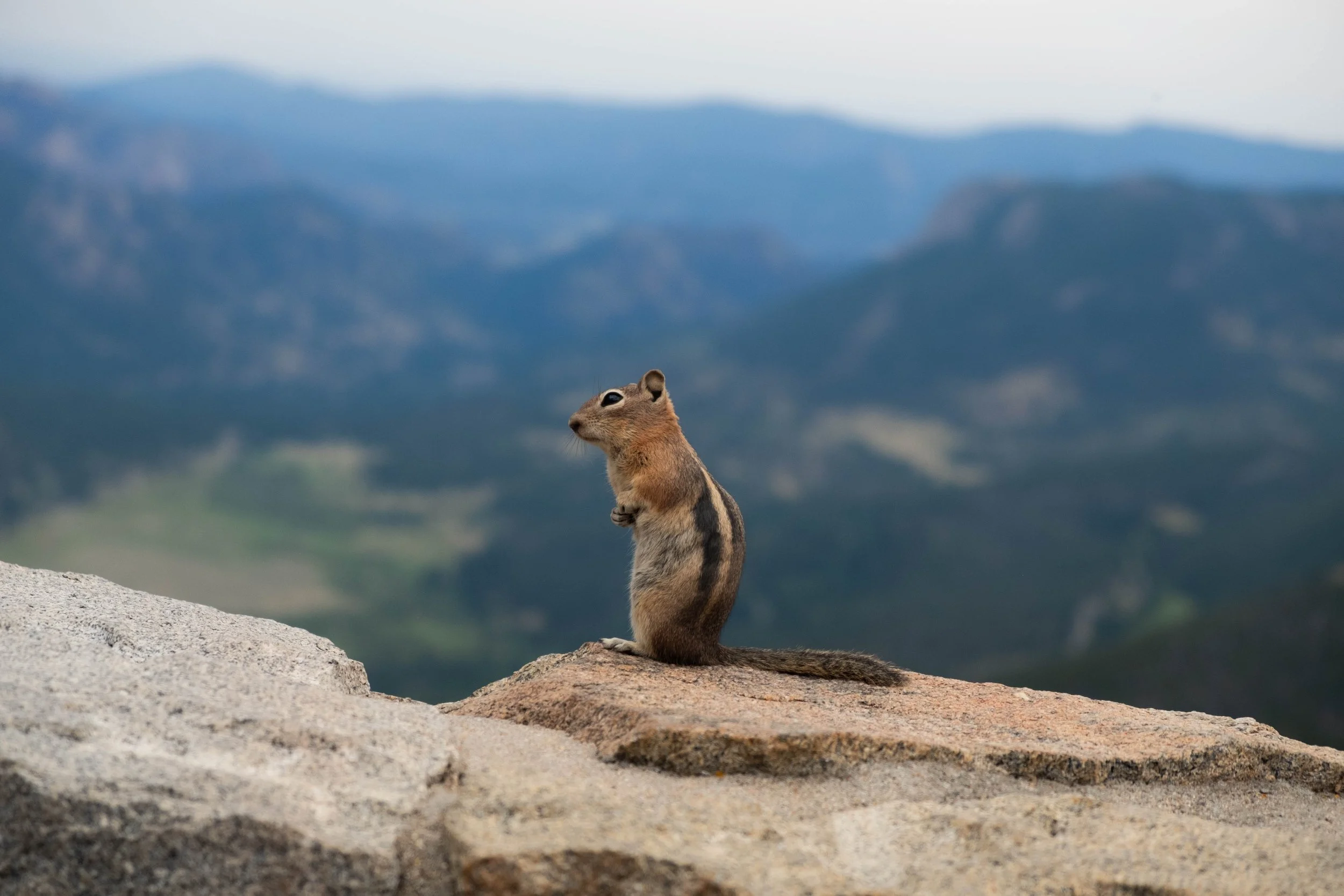
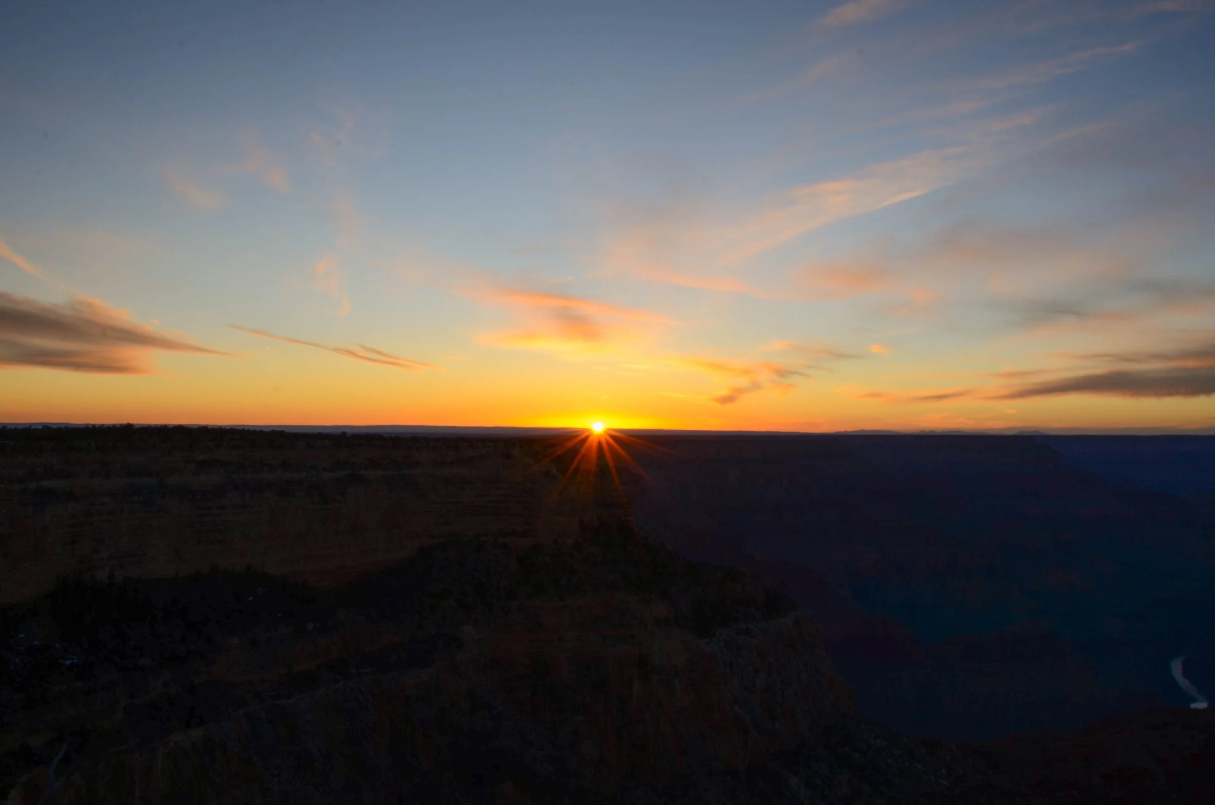
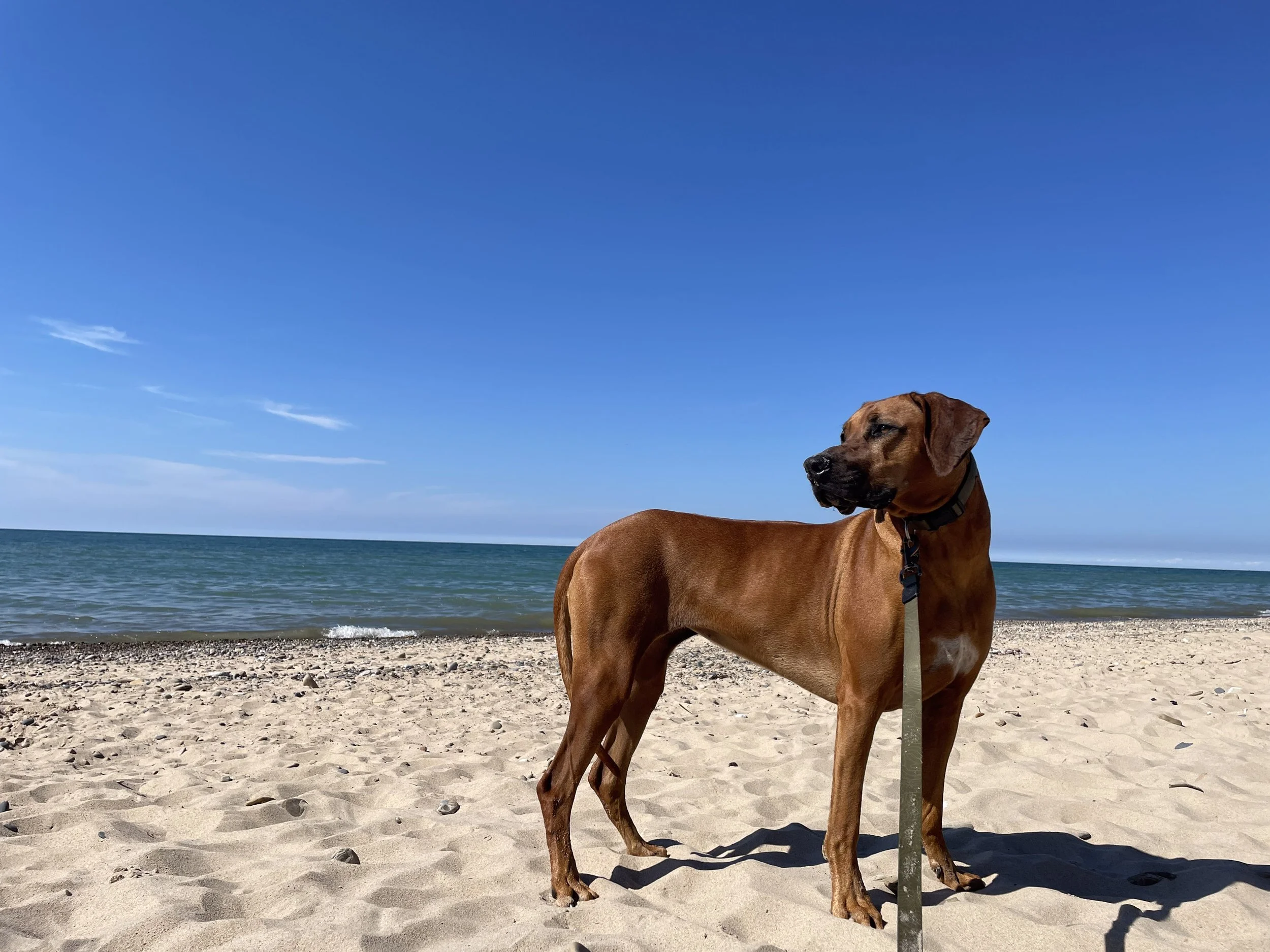
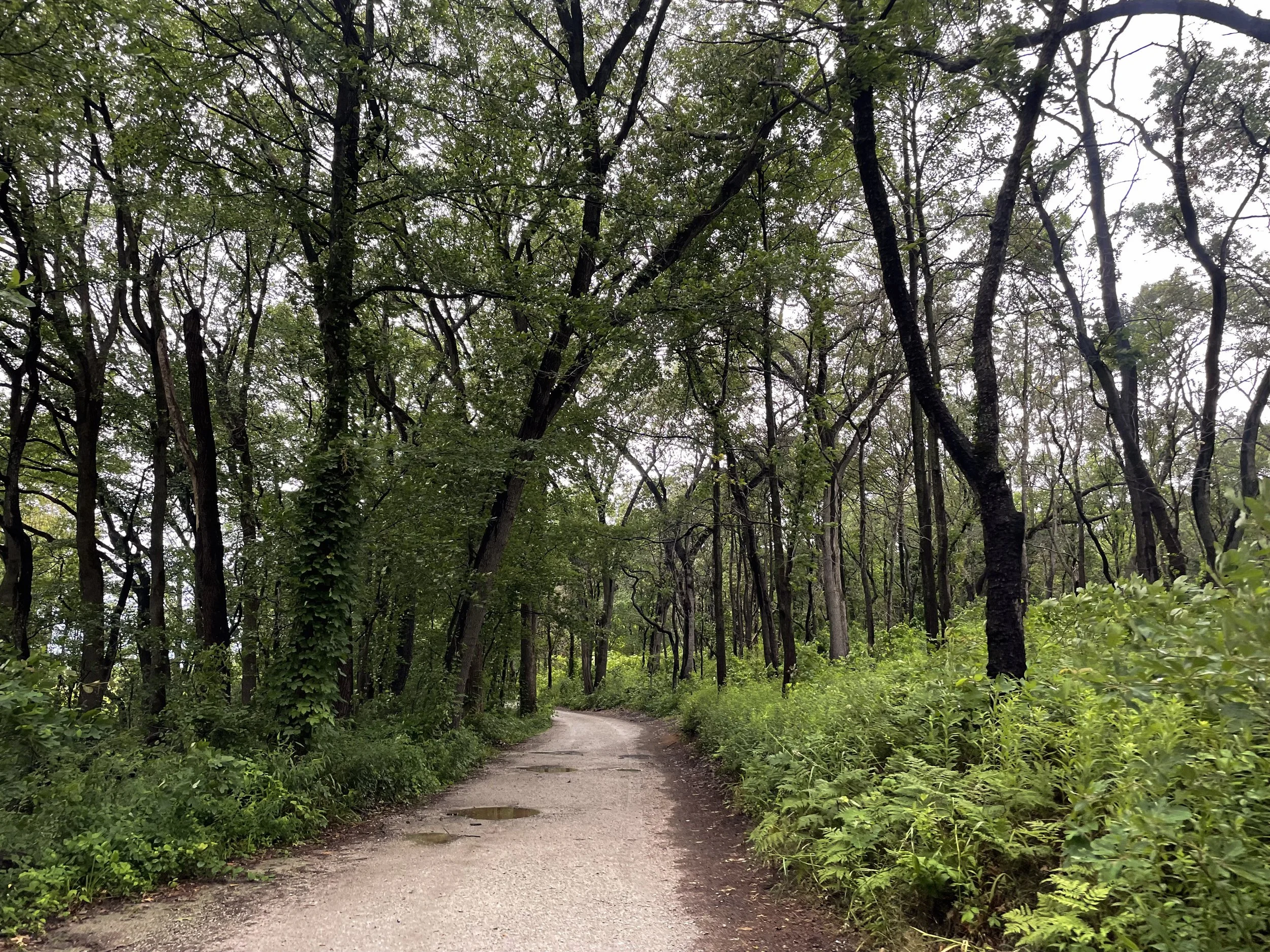
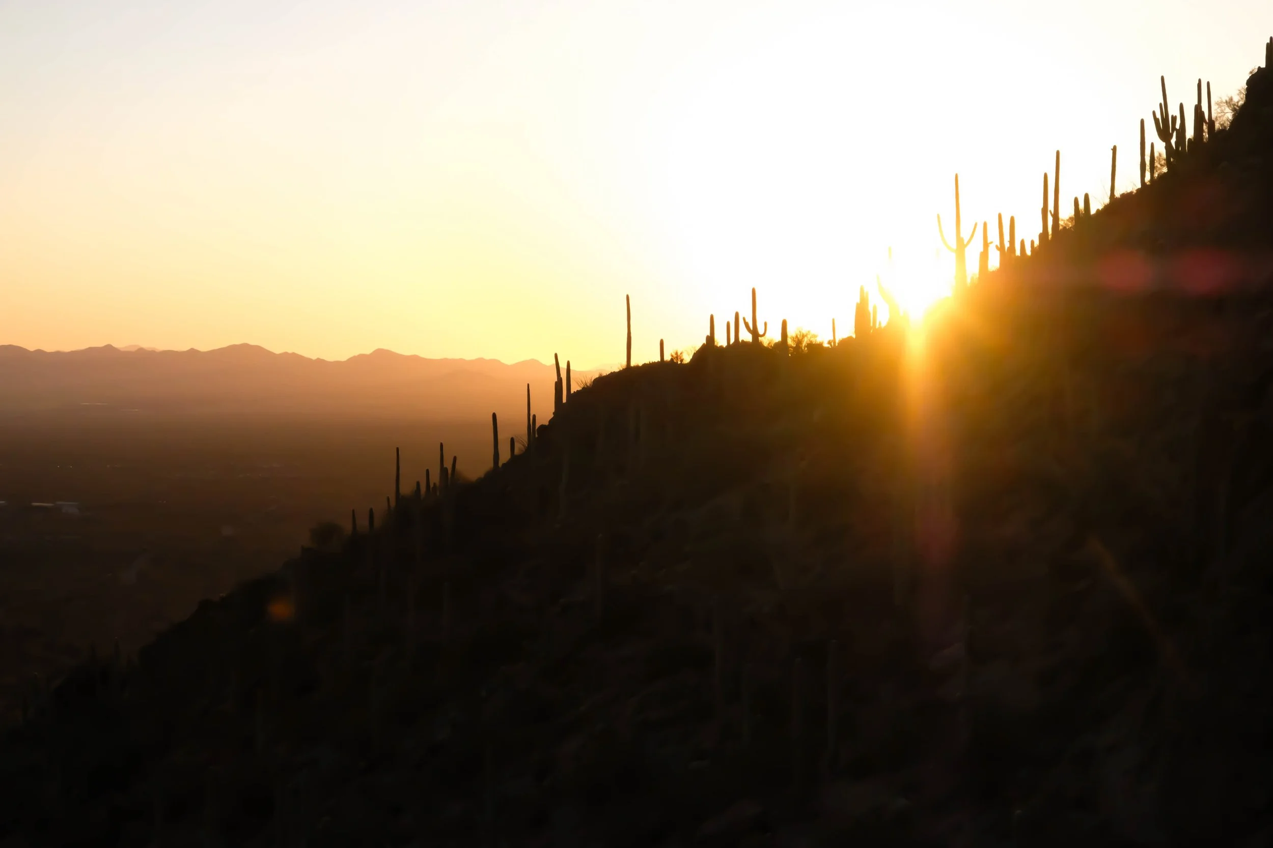
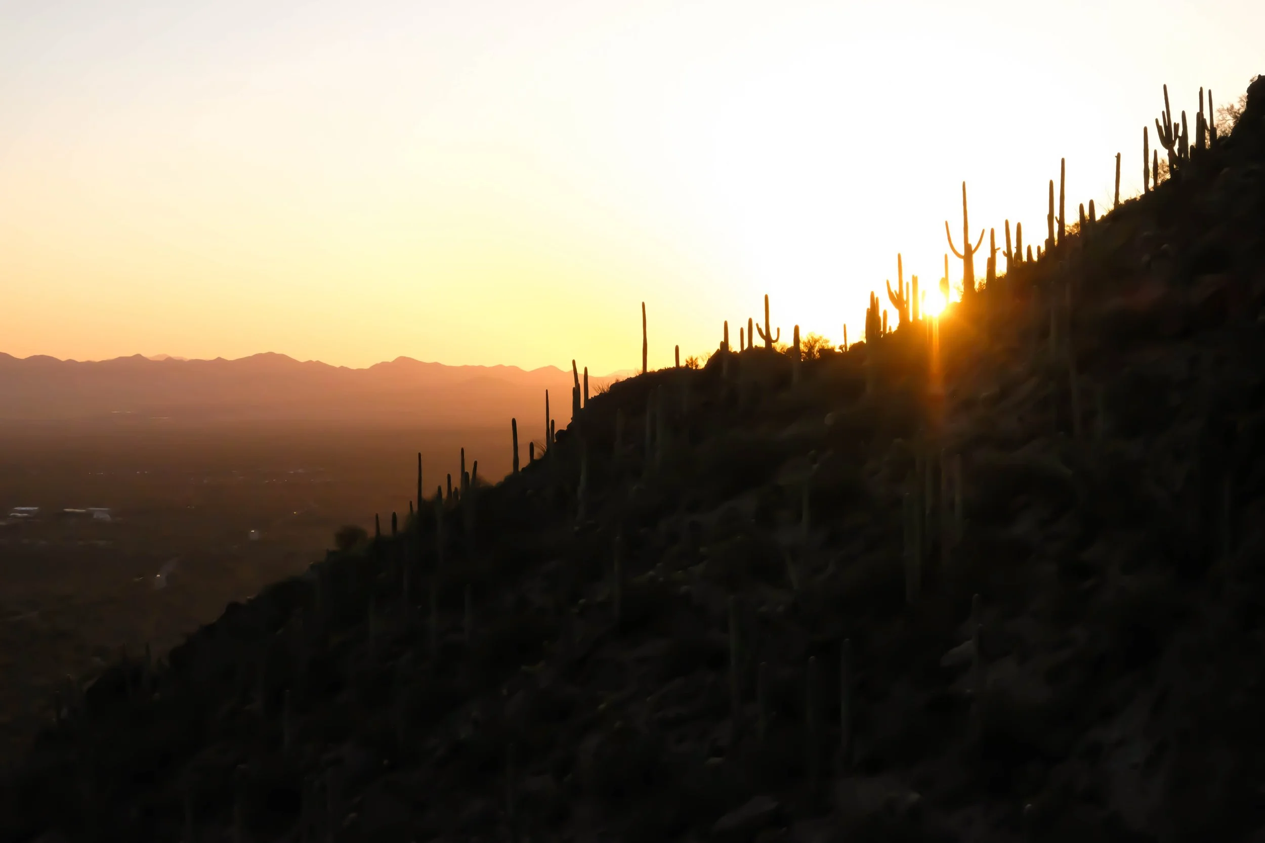
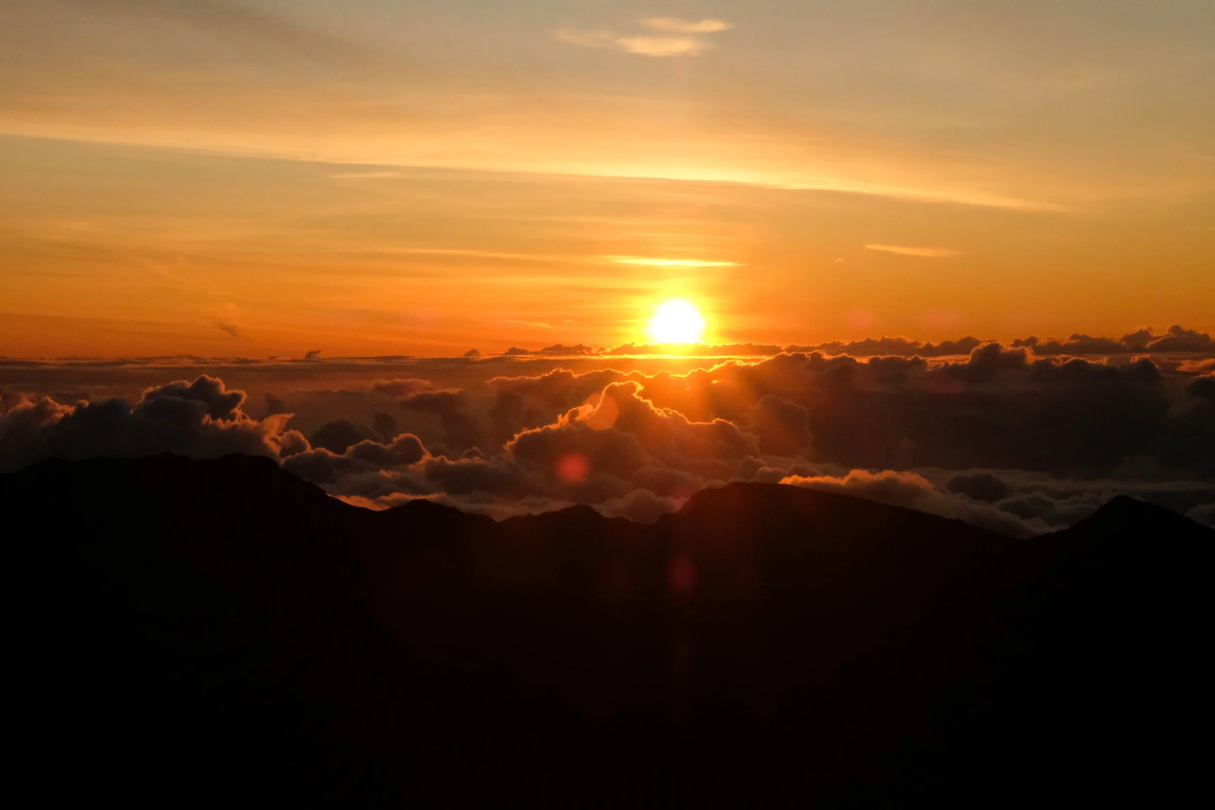
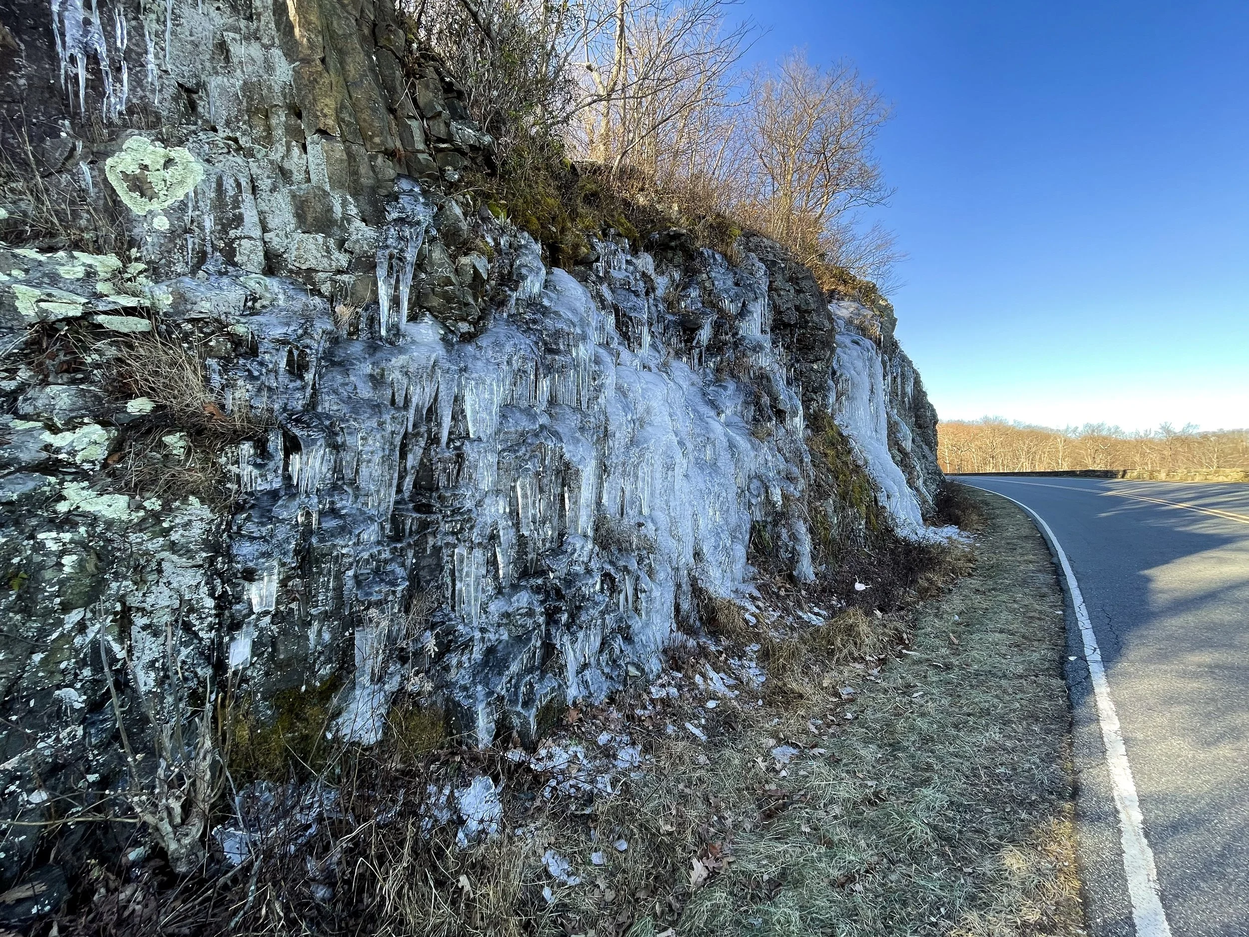
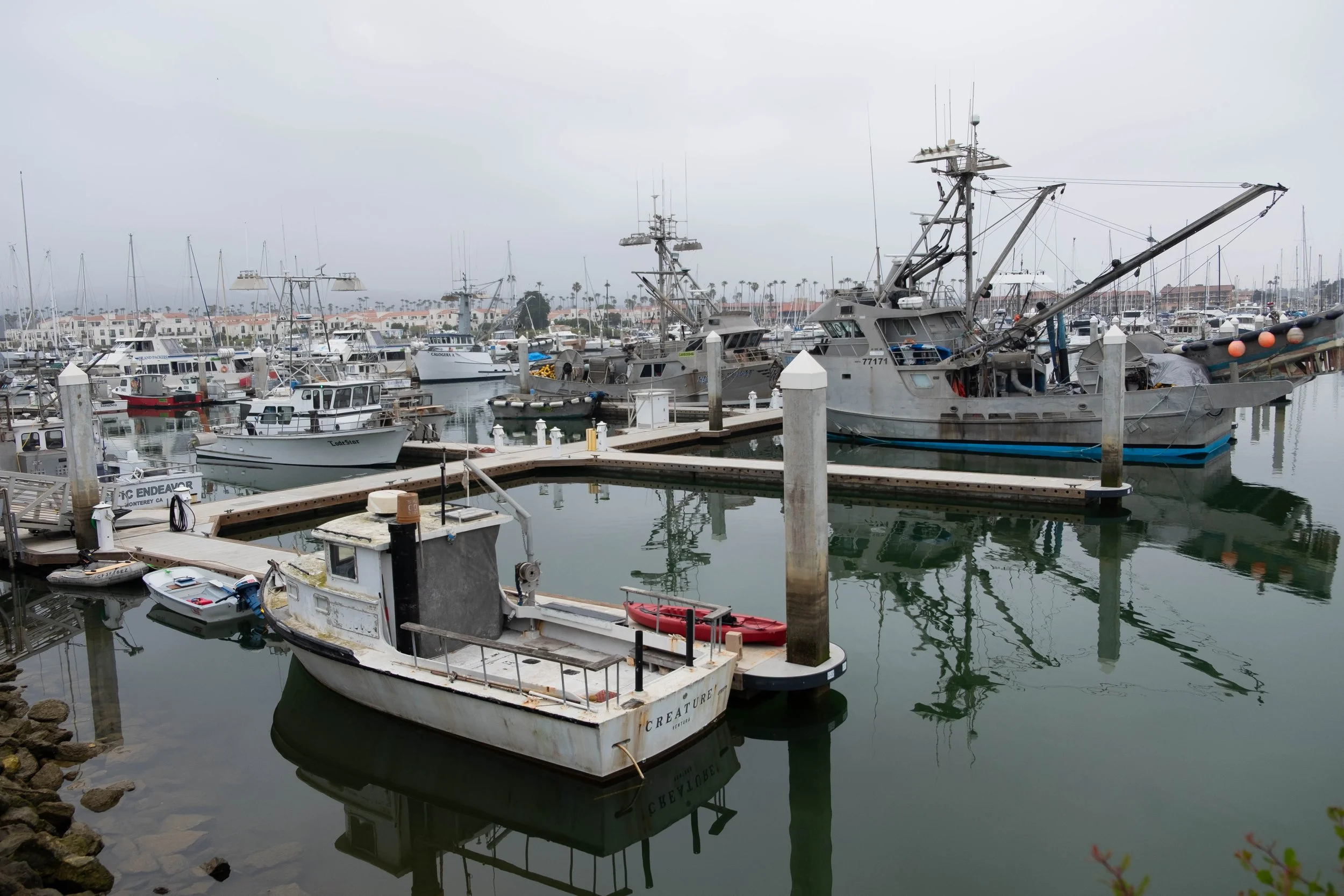
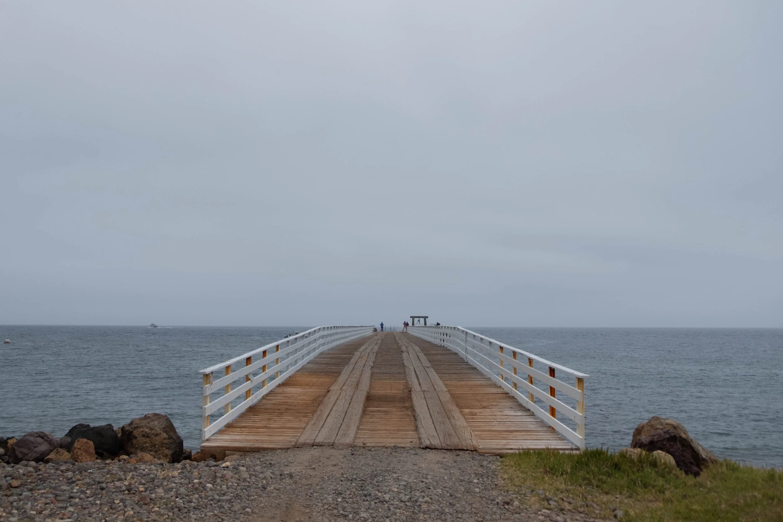
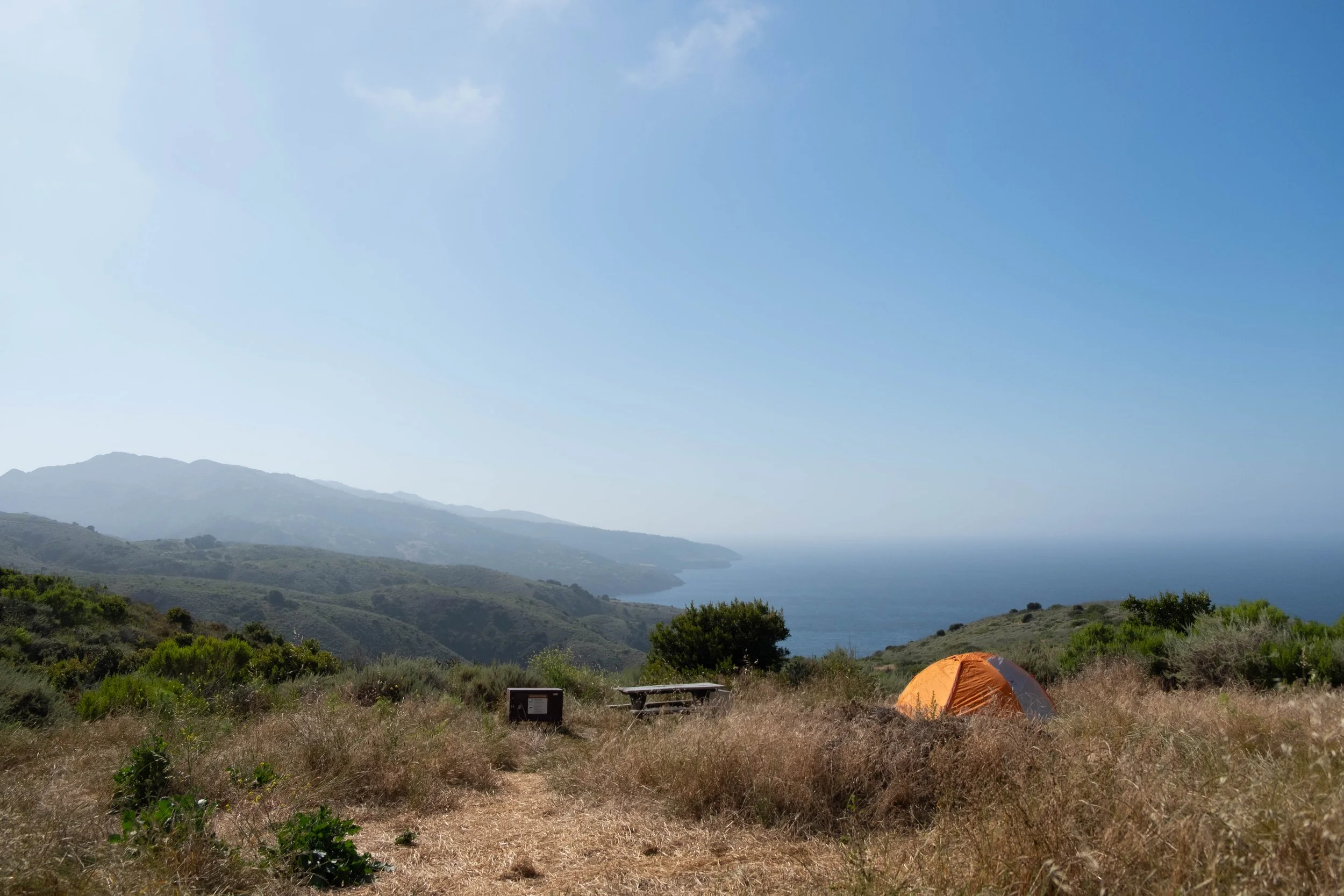
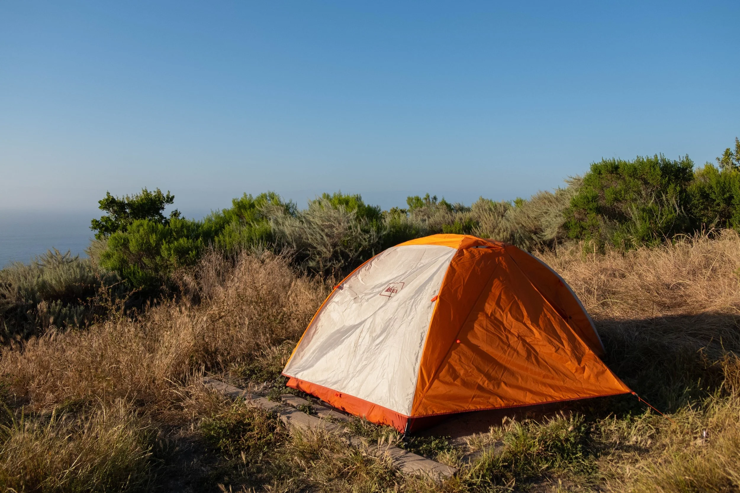
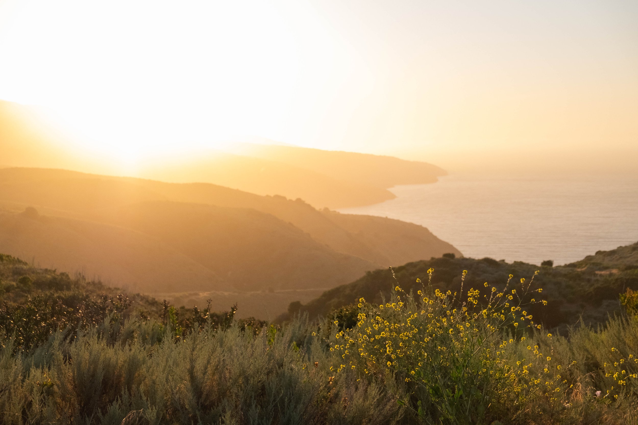
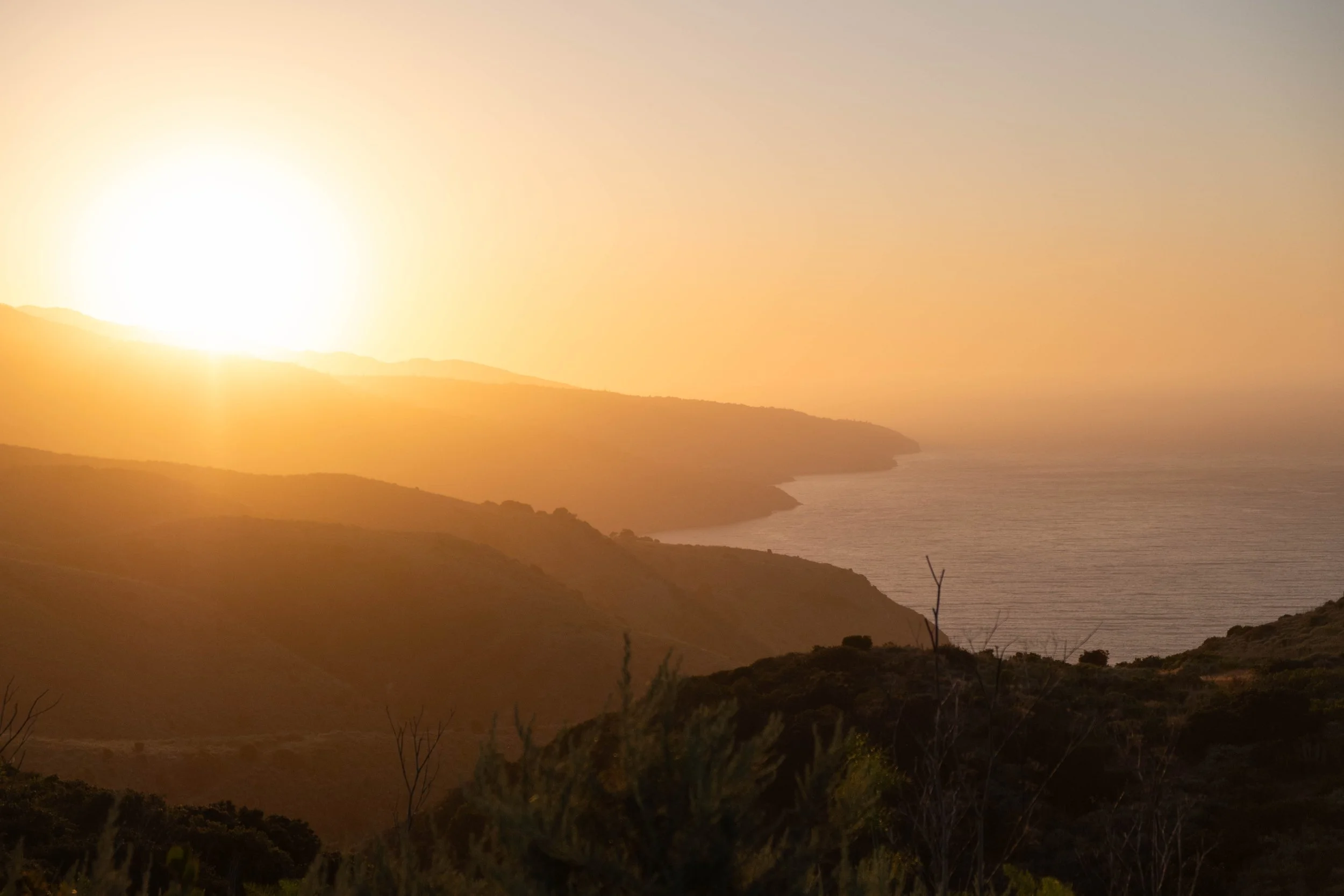
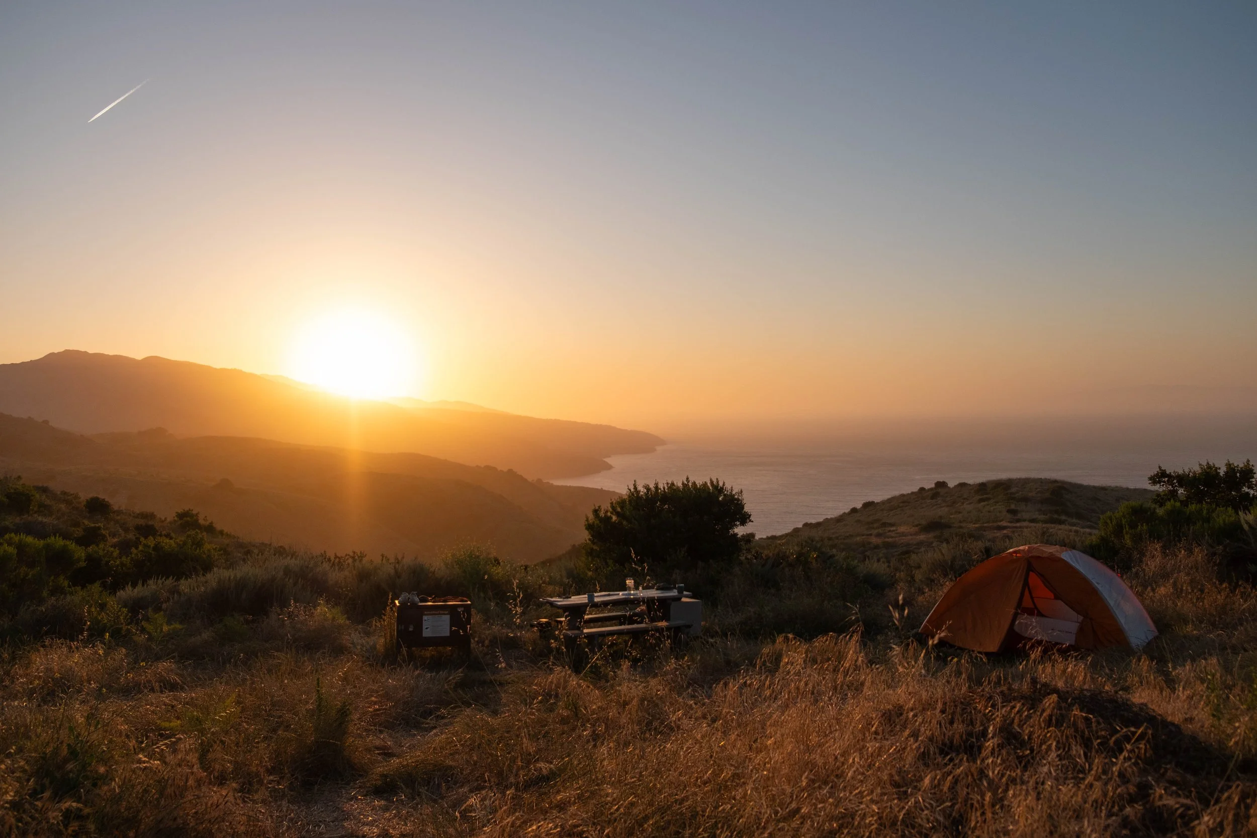
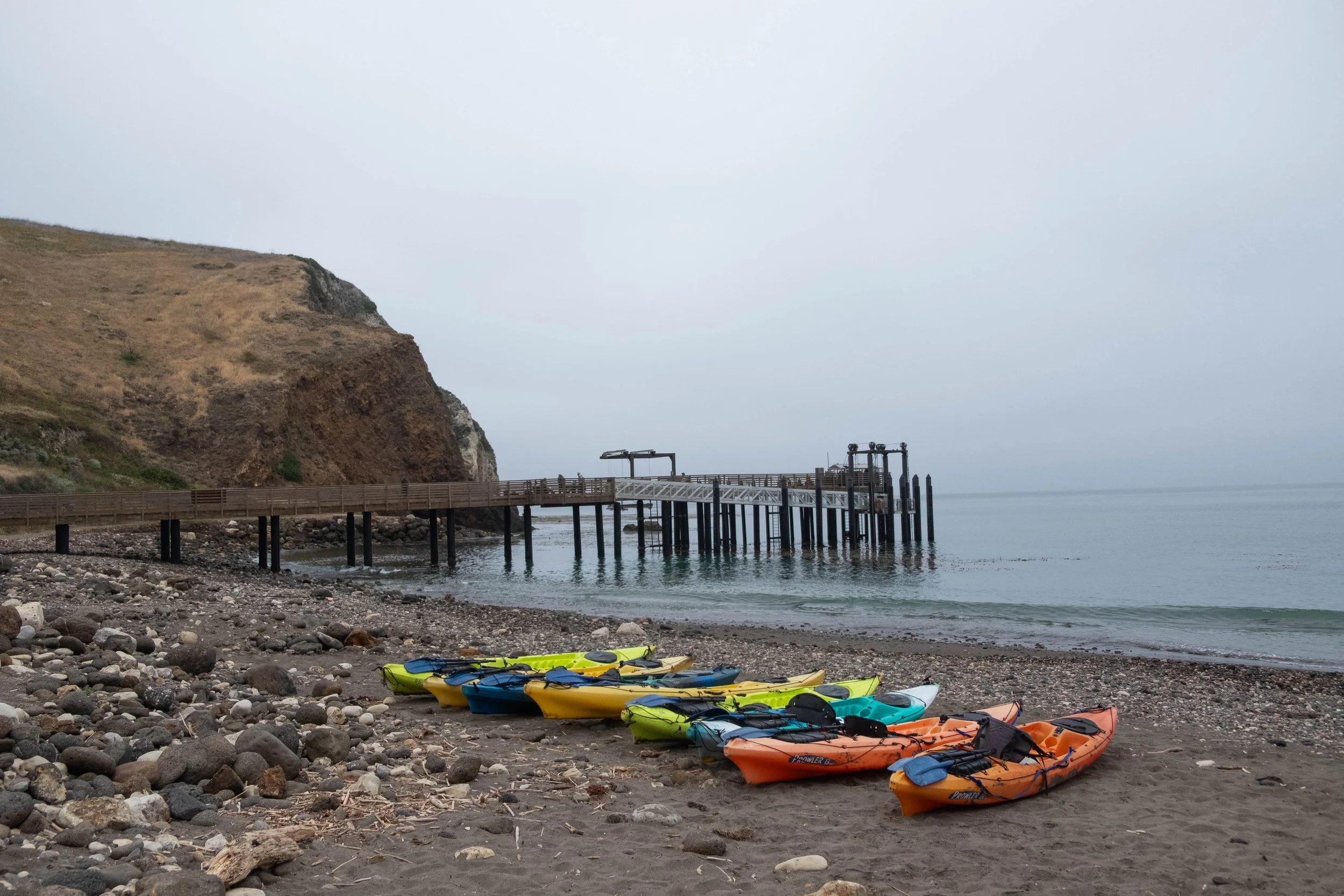
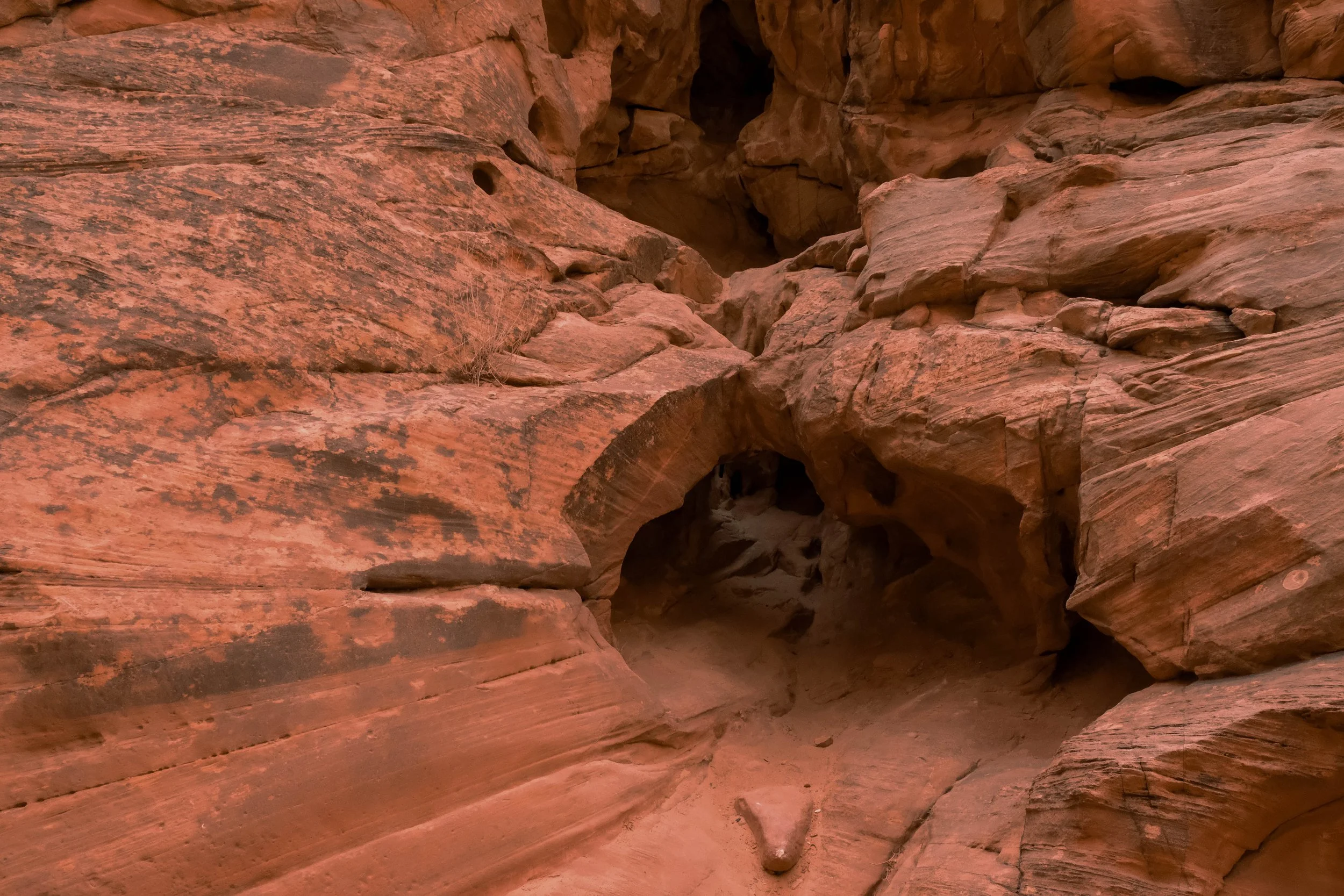
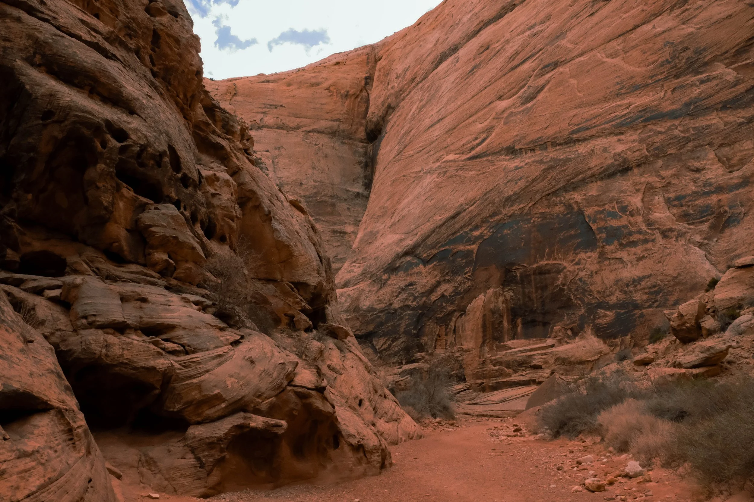
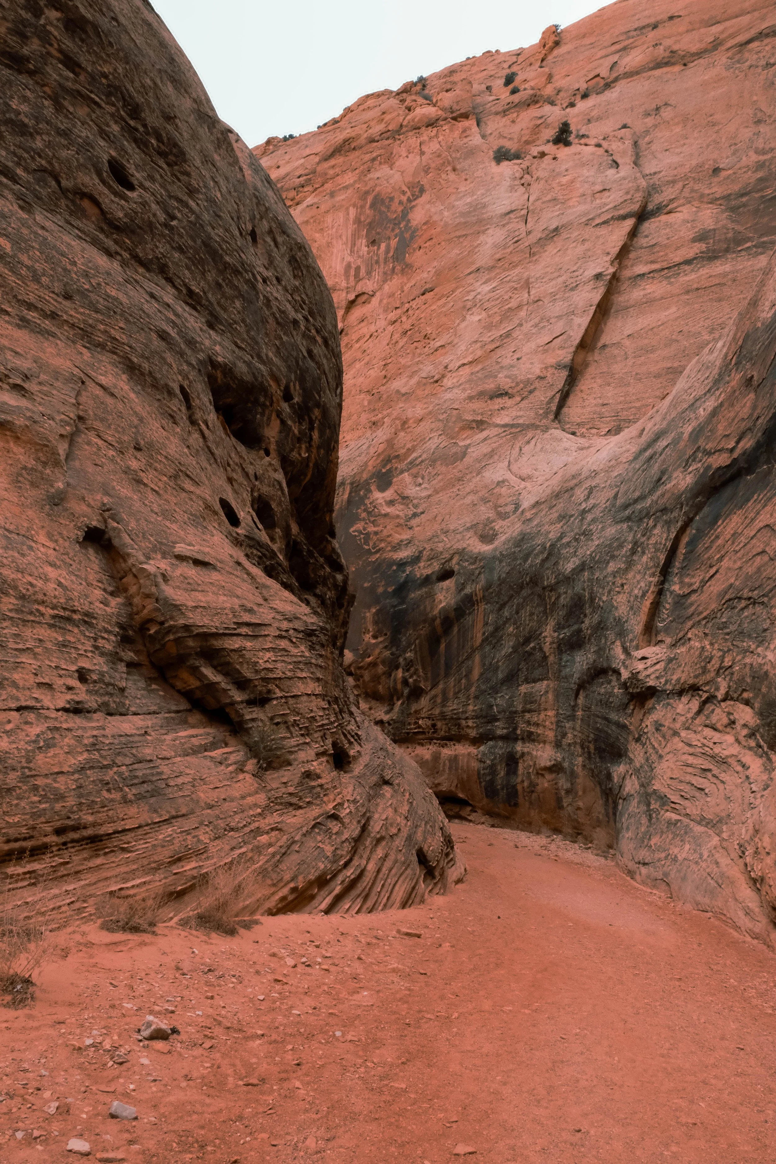
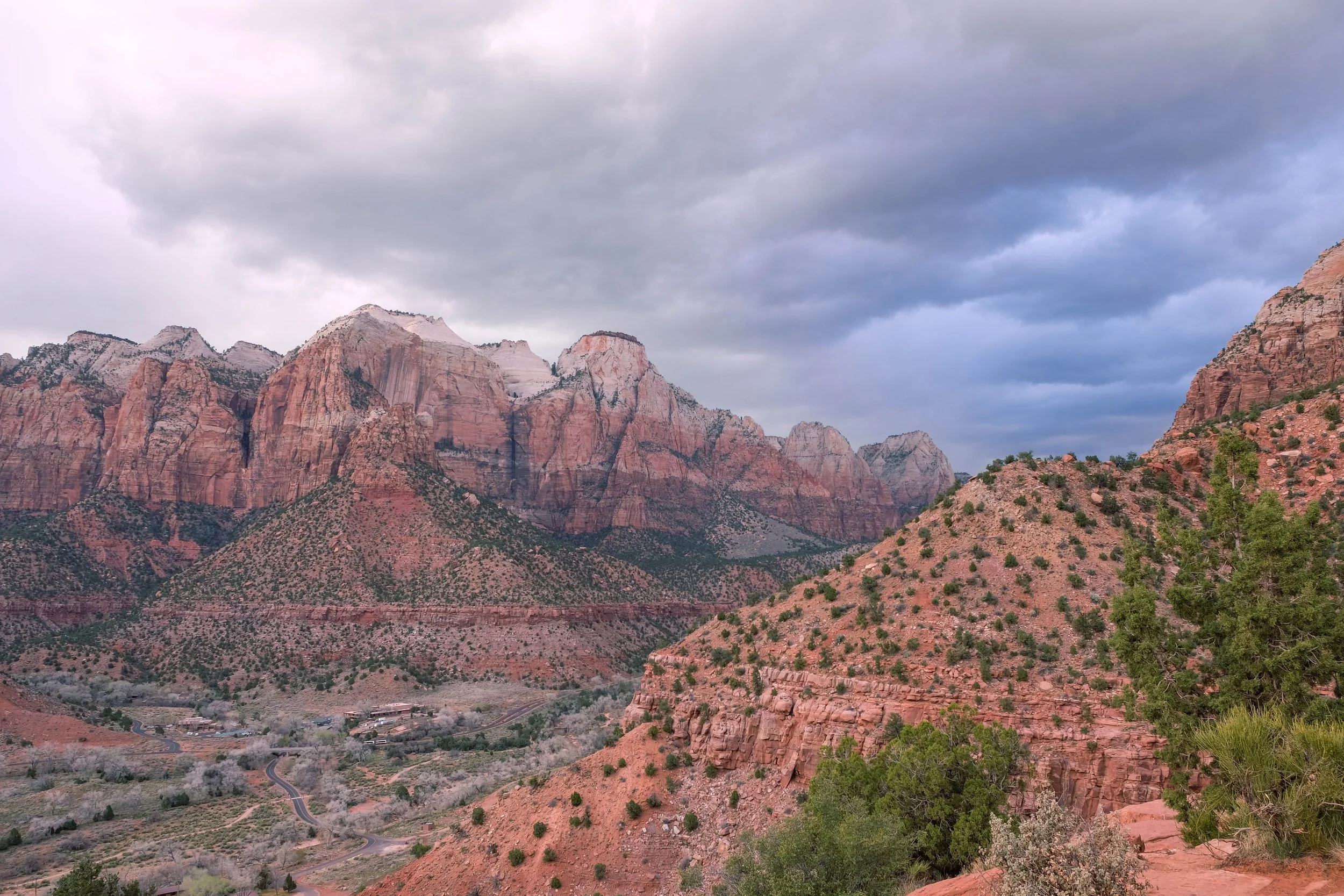
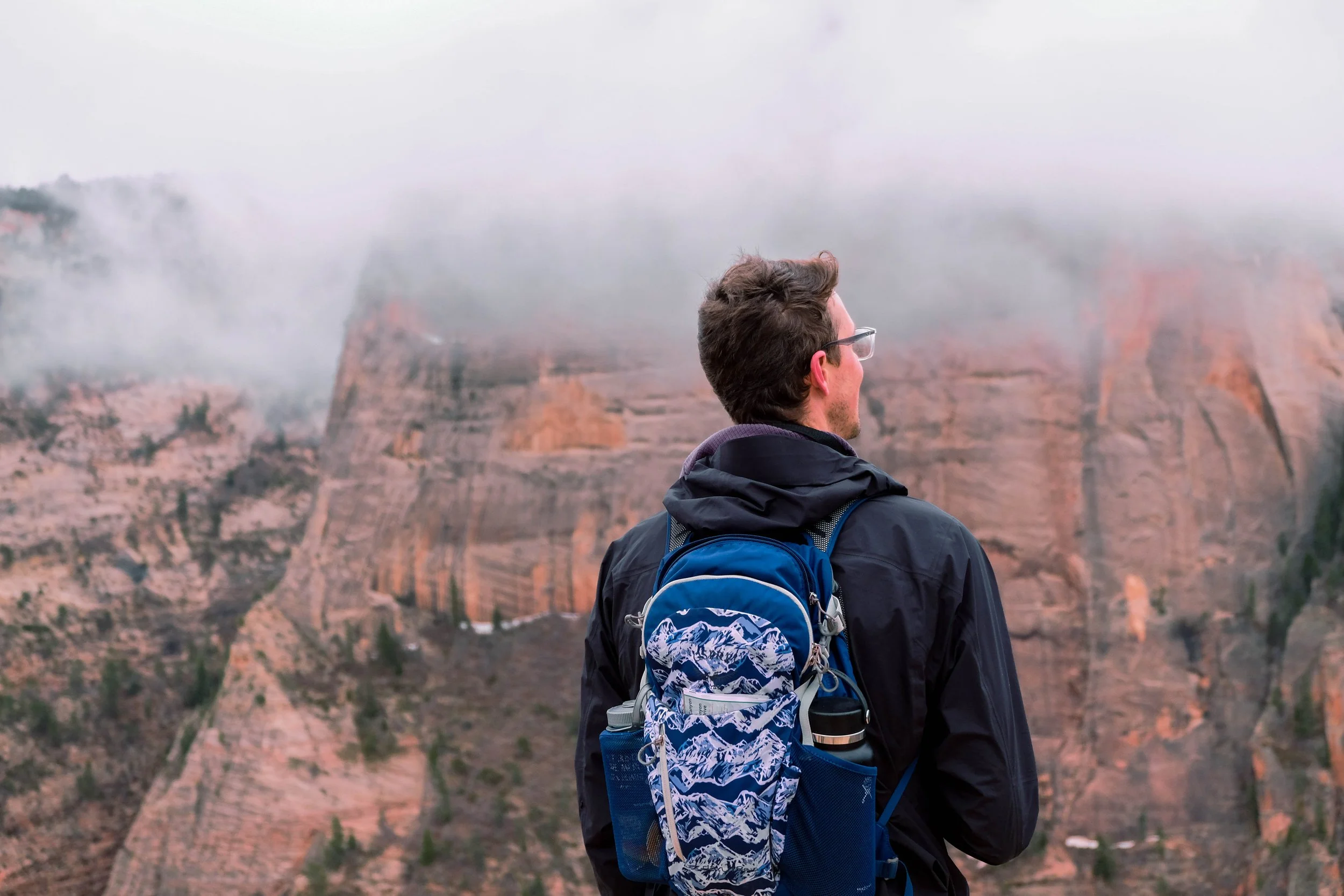
Grand Canyon
Park 39 | Multiple visits
Rim to River: Backpacking to Bright Angel Campground | March 2026
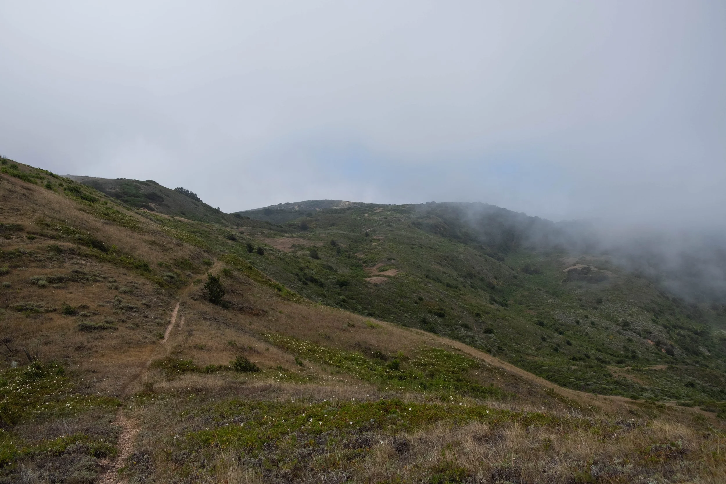
We celebrated our eighth anniversary with a backpacking trip to the bottom of the Grand Canyon. Although we’ve been counting the Grand Canyon as one of the parks we’ve visited since we’d both been here independently (we’ve done the same for Black Canyon of the Gunnison), this trip made it feel more official. Subsequently, I moved this post up to the top of our tally, marking it as the more recent park we’ve visited.
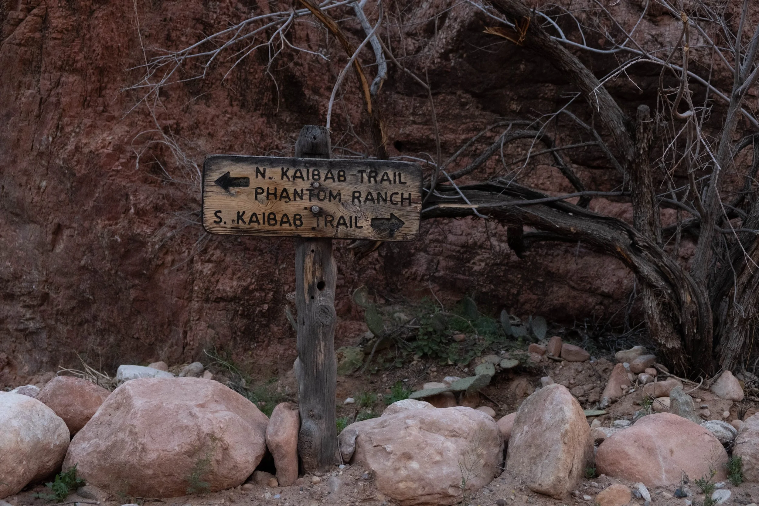
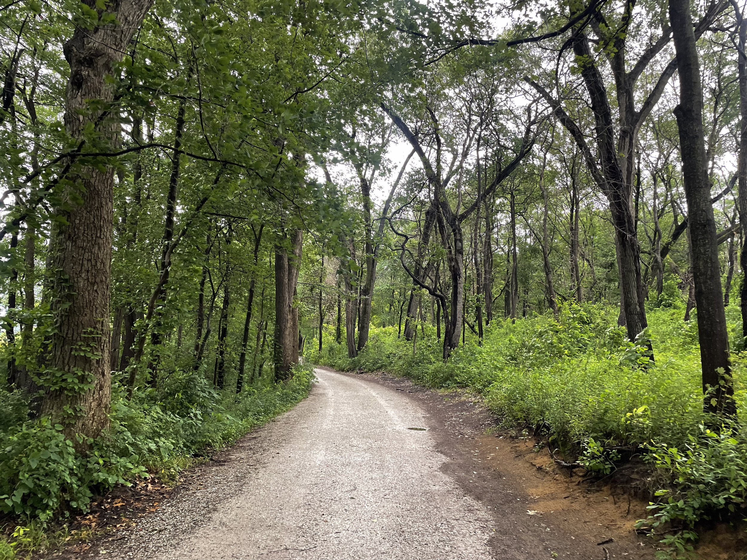
Day 1 | Descent: South Rim to Bright Angel Campground/Phantom Ranch via South Kaibab Trail
Distance: 7.5 miles | Elevation loss: -4,700 ft
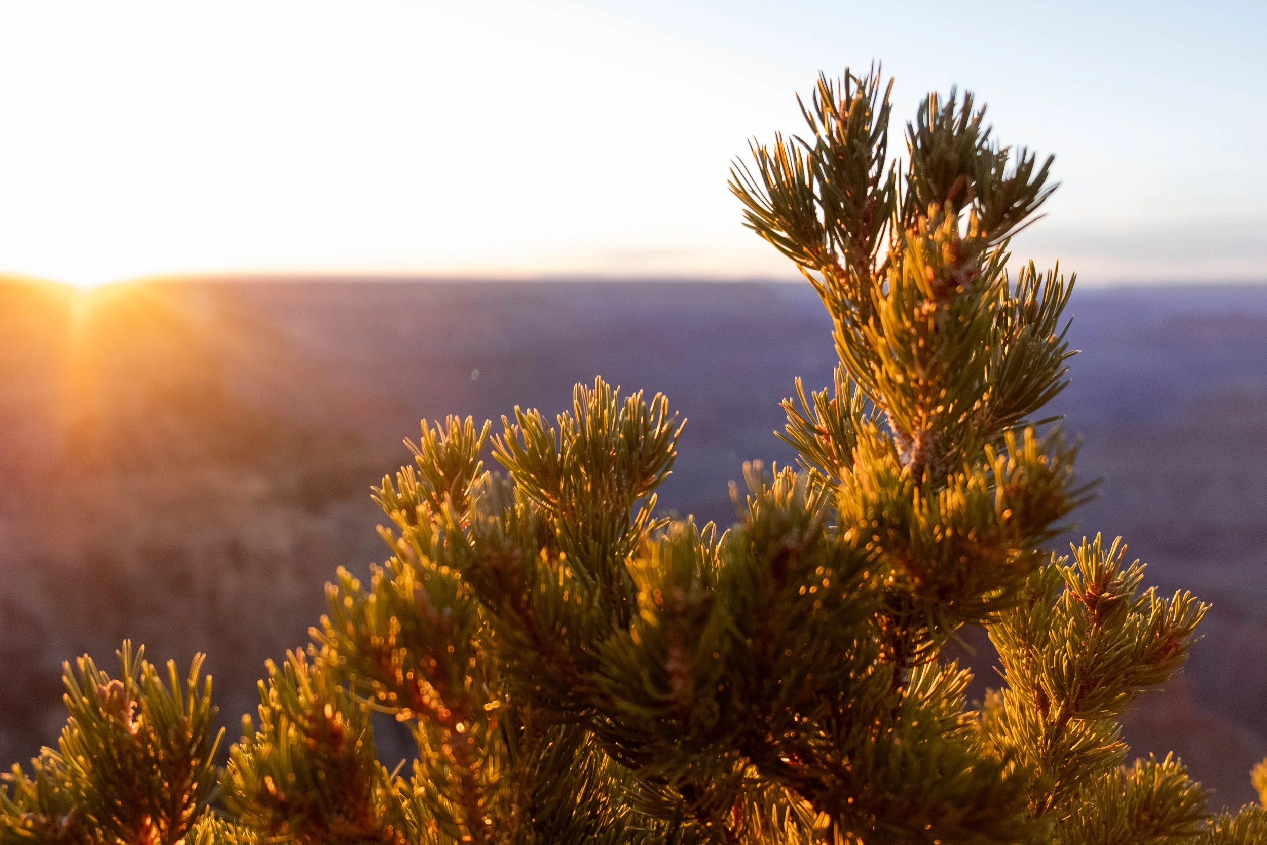
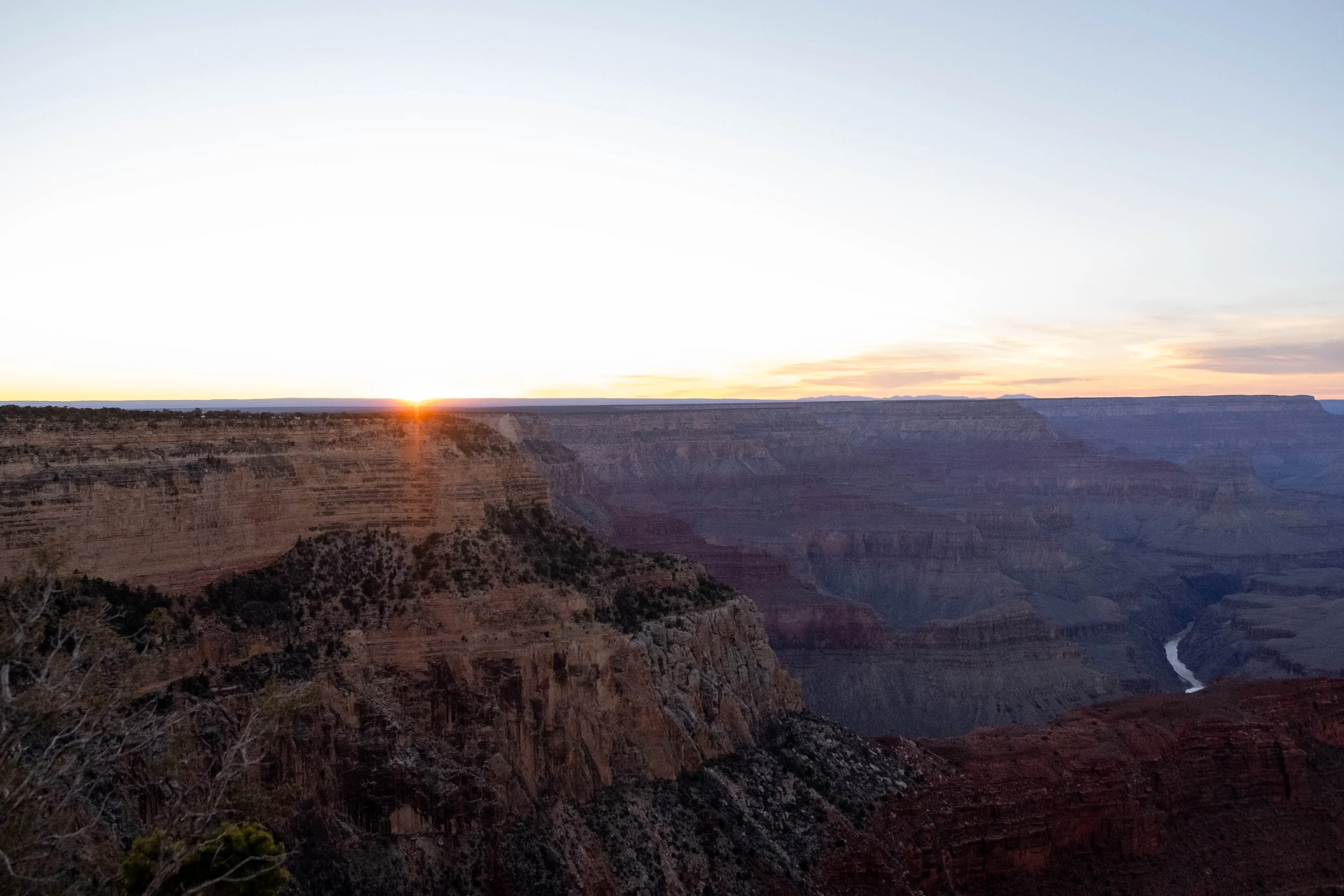
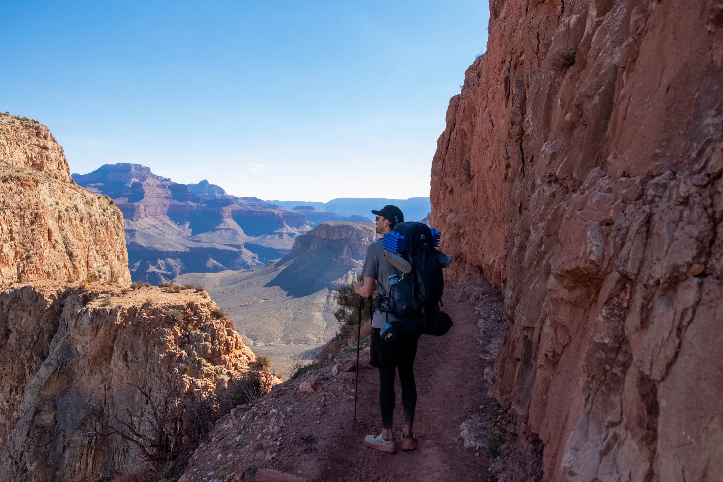
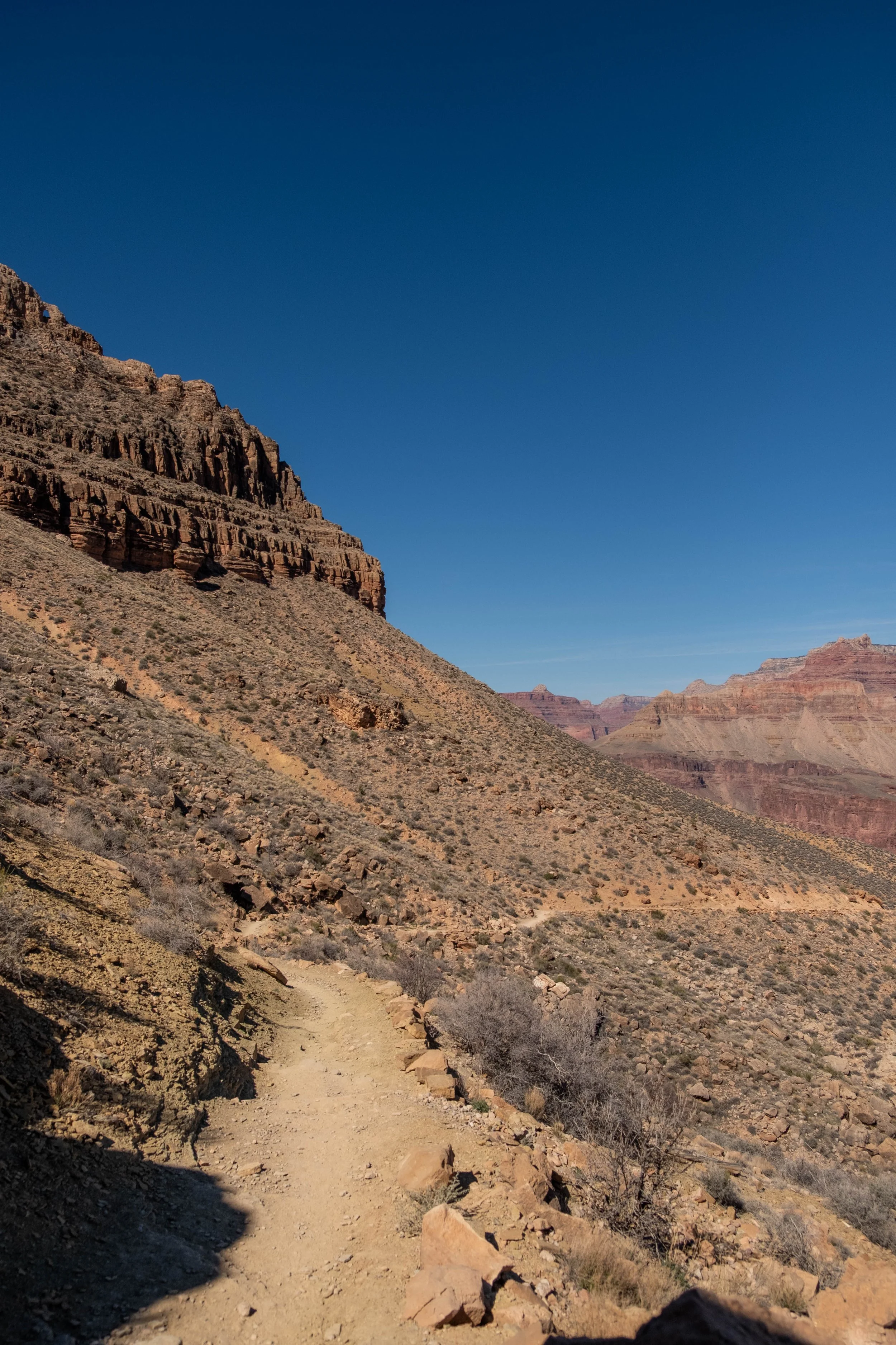
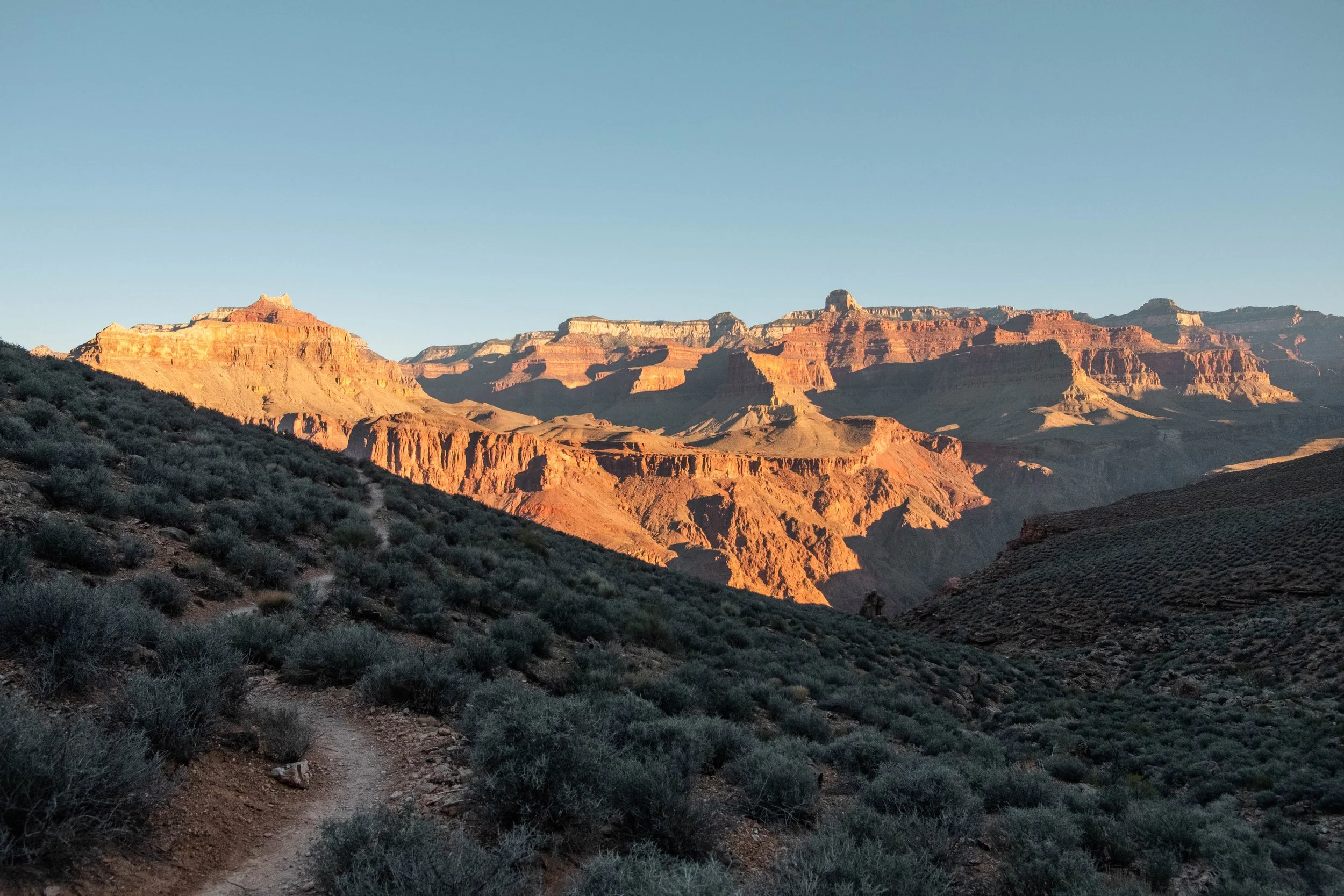
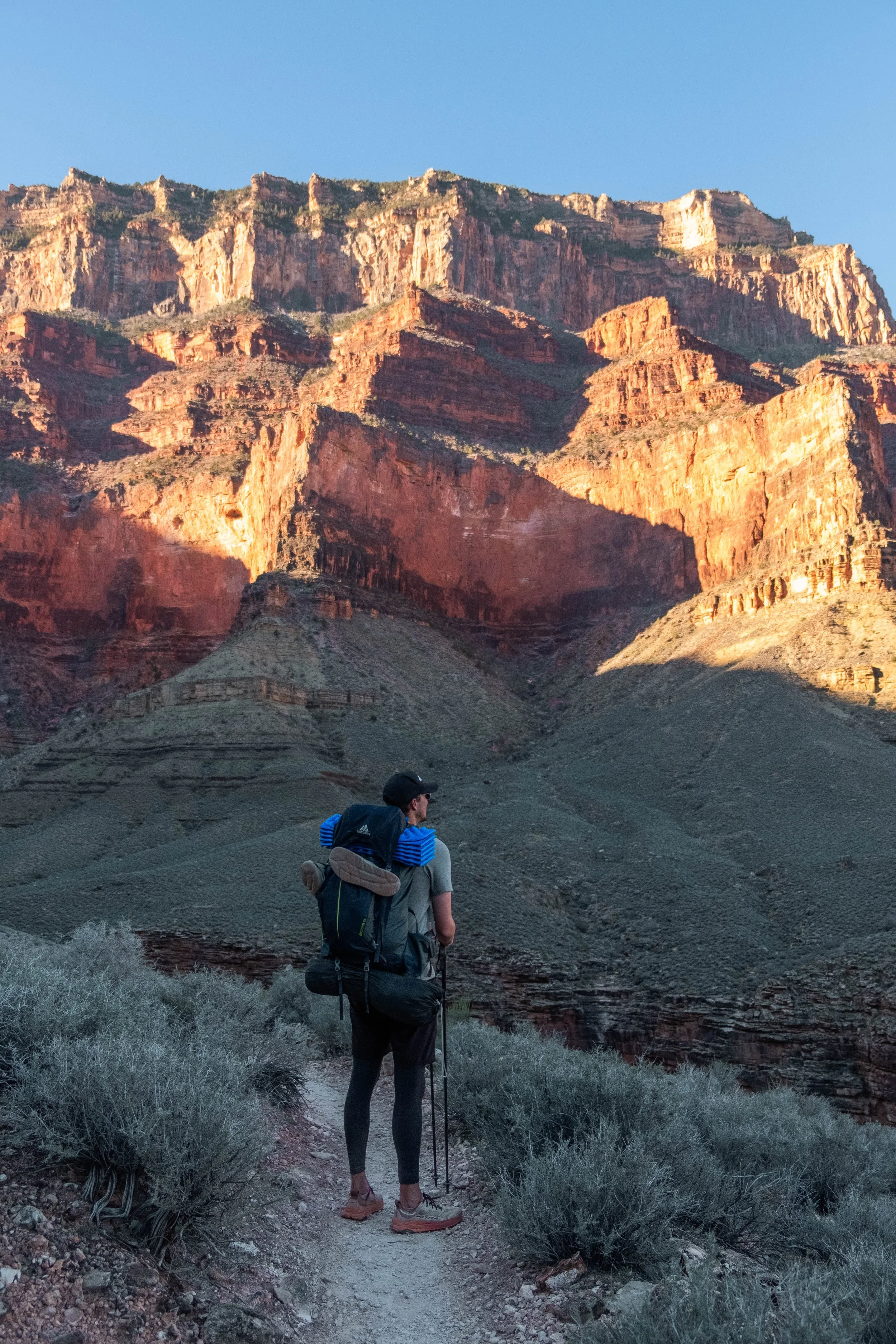
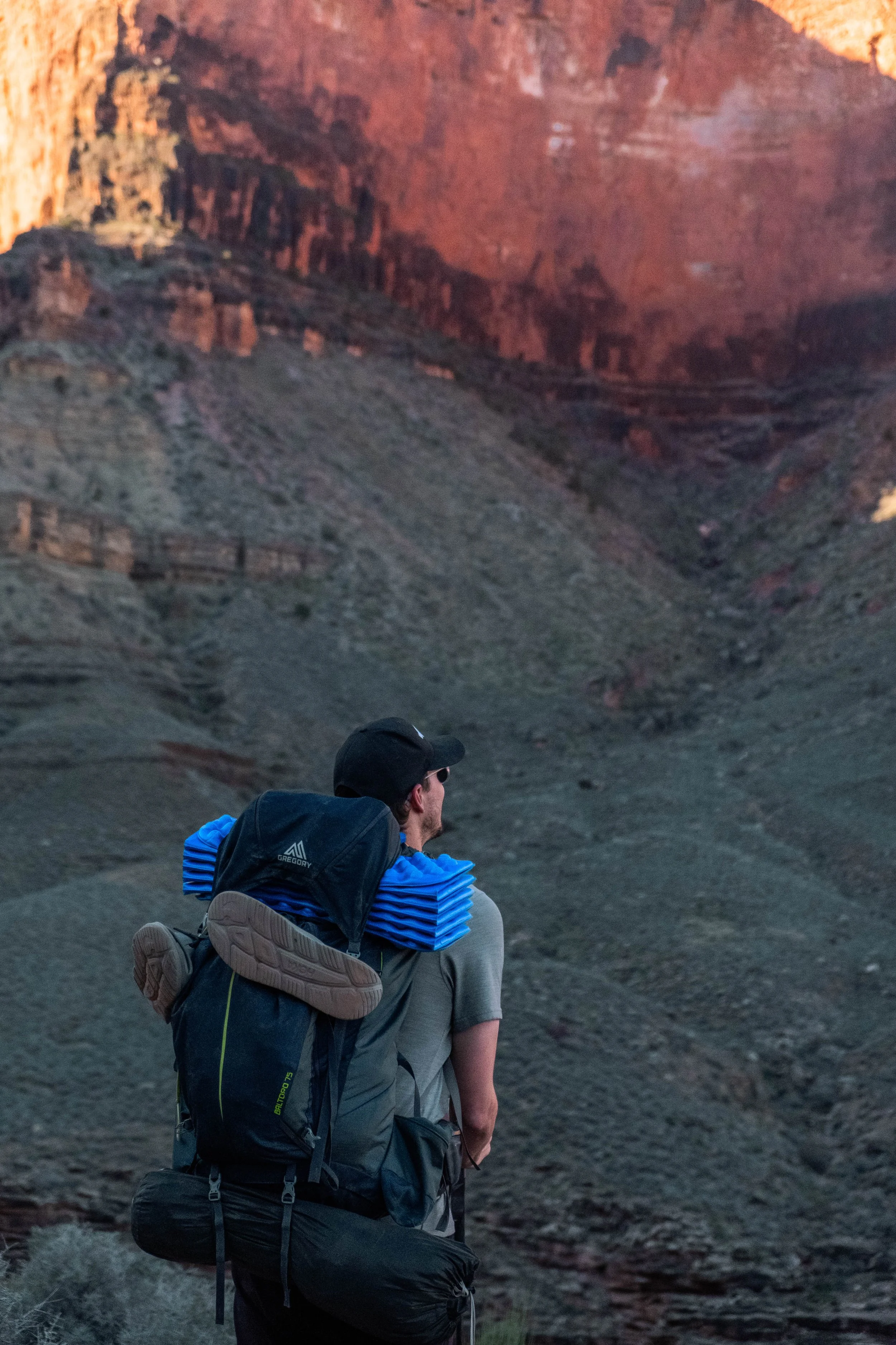
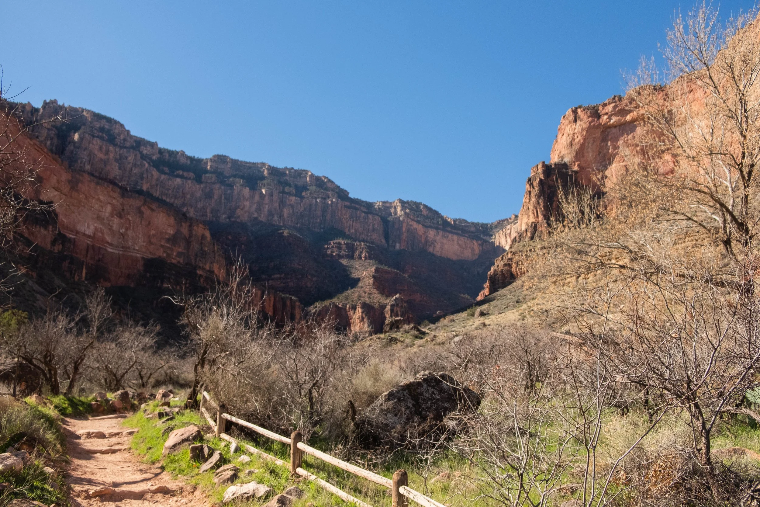
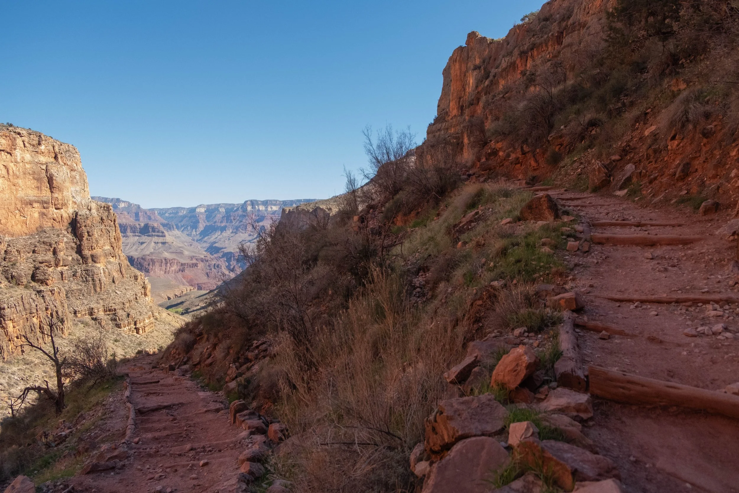
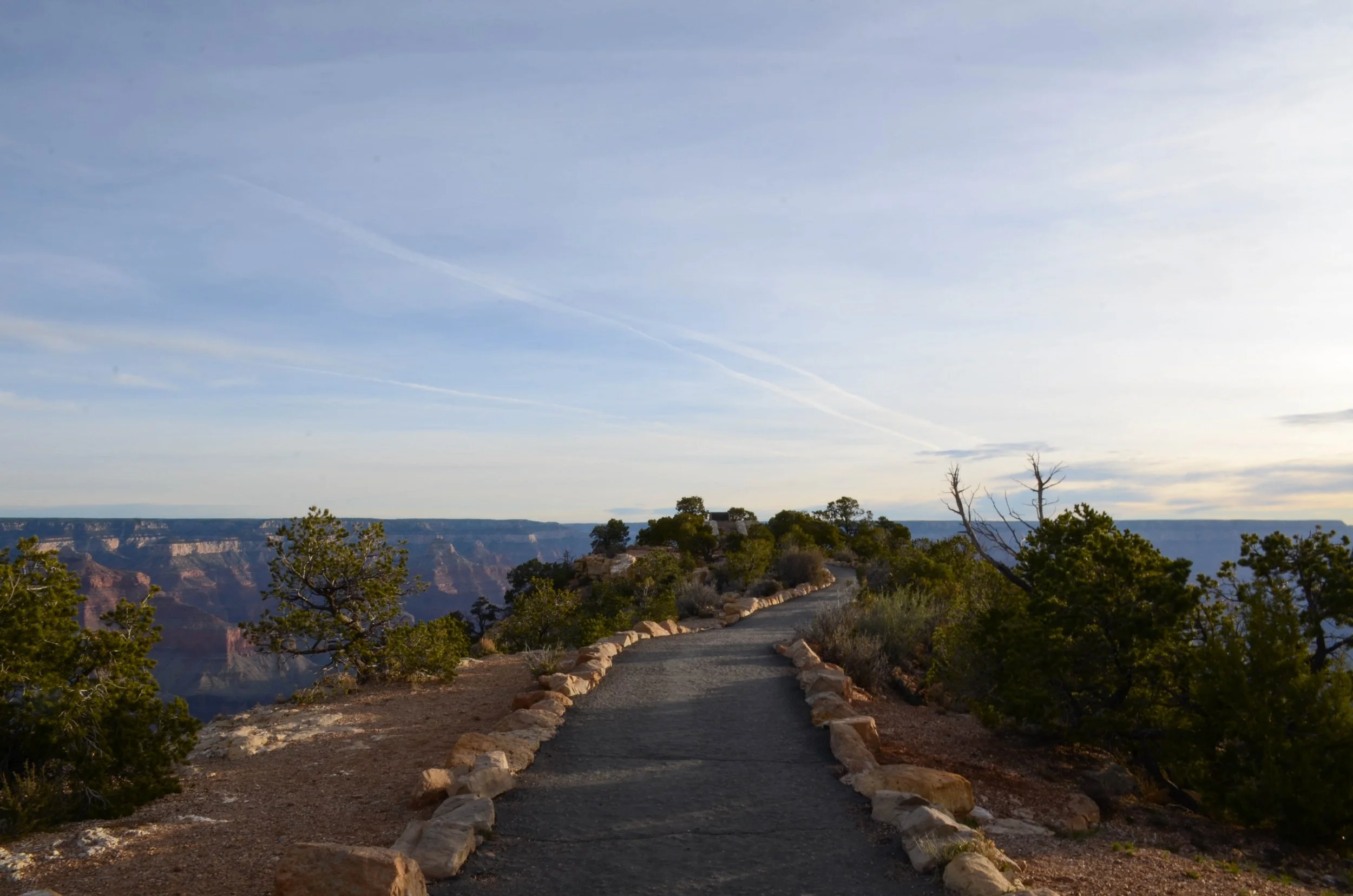
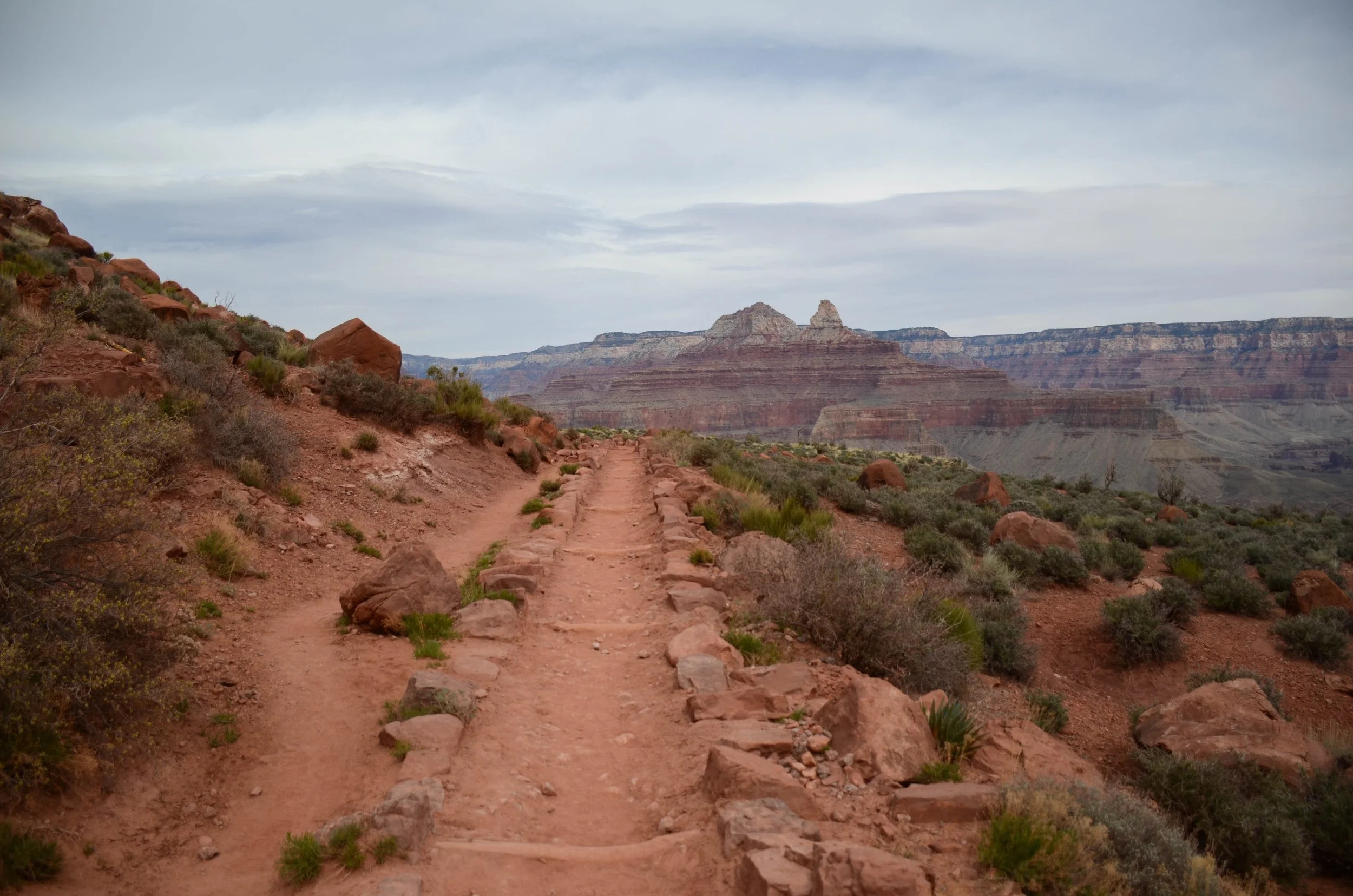
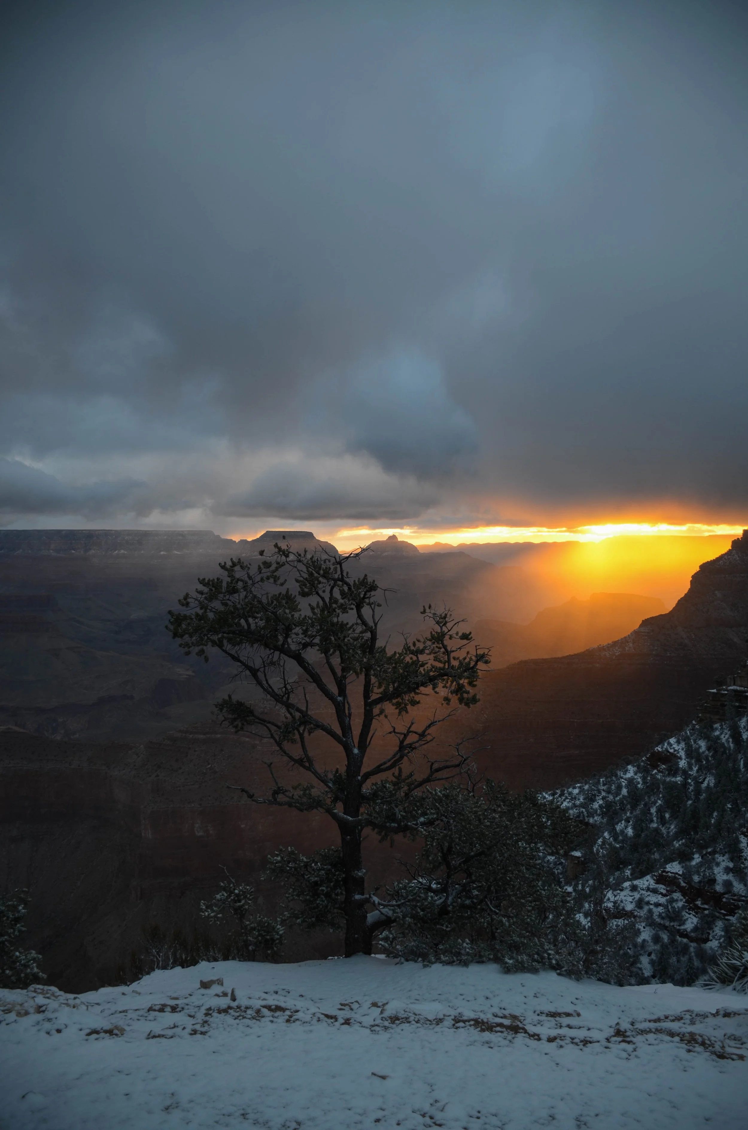
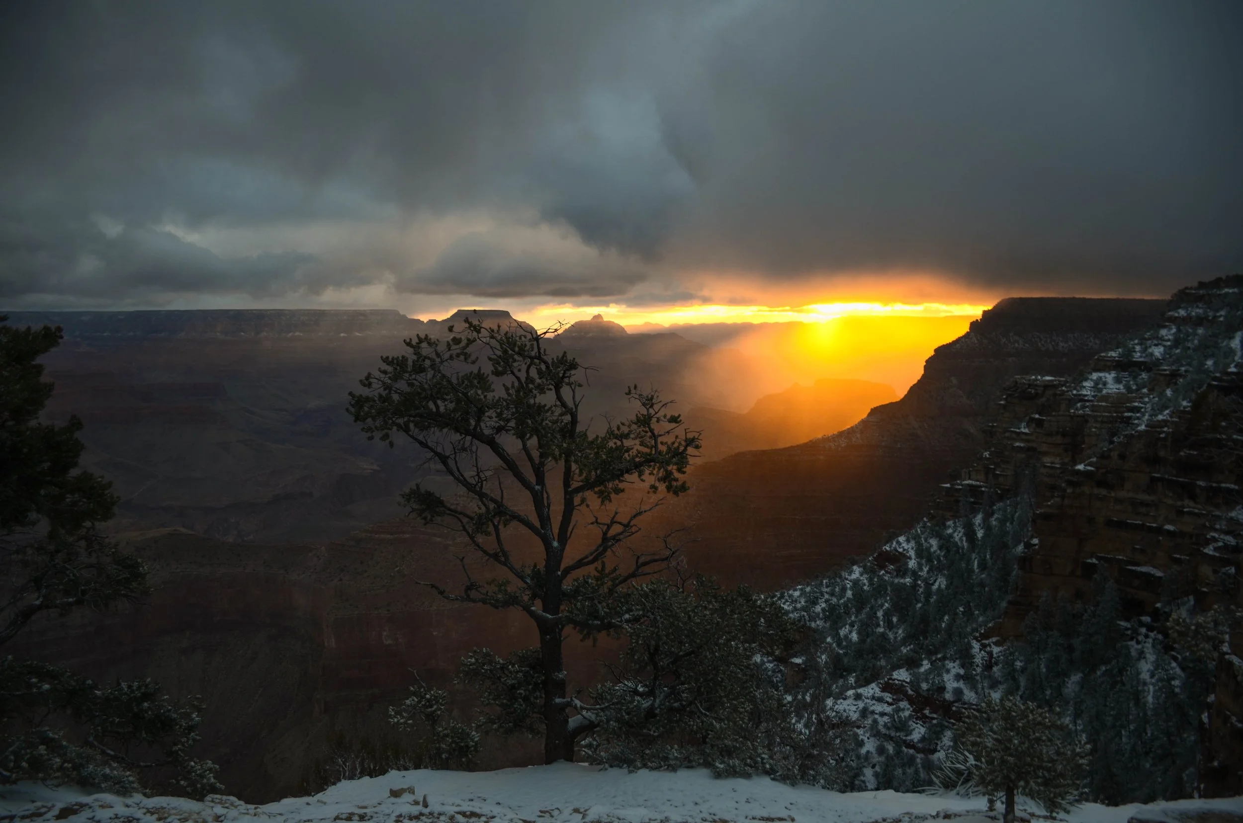
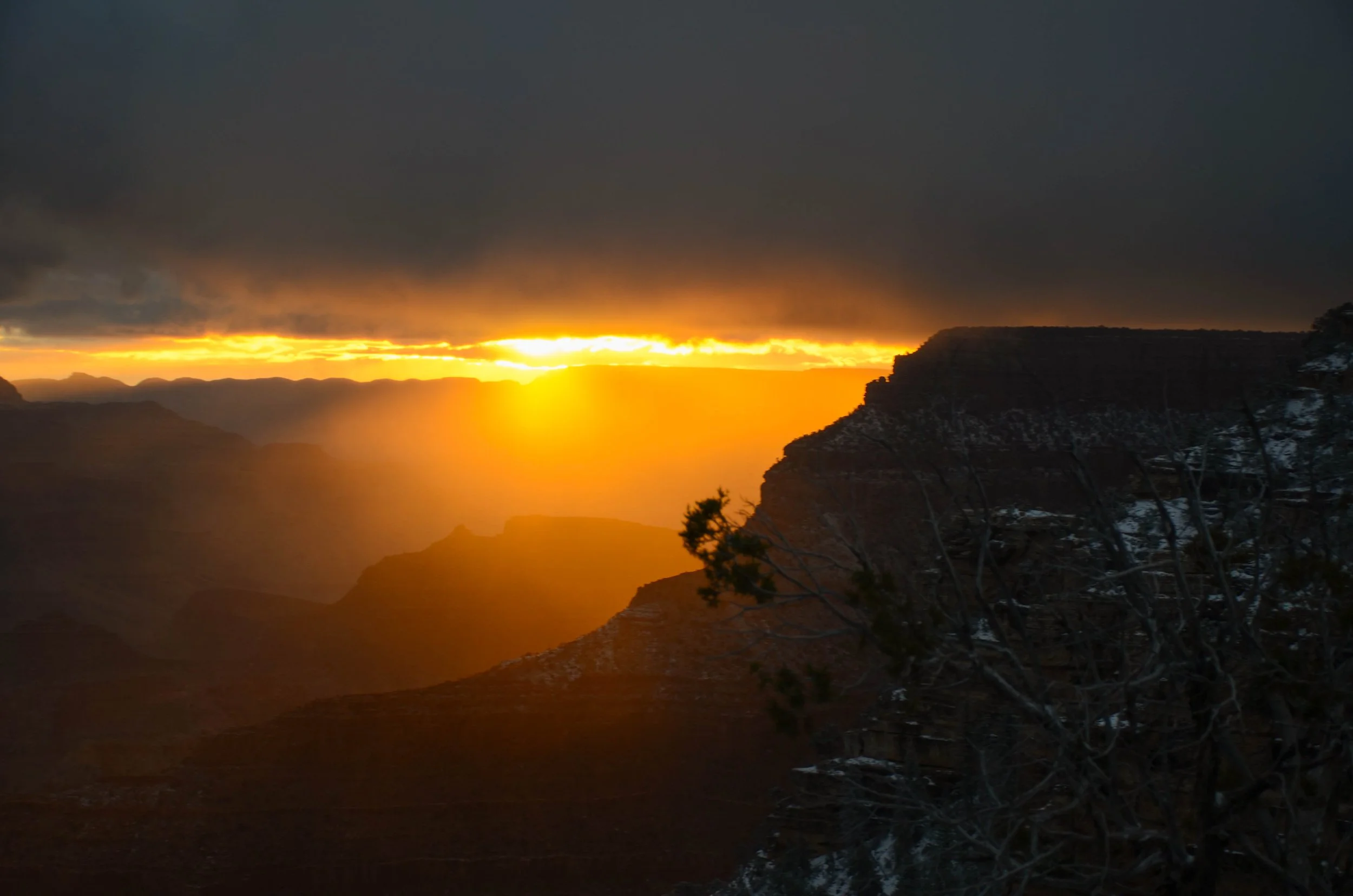
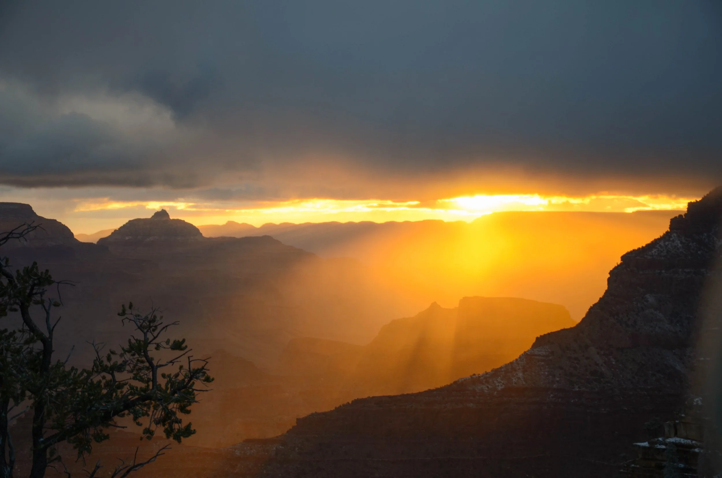
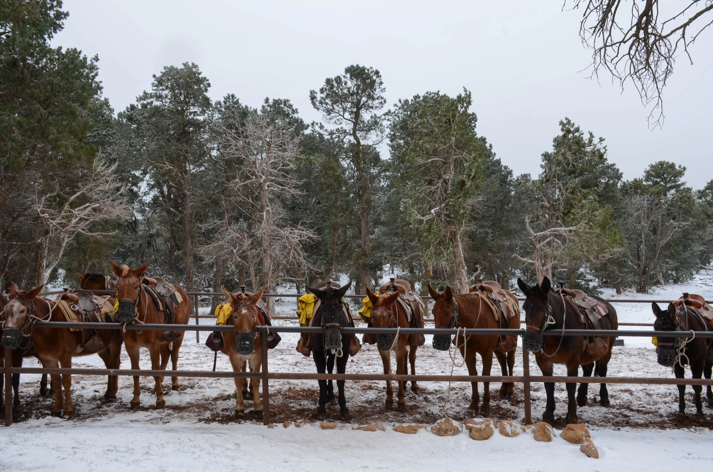
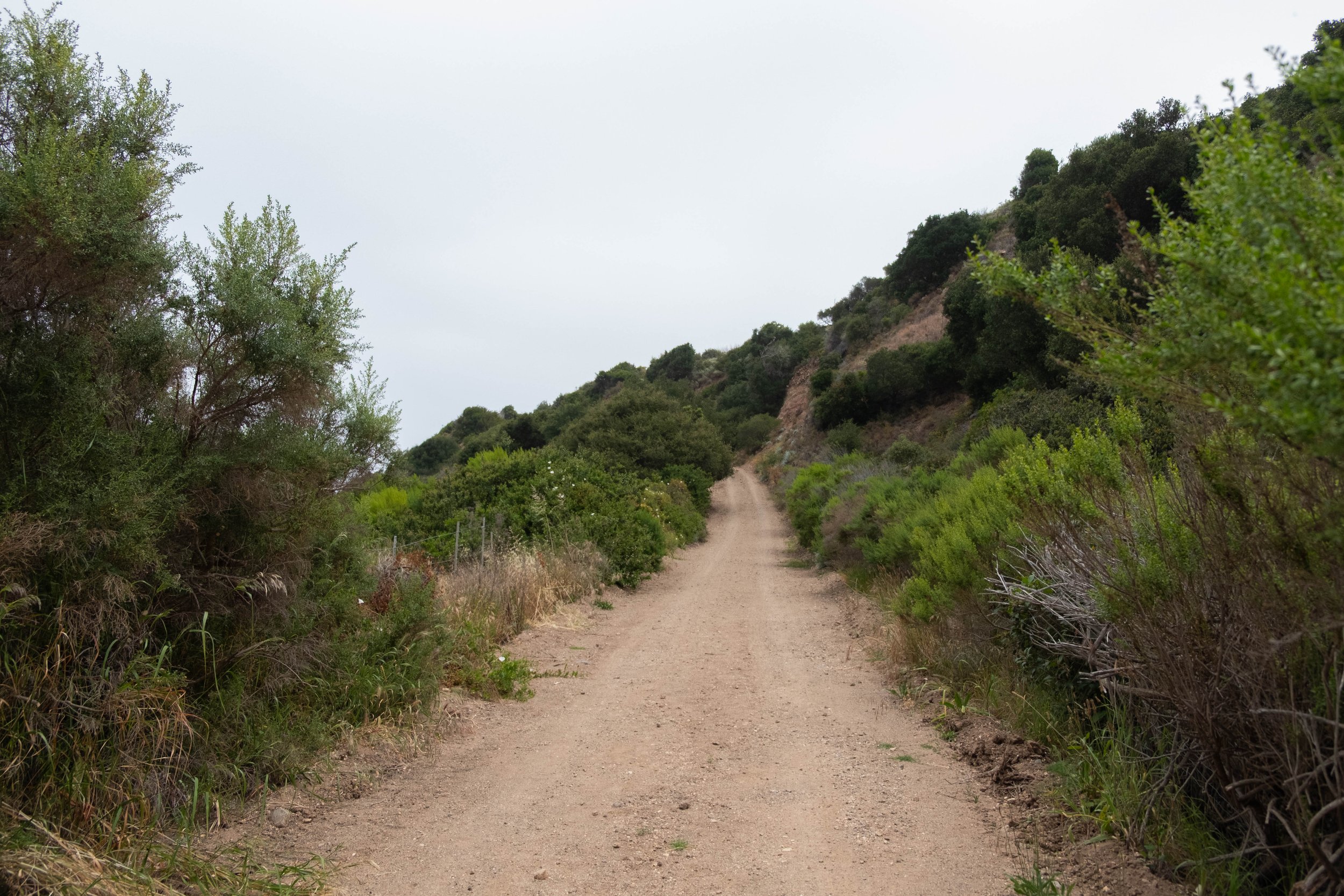
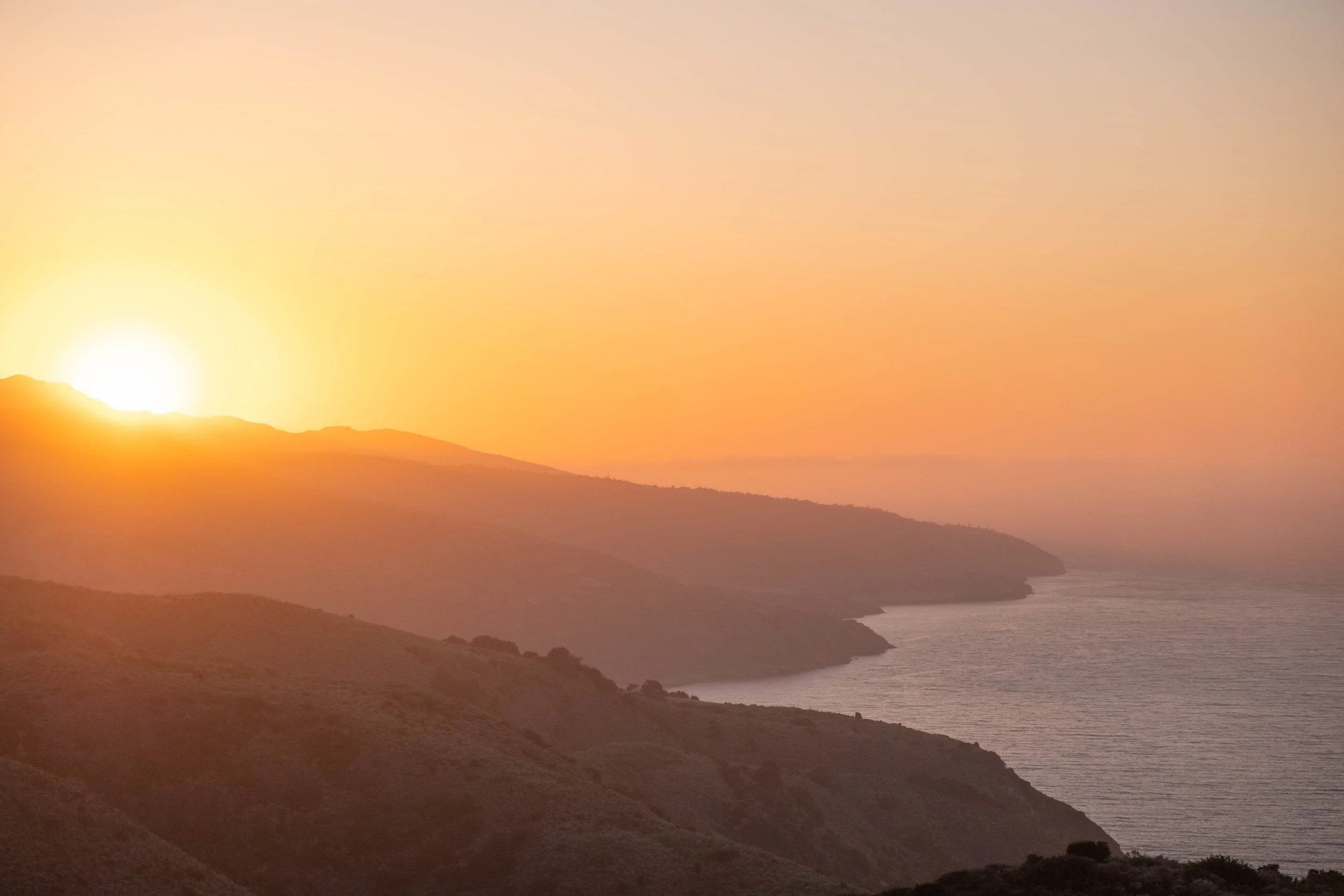
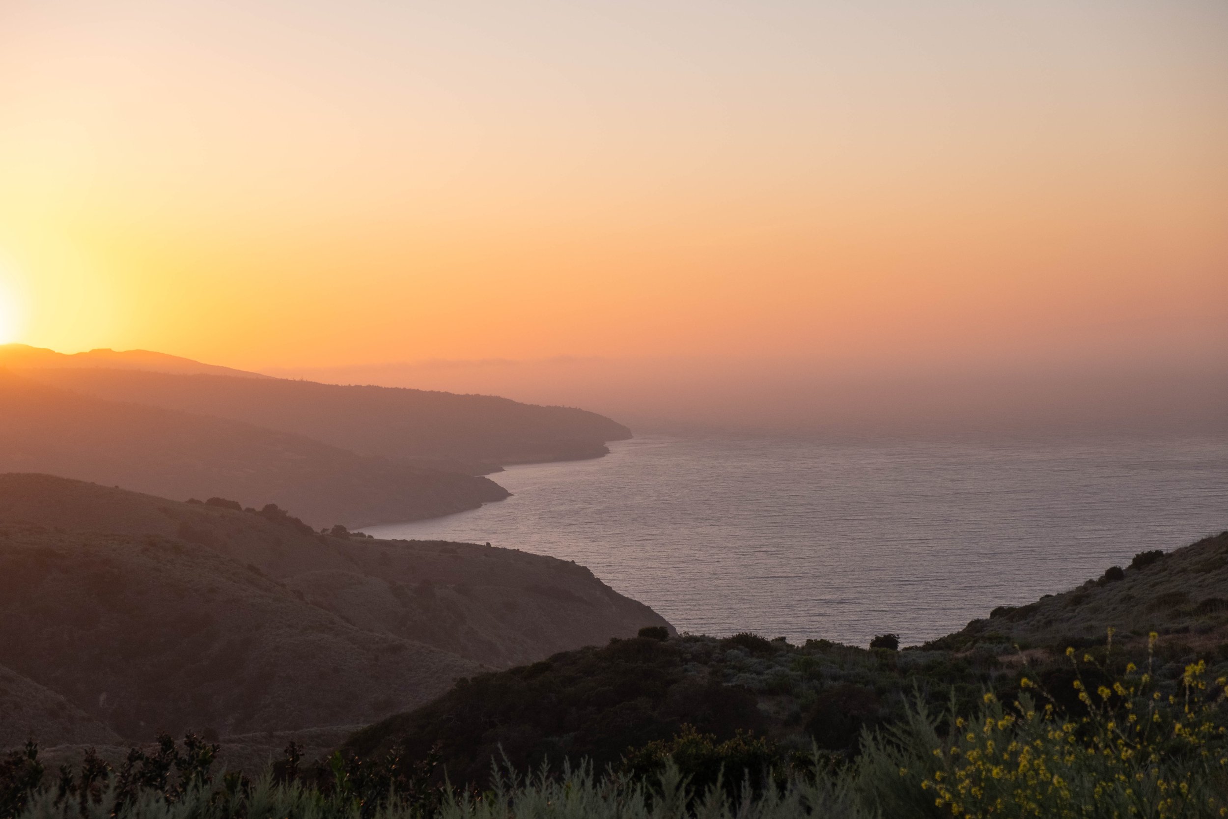
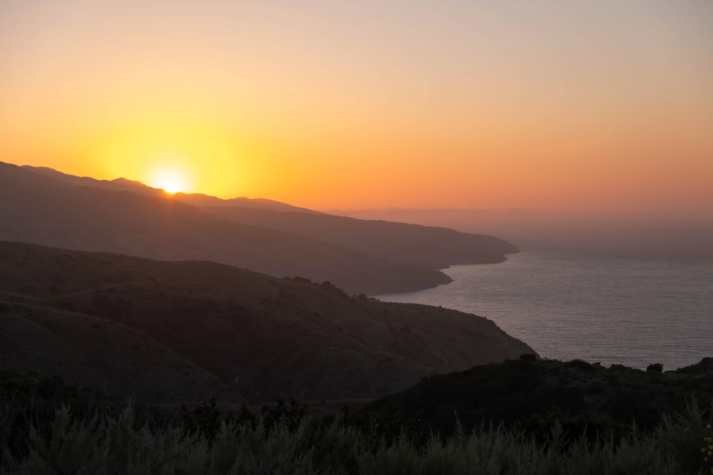
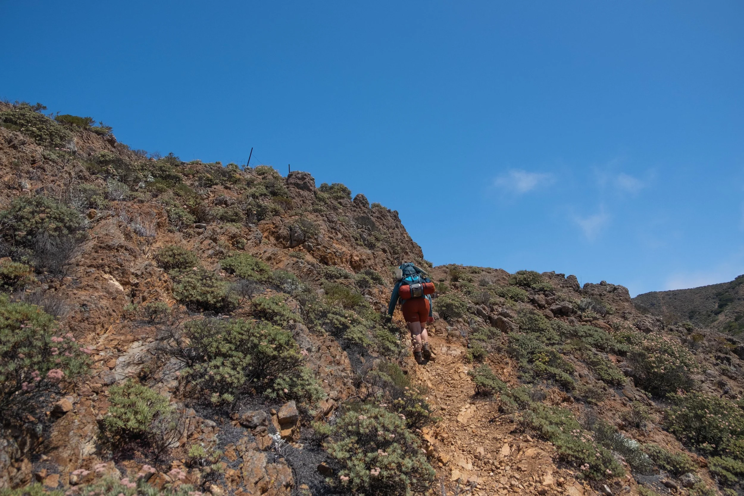
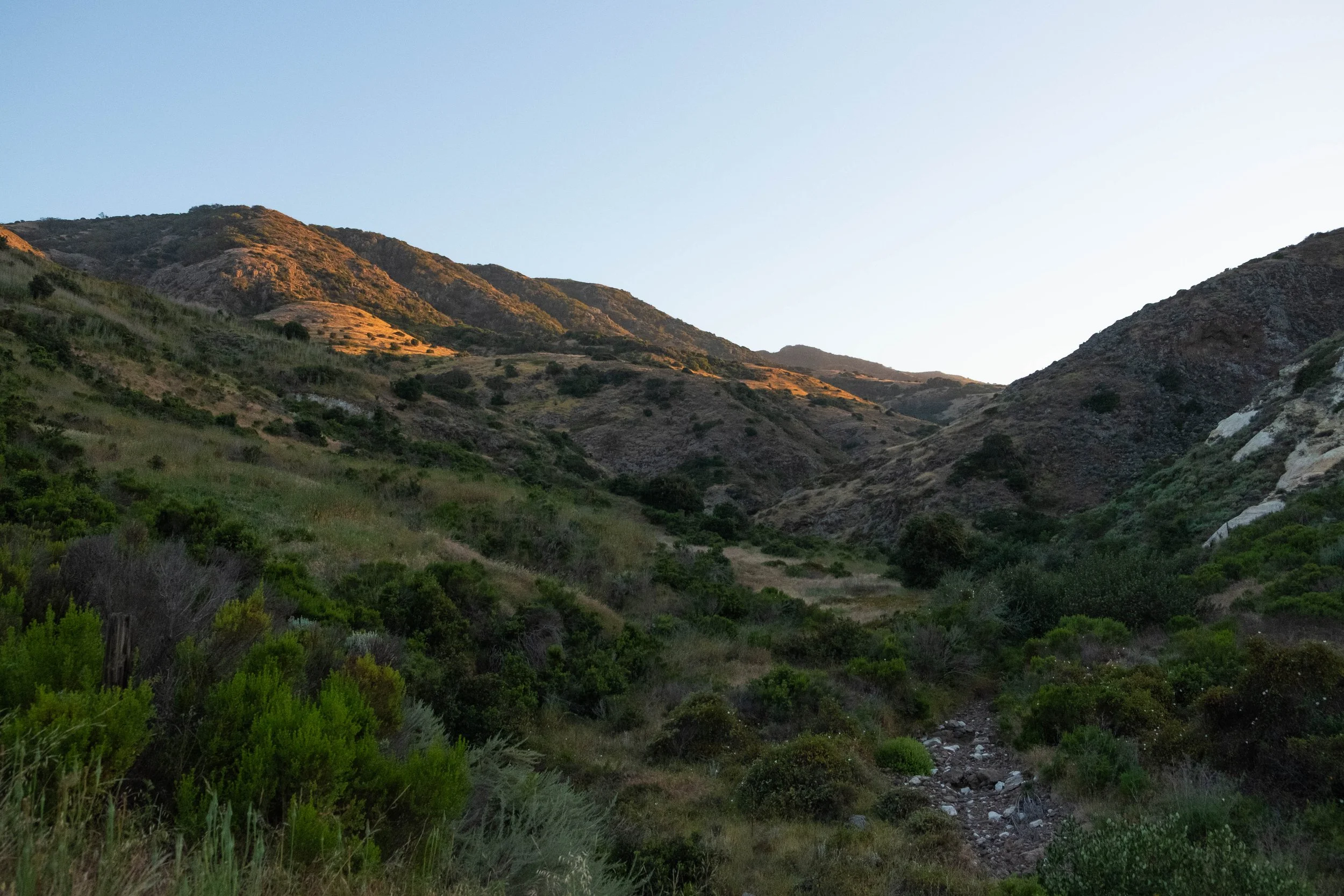
After an eleven-hour drive from Denver, we’d enjoyed an evening exploring Grand Canyon Village on the South Rim: Dinner at Harvey House Cafe, sunset at Hopi Point, and finalizing the gear in our backpacks at Maswik Lodge. The next morning, we drove our car to the neighboring Backcountry Information Office, where we would park it for the next couple of days, and caught the Hiker’s Express Shuttle to the South Kaibab Trailhead.
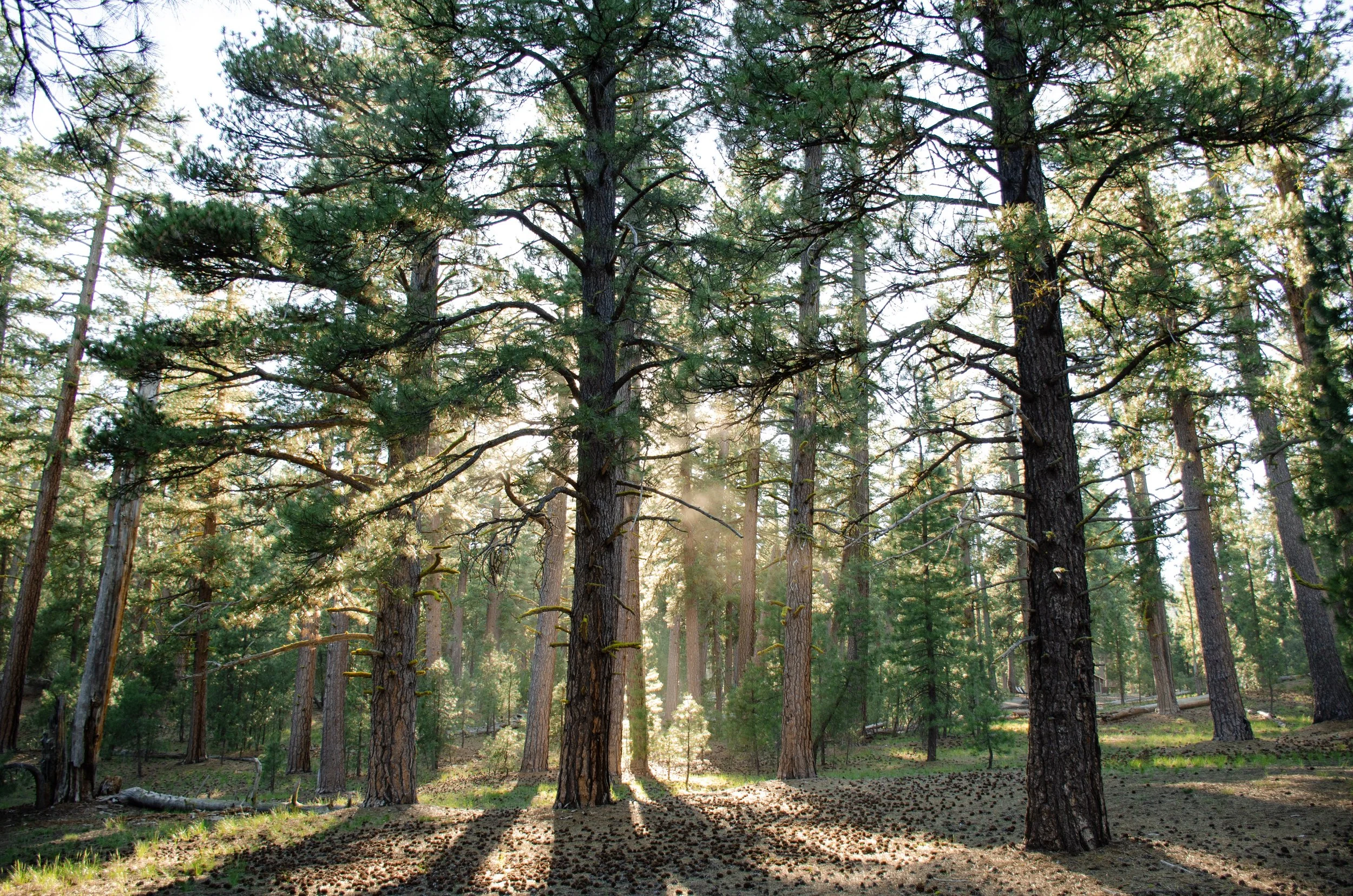
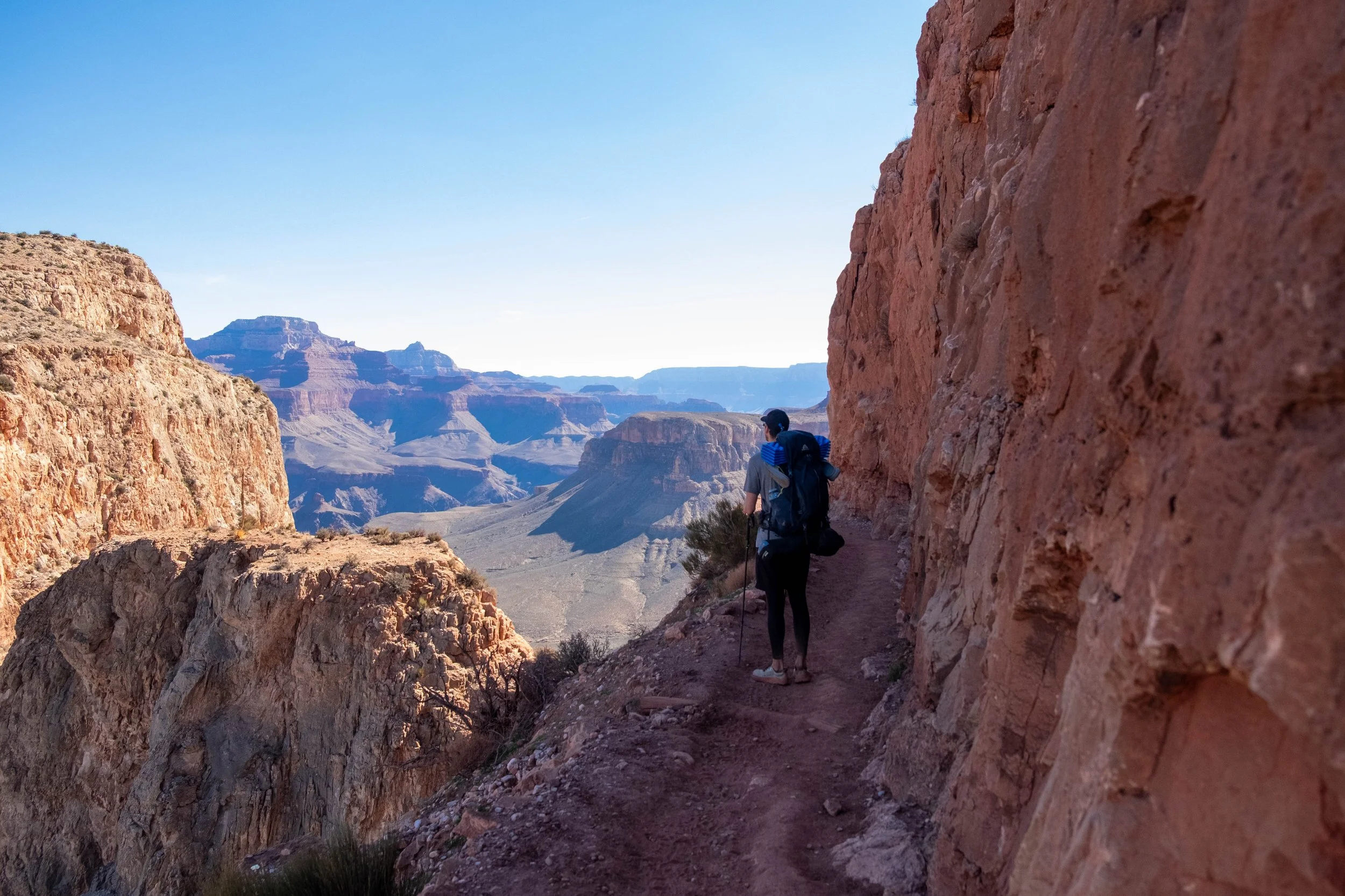
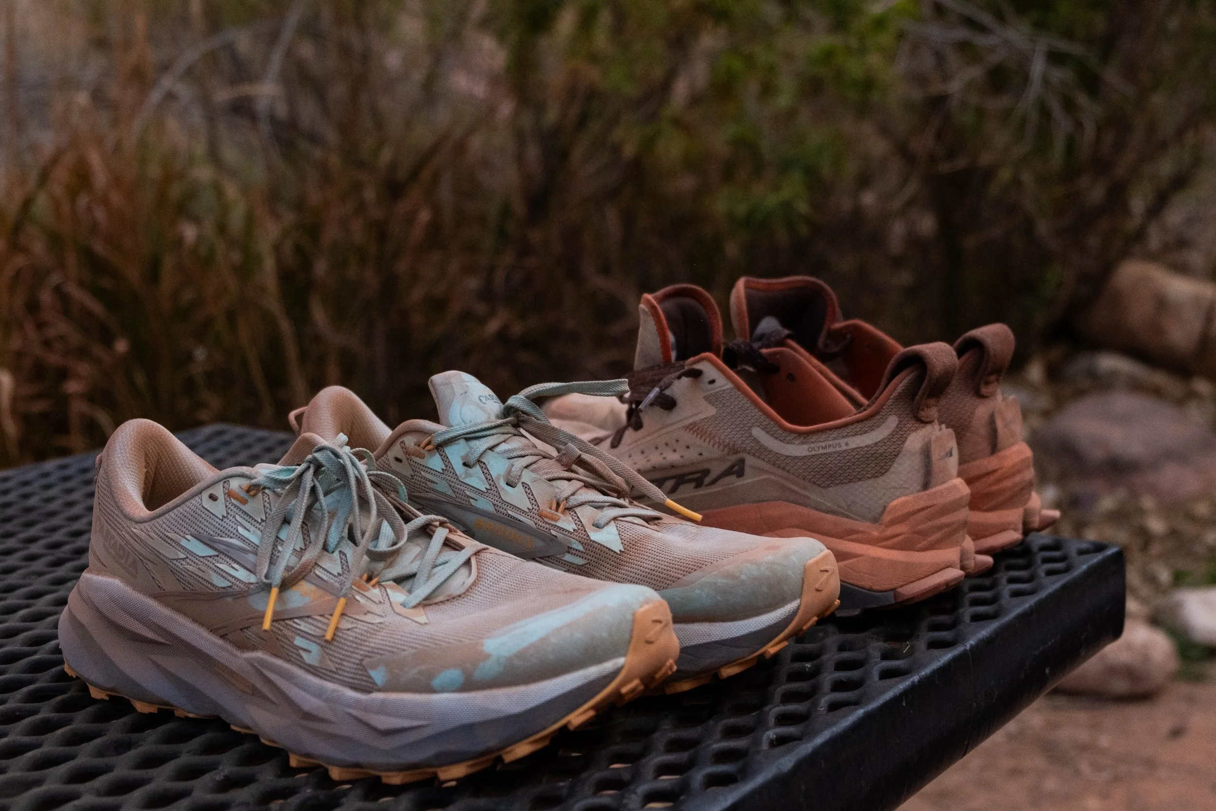
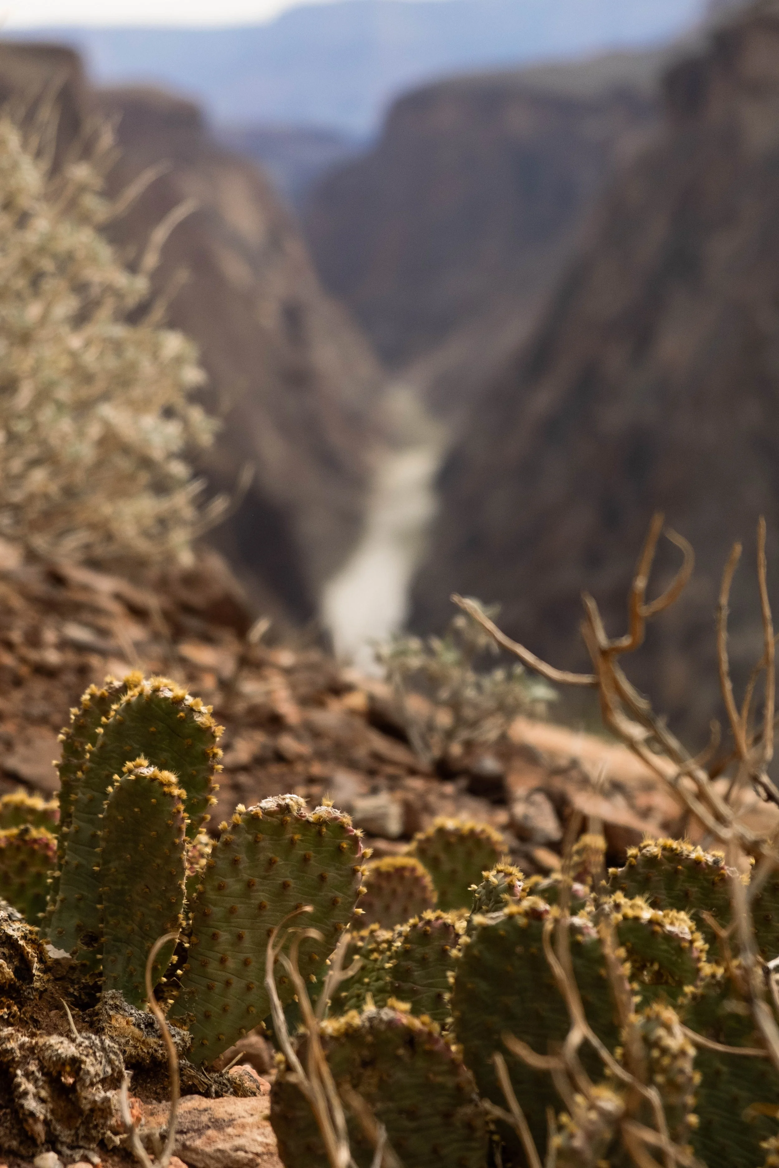
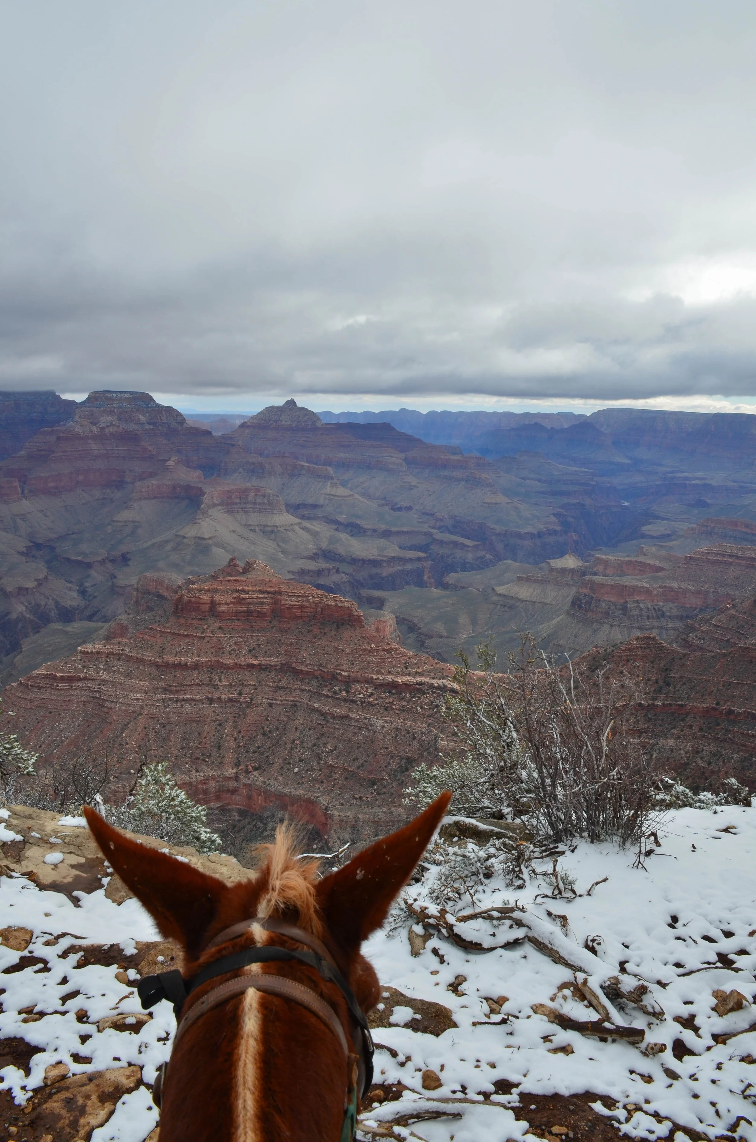
I’d hiked the South Kaibab to Skeleton Point on both of my previous trips to GCNP, but was eager to get beyond the known-to-me parts of the trail. The air was cool at the top, but steadily increased in temperature as we wound our way further down into the canyon. The weather at the bottom was supposed to get up to 87 degrees F, almost 20 degrees warmer than the rim. We are more used to ascending a trail to start and the air getting cooler as we go, so I prepared myself for what I knew would feel like an oddly reversed experience. We were carrying two liters of water and one liter of electrolytes each, which was a fairly significant addition of weight to our packs but we’d deemed it necessary since there are no water sources along the way.
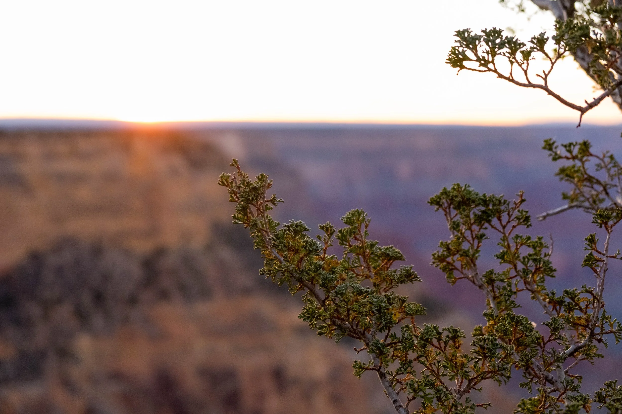
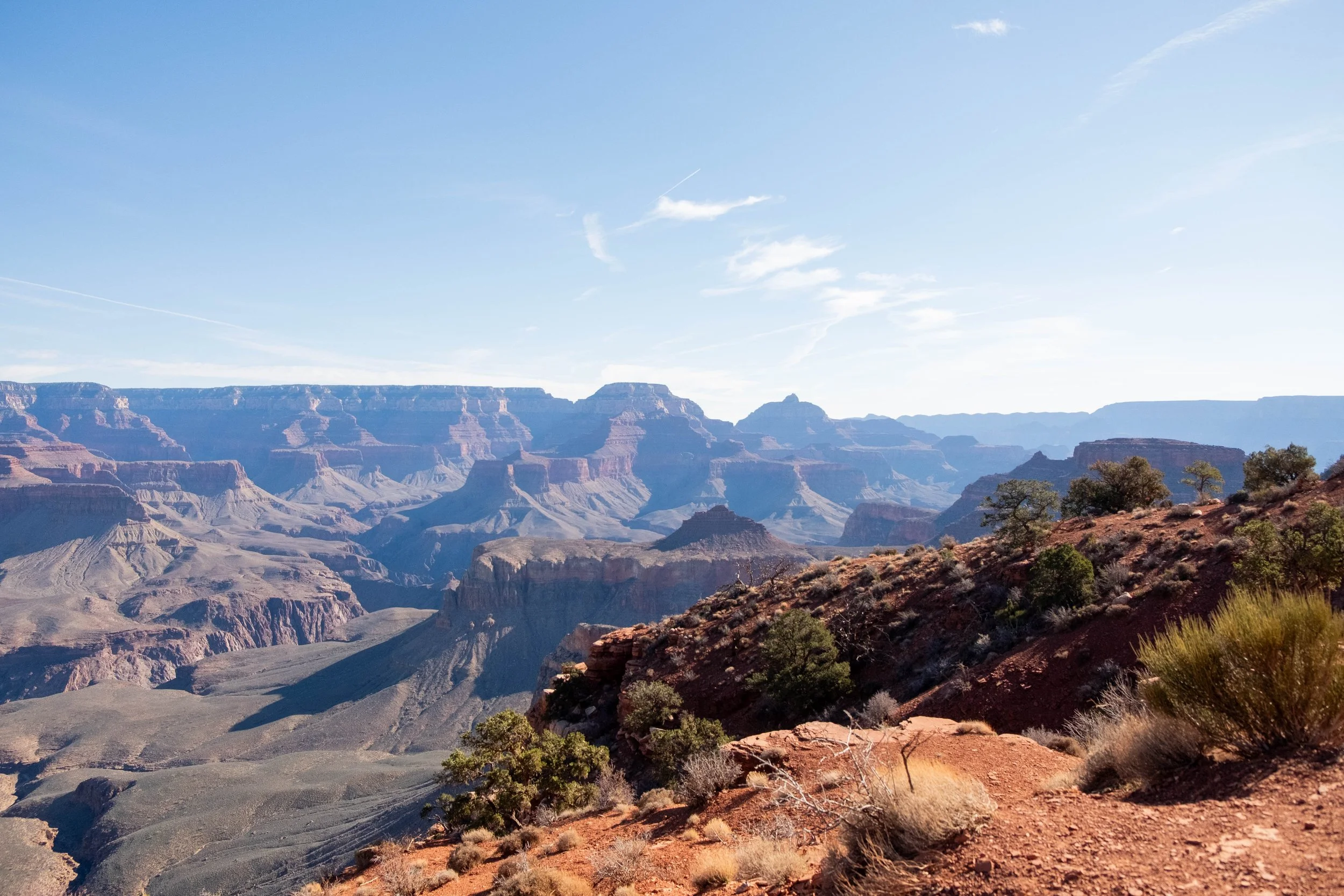
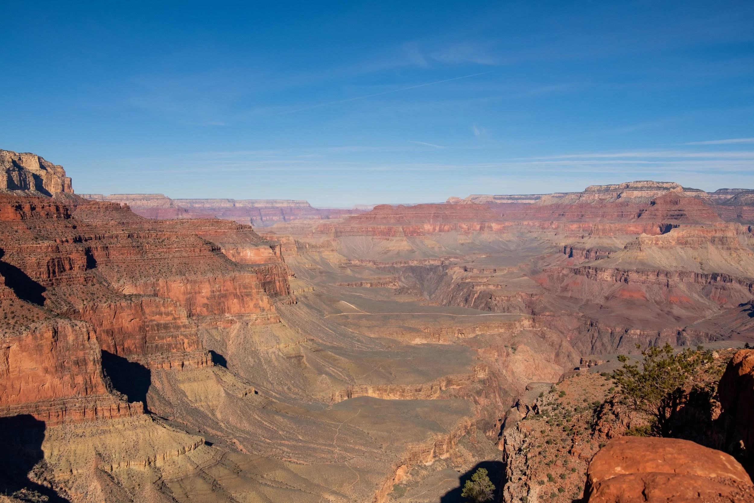
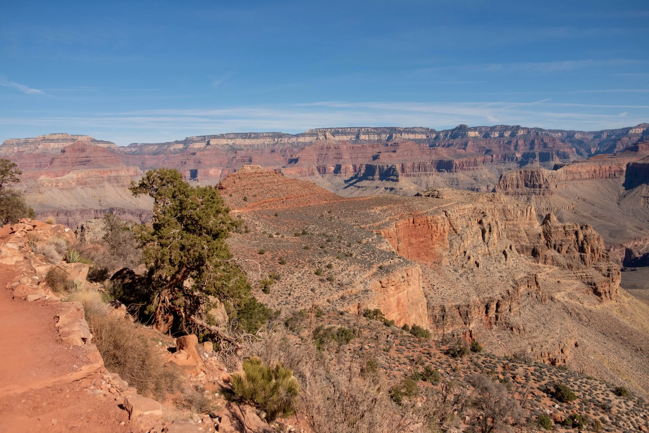
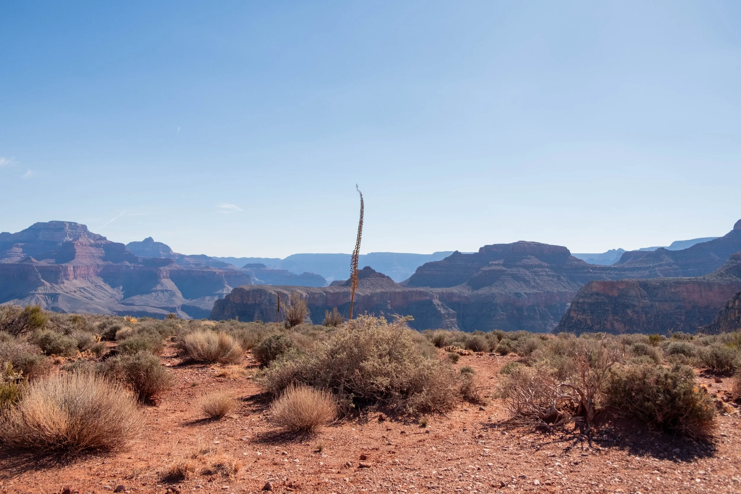
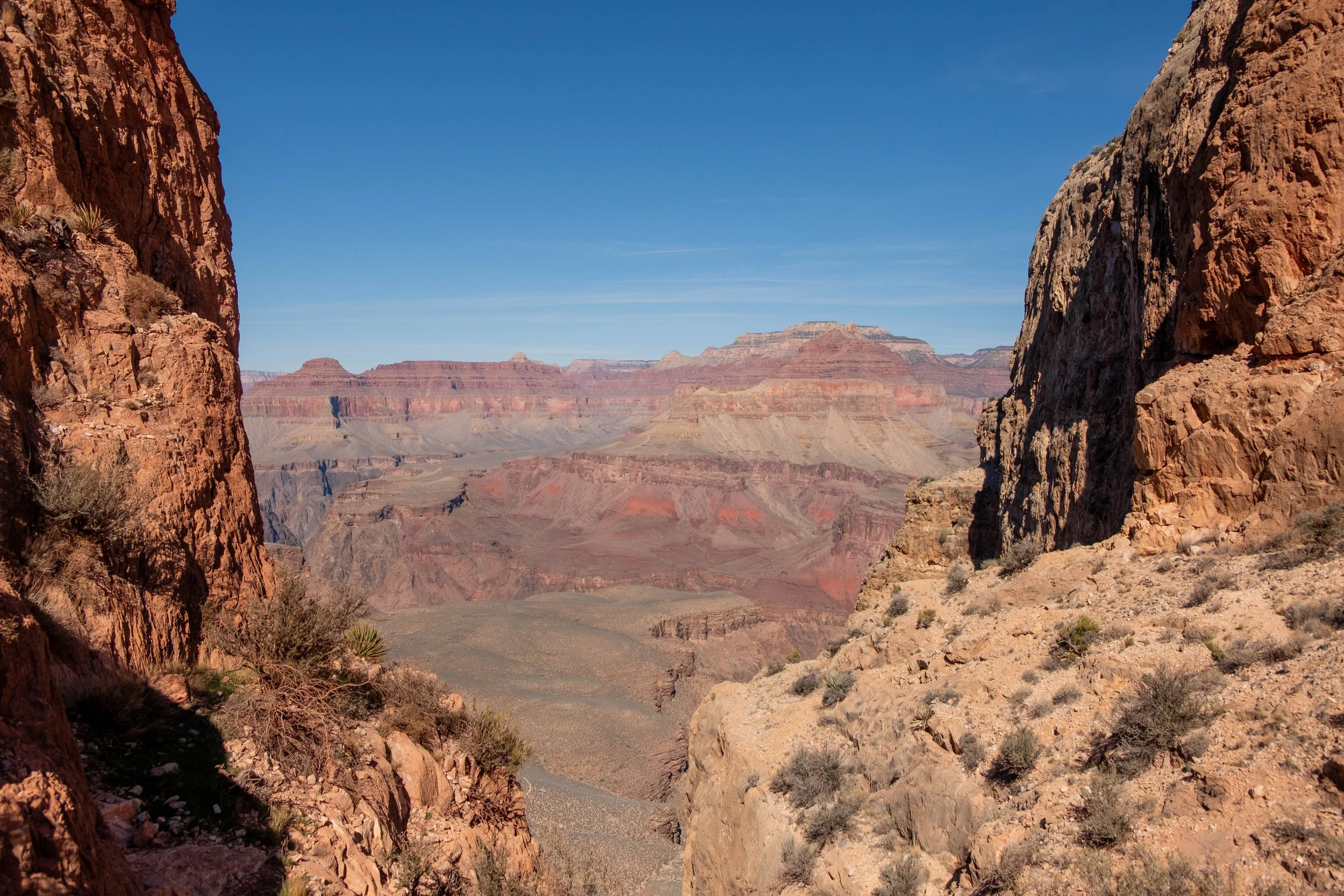
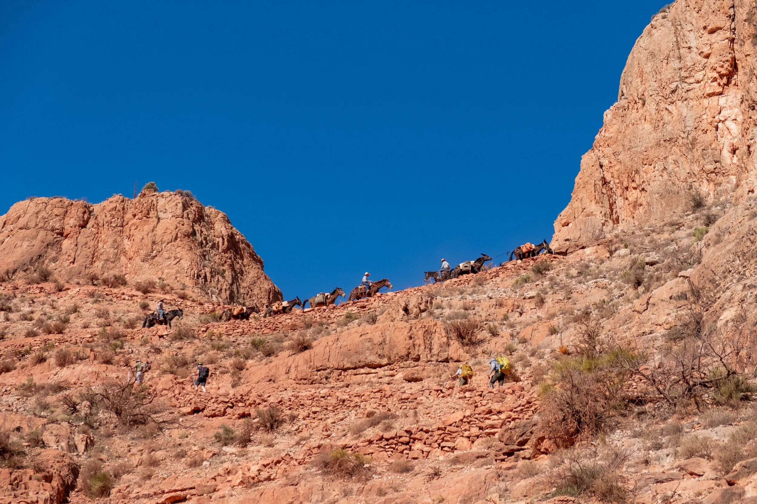
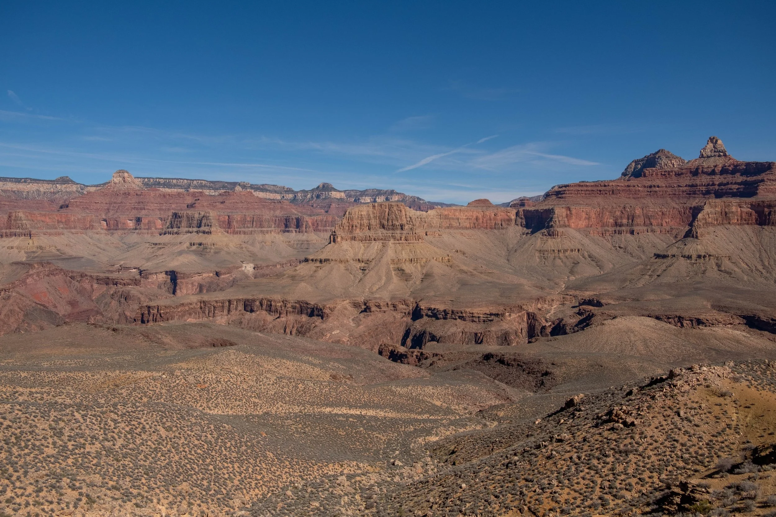
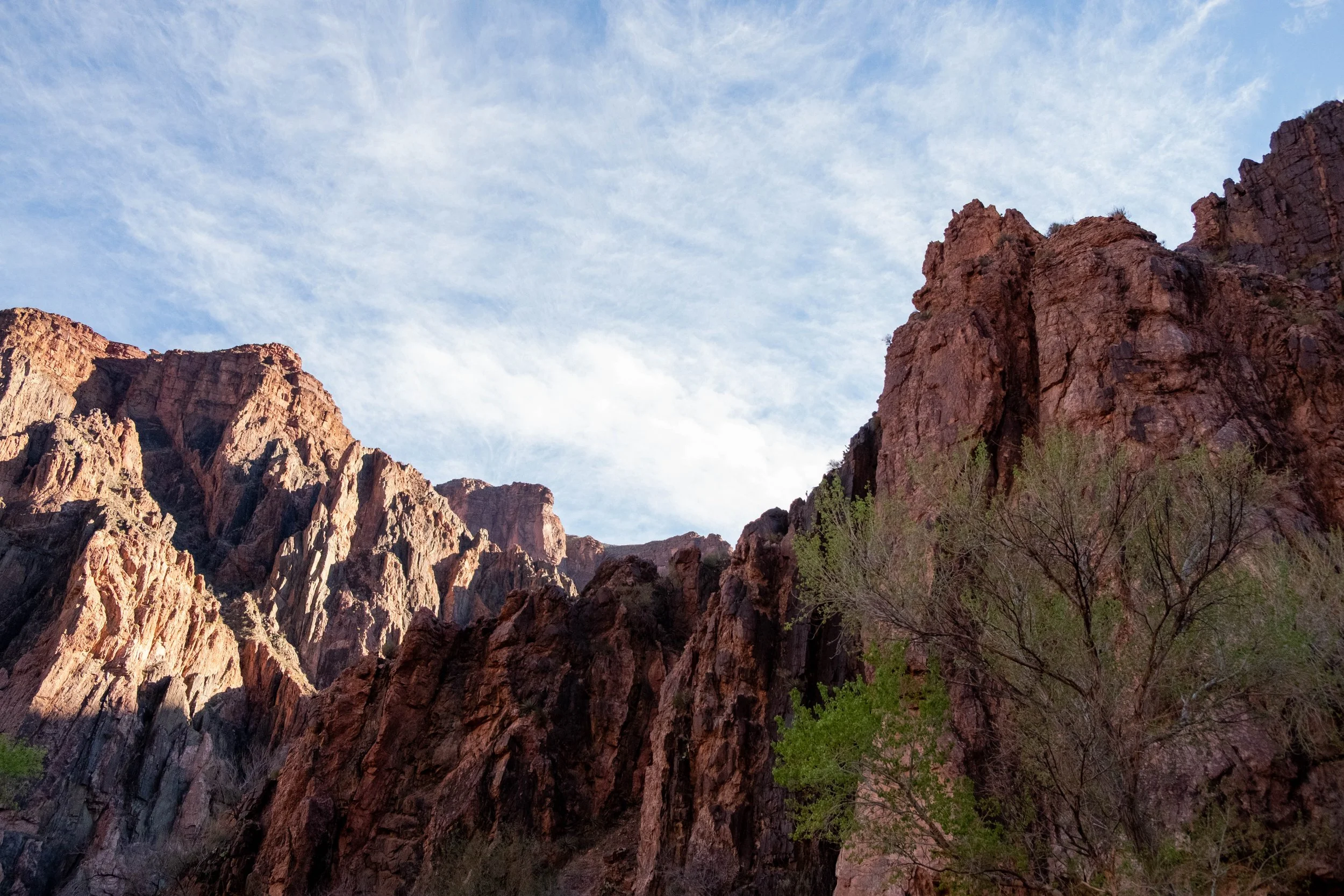
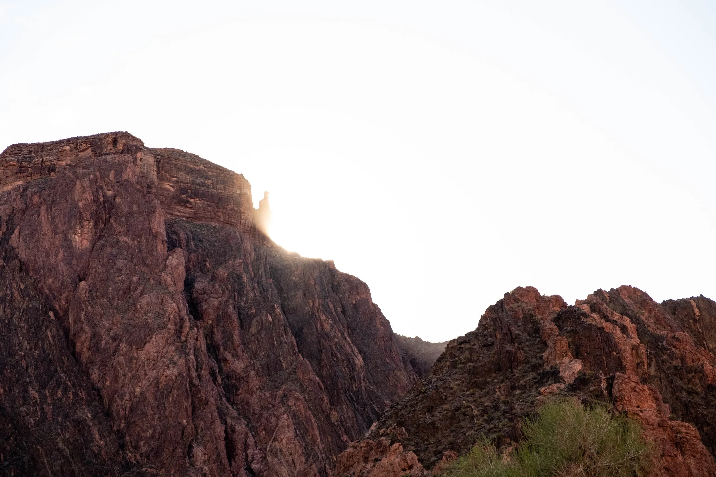
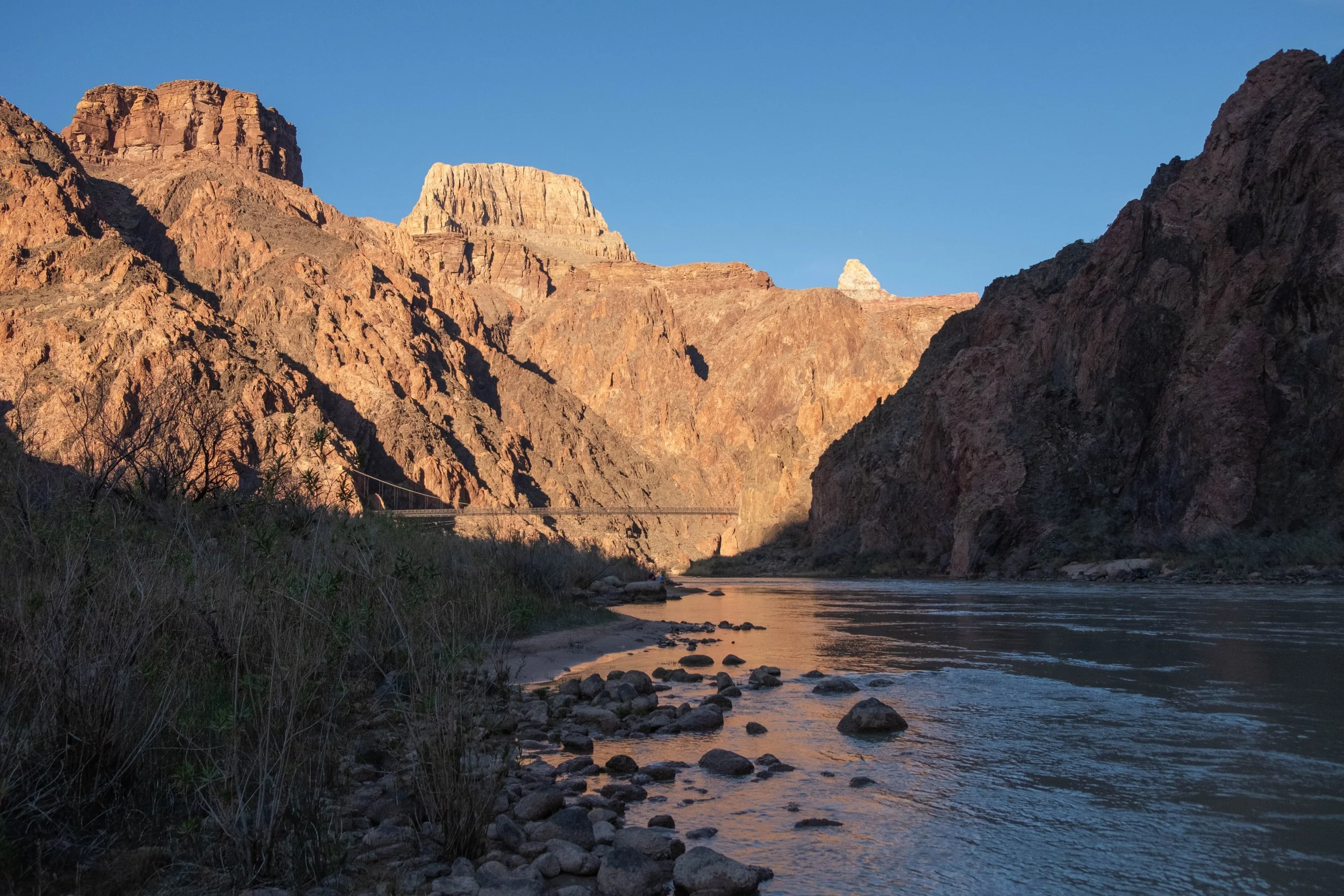
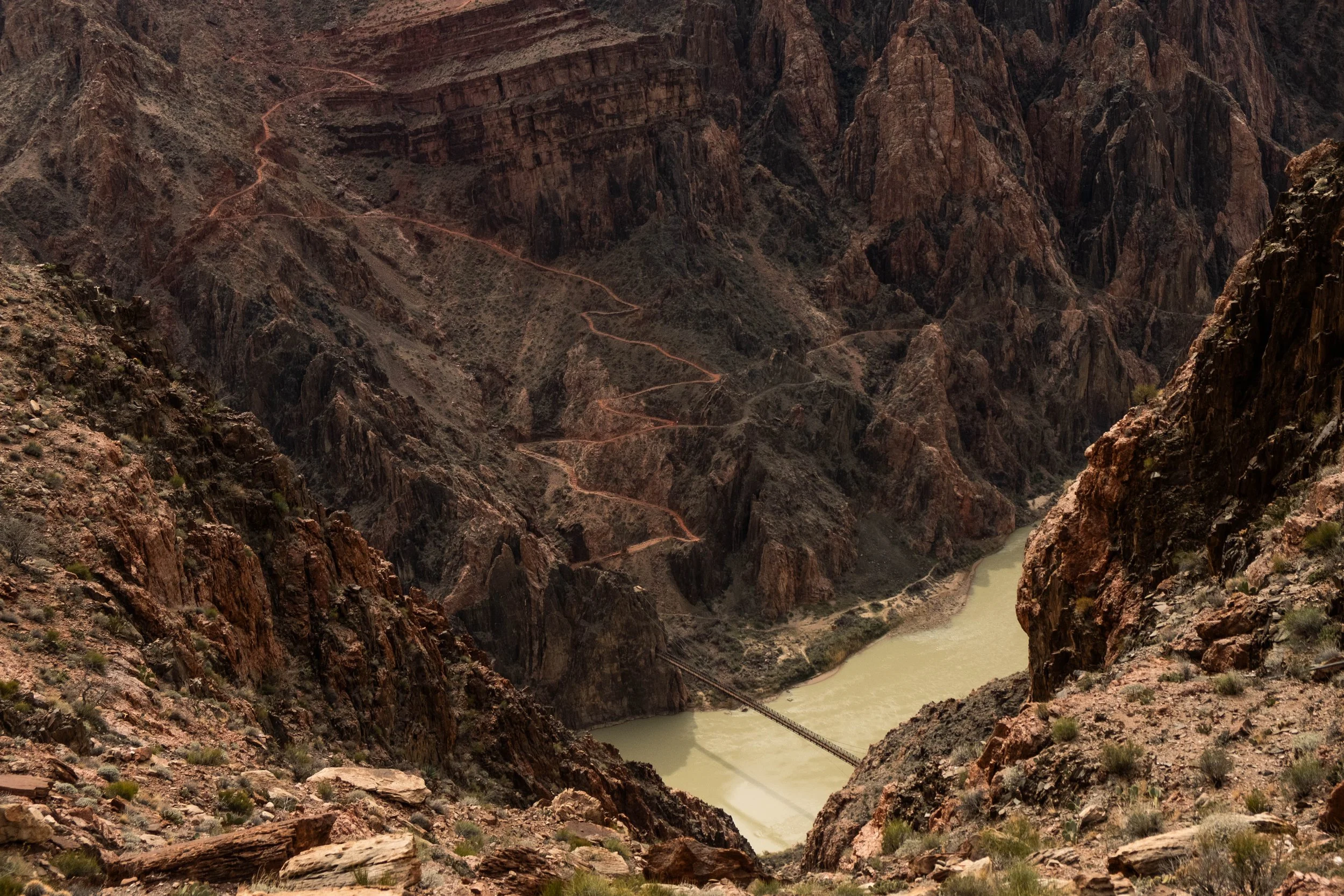
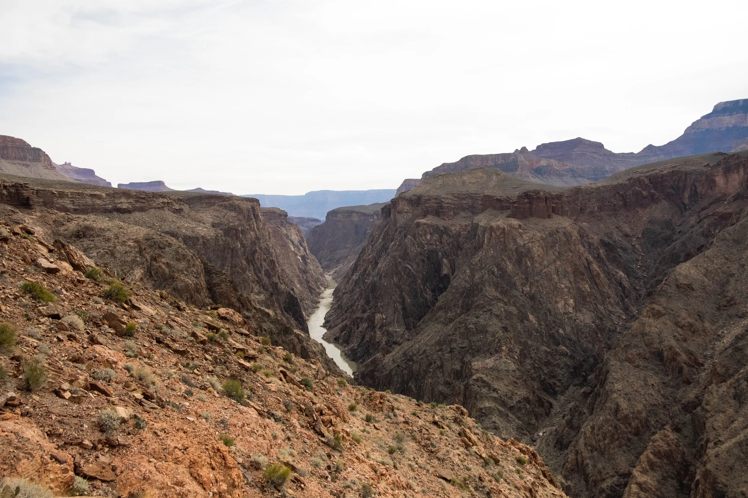
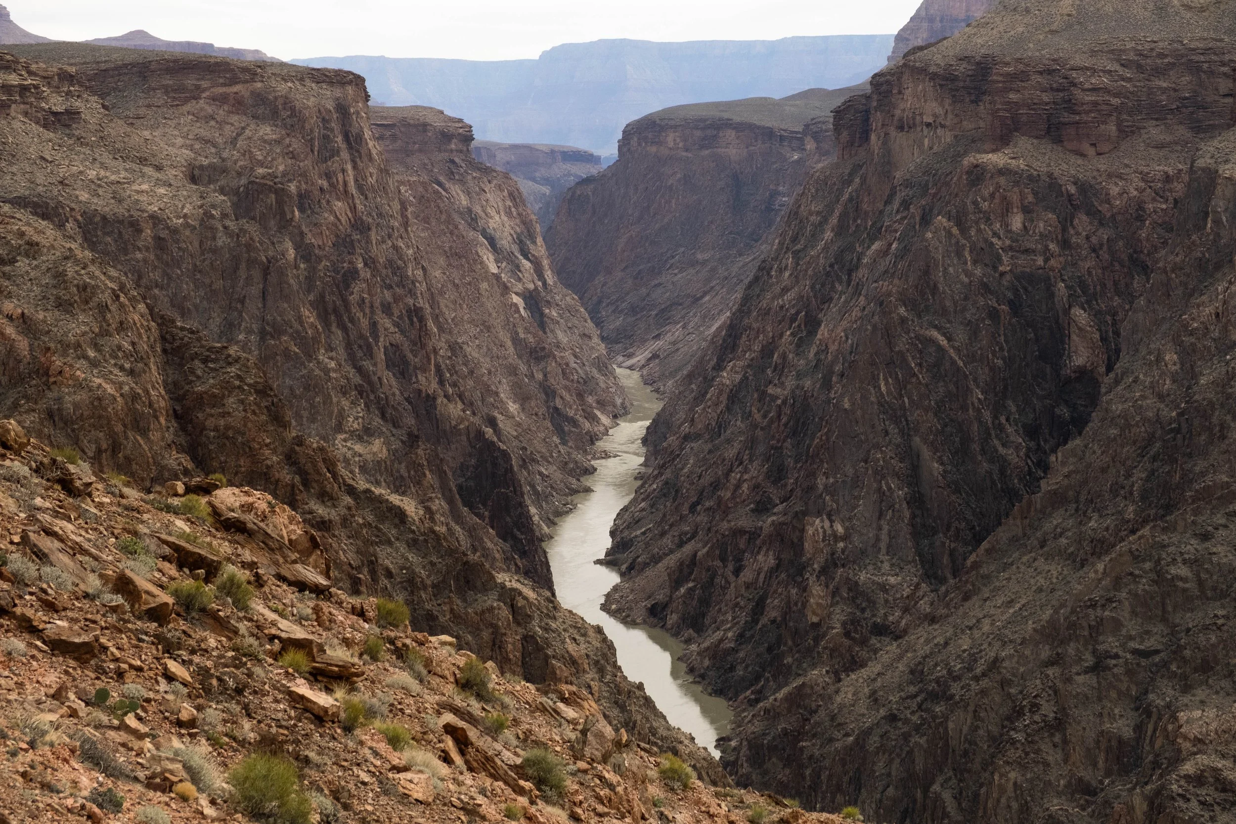
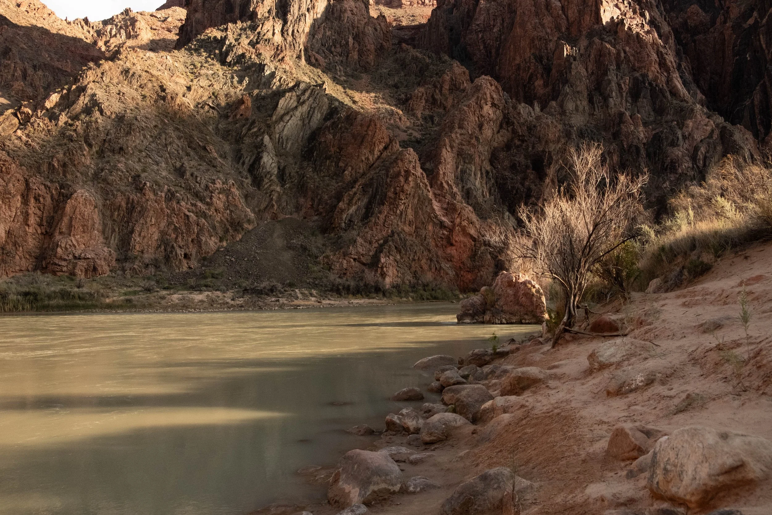
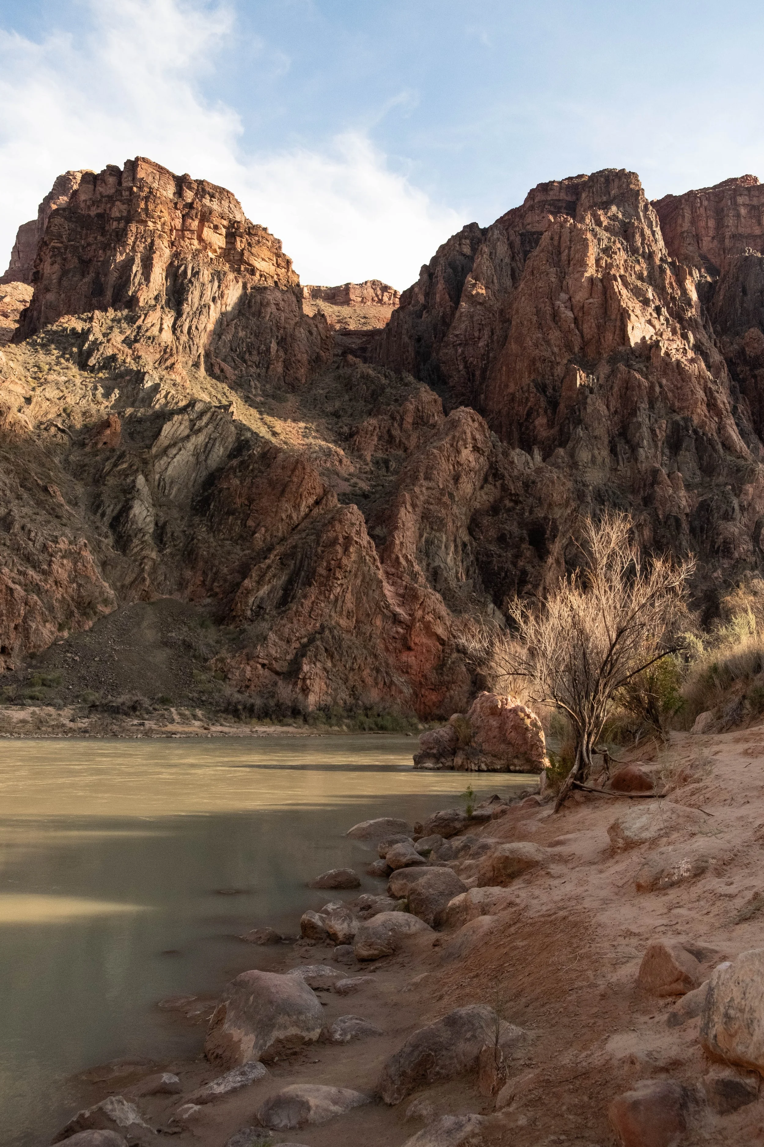
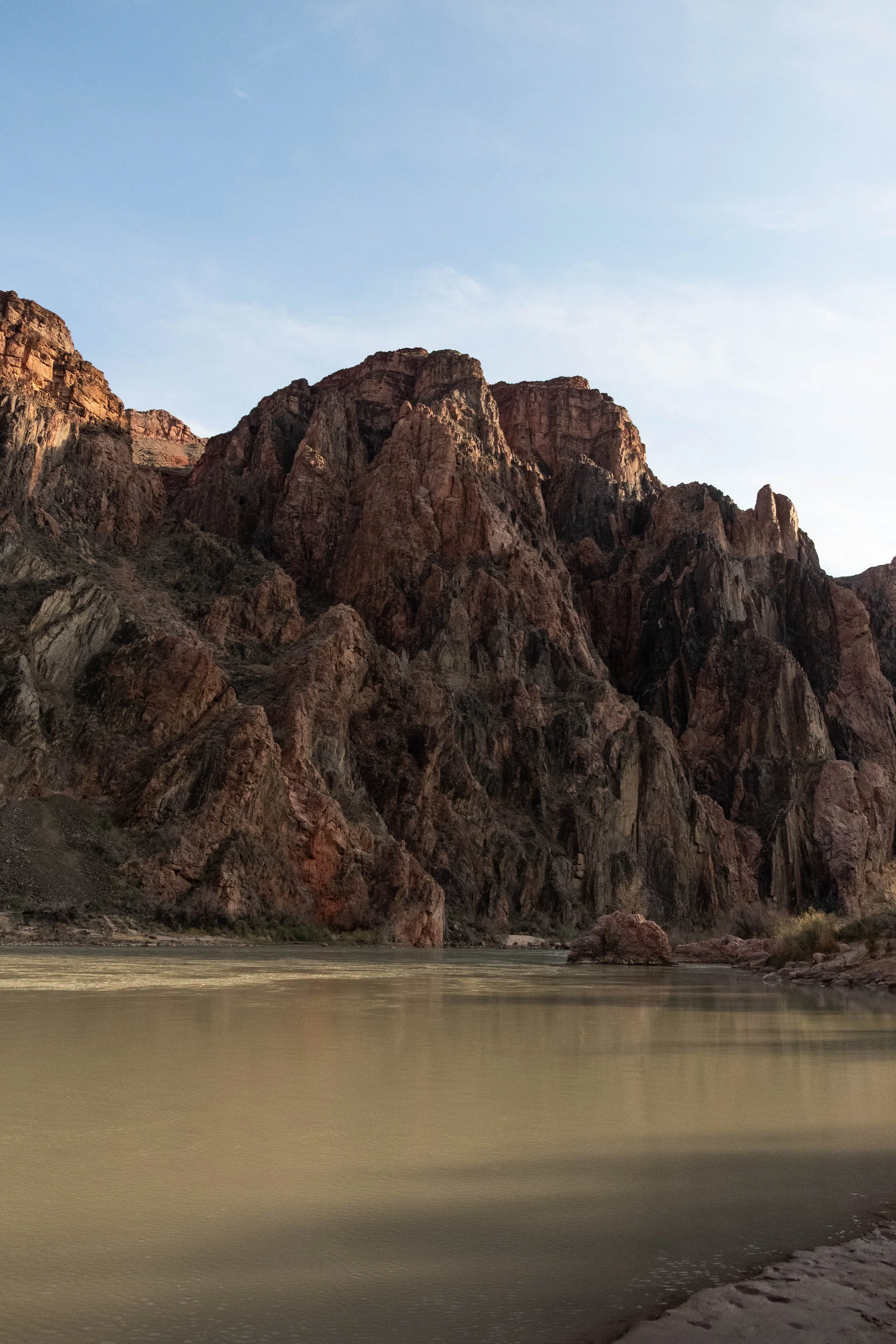
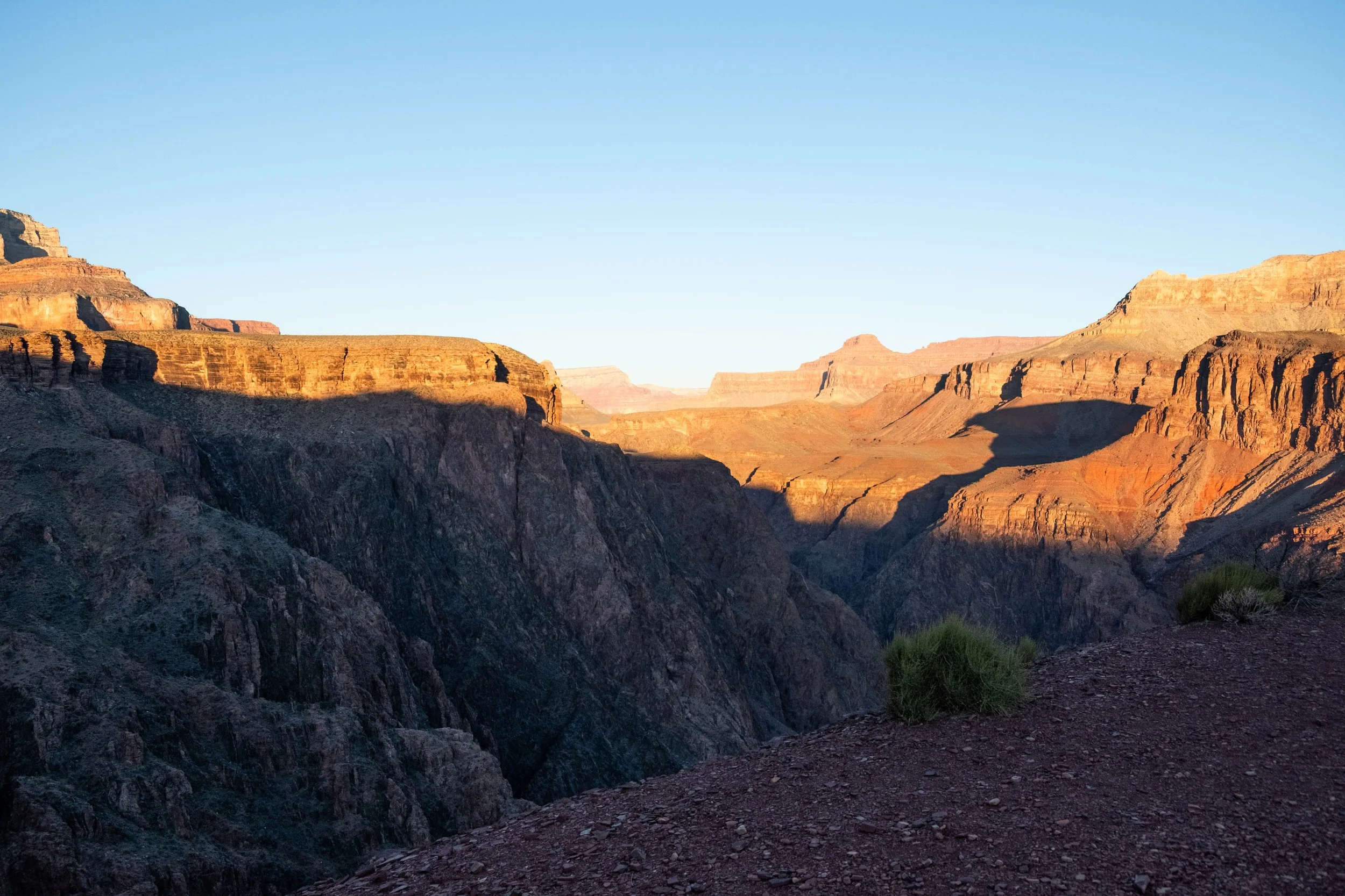
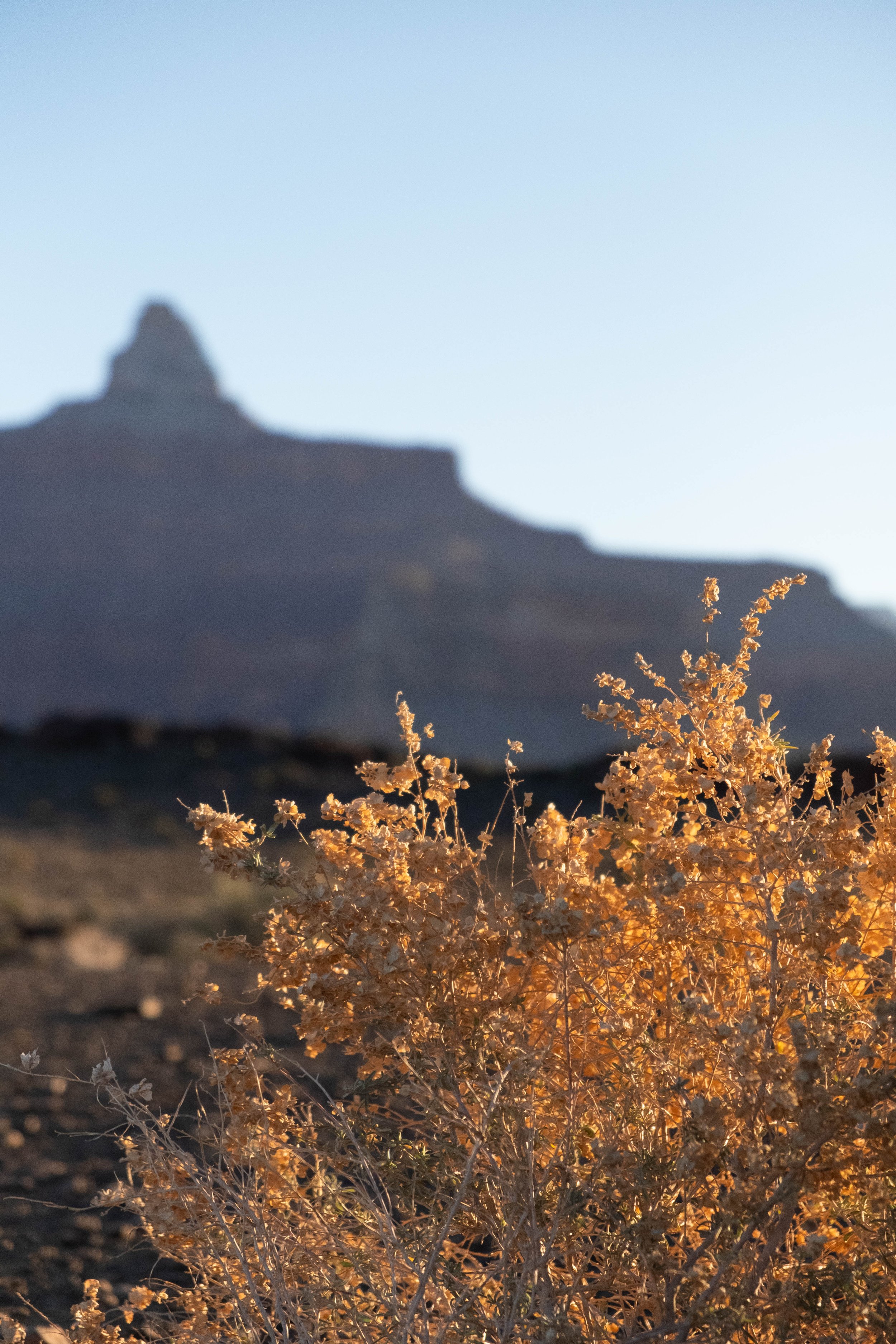
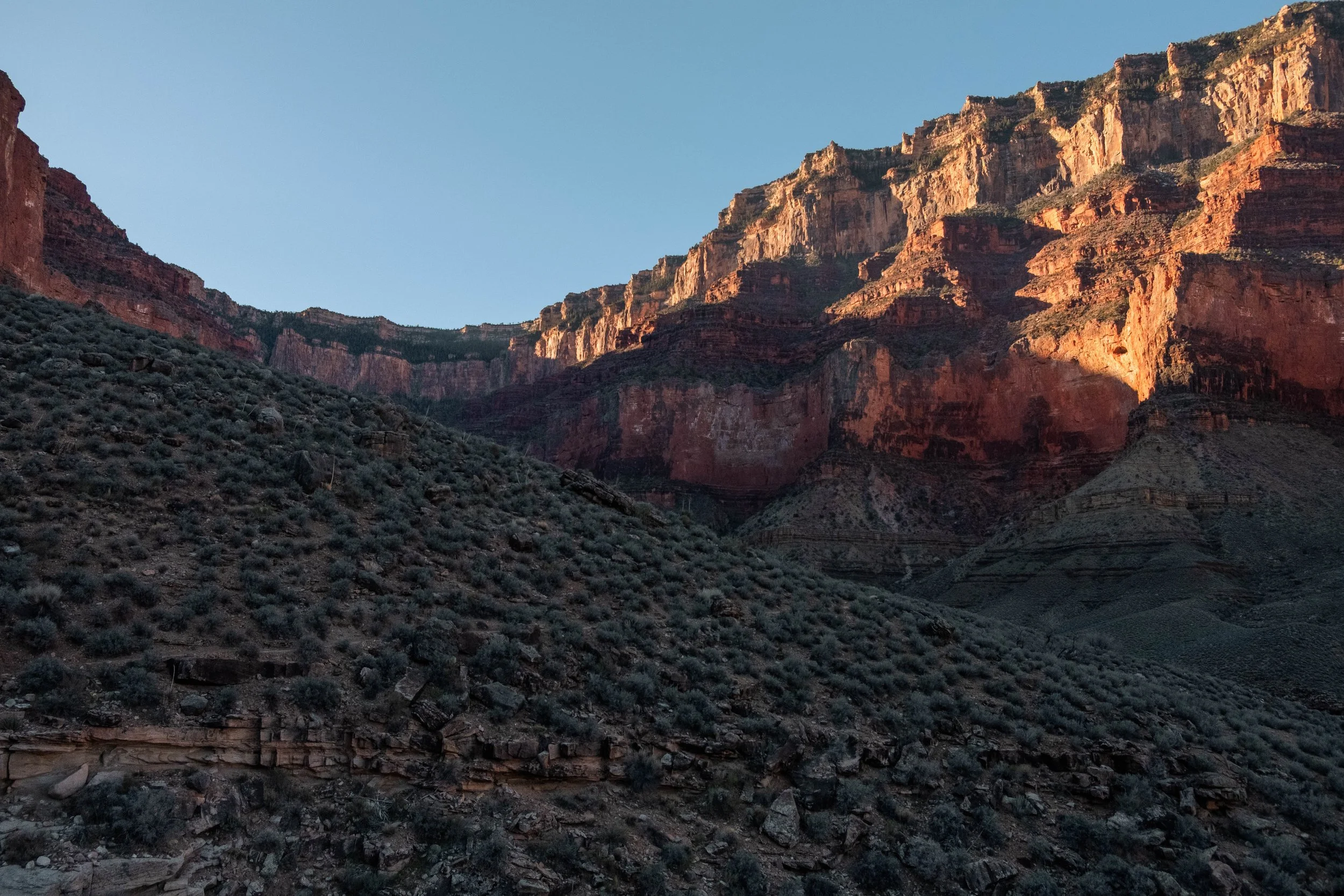
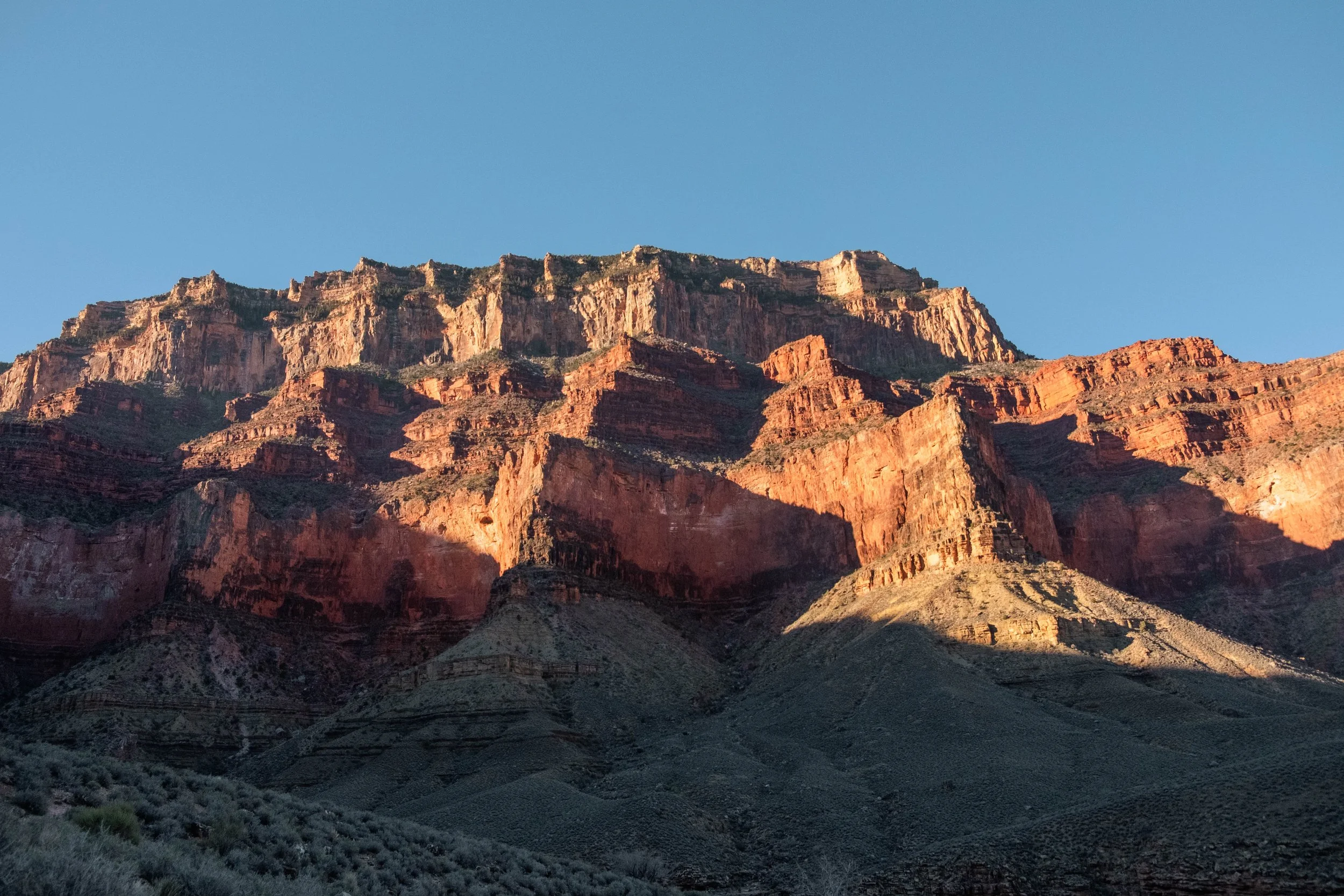
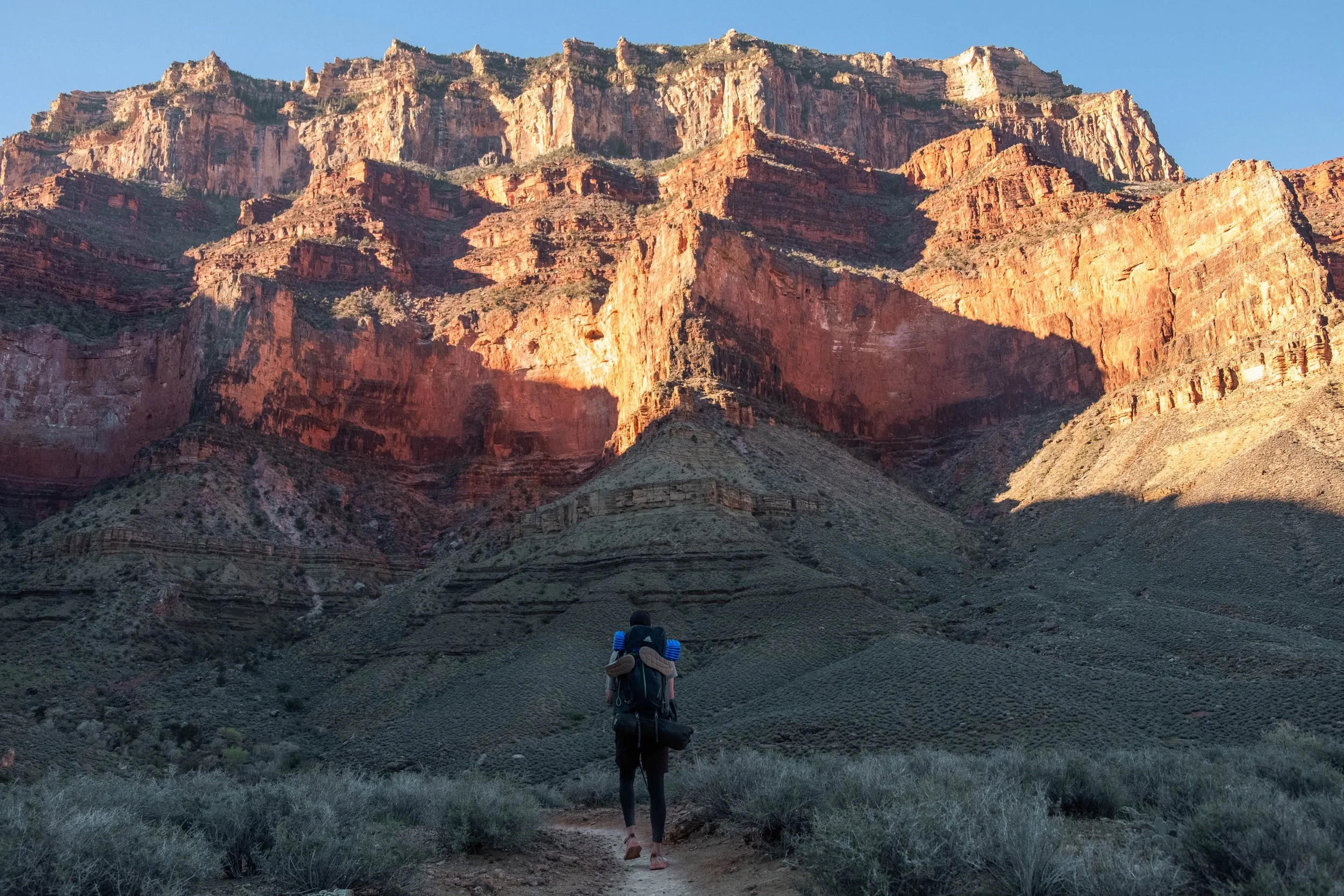
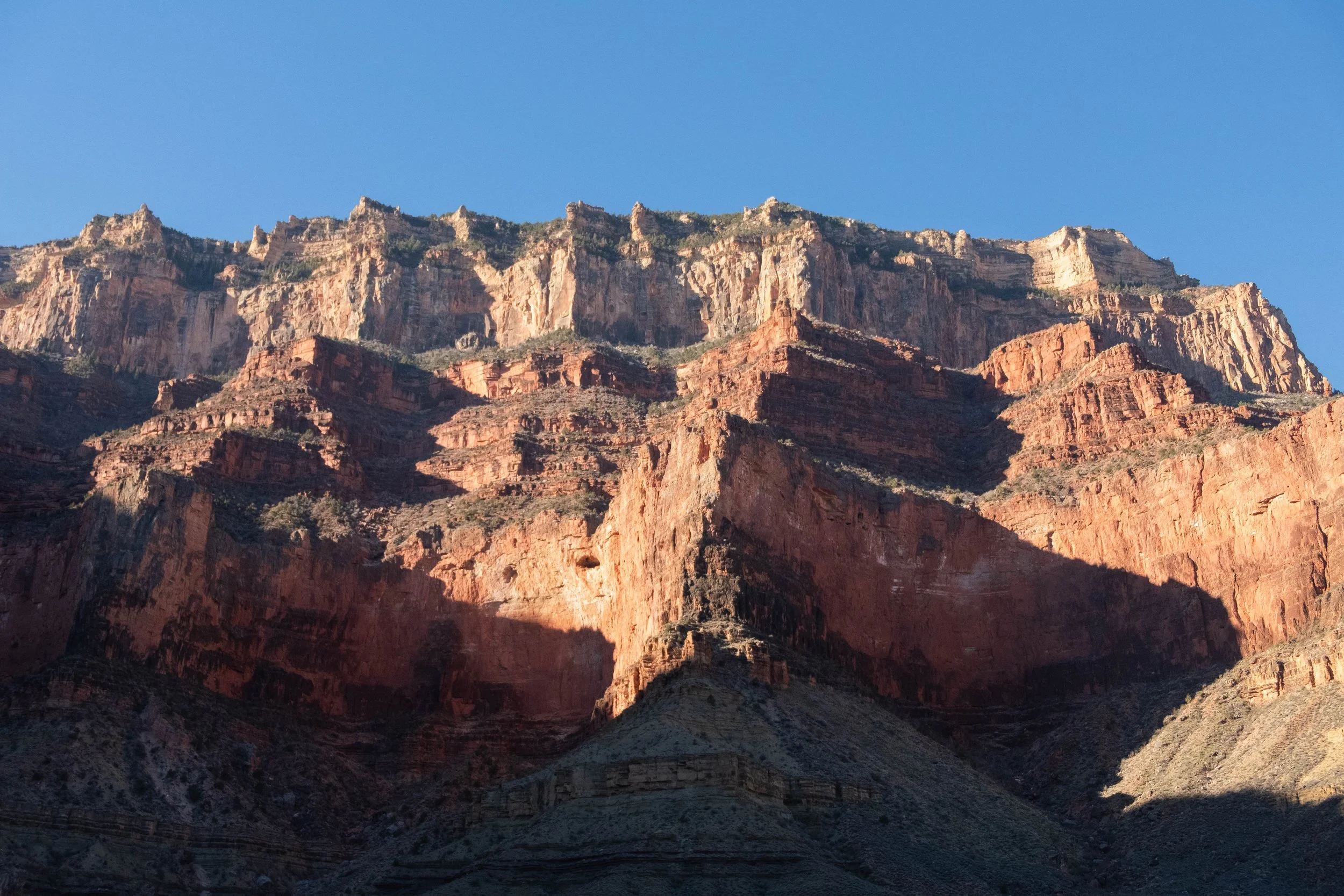
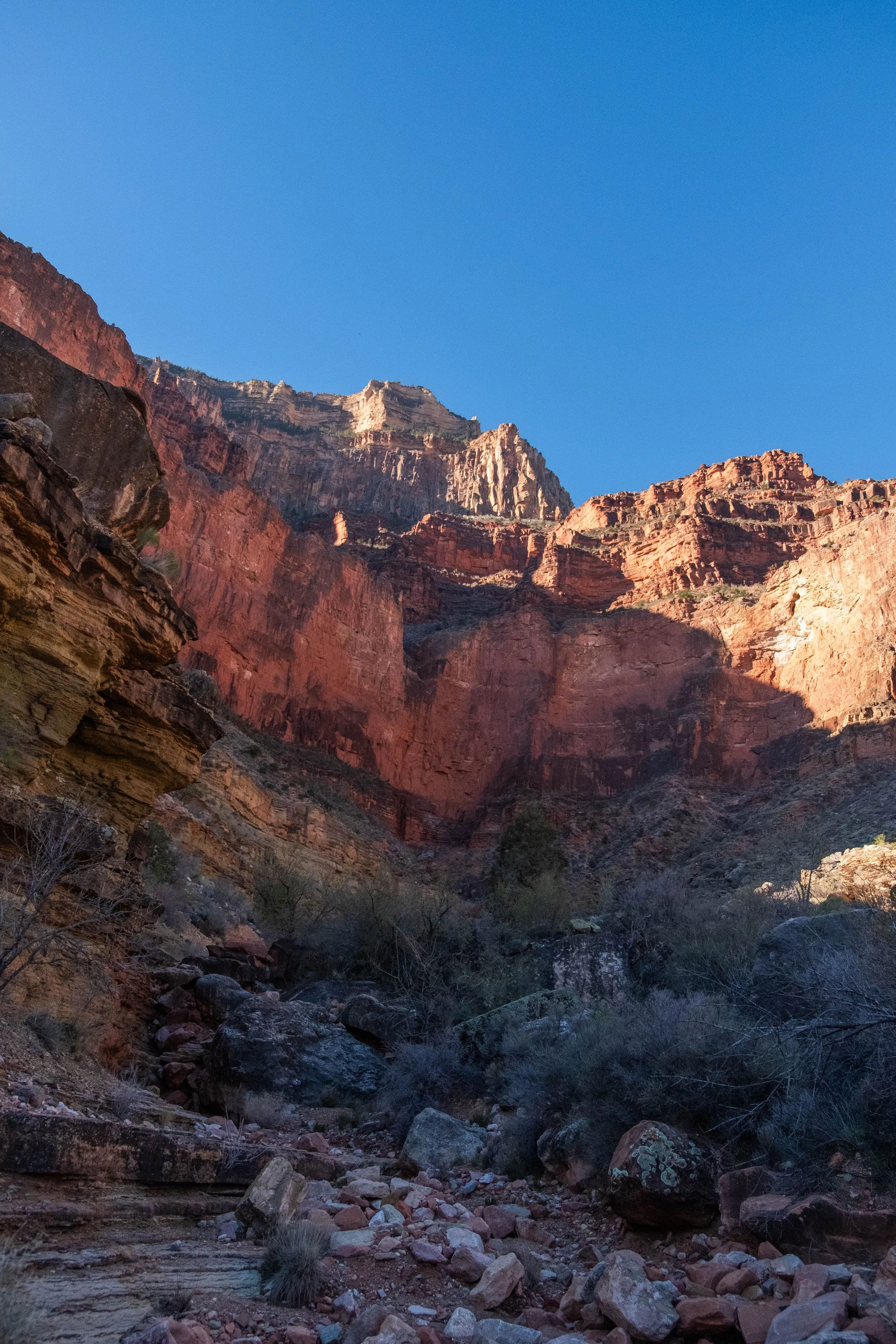
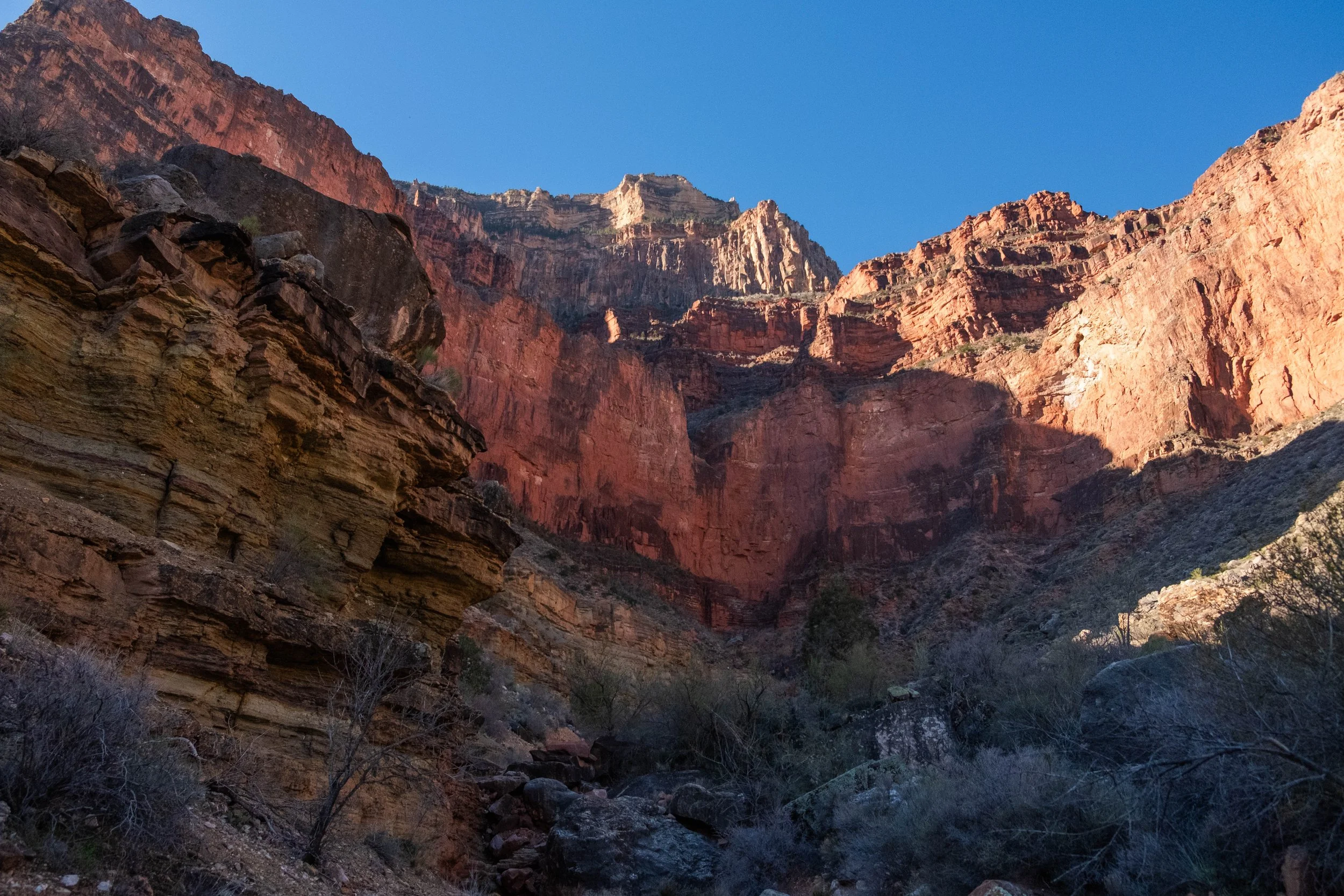
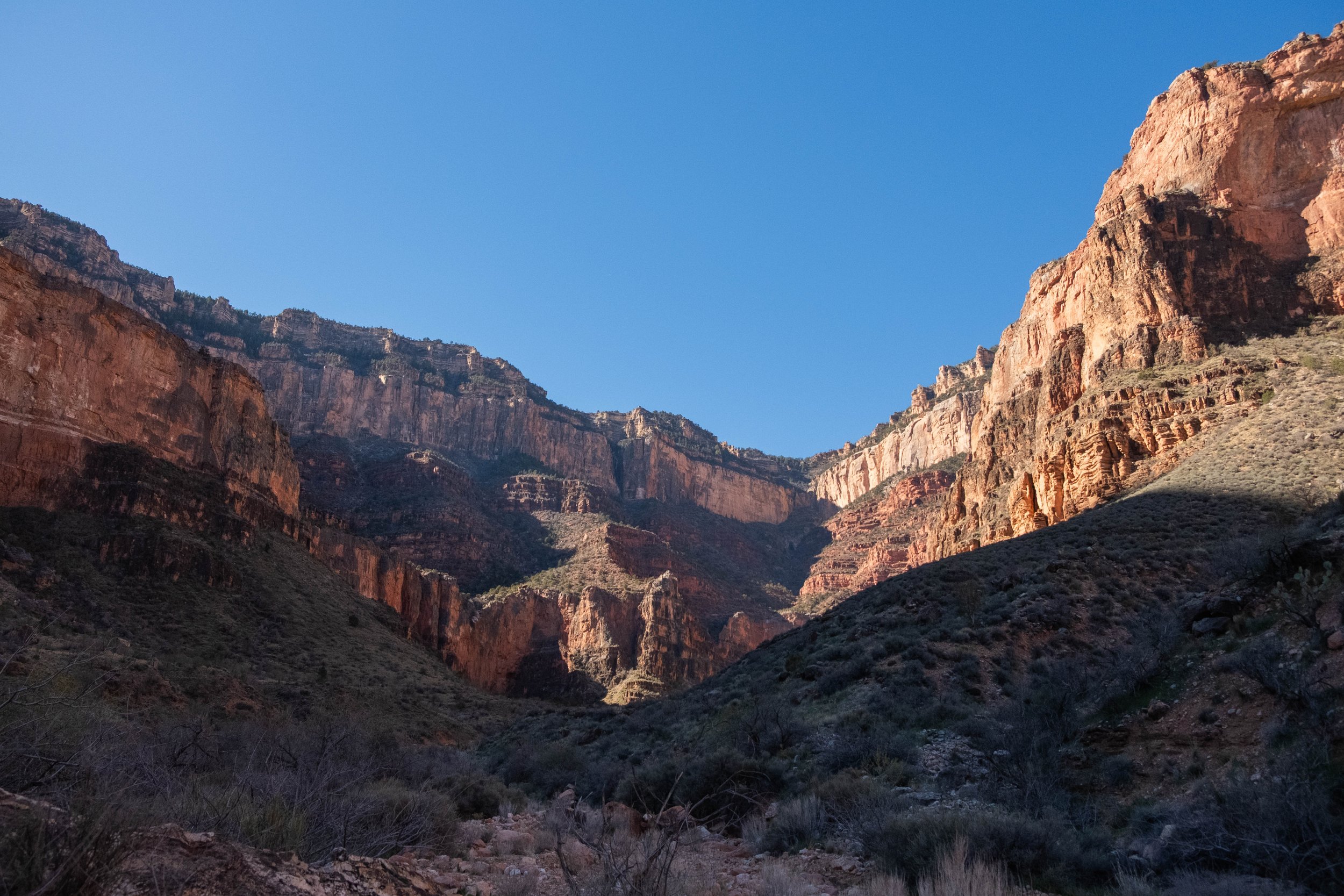
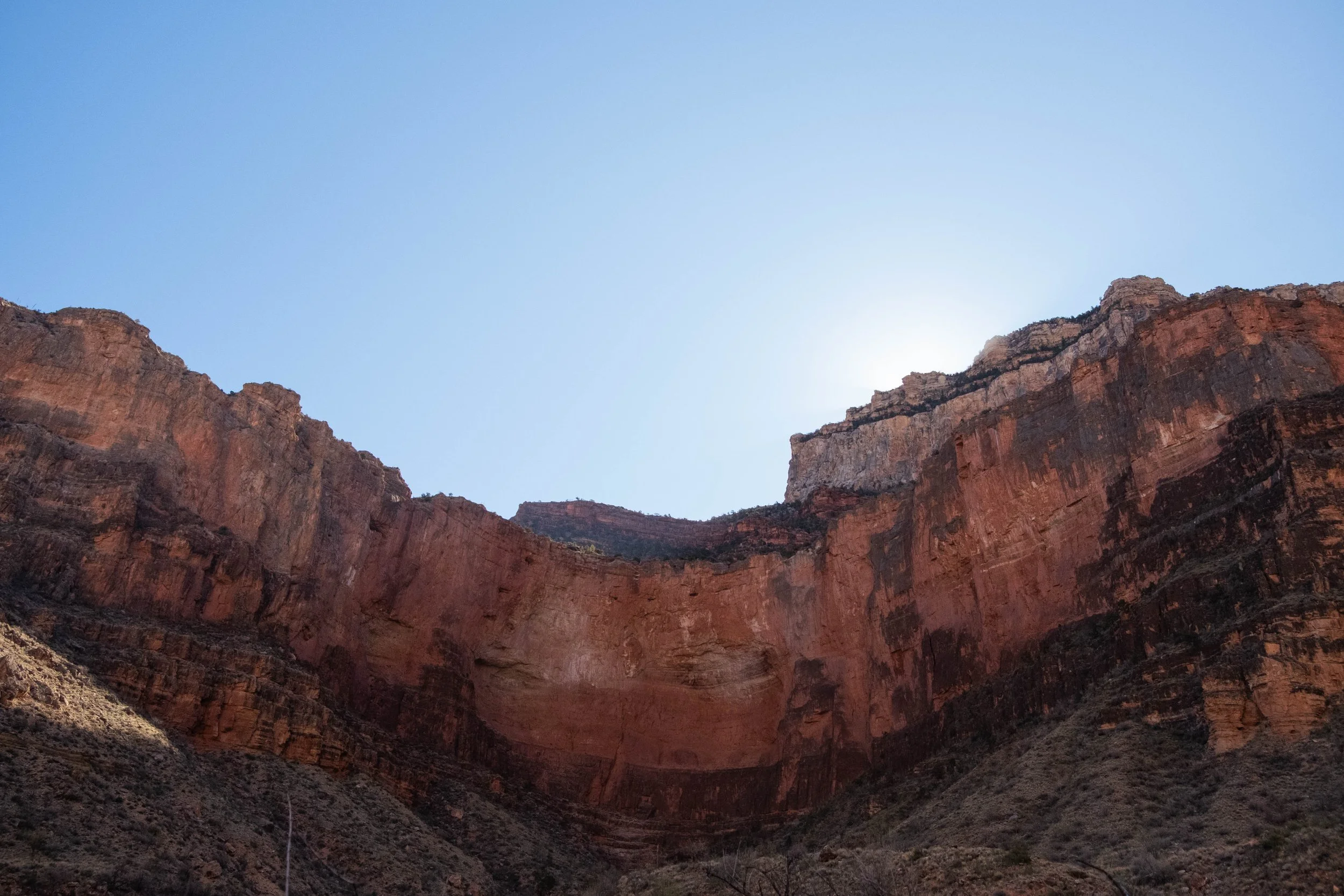
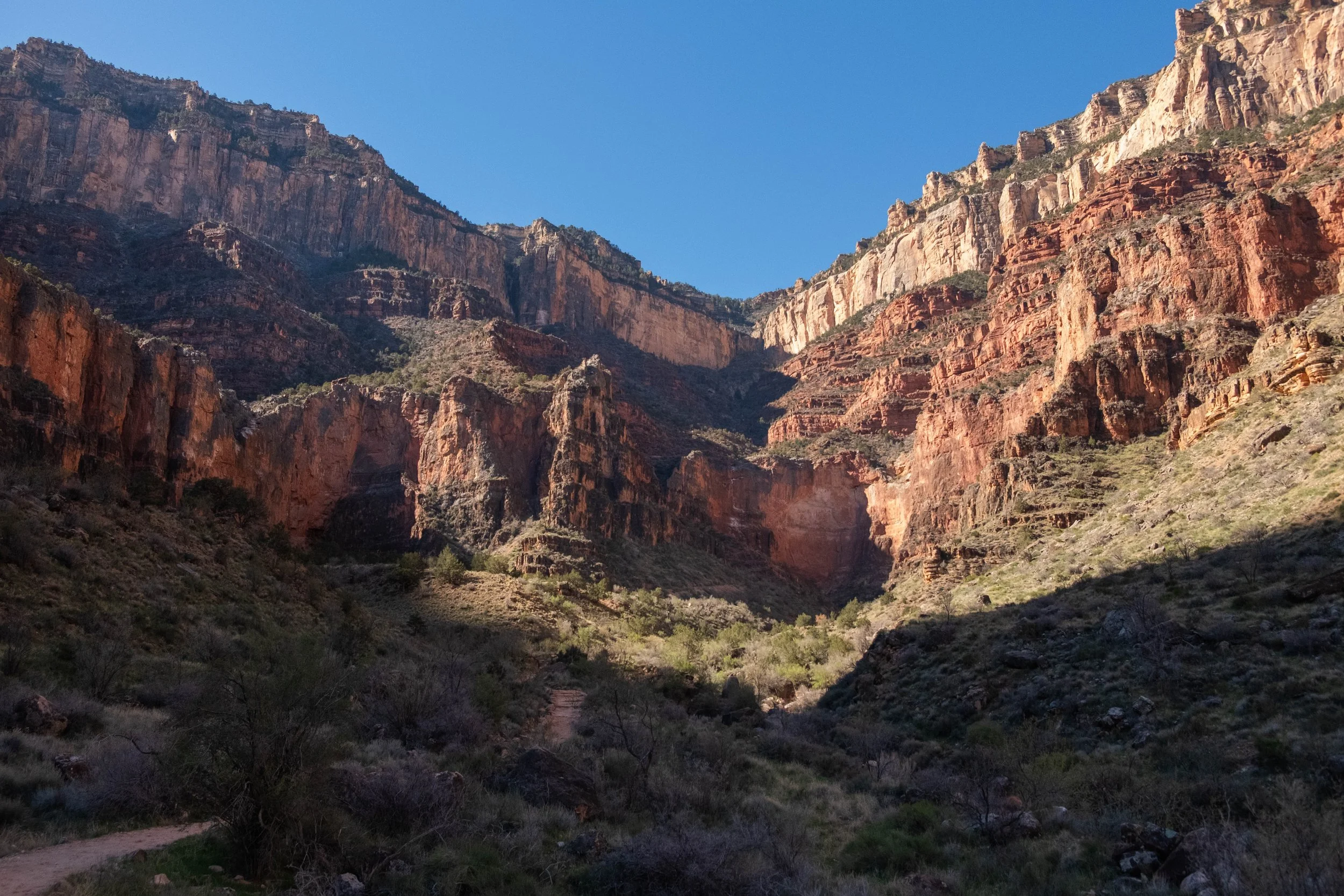
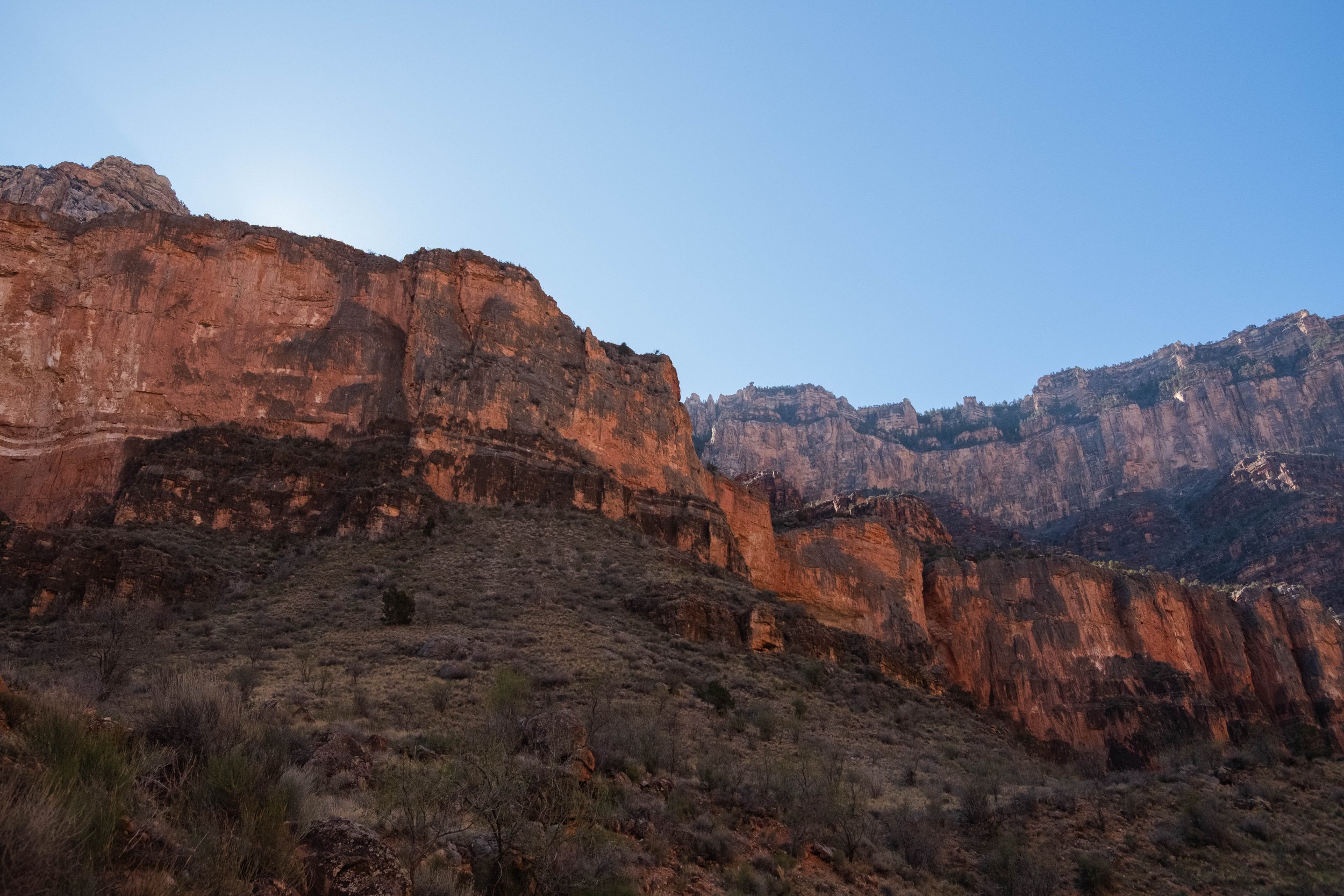
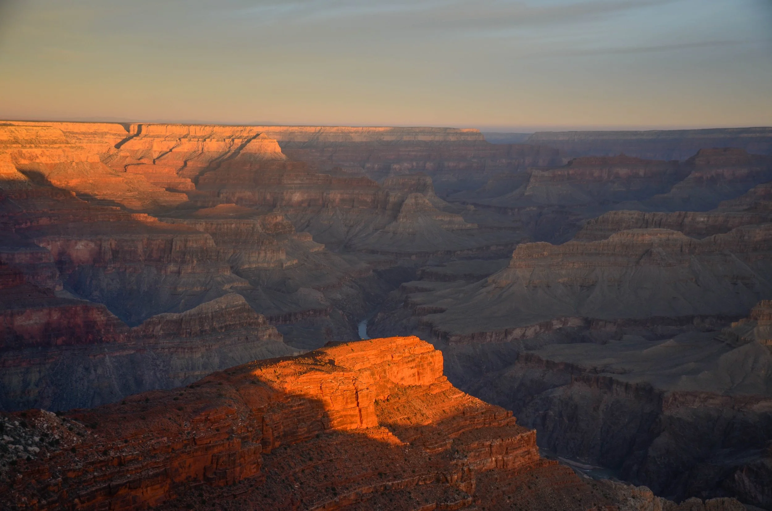
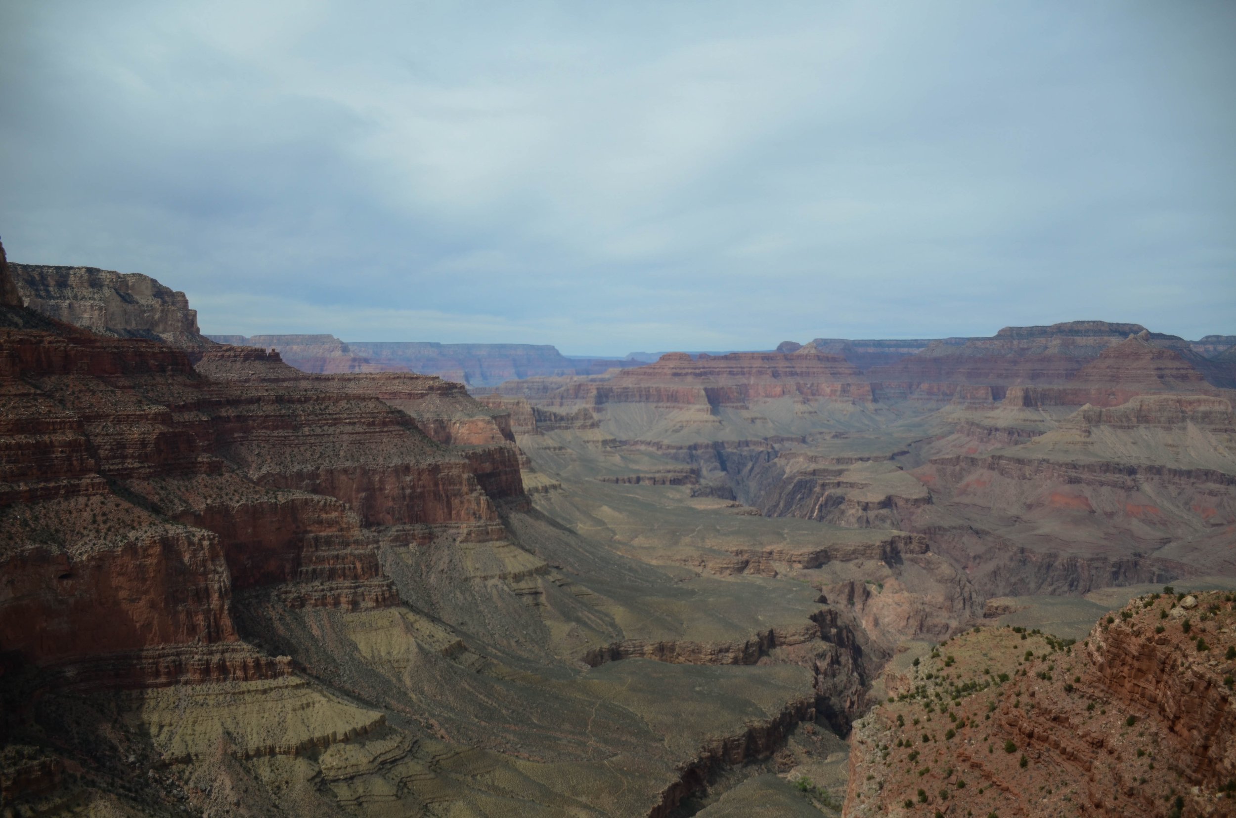
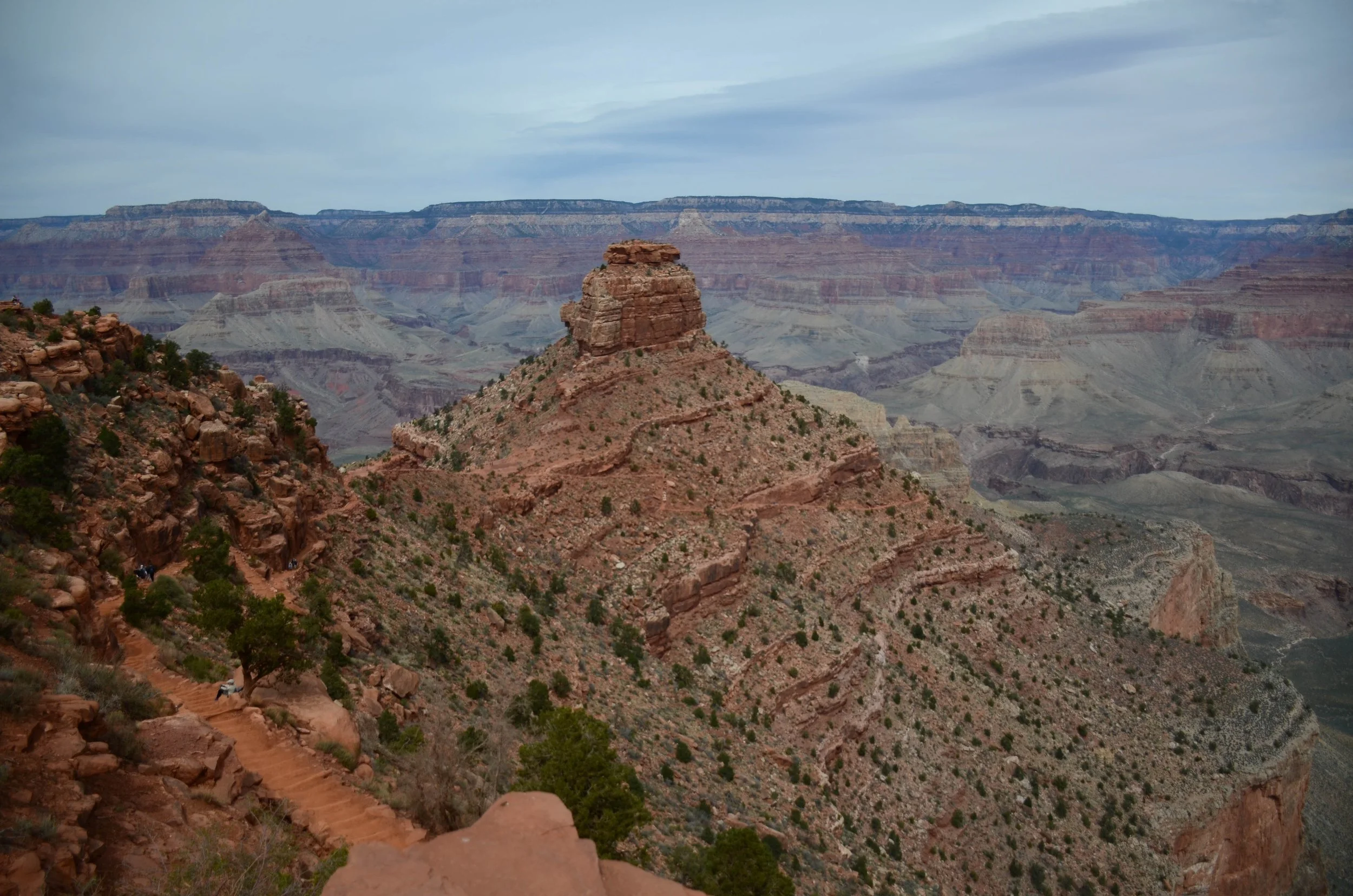
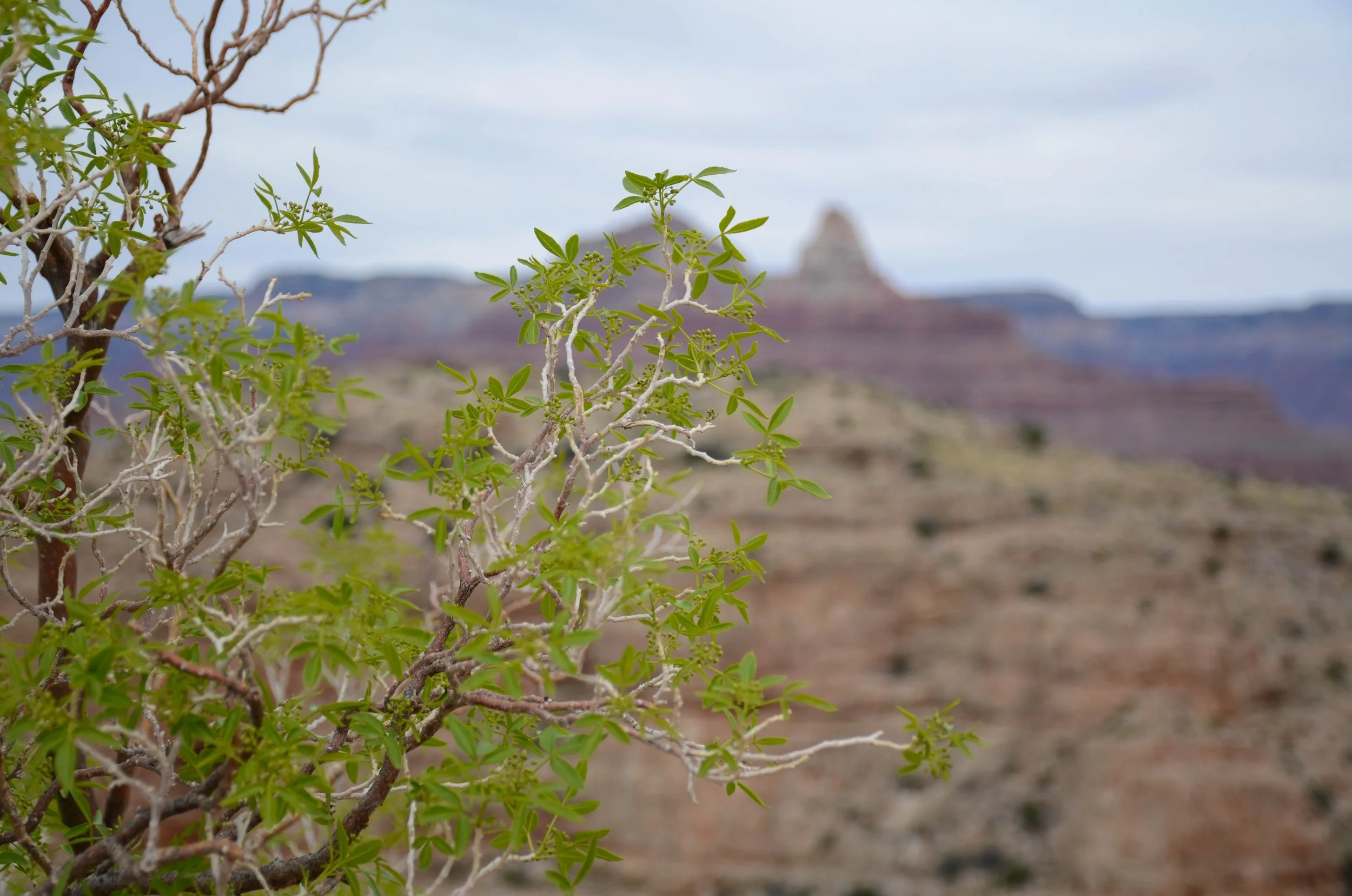
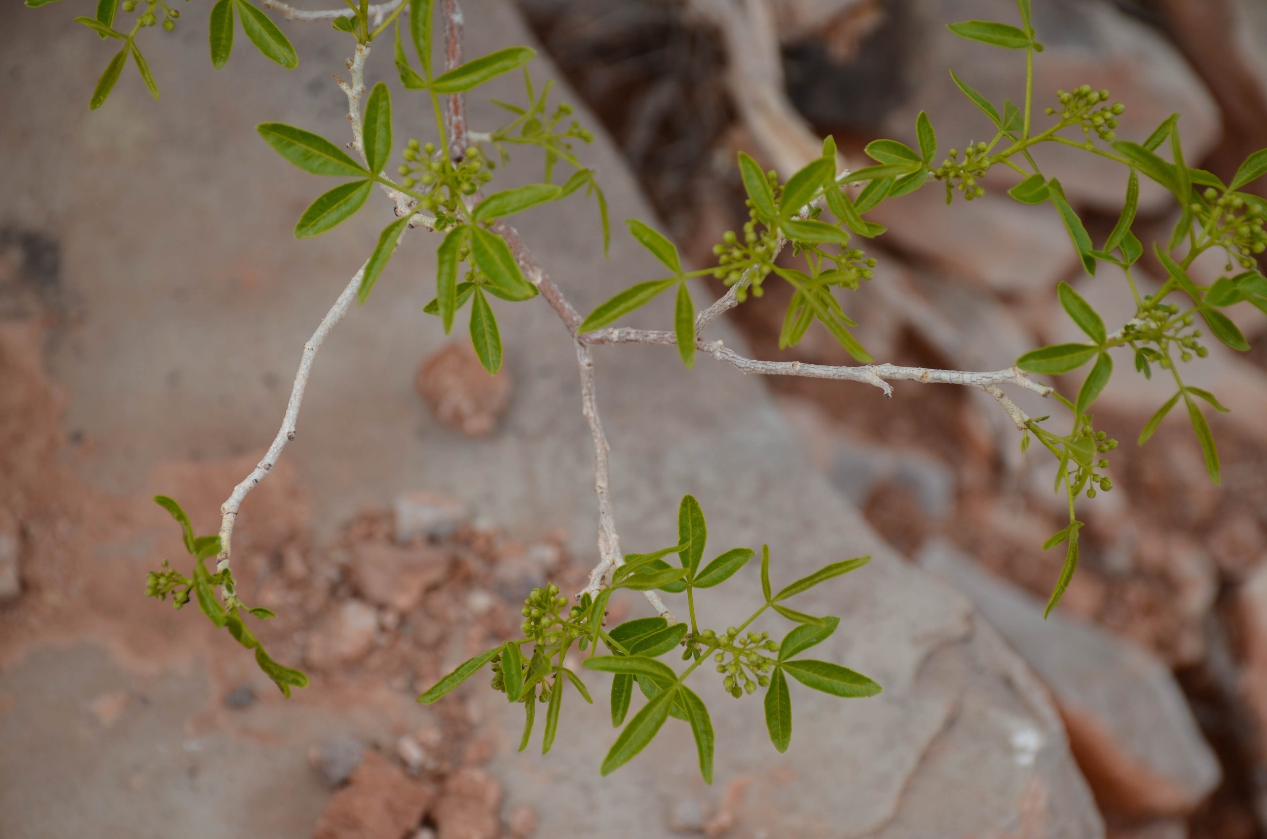
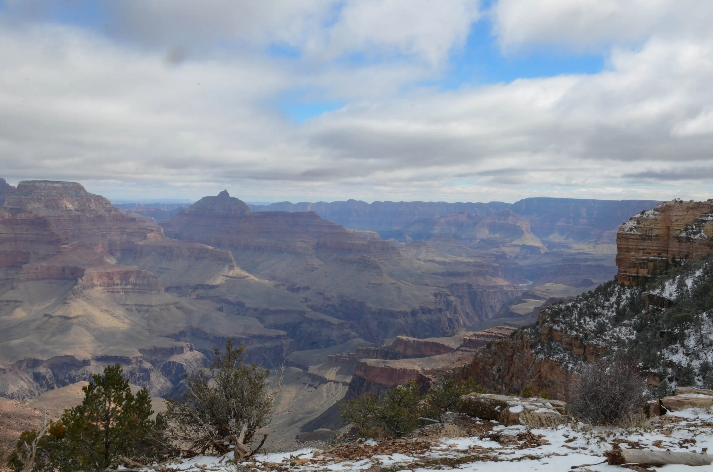
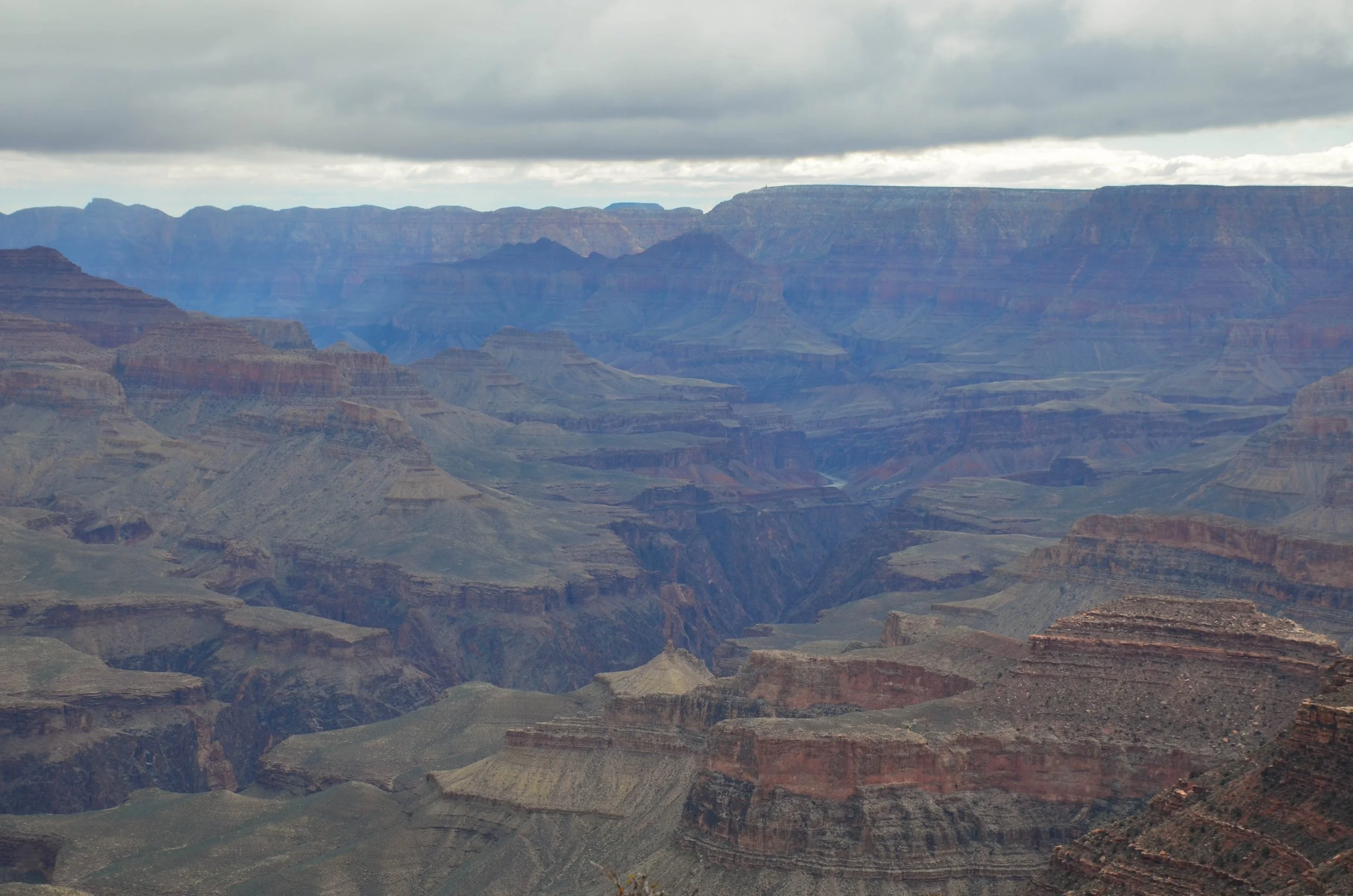
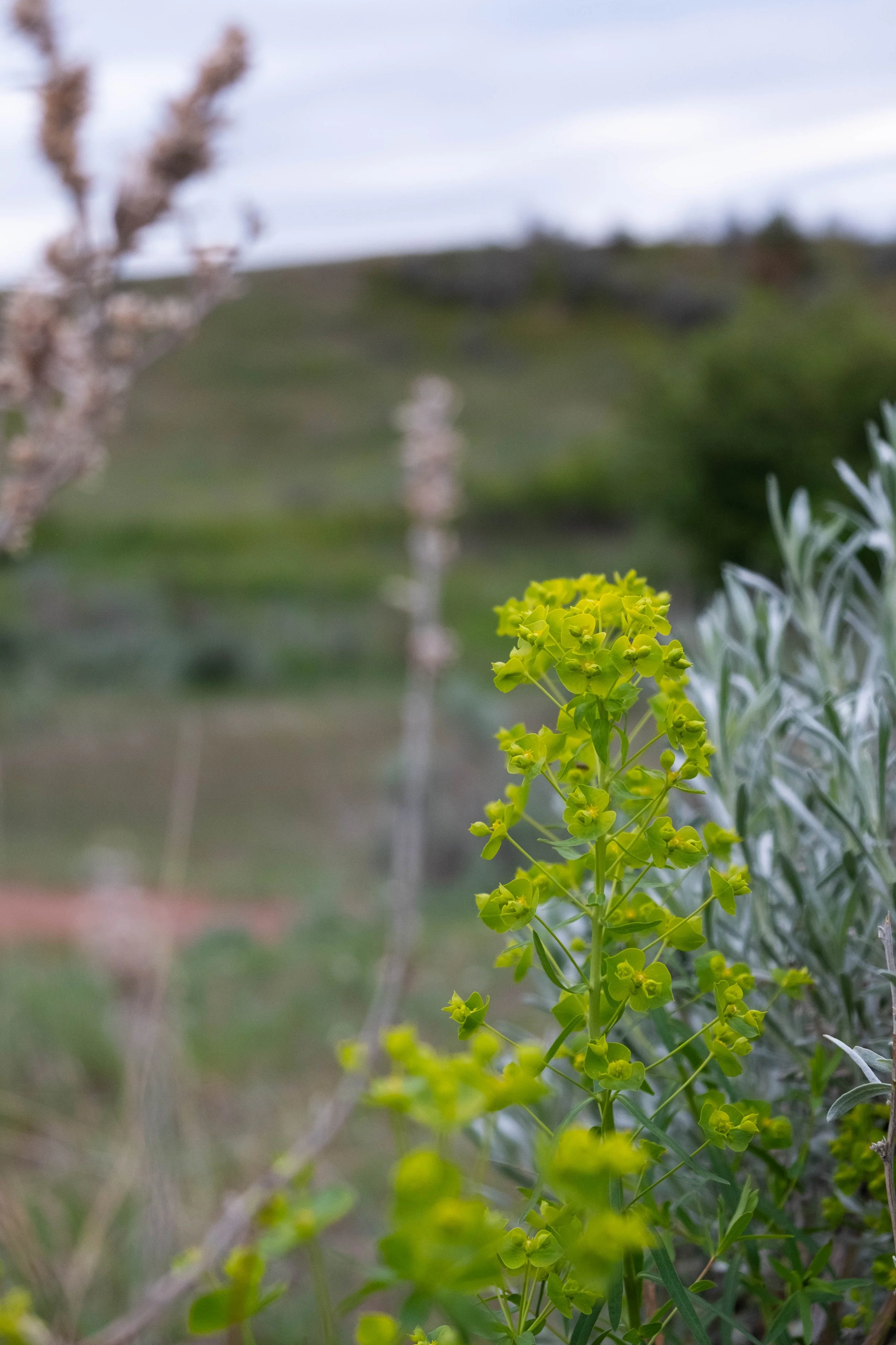
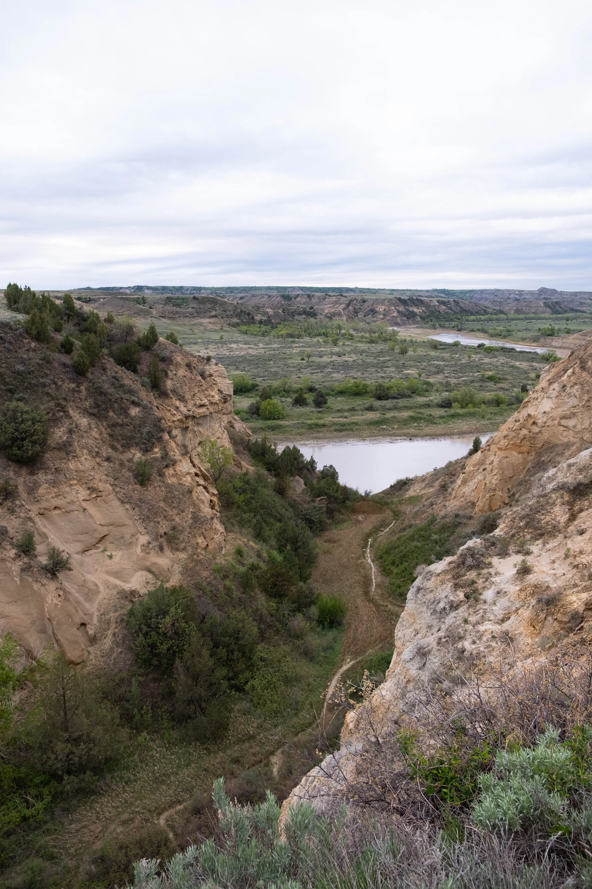
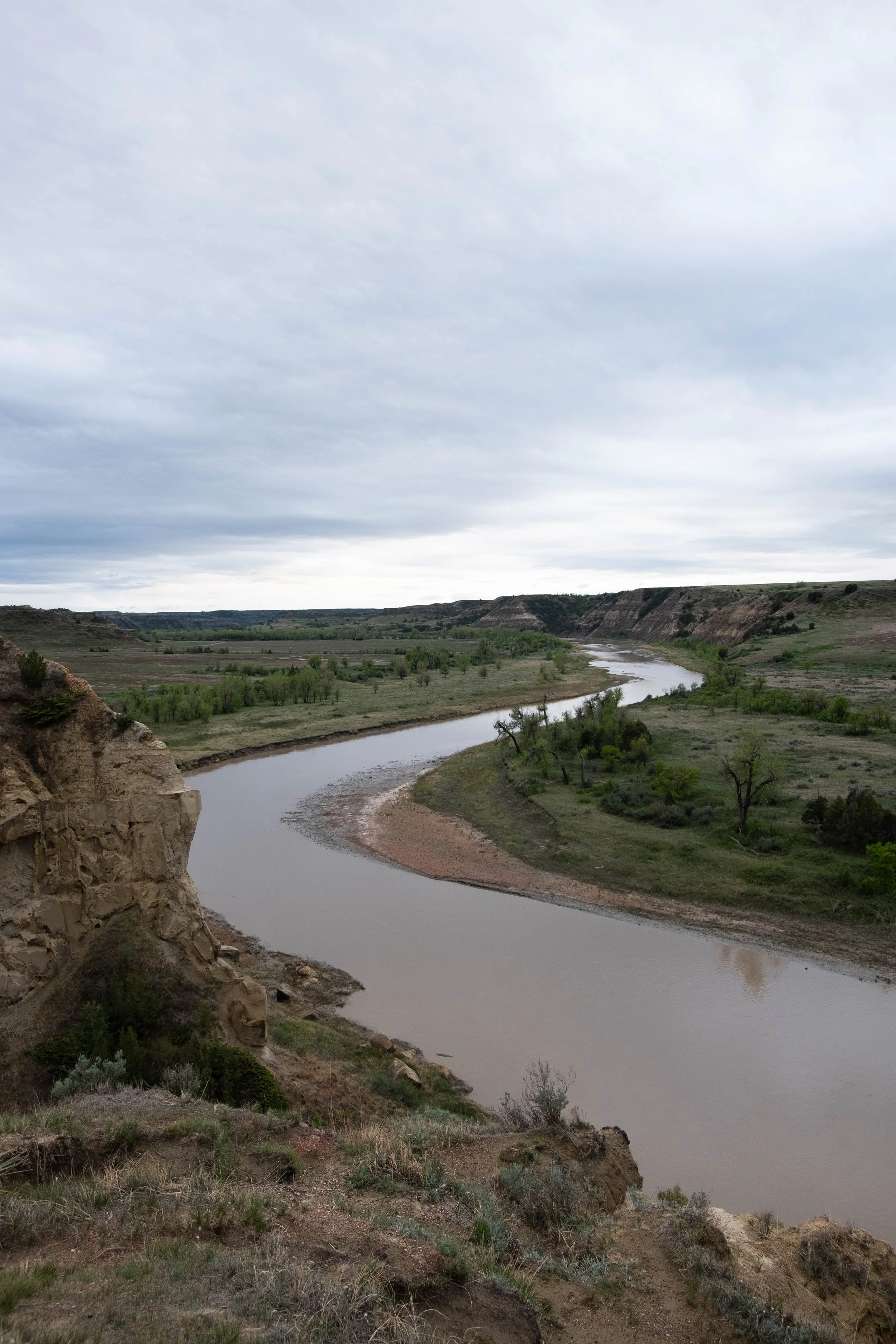
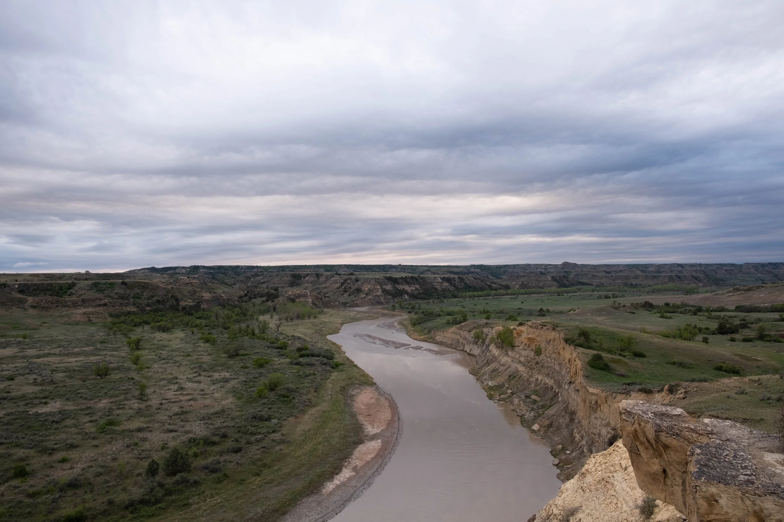
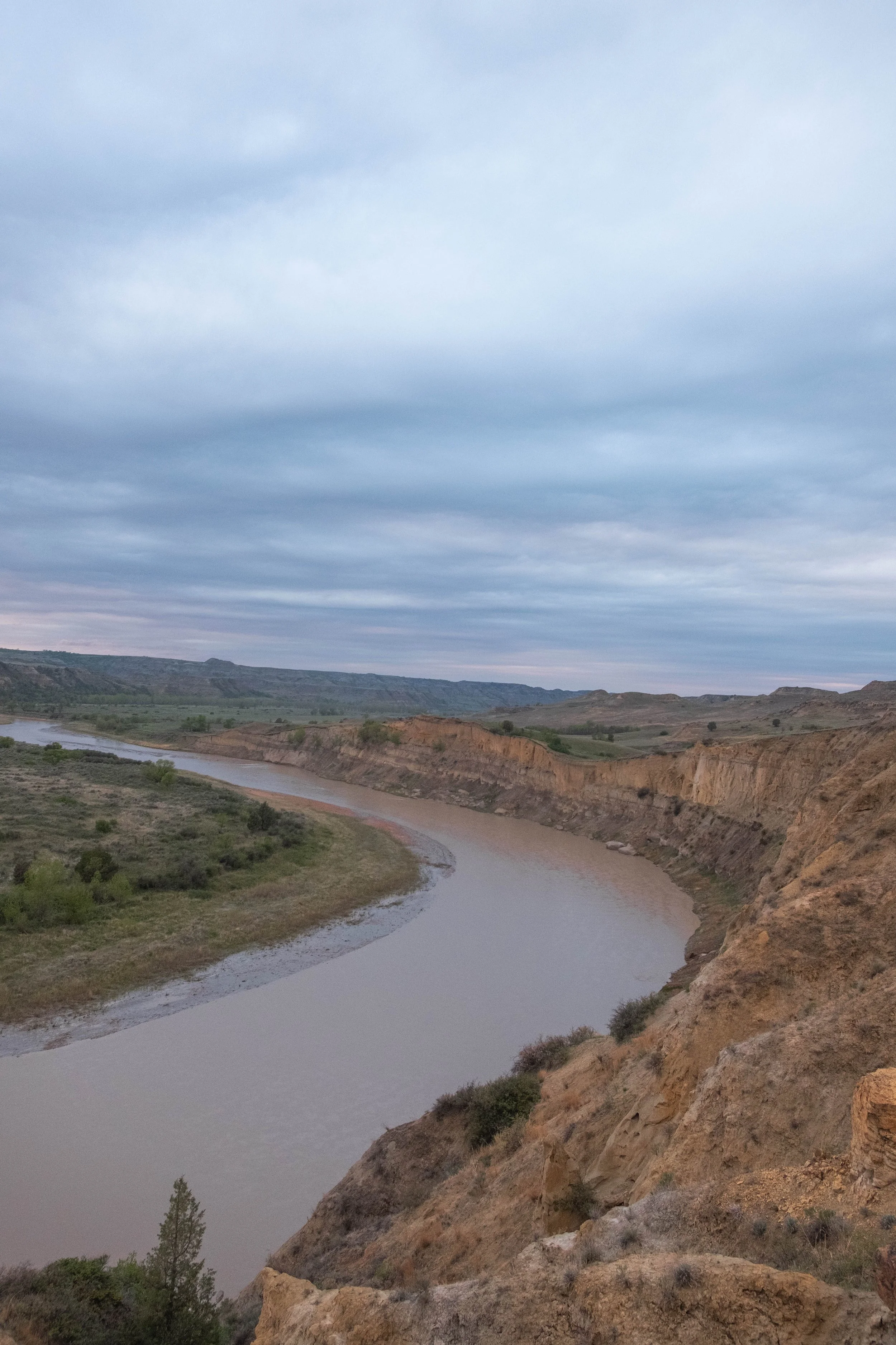
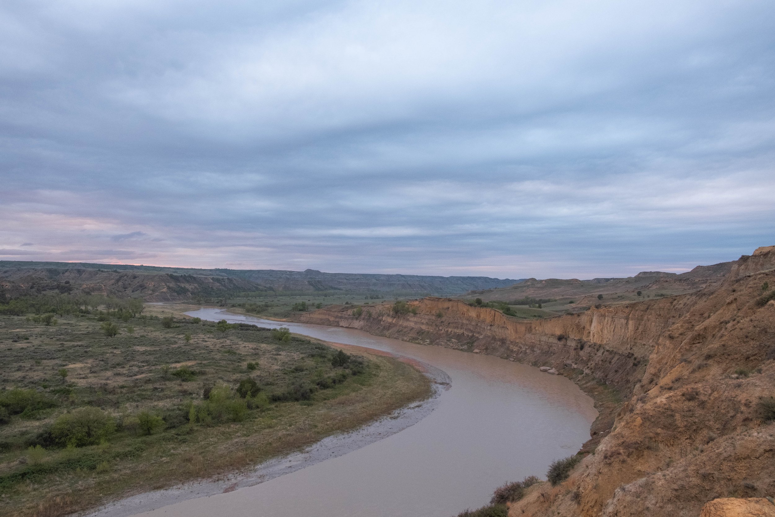
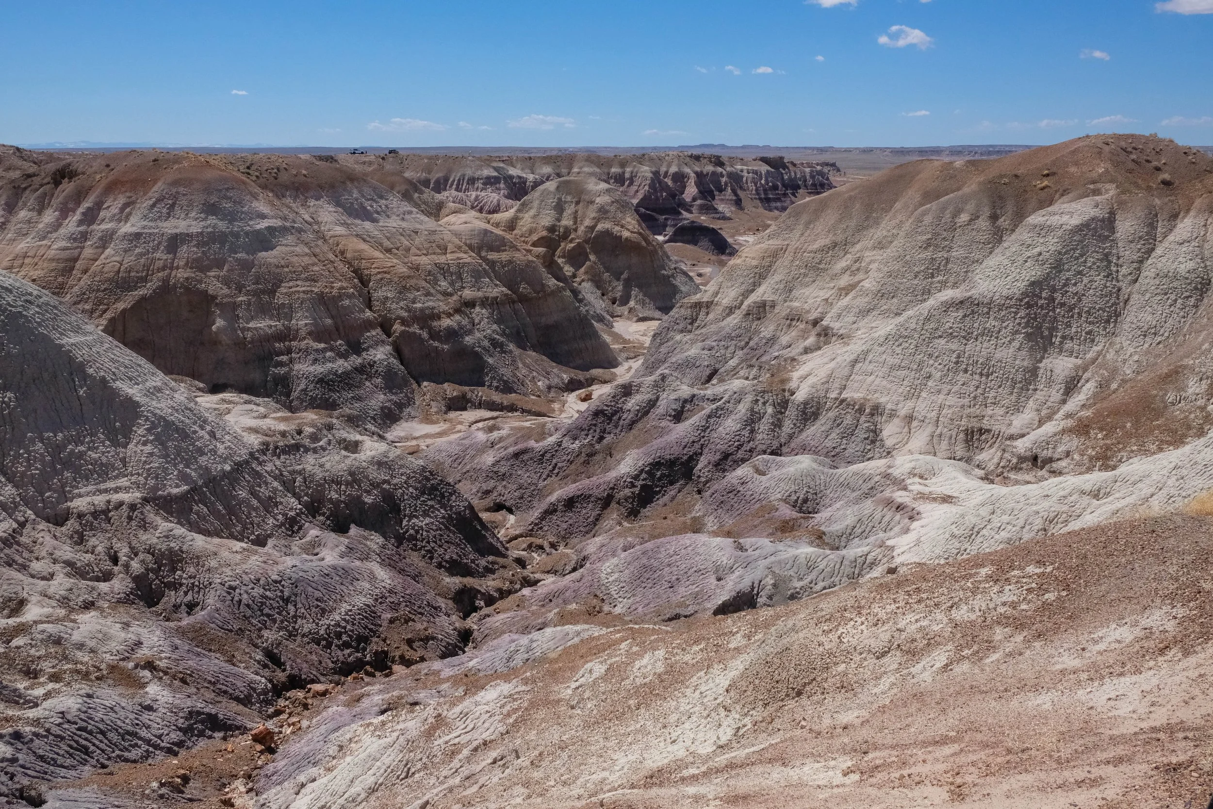
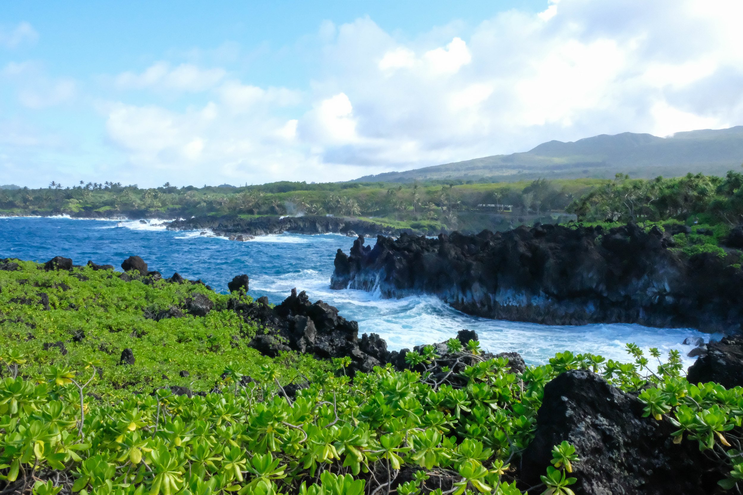
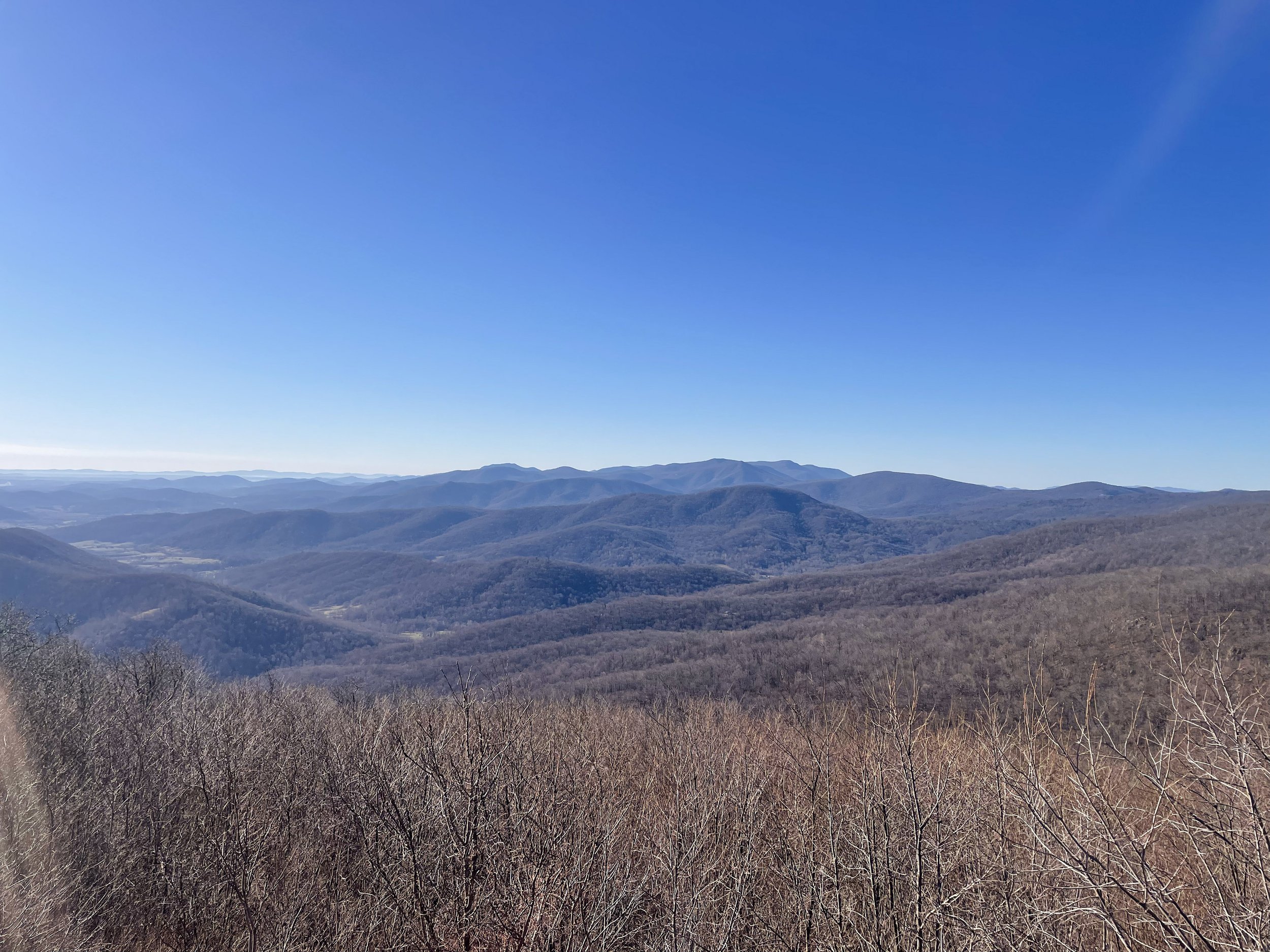
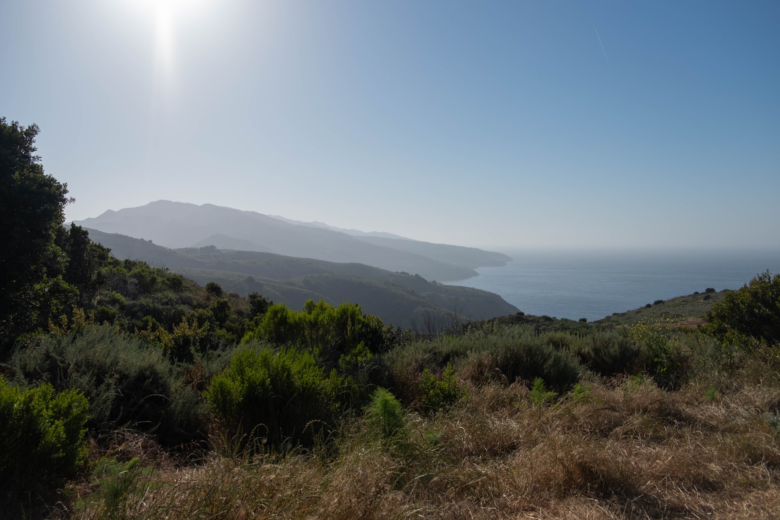
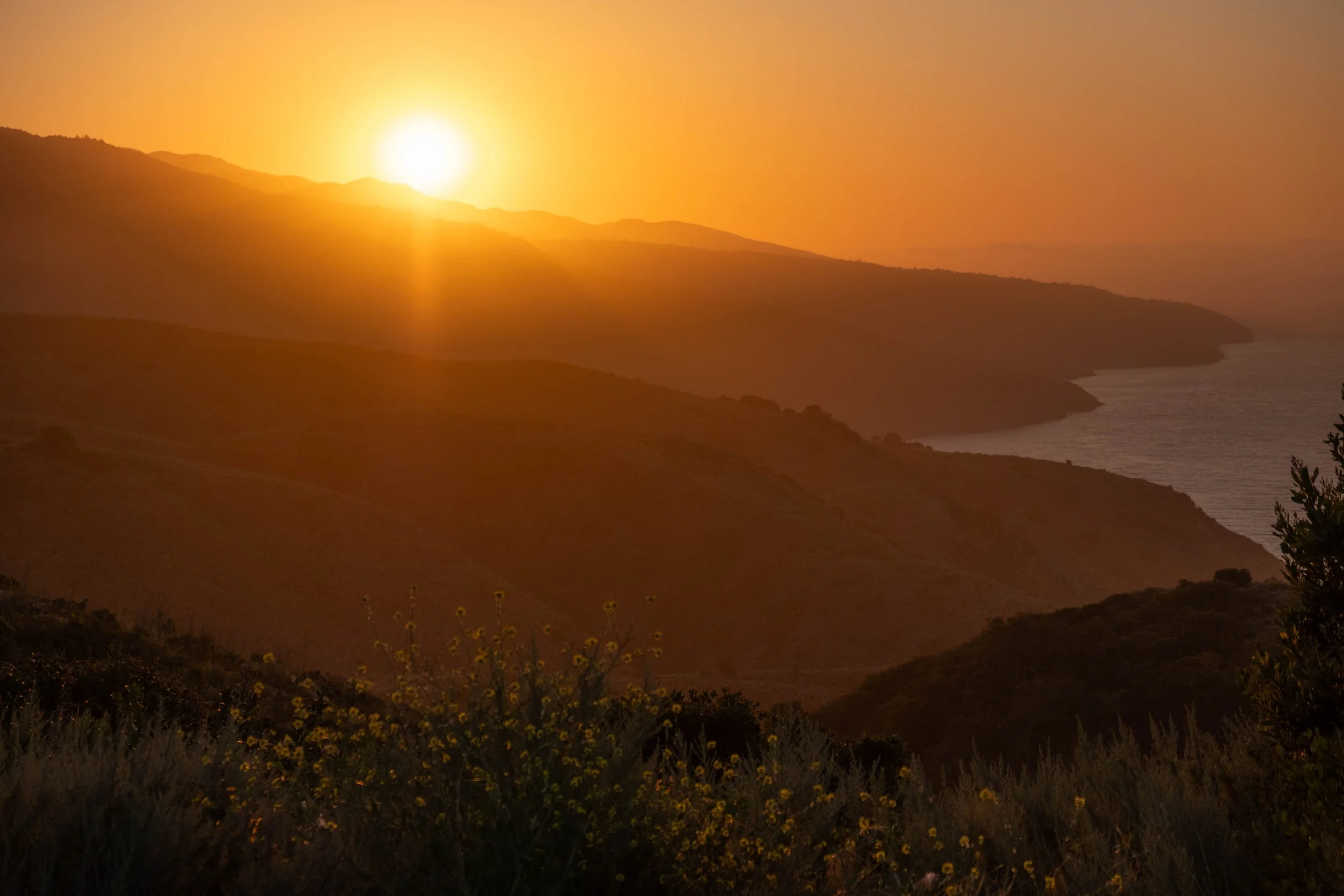
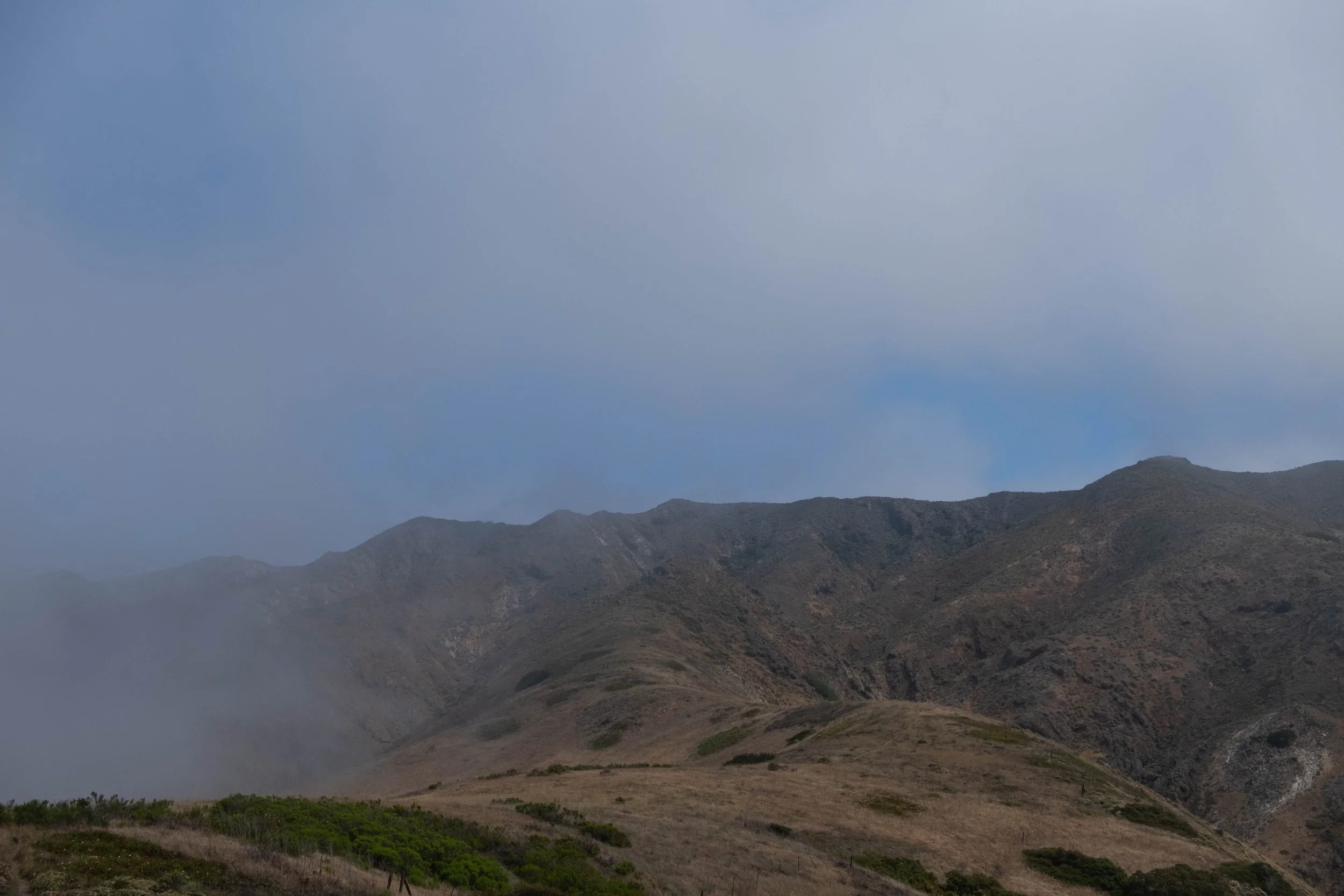
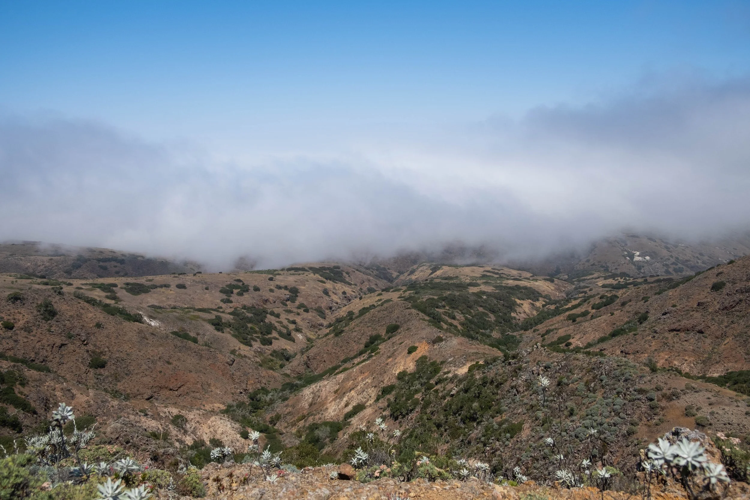
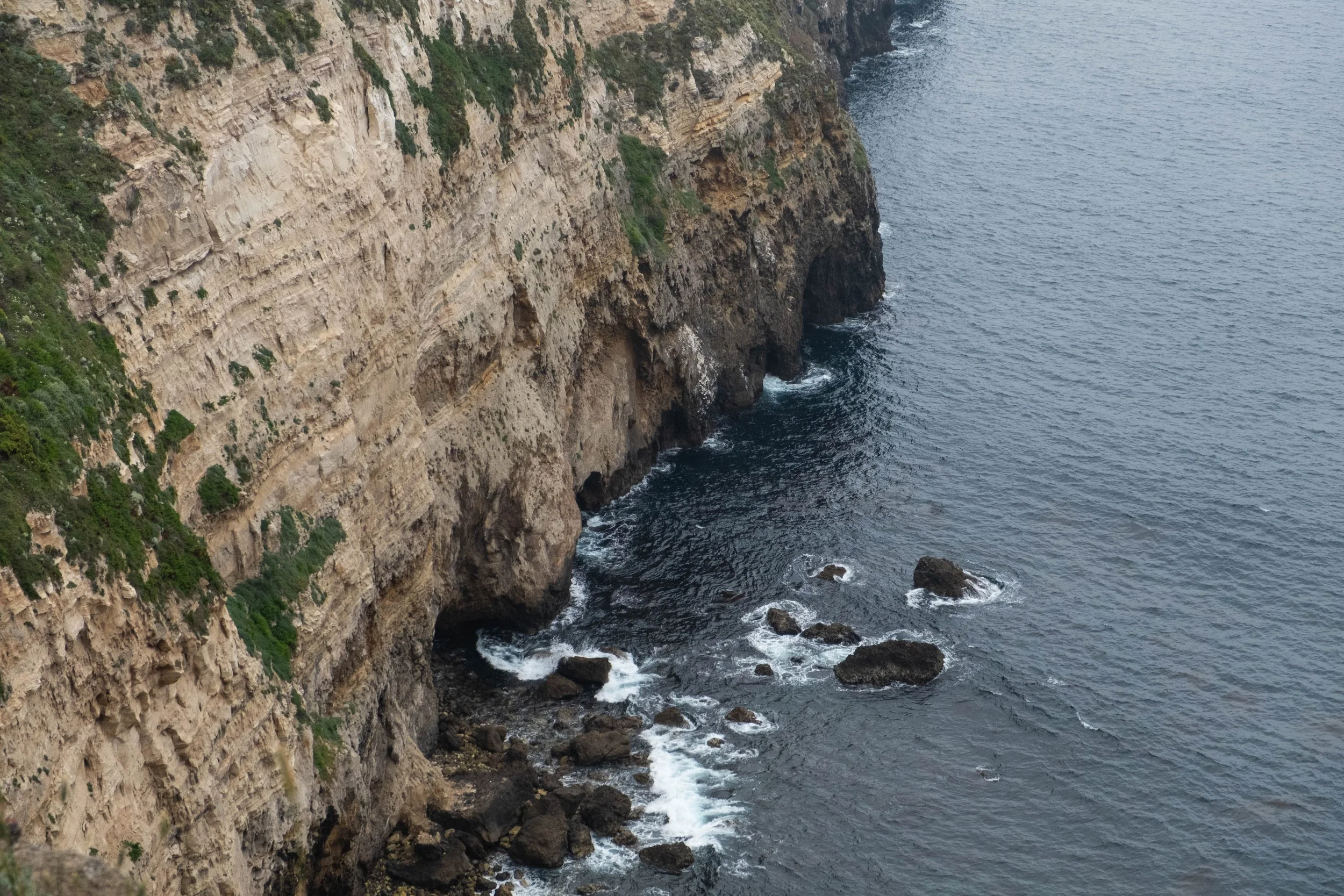
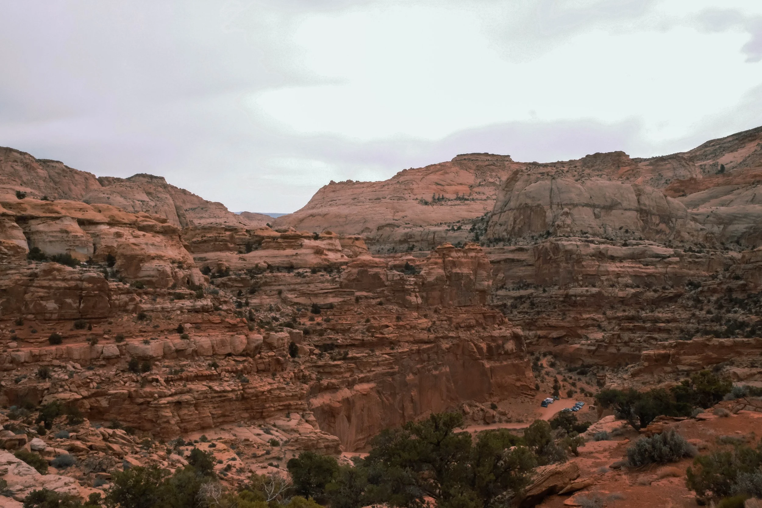
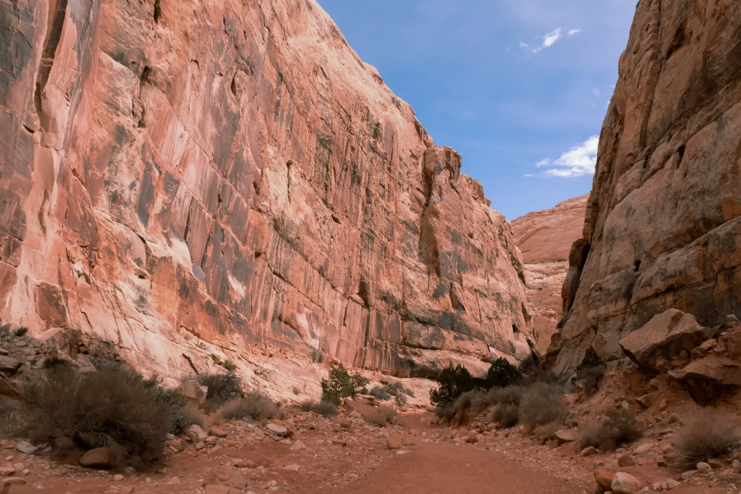
The Grand Canyon is aptly named and defies description. The views are difficult to put into words: Layers upon layers of rock that might be red, orange, blue, purple, green, yellow, or pink depending on the lighting and the makeup of the sediment. The hike down to the Colorado River is essentially a hike through more than a billion years of time; the rocks get older the deeper you go. It felt profound to see this place from every different angles as we continued our steep descent. We intersected with weary hikers trekking up from Phantom Ranch, long lines of mules carrying supplies out of the canyon, and NPS employees working on trail improvements. The latter, when asked, candidly shared with us how federal funding cuts over the last year have resulted in reduced personnel and difficulties maintaining the park.
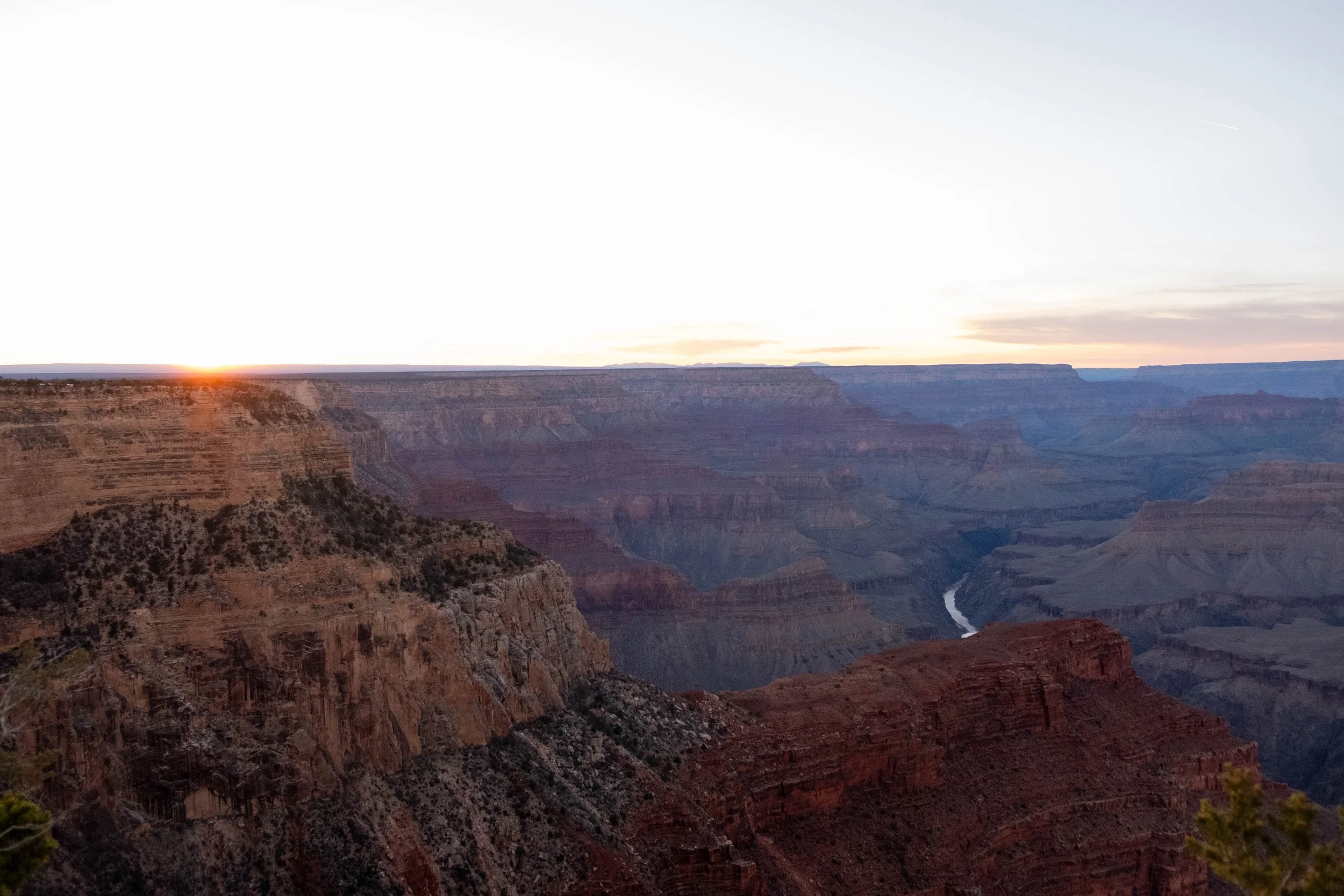
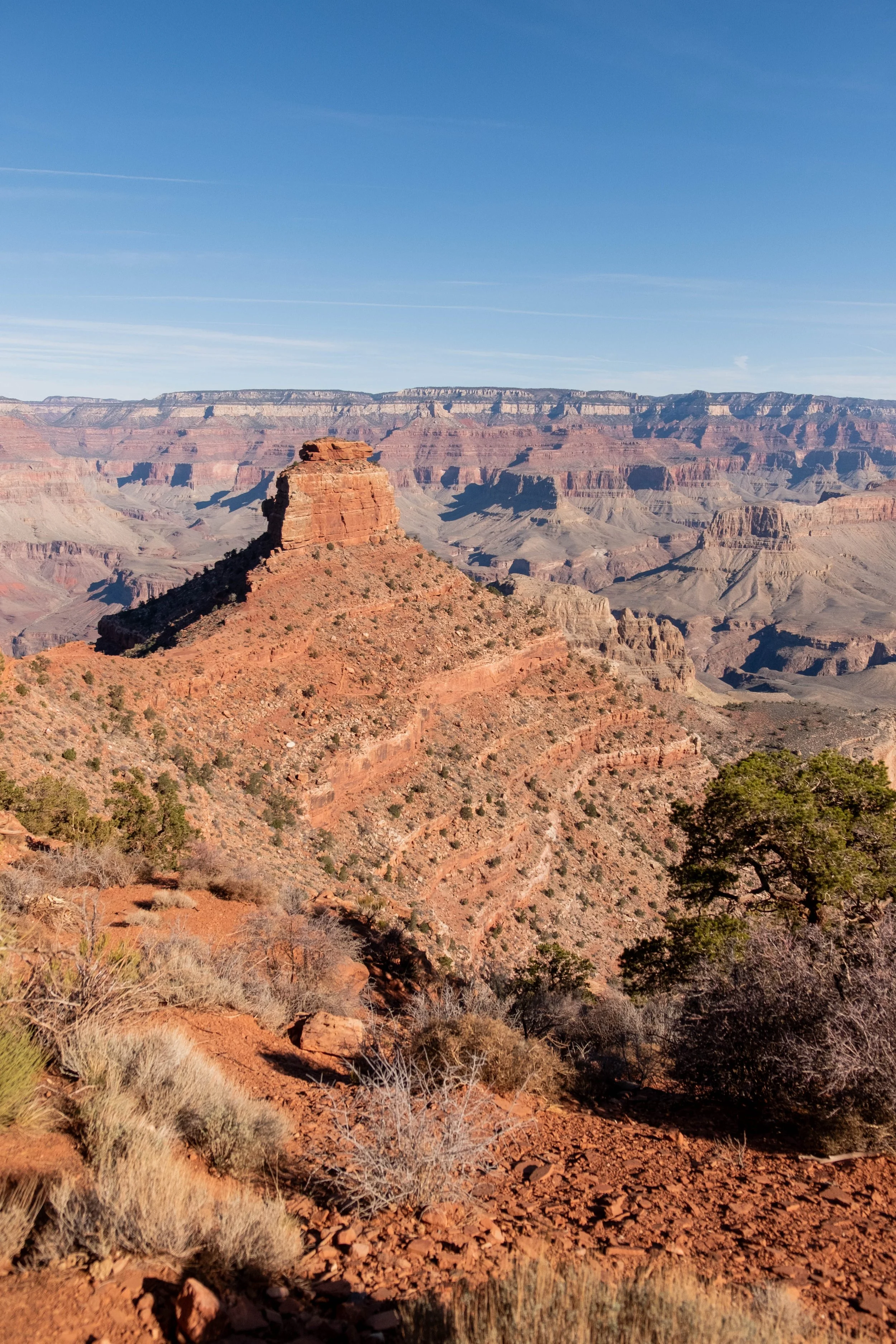
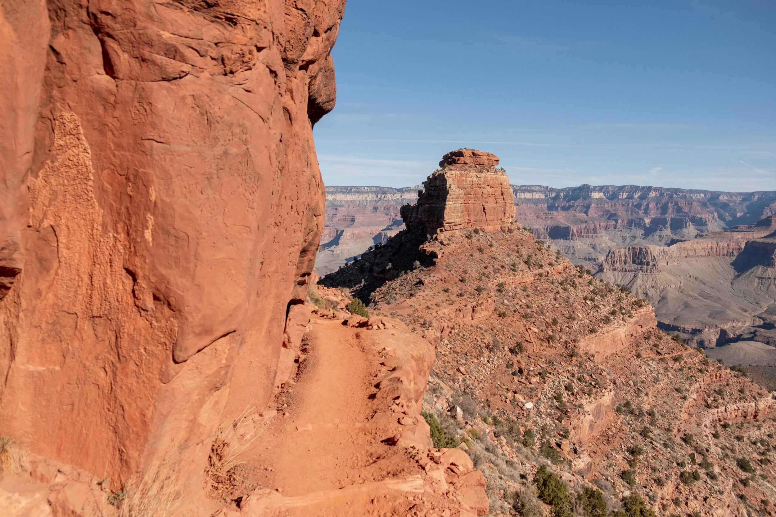
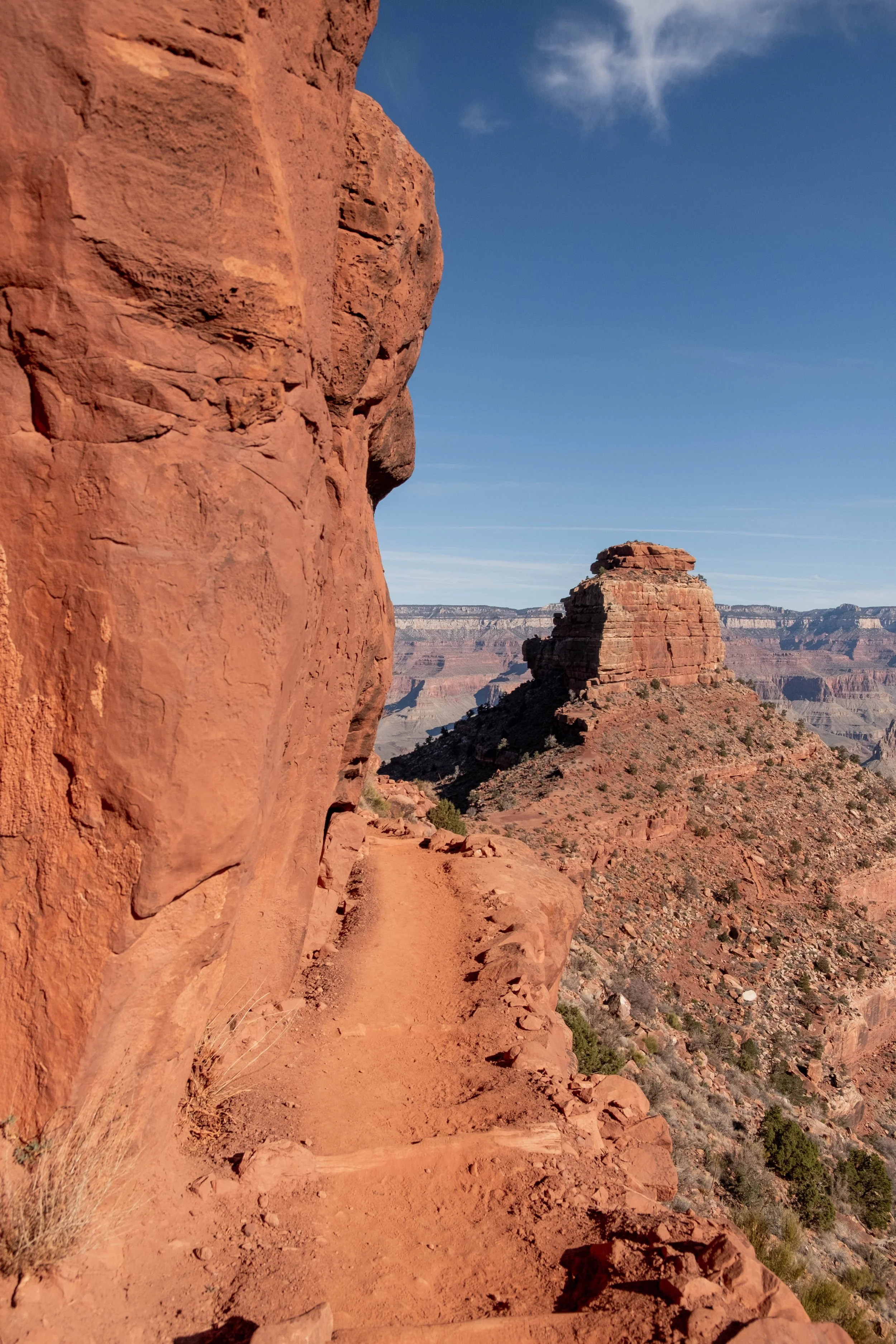
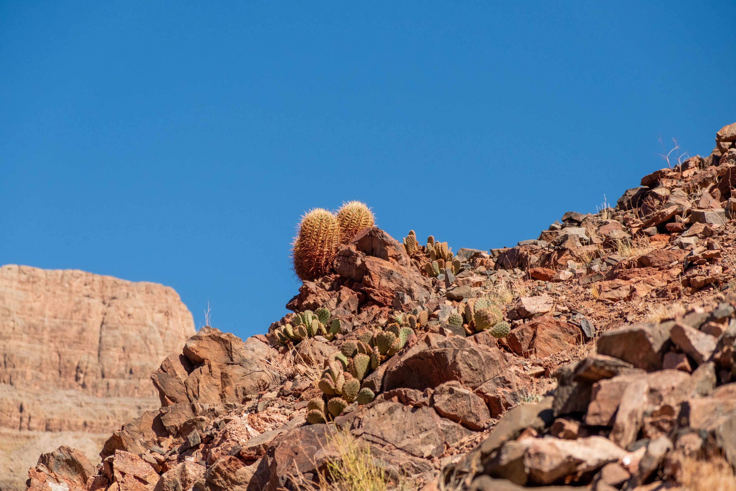
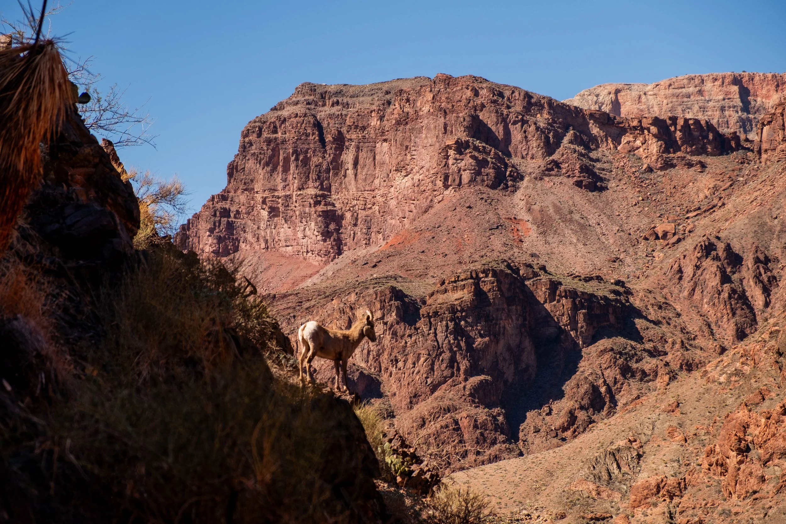
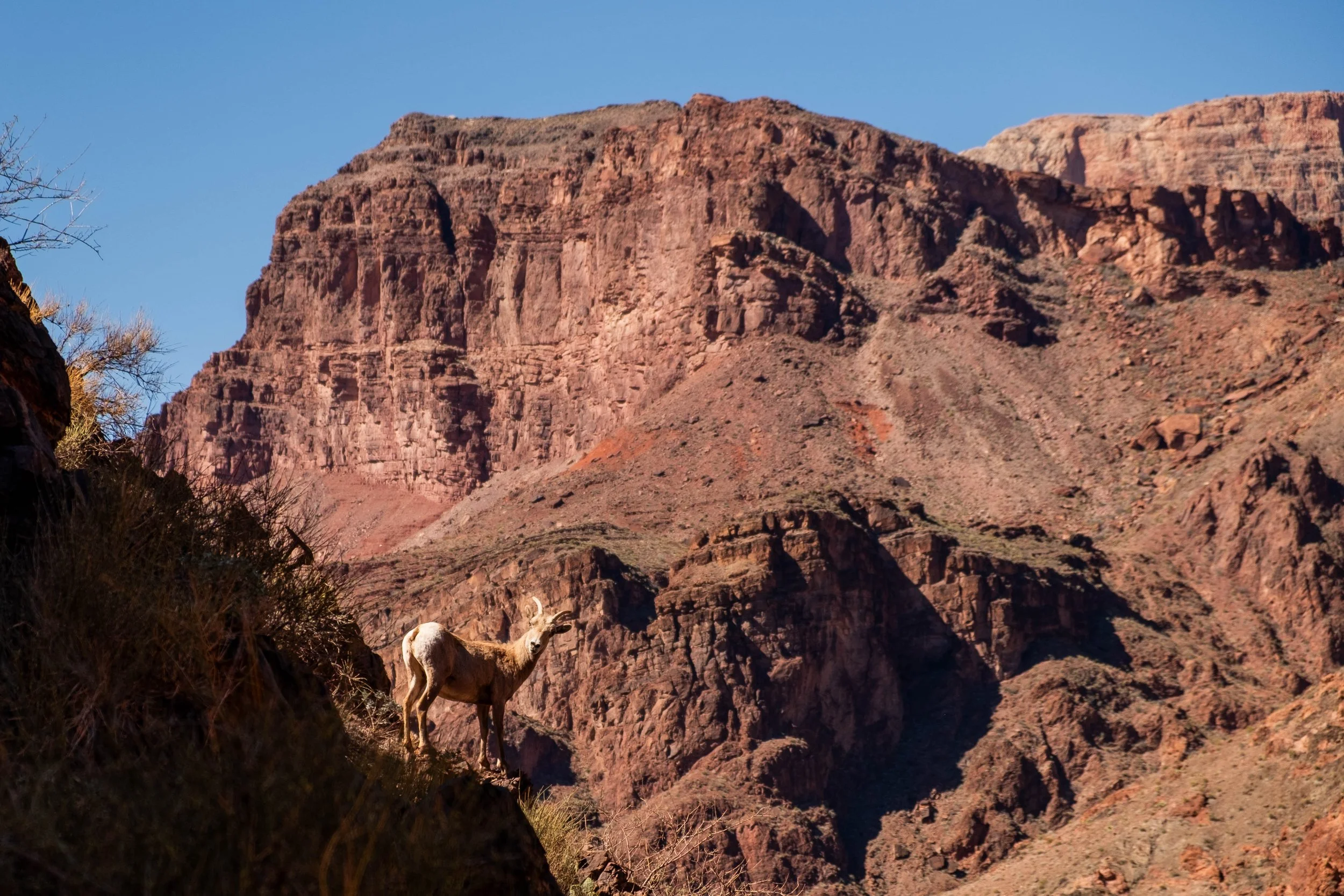
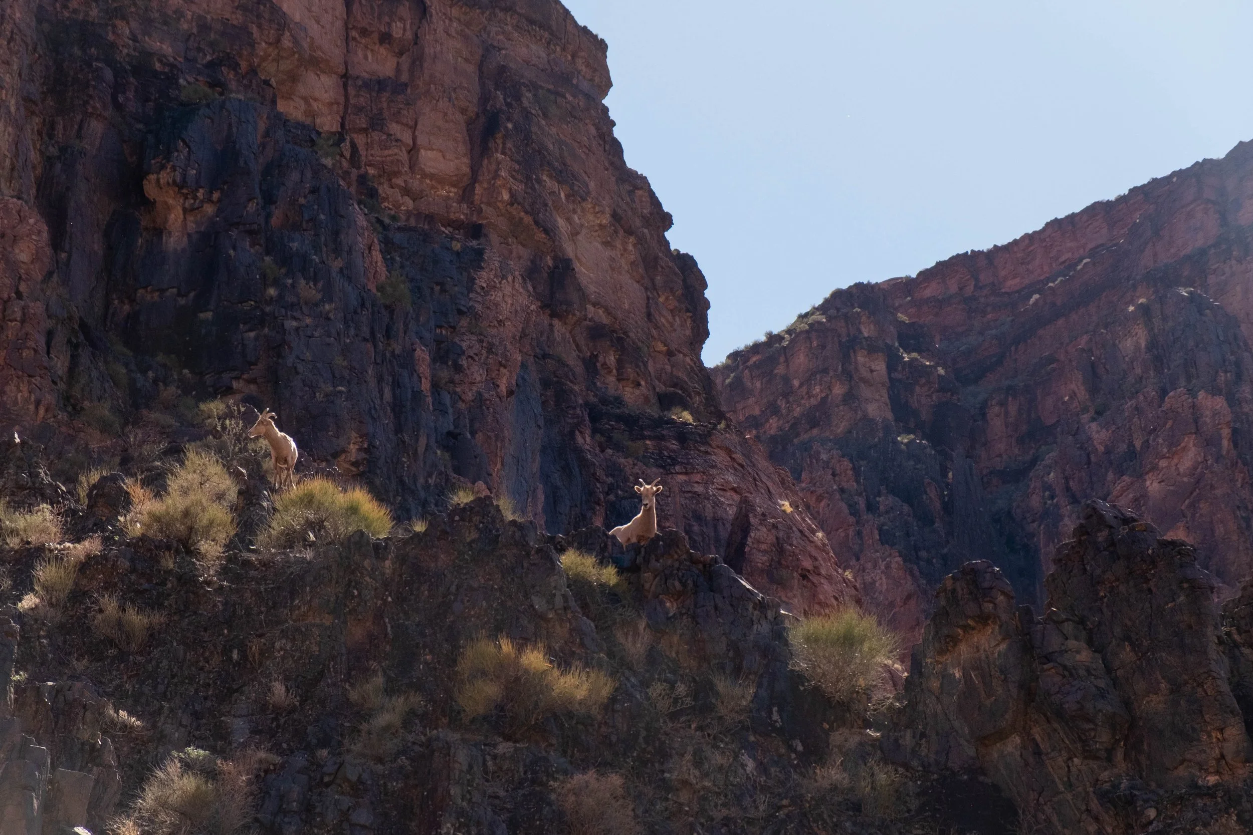
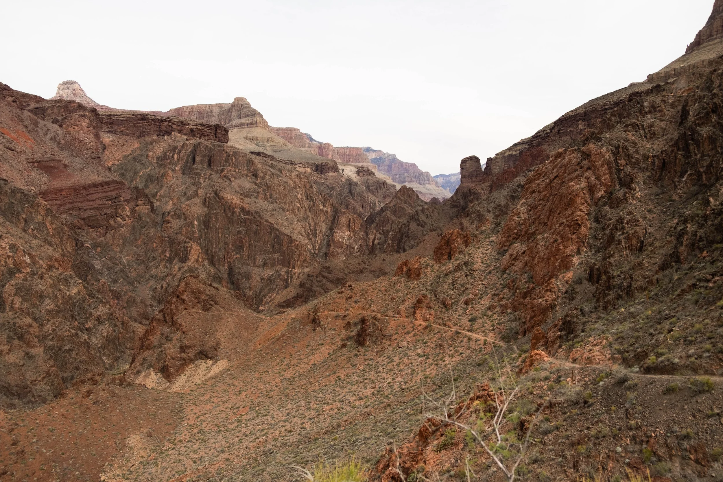
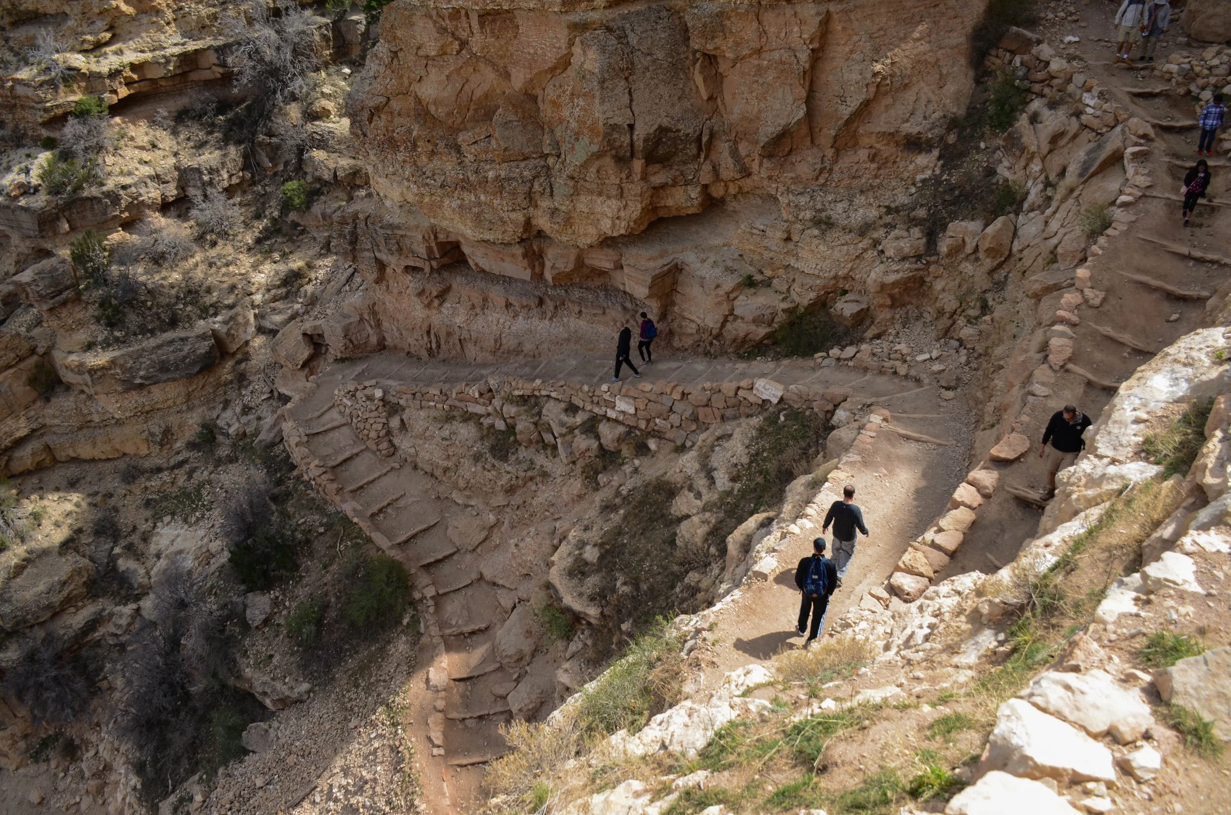
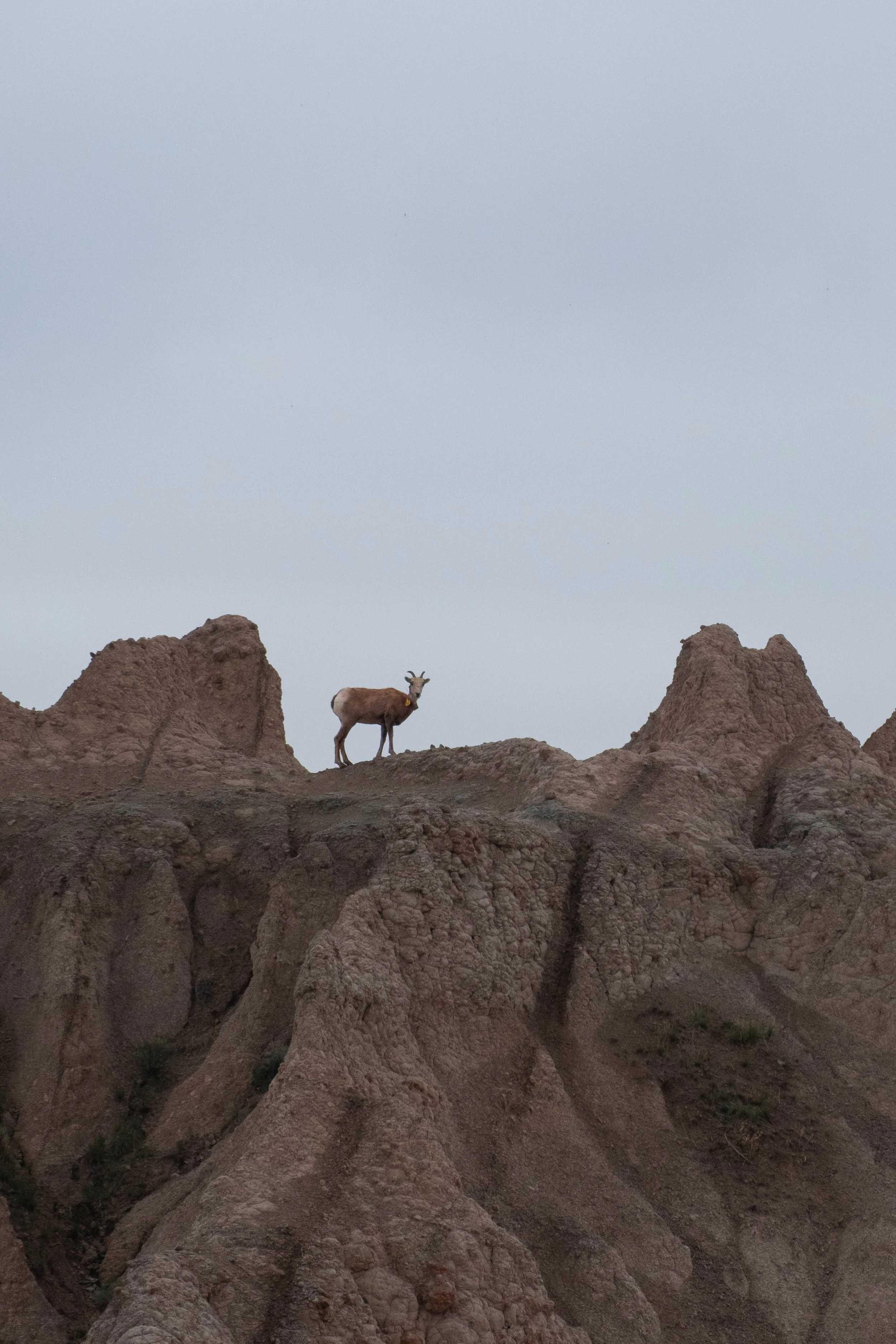
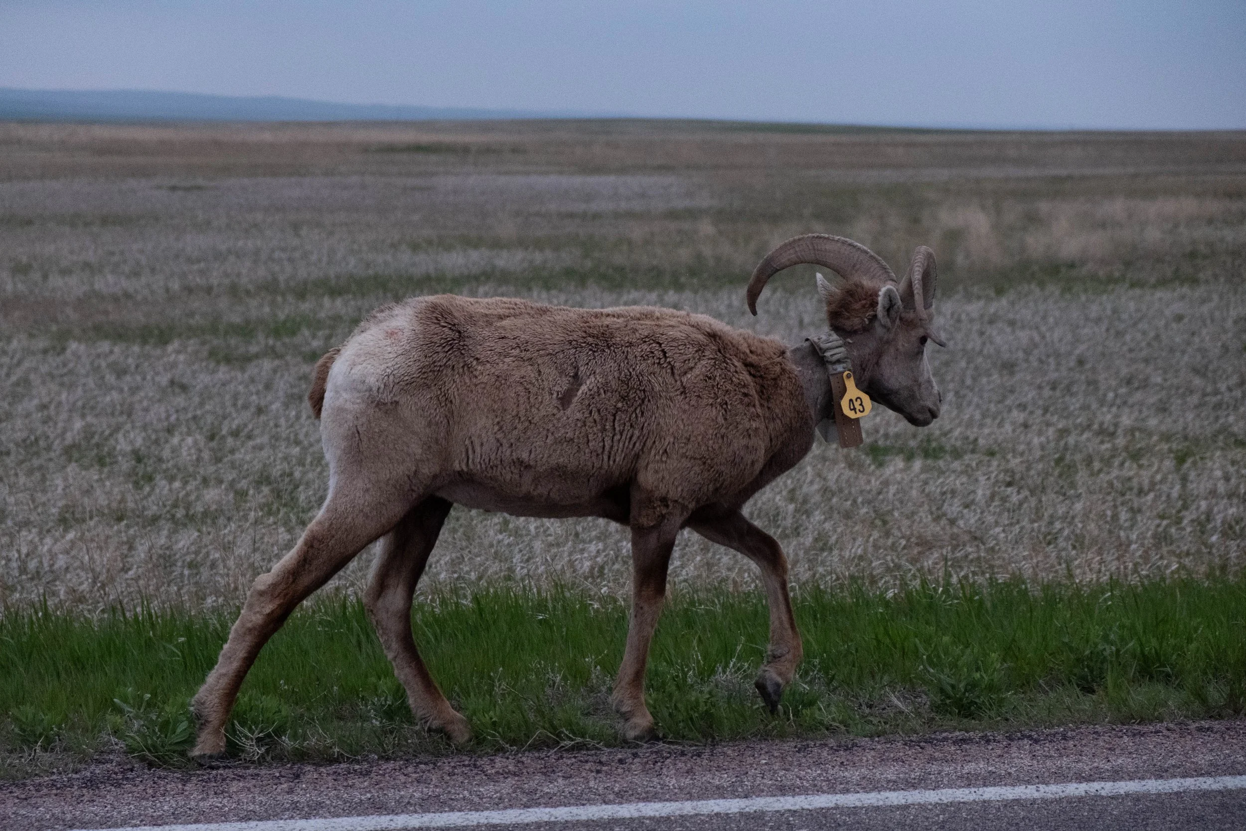
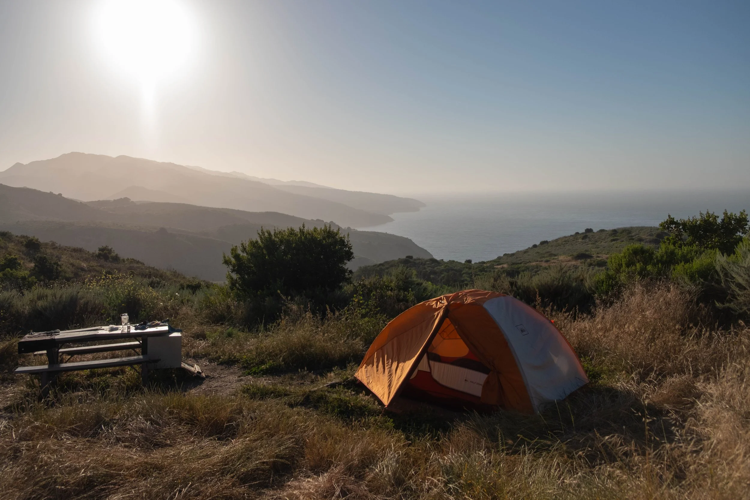
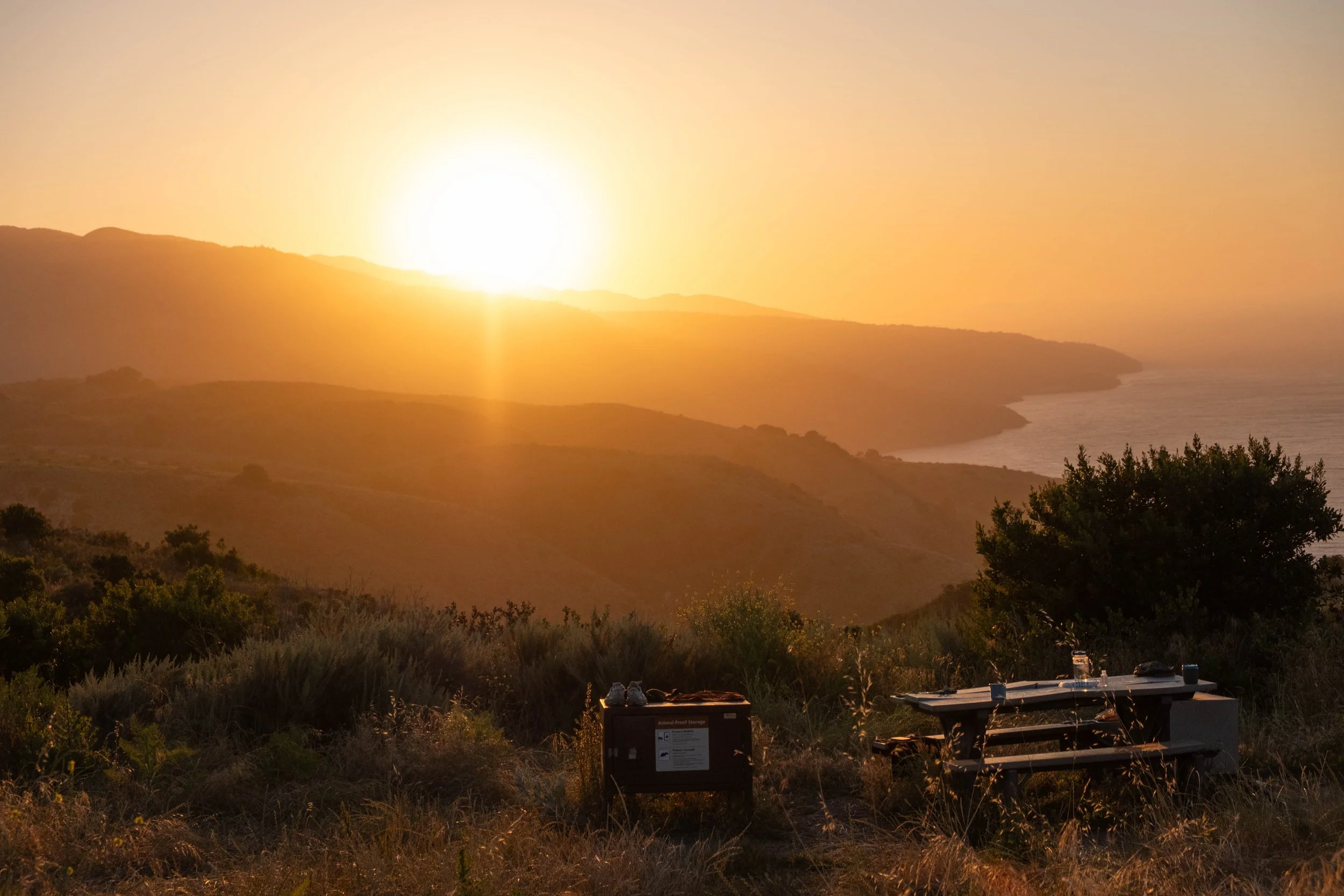
A mile and a half past Skeleton Point, we reached The Tipoff, the final resting point on the South Kaibab before reaching our destination: Bright Angel Campground and nearby Phantom Ranch. This was also the place we would ascend to when leaving the canyon, before cutting across the Tonto Plateau to finish our ascent via Bright Angel, the other established South Rim trail. We hydrated, ate a snack, and then continued on for the push to the bottom. It was hot at this point, which is my hiking kryptonite, but the next section of trail flew by as we were delighted to come across two desert bighorn sheep. We hiked alongside these shy, curious cuties for most of the way down to the river.
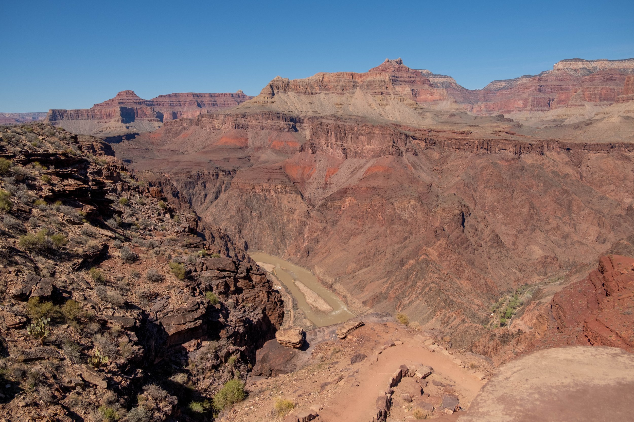
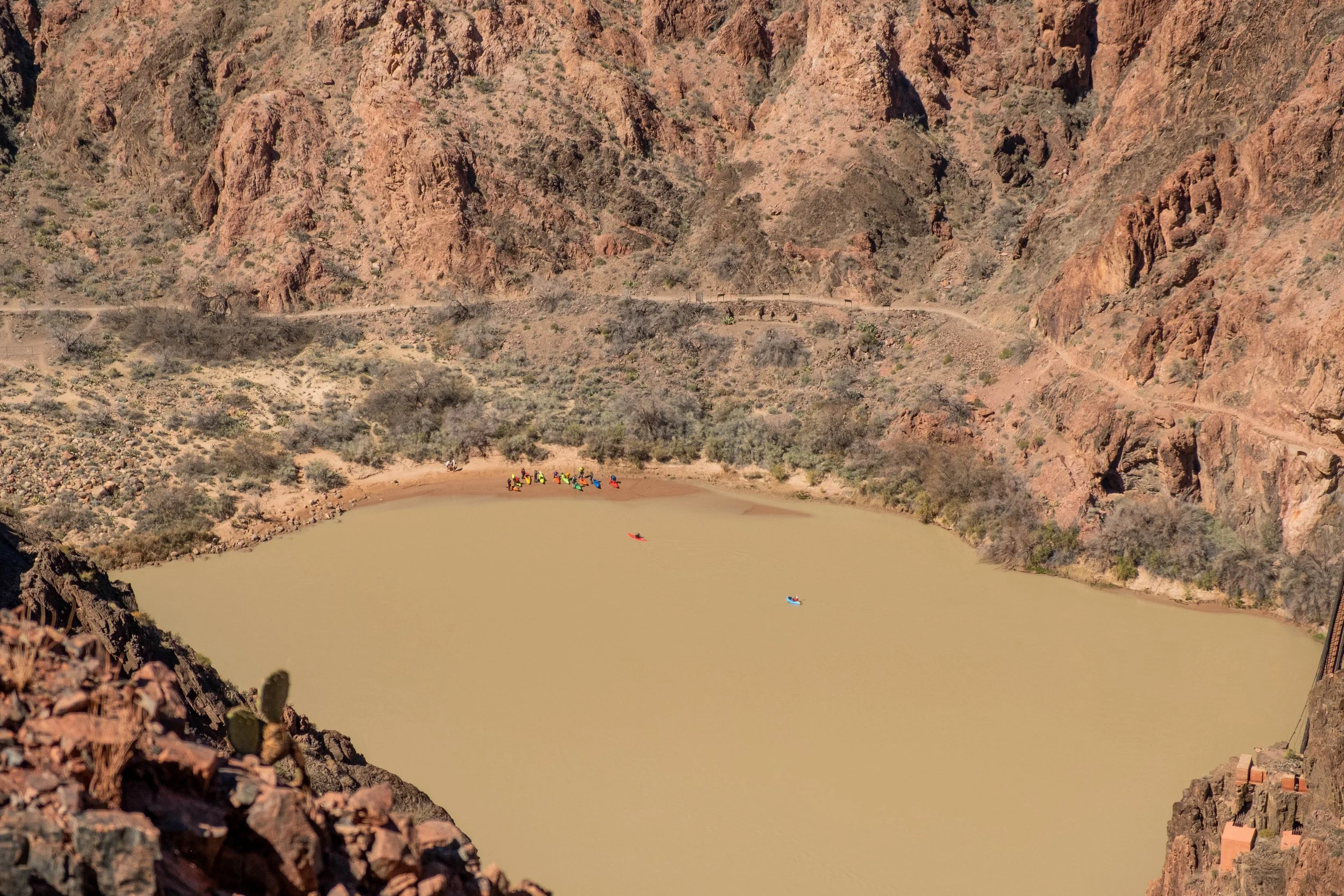
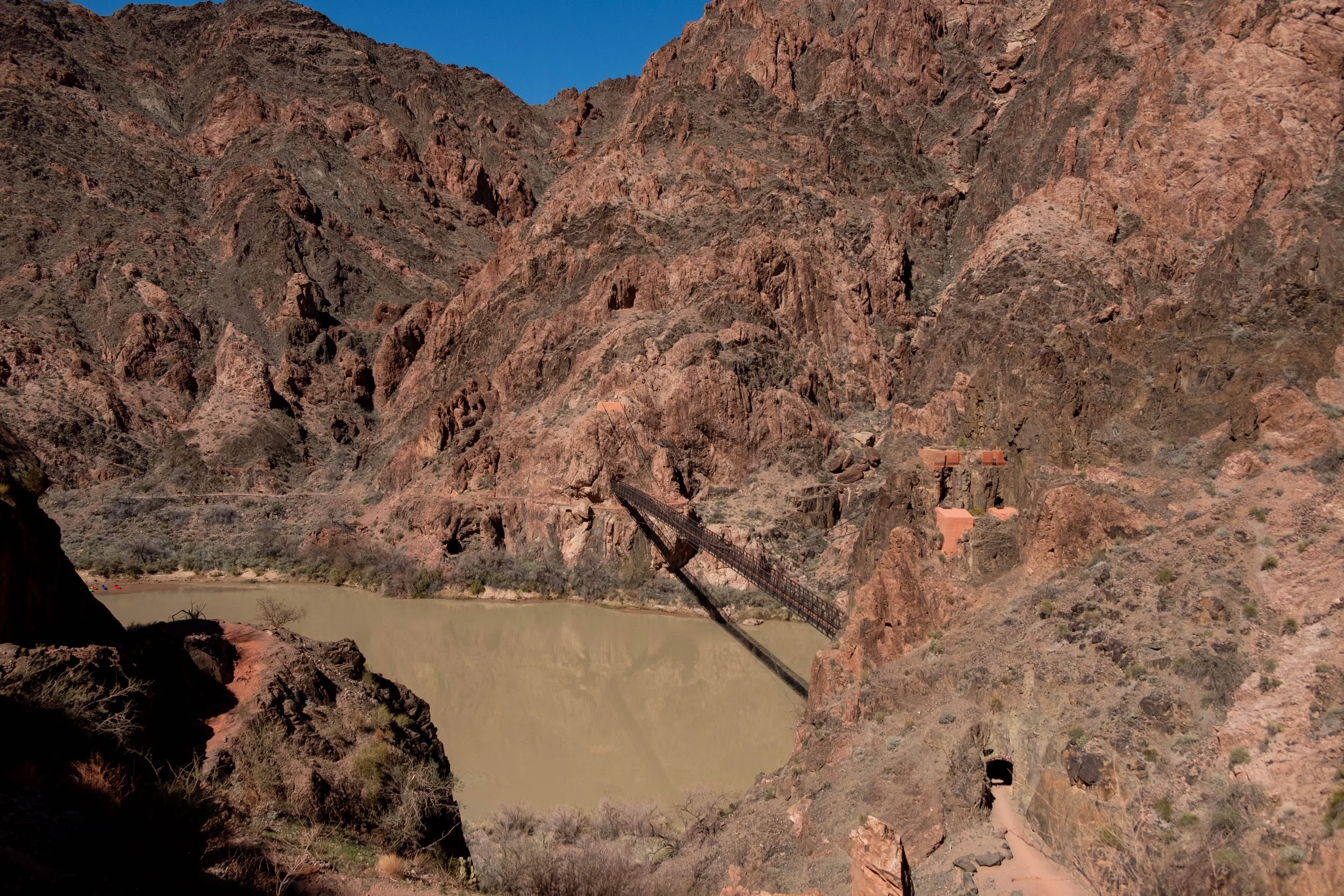
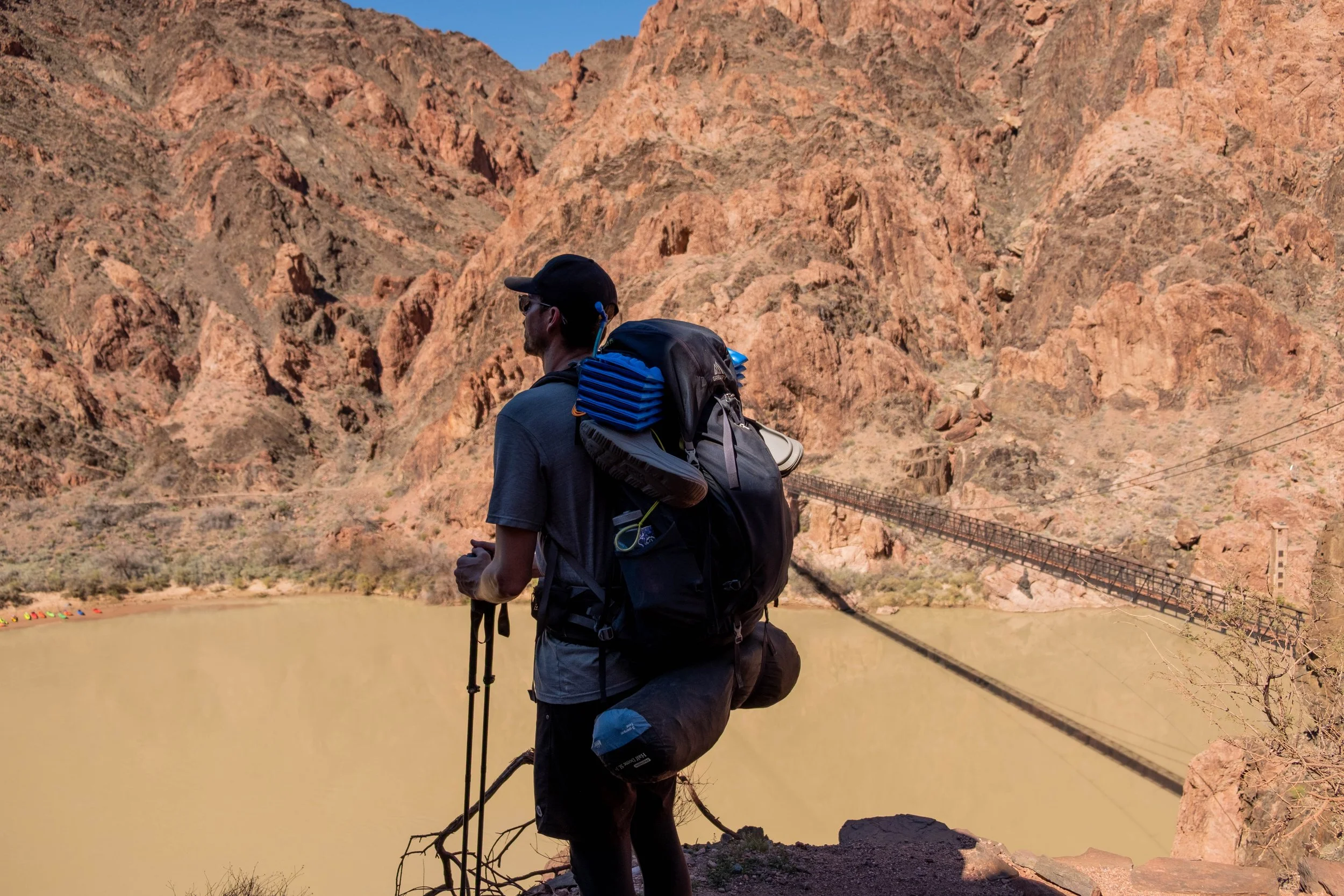
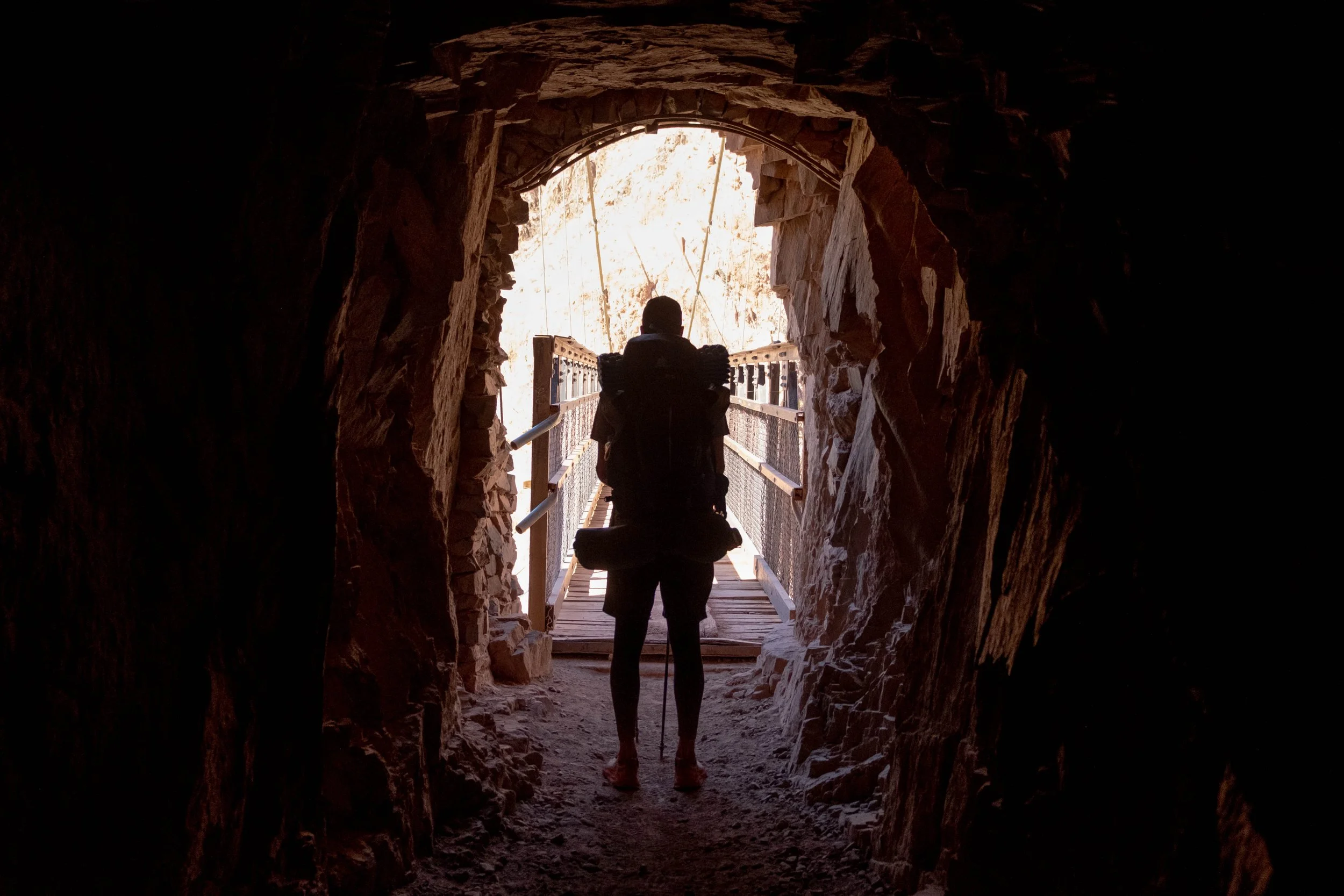
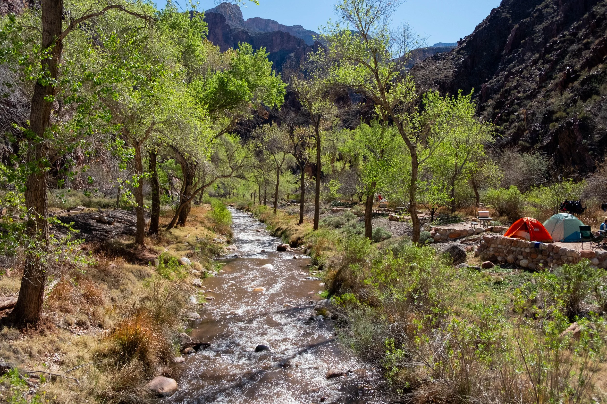
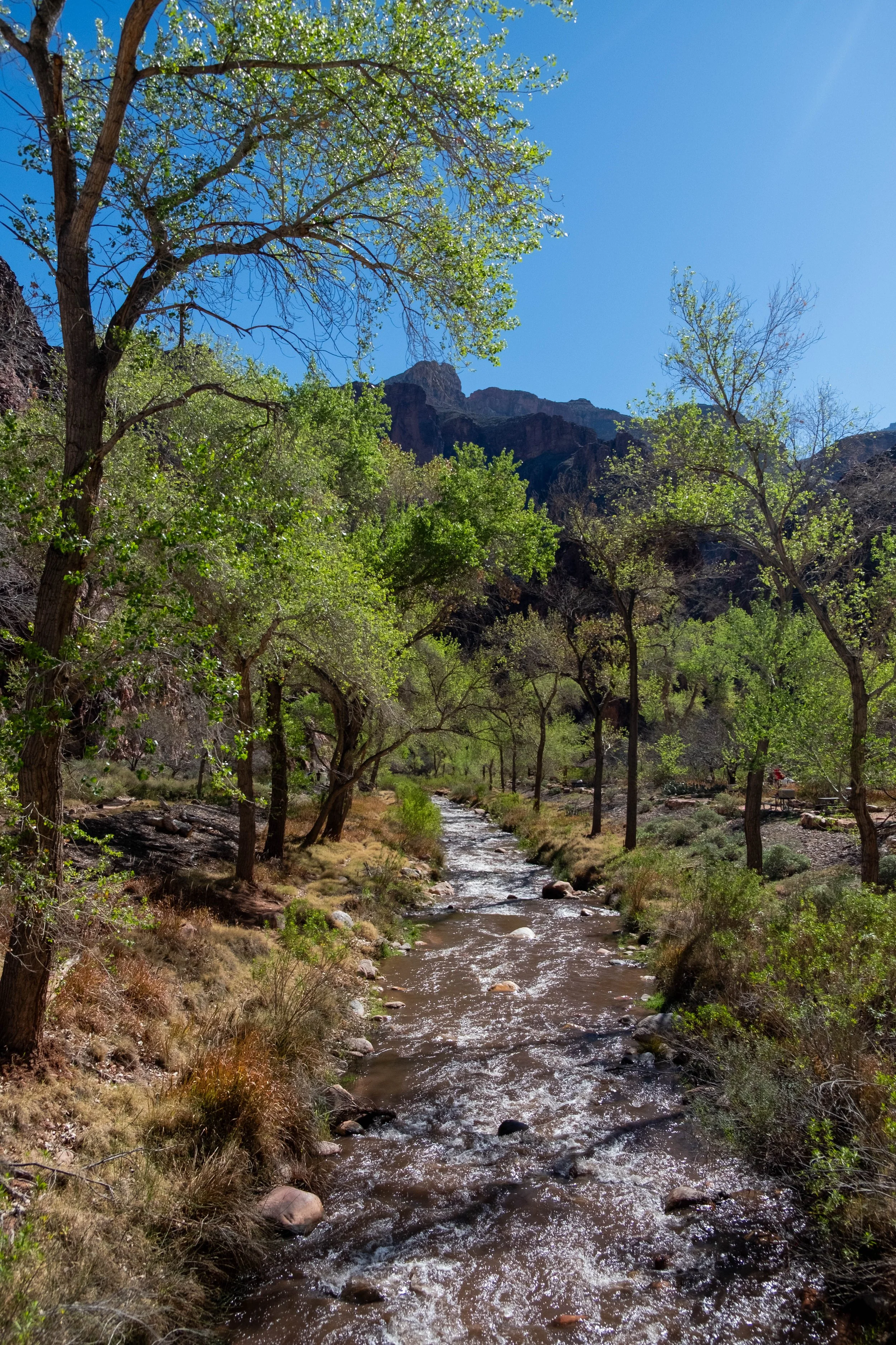
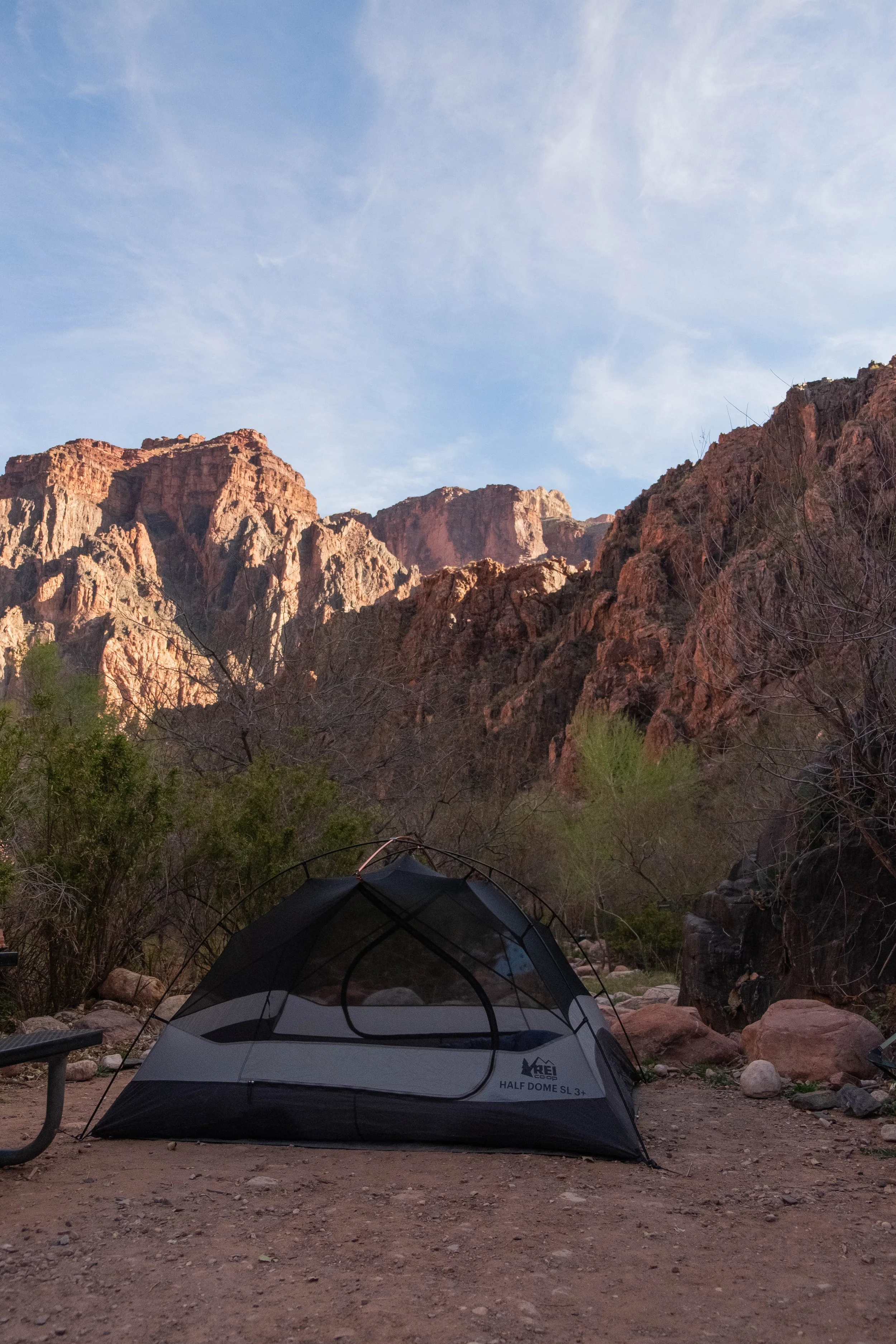
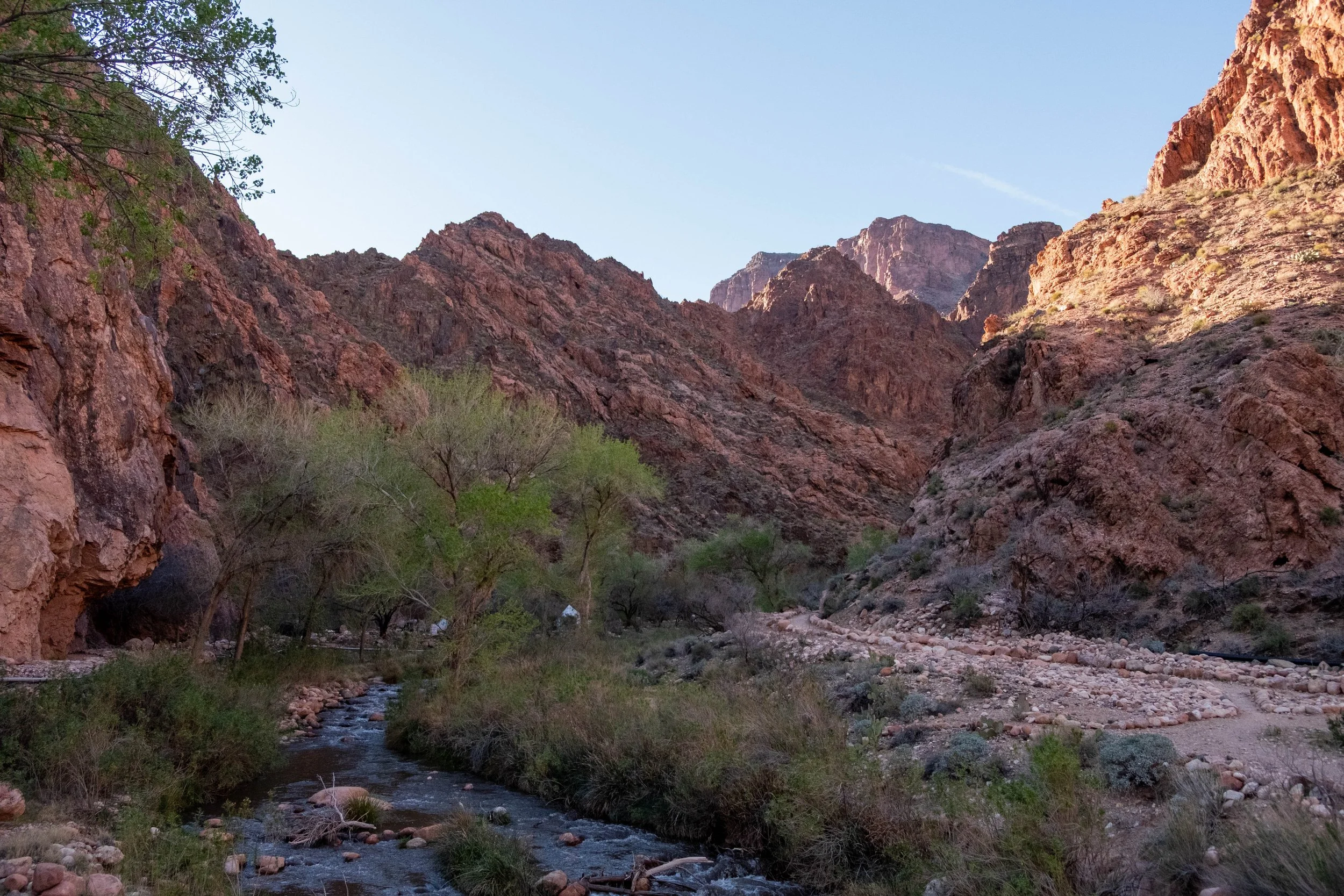
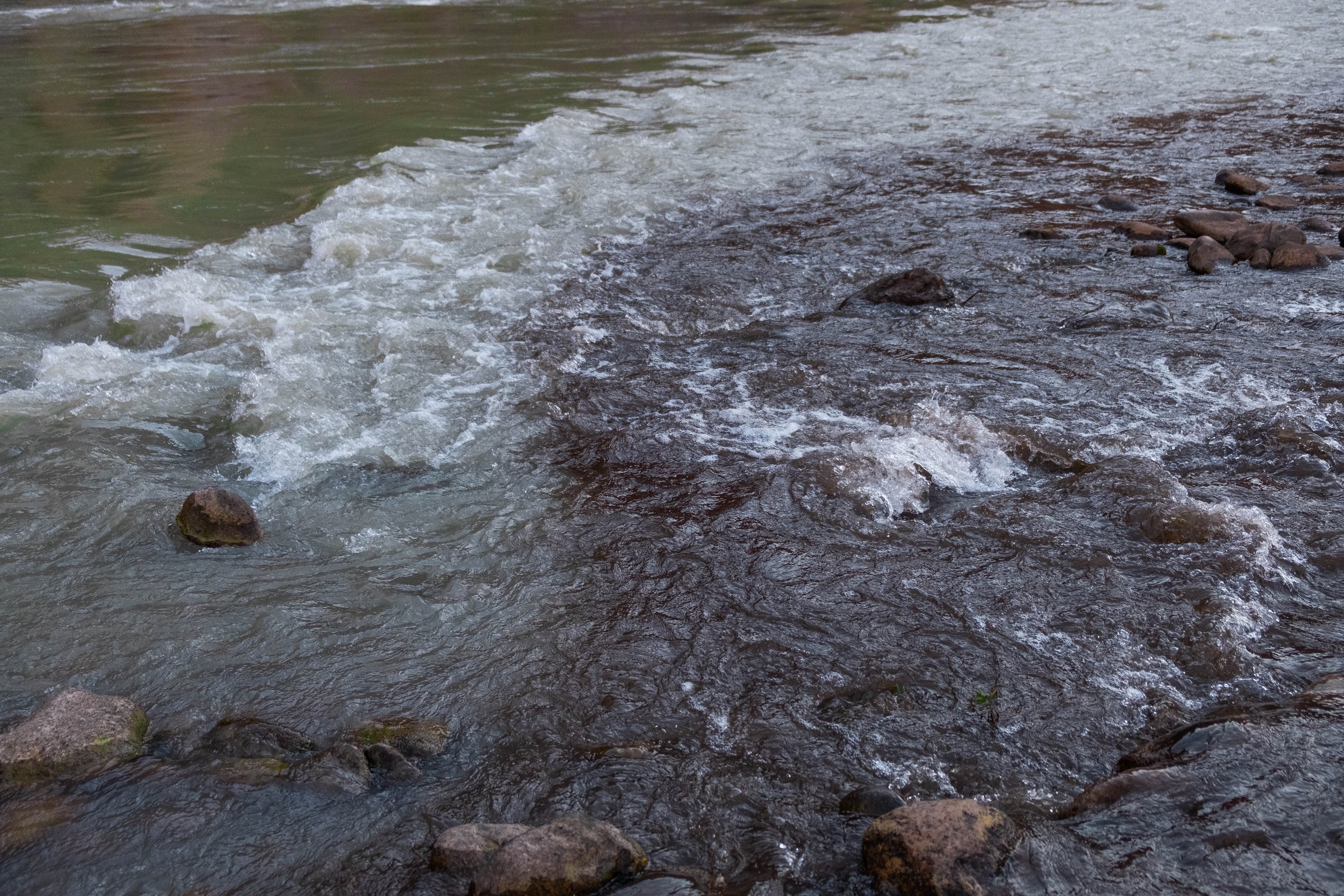
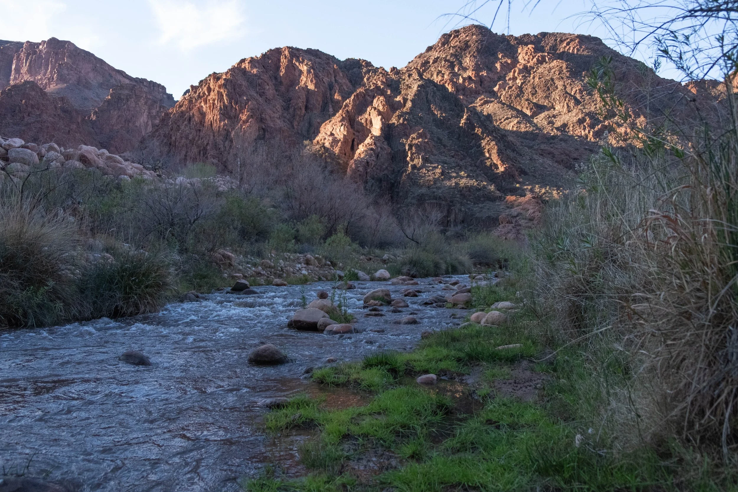
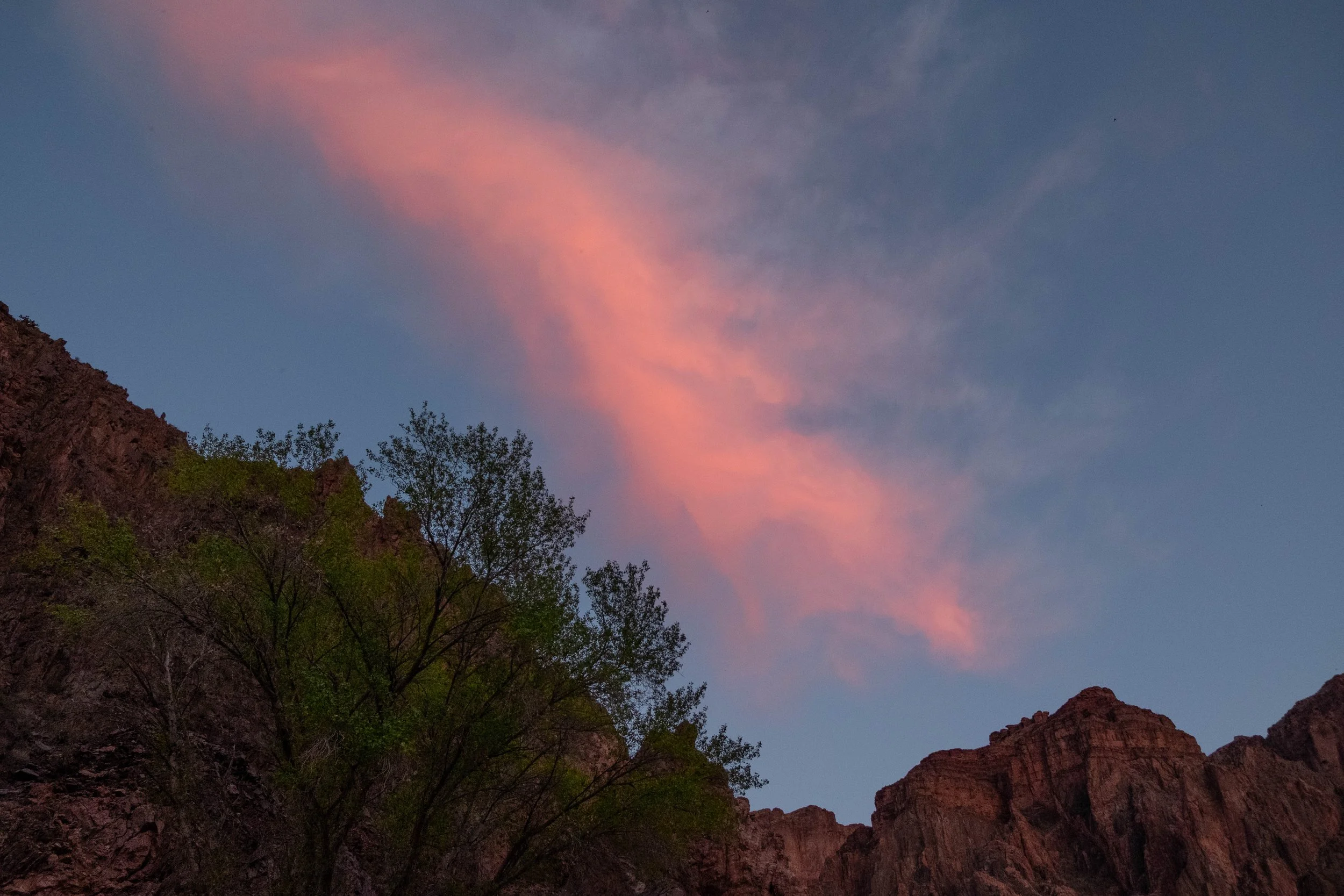
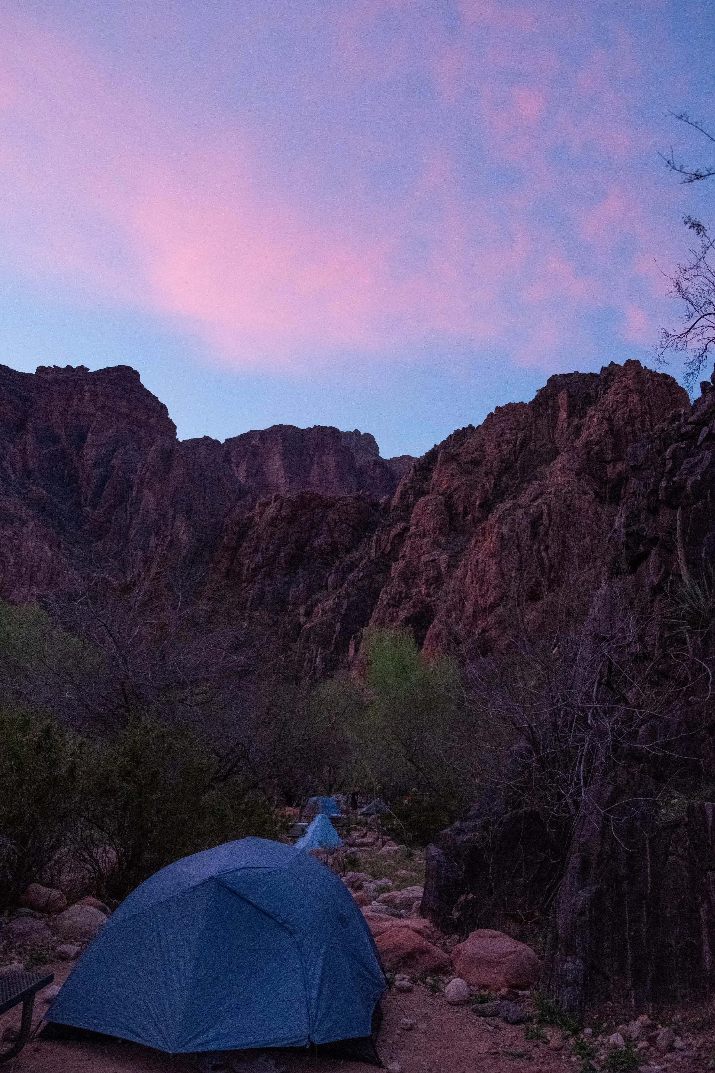
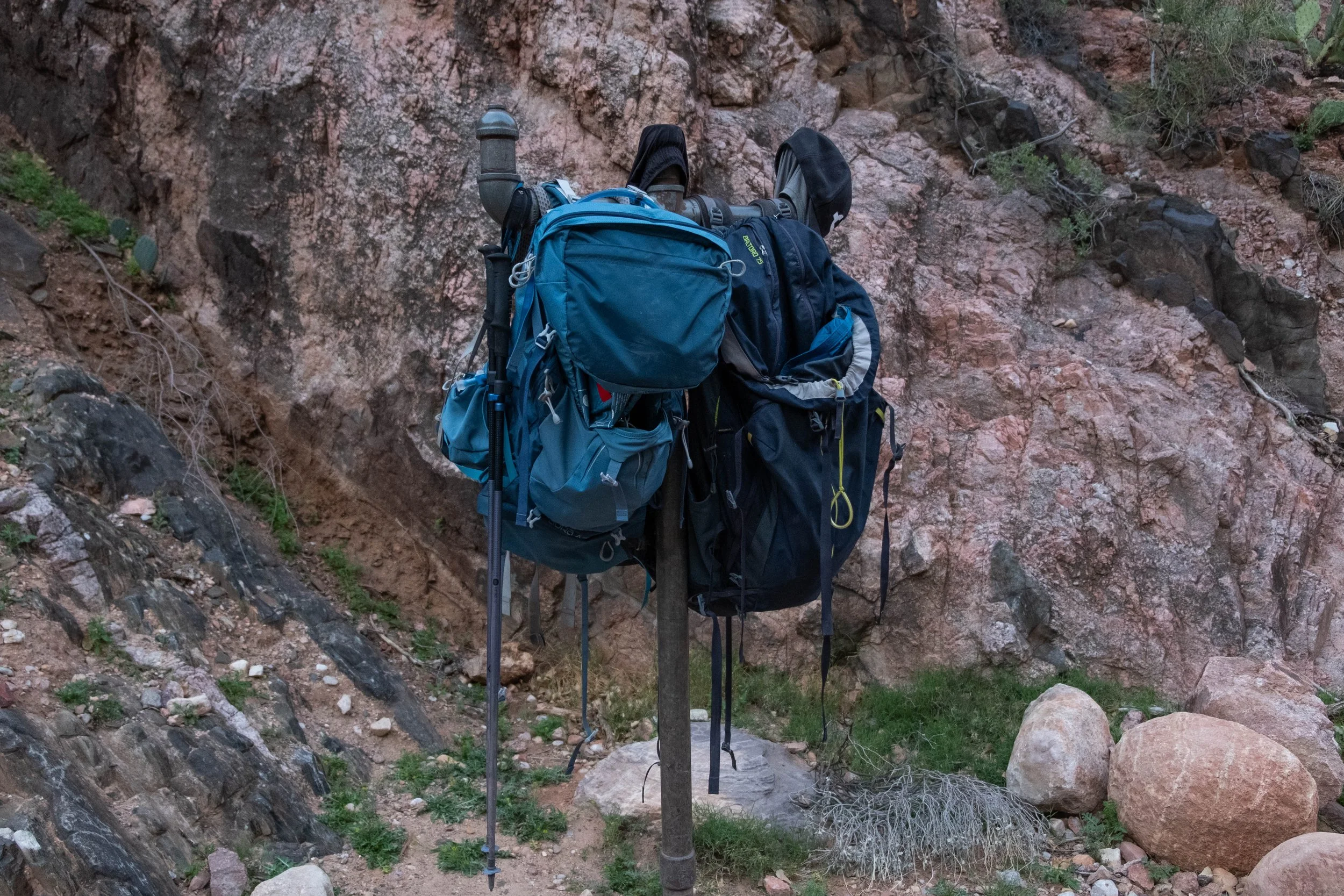
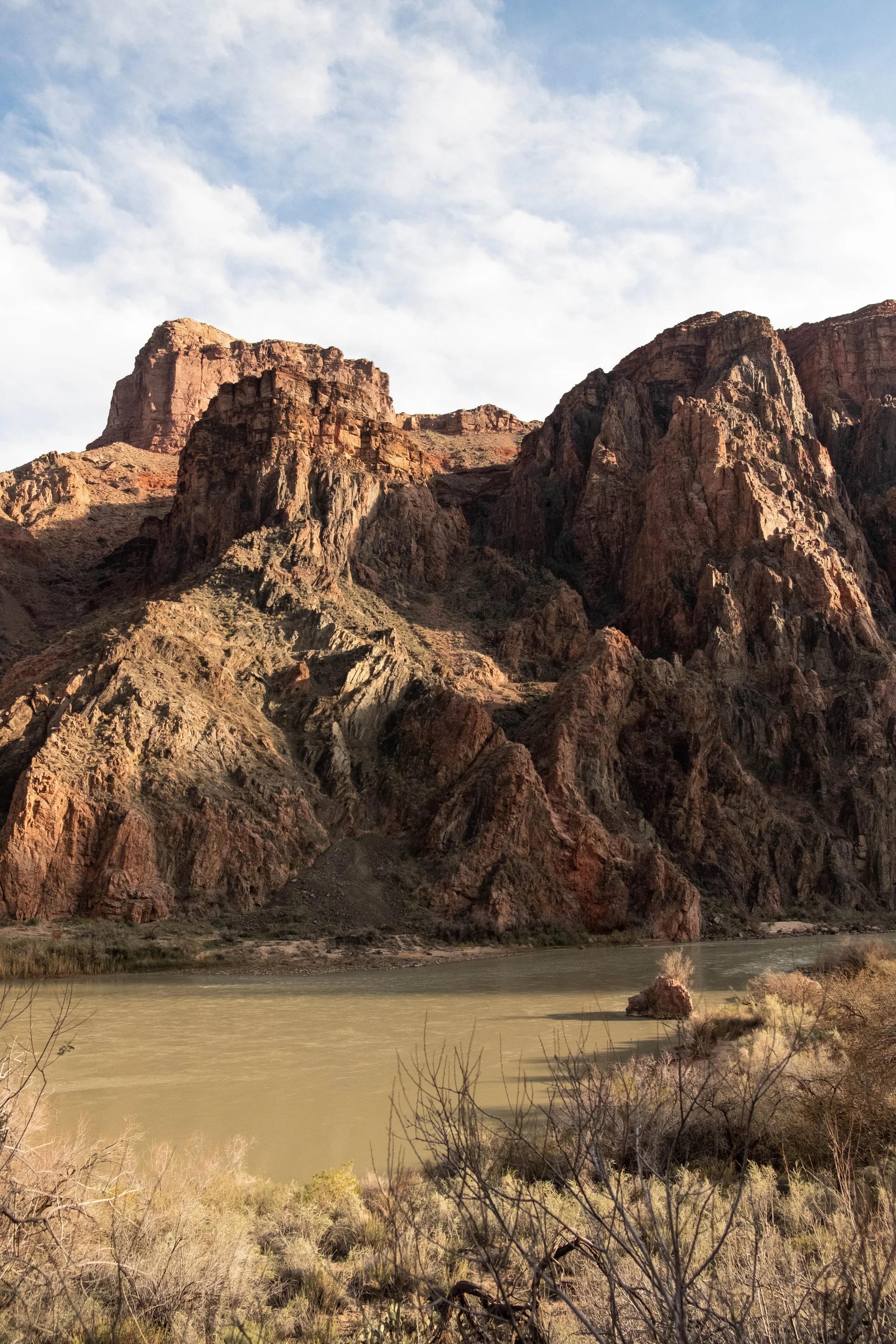
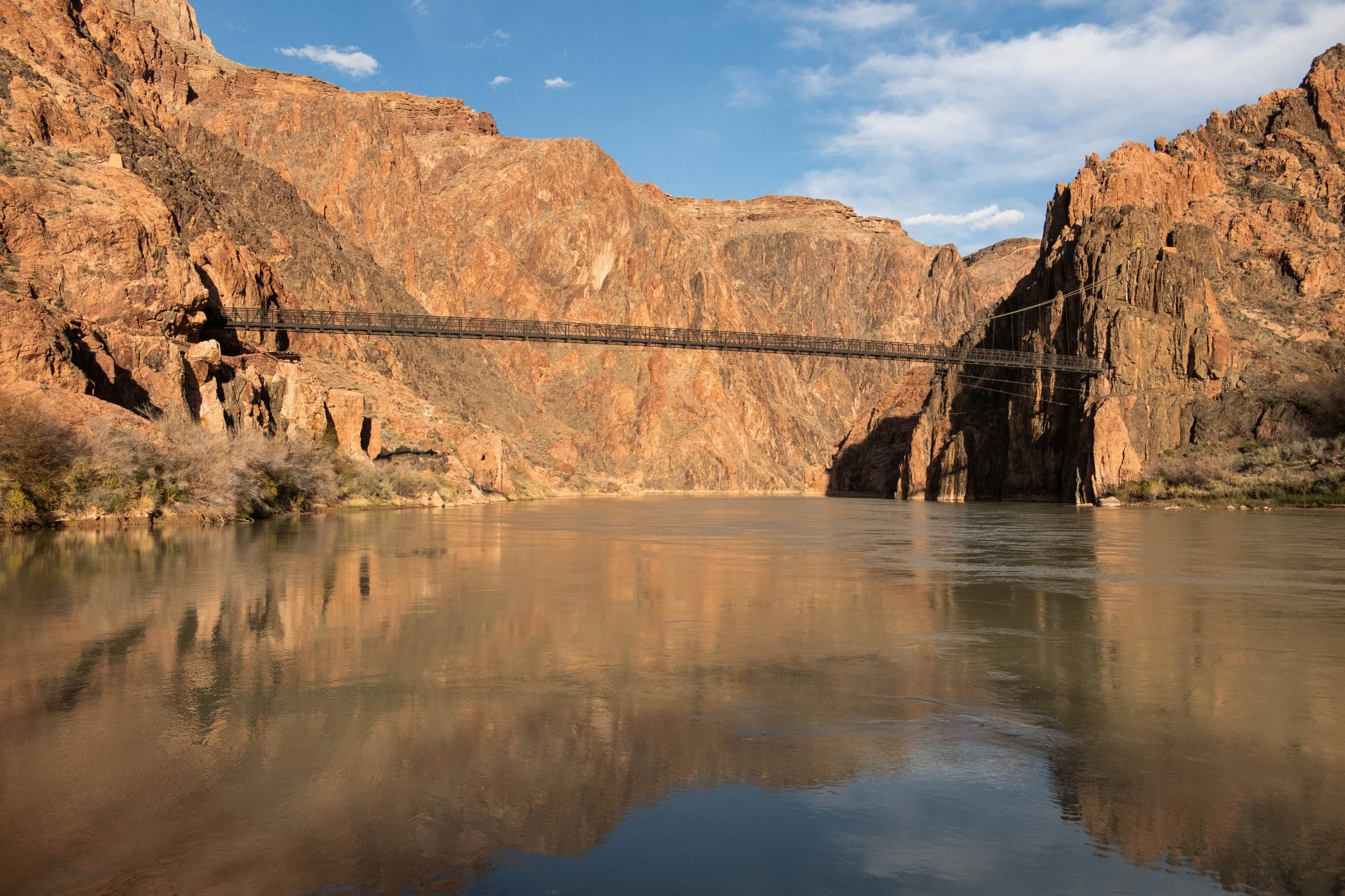
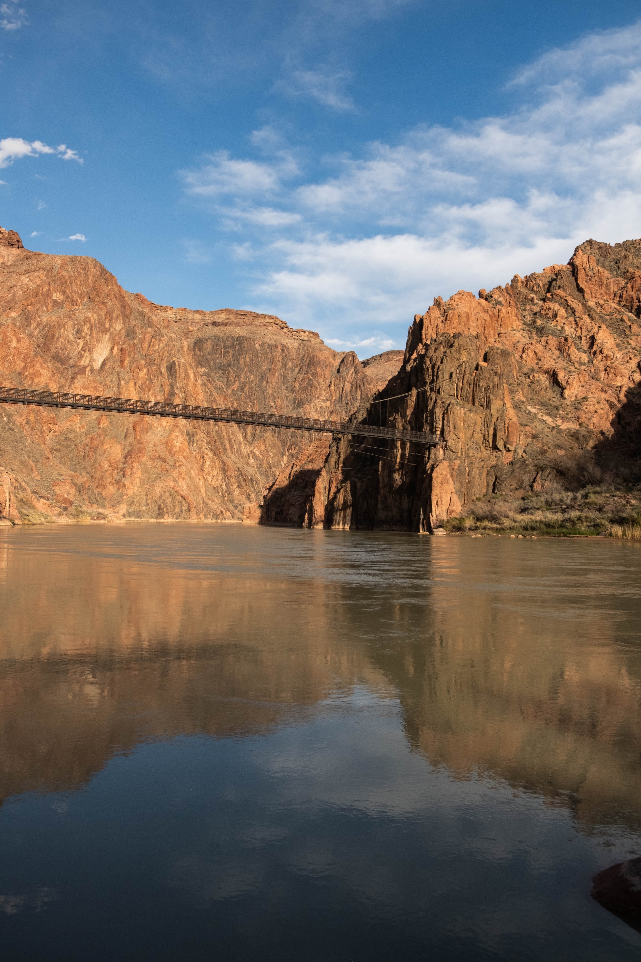
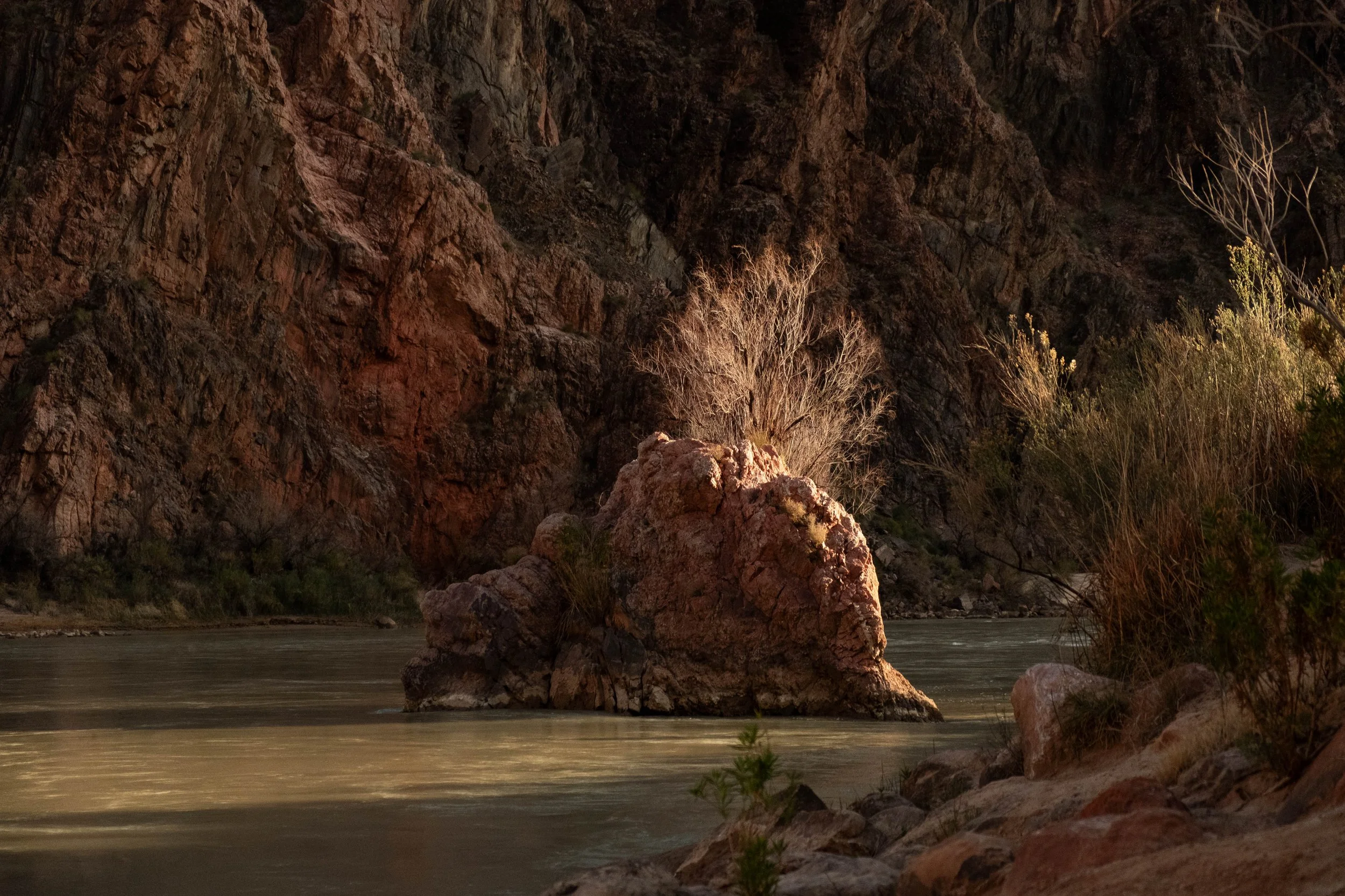
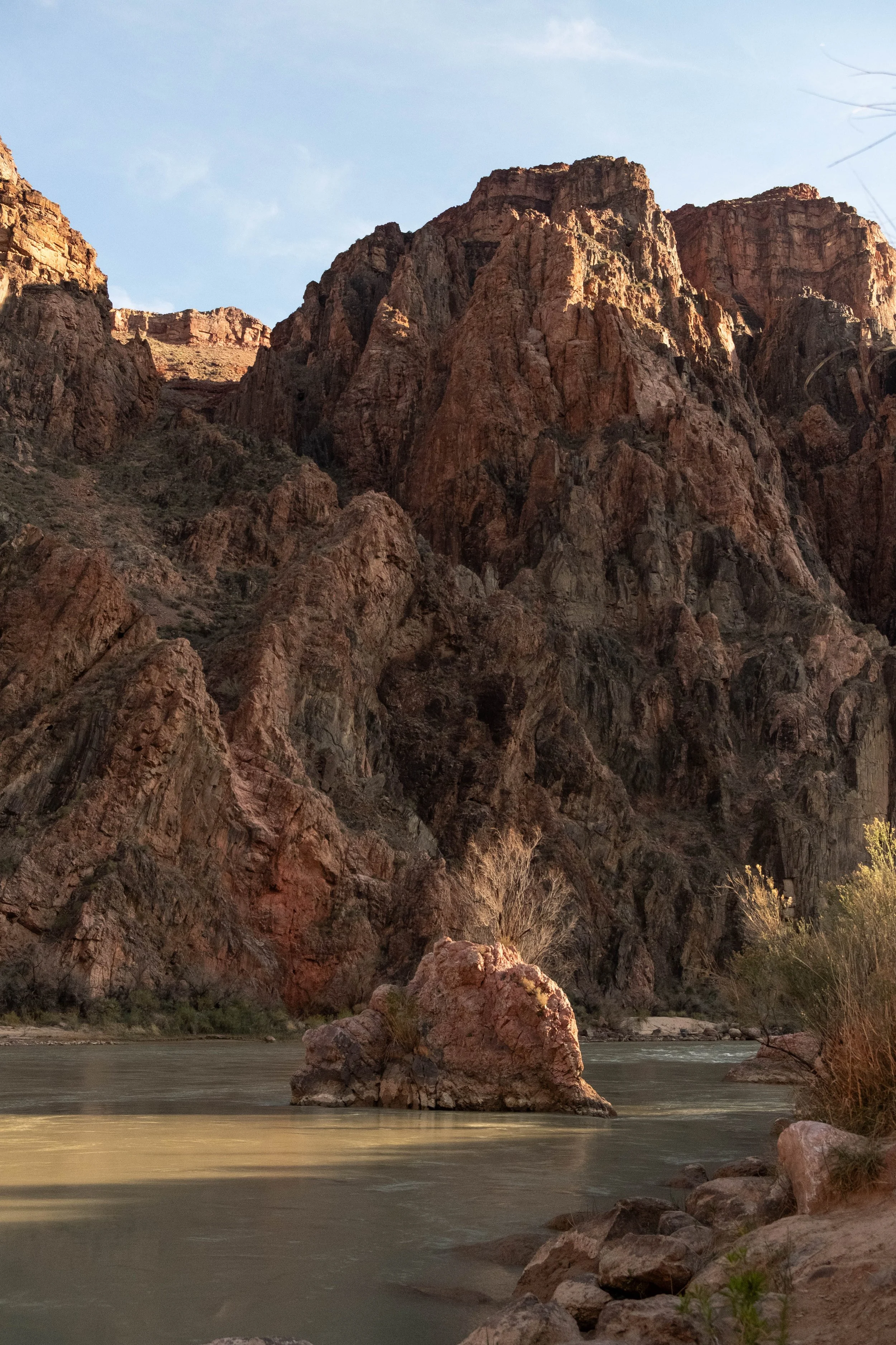
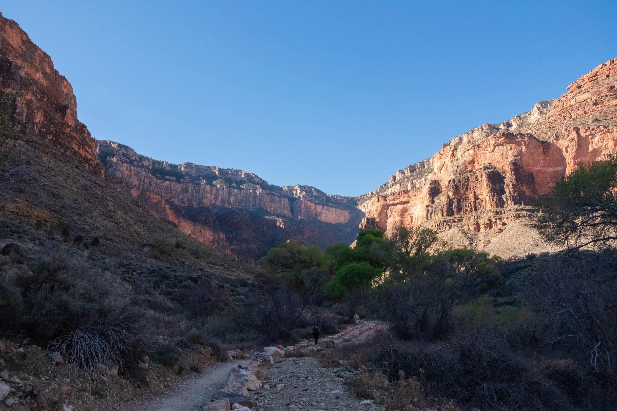
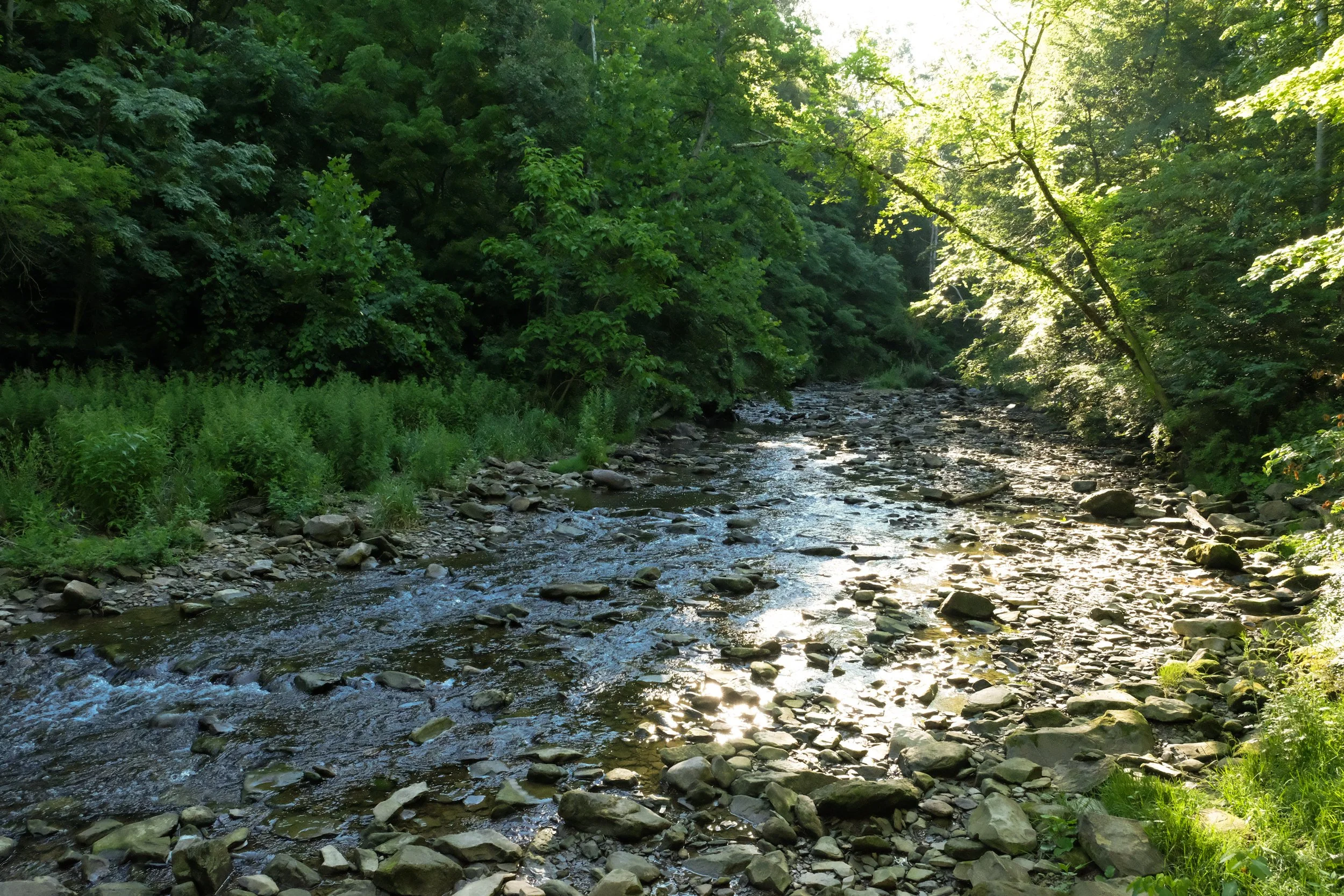
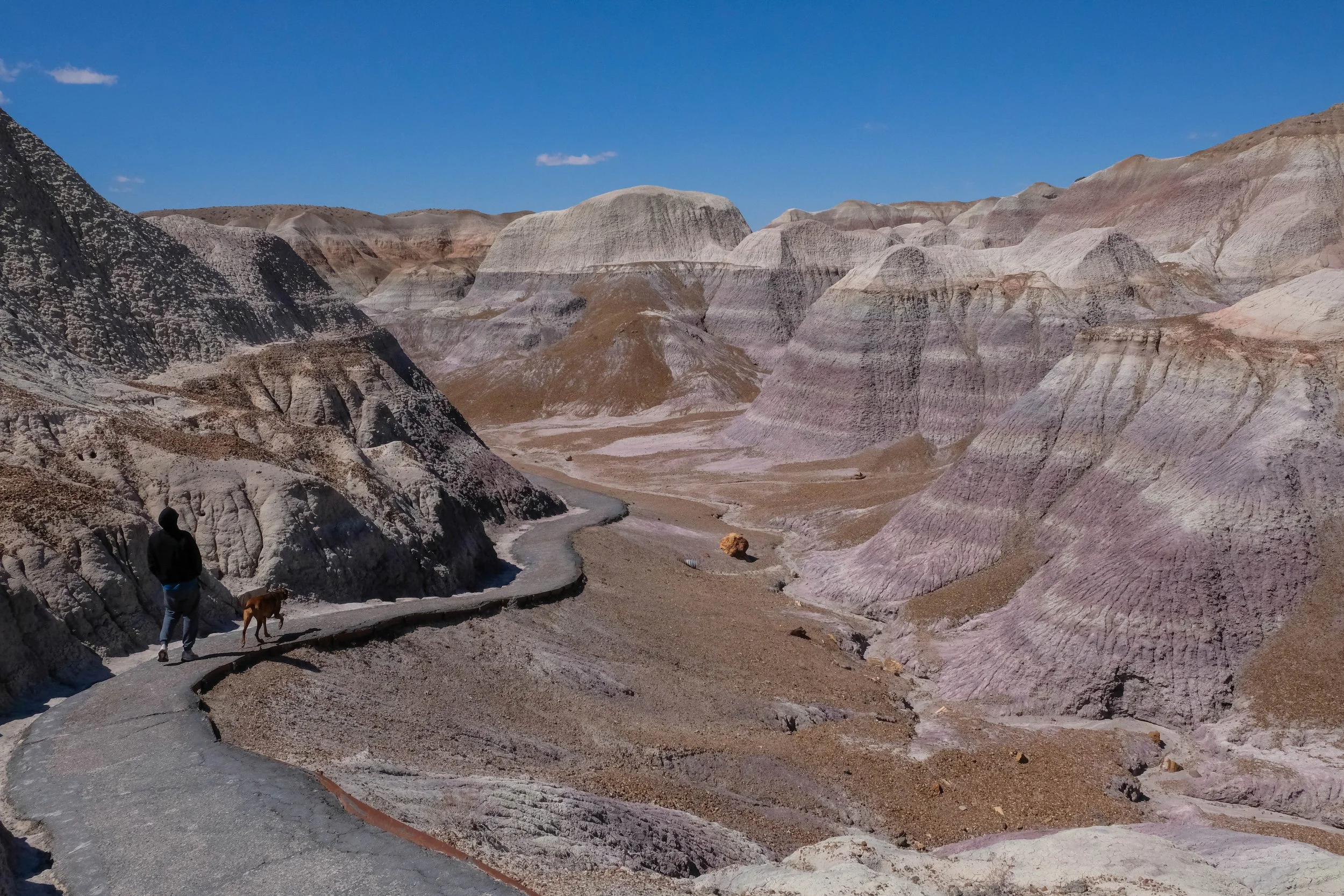
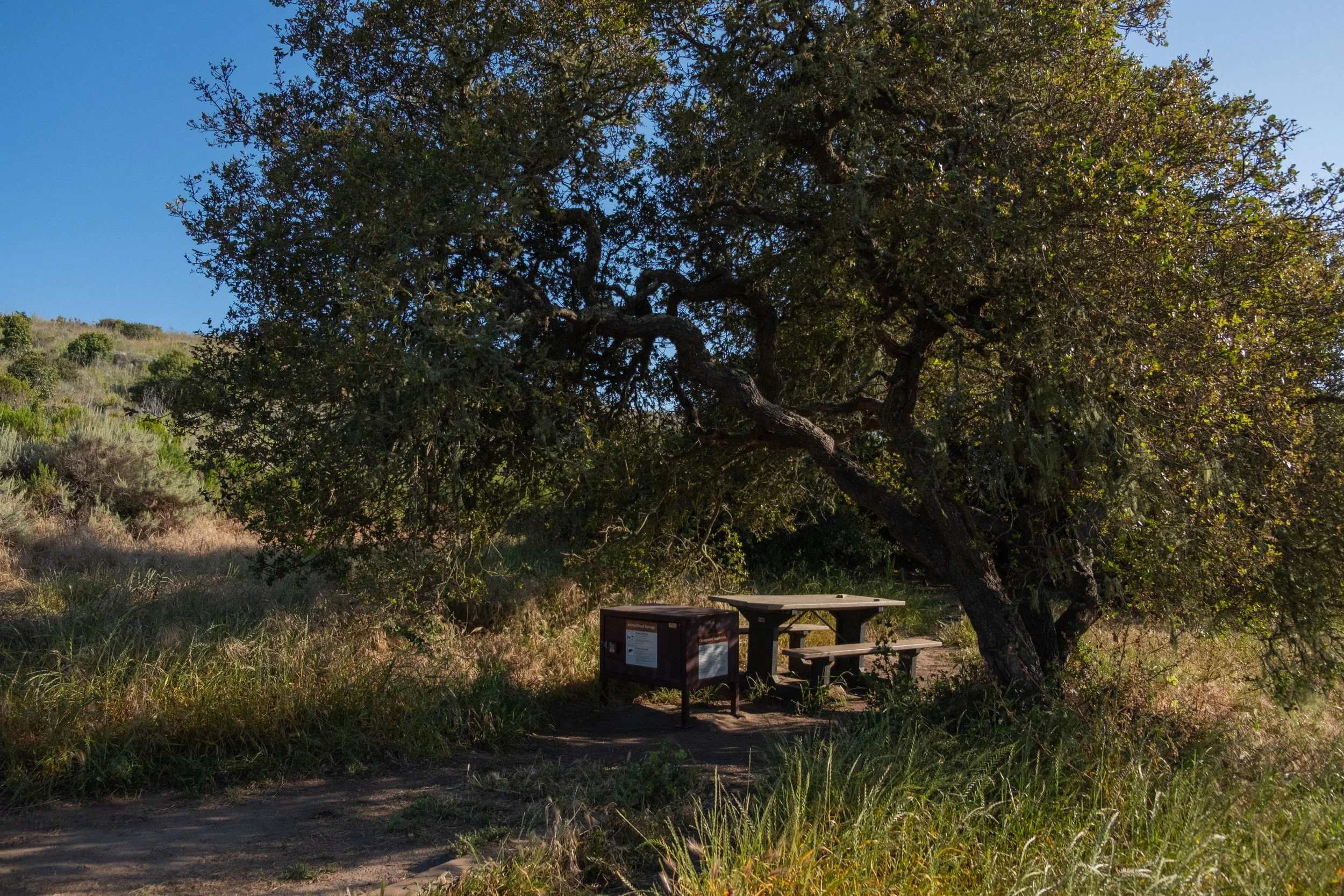
Once we crossed the Black Bridge to the other side of the Colorado, we soon came the narrow corridor in the canyon where our campground was nestled. It was surprisingly lush feeling after the dusty miles we’d just traversed. Cottonwoods lined Bright Angel Creek, their leaves a brilliant spring green that contrasted with the rust-colored canyon walls around us. We were some of the first hikers down for the day, so had our pick of (most of) the campsites. We landed on #23 which offered an ideal mixture of afternoon shade, access to the creek, and proximity to the restroom. Before long our food was stored in the provided metal box, our backpacks were hanging off the ground (to protect from mice, which we were informed would chew through anything to find food or other scented items), our tent was pitched, and our legs were plunged into the ice cold creek to begin treatment of our soon-to-be very, very sore calves.
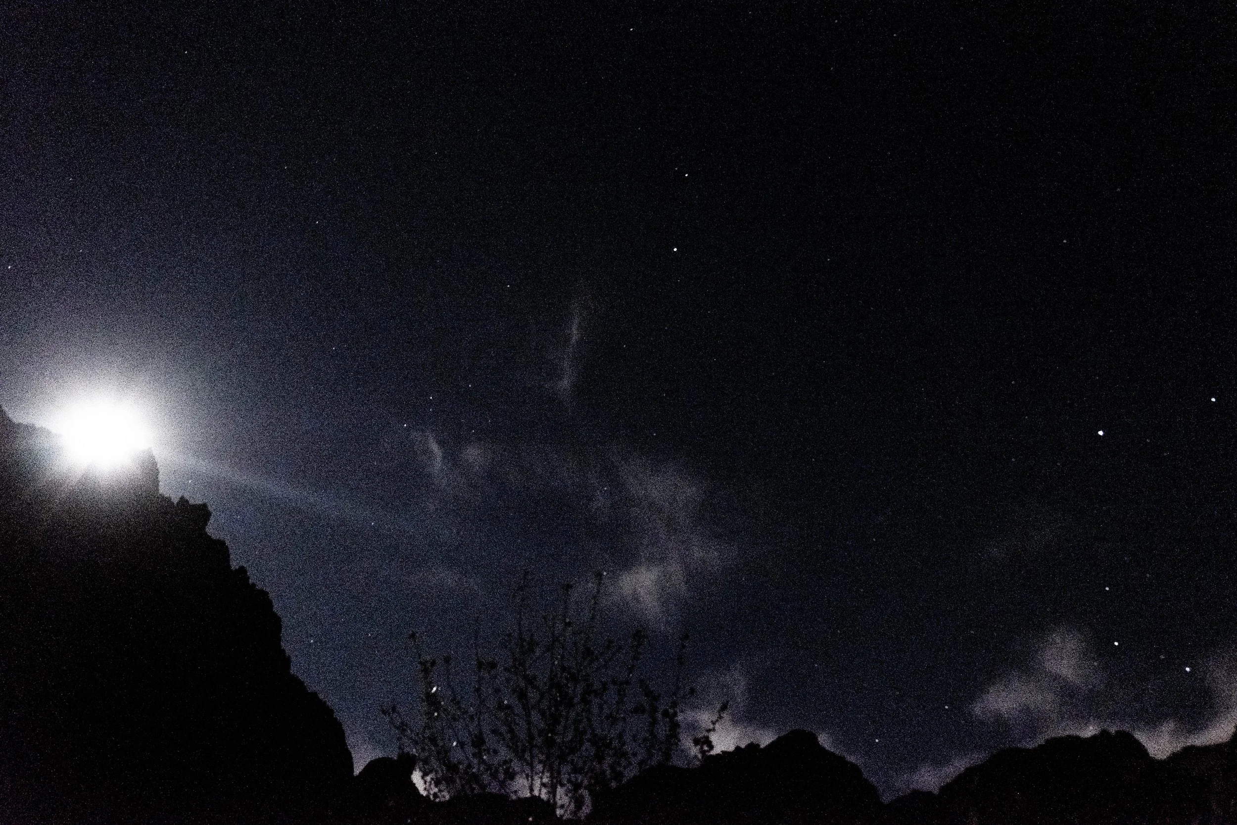
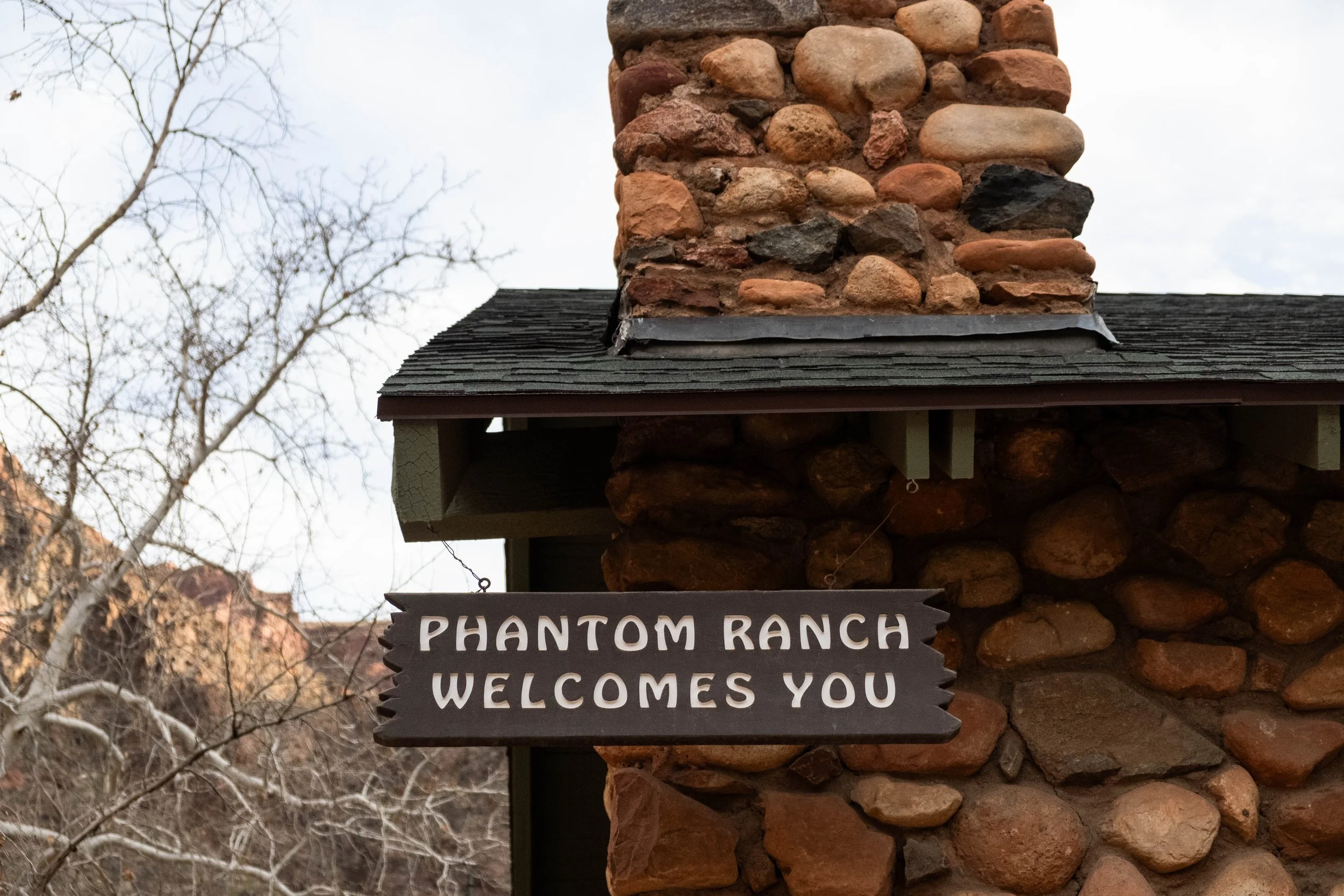
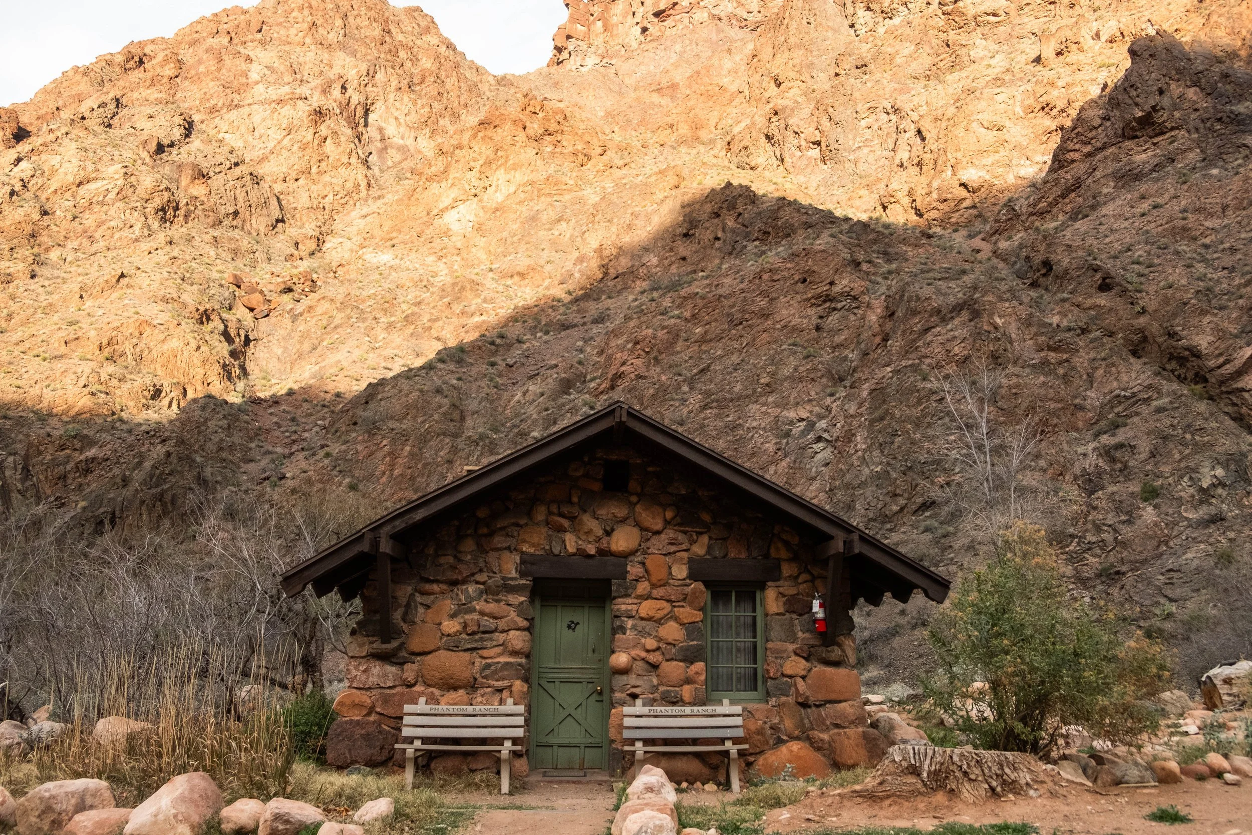
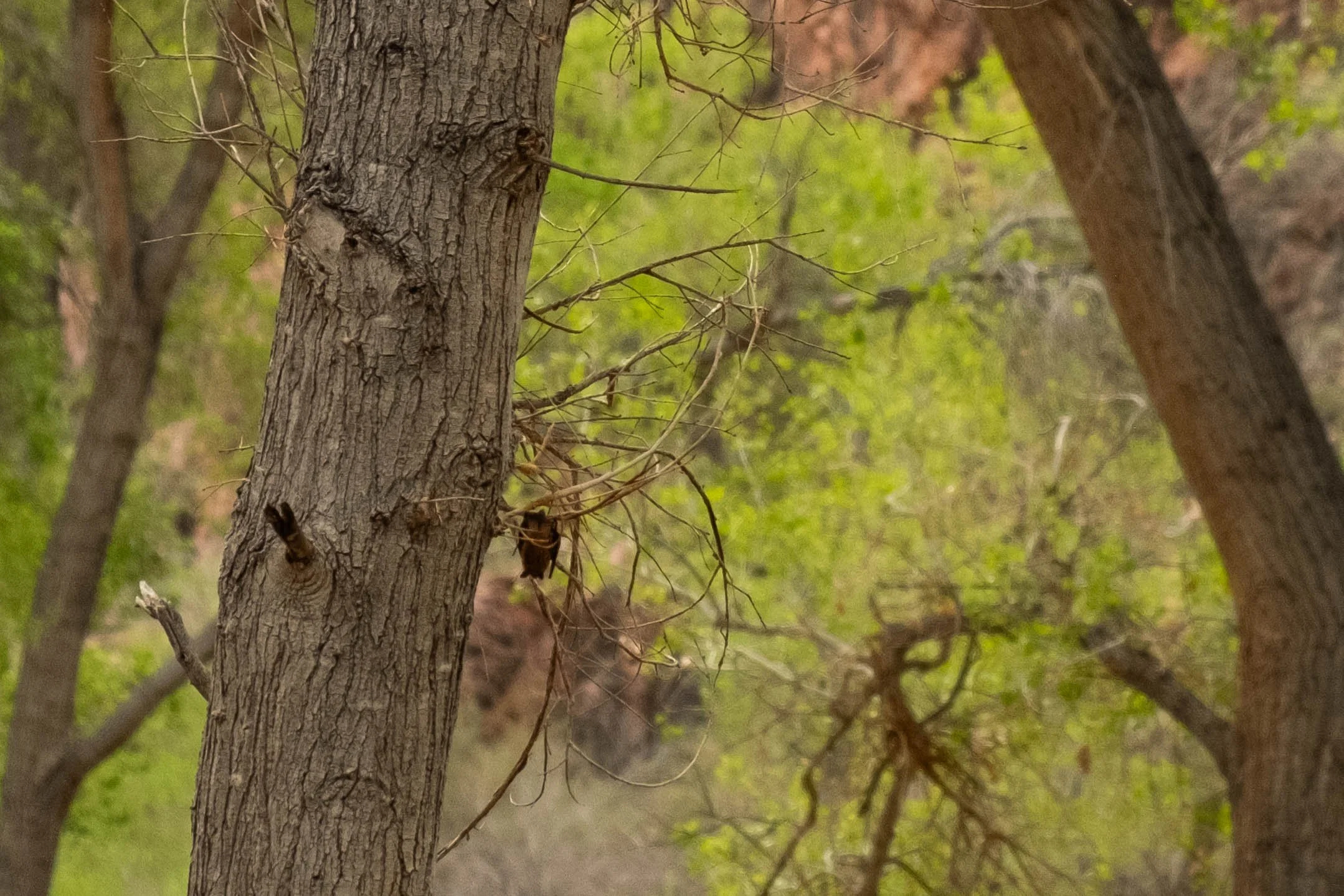
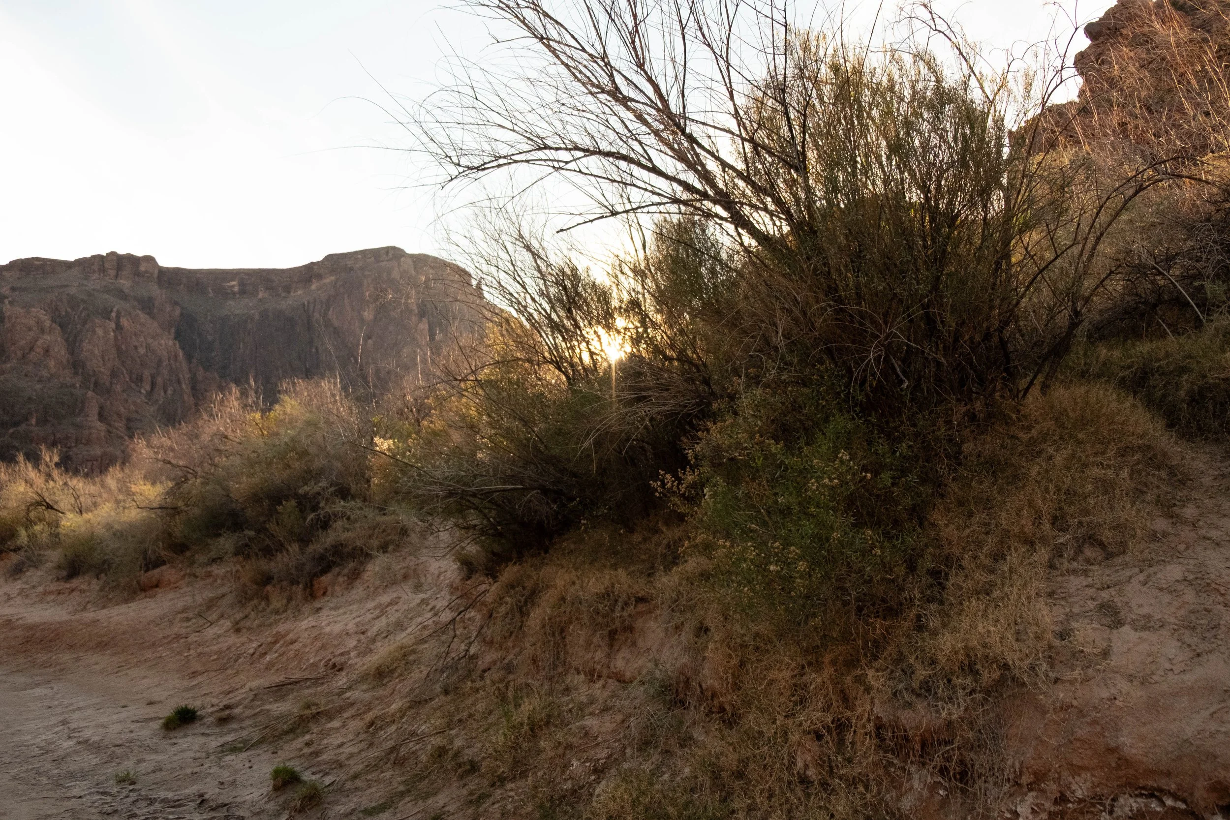
The rest of the day was quiet. We watched more backpackers arrive and choose their sites; explored Phantom Ranch; and meandered down to the banks of the Colorado at sunset. As dusk fell, Canyon Bats emerged and filled the sky above us, careening in wild patterns as they hunted for insects around us. The waxing full moon rose and cast a silver spotlight on the canyon walls above us, almost eliminating our need for headlamps as we walked to the restroom to brush our teeth. We were both fast asleep in our tent not long after 8pm.
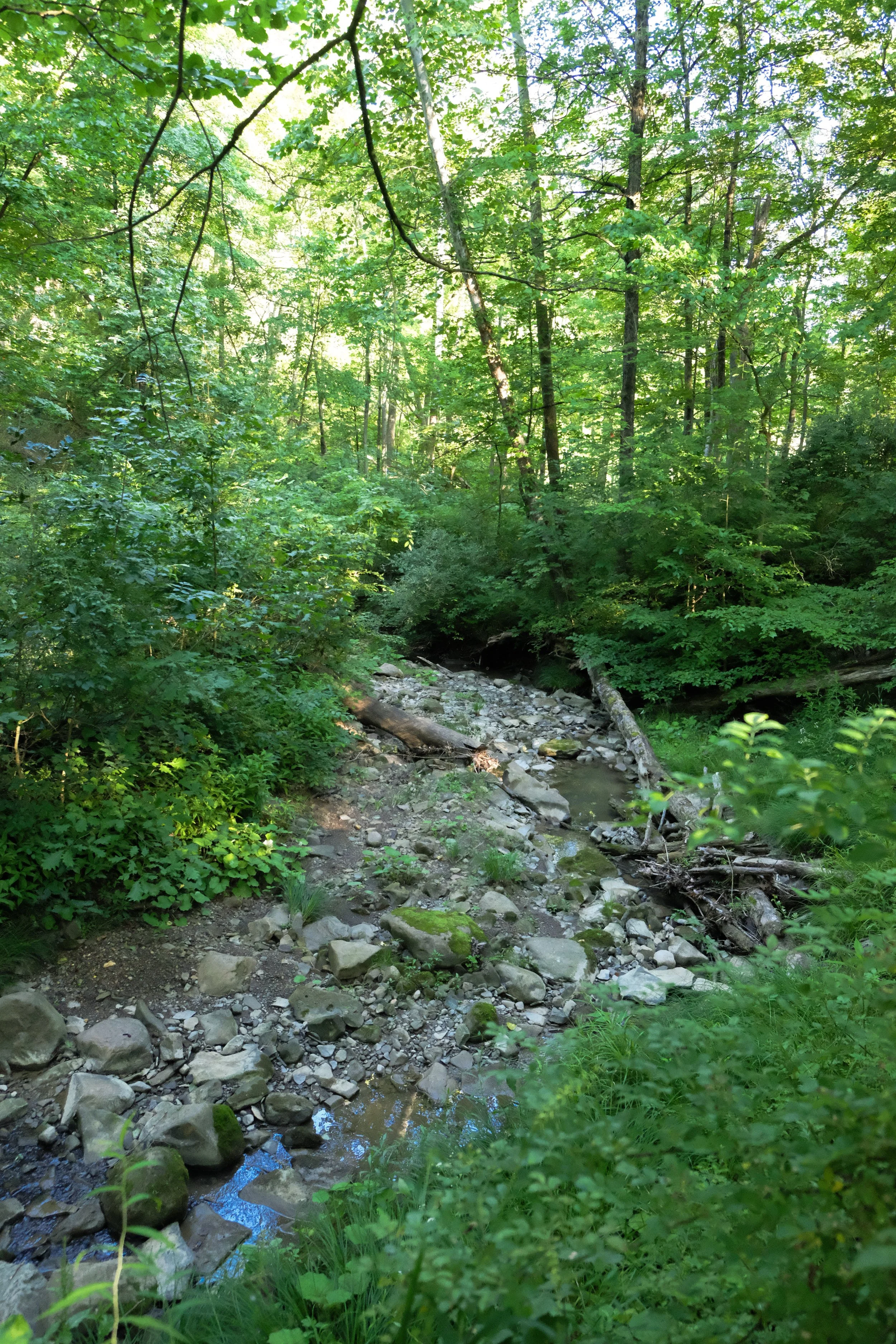
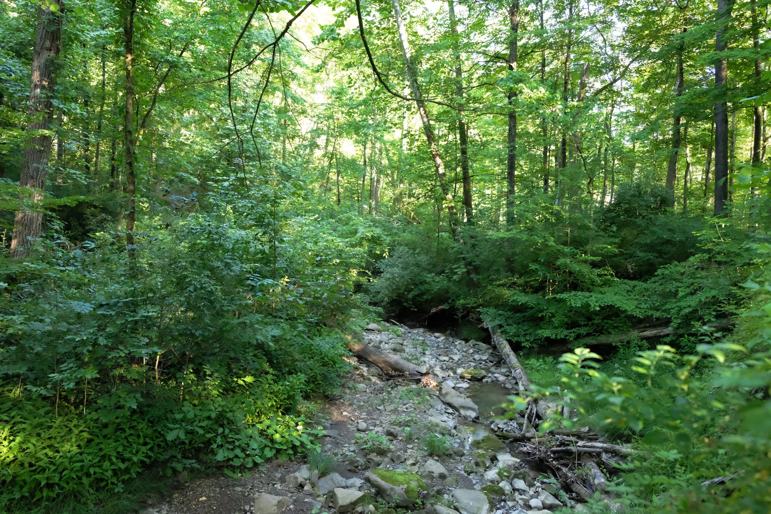
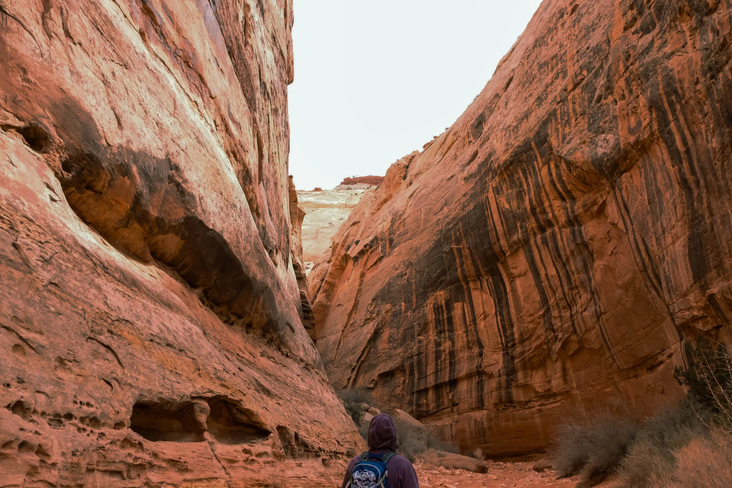
Day 2 | In the Canyon: Clear Creek Trail
Distance: 5.5 miles | Elevation gain/loss: ±1,200 ft
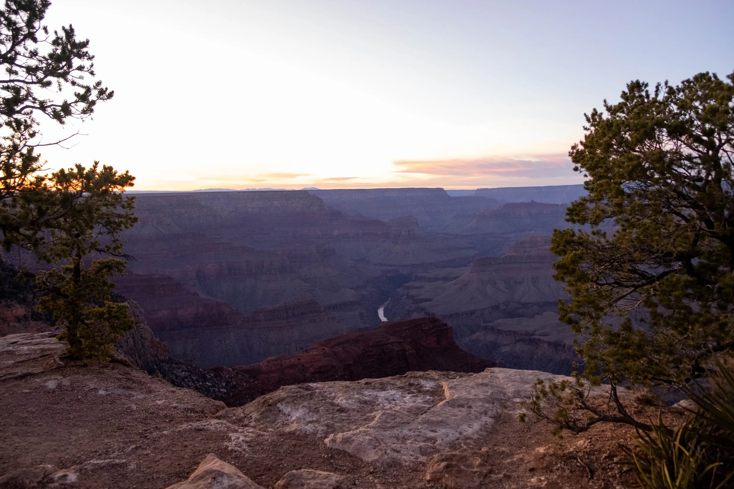
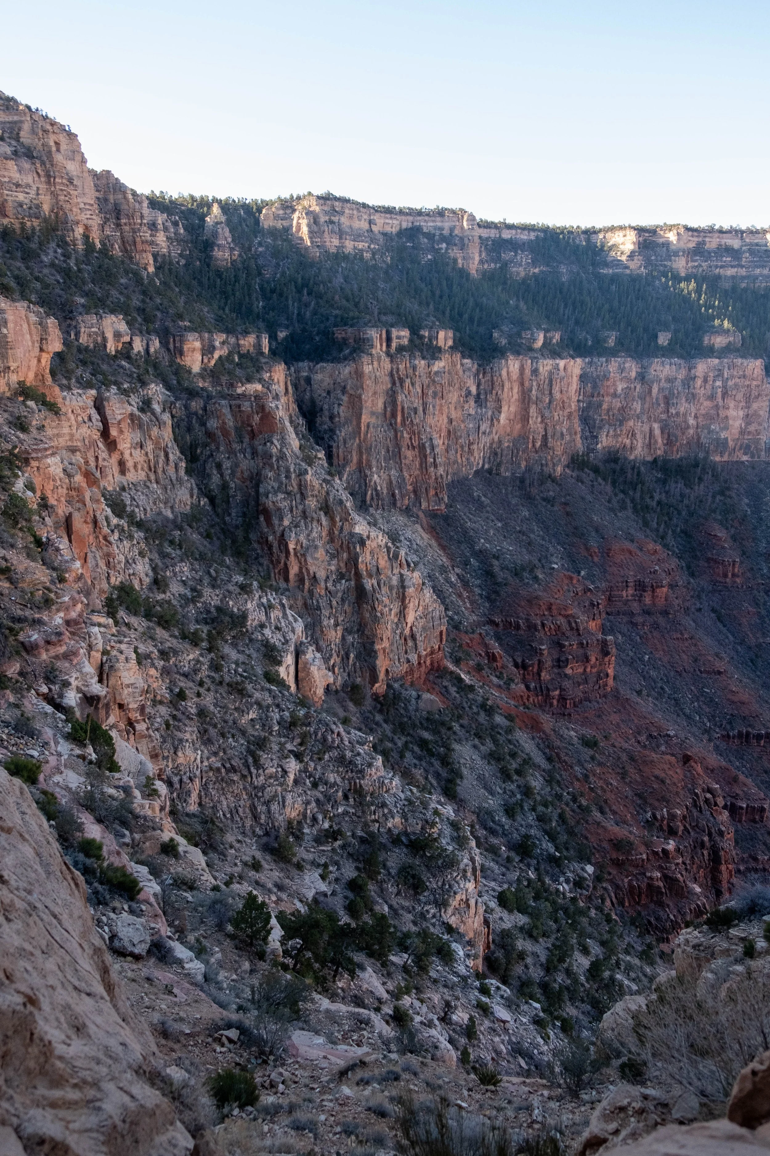
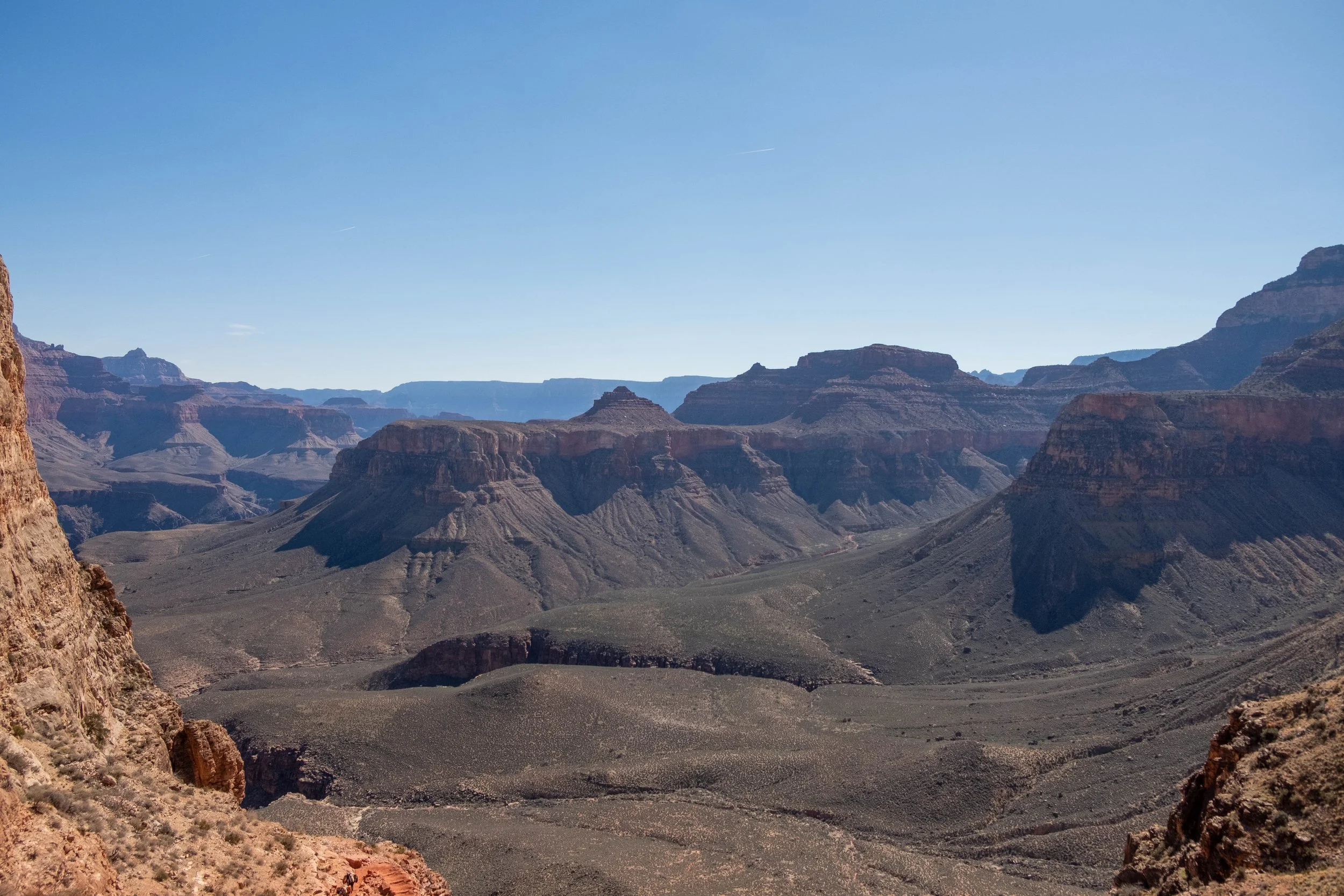
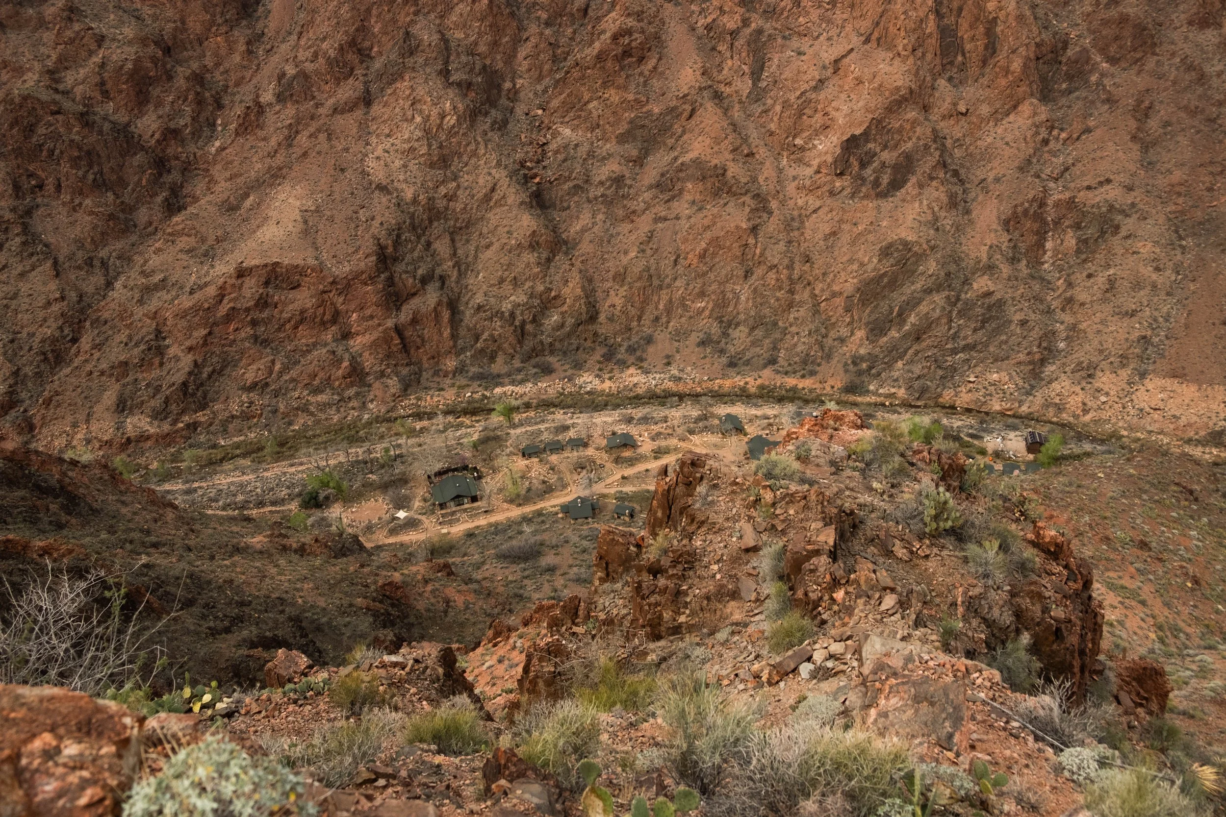
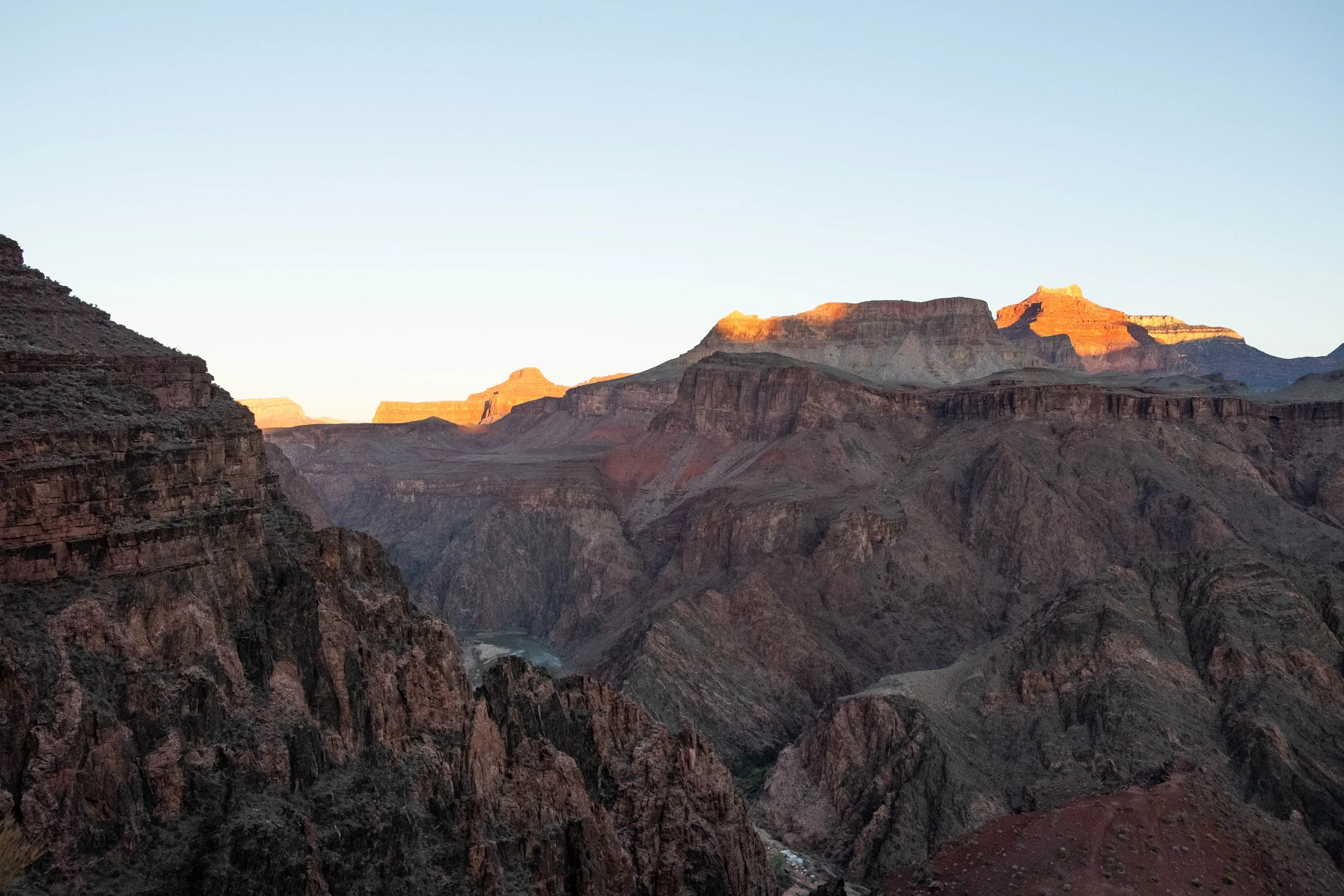
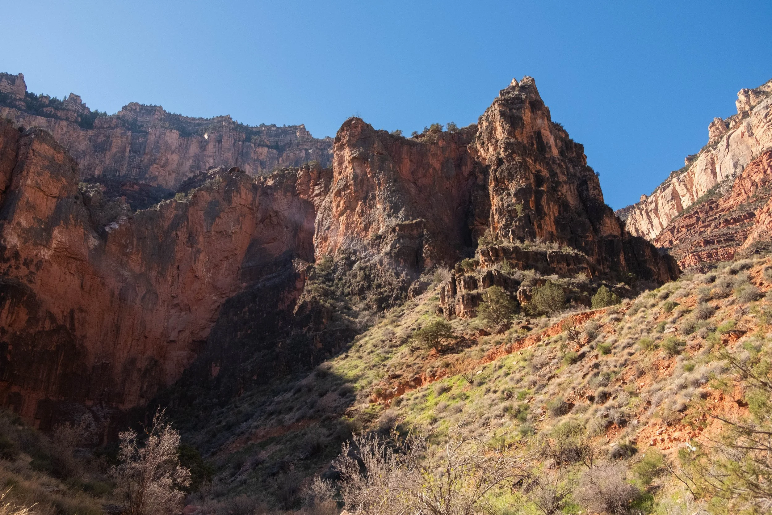
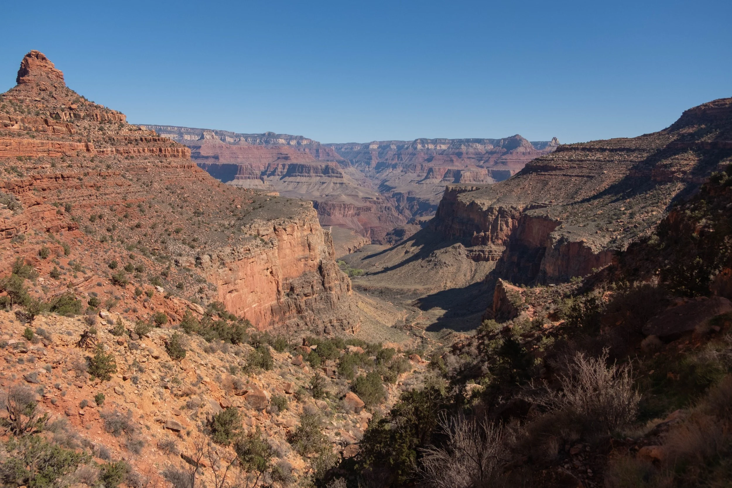
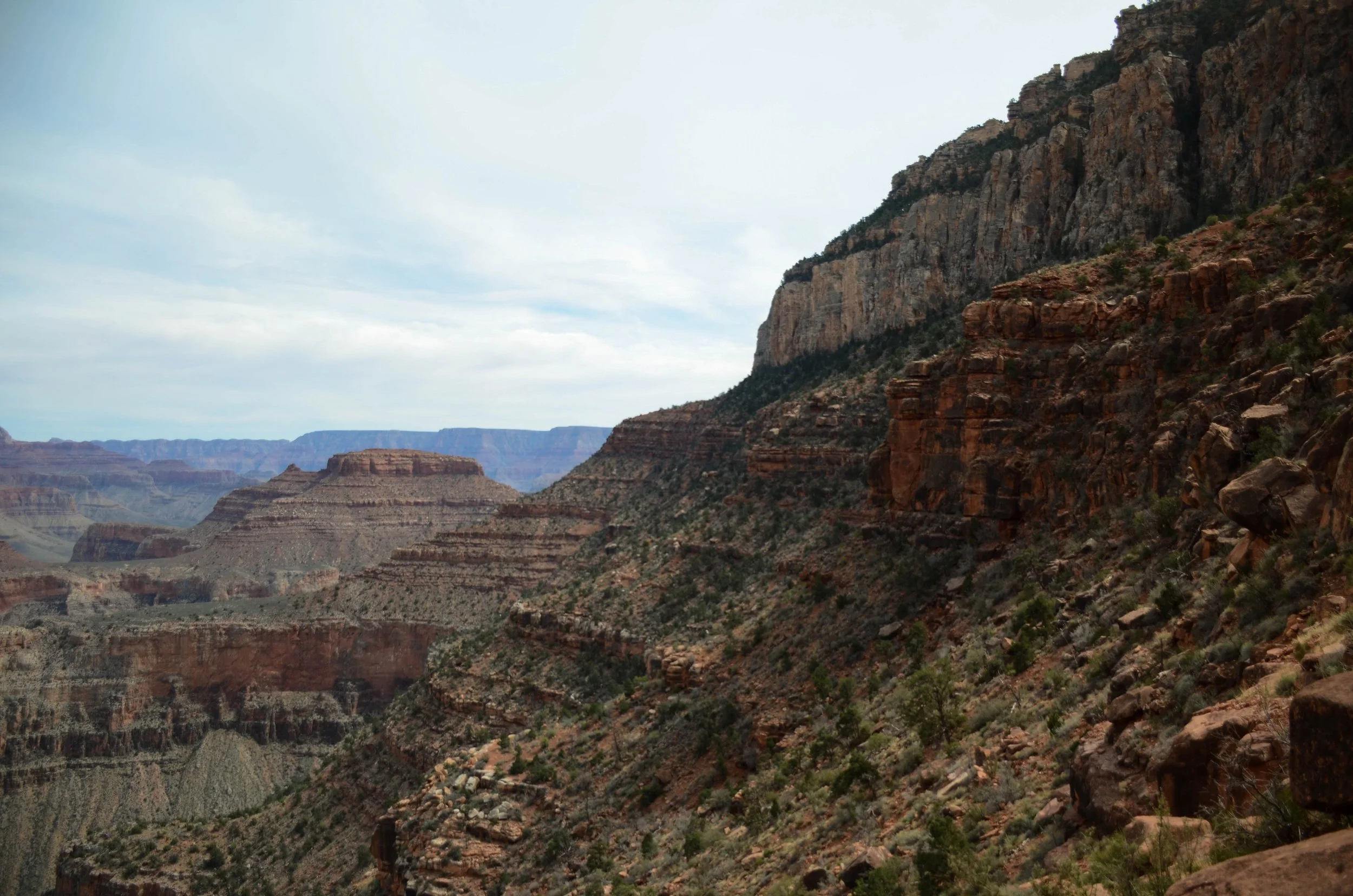
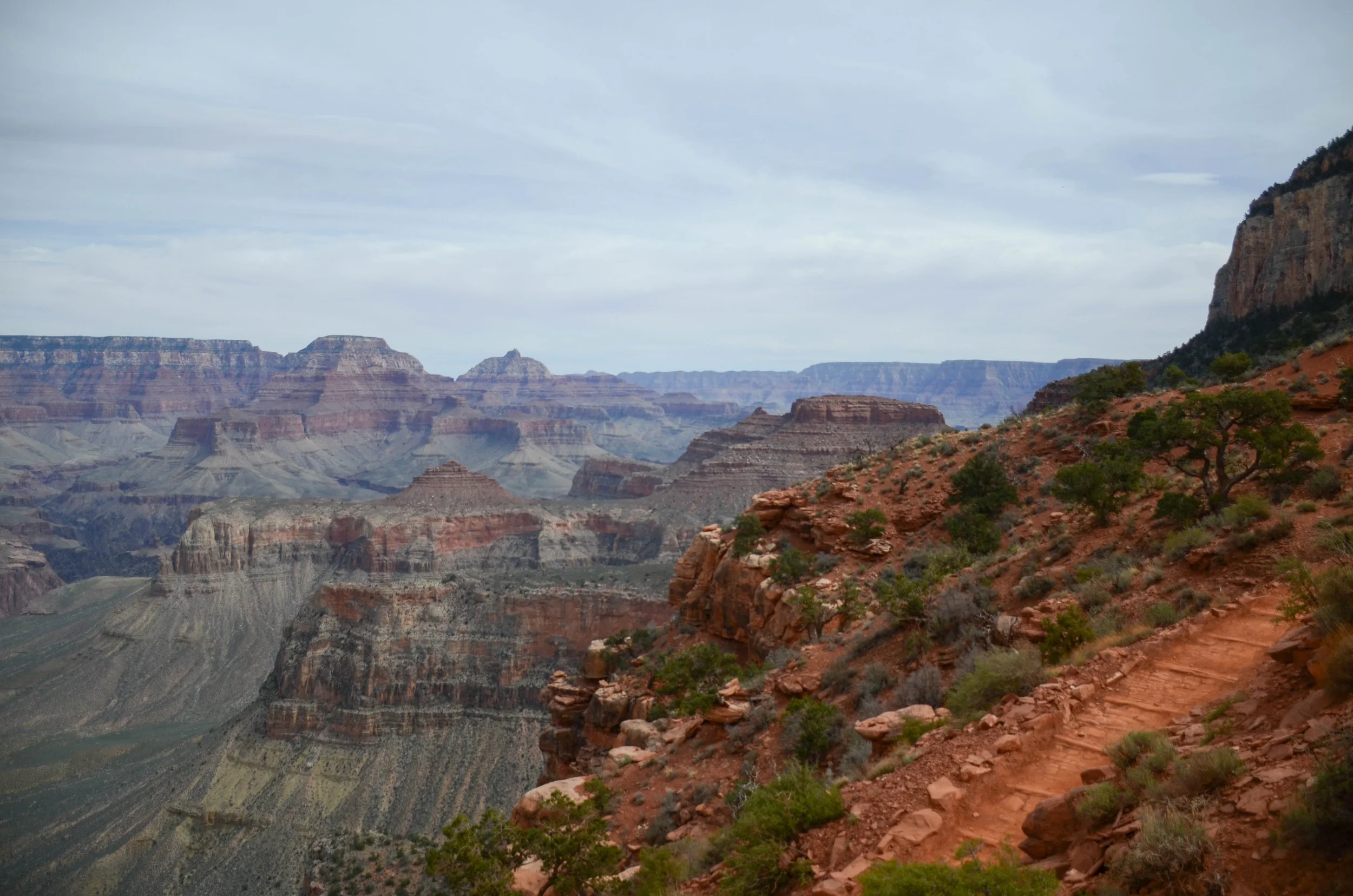
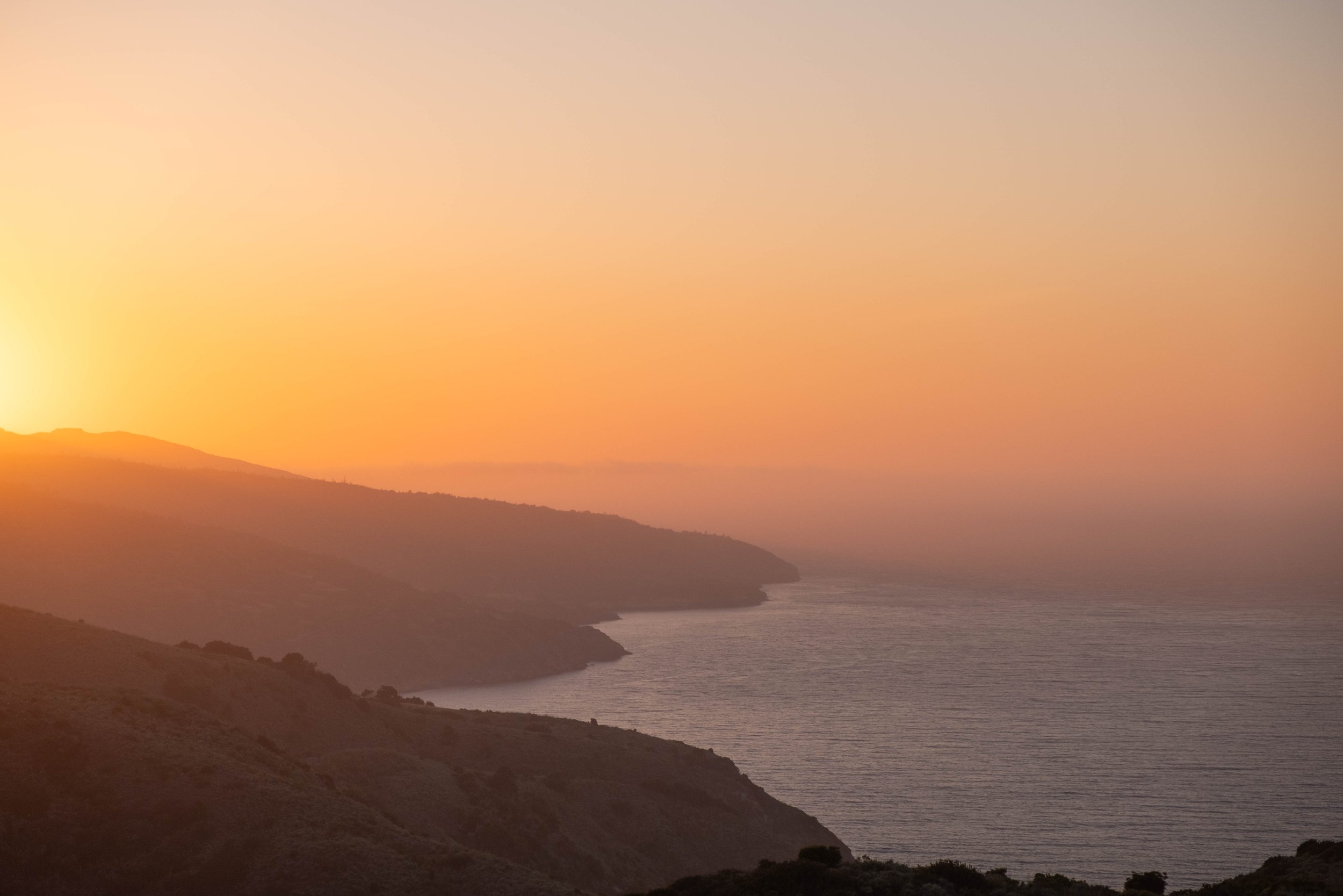
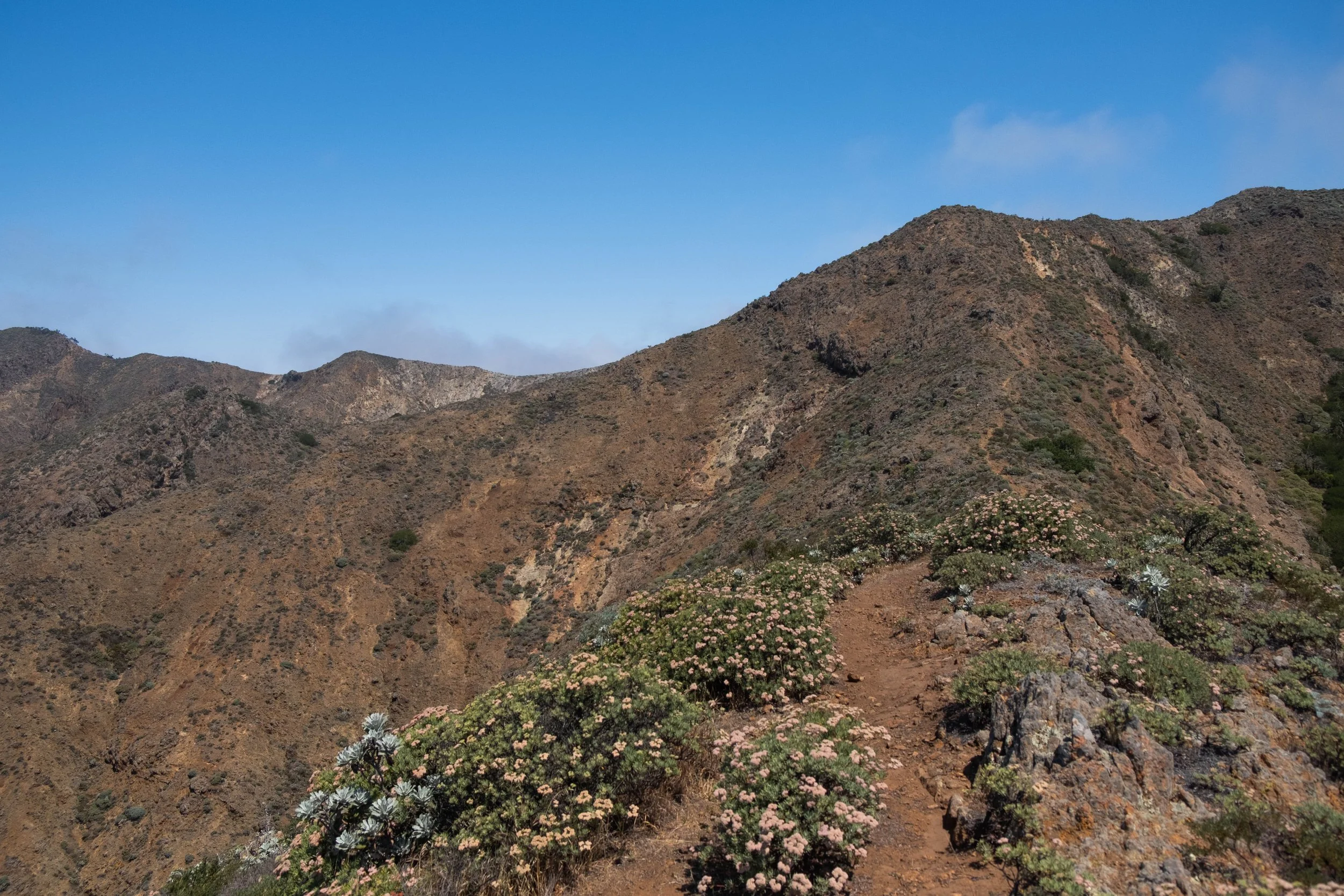
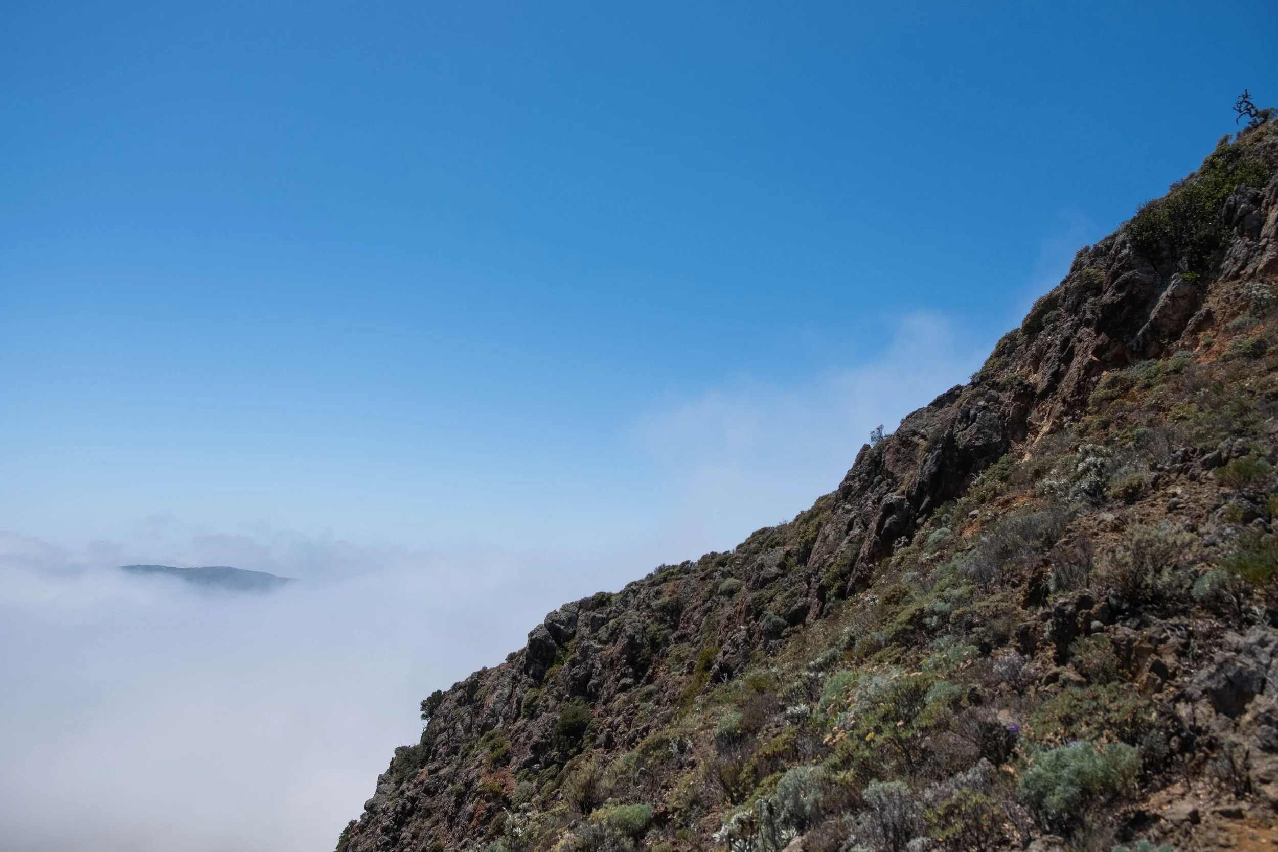
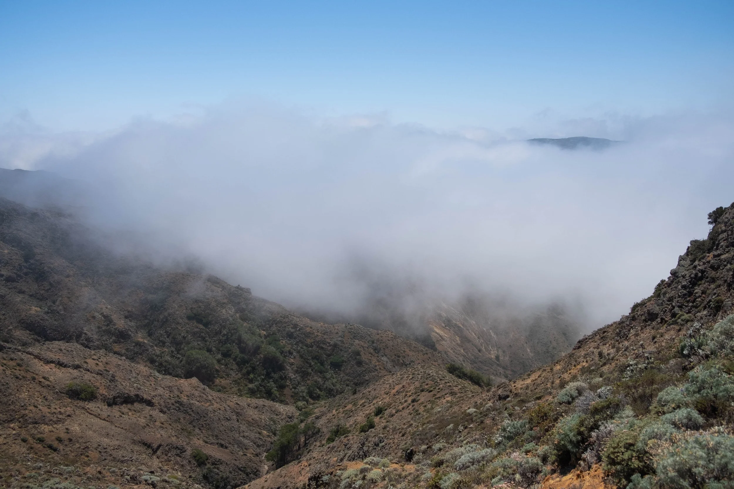
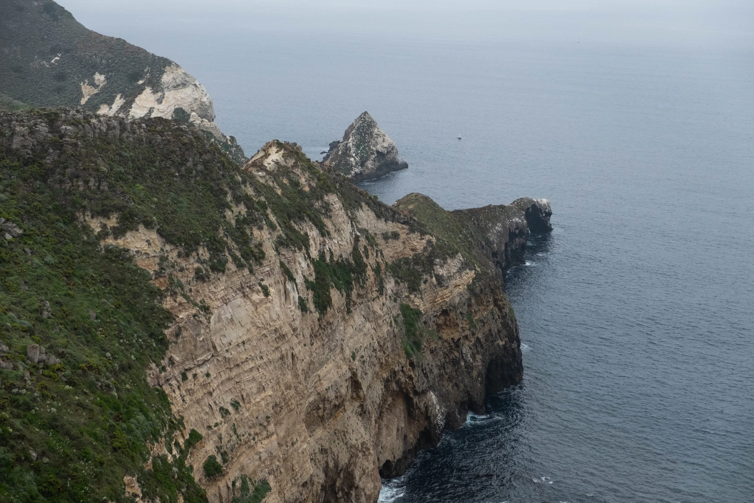
My one disappointment on this trip is that we weren’t able to do the classic Rim-to-Rim hike due to an ongoing closure of the North Kaibab Trail after the Dragon Bravo fire in 2025. The Rim-to-River (going down one South Rim trail and ascending the other) we’d planned instead isn’t that dissimilar in terms of mileage, but it did feel we were missing out on a unique part of the park since the North Rim is higher in elevation than the South, is much quieter and less visited, and would have allowed us to see the full Canyon Corridor. That said, since the North Kaibab was off limits, we opted to spend part of our day hiking the other trail that snakes east along a high plateau over the river: Clear Creek. This trail stretches for close to 10 miles one way, so we only did a section of it, but it was nevertheless worthwhile. After a steep initial climb, we were rewarded with a bird’s eye view of Phantom Ranch, the Colorado River, and the zigzagging line of the South Kaibab we’d descended the day before. We stayed up there for a while, hiking to different lookouts before turning around to head back.
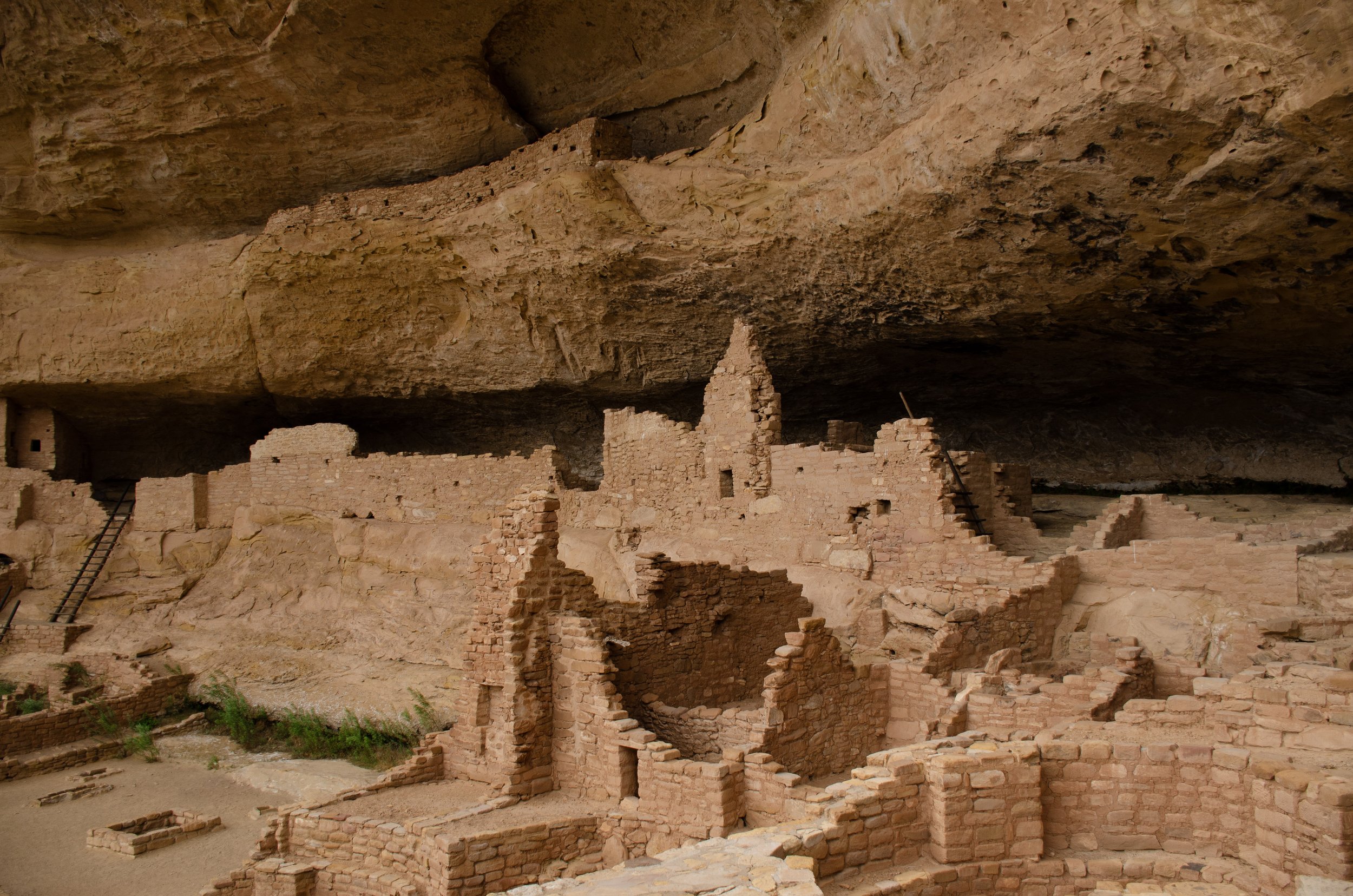
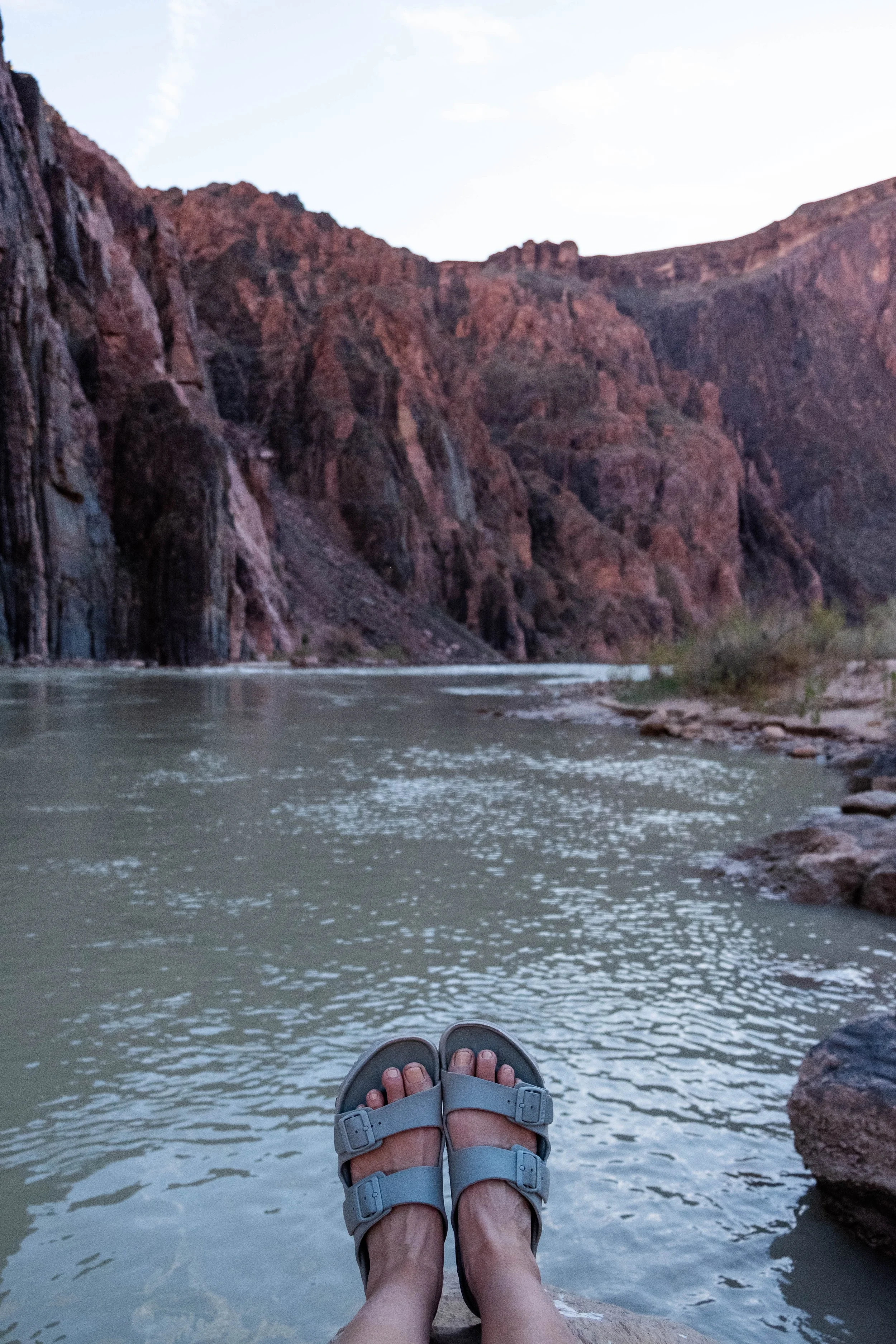
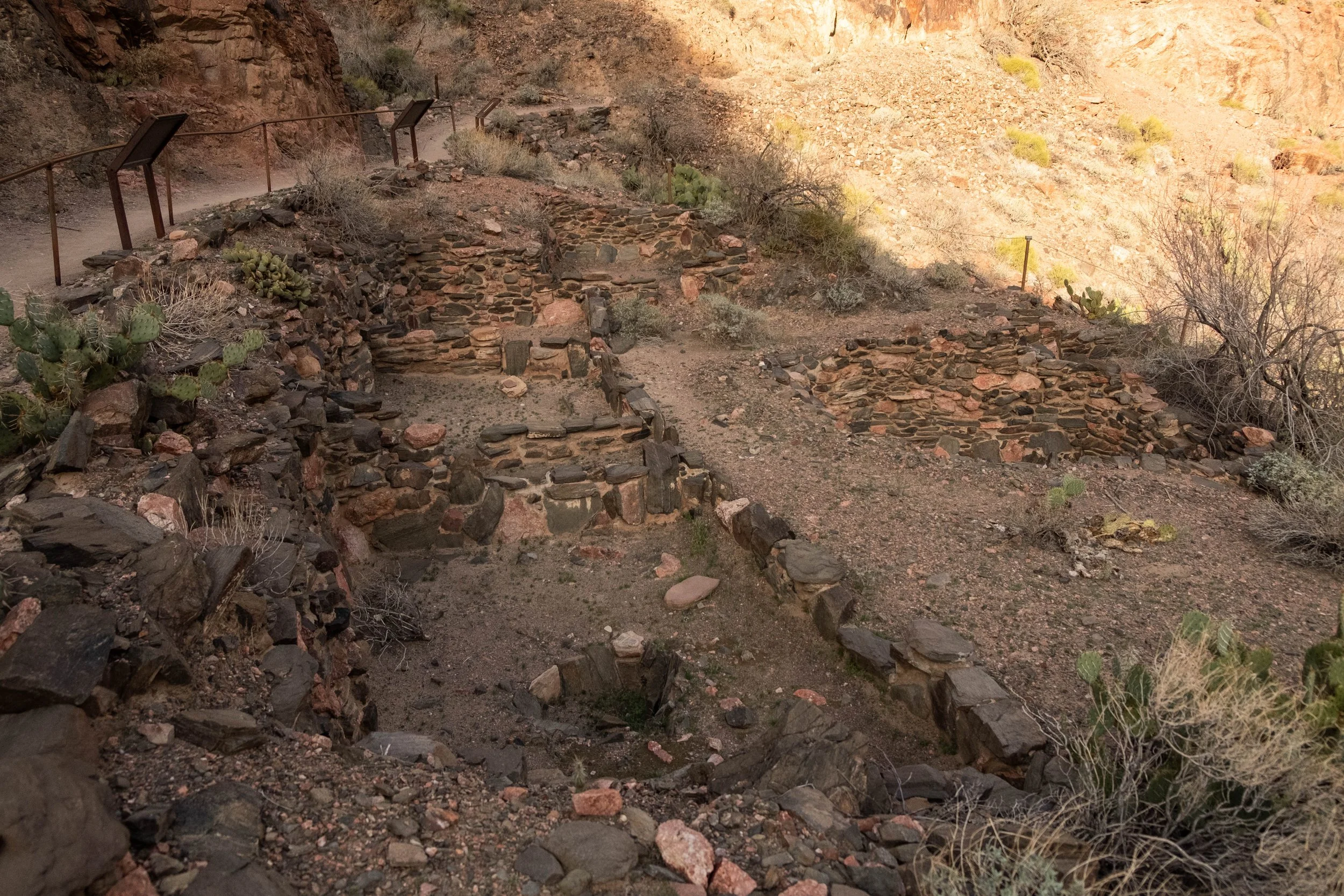
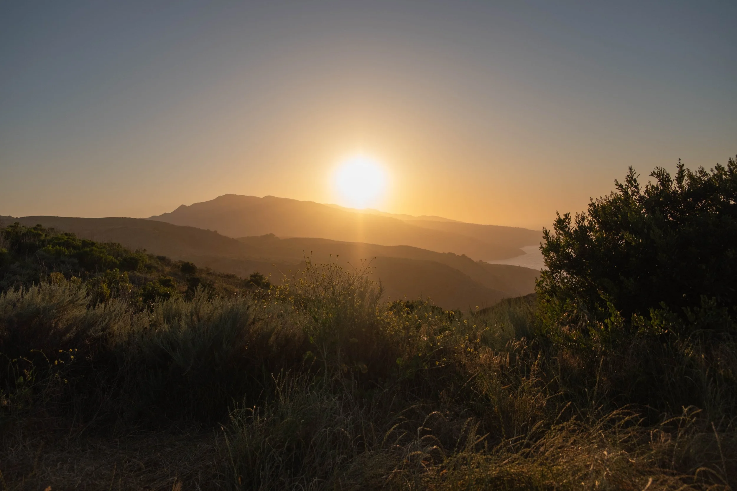
The rest of our afternoon was spent in the Phantom Ranch Canteen: Playing cribbage, chatting with a few other hikers and staff, and writing postcards which would be mailed by mule to our friends’ kids. Before dinner, we made our way back to the river to visit the nearby pueblo ruins, remnants of a Puebloan family that lived here around A.D. 1050. We quietly paid our respects as we drank in the views of the river and the ancient rock walls and the sunlight casting everything in a soft yellow haze. I wondered who had lived in these rooms, who had woken up to this view, what stories their lives held. It was a profound feeling: To stand beside a thousand-year-old human settlement while staring at billion-year-old stone that has been exposed by the ever-present flow of the very river we were now watching. We felt our own brevity. We felt the swift flow of our own lives, so like the shimmering green waters of the Colorado.
We sat there quietly on the sandy banks of the river until the sunlight had faded and our stomachs rumbled for dinner.
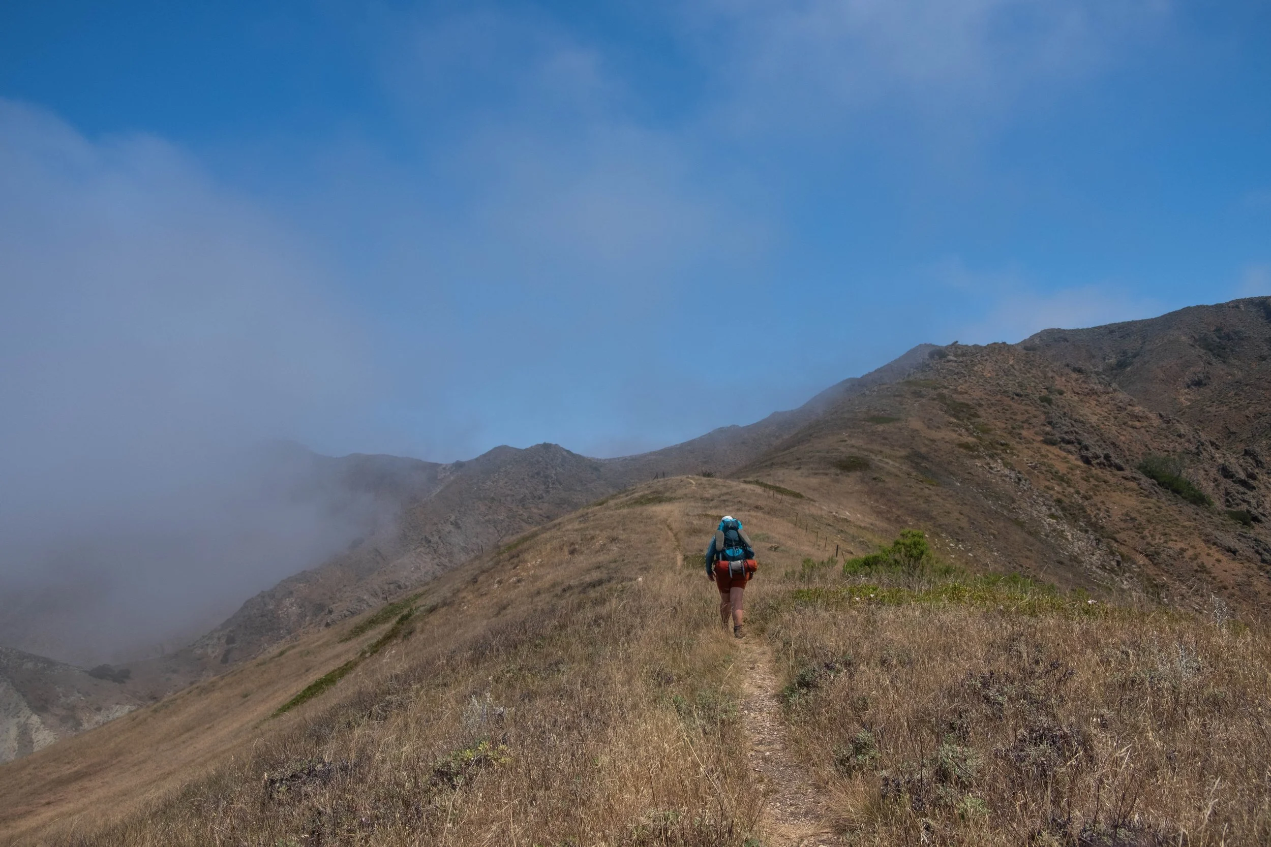
Day 3 | Ascent: Bright Angel Campground to South Rim via South Kaibab, Tonto, and Bright Angel Trails
Distance: 12 miles | Elevation gain: +4,950 ft
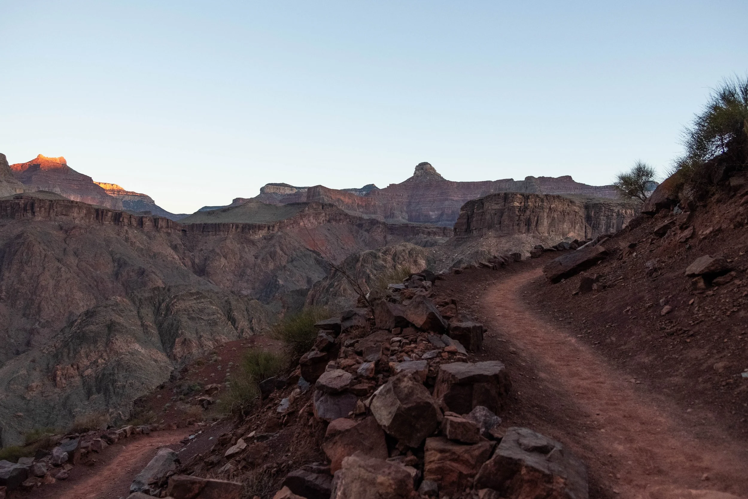
Wanting to hike in the cool of the day for as long as we could, we woke at 5:30am to break down our camp, eat breakfast, drink a cup of coffee, and set out on the trail. We were hiking back up the South Kaibab by 6:25am, just as the sky was beginning to lighten.
At this point, my calves were more sore than I think they’d ever been in my life. Although we’ve previously descended more actual feet and mileage in a single day (looking at you, Kilimanjaro), the hike down the South Kaibab was the first time we’d done something so extreme with very little hiking training beforehand. I was coming off a December/January where health issues had kept me from very much exercise, and J was coming off a stressful February at work that had occupied most of his free time. Between all that, our calves were shot from the downhill. So I found myself actually looking forward to the challenge of the ascent, desperate to get some opposing muscles involved to hopefully flush out some lactic acid.
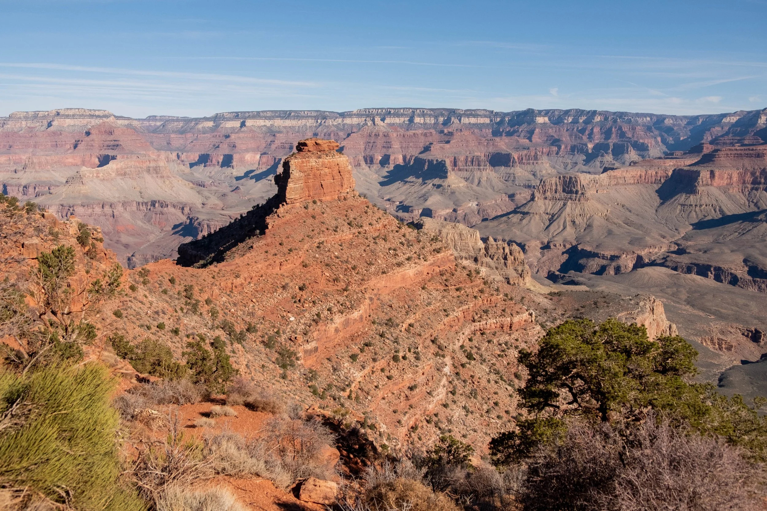
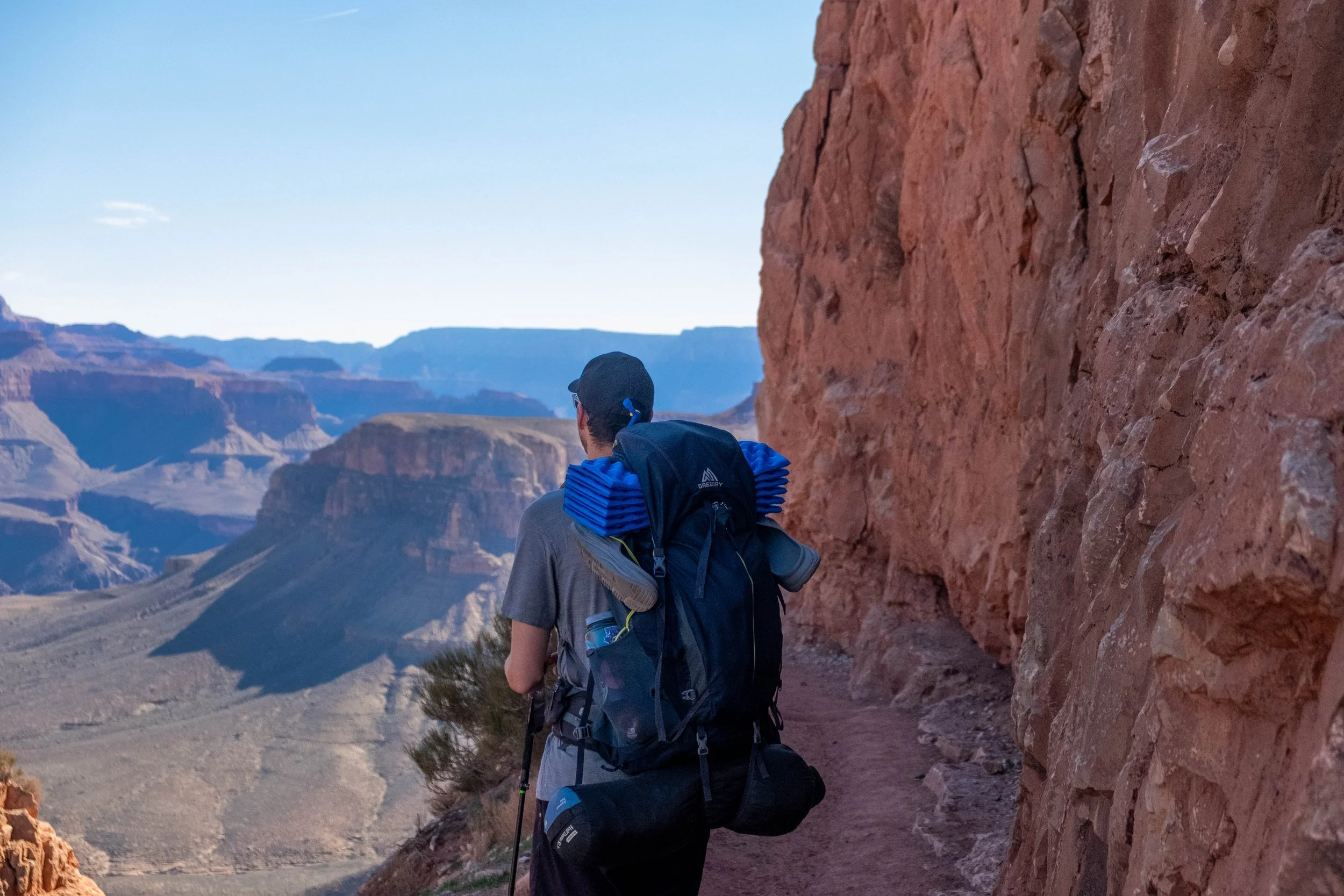
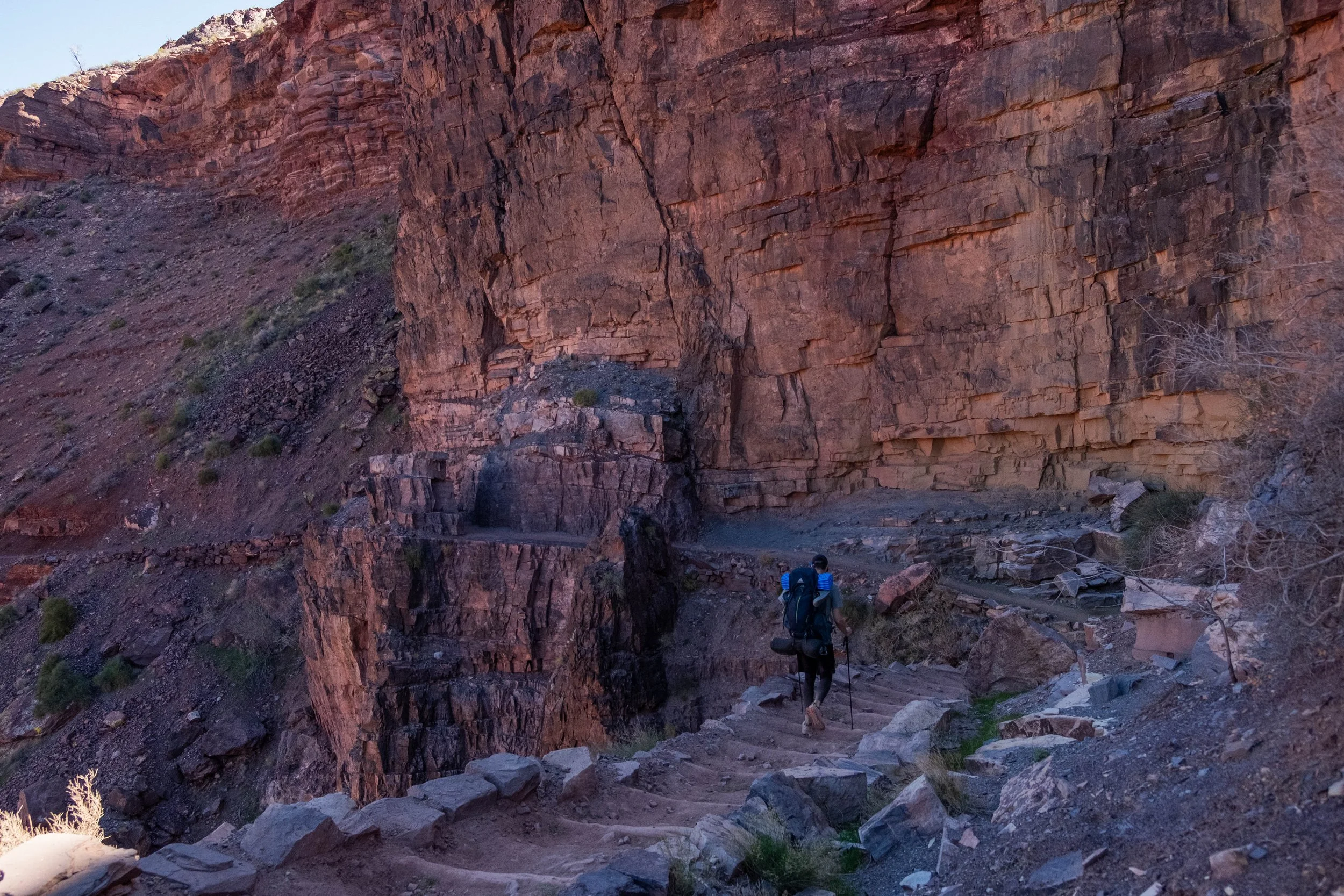
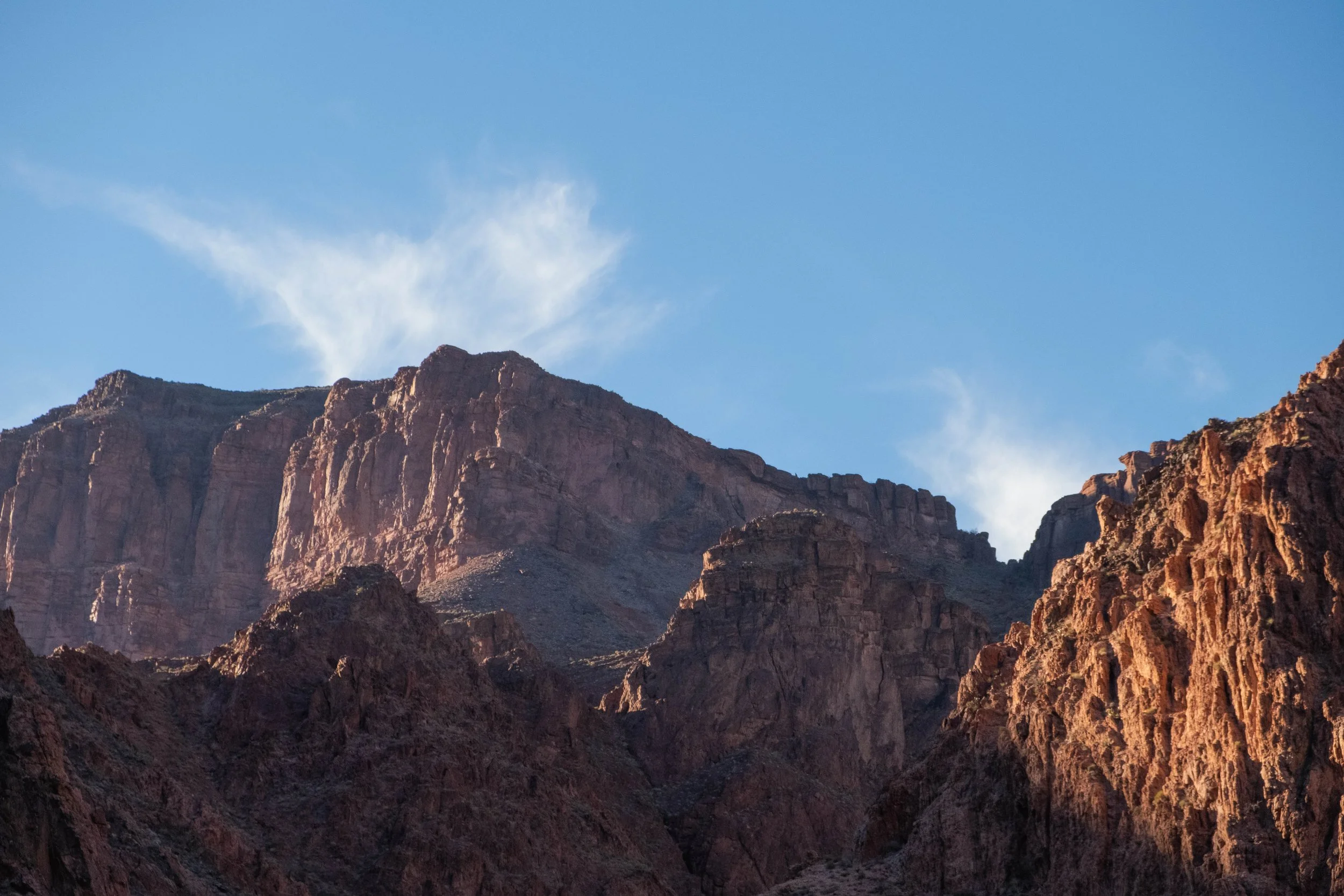
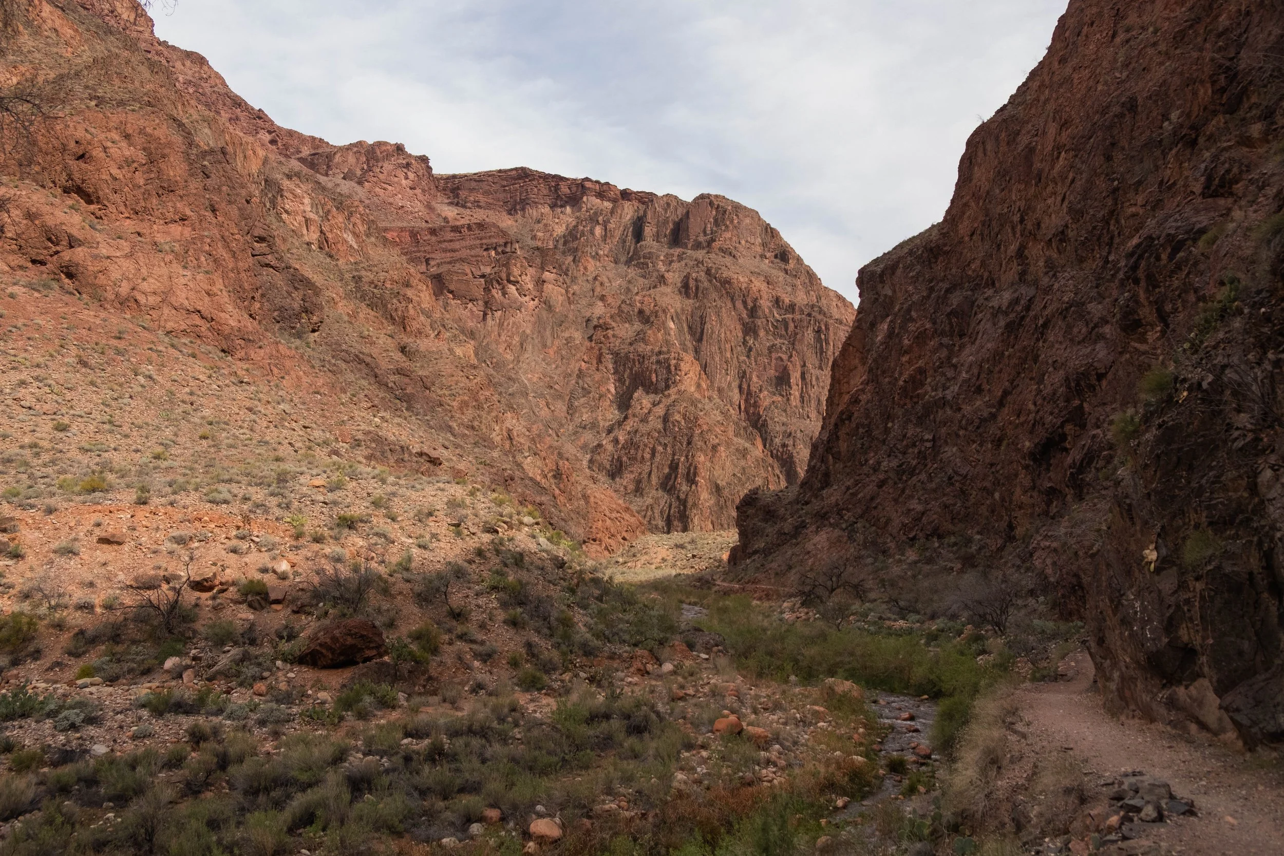
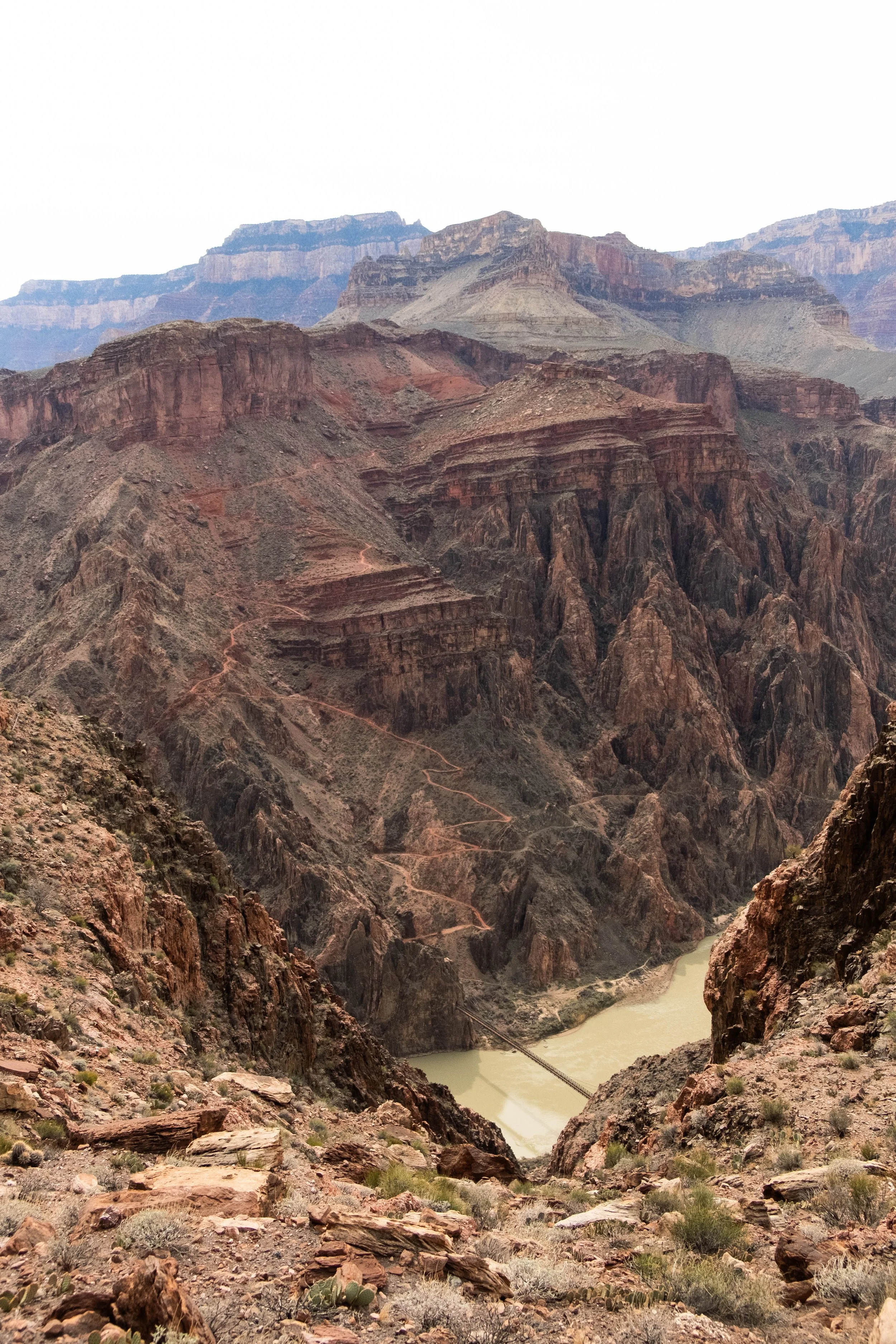
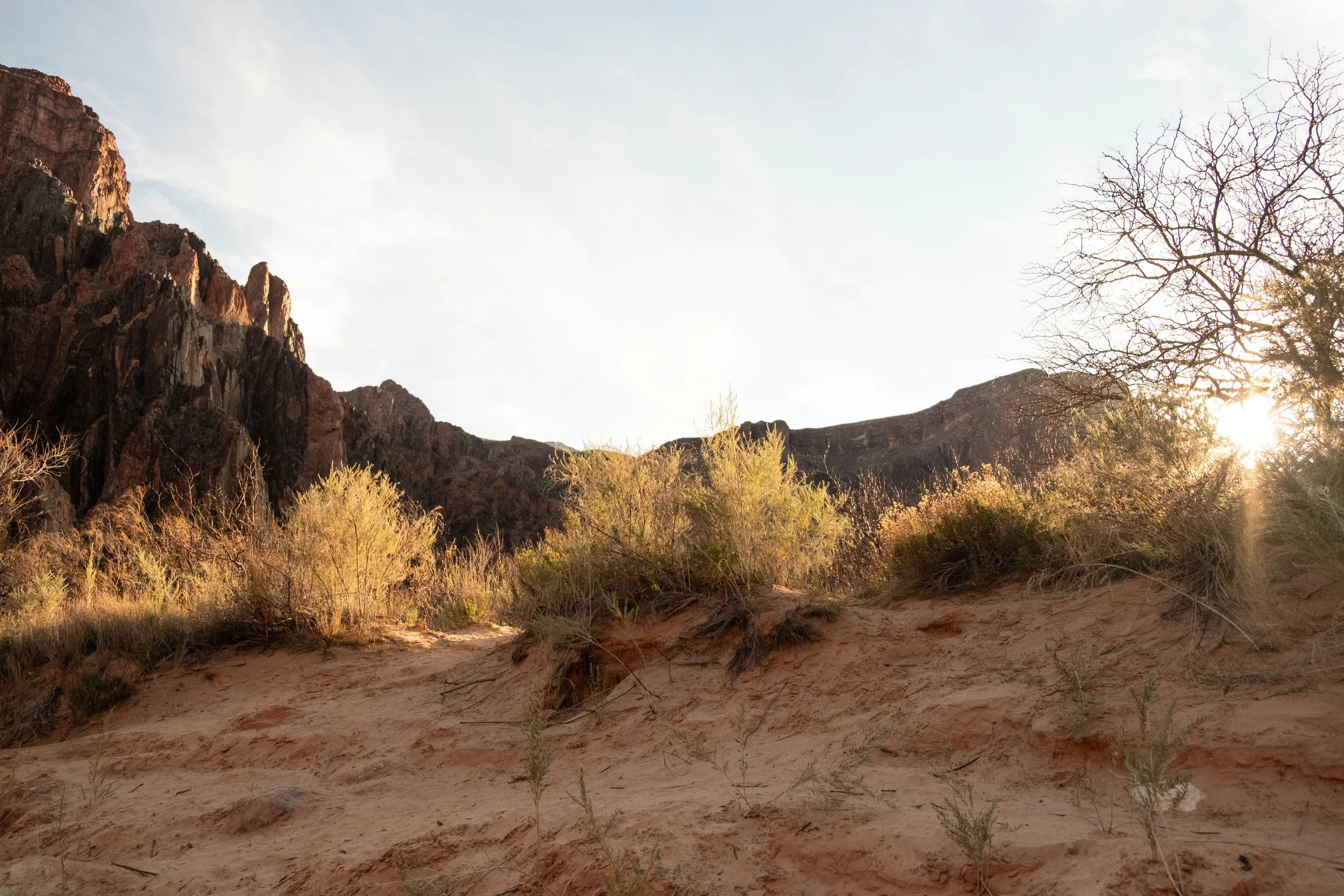
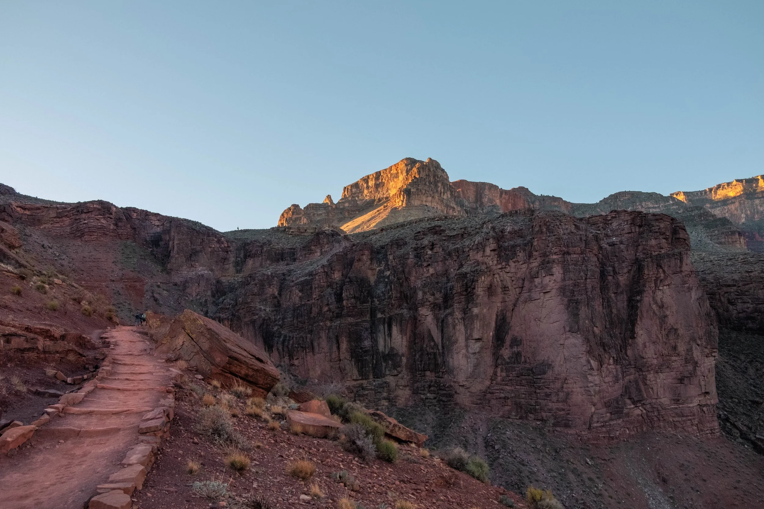
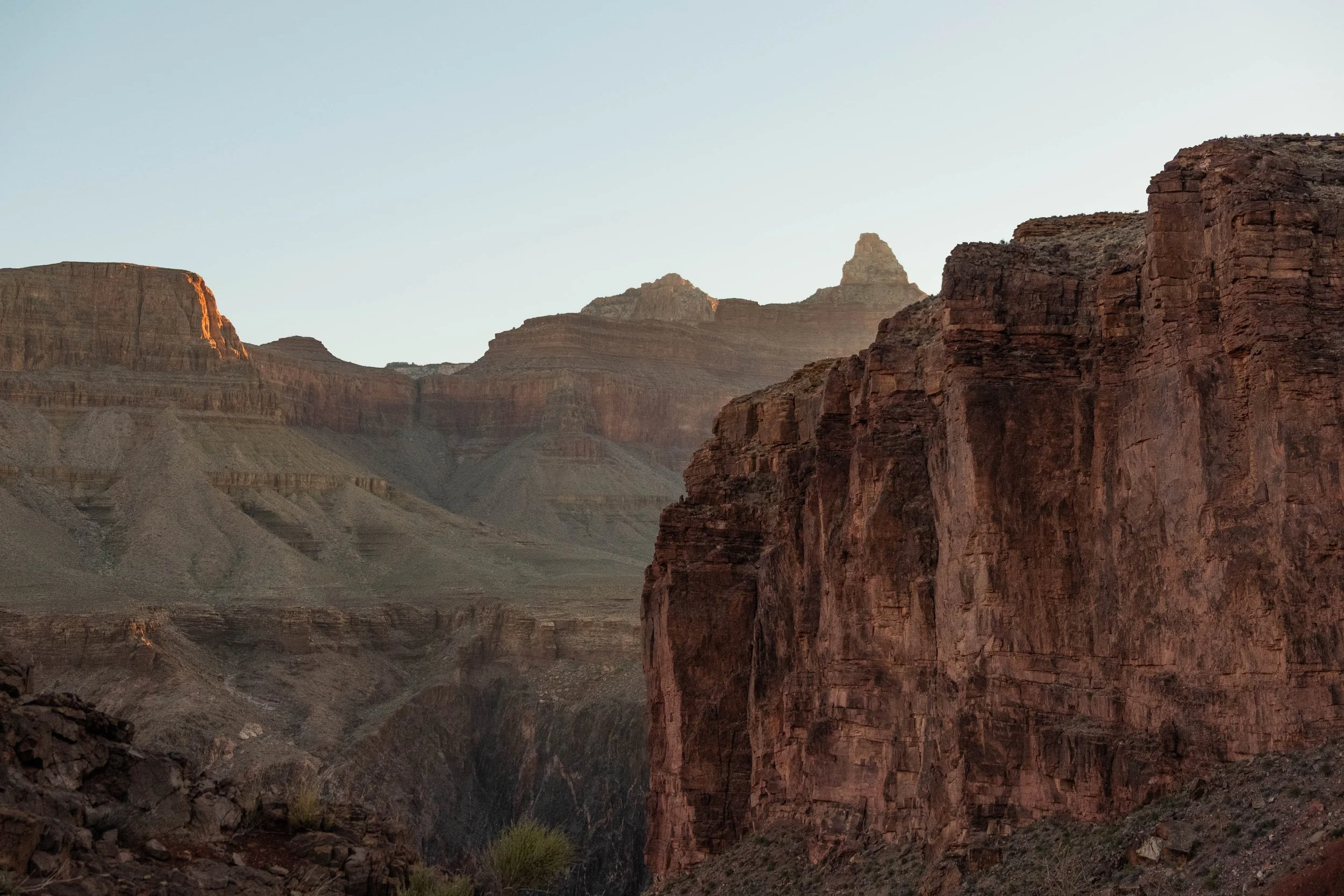
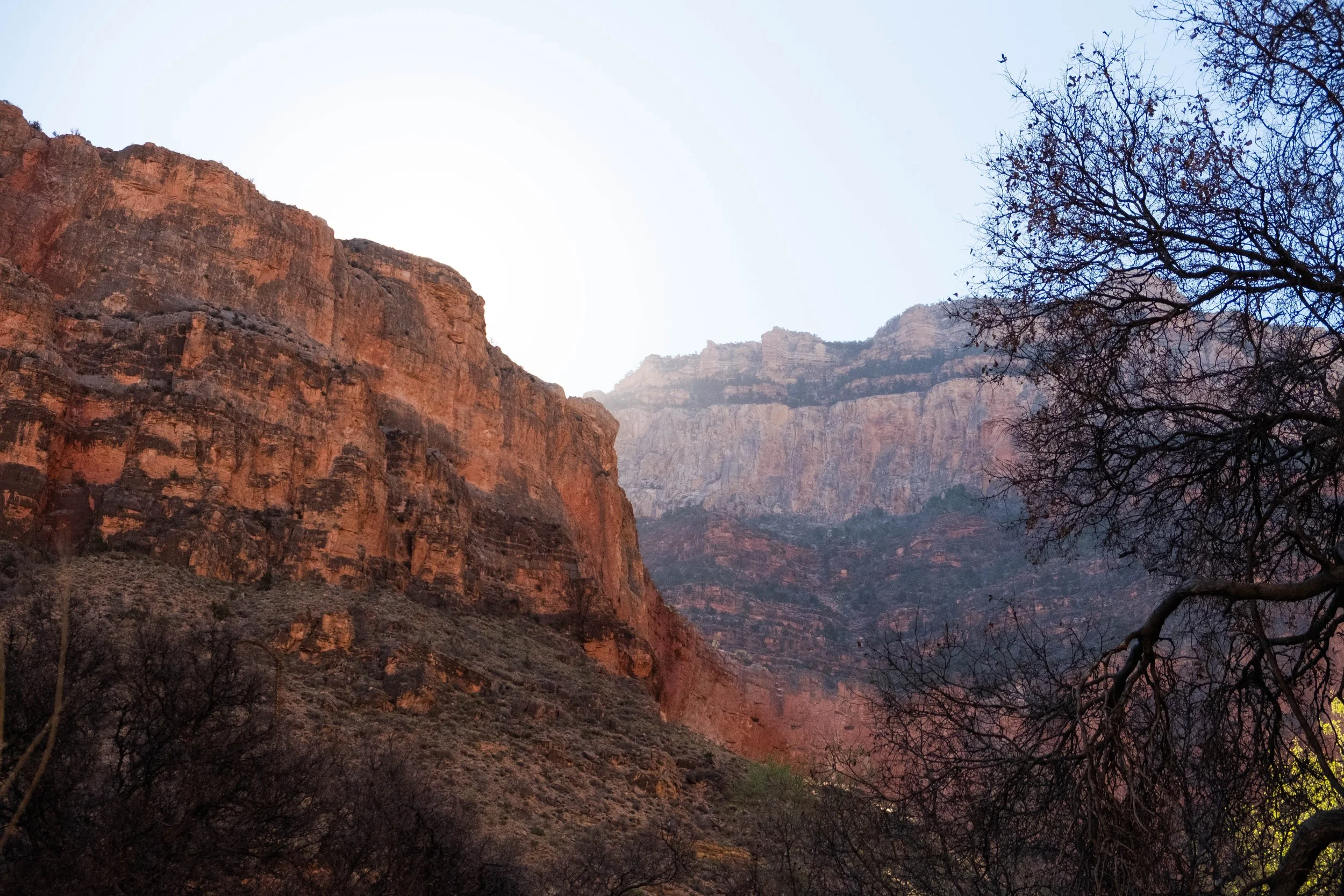
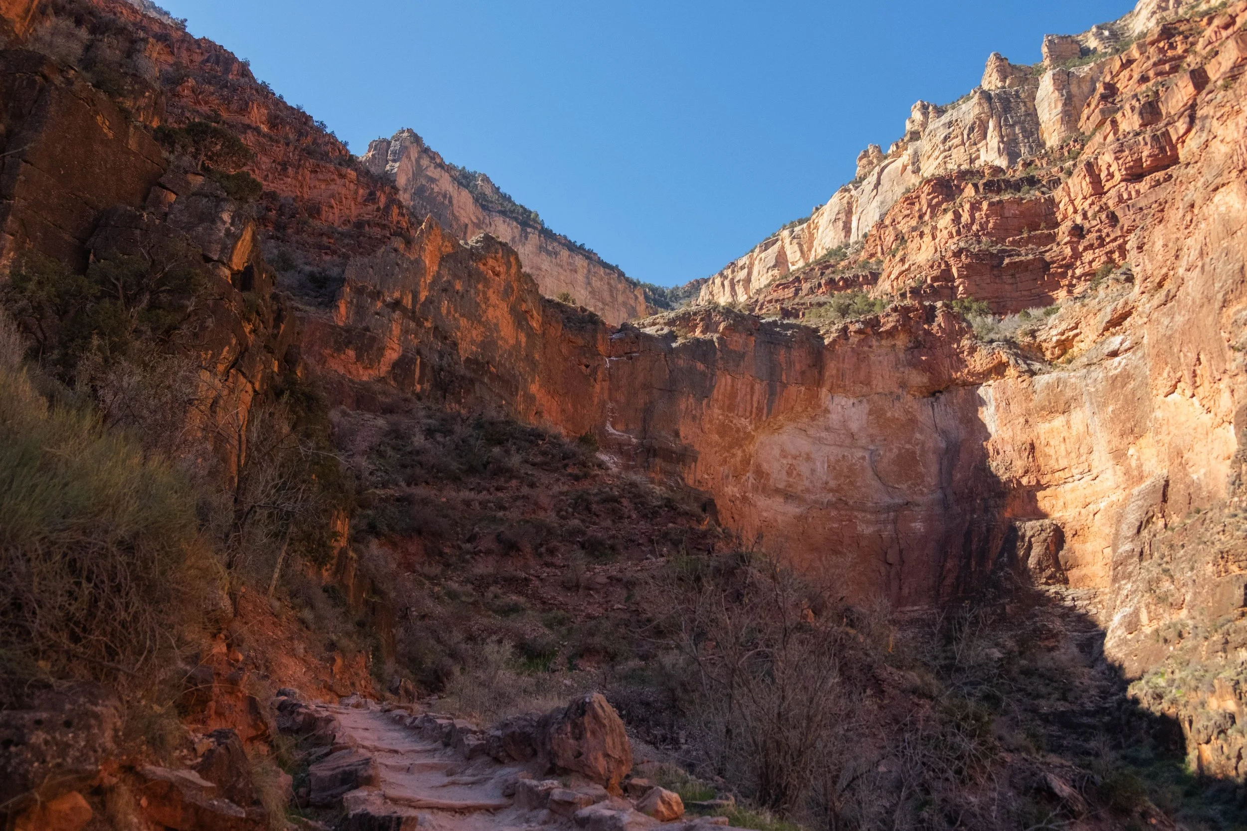
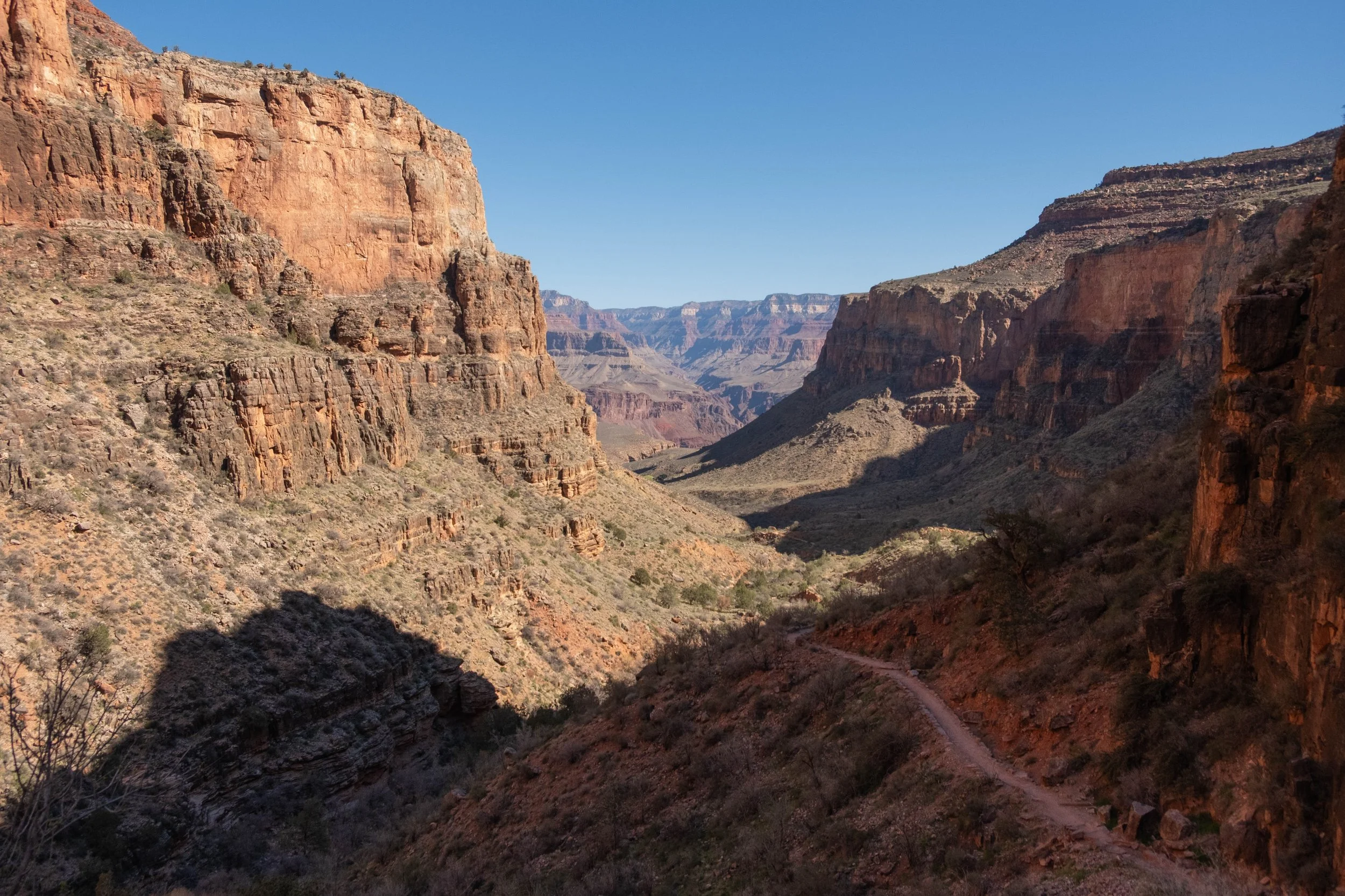
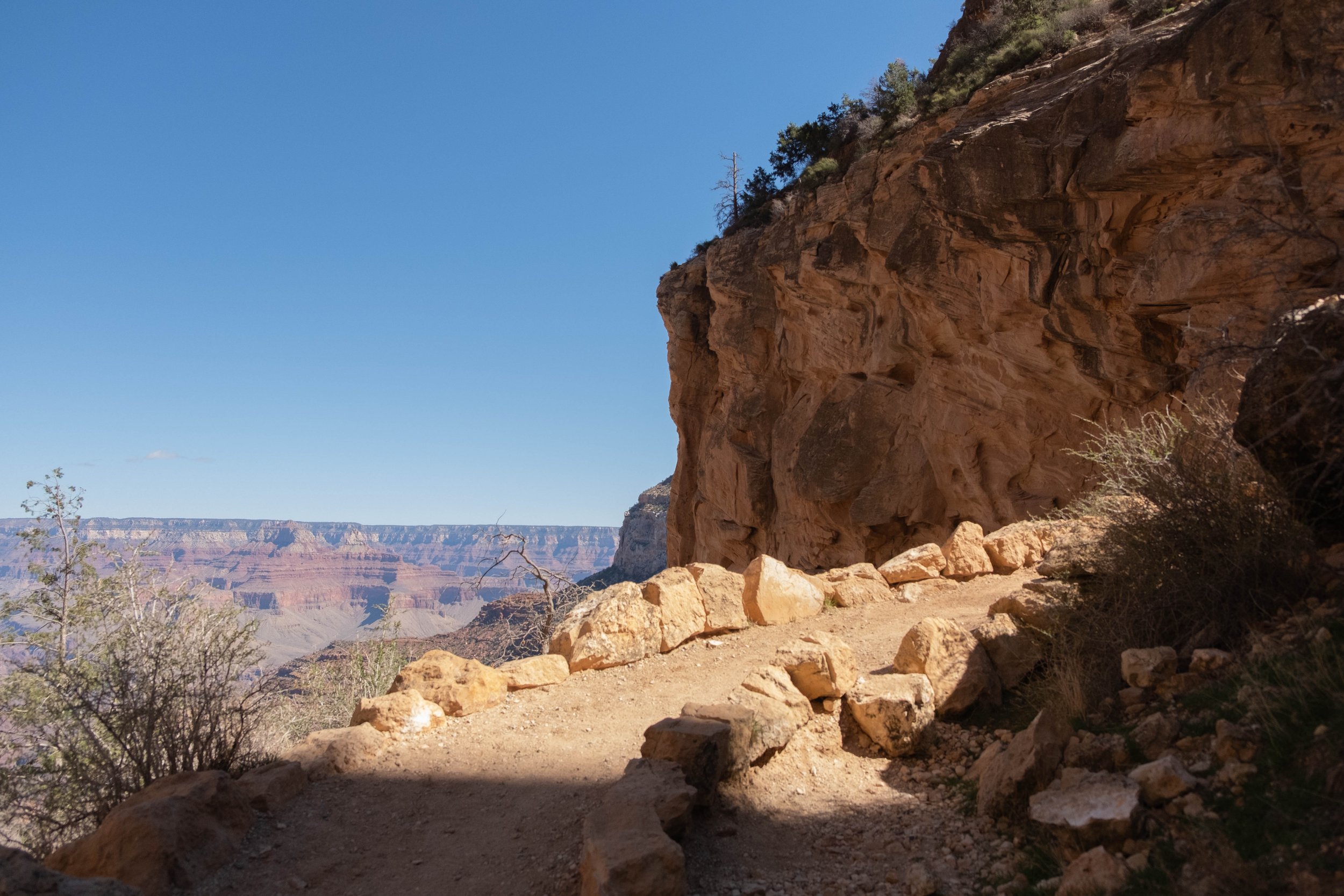
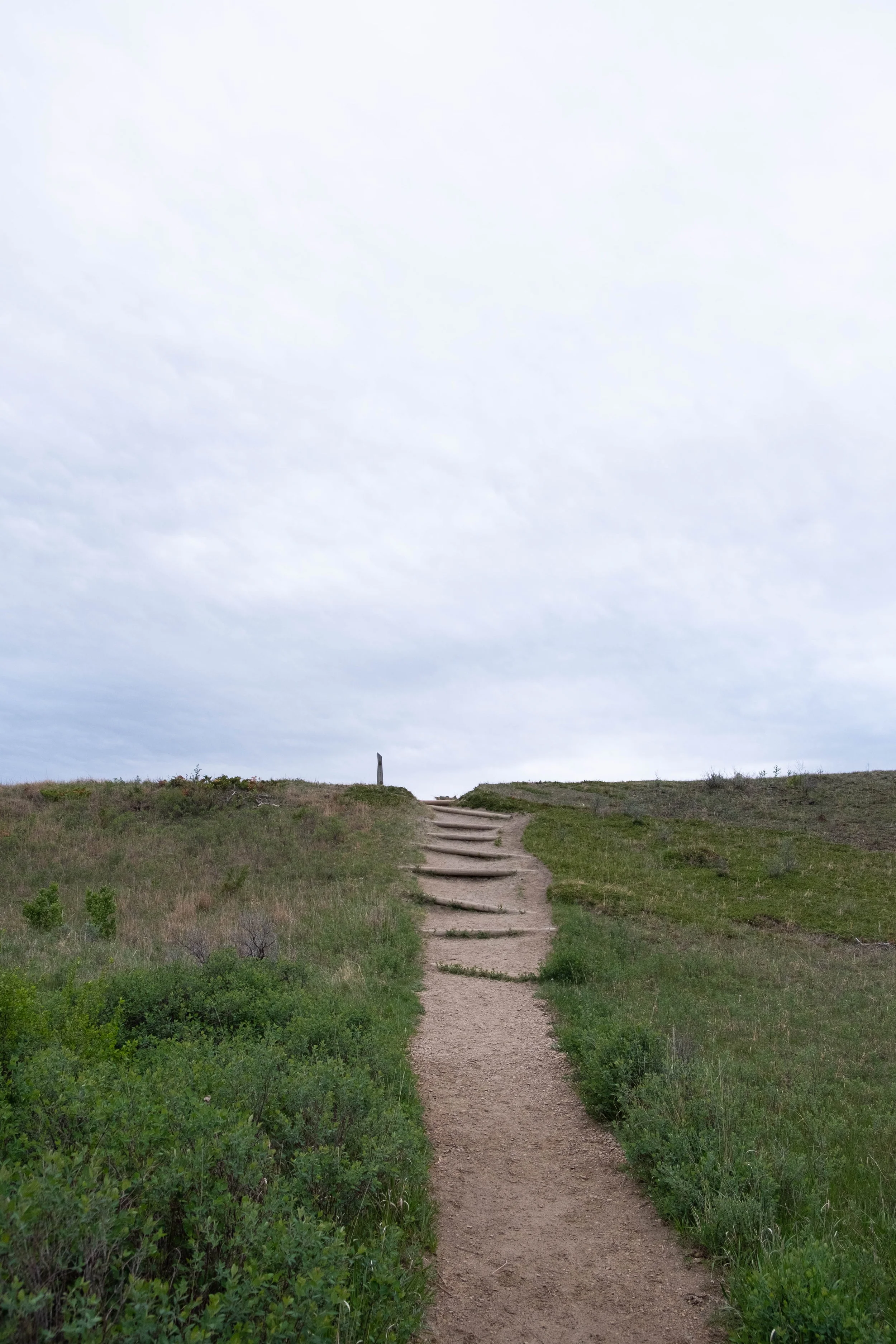
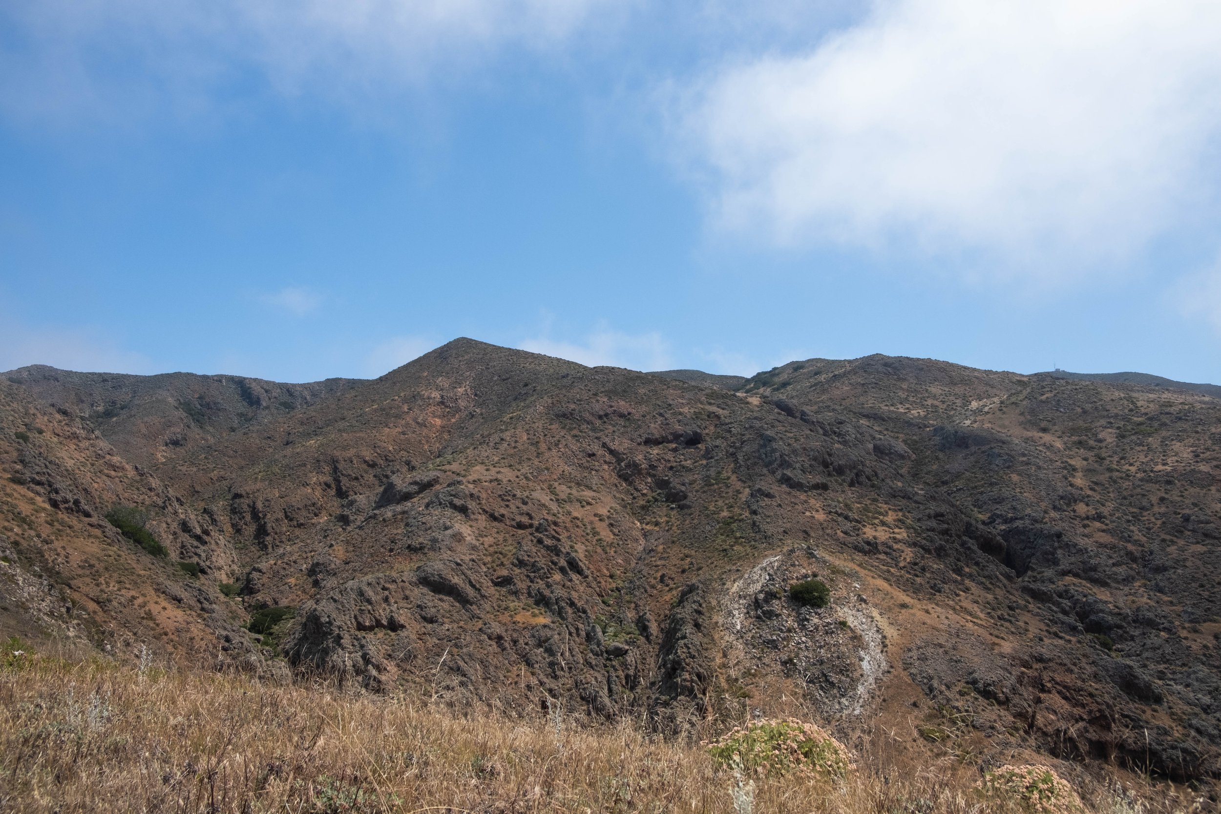
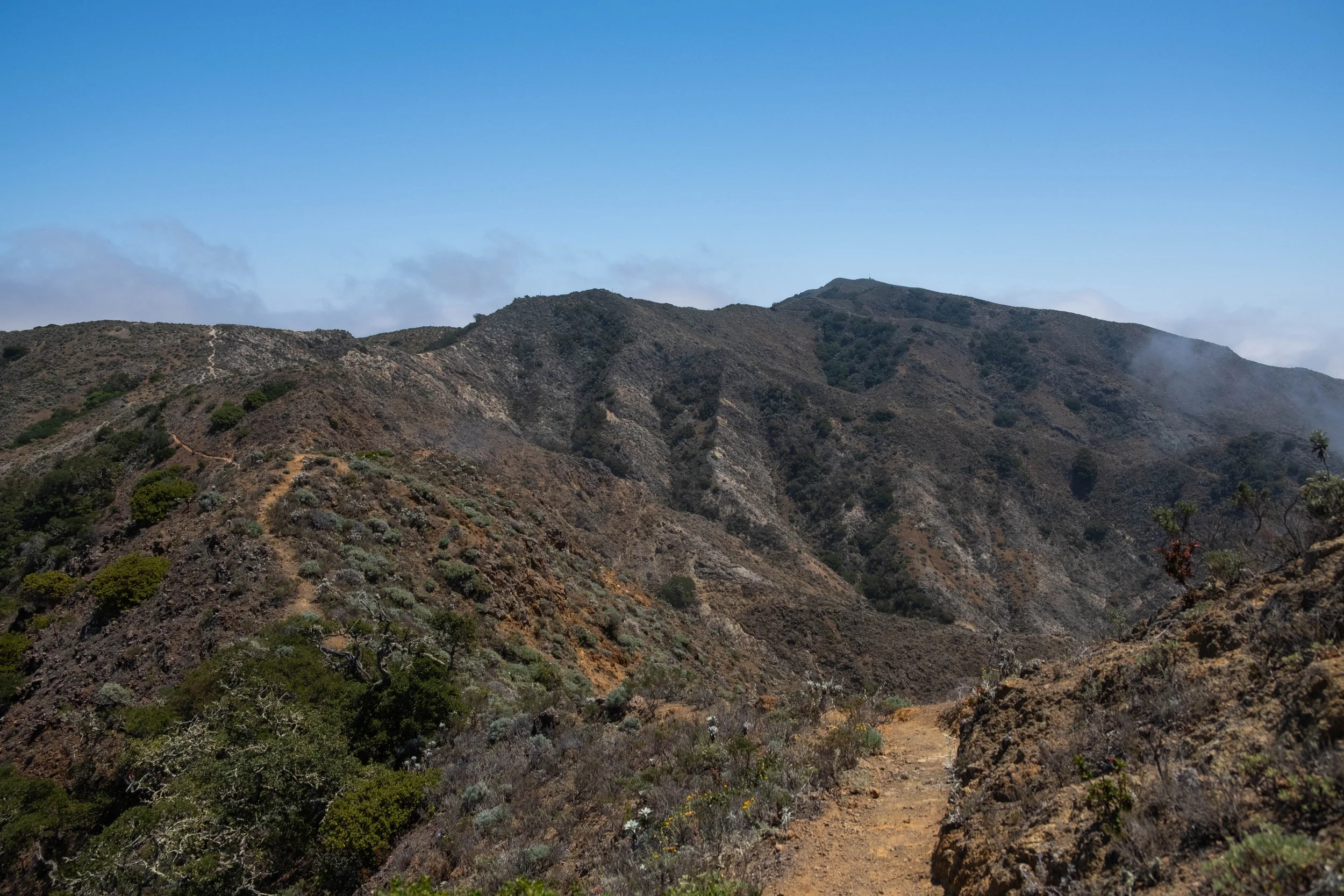
We powered our way up to The Tipoff, where we stopped for a quick snack before strapping our packs back on and leaving the South Kaibab for the West Tonto Trail. This ended up being one of our favorite sections of the day: Flat, fast, shaded, and absolutely beautiful views as we traversed the plateau toward where it intersected with Bright Angel Trail. The fiery morning light lit up the tips of the canyon over us. We saw almost no one along this stretch, save a park ranger sipping coffee (who passed us with a nod and laconic greeting: “hell of a morning commute”) and a group of backpackers on their way to Phantom Ranch after a night at Havasupai Gardens.
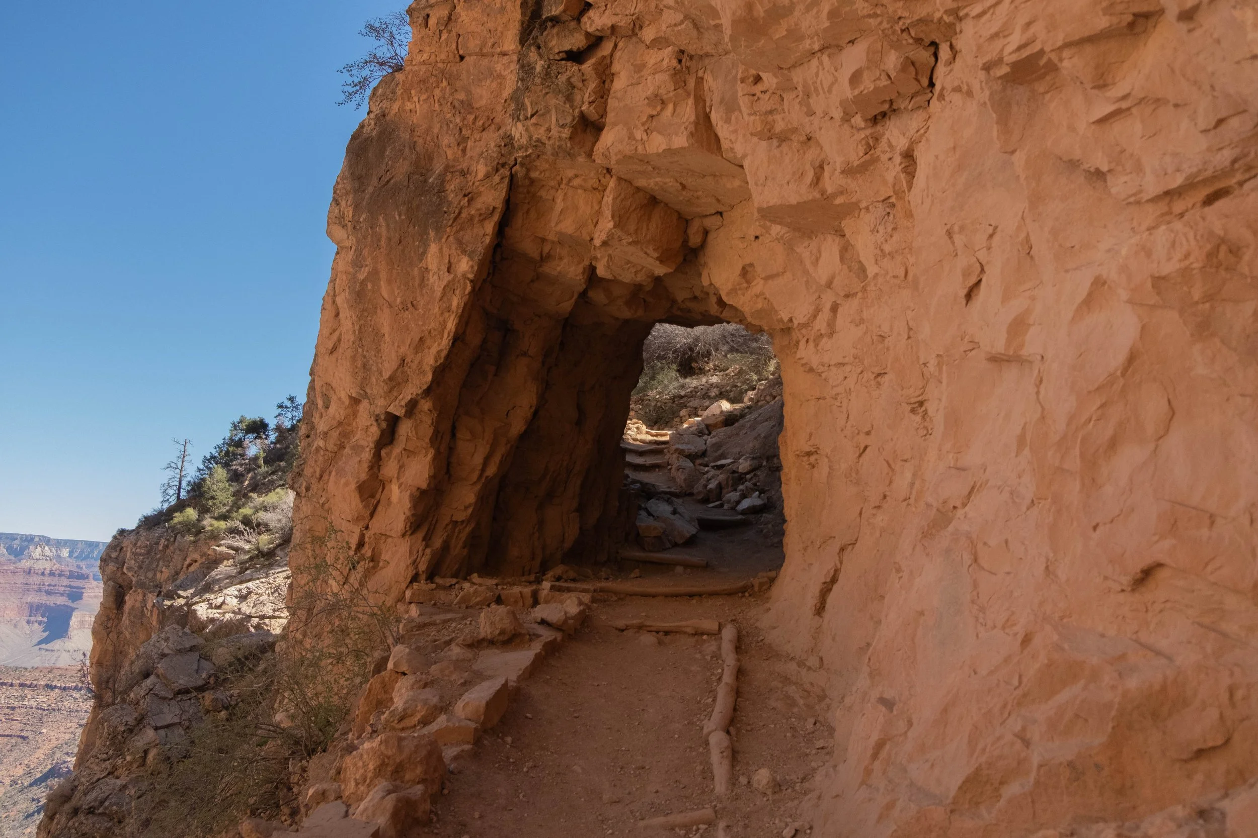
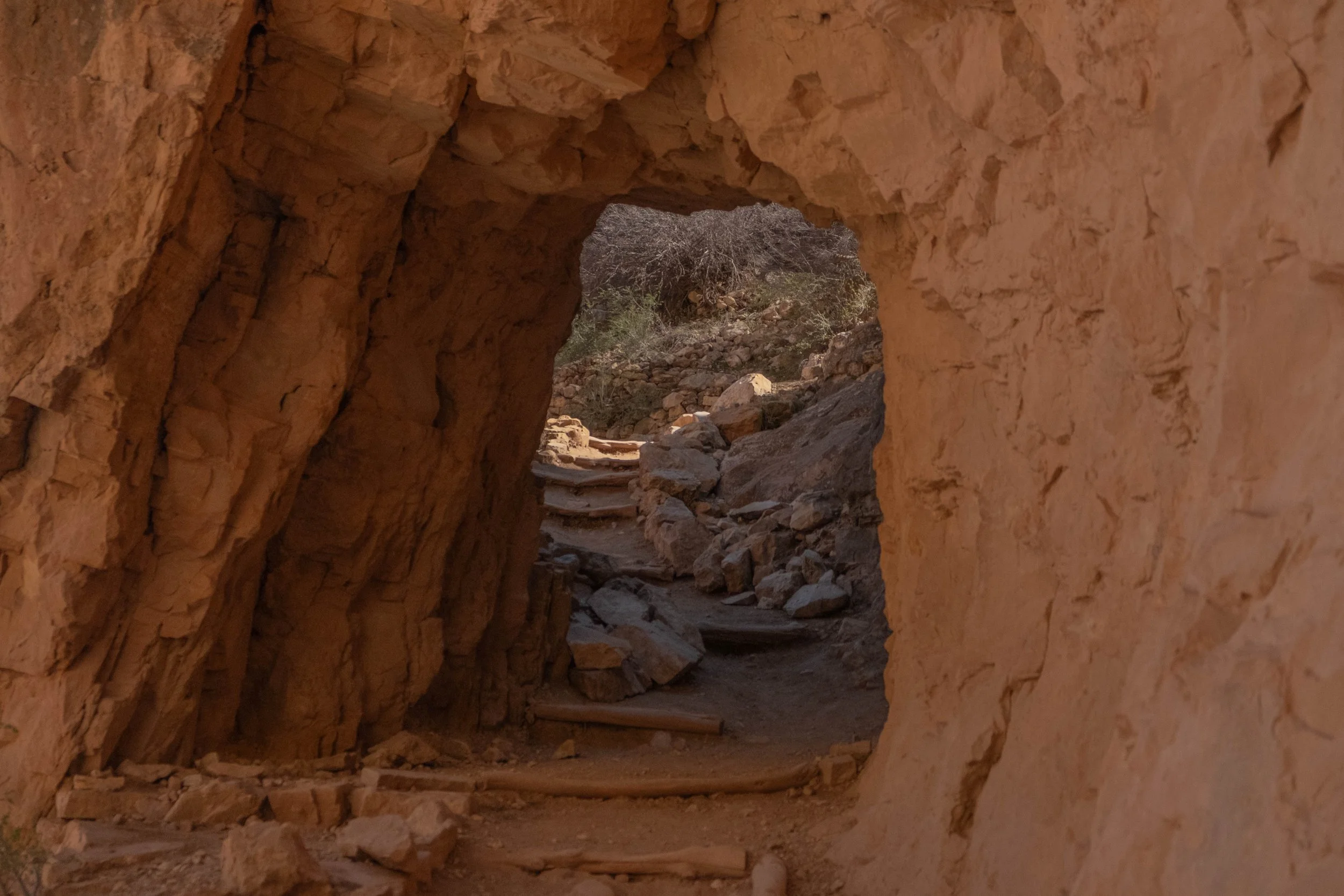
Once we reached Bright Angel Trail, we turned left and stopped at the recently renamed Havasupai Gardens (known as Ha’Gyoh to the Havasupai people; Havasupai means “people of the blue-green waters”) This is a true oasis in the canyon, a lush spring-fed haven filled with dense cottonwoods, bright green grasses, and thick vegetation, protected on three sides by tall canyon walls. Its beauty belies the legacy of violent forced displacement of the Havasupai people by the National Park Service. The last family to be removed was a mere 98 years ago: The Burro-Tilousi family was quite literally run out of Havasupai Gardens by two NPS rangers in 1928. Heartbreaking testimony chronicles Billy Burro-Tilousi’s tears as he stood on the rim of the canyon and wept over the loss of his home. The reasons for this displacement are rooted in the monetization of “recreation” and nature tourism that so often co-exists with the NPS and in the greater conservation world. Adding insult to injury is the fact that the trail that zigzags up the remaining 4.8 miles and three thousand feet of elevation gain between Havasupai Gardens and the top of the South Rim — the trail we ourselves were about to walk, the trail that the NPS rangers must have used when removing families like the Burro-Tilousis, the trail that enabled tourists like us to first descend into the canyon and see the views that we were drinking in at the moment — was first laid by the Havasupai people. The theft of their genius, their knowledge of the land, and their very home is what led to this national park. And by extension, it is what led to our visit.
It feels impossible — perhaps it is impossible — to right such a deep and profound injustice. Renaming Havasupai Gardens is an amelioration of this wrong, a step toward recognition of the people who farmed and tended the land there, as well as the Havasupai people who still occupy lands around the South Rim and even within the canyon. The effort was led by the Intertribal Centennial Conversations Group and was approved in late 2022, followed by a renaming ceremony in Havasupai Gardens in May 2023. Much has been written about the symbolism and importance of renaming this place; I am grateful for the education I received in this article by Ophelia Watahomigie-Corliss (starting on page 10).
Renaming places in partnership with Indigenous peoples can certainly be merely performative, similar to the critique of the now popular practice of land acknowledgements. For me, however, learning this history and taking time to pause in silence at Havasupai Gardens — recognizing the harms that have been done, offering our own silent apologies, sitting with the discomfort and sorrow and utter wrongness of it all — was an experience that changed the way we moved when we finally set out on the rest of this trail originally laid by the Havasupai. Each footfall was an opportunity for reflection and for penance. We do not have the ability to undo the violence of the past, but we do have the power and responsibility to engage with the present in ways that challenge the status quo. Using these trips to educate ourselves, learn and sit with truer histories, and resist the pull to view these parks simply as recreational playgrounds are one of the small ways J & I attempt to do this in our daily lives.
The last mile of the climb felt hard on our tired legs, but the end was in sight. We emerged at Bright Angel Trailhead feeling like different versions of ourselves, changed by the stories of this place, the ancient rocks we’d slept beside, the rare and precious water, the wind whipped across the plateaus, the vegetation and the mammals and the views.
It was a gift to spend two nights below the rim. We offer deep thanks to the land and to the people who have called this place home since time immemorial.
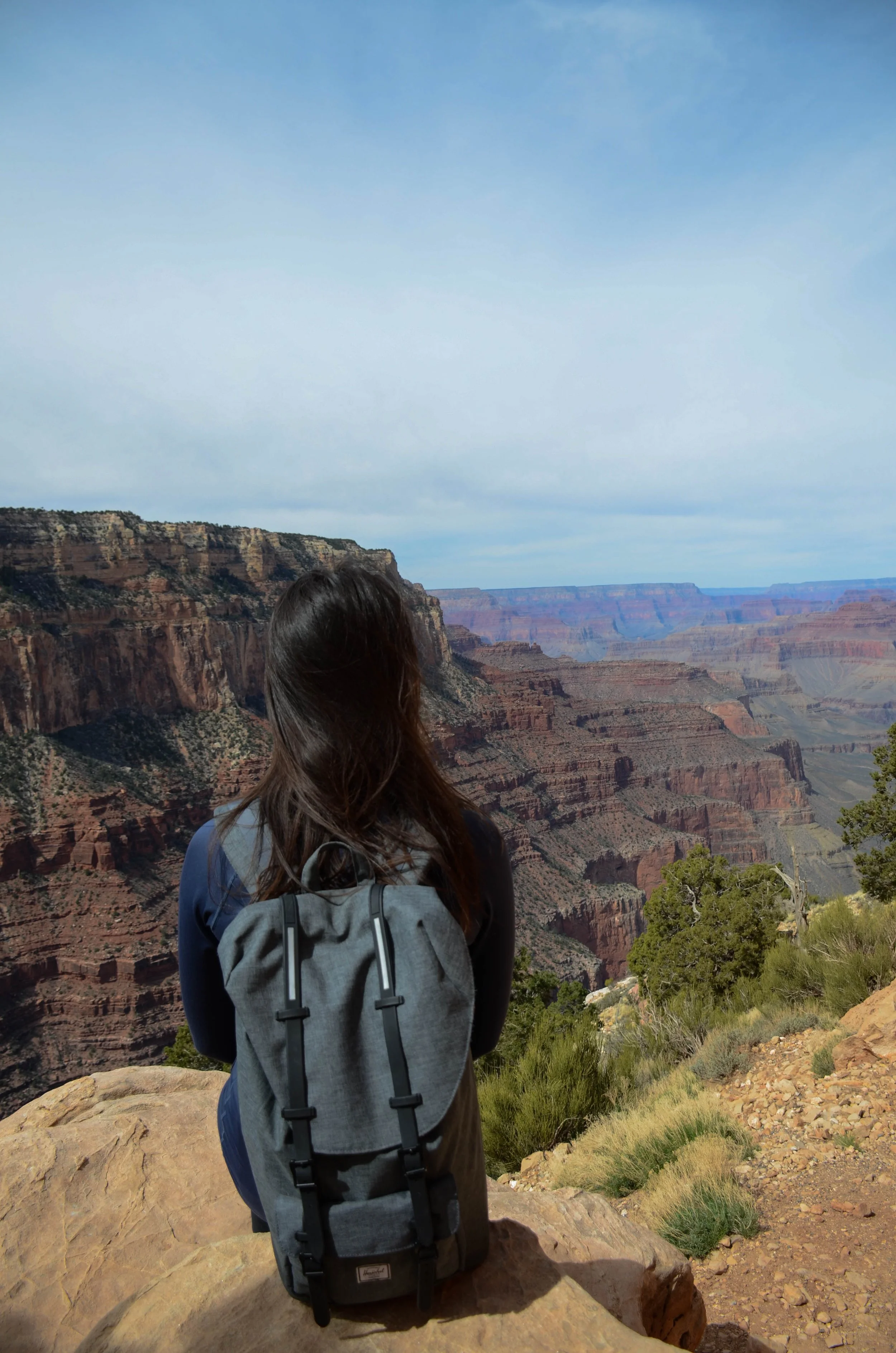
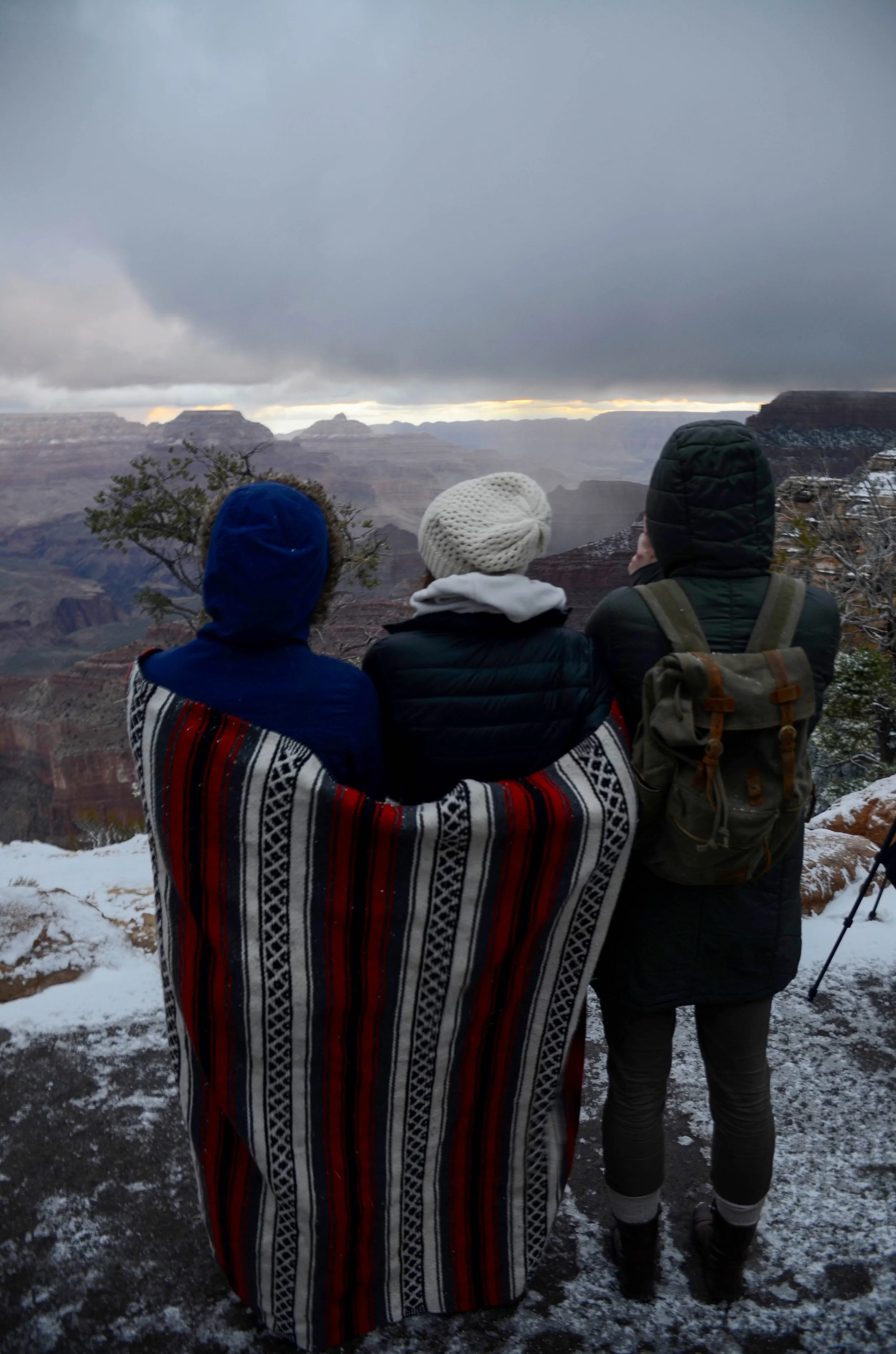
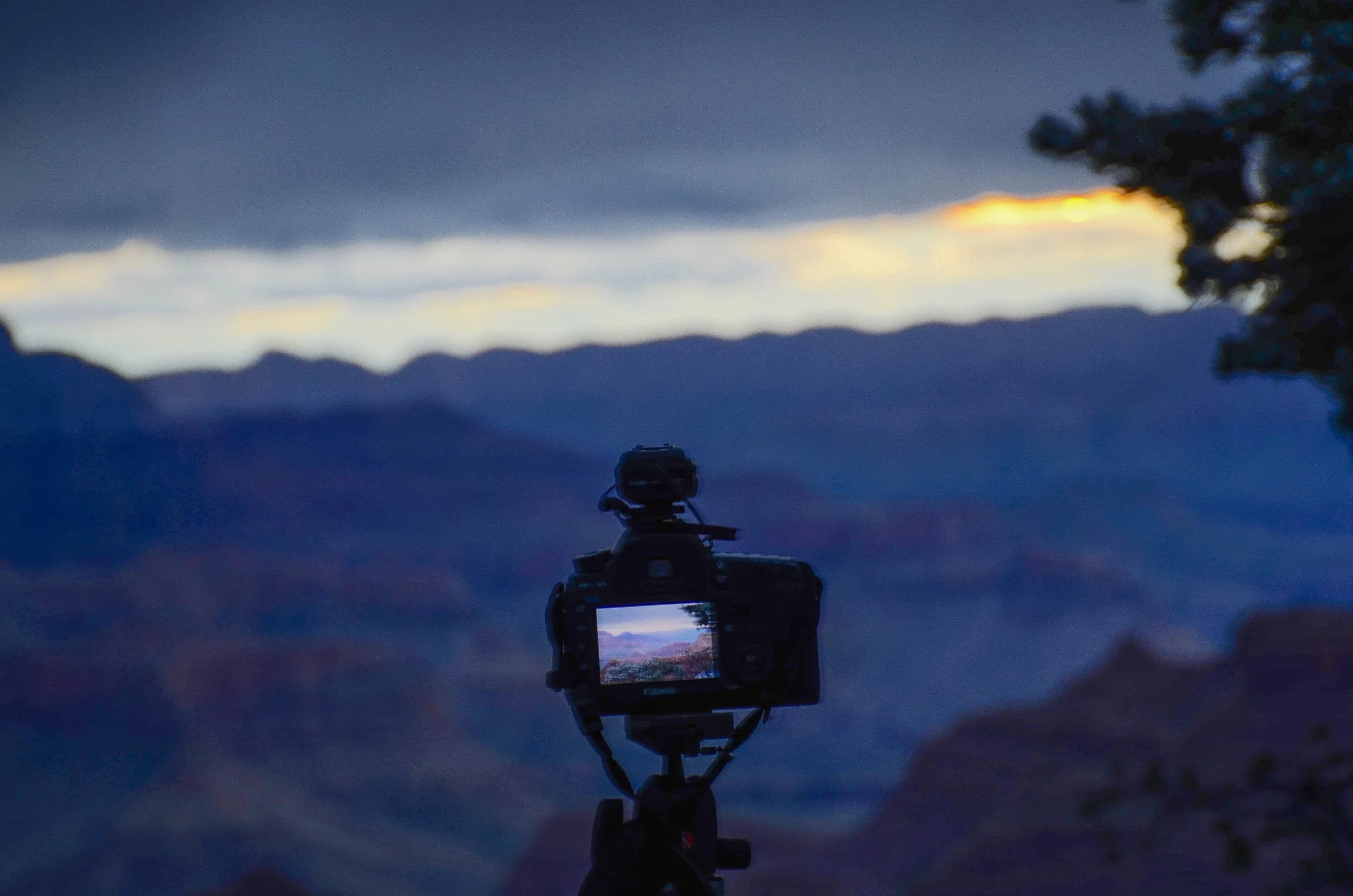
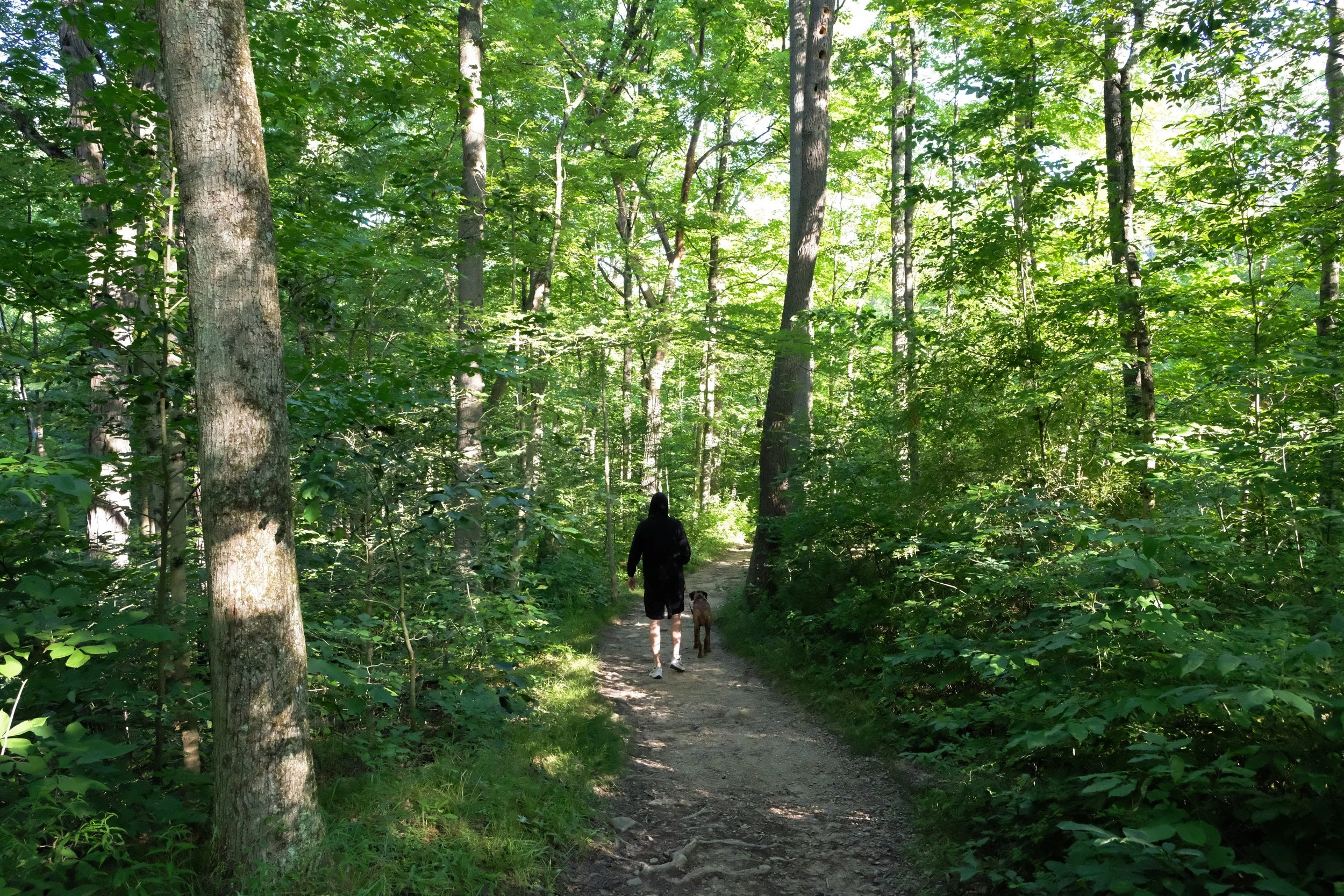
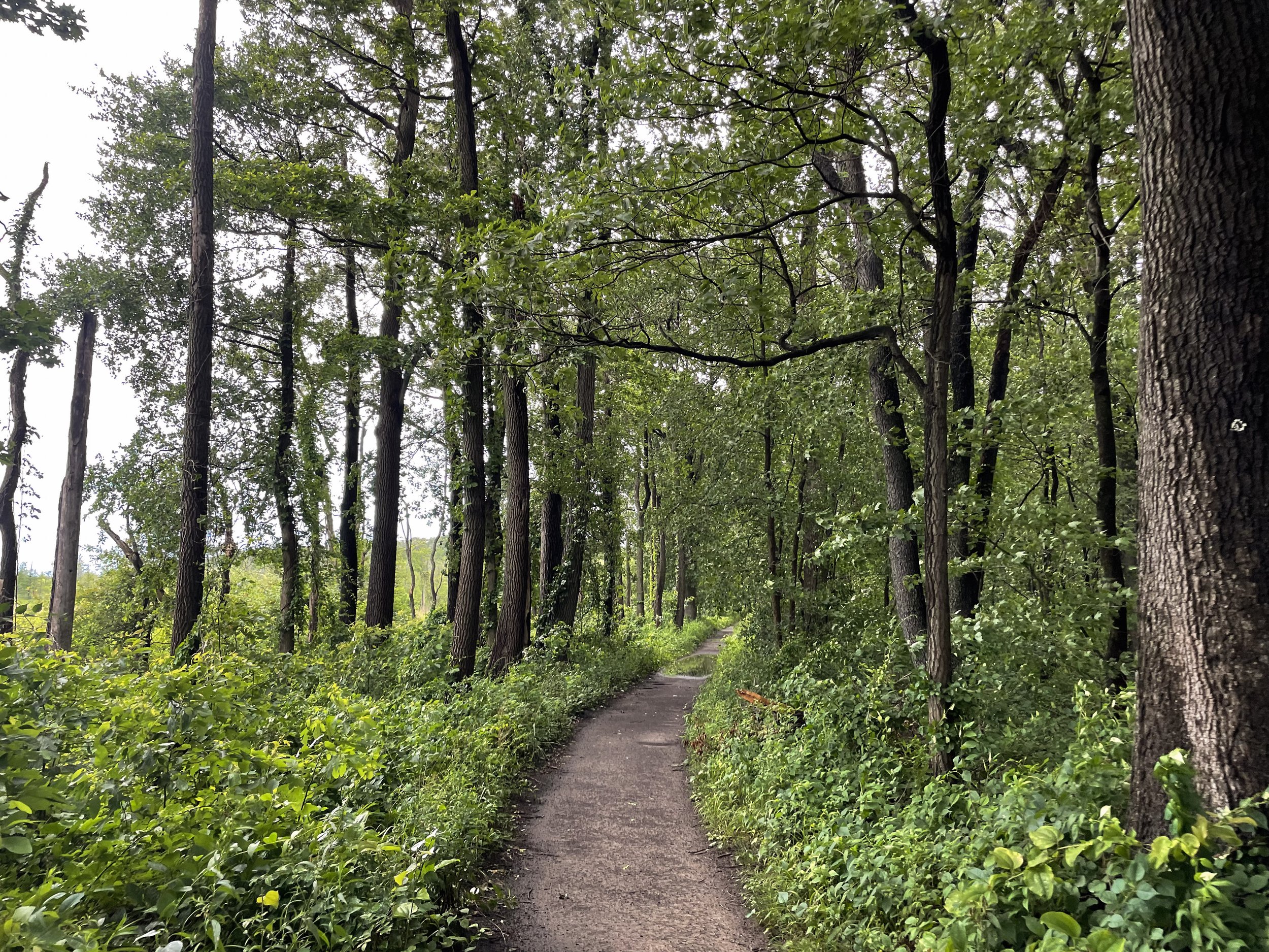
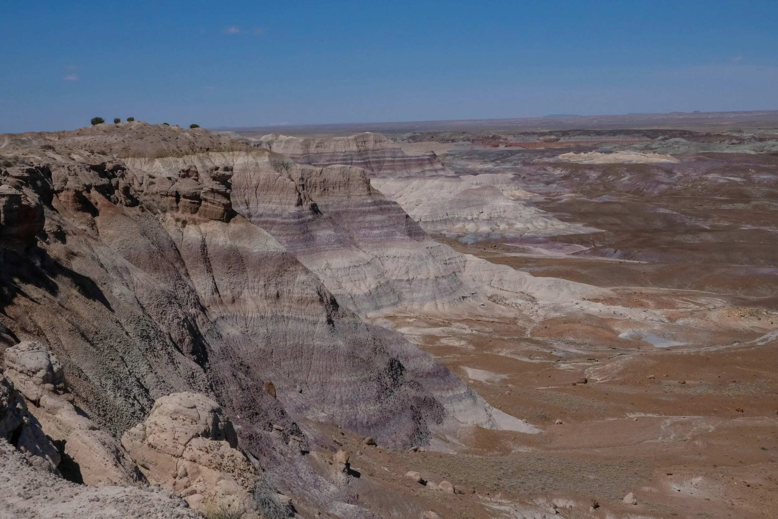
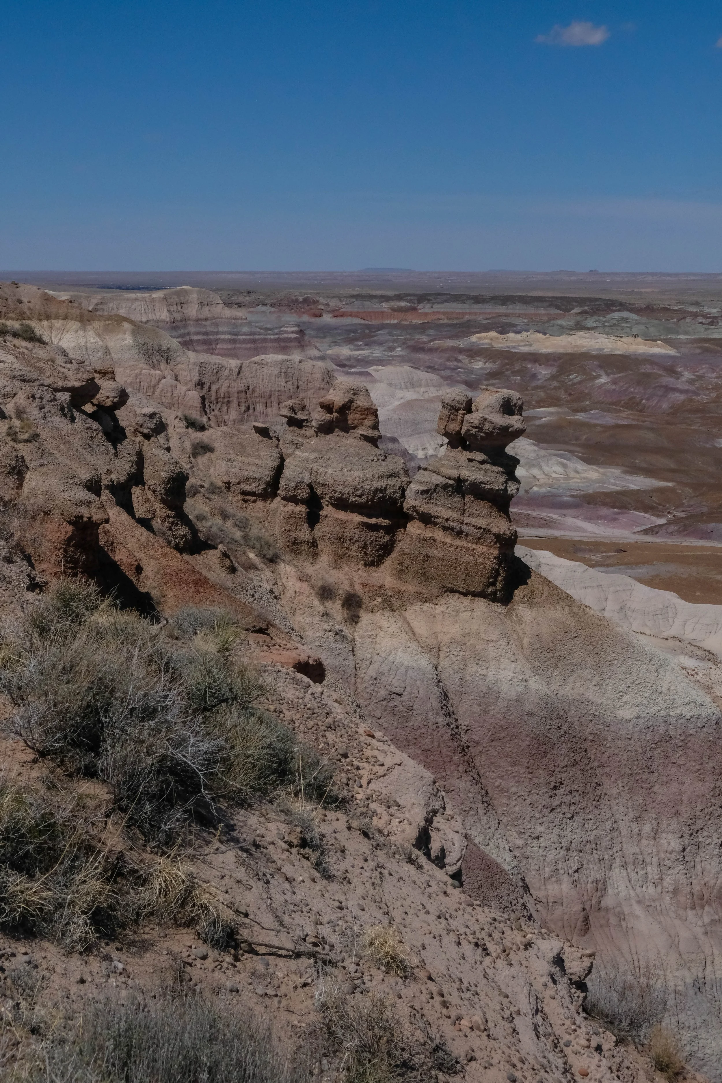
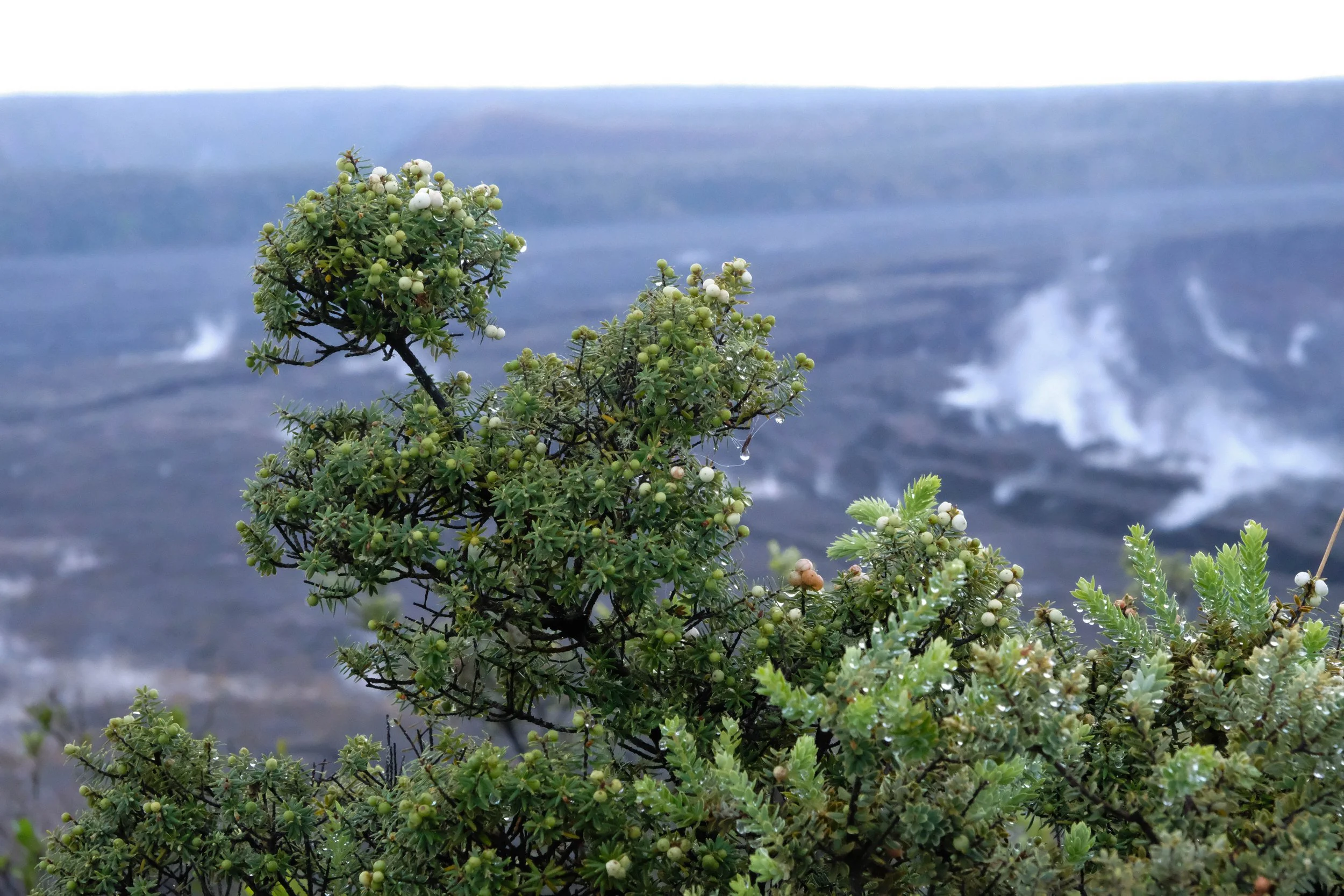
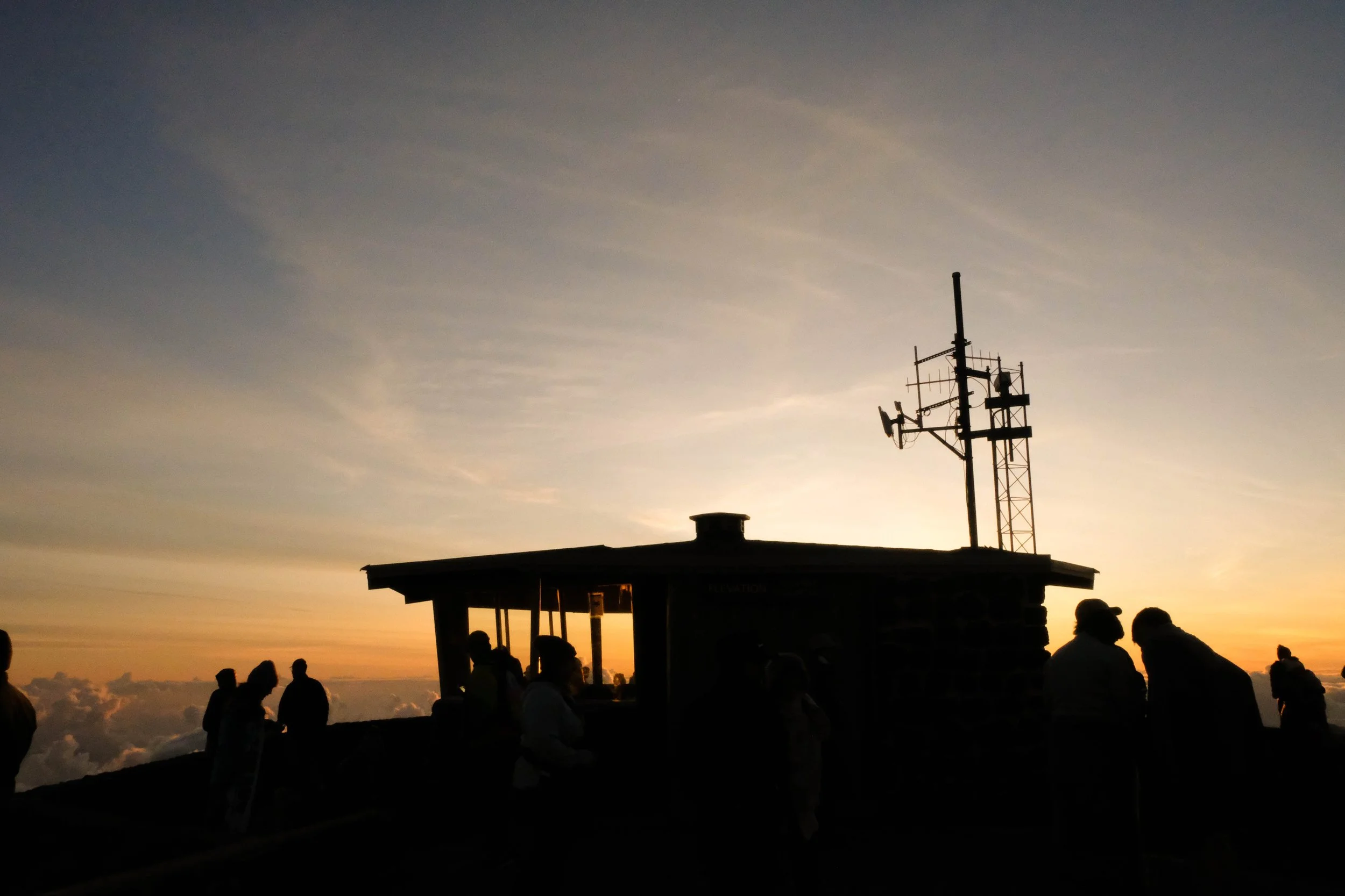
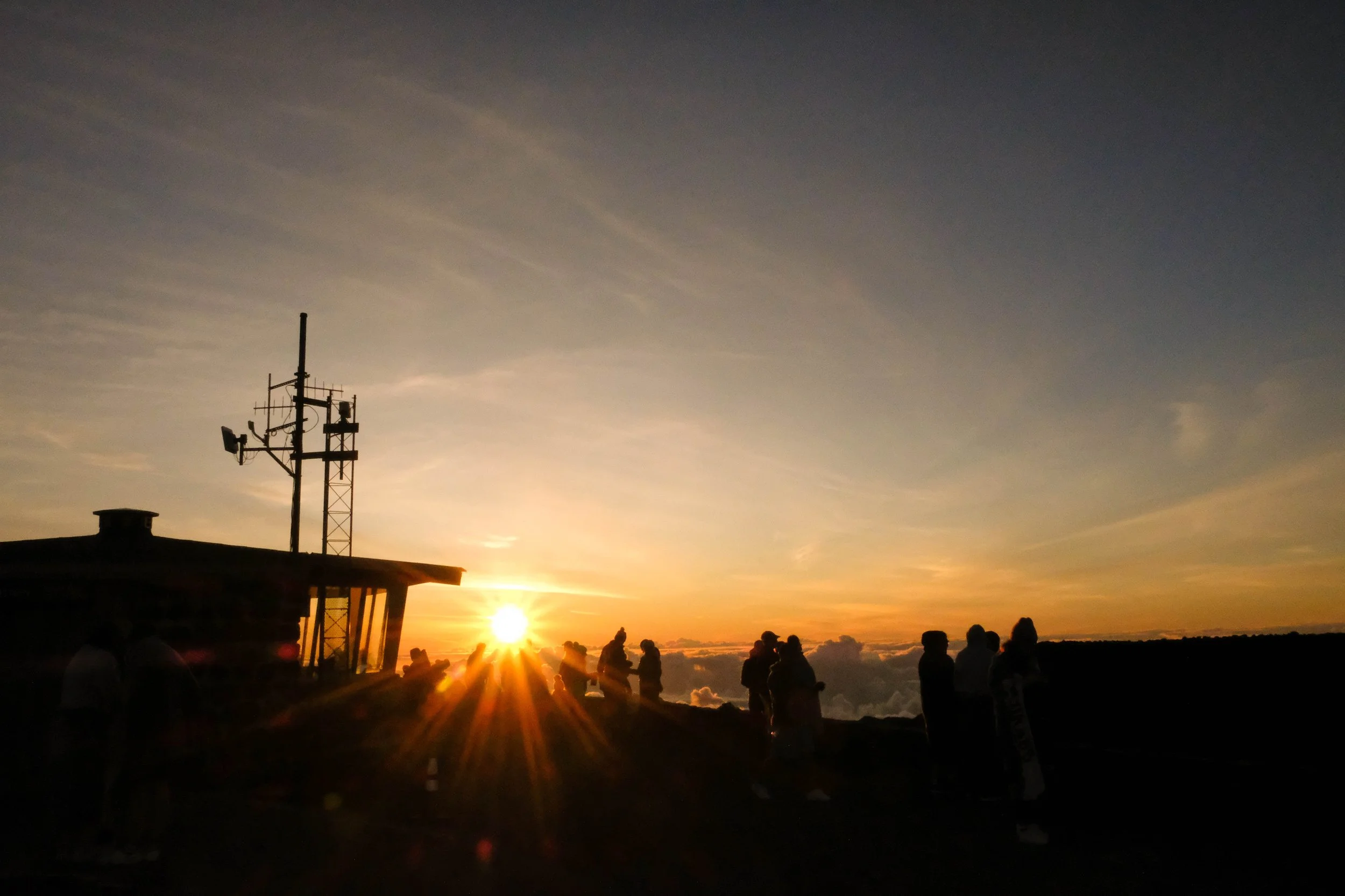
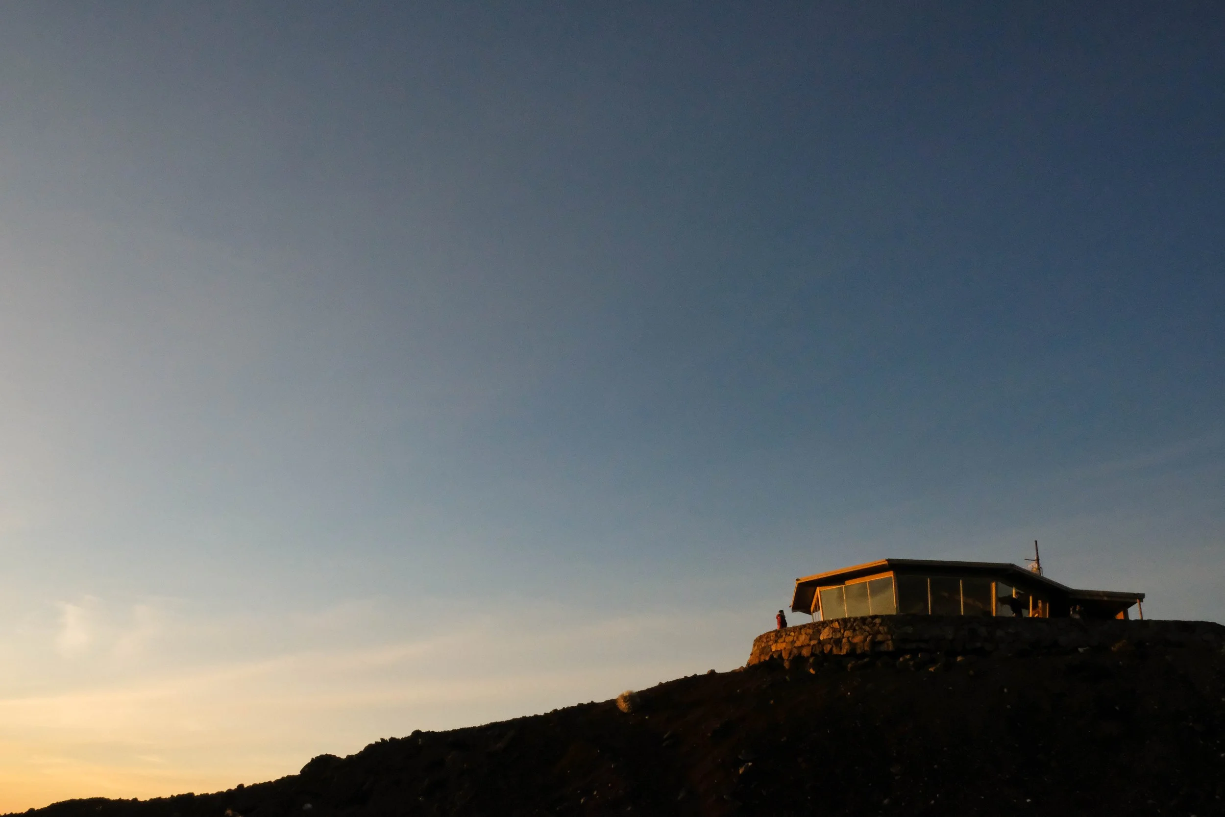
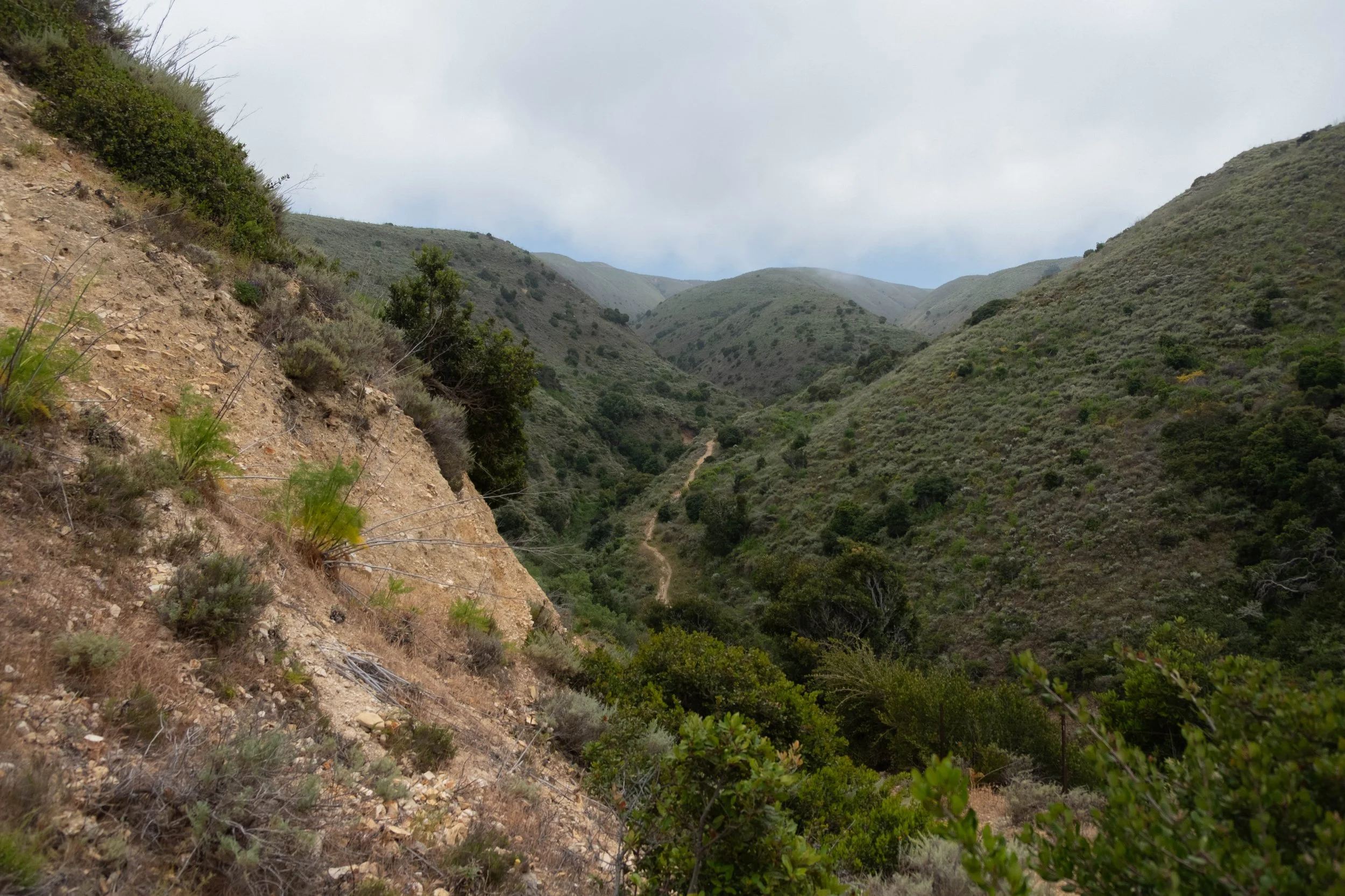
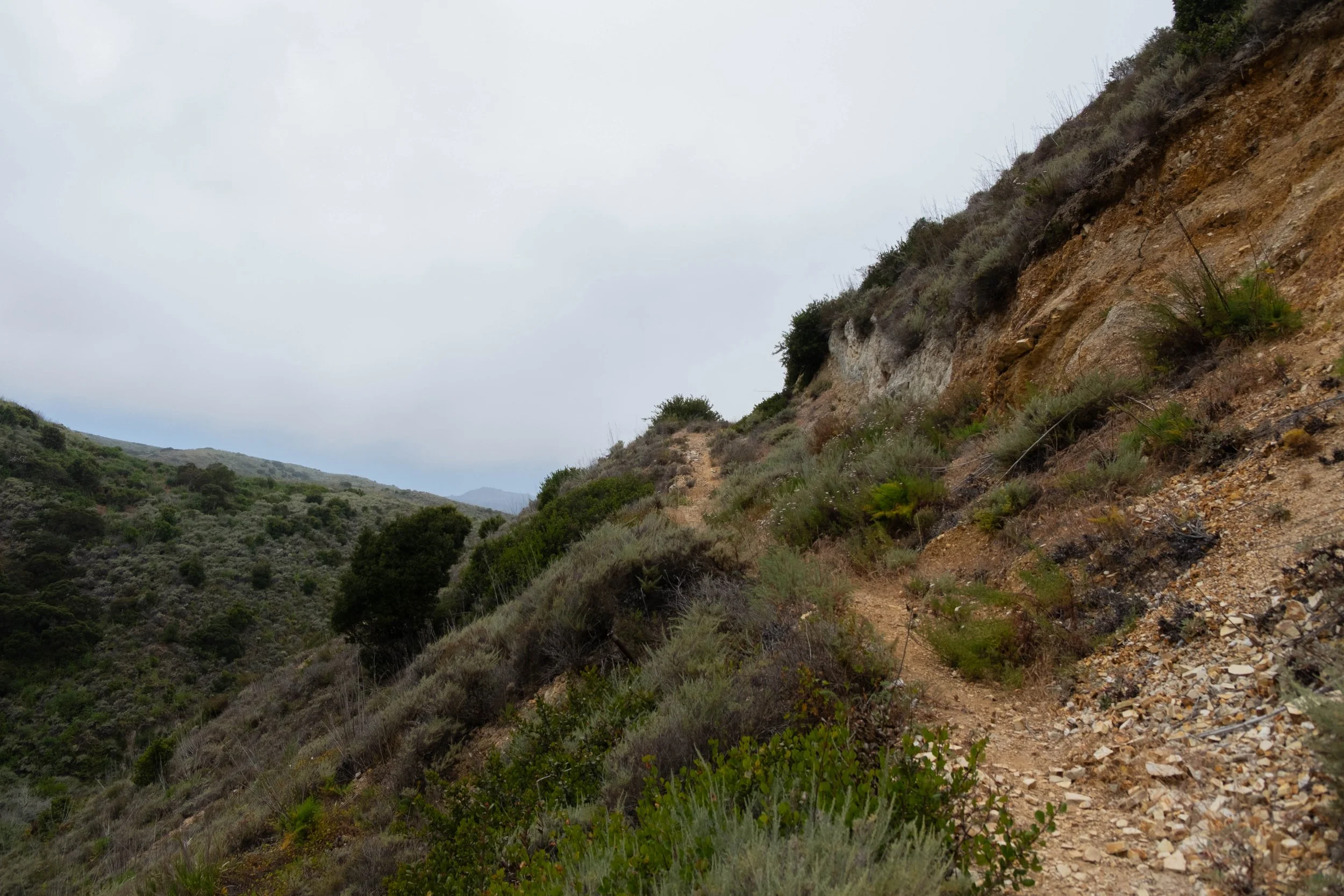
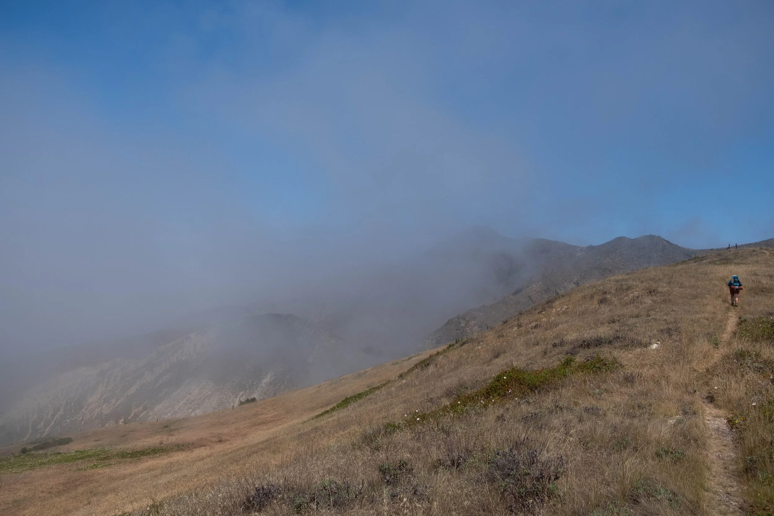
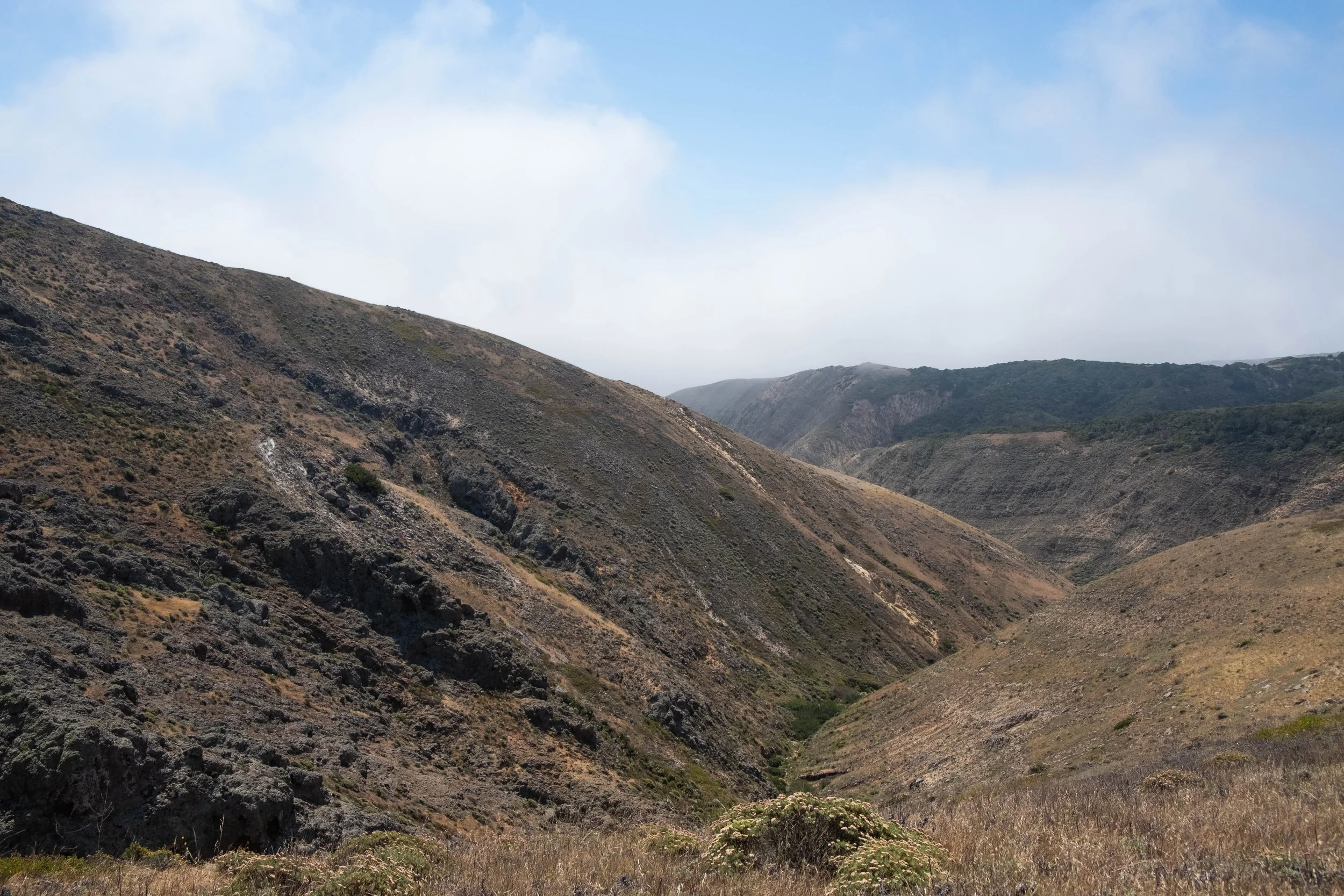
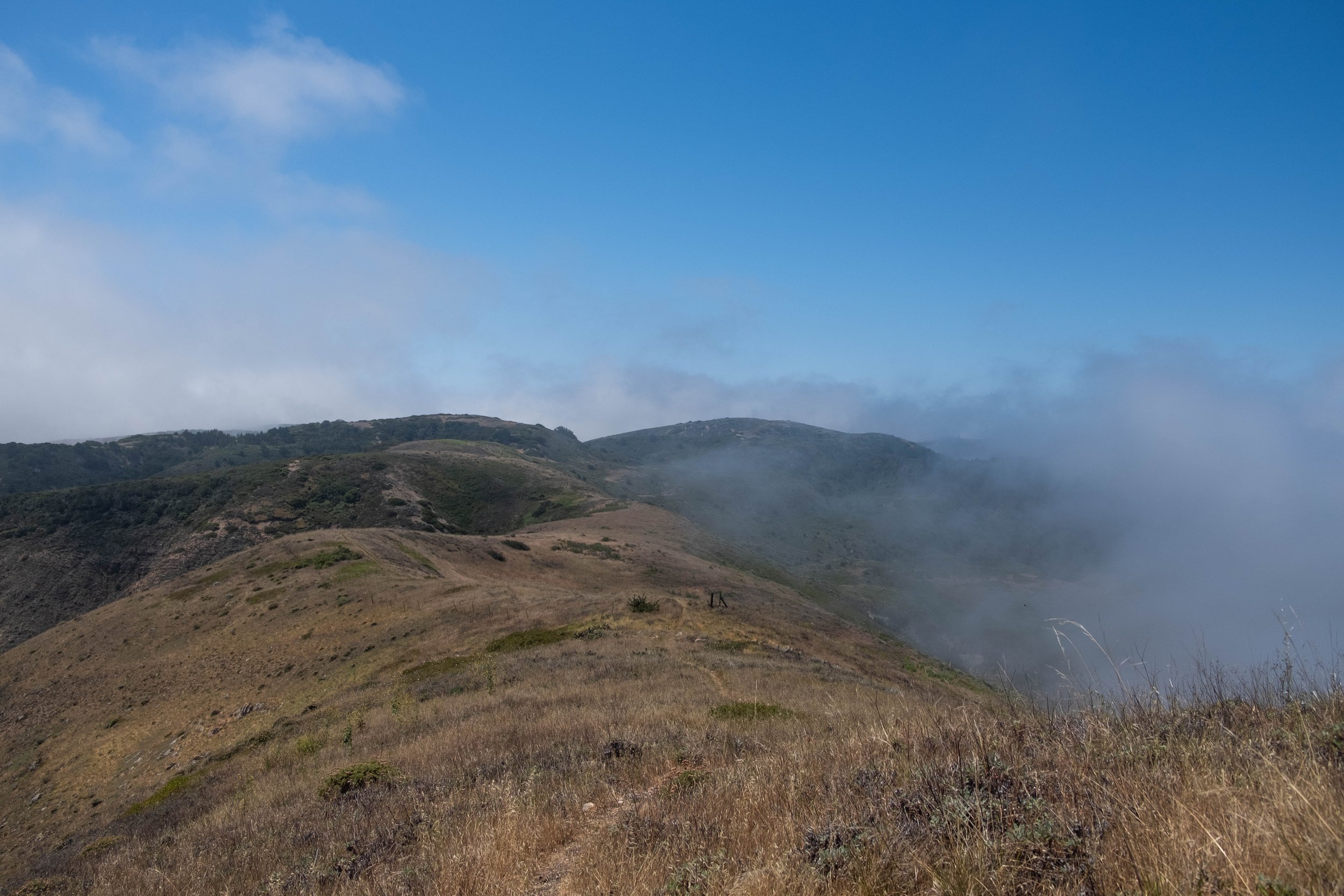
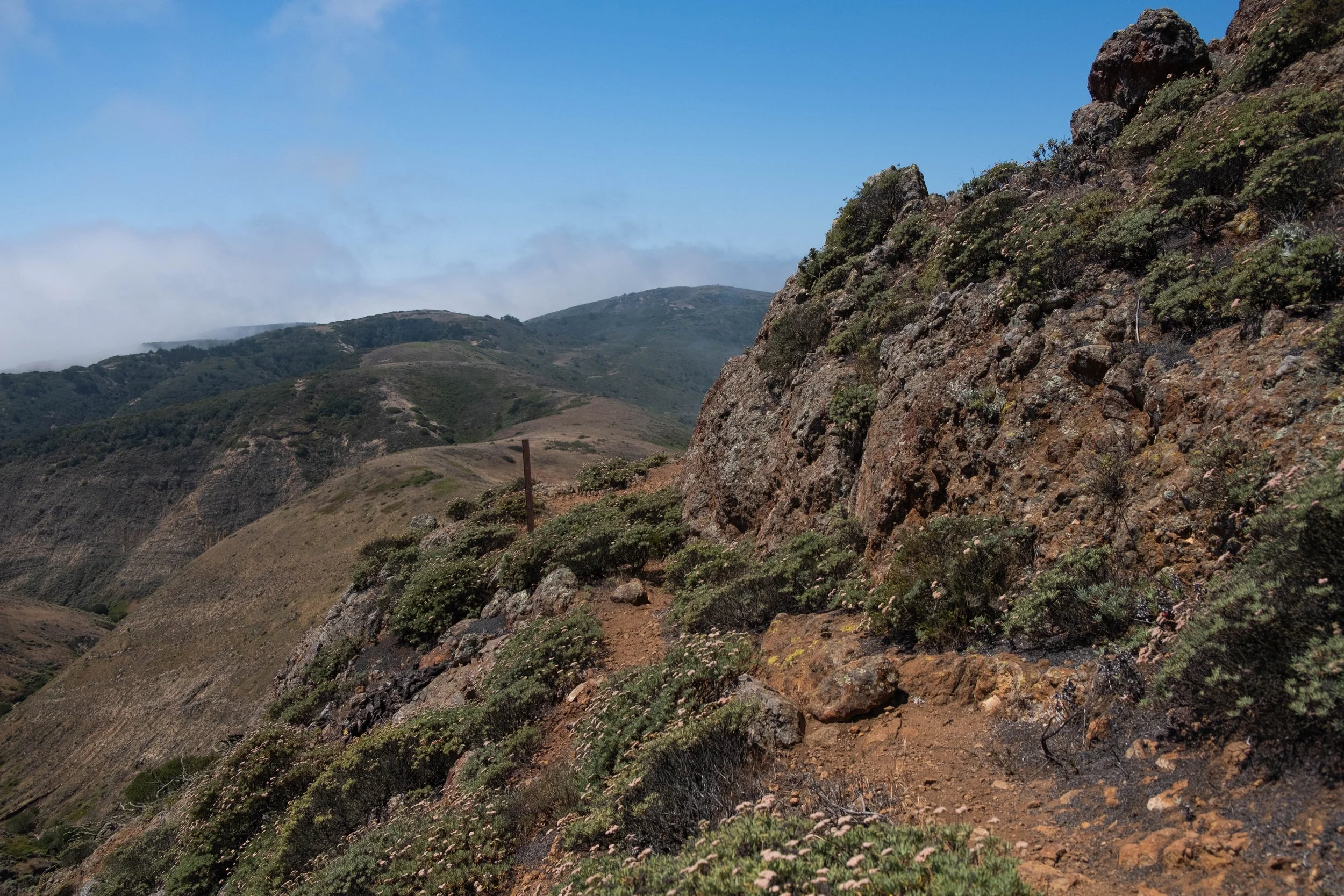
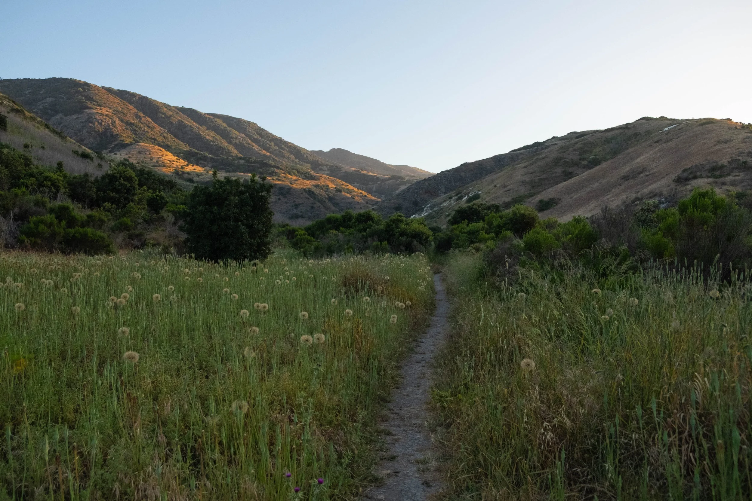
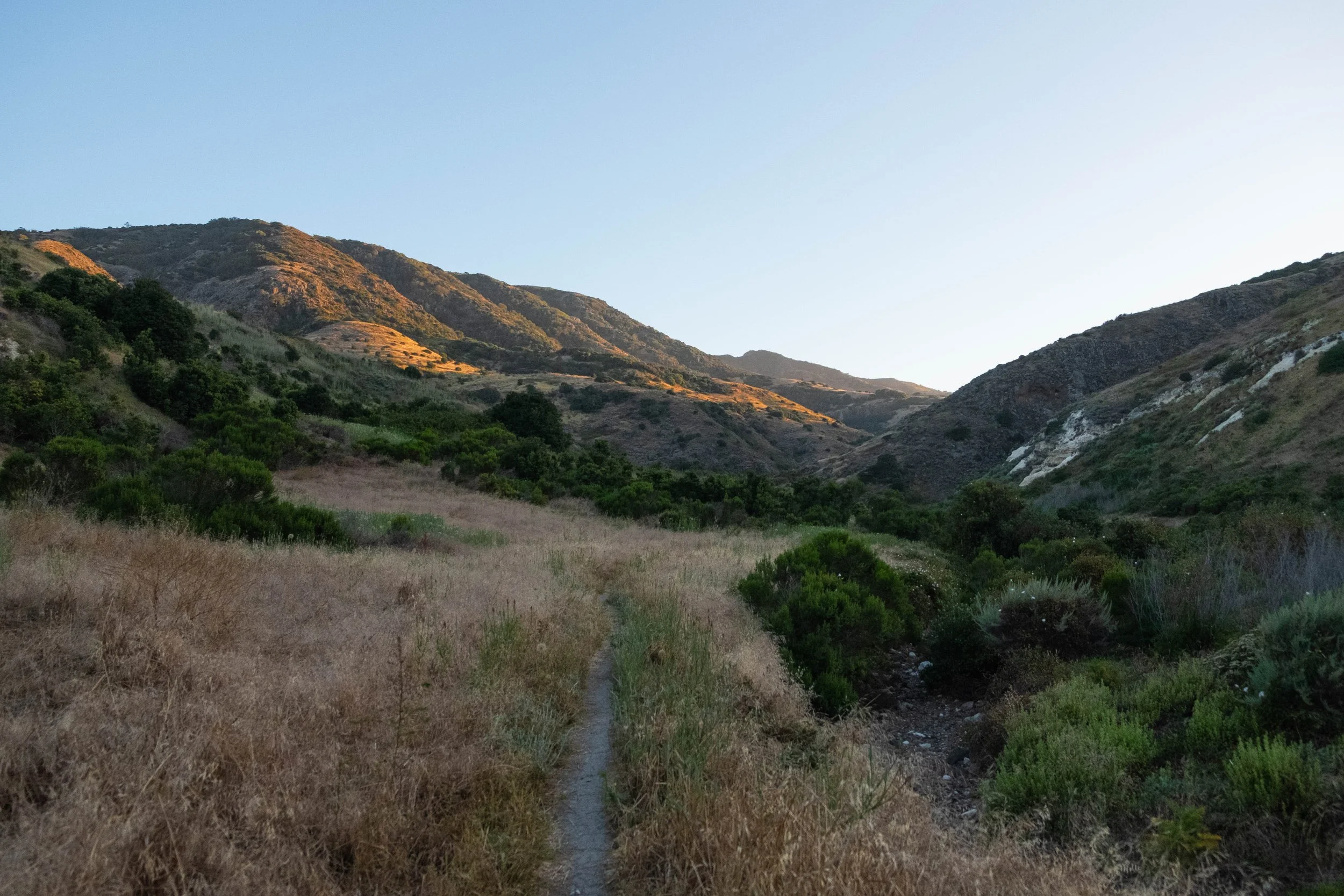
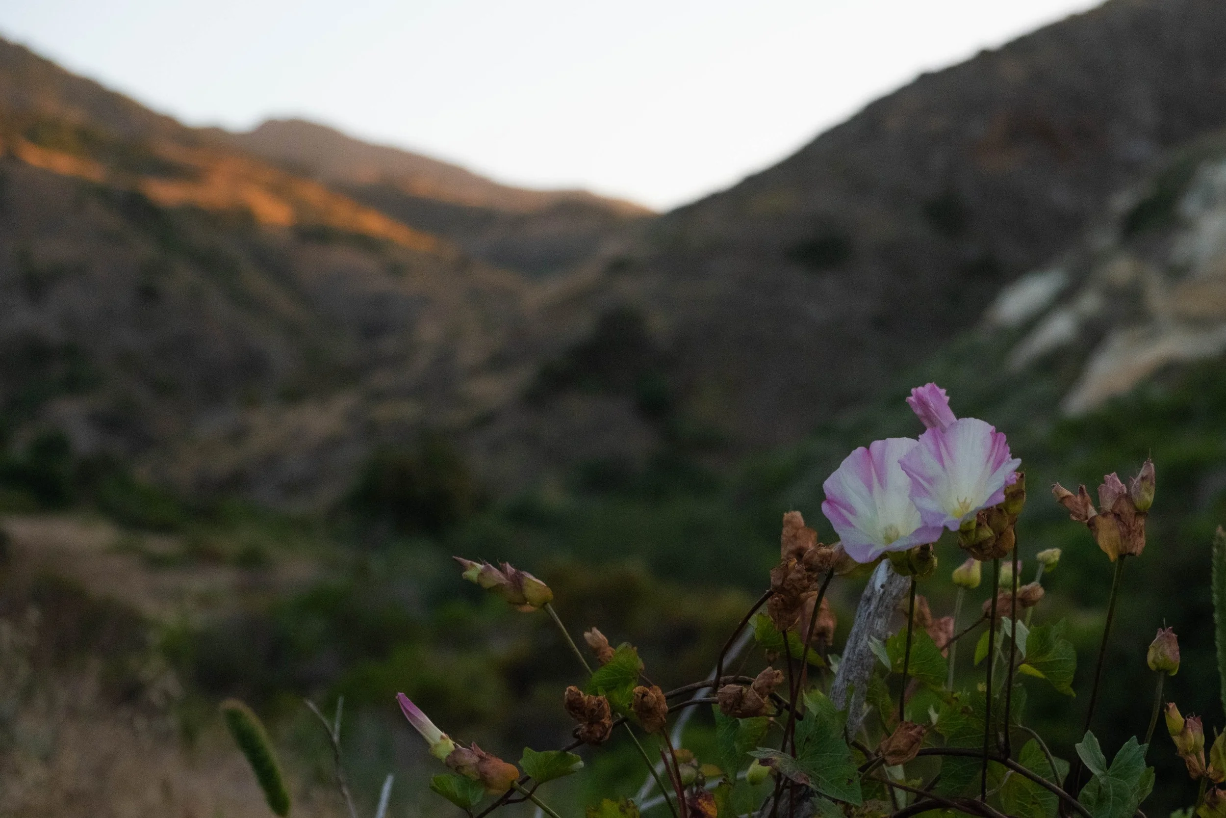
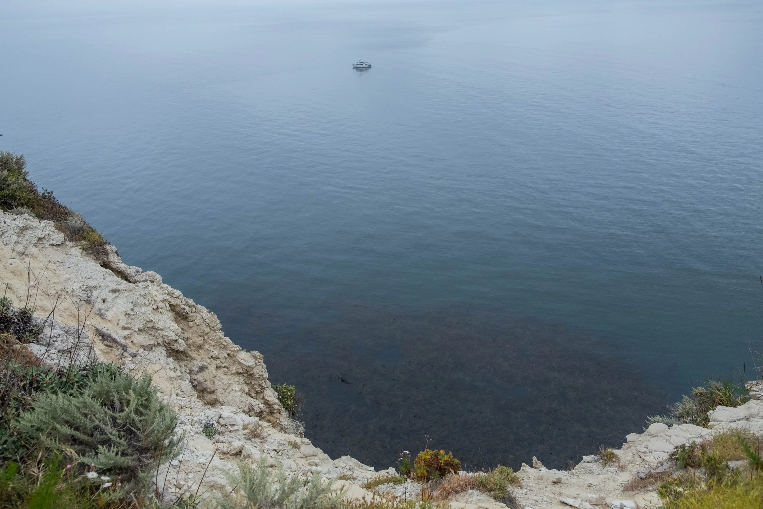
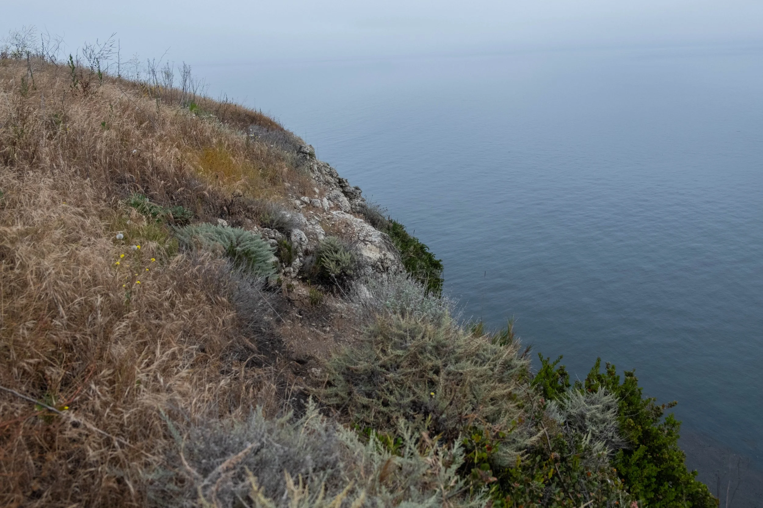
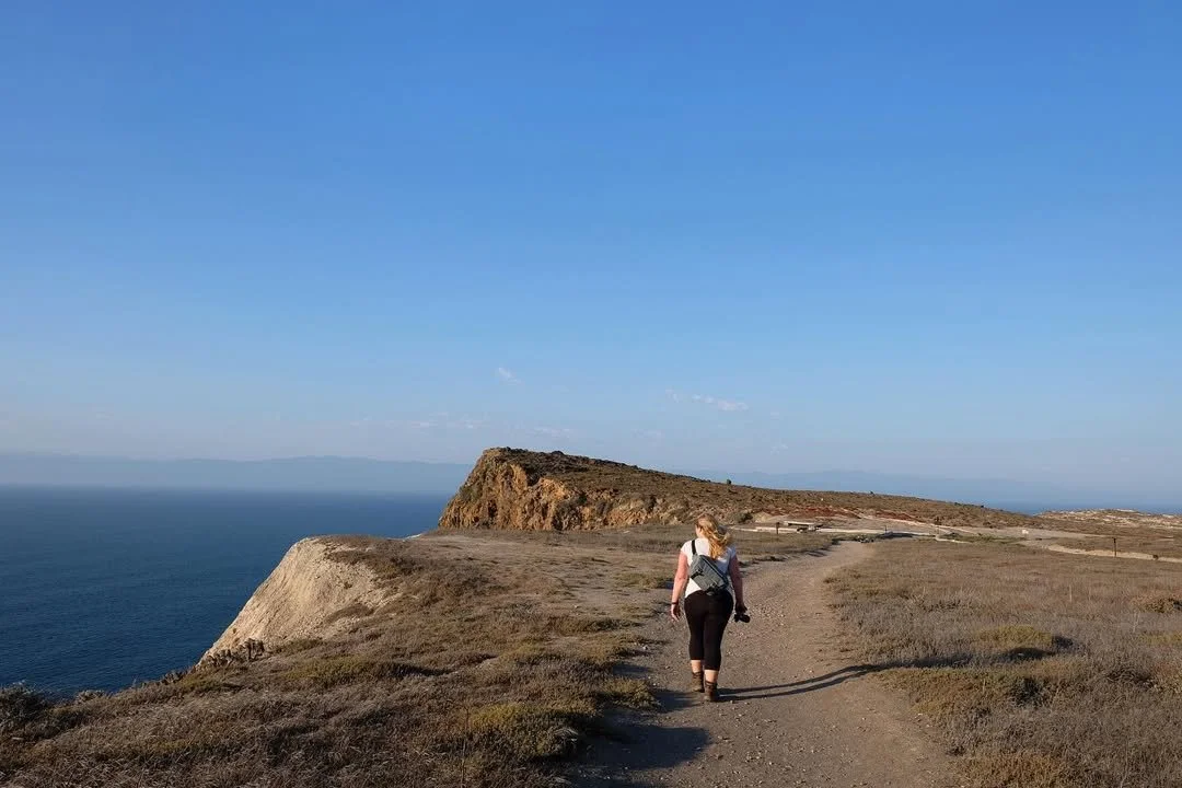
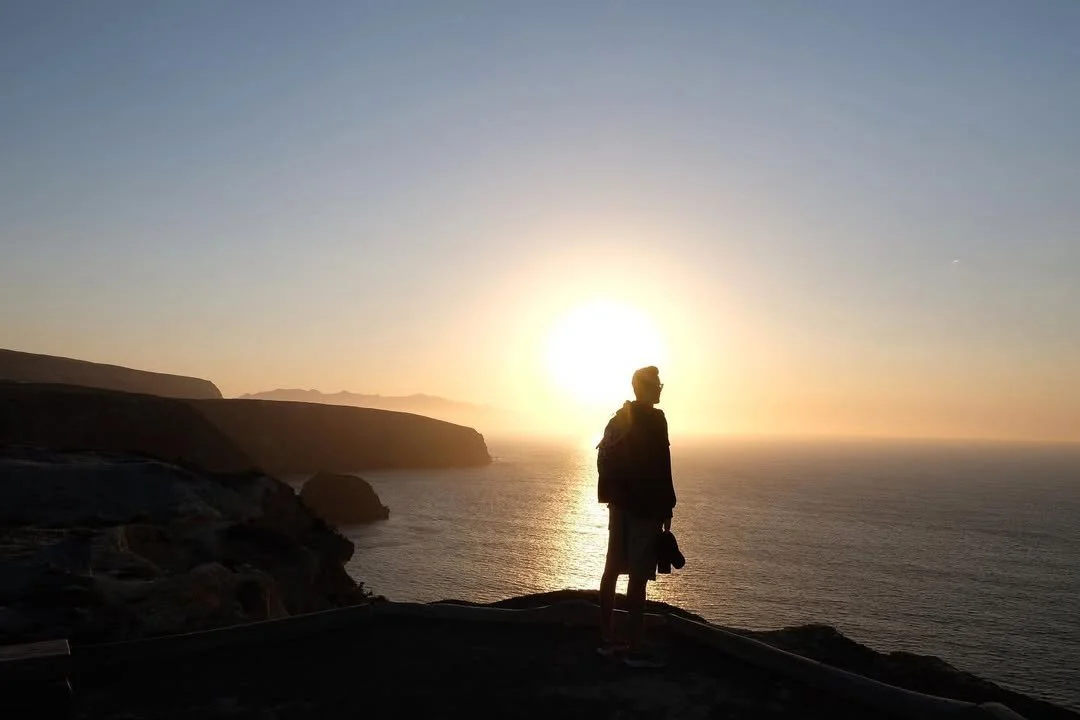
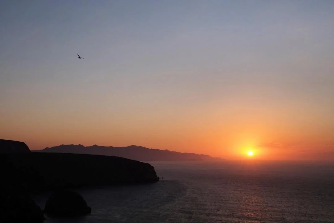
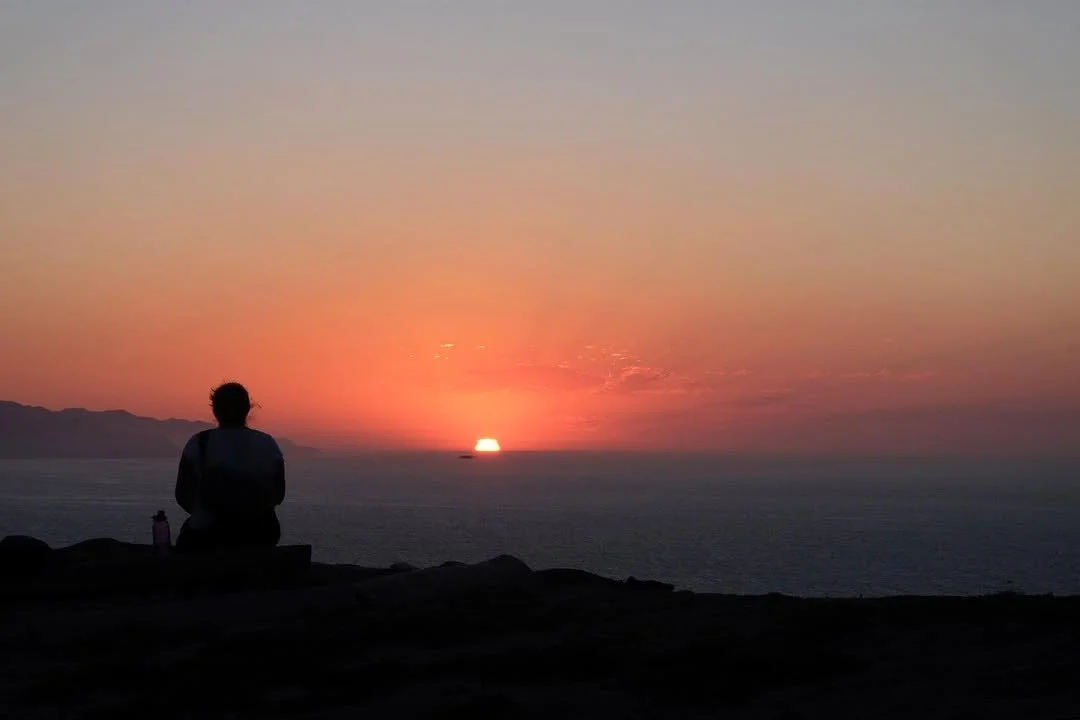
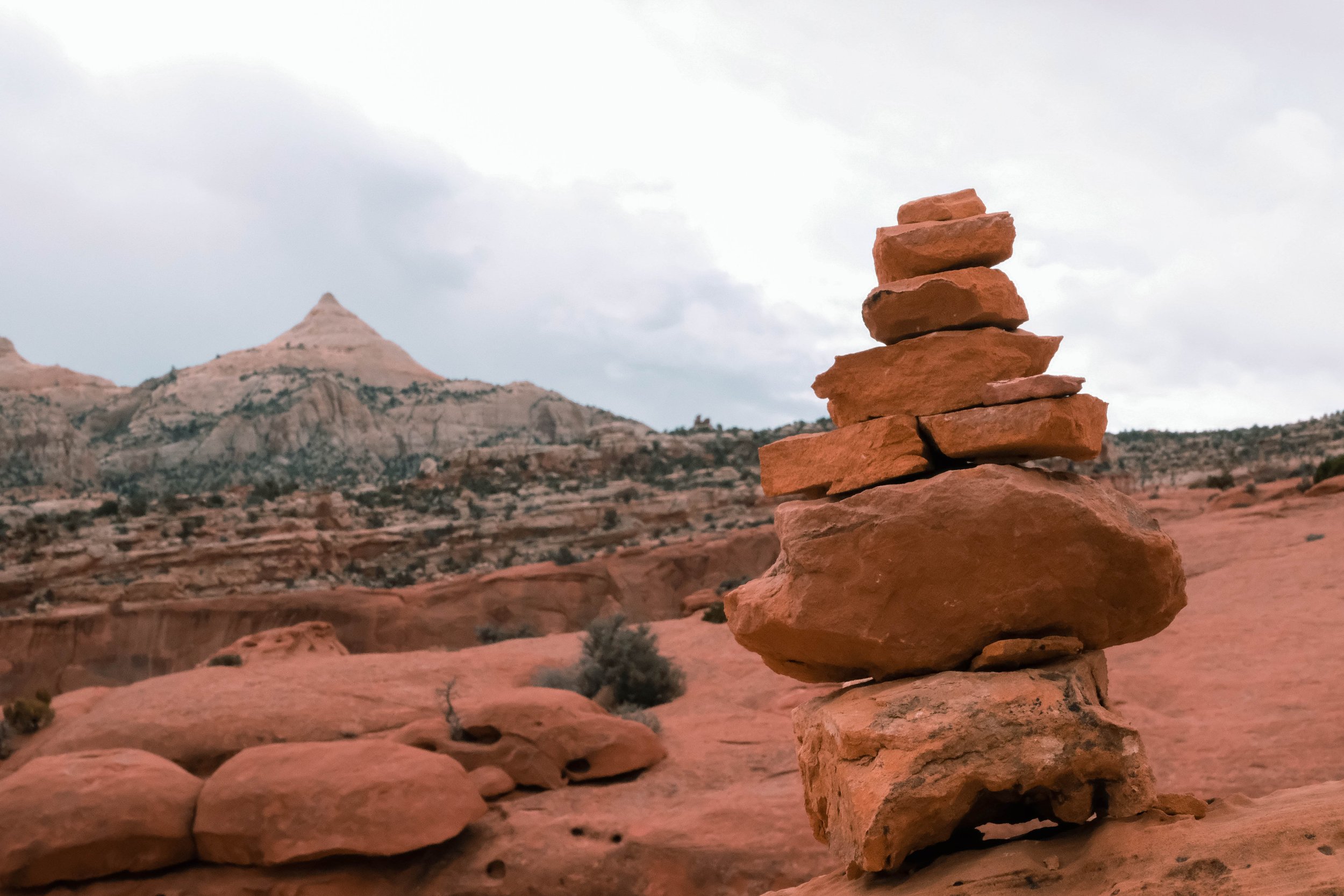
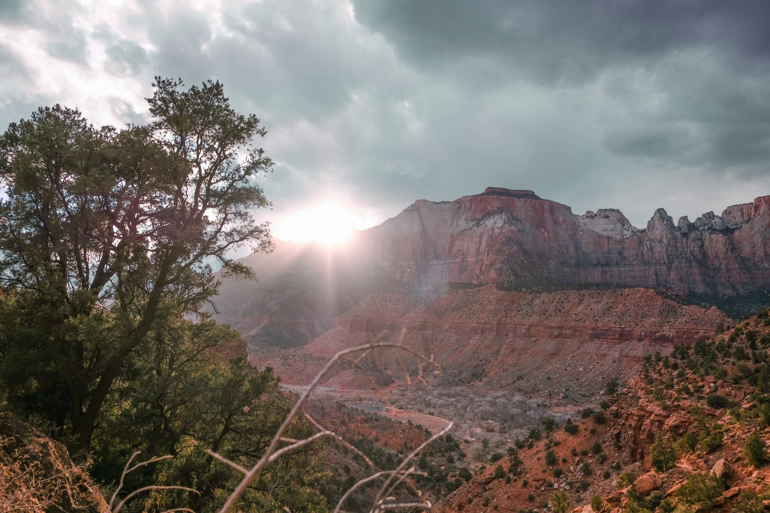
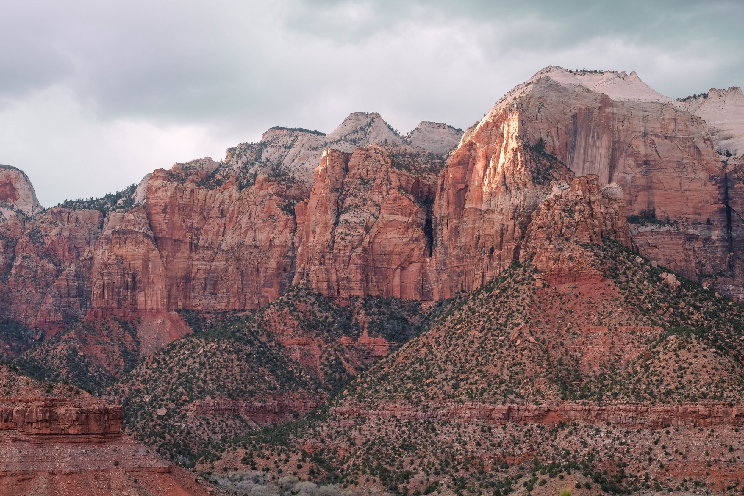
Solo South Rim trips (Emily) | March 2016 & April 2024
Pictured below:
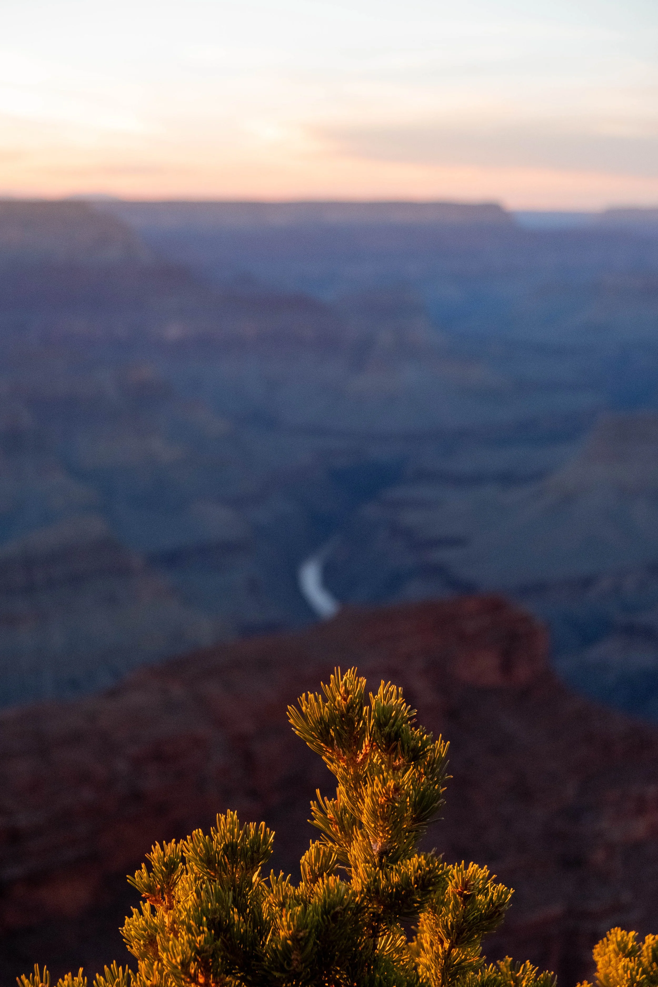
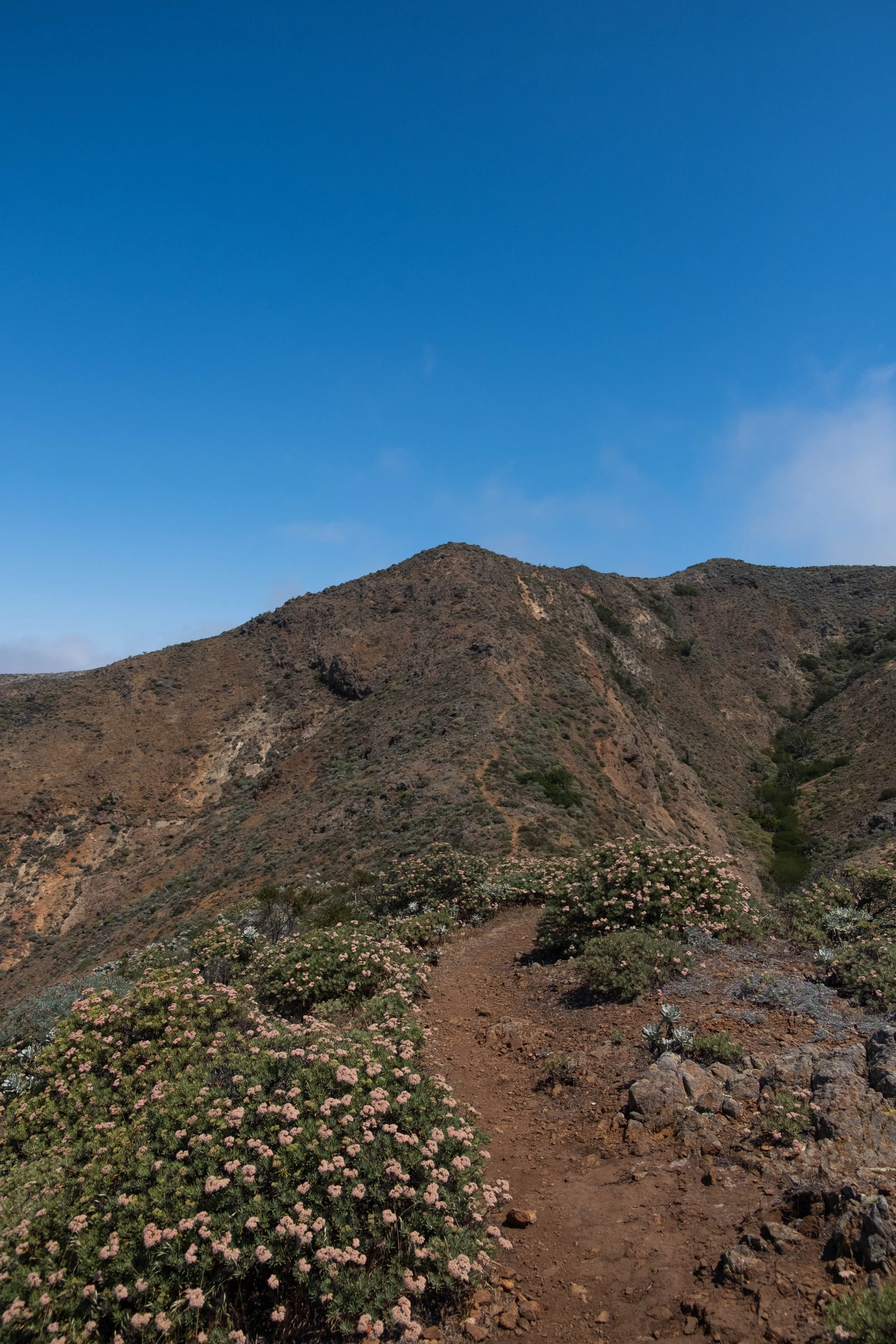
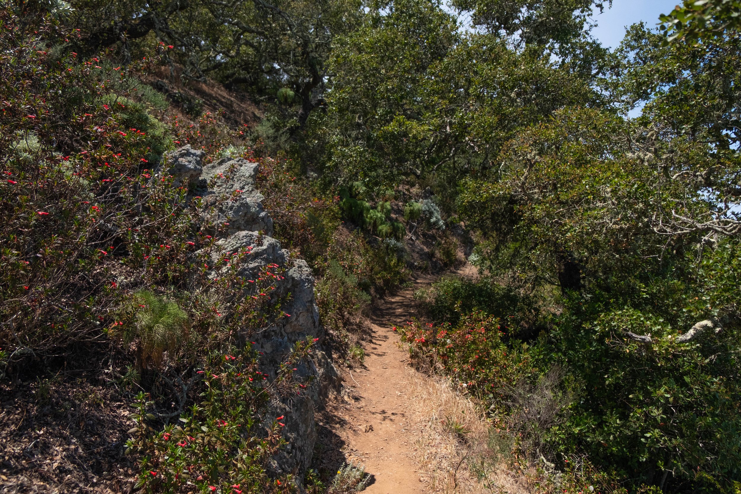
Views on the South Kaibab Trail to Skeleton Point.
Sunrise and sunset from various lookouts along the South Rim.

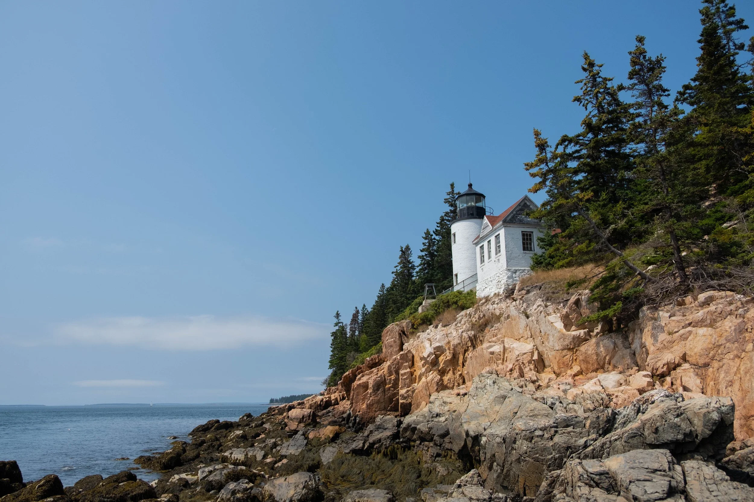
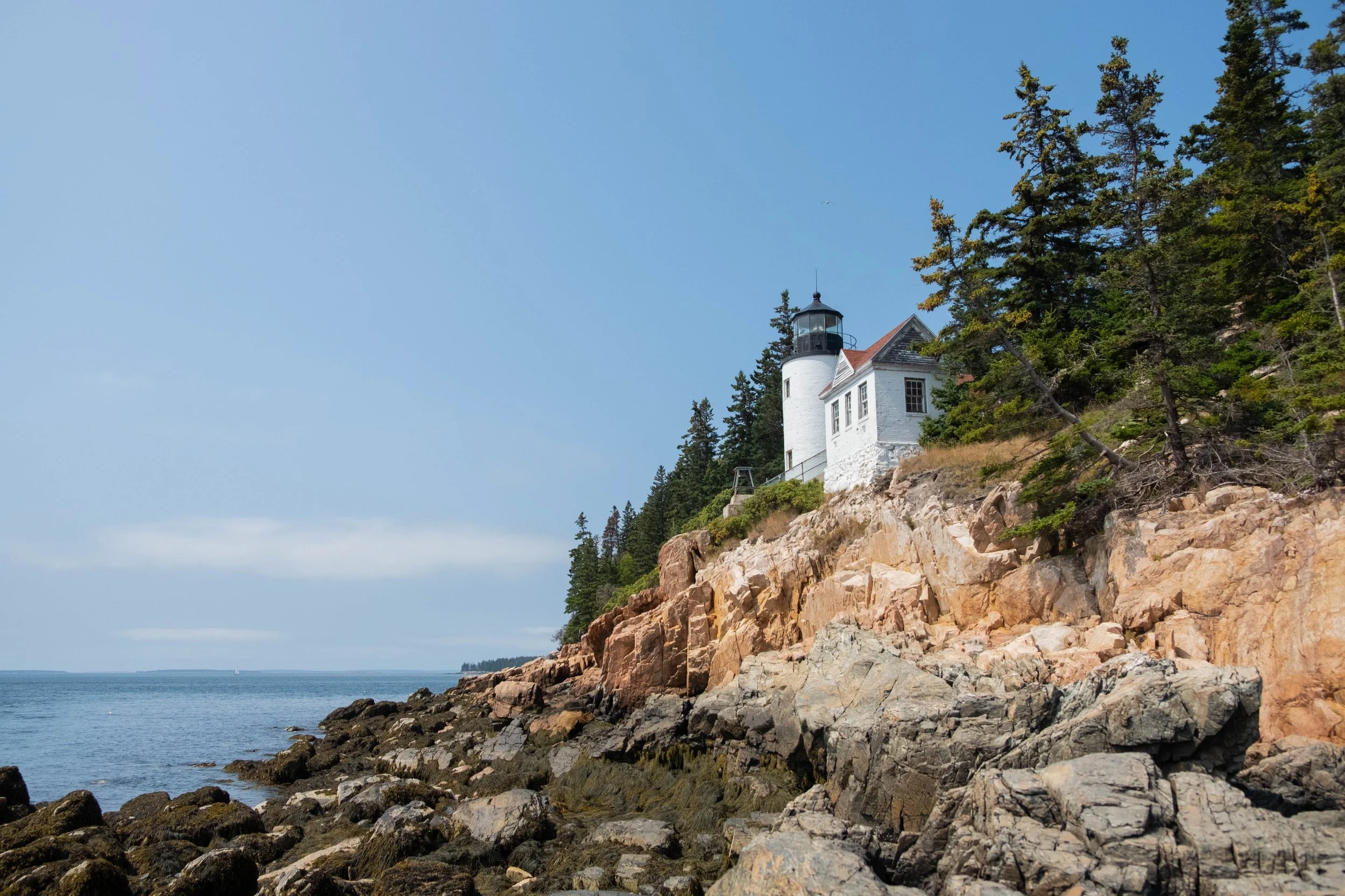
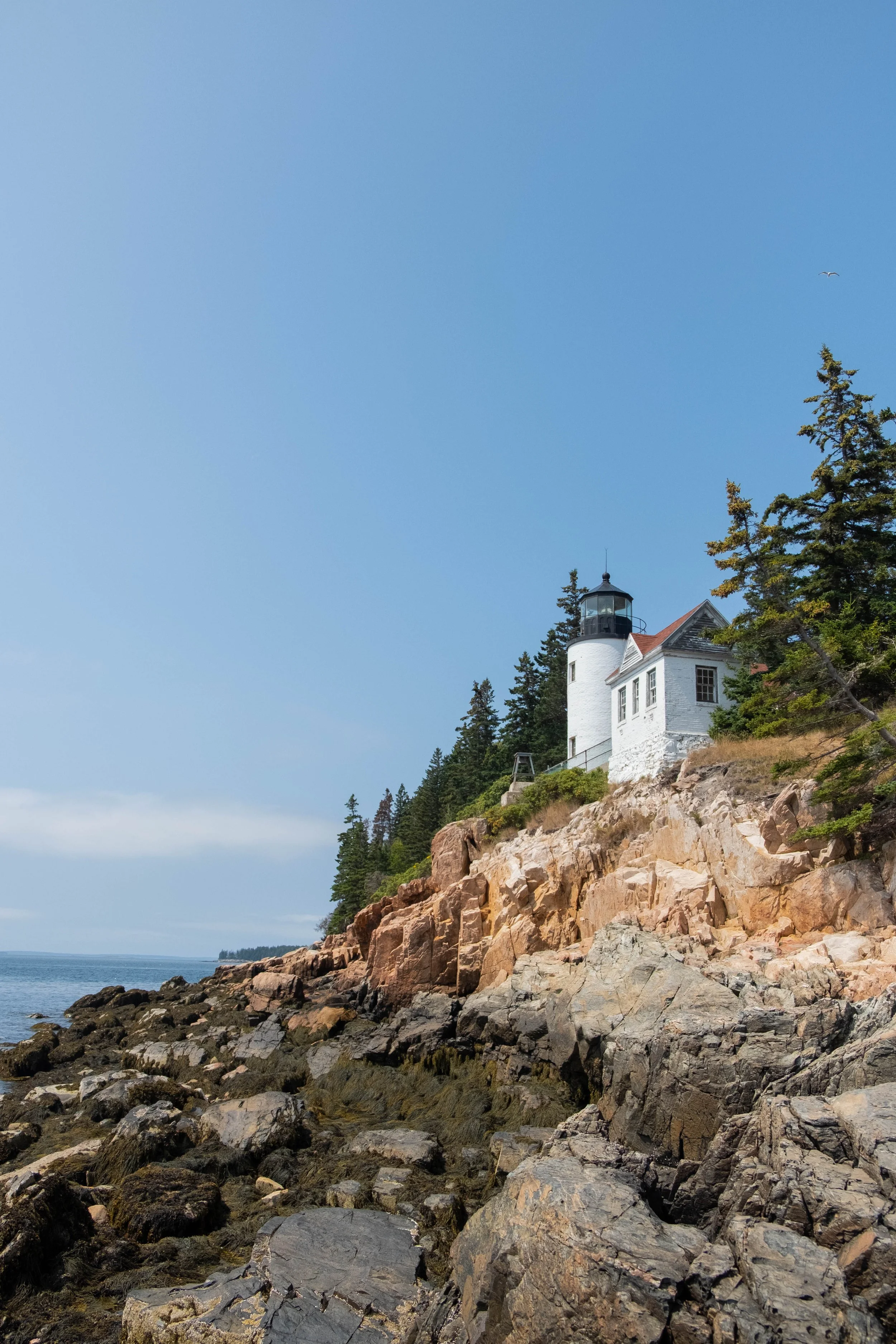
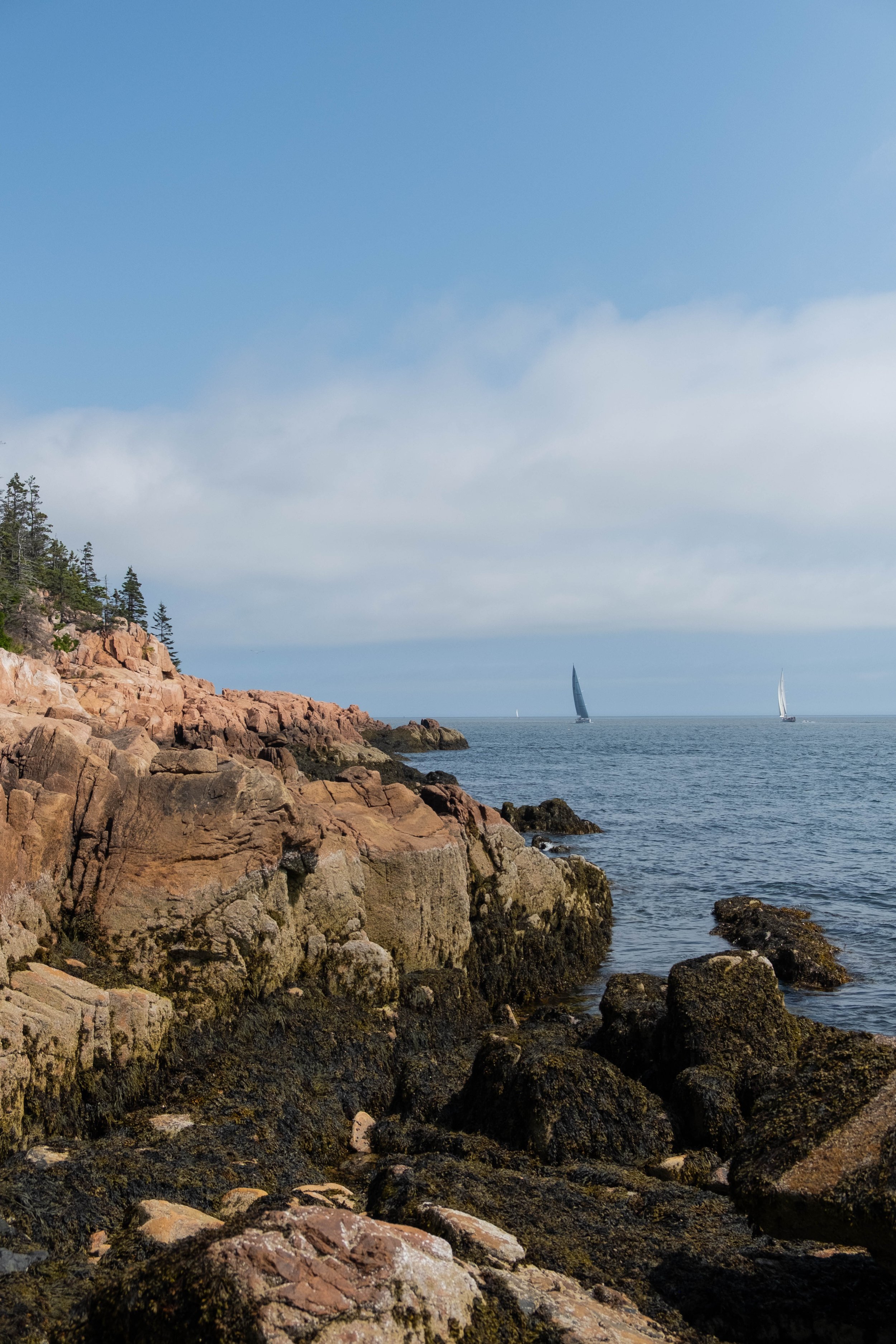
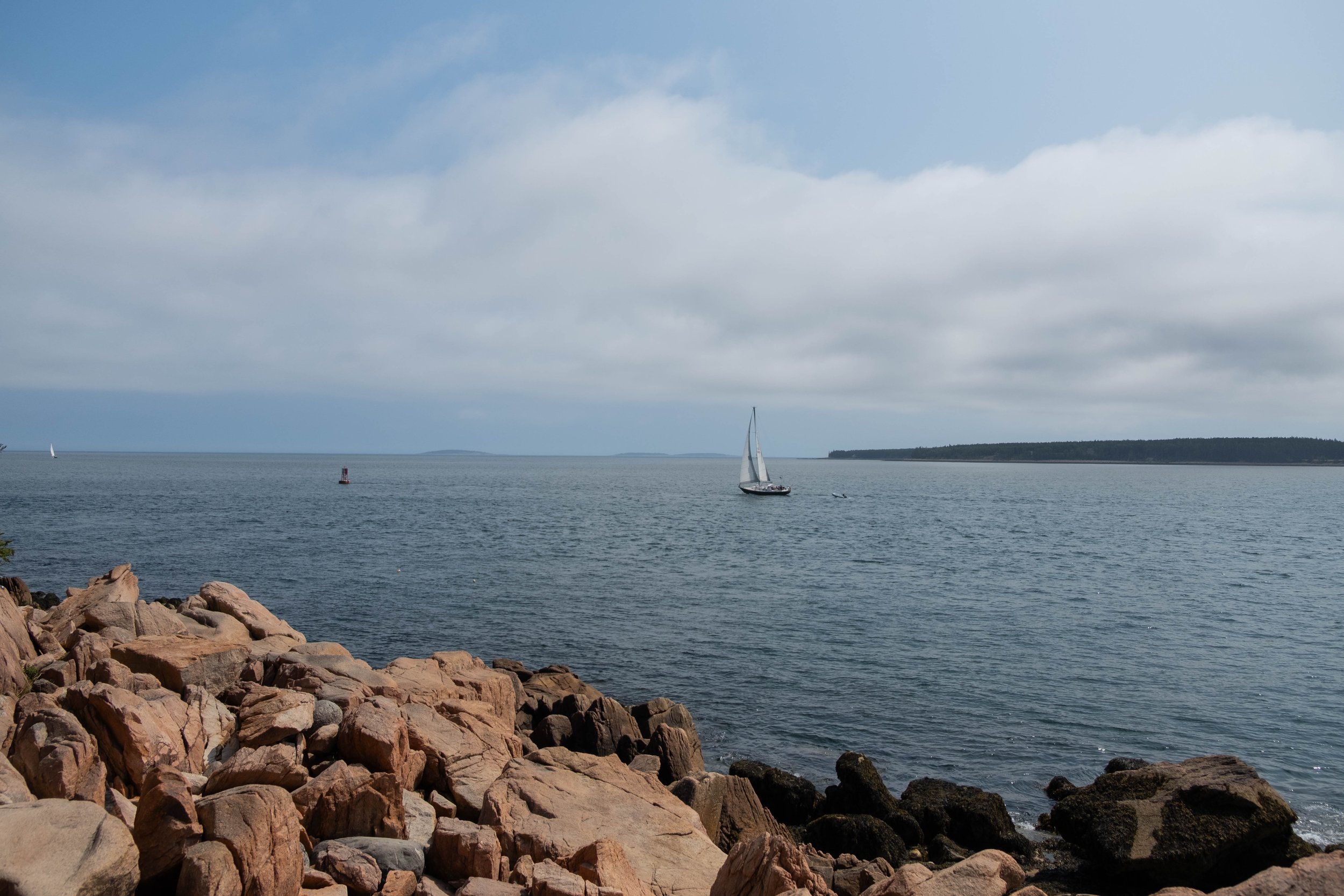
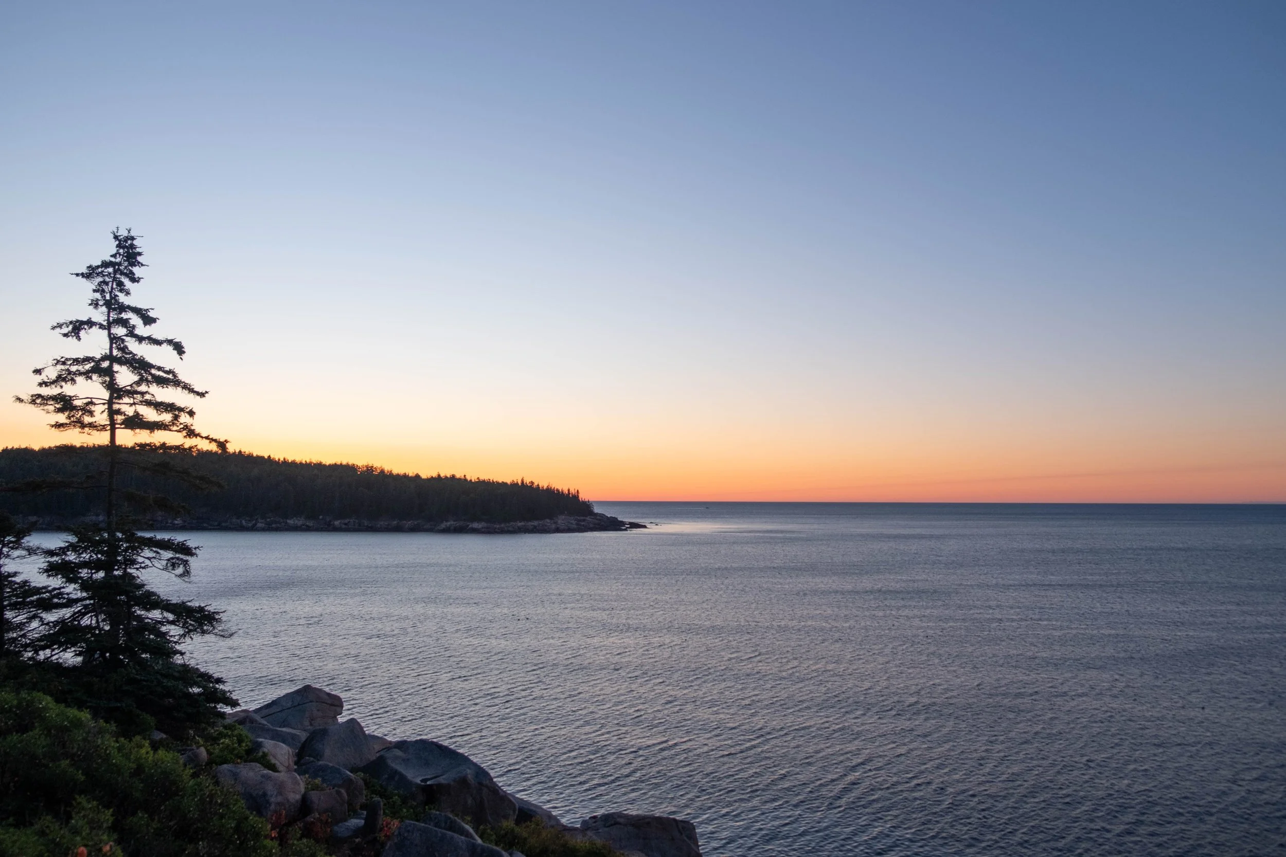
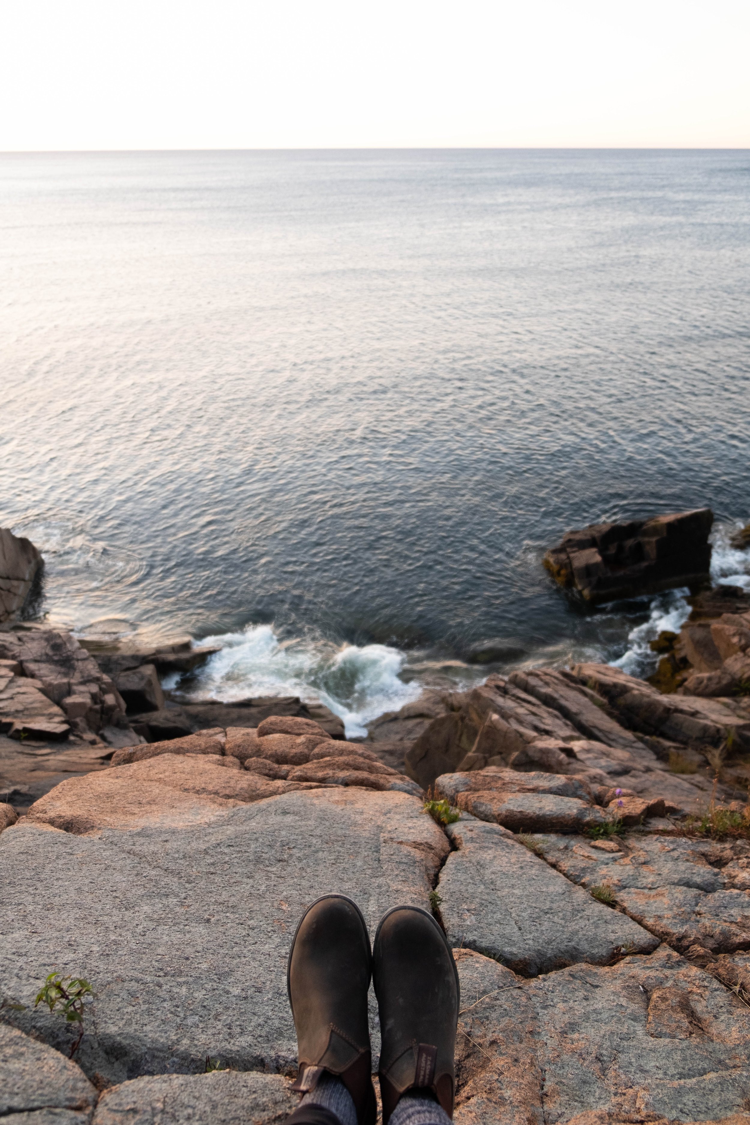
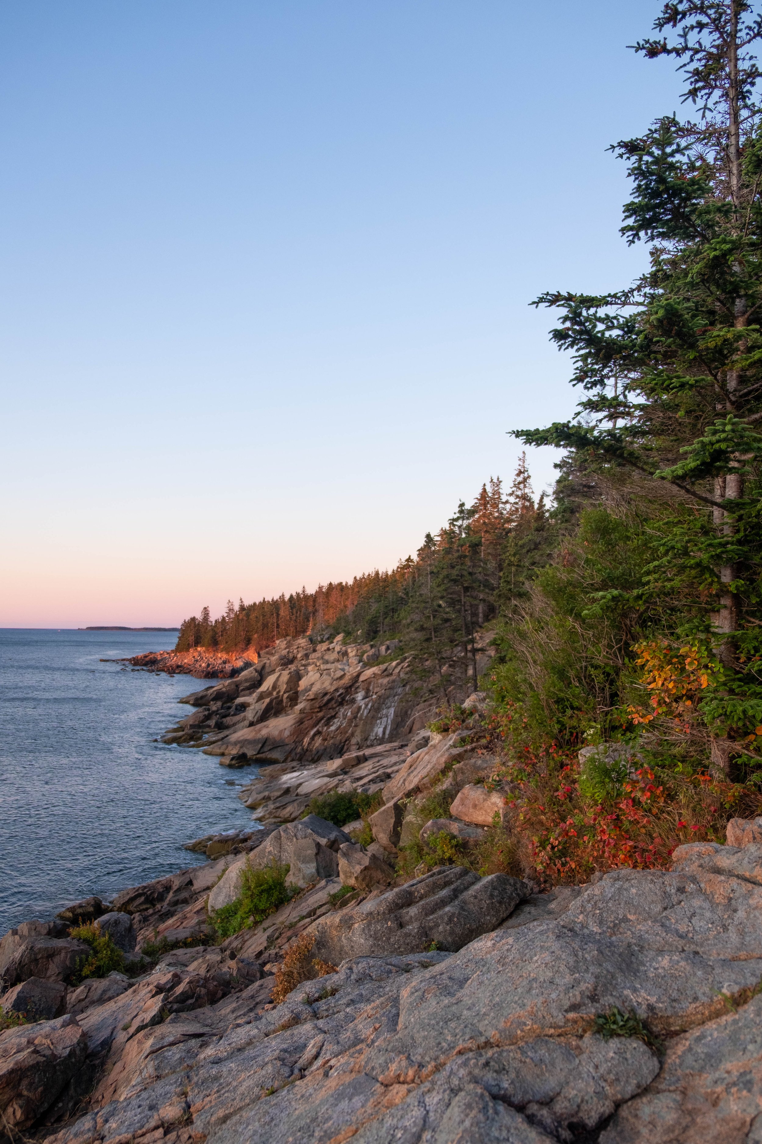
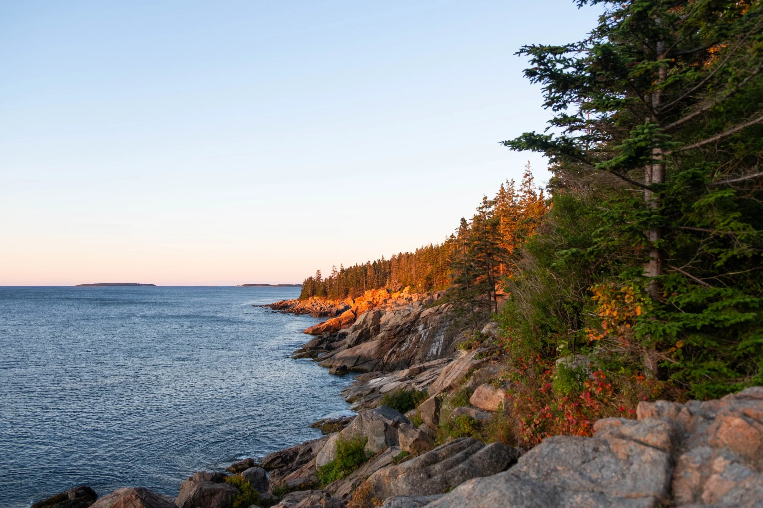
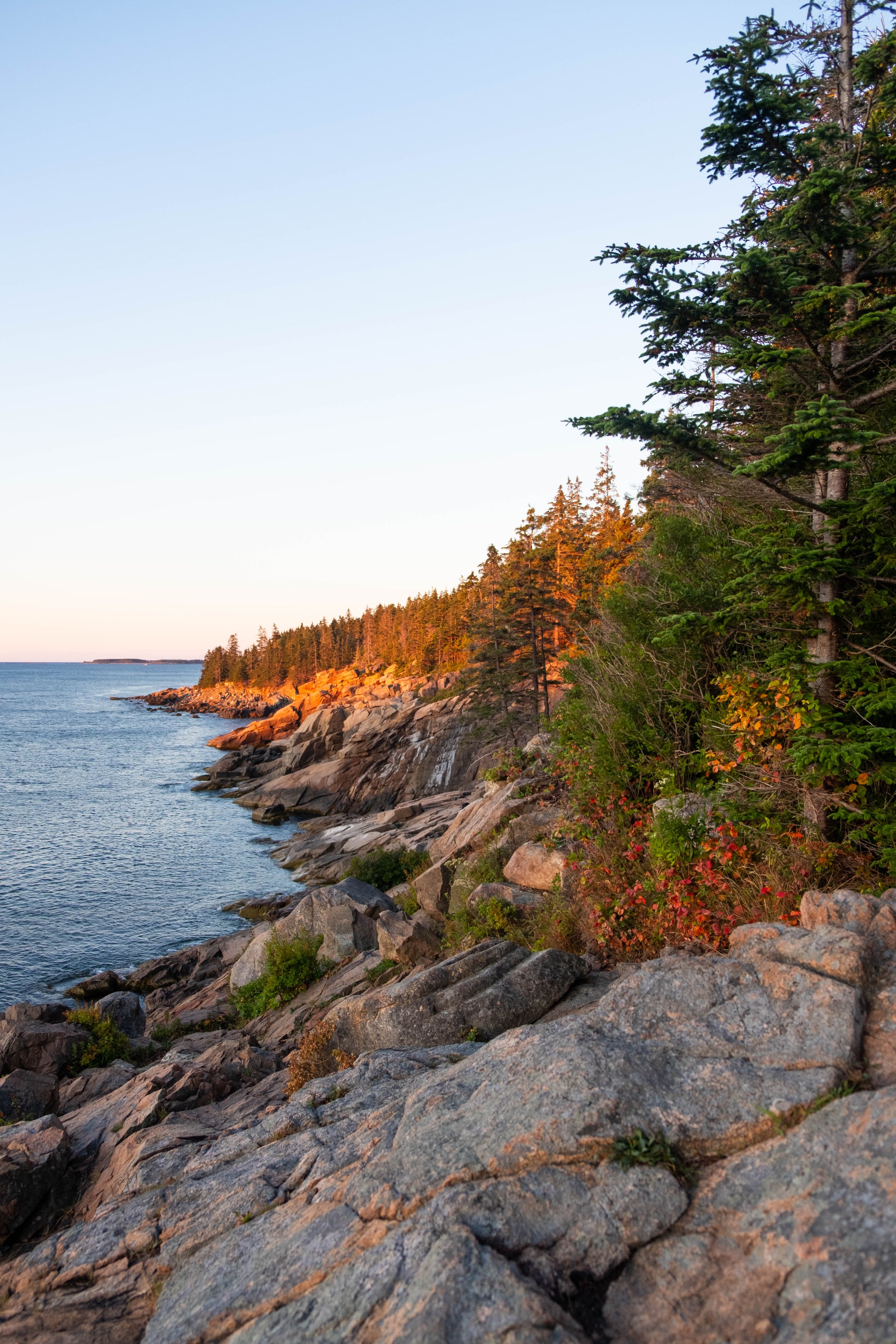
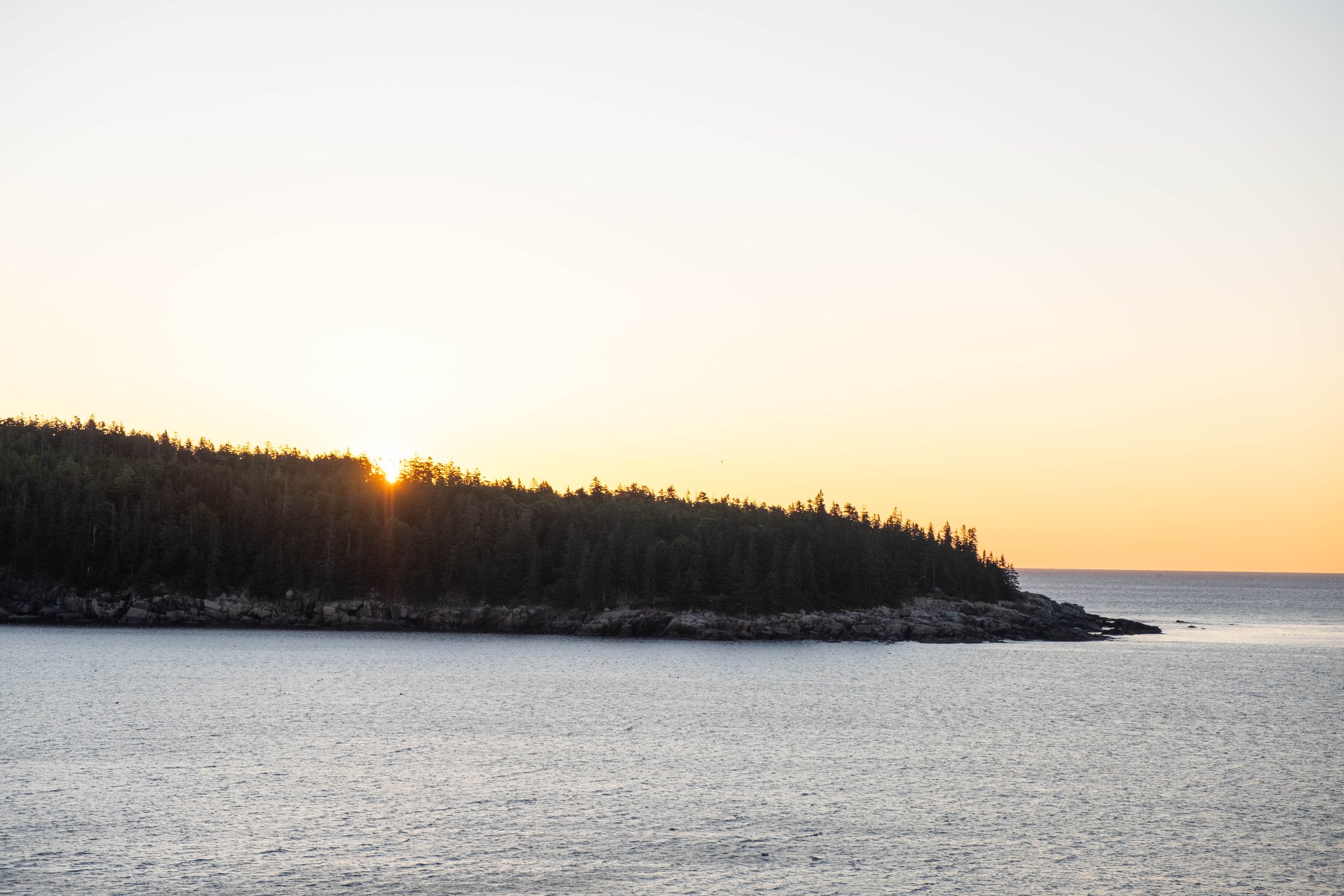
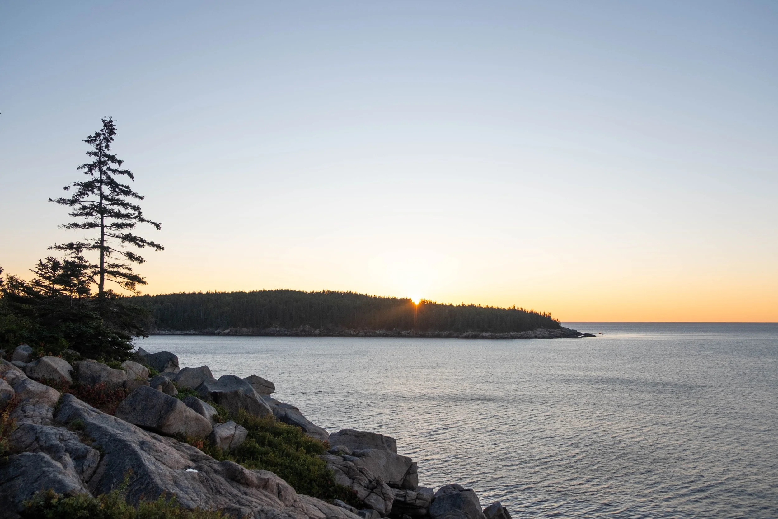
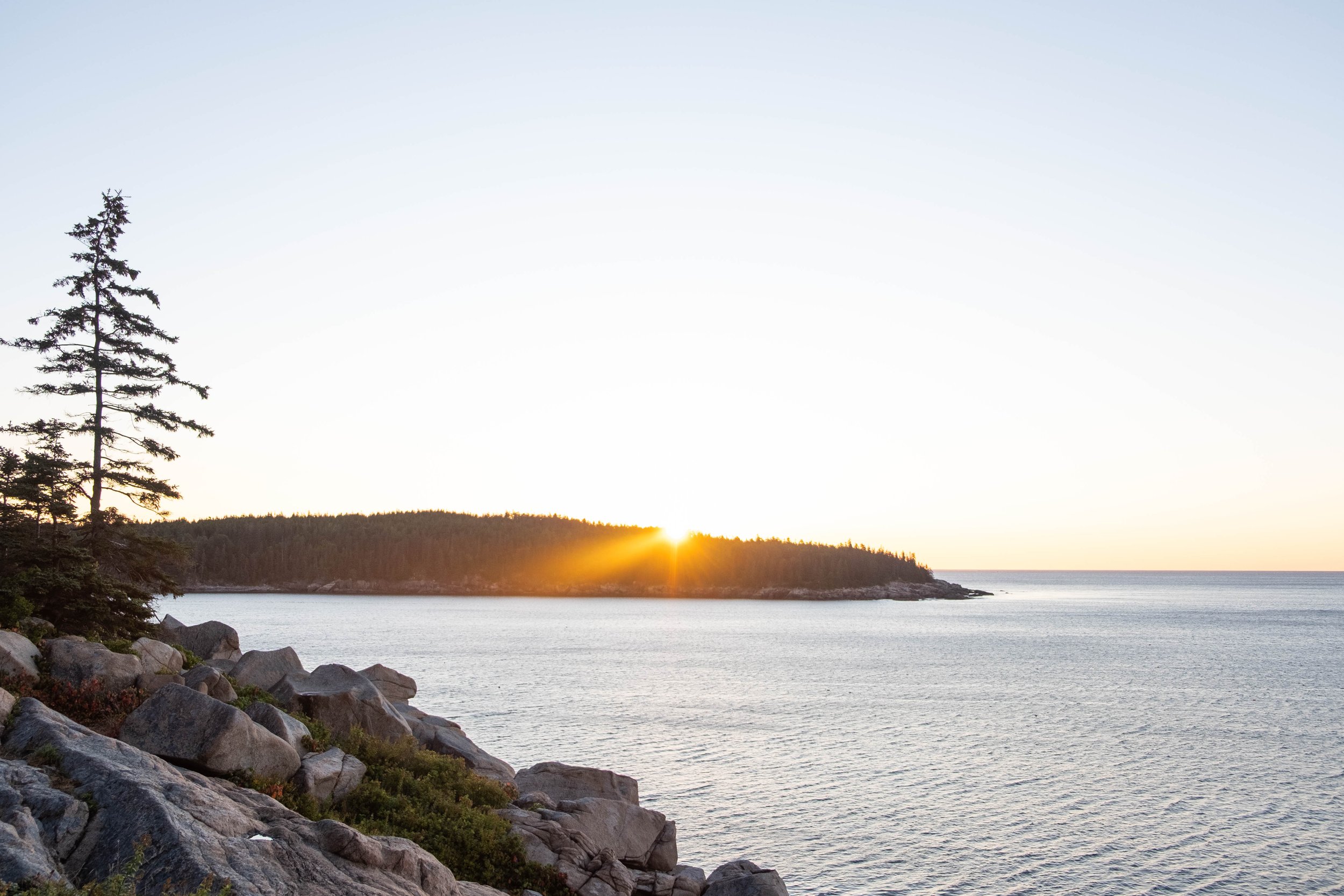
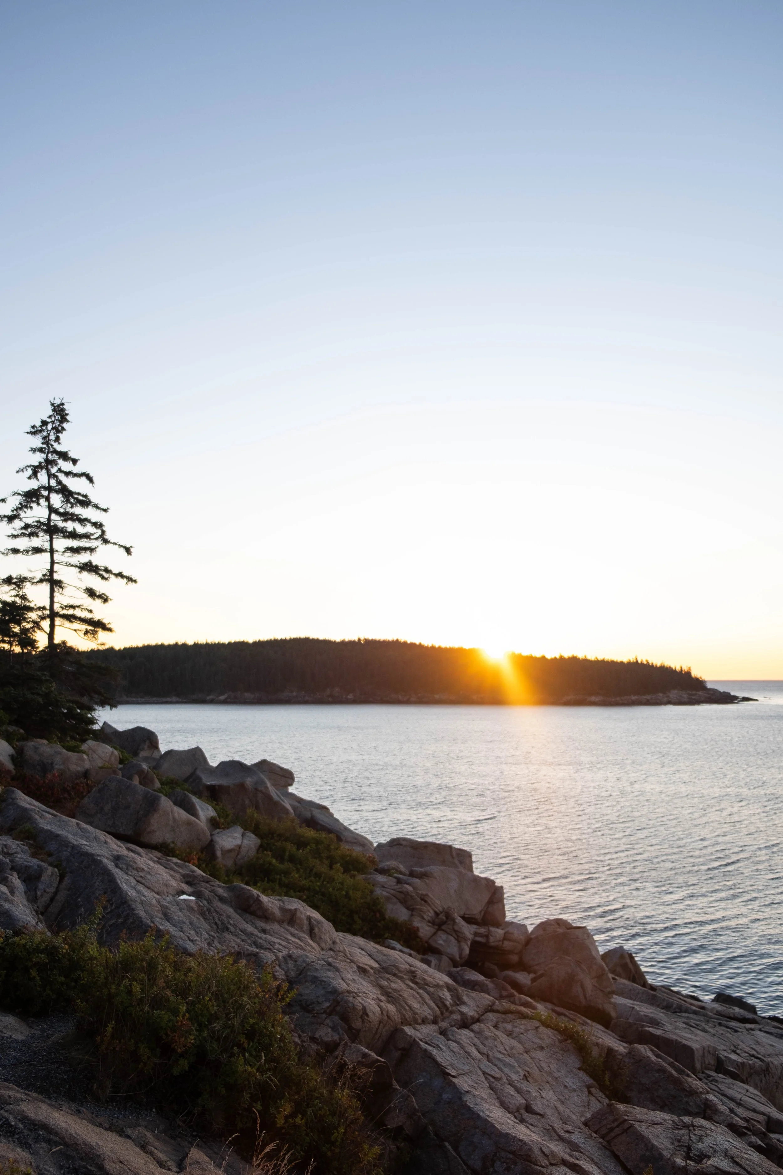
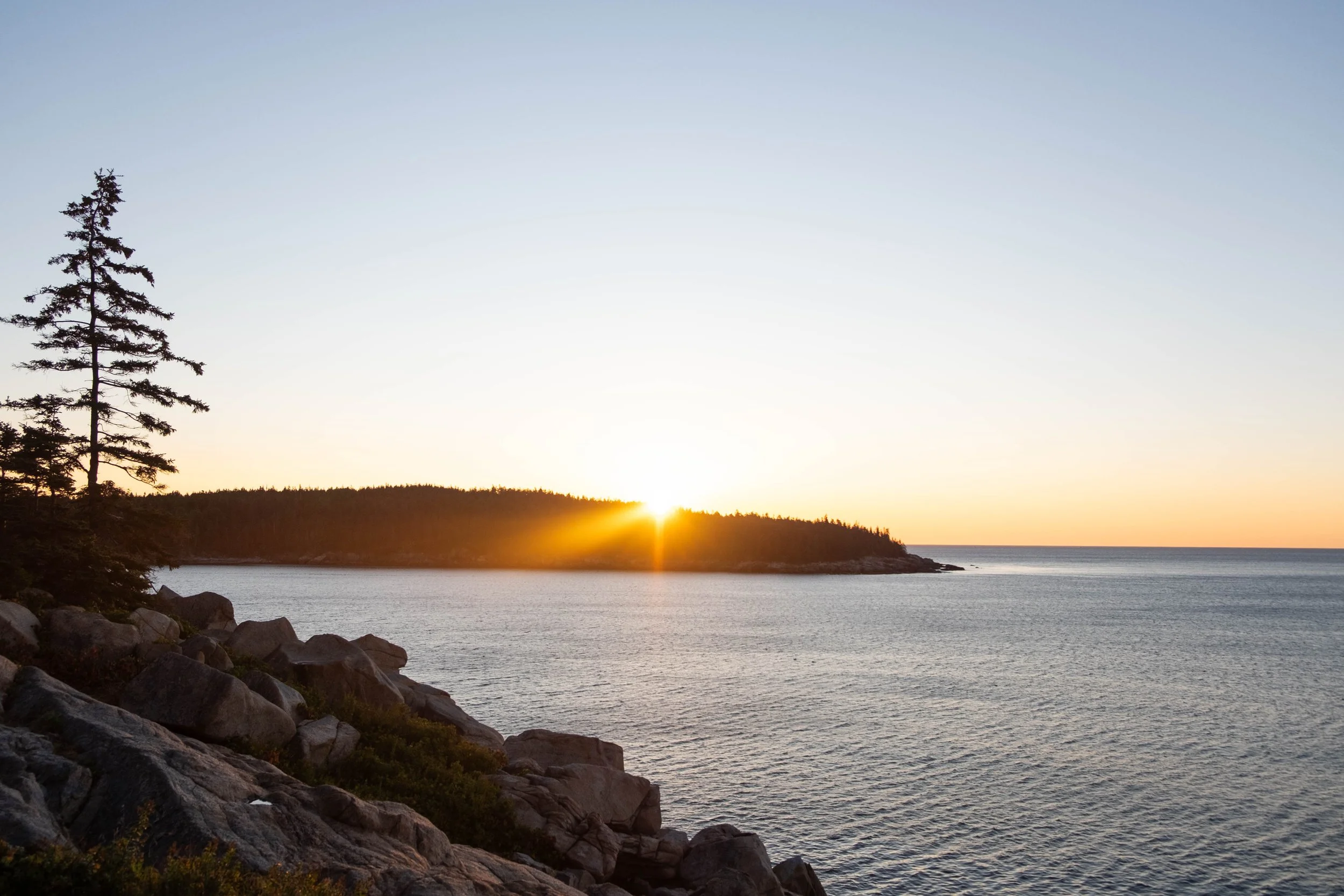
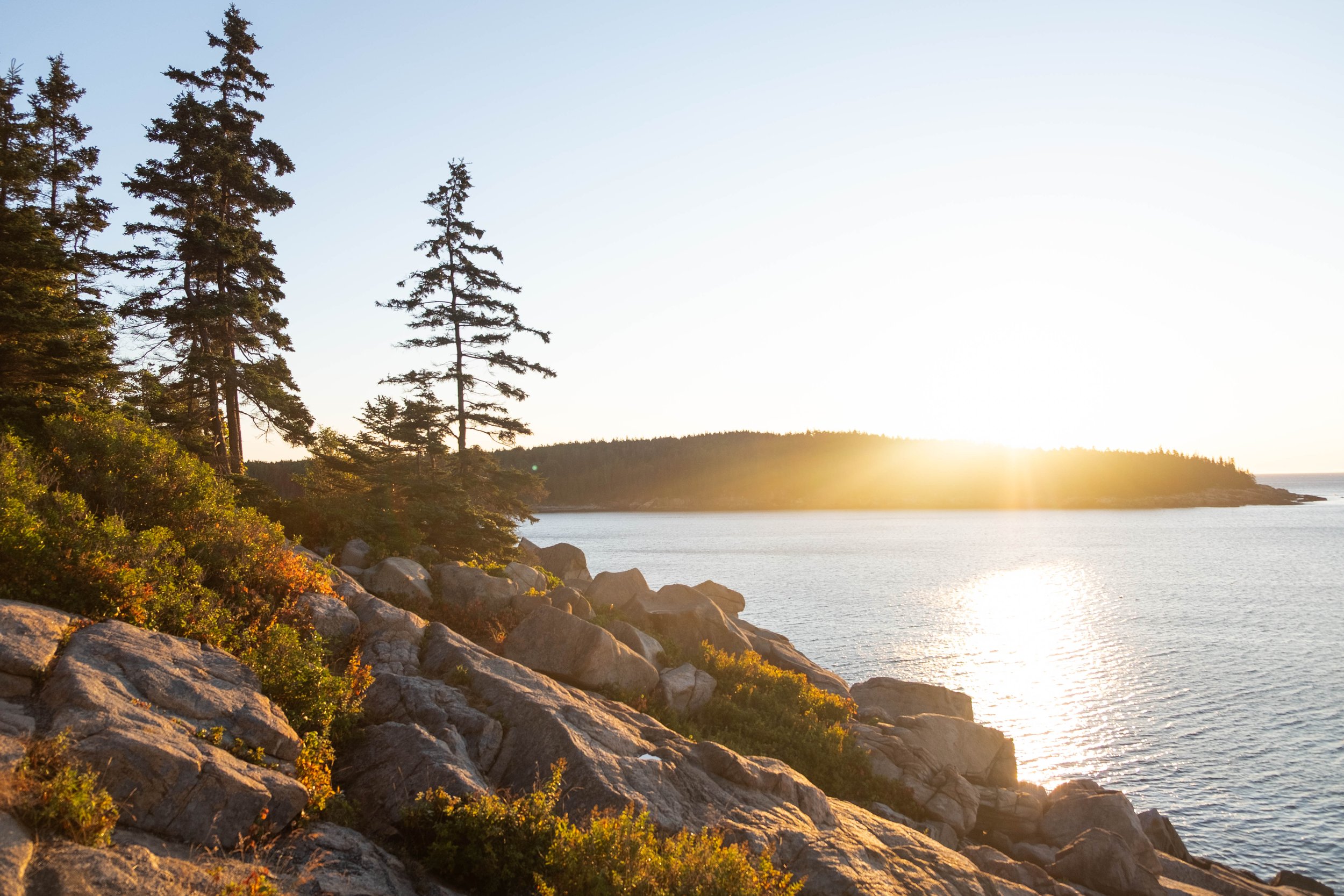
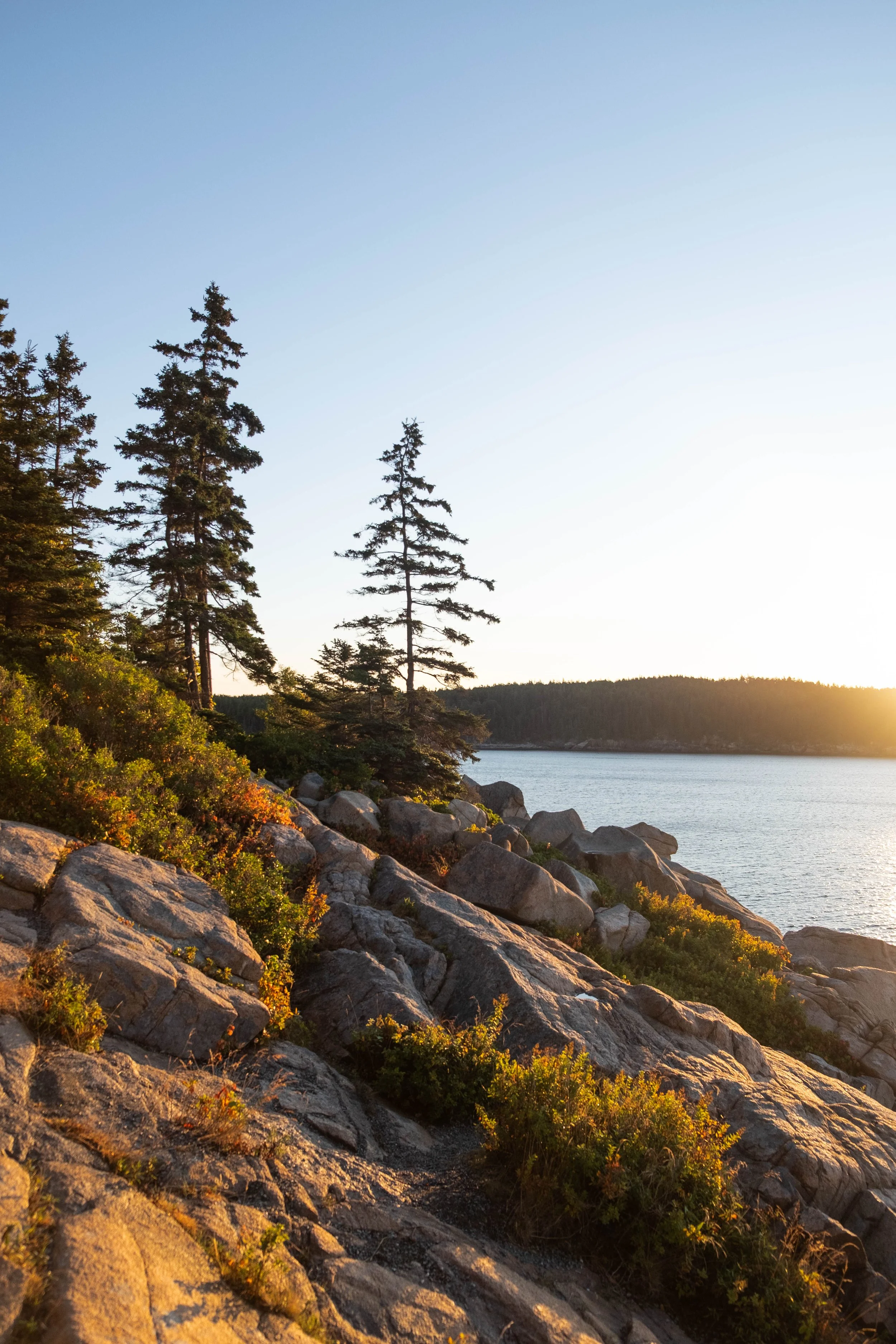
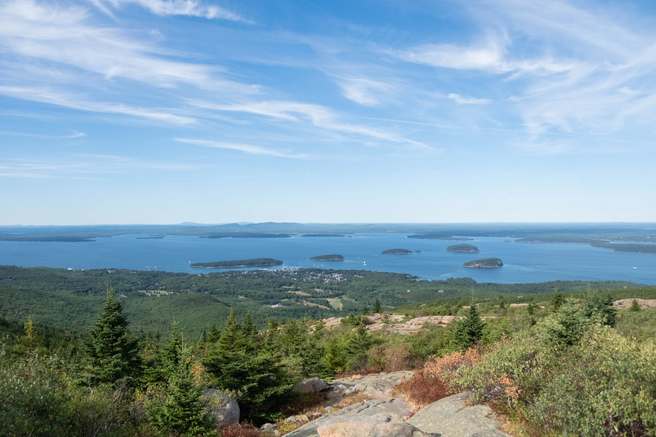
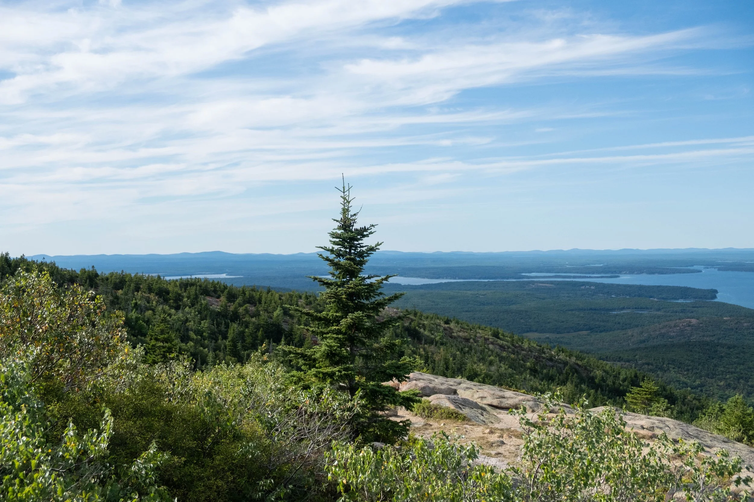
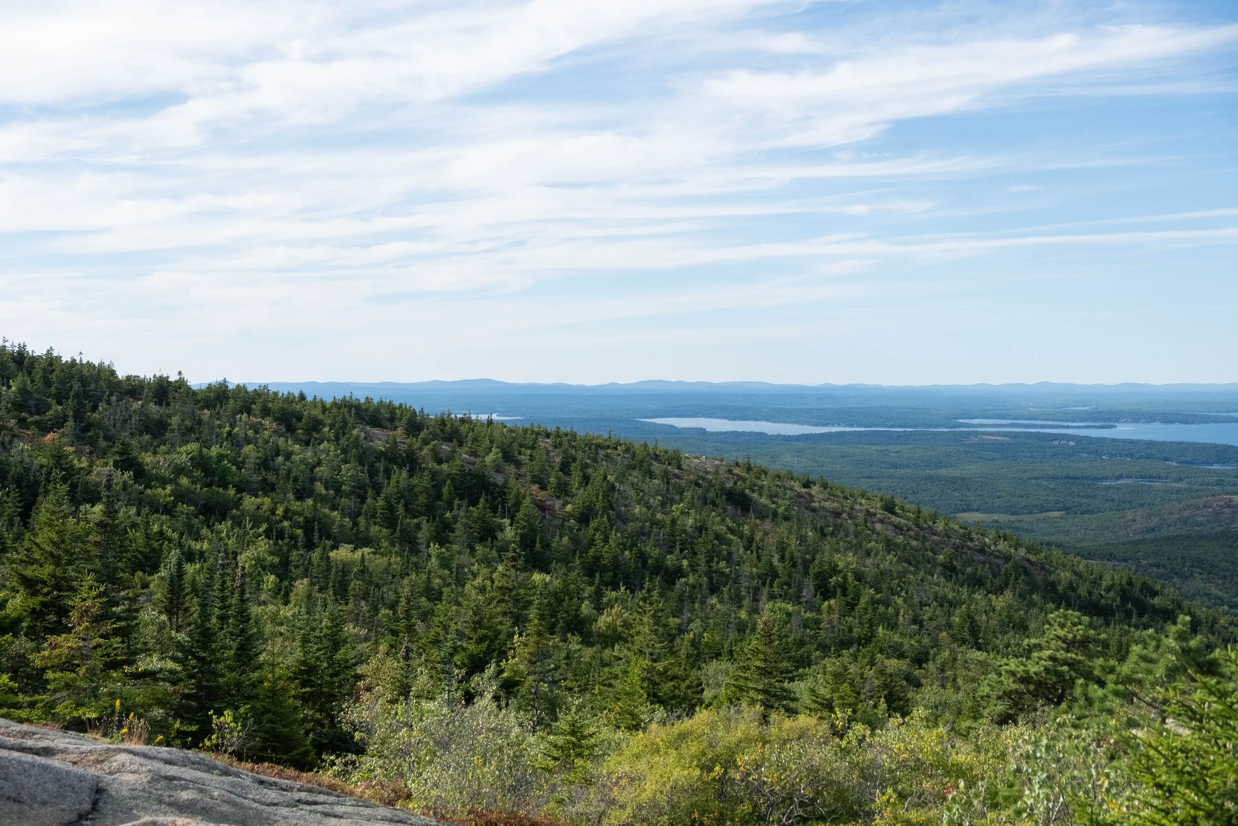
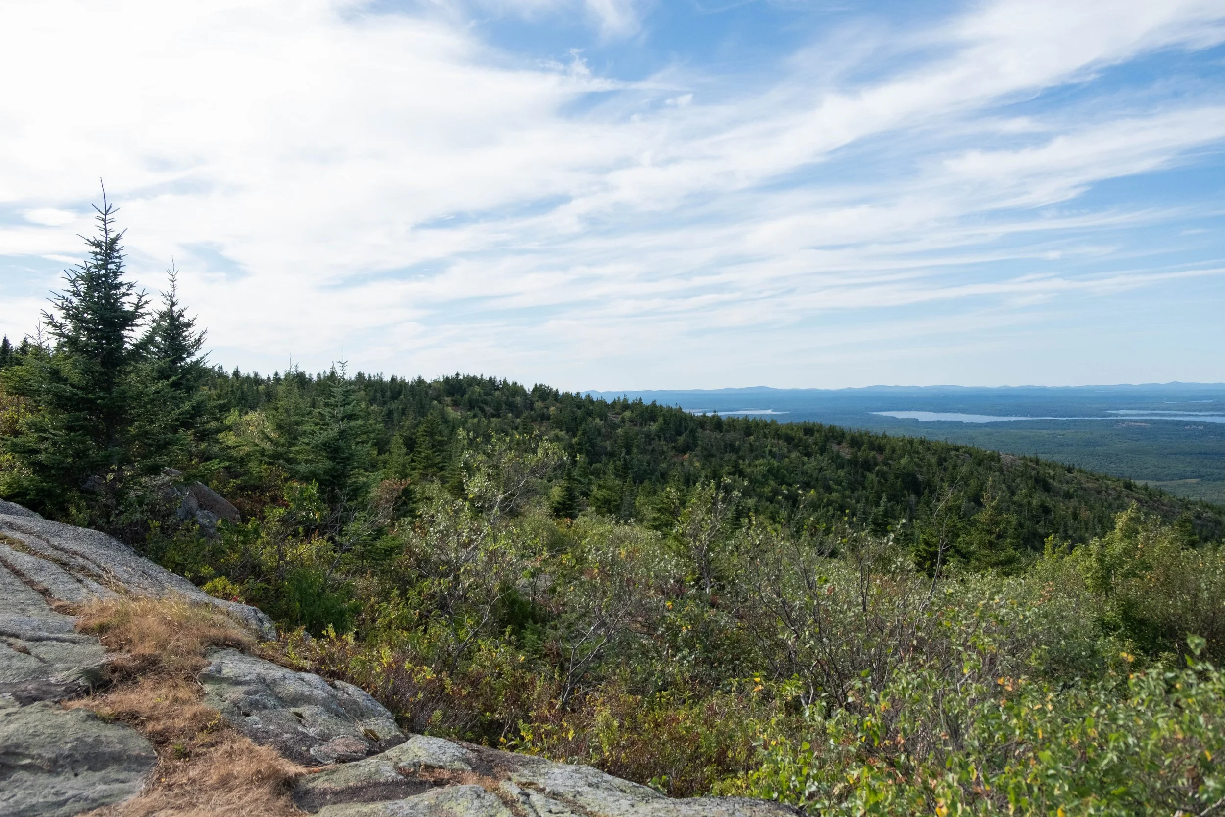
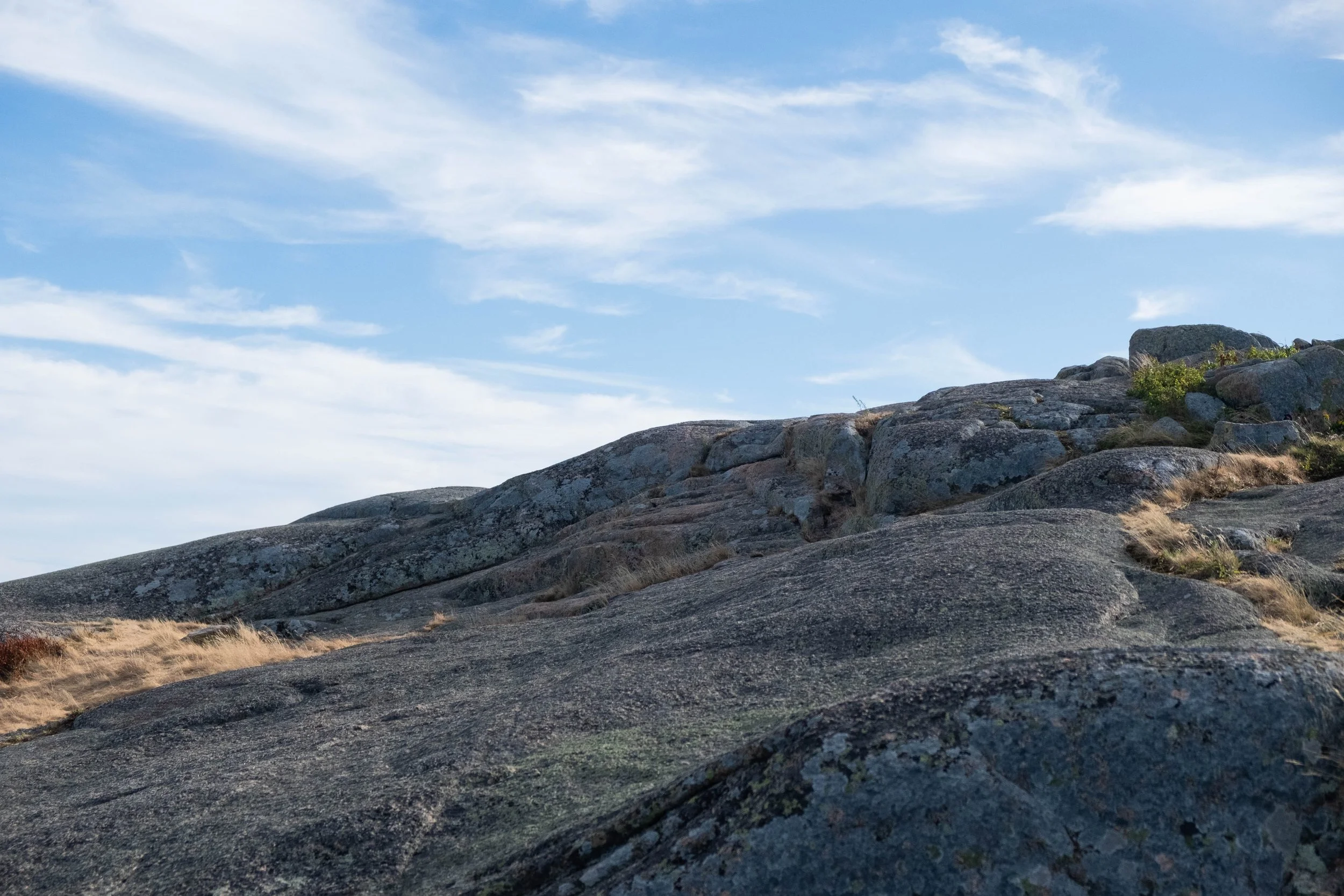
Acadia
Park 38 | August 2025
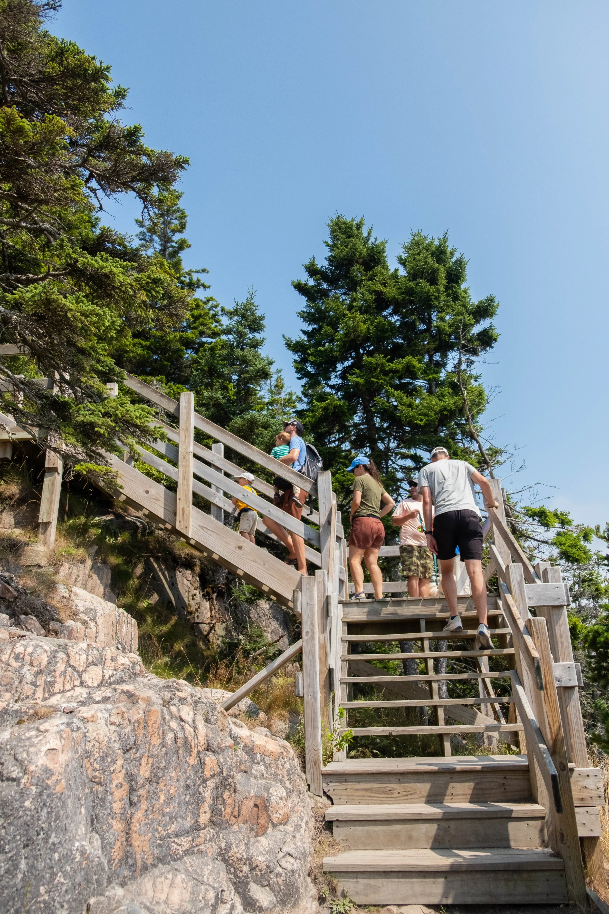
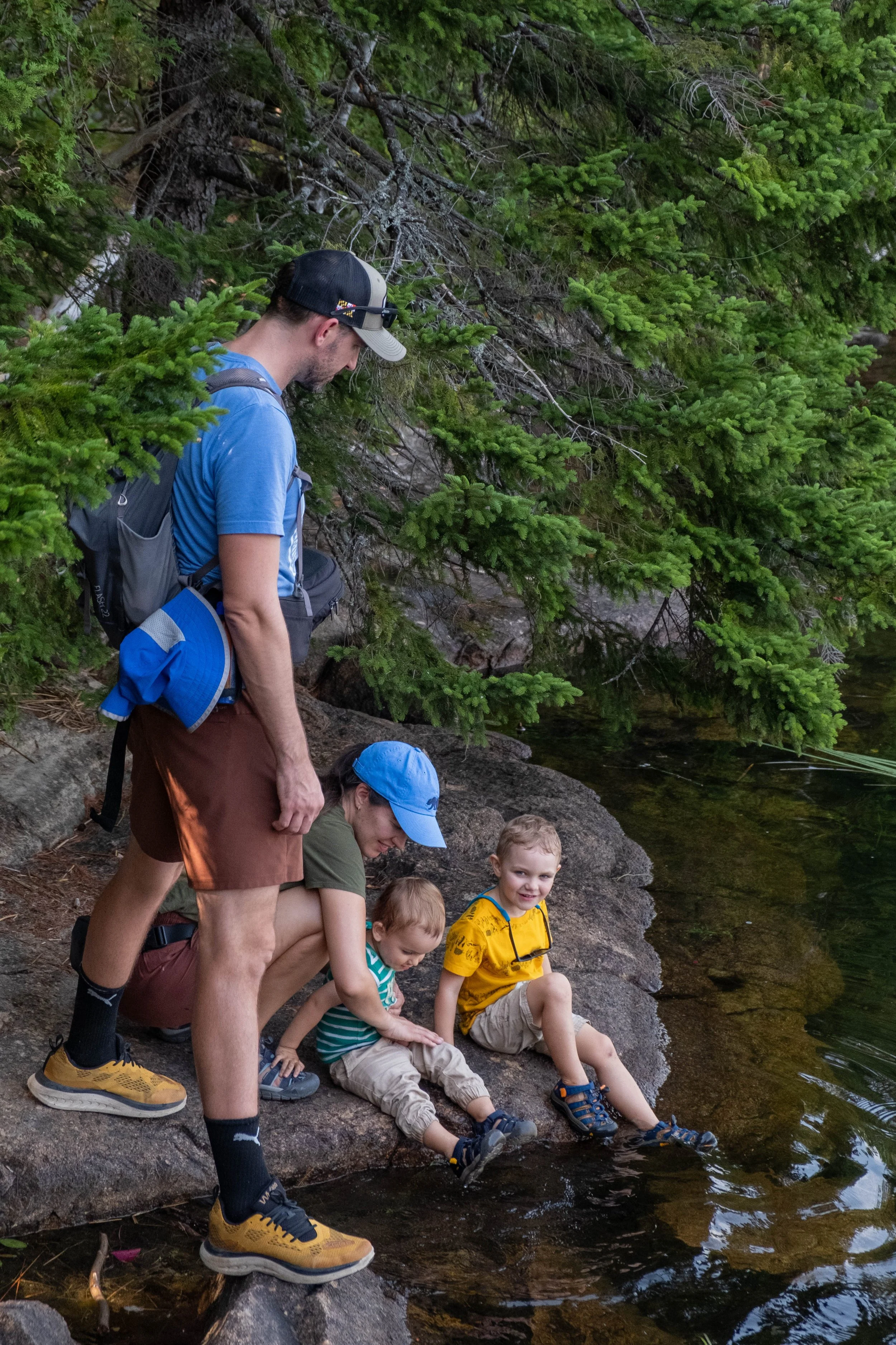
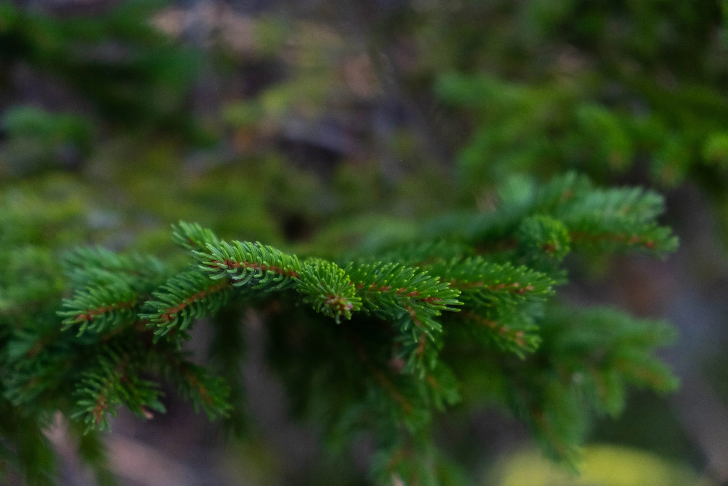
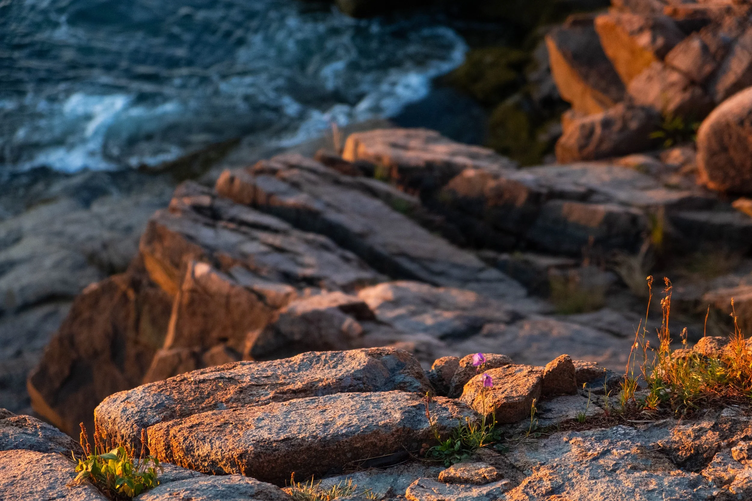
I’ve heard Maine described as an East Coast destination with a West Coast vibe. Acadia National Park epitomizes this for me, in all the best ways. As we slowly shifted from mid to late summertime, J & I spent a sunshine-soaked long weekend spent exploring Acadia with dear friends and their two little ones.
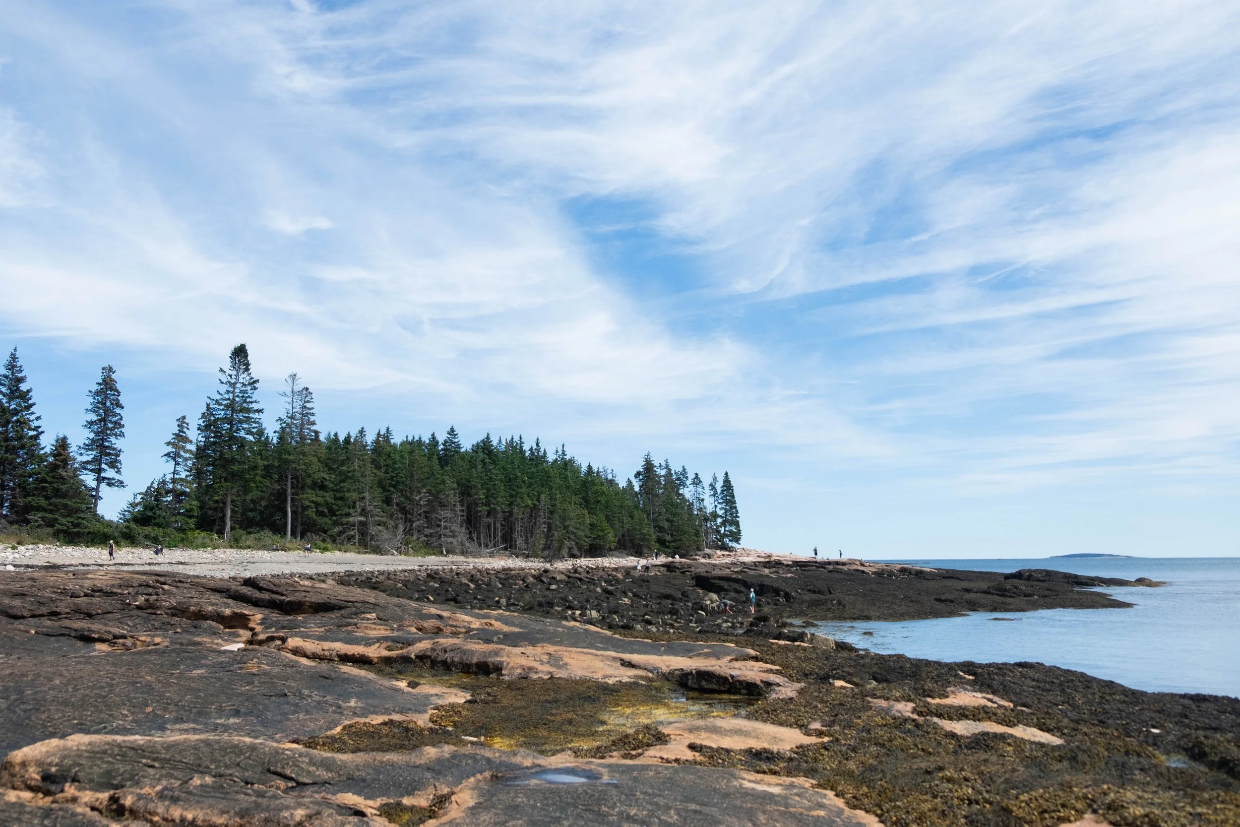
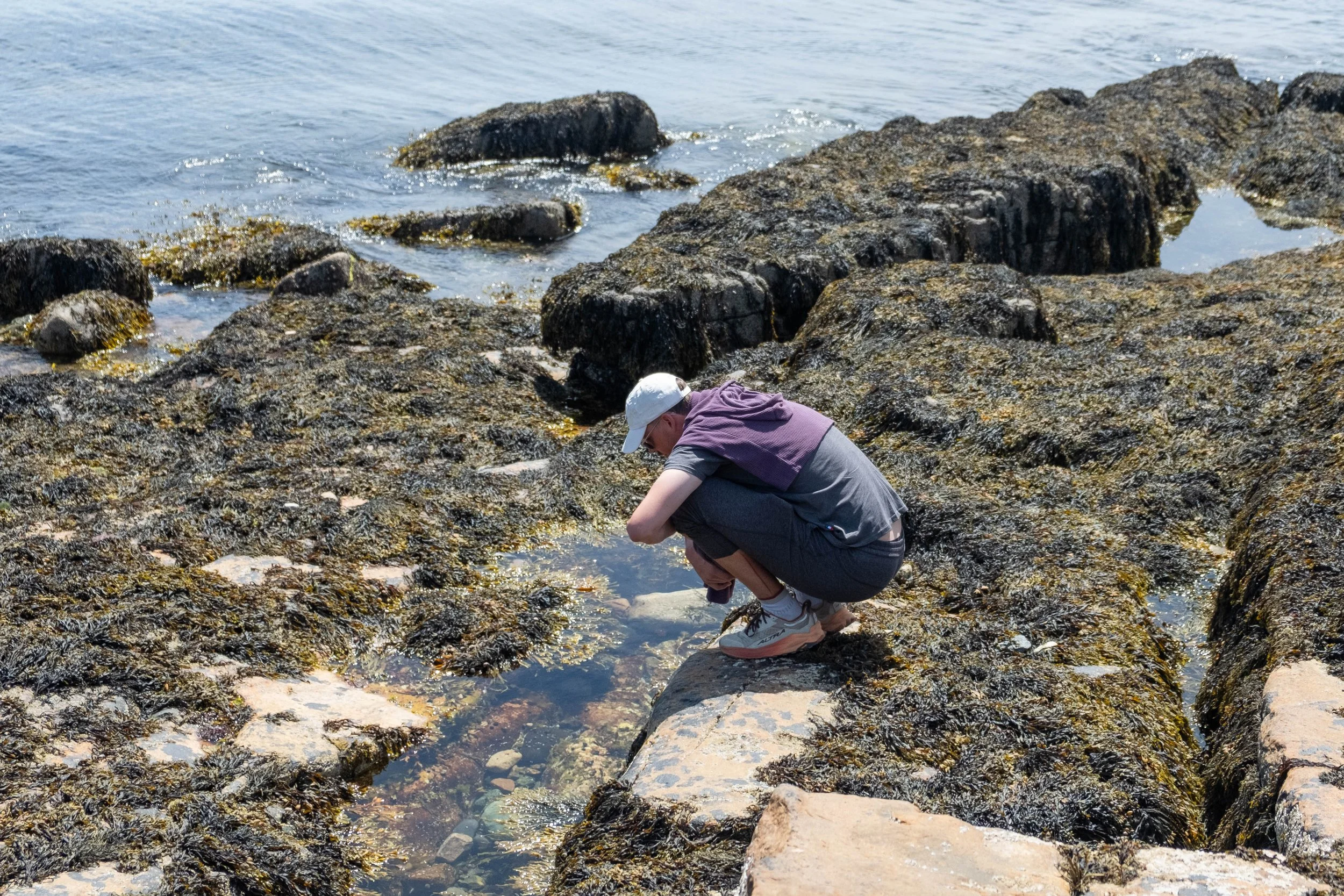
We took a late night flight to Boston, spent the night in a hotel by the airport, then woke up and began the drive northeast toward Acadia. We met up with our friends at the LL Bean Flagship store in Freeport (obligatory flannels and slippers were purchased) and then enjoyed three nights in Blackwoods Campground. We saw the Milky Way and shooting stars over the Atlantic. We went hiking and tide-pooling. We drank scotch out of camping mugs by a late night fire. We accompanied the boys on Diver Ed, a family-friendly boat ride where a scuba diver brings sea stars, crabs, sea cucumbers, and lobsters up to the surface for children to see and touch before releasing them back to their ocean home, which made both of our ocean and nature-loving hearts very happy. We ate lobster in Bar Harbor and clam chowder at Jordan Pond House and we were the best kind of tired when it was time to leave.
I first visited Acadia in 2017 with my sister when we were celebrating graduating from grad school (me) and high school (her). It left an indelible mark on me then and that only felt more solidified after this second trip. Grateful for the chance to share it with J and others we love.
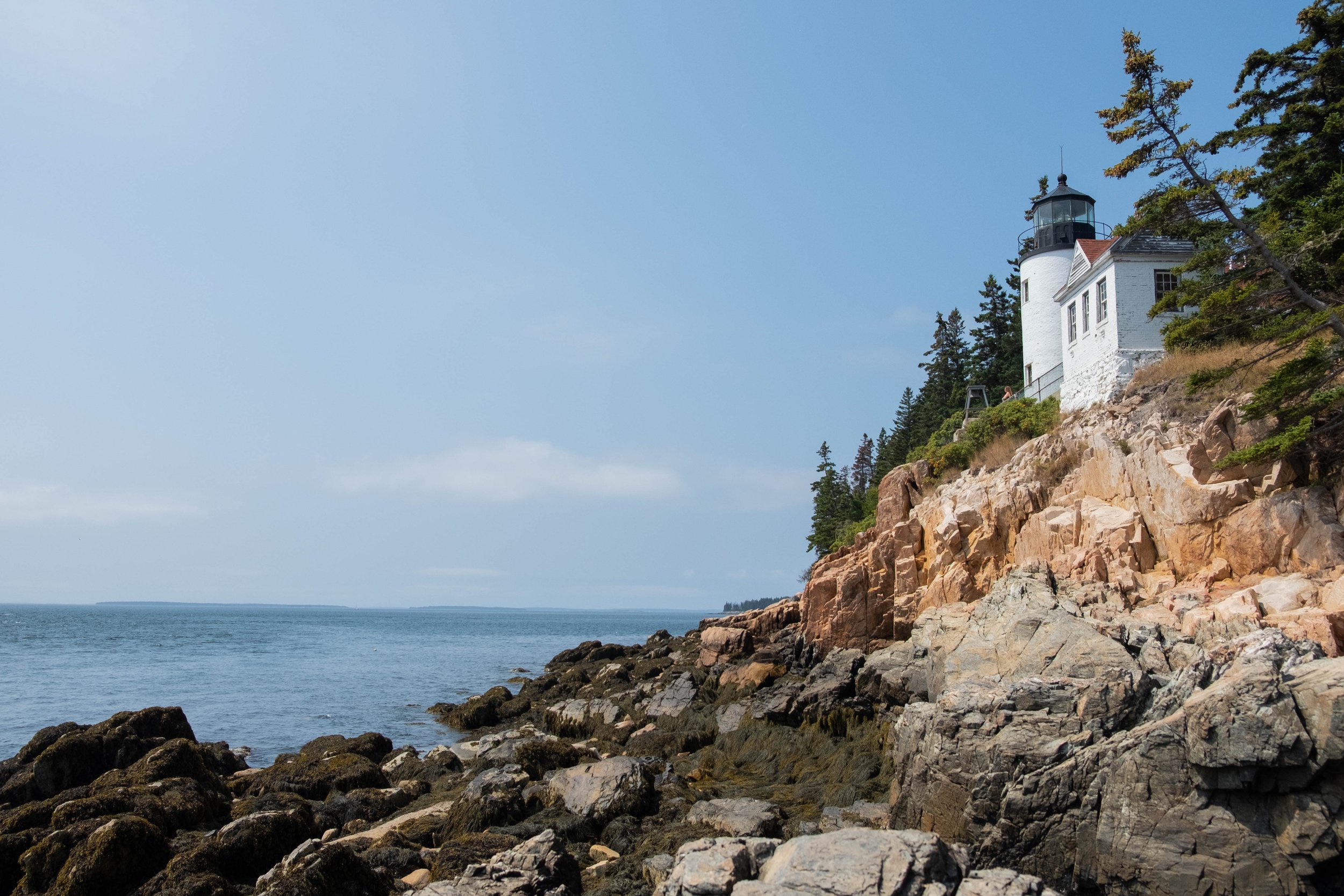
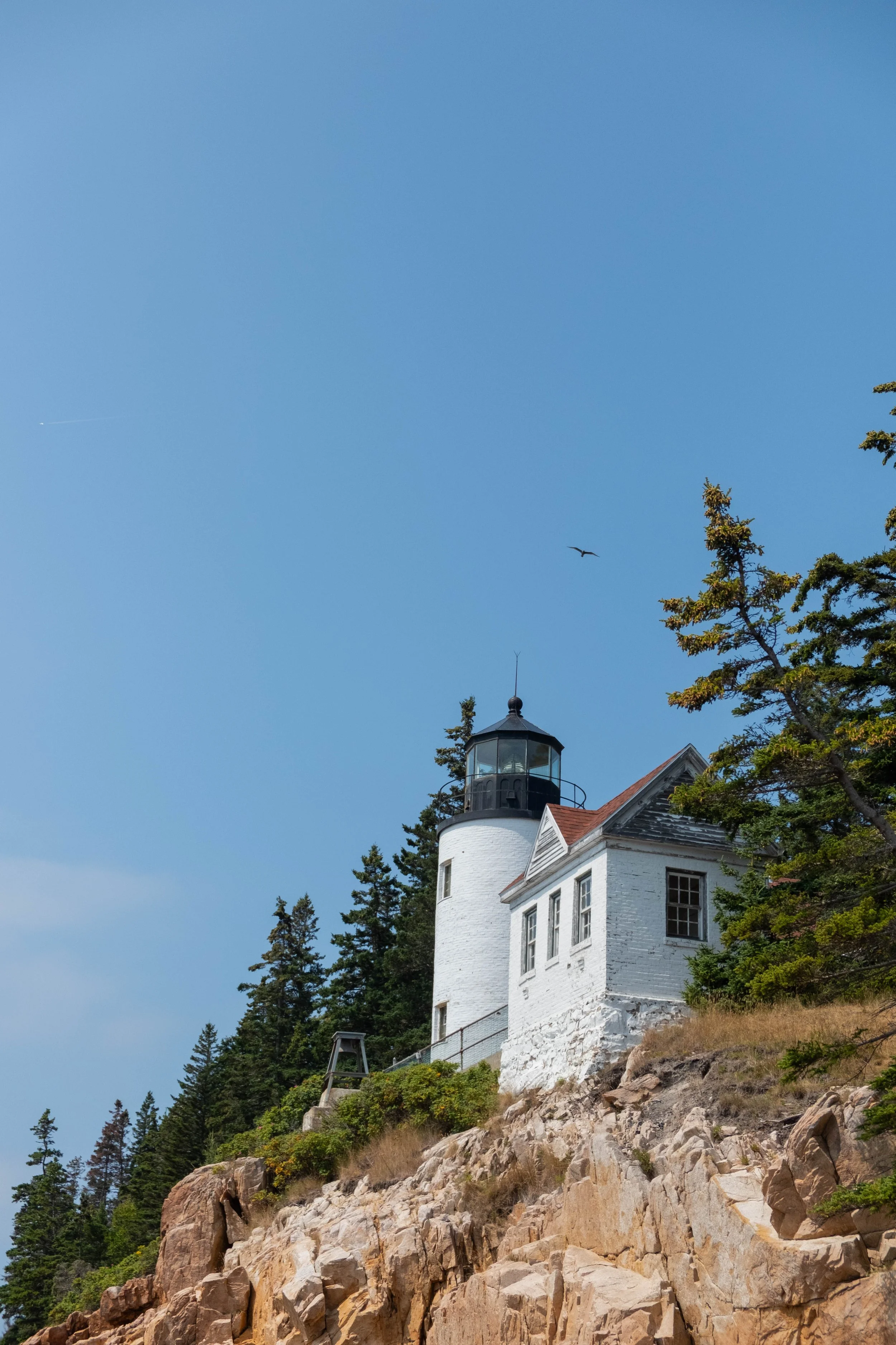
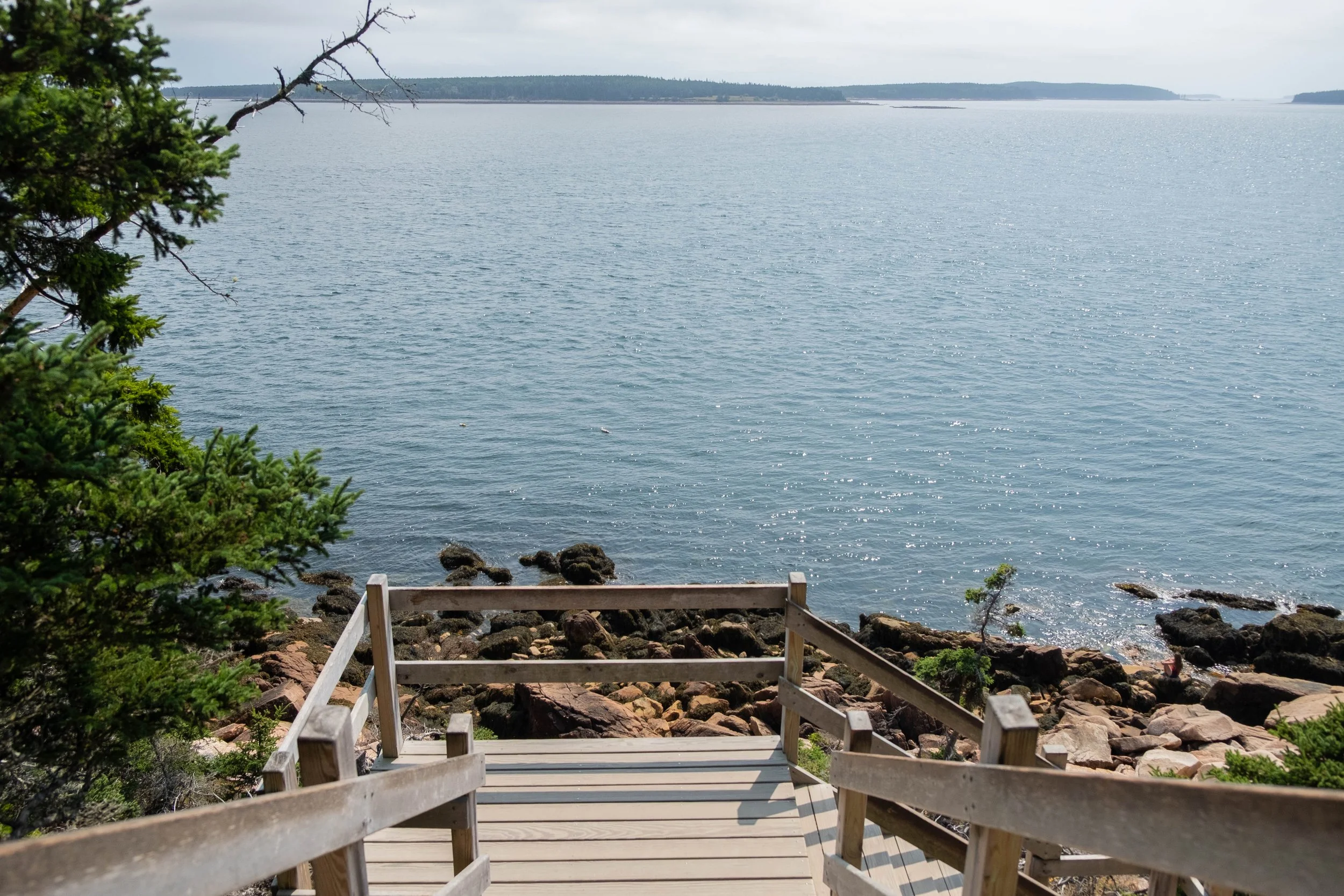
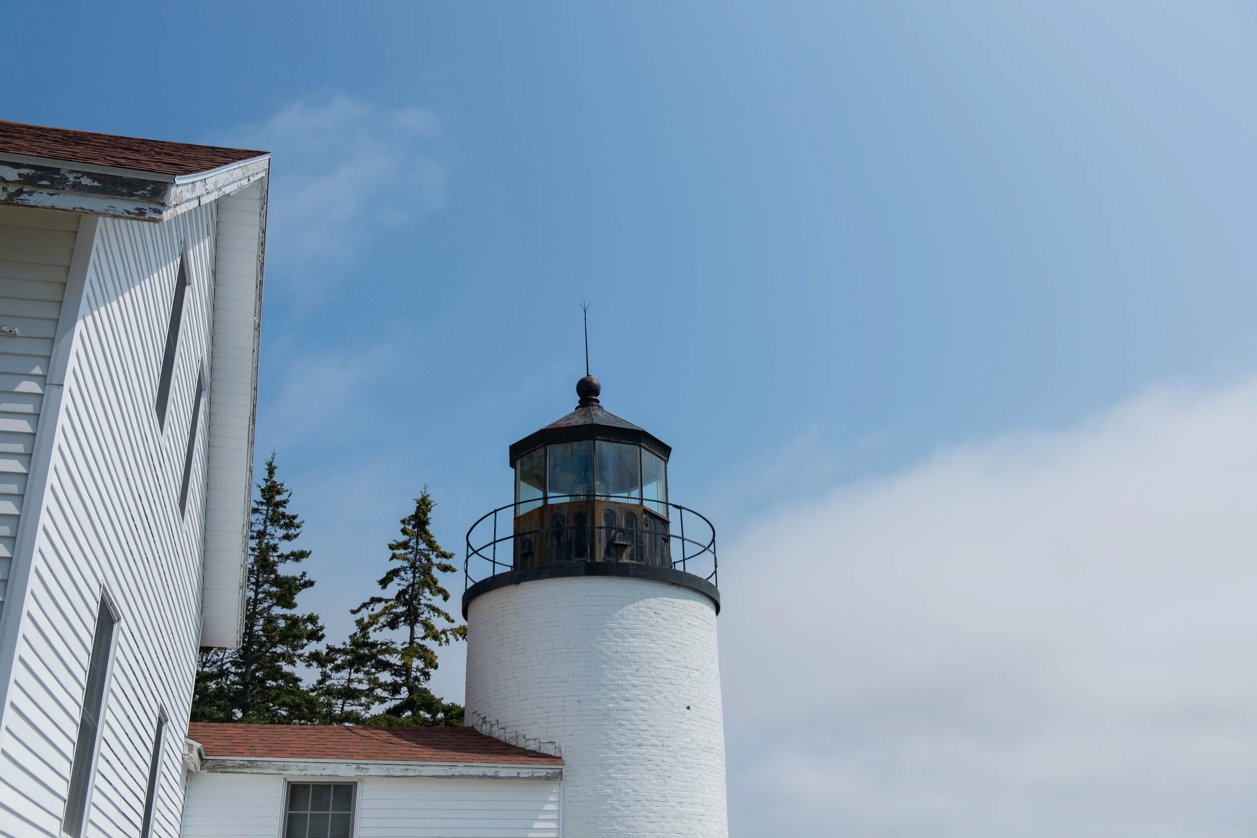
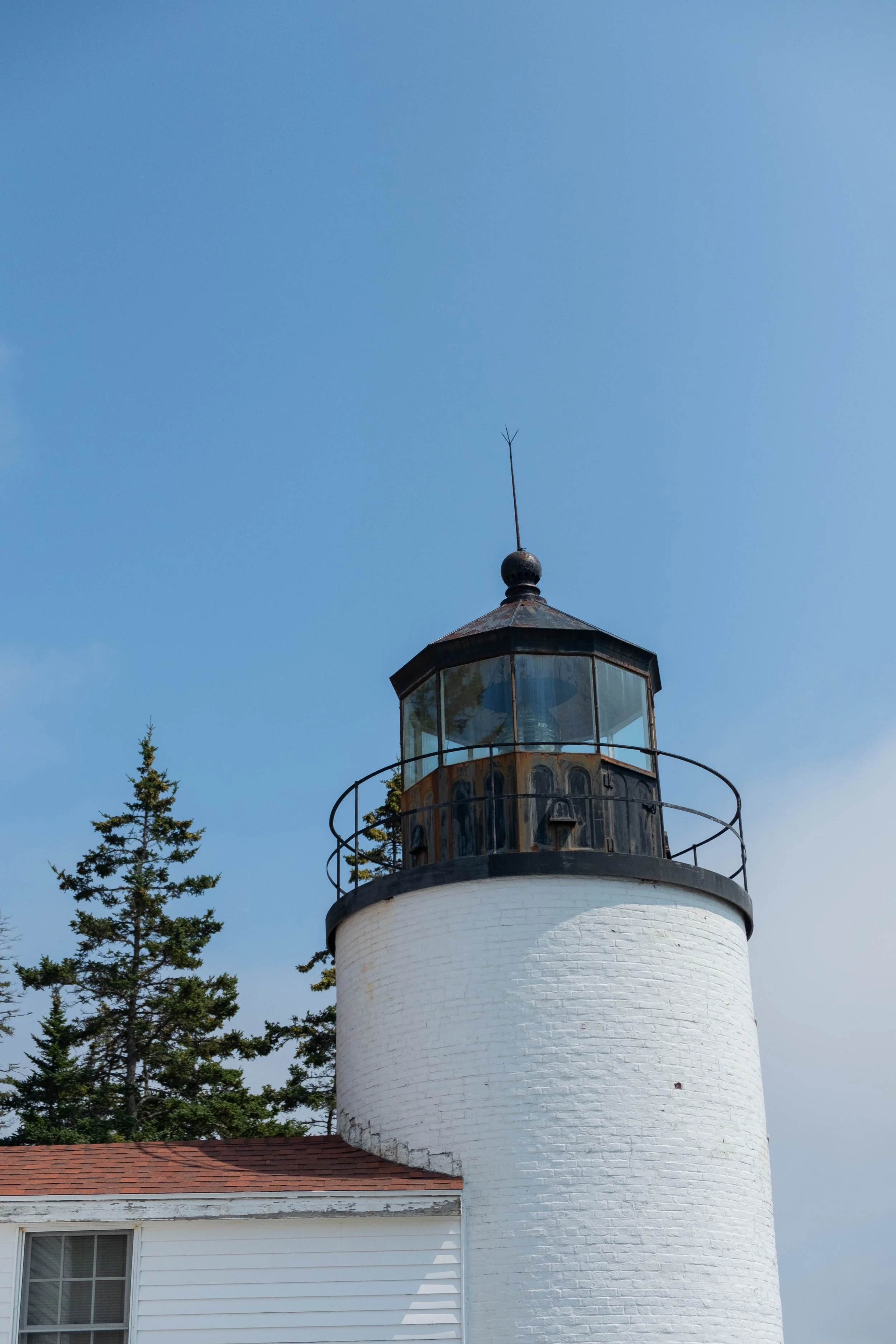
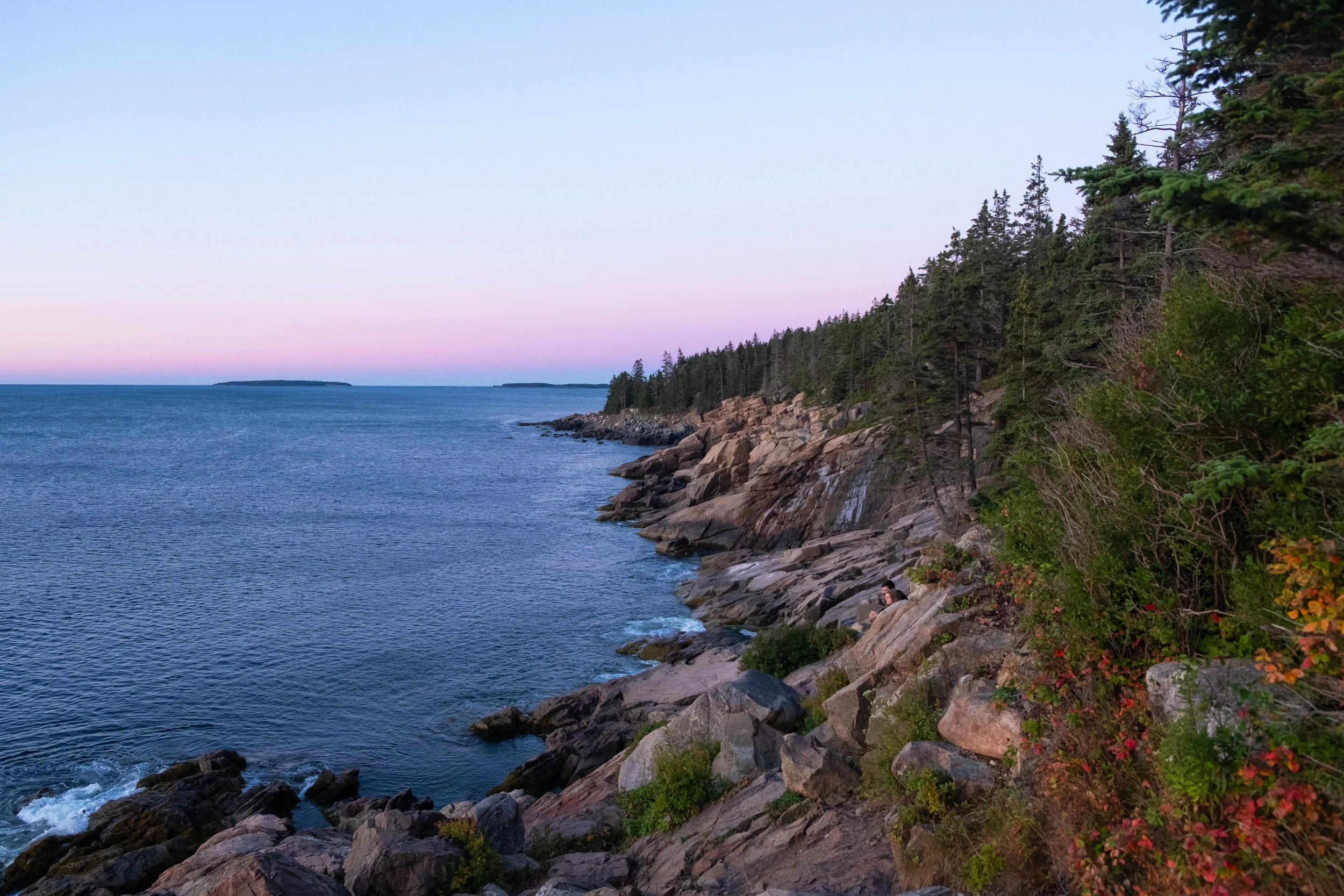
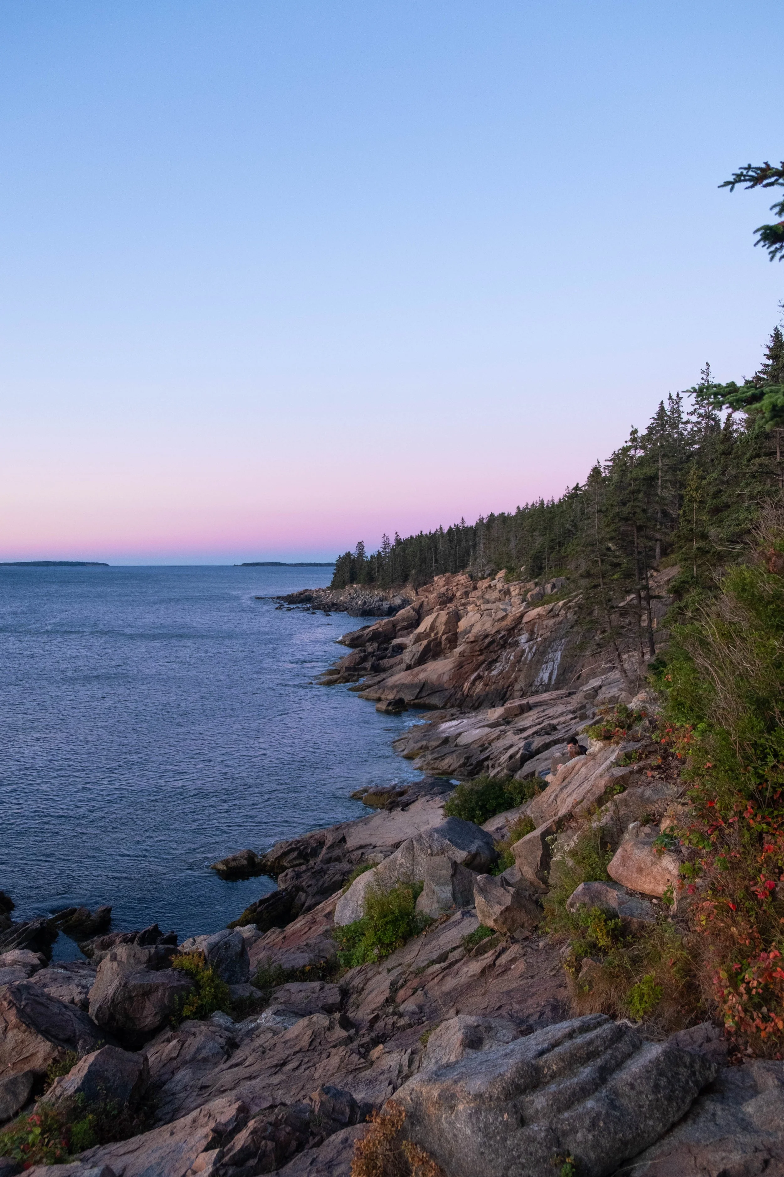
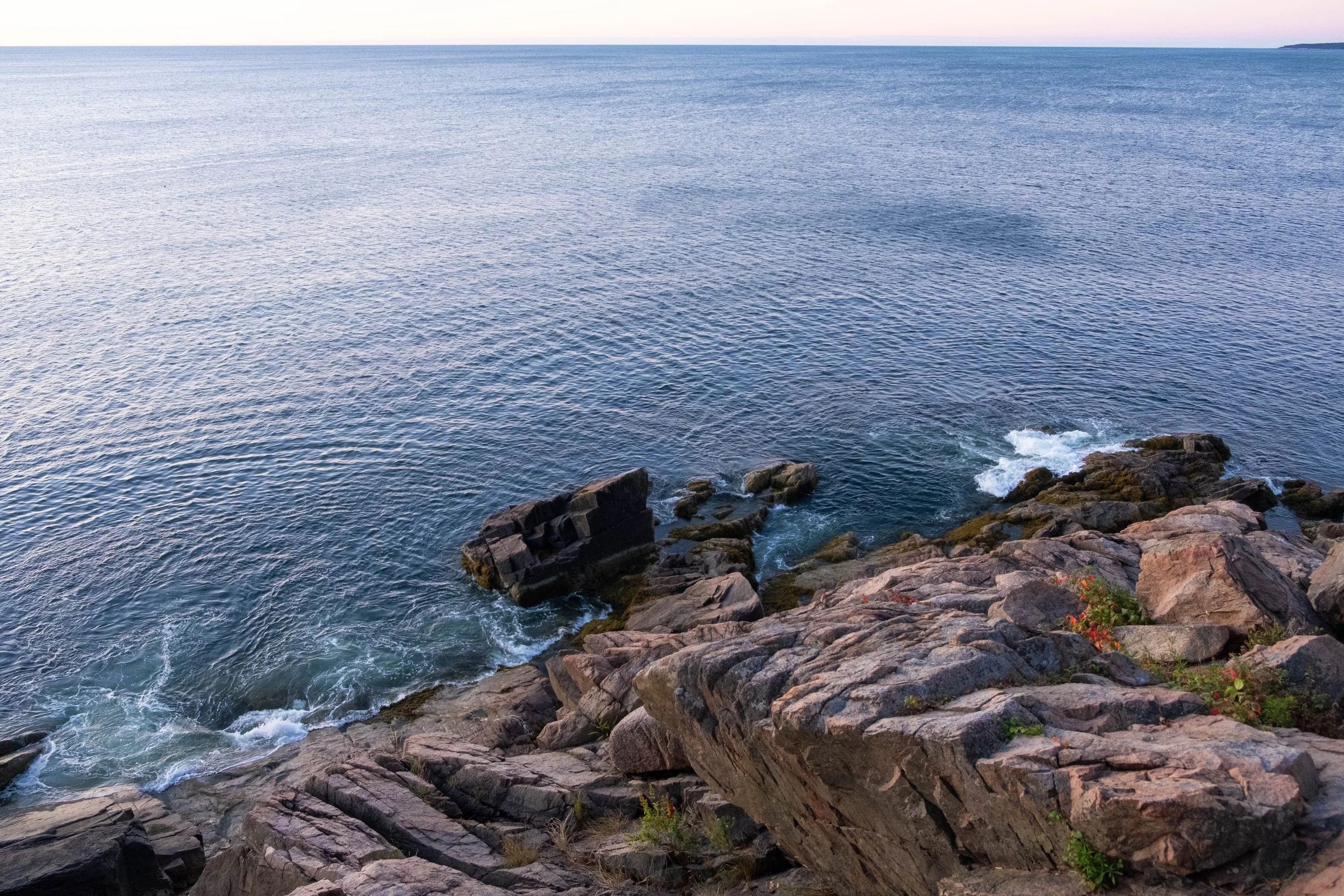
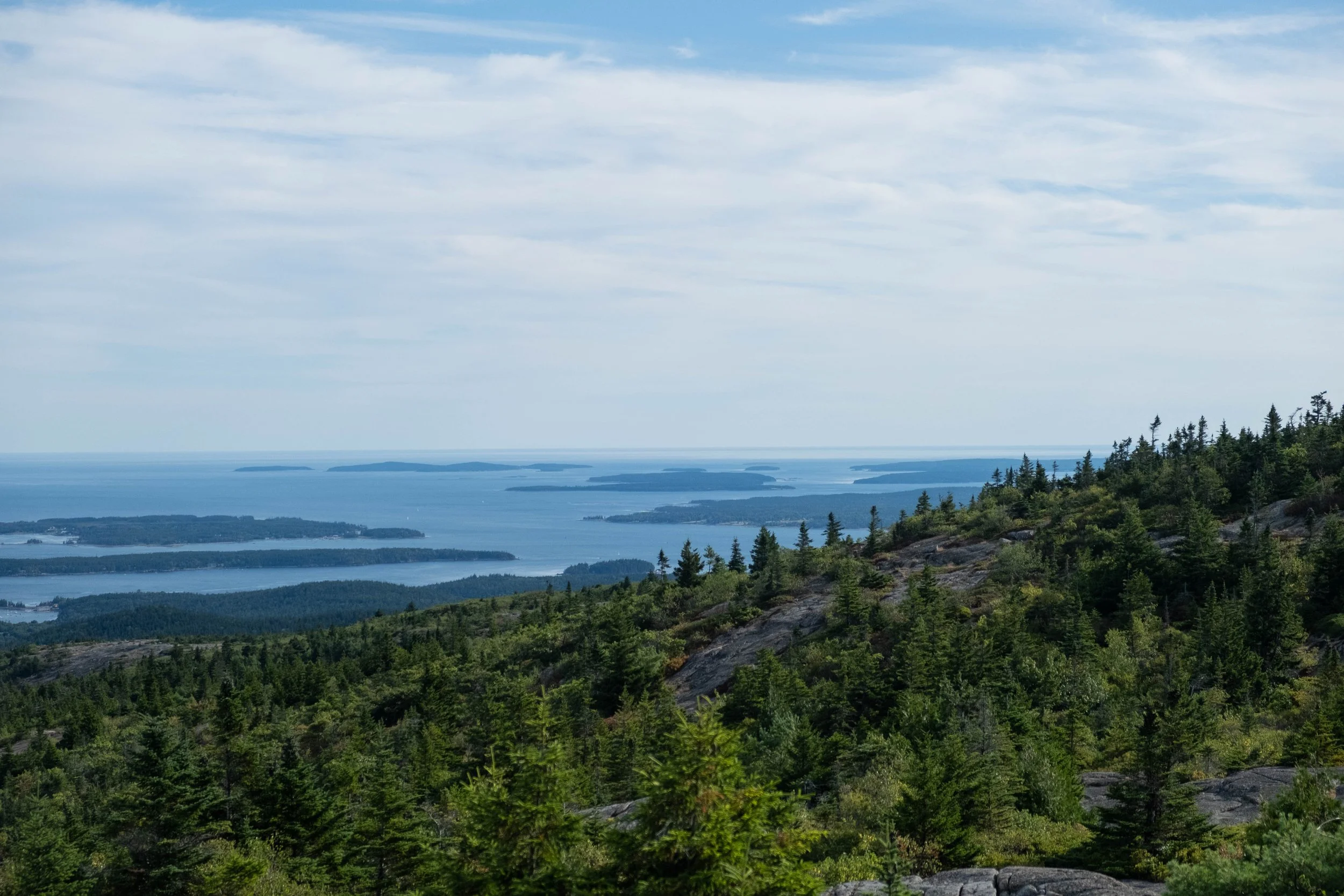
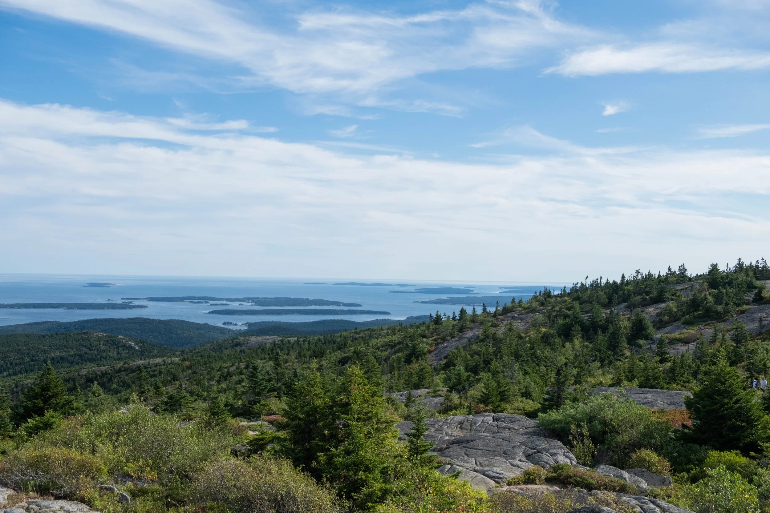
Pictured below:
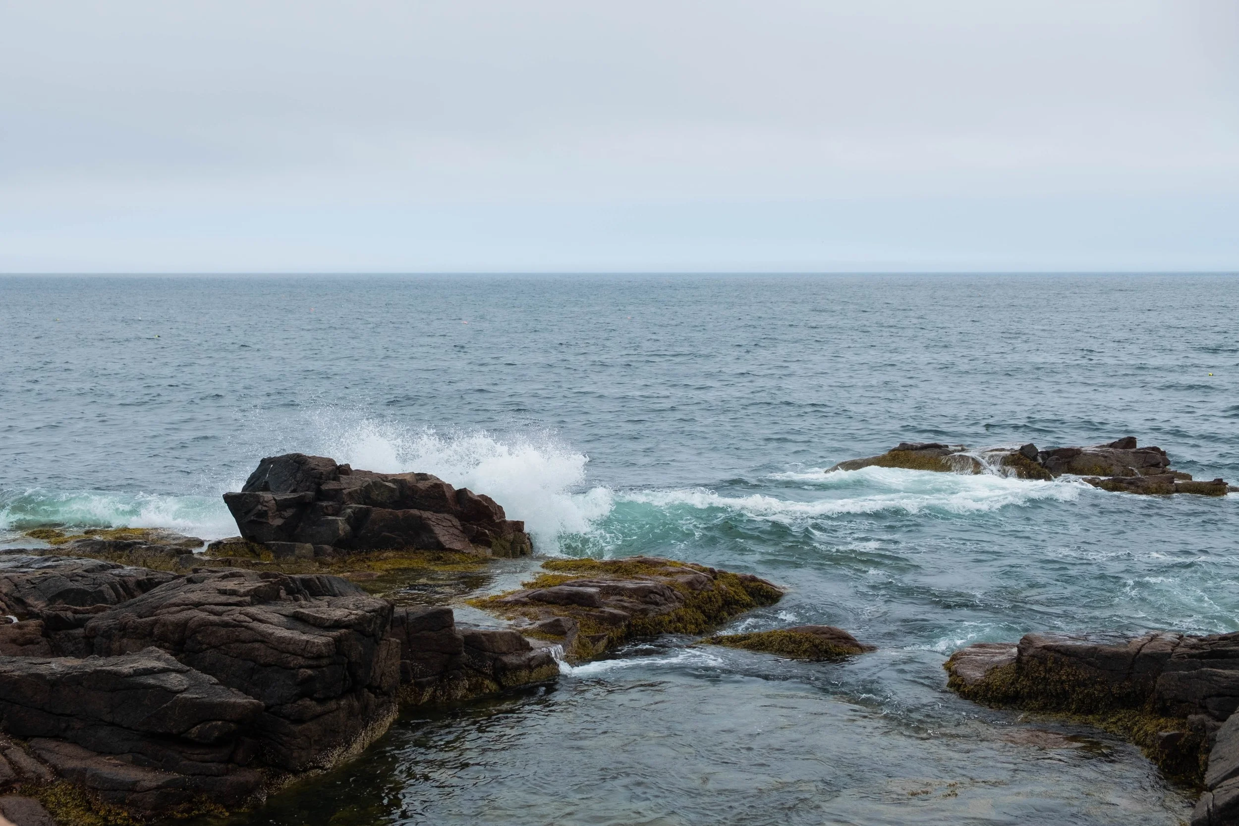
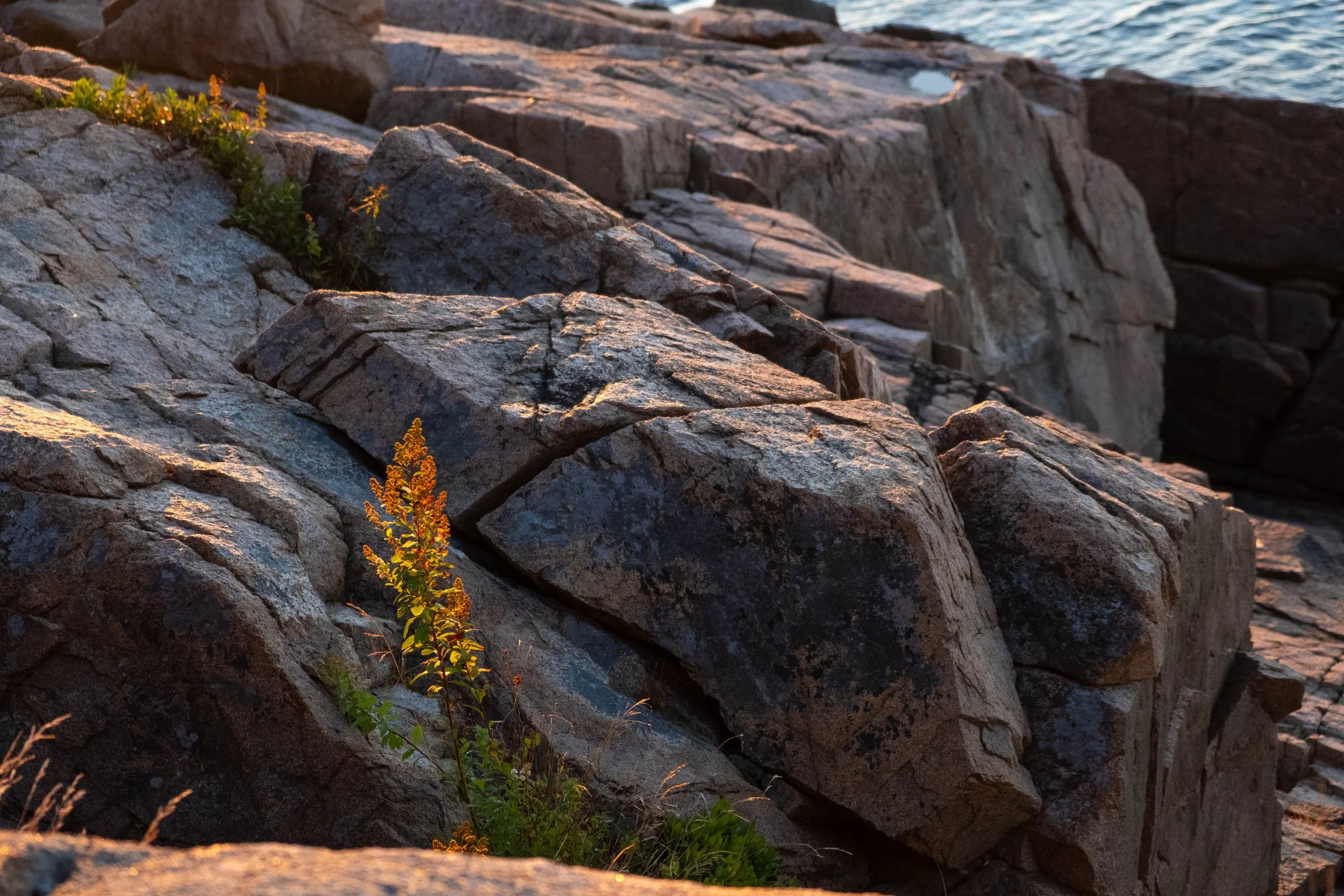
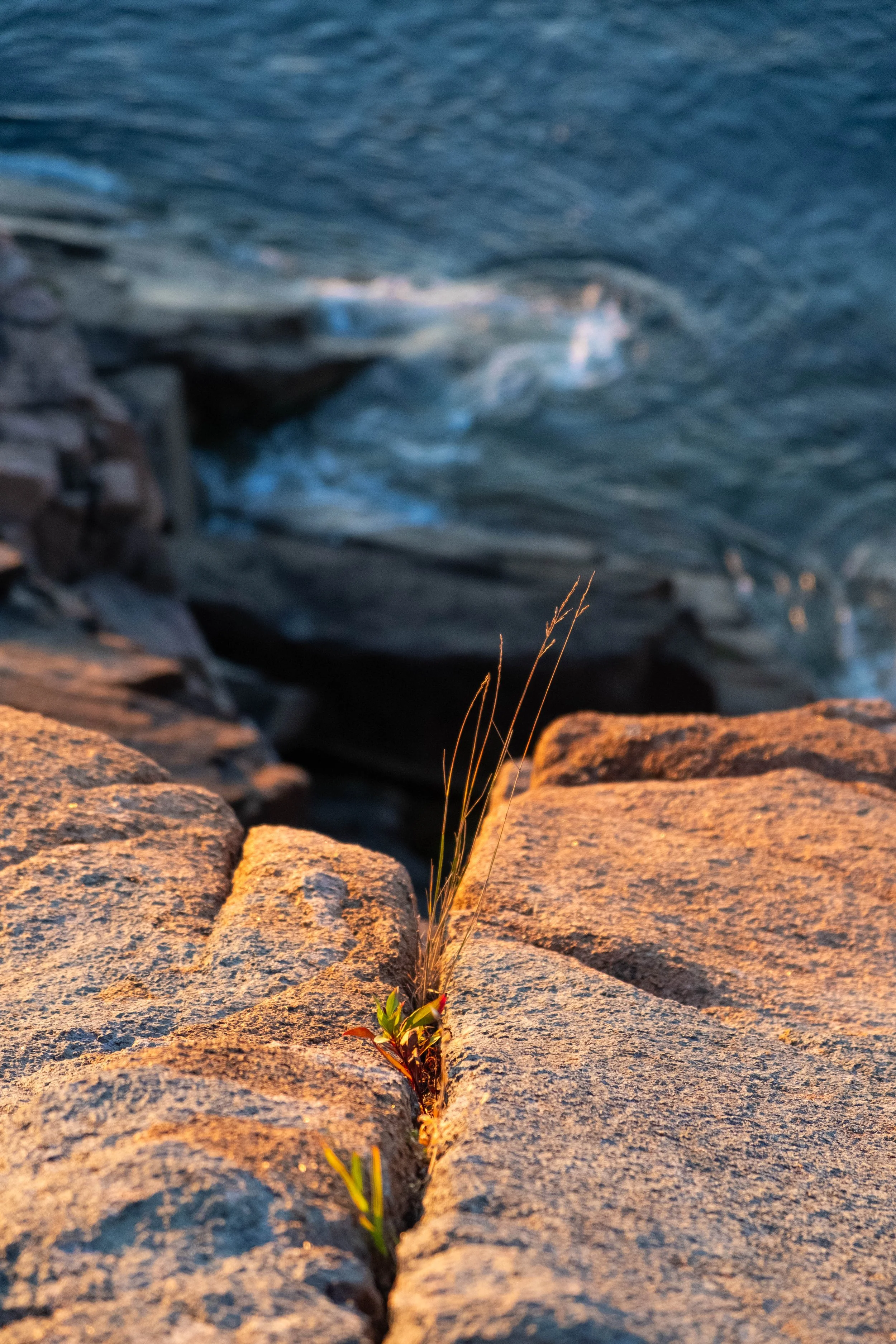
Bass Head Harbor Lighthouse.
Views from the ocean path overlook near Blackwoods Campground.
Tidepooling near Southeast Harbor.
Views from the top of what the Wabanaki people called Wapuwoc, the “White Mountain of the First Light” (Cadillac Mountain).

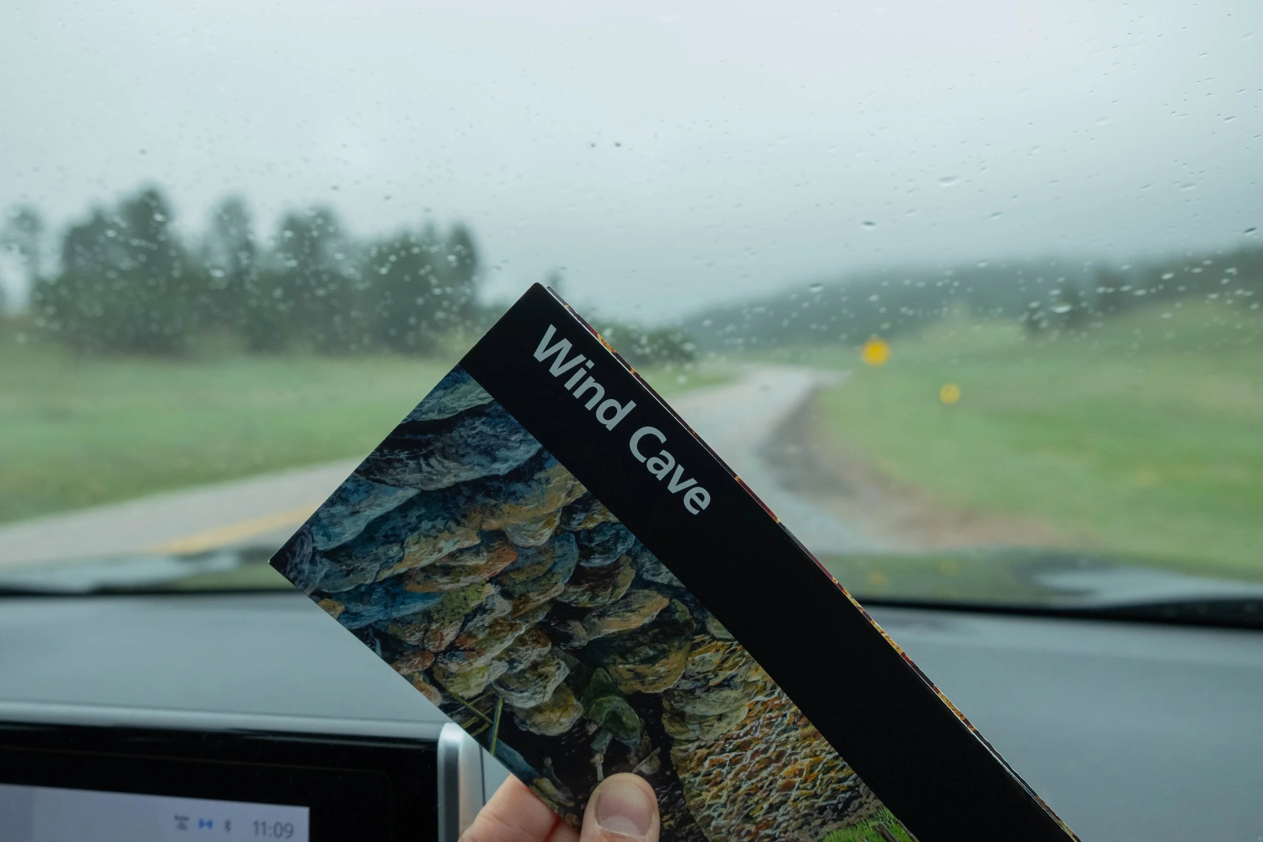
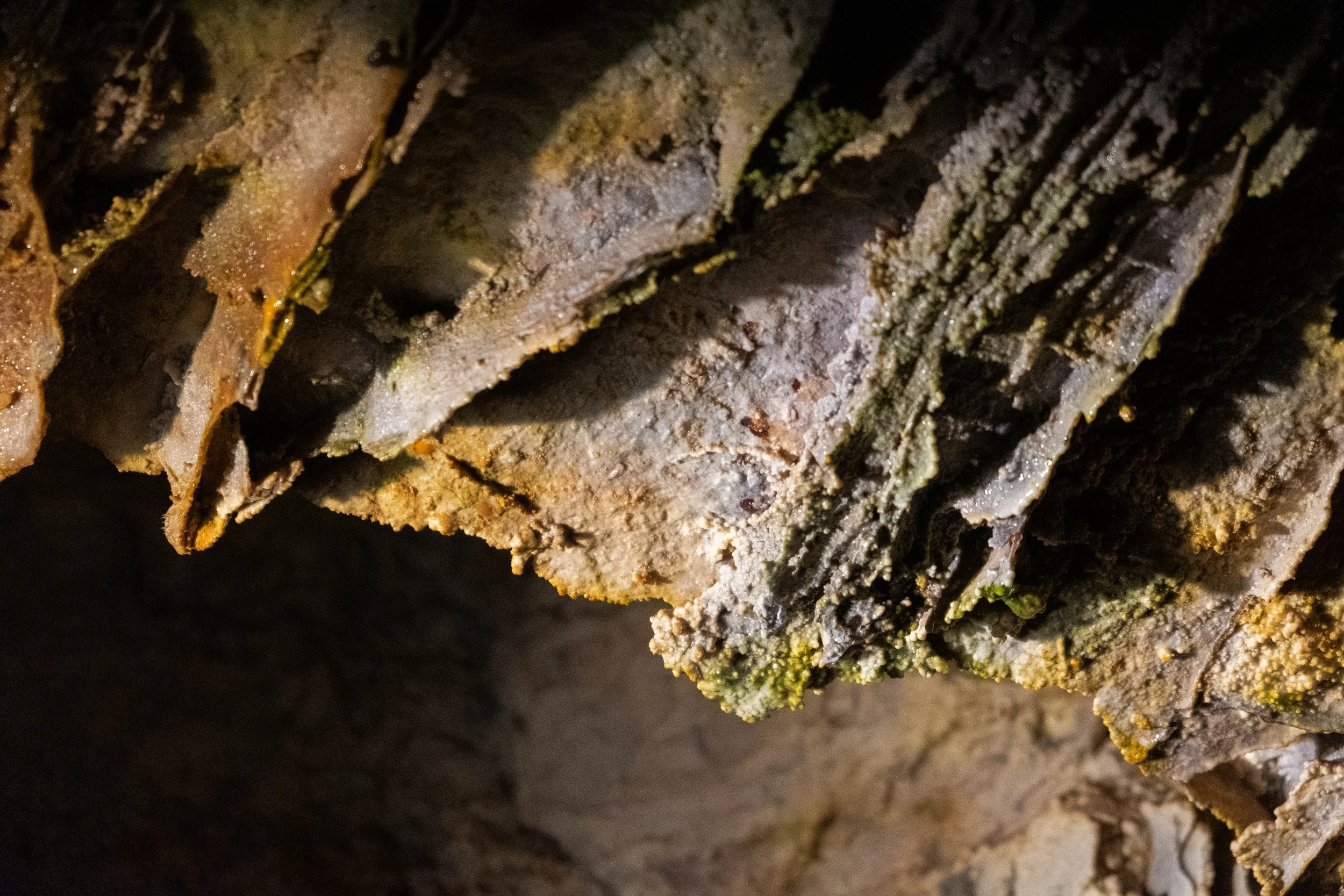
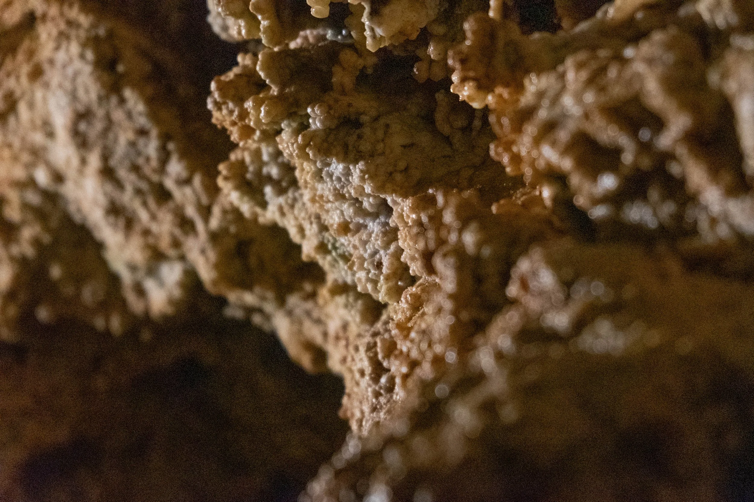
Wind Cave
Park 37 | May 2025
Part + Park 3 (of 3) of our Memorial Day roadtrip, and this was the day the sky really opened.
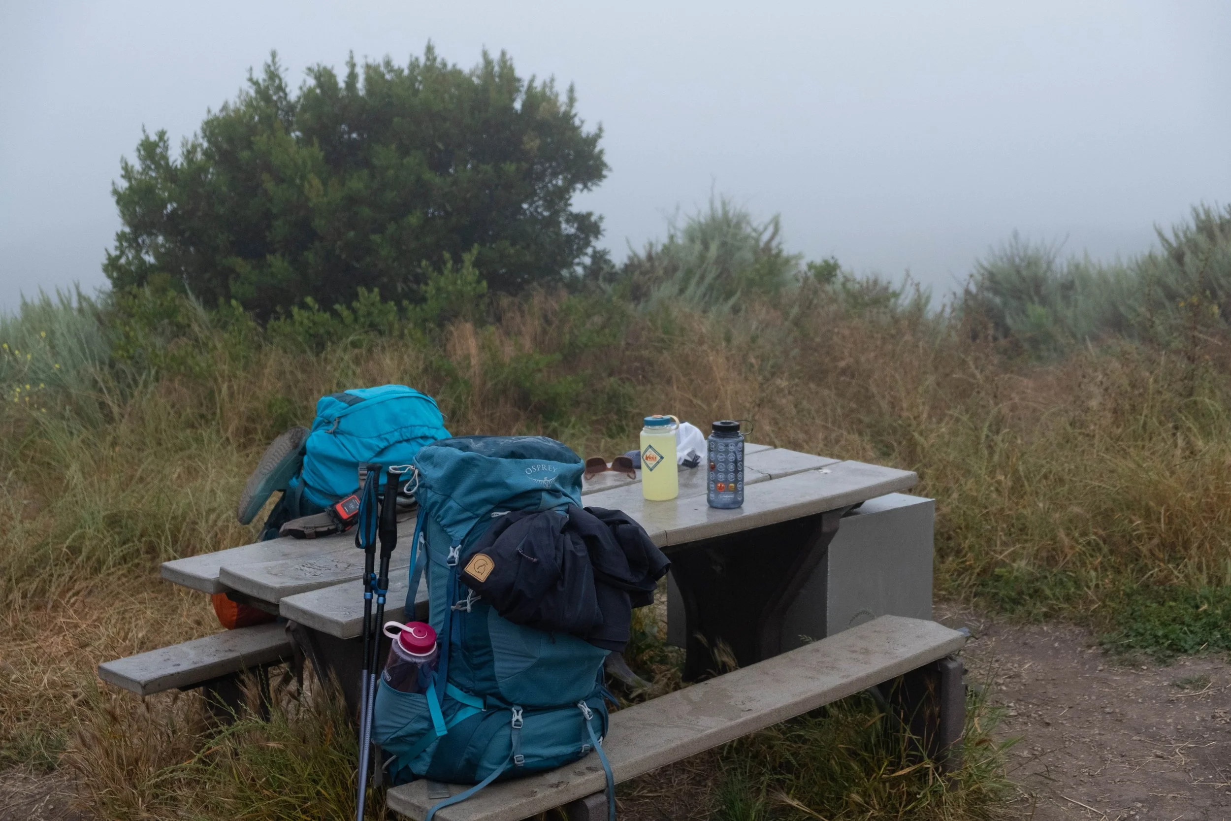
It poured from morning to night, which was ideal for when we went into the cave but unfortunate for all our hiking and camping plans in the surrounding Black Hills. We called the trip one night early and started our drive back to Denver at 5pm when facing the choice of sleeping in a very soggy tent or gutting out a five-hour drive and making it back to our own cozy bed.
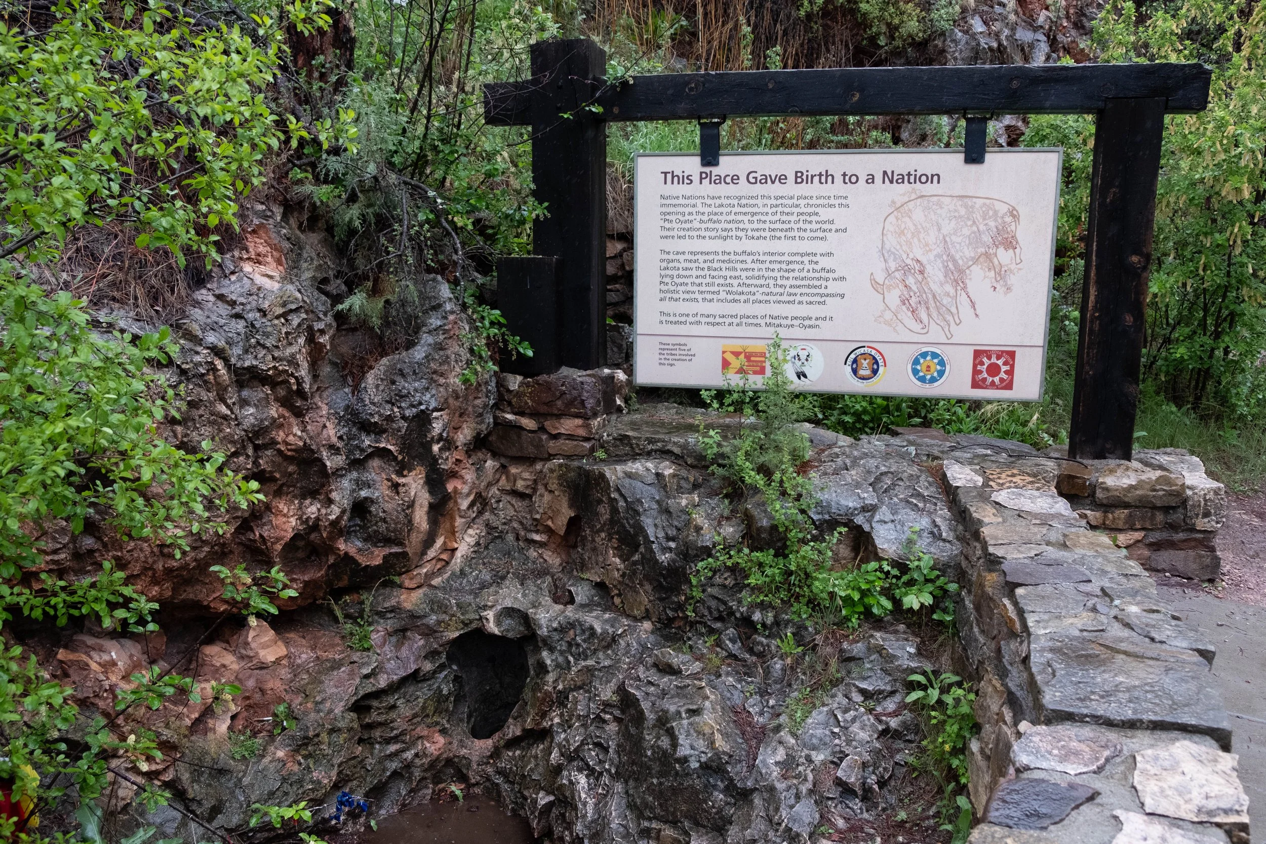
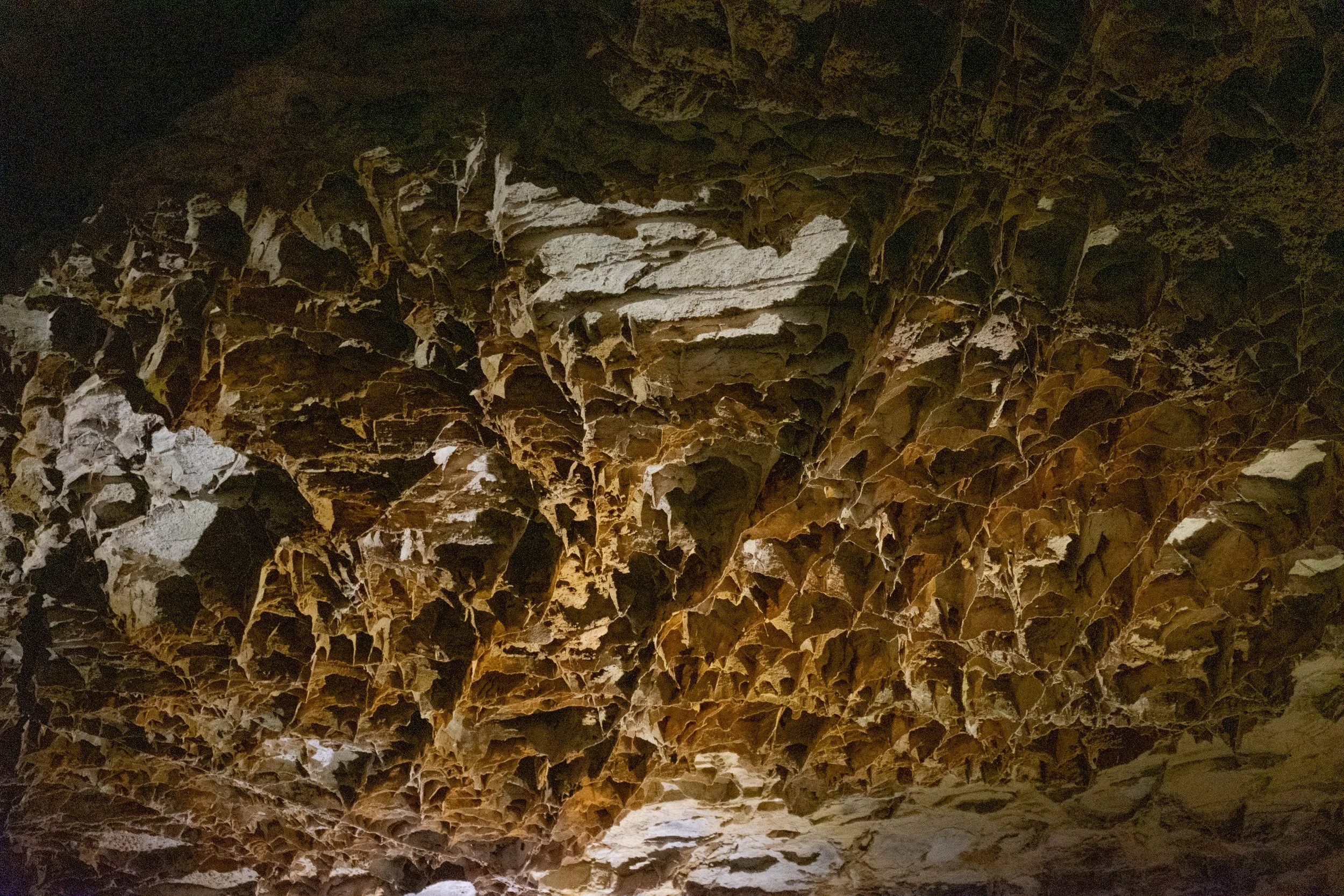
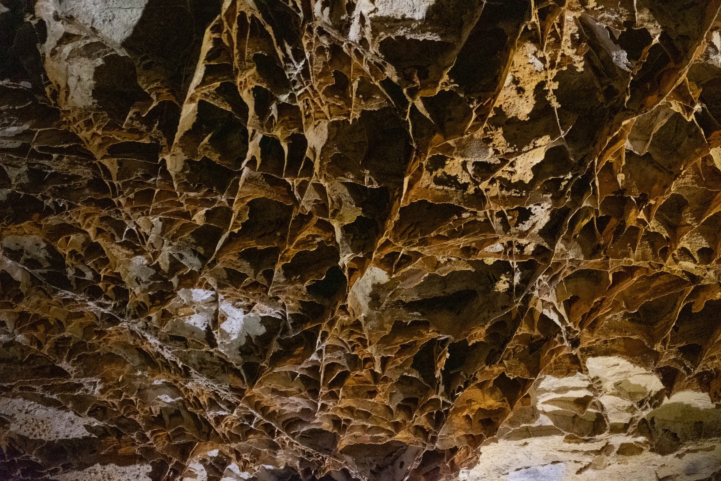
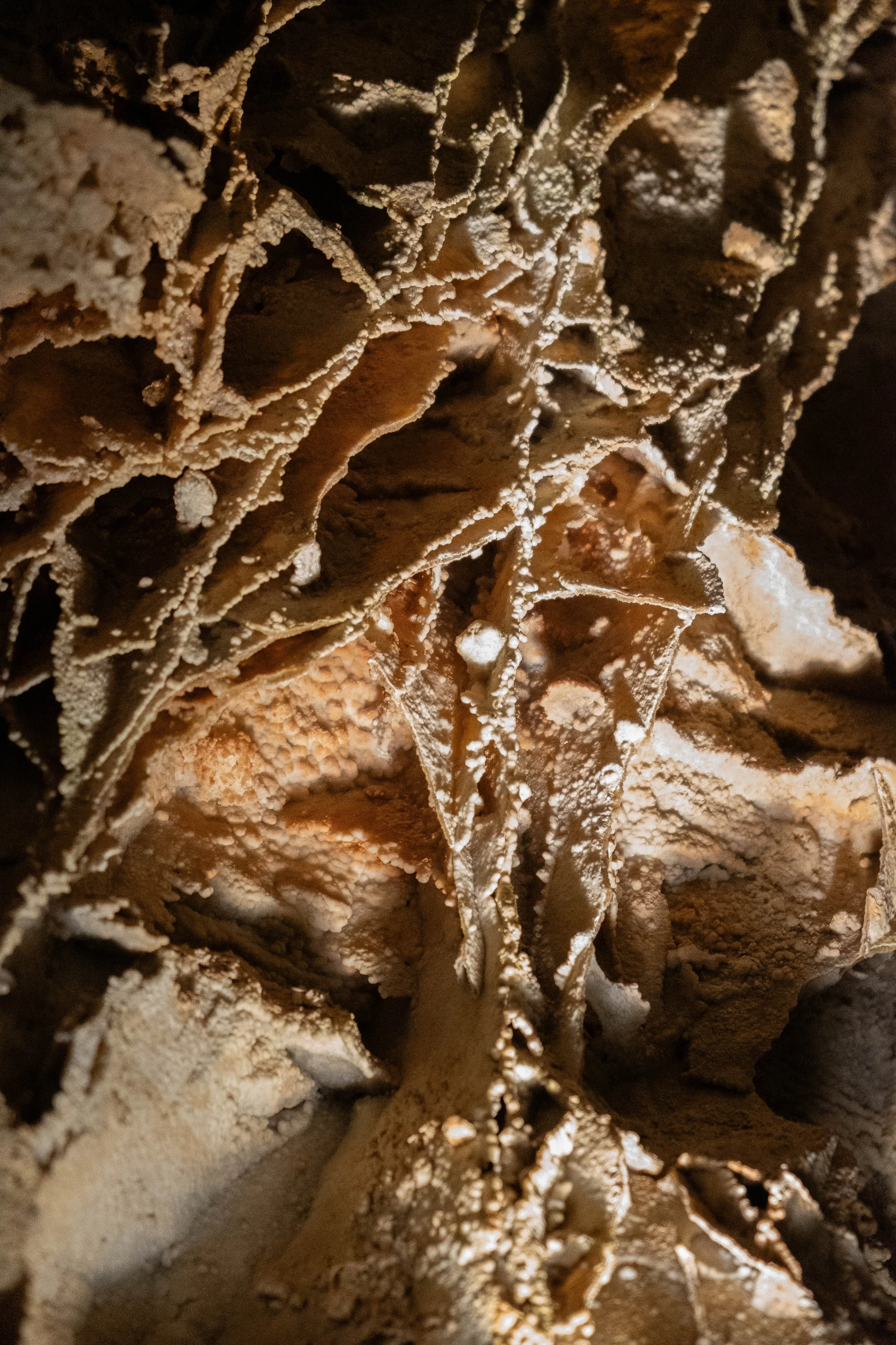
Although this was definitely the right choice, it felt like it cut our time here a bit shorter than we wanted. The cave itself was beautiful, which means a coming lot from me since I’m firmly an above-ground girl. We deeply appreciated the reverence with which it was shared with the public as Wind Cave is a sacred site to many surrounding Tribes, including but not limited to the Lakota, Dakota, and Nakota peoples. The visitor center landed among our top five favorites seen so far based on the co-creation of content with these and other Tribal Nations.
If there is a next time that I’m in the vicinity, I would definitely visit again — the Black Hills alone would draw me back. Another day, perhaps!
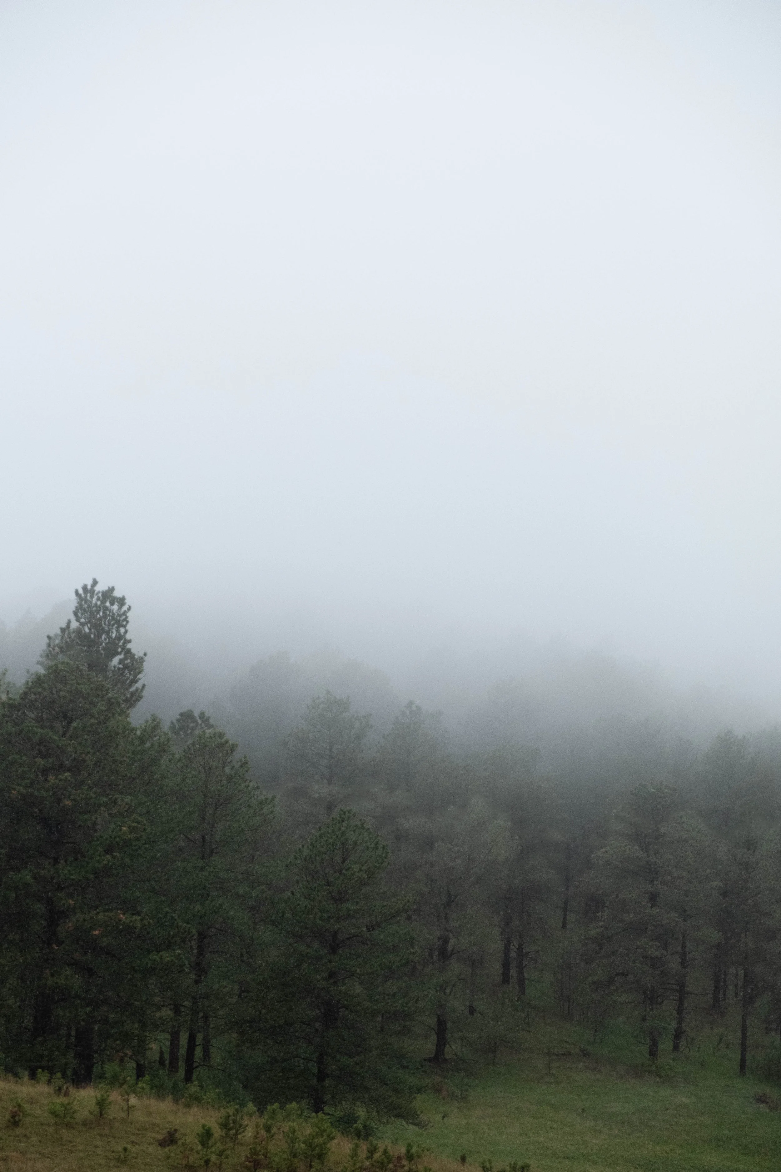
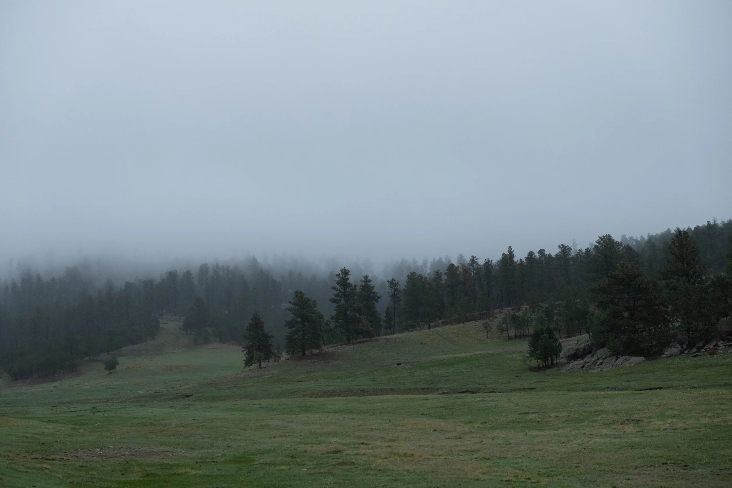
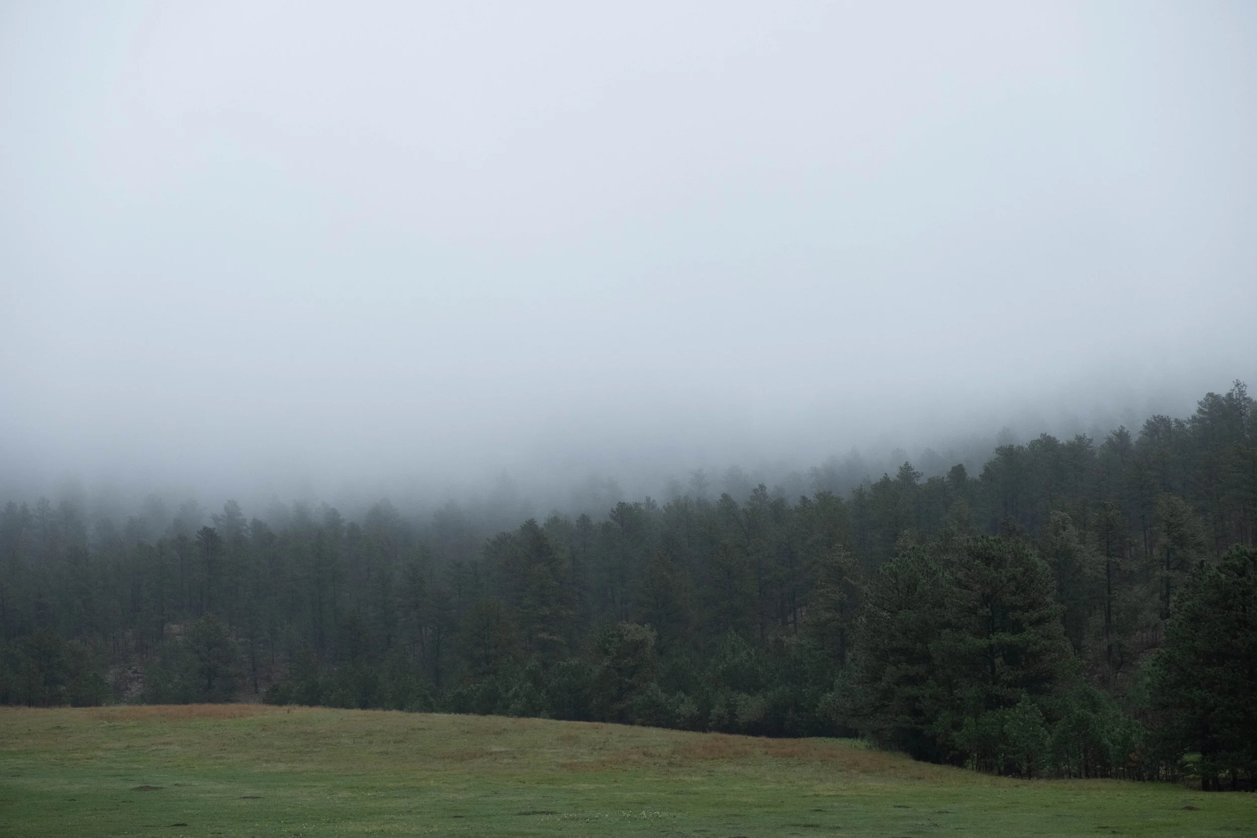
Pictured below:
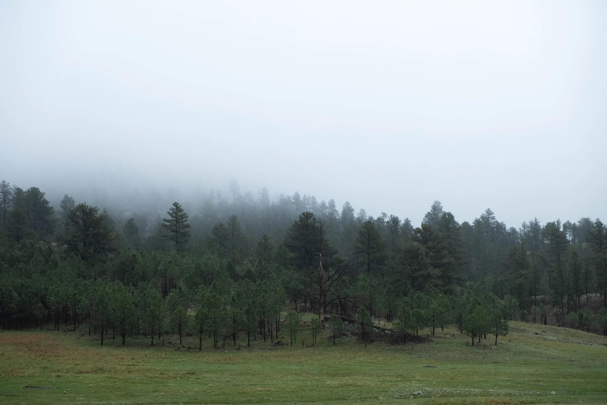
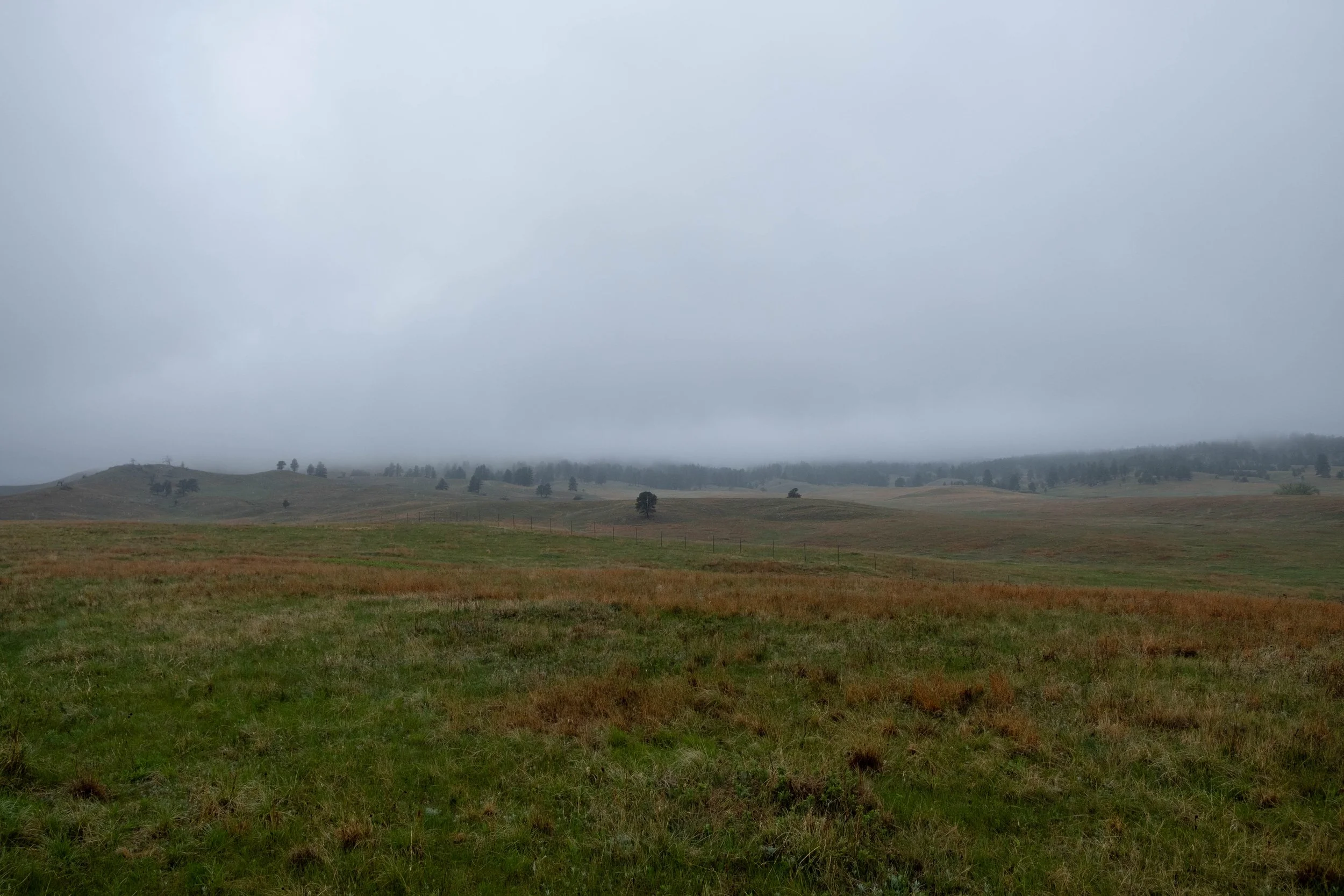
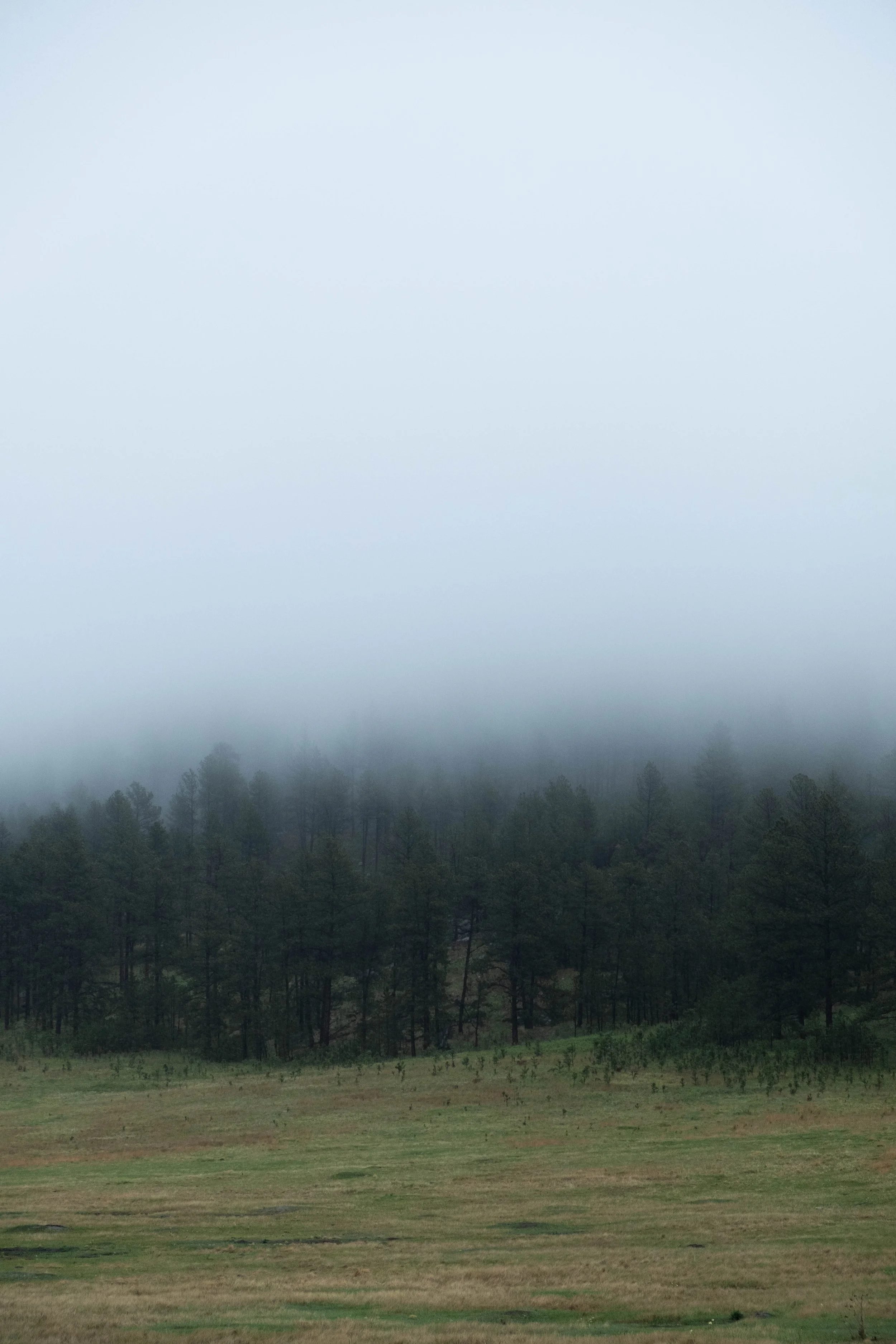
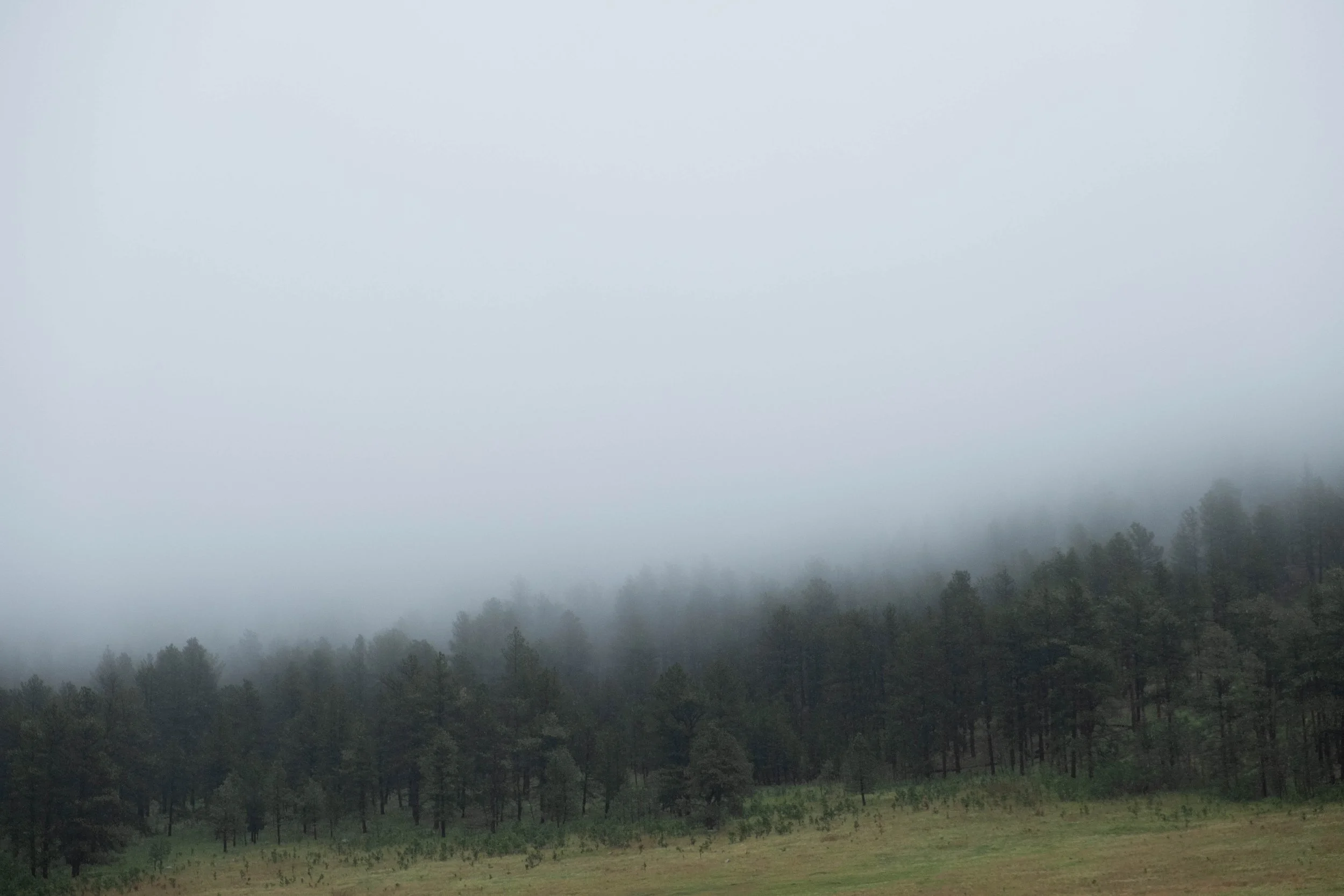
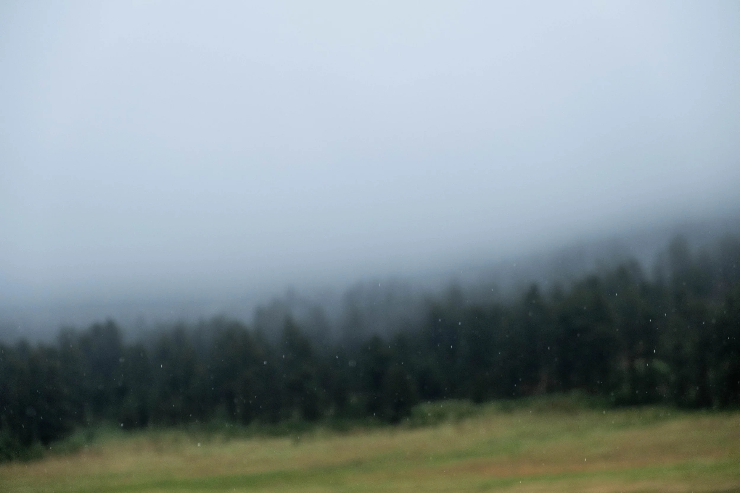
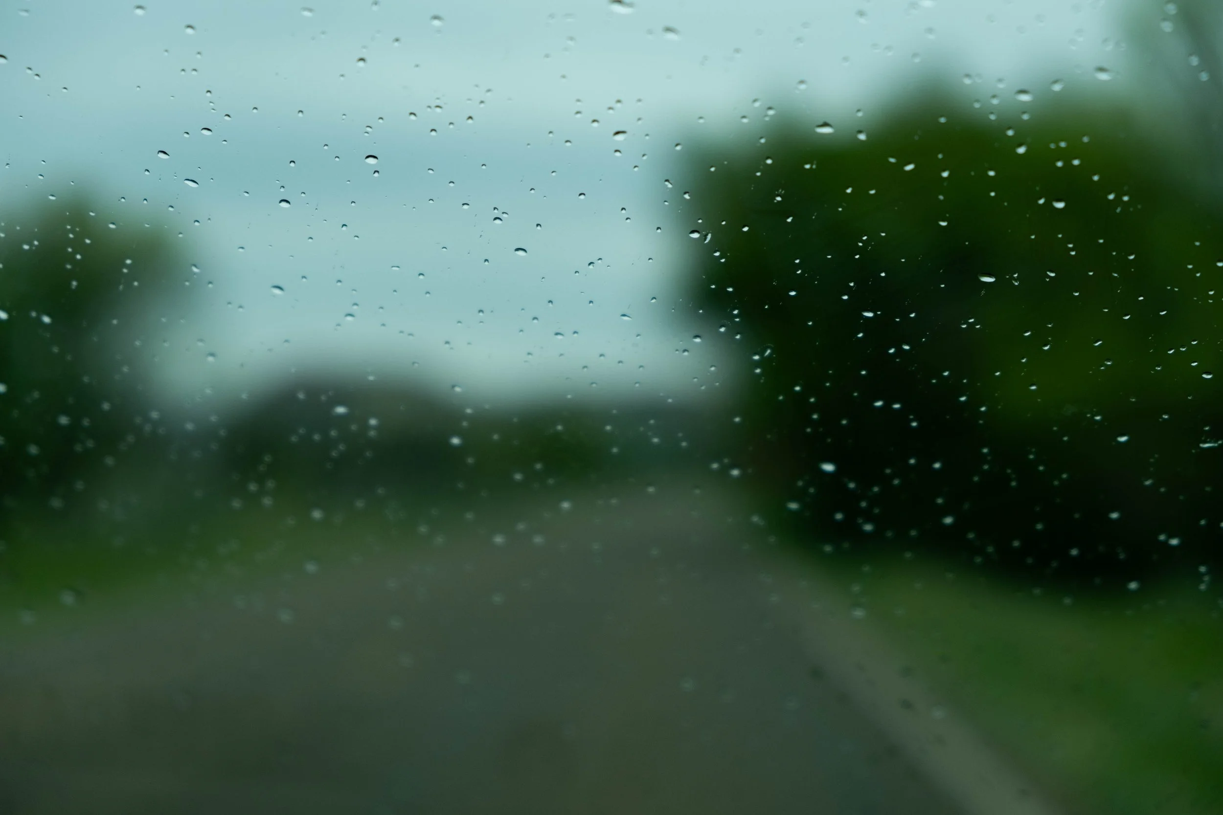
Our misty, rainy drive through the Black Hills.
Boxwork and other features in Wind Cave.


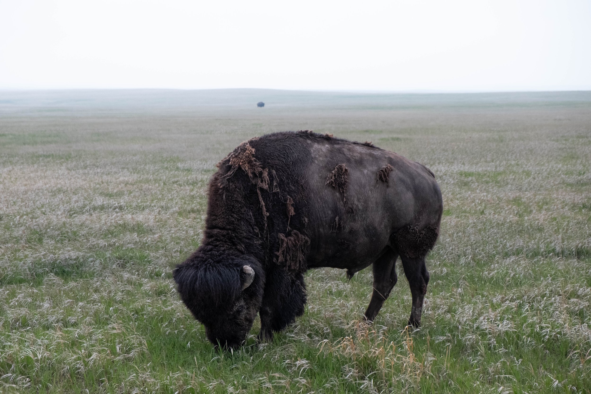
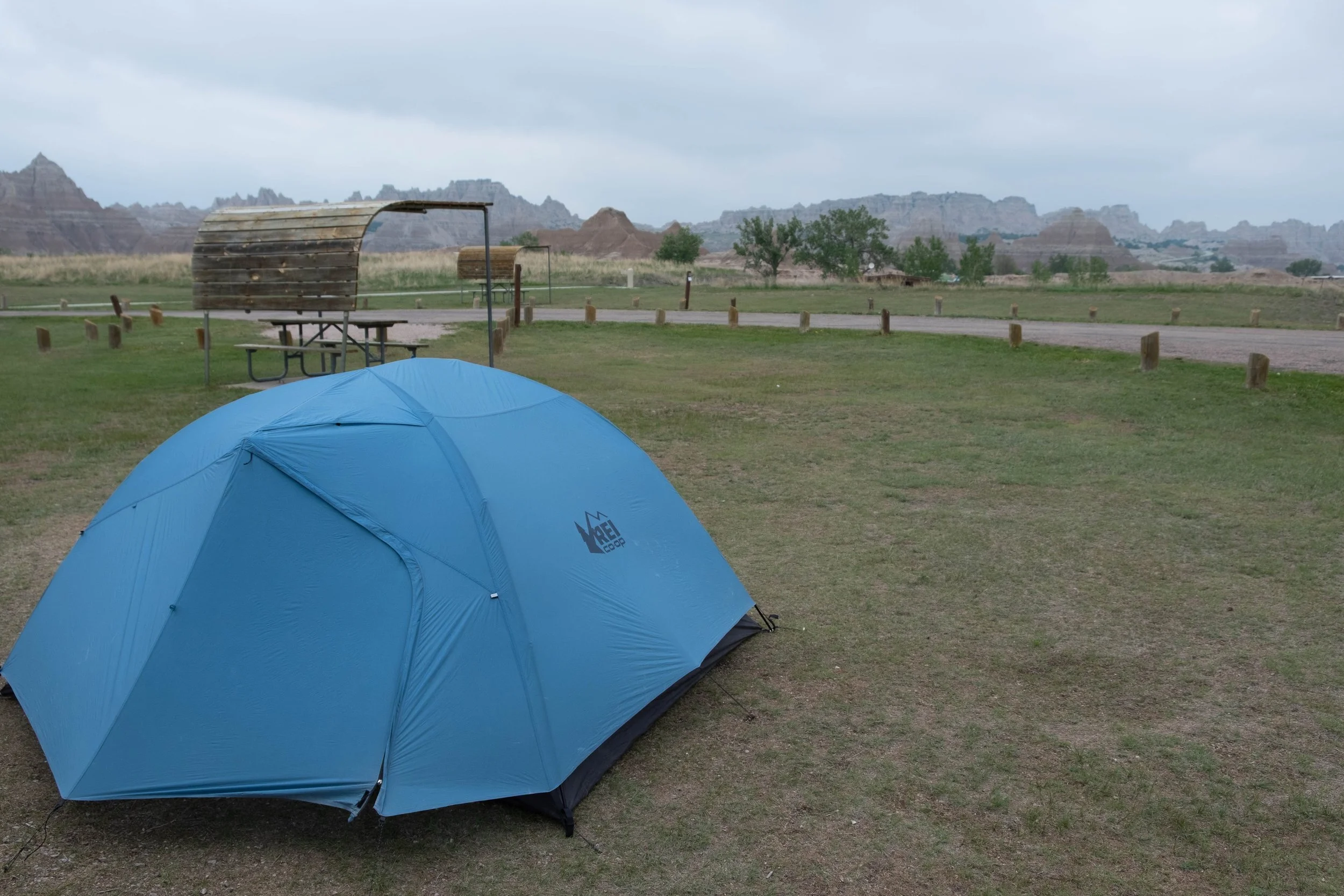
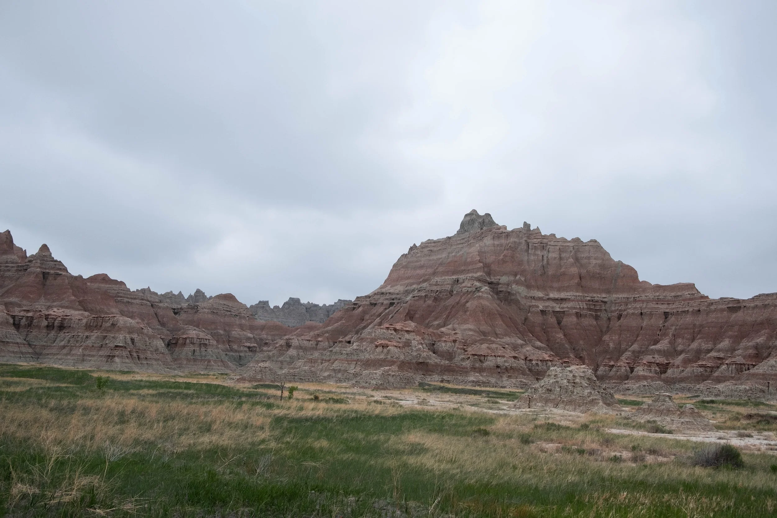
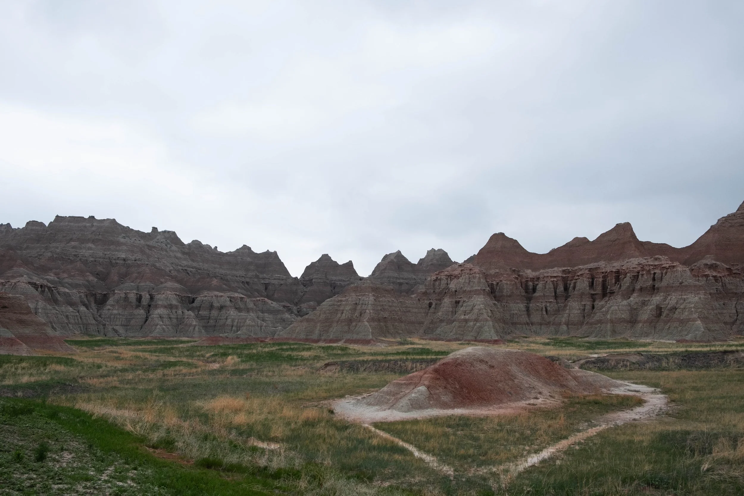
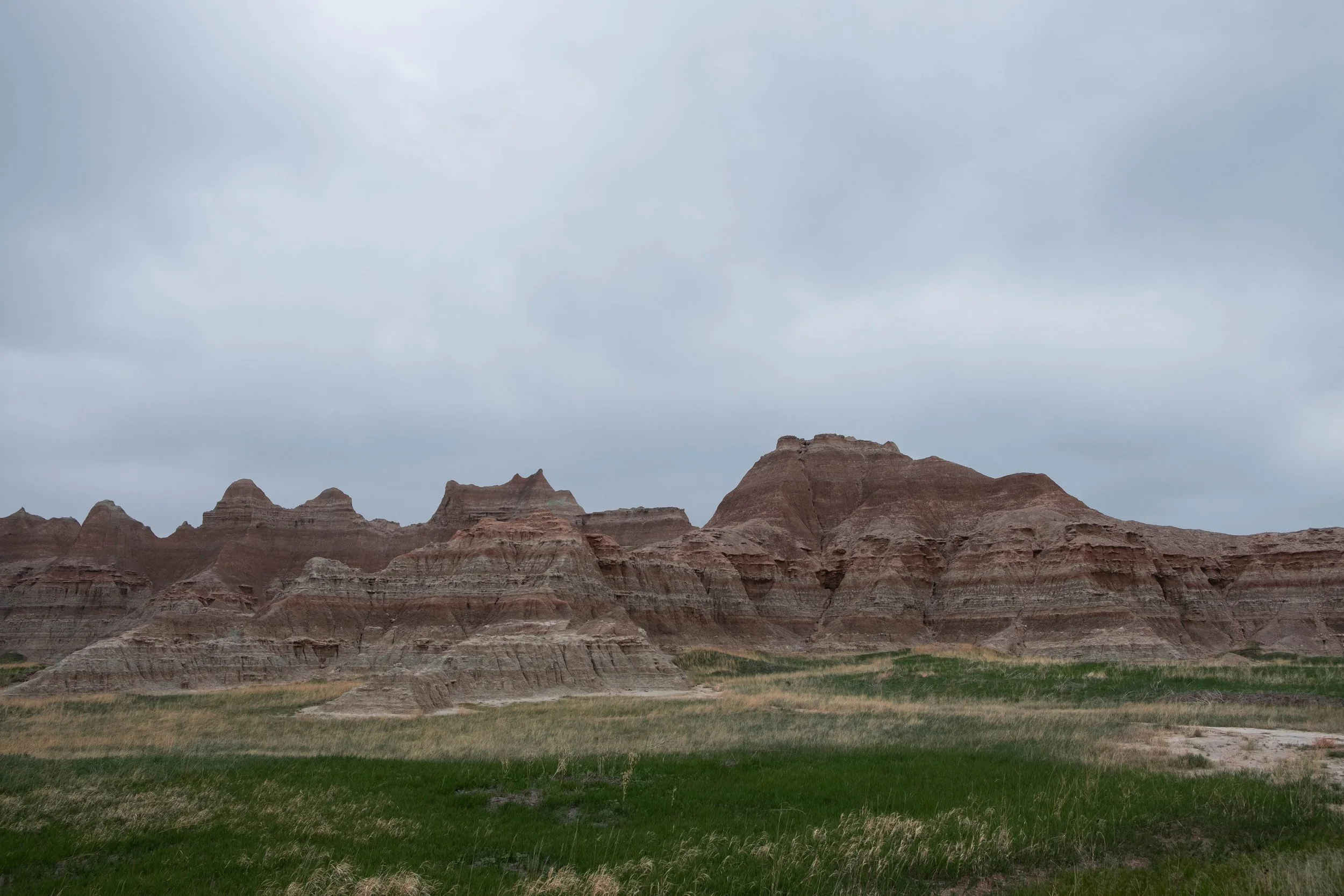
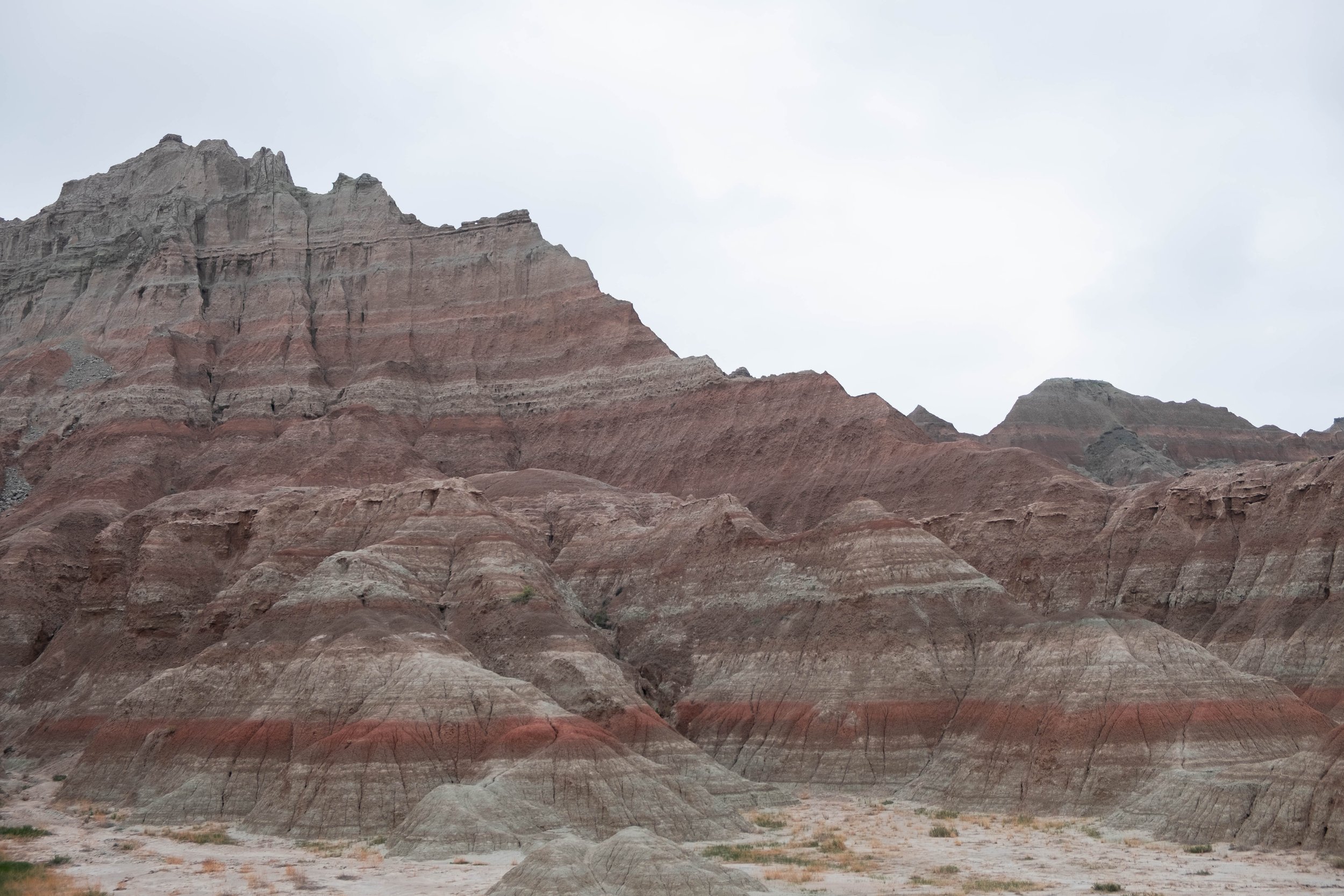
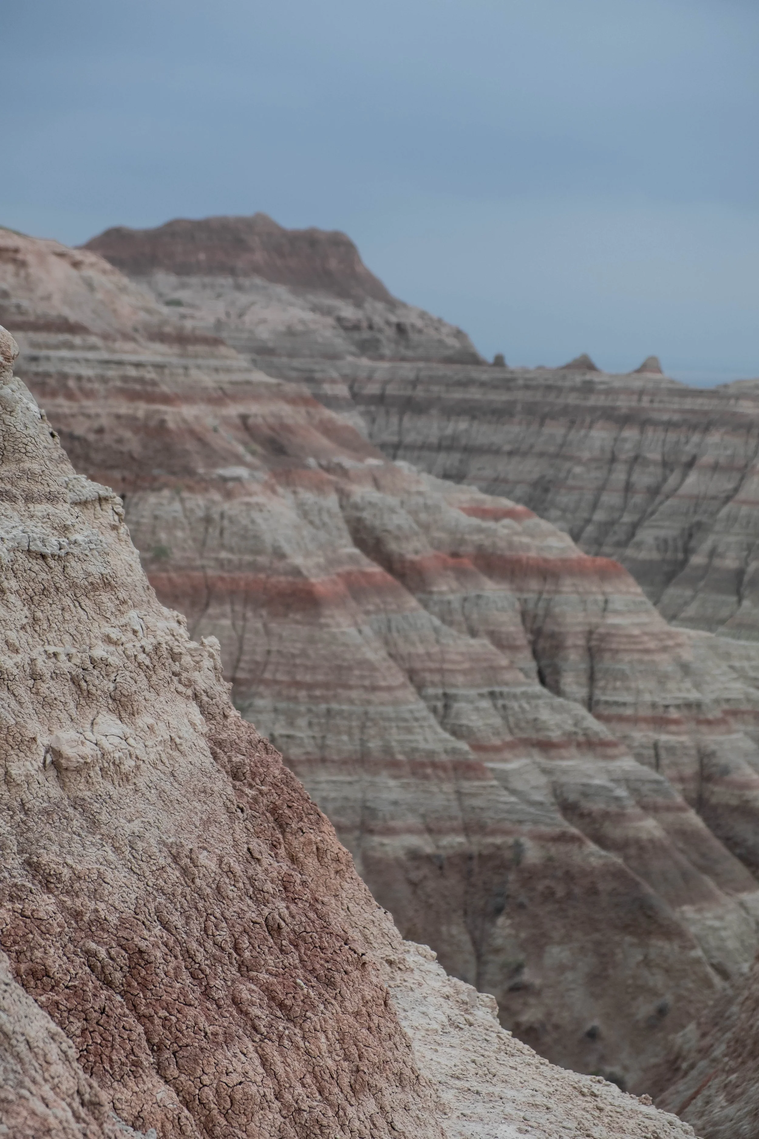
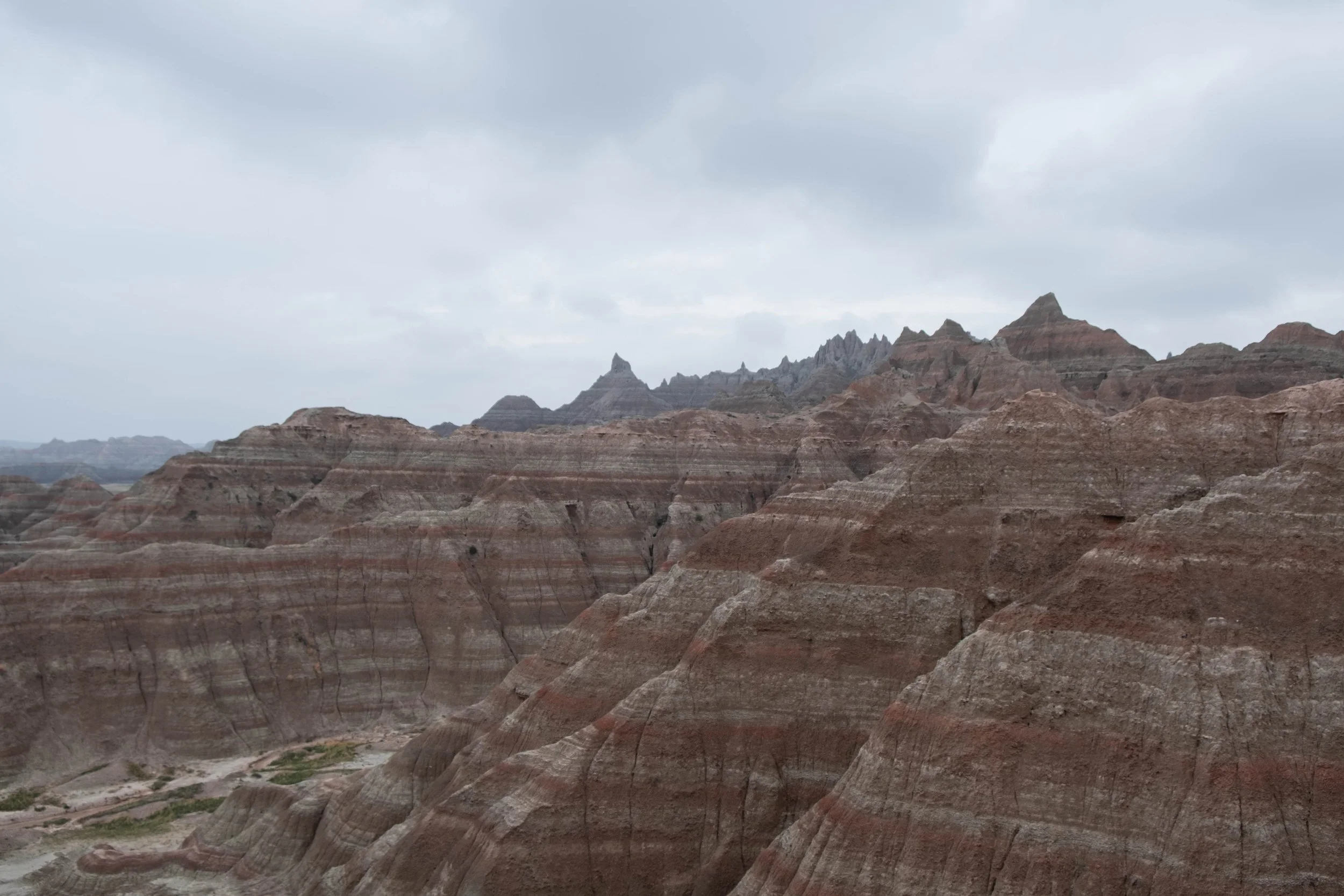
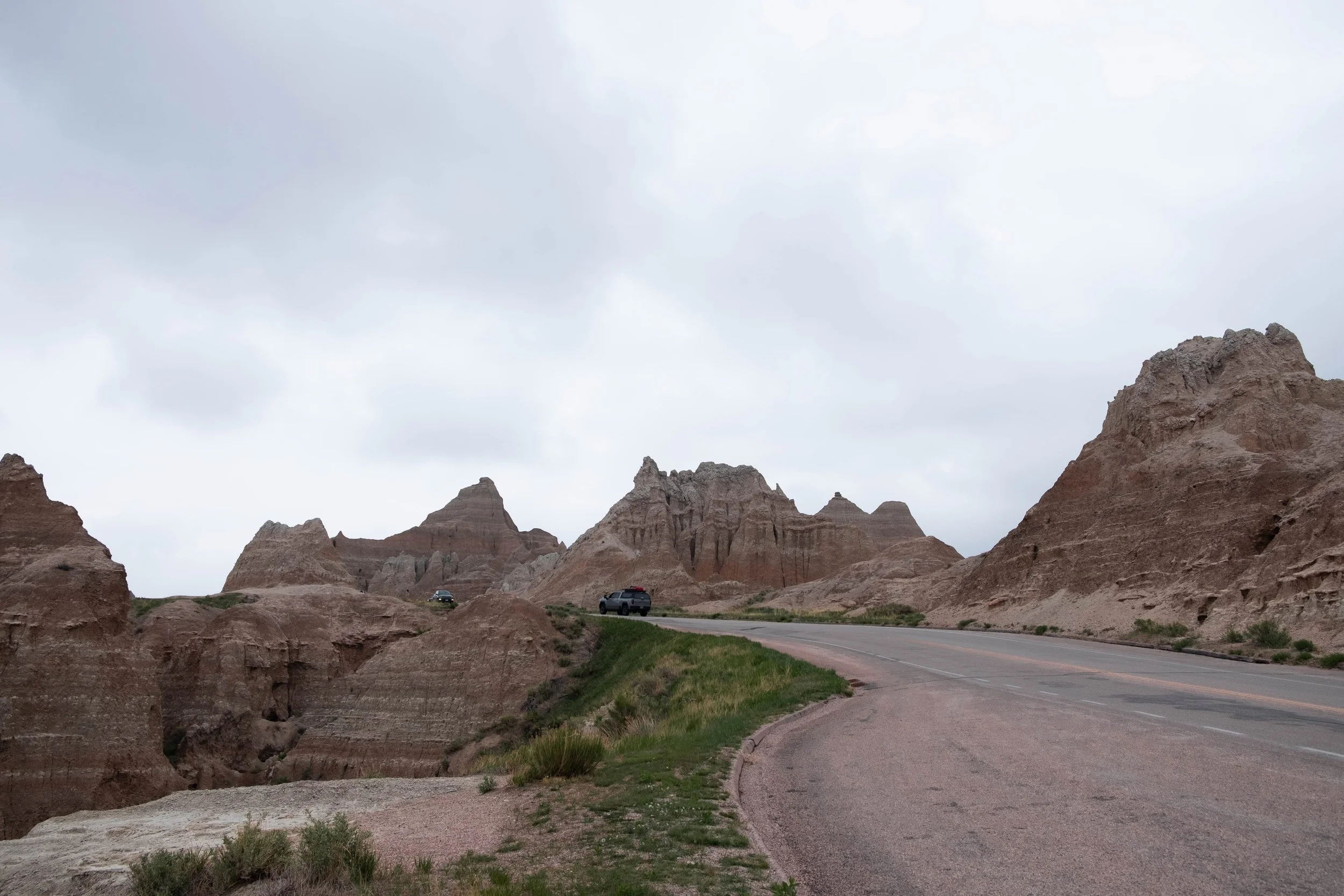
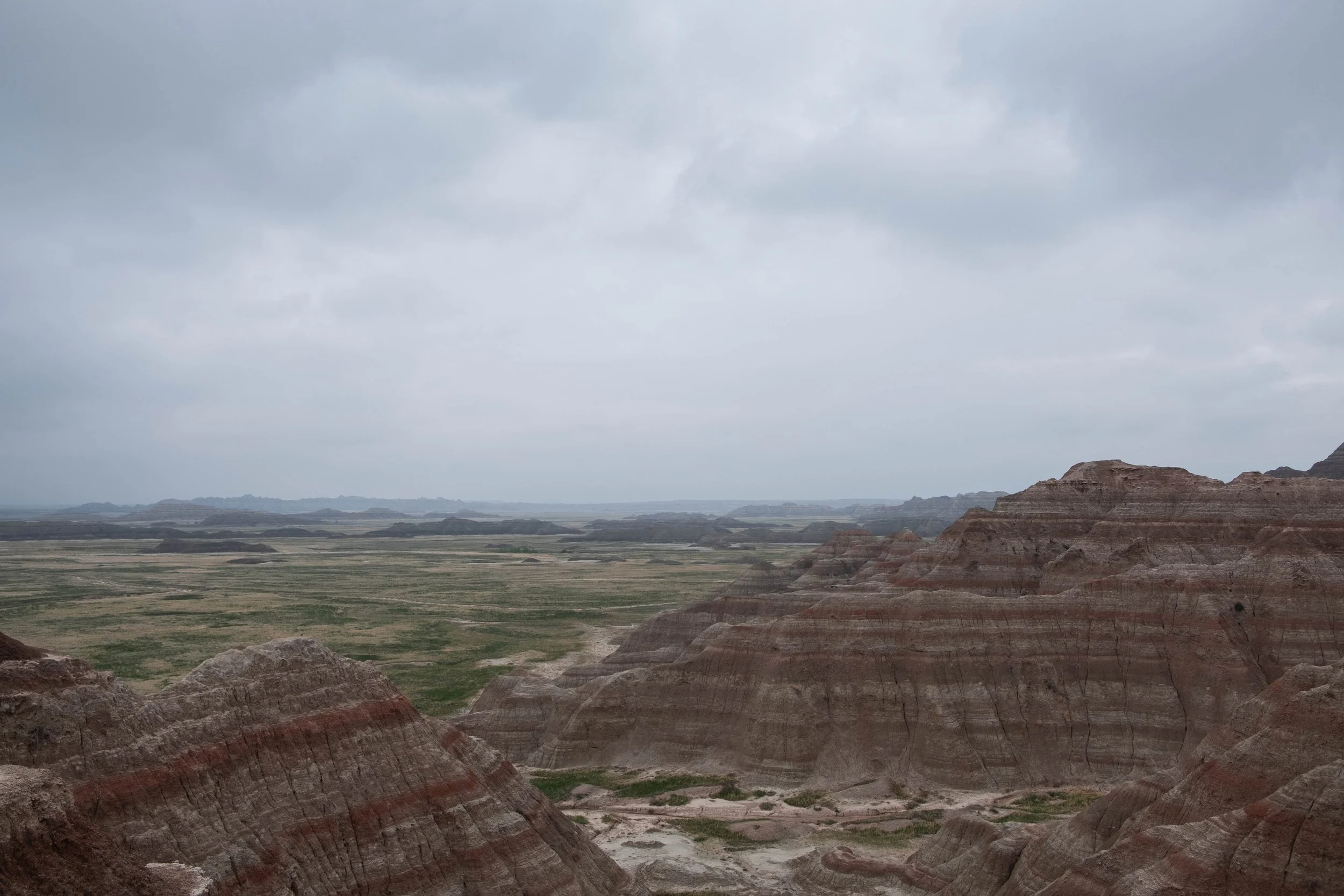
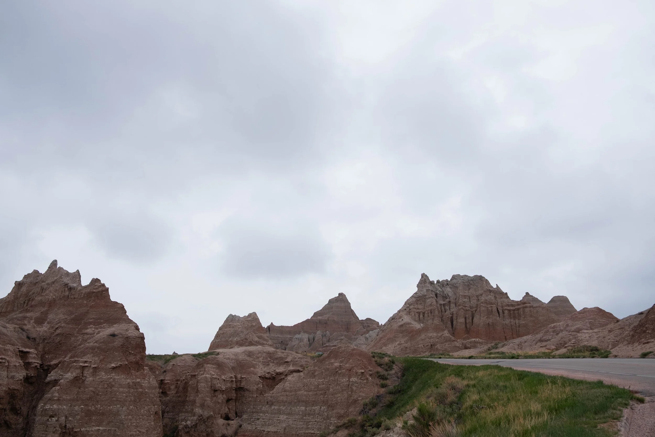
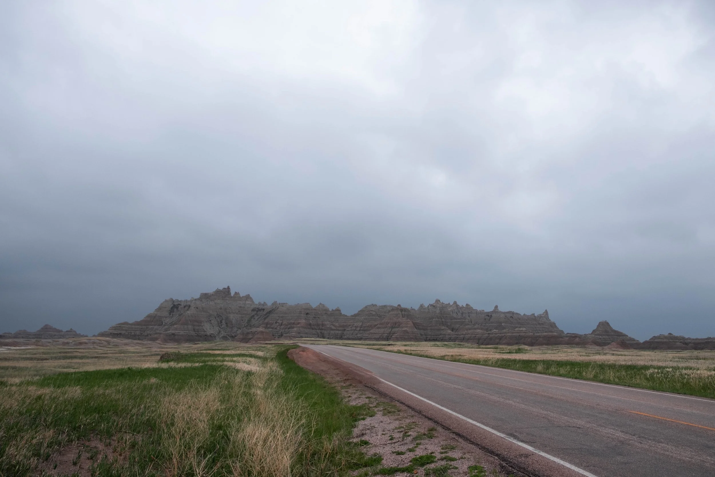
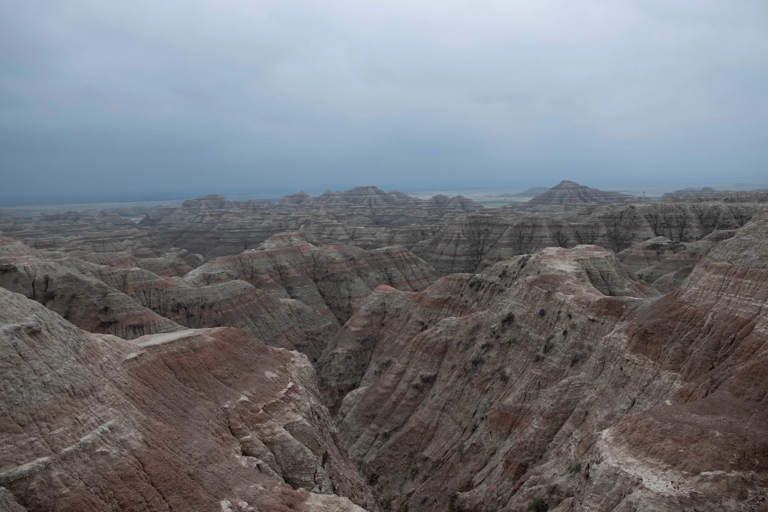
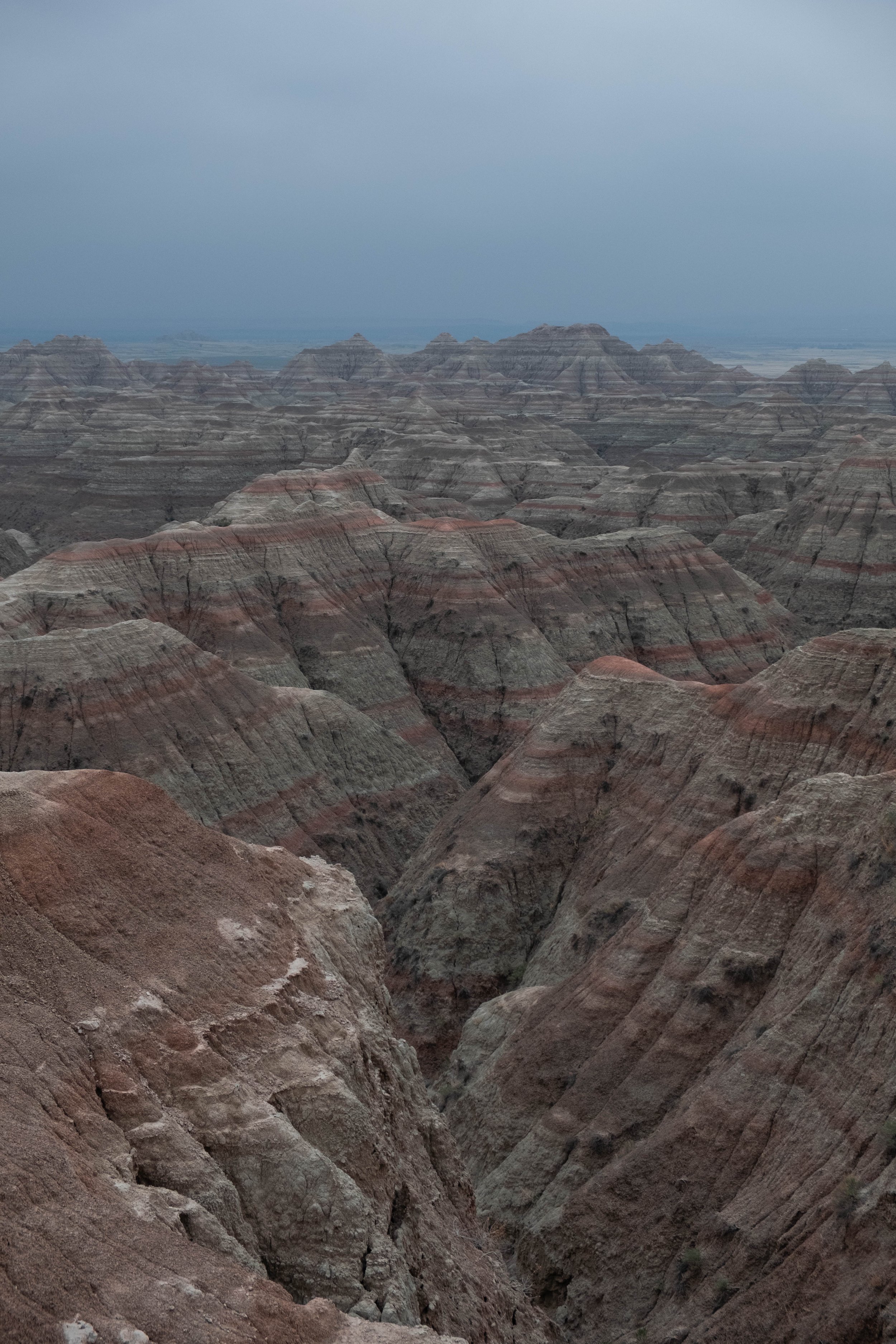
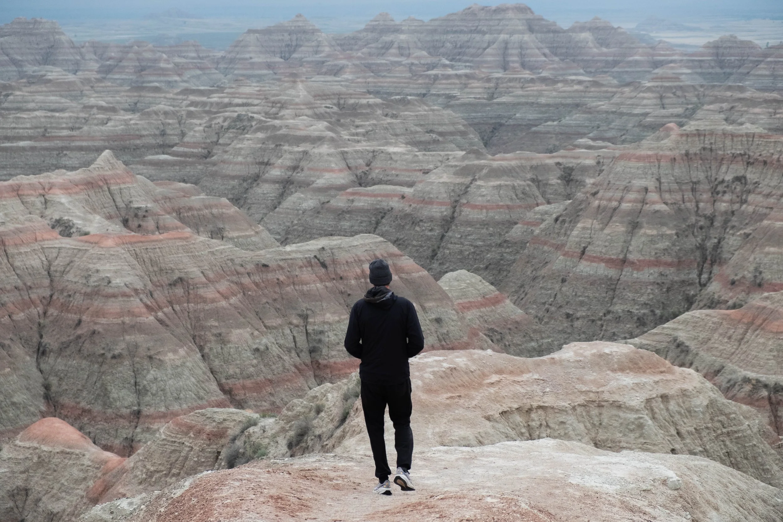
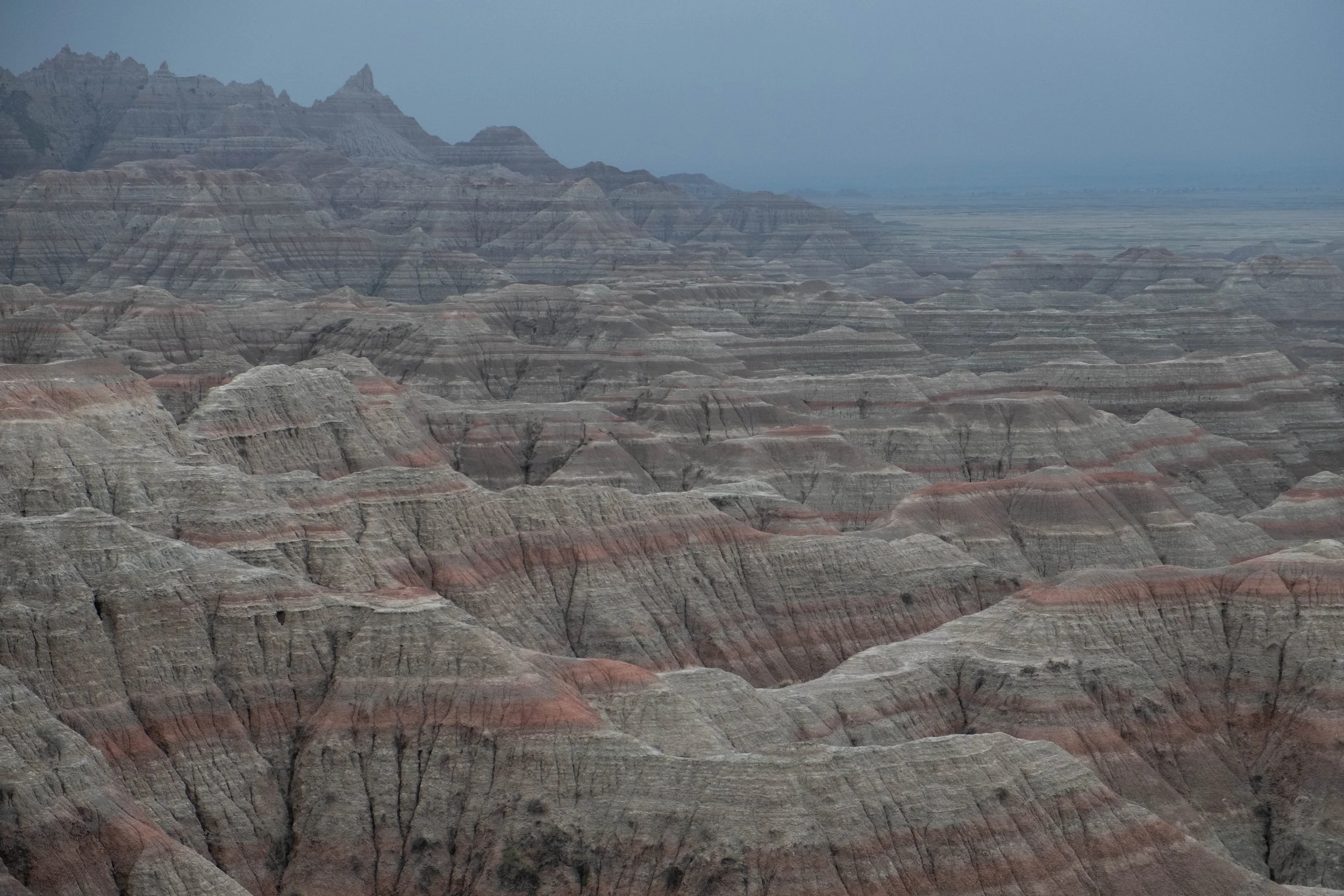
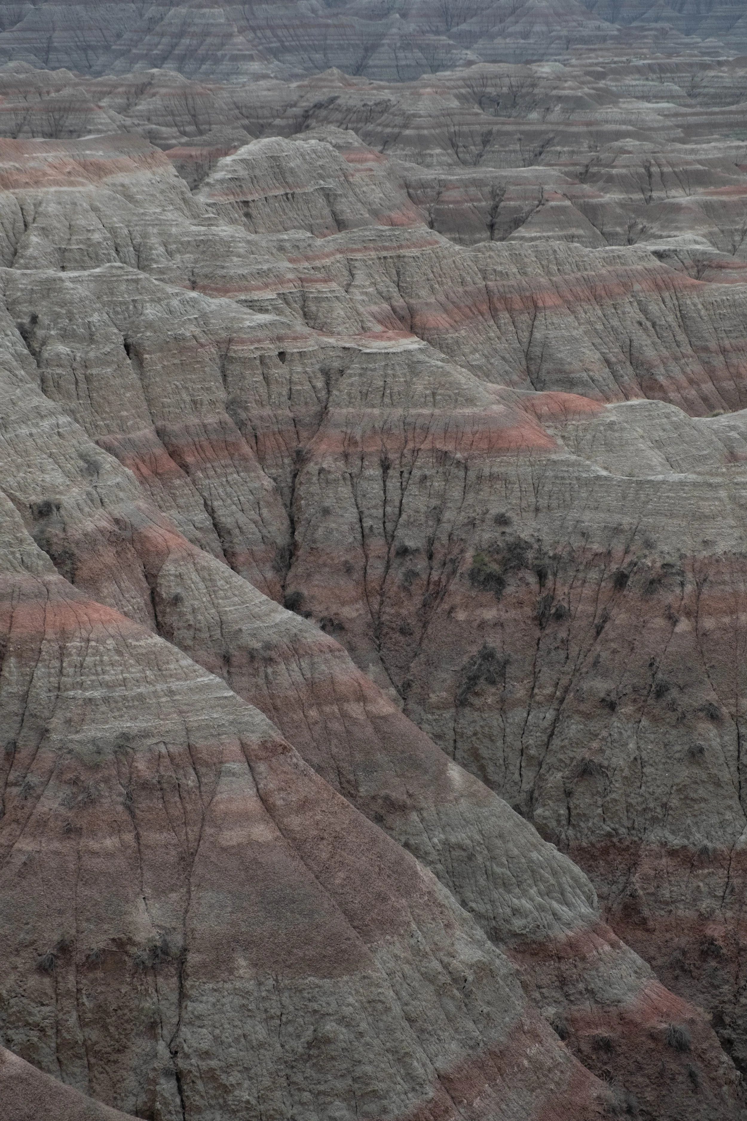
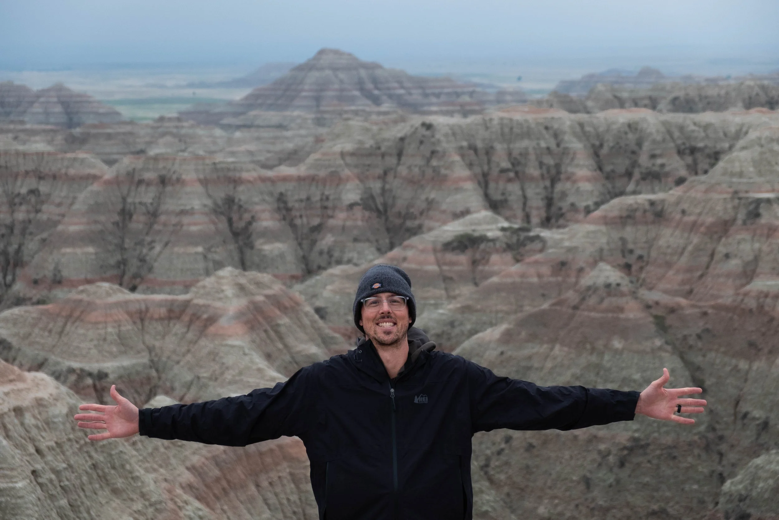
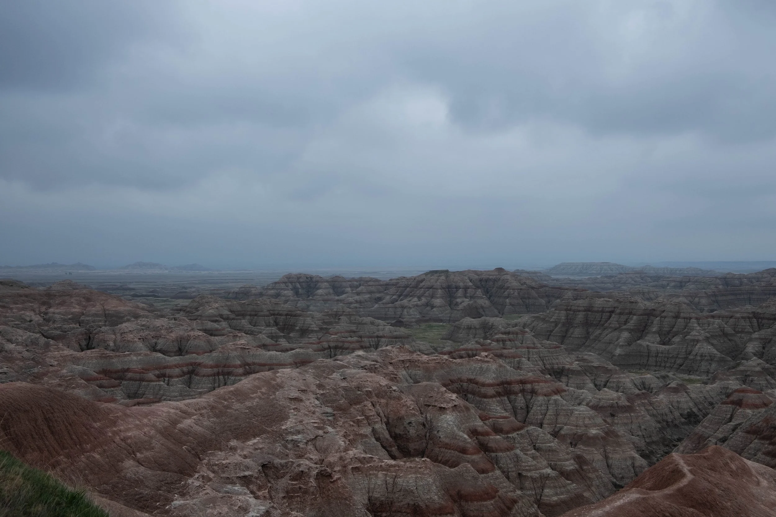
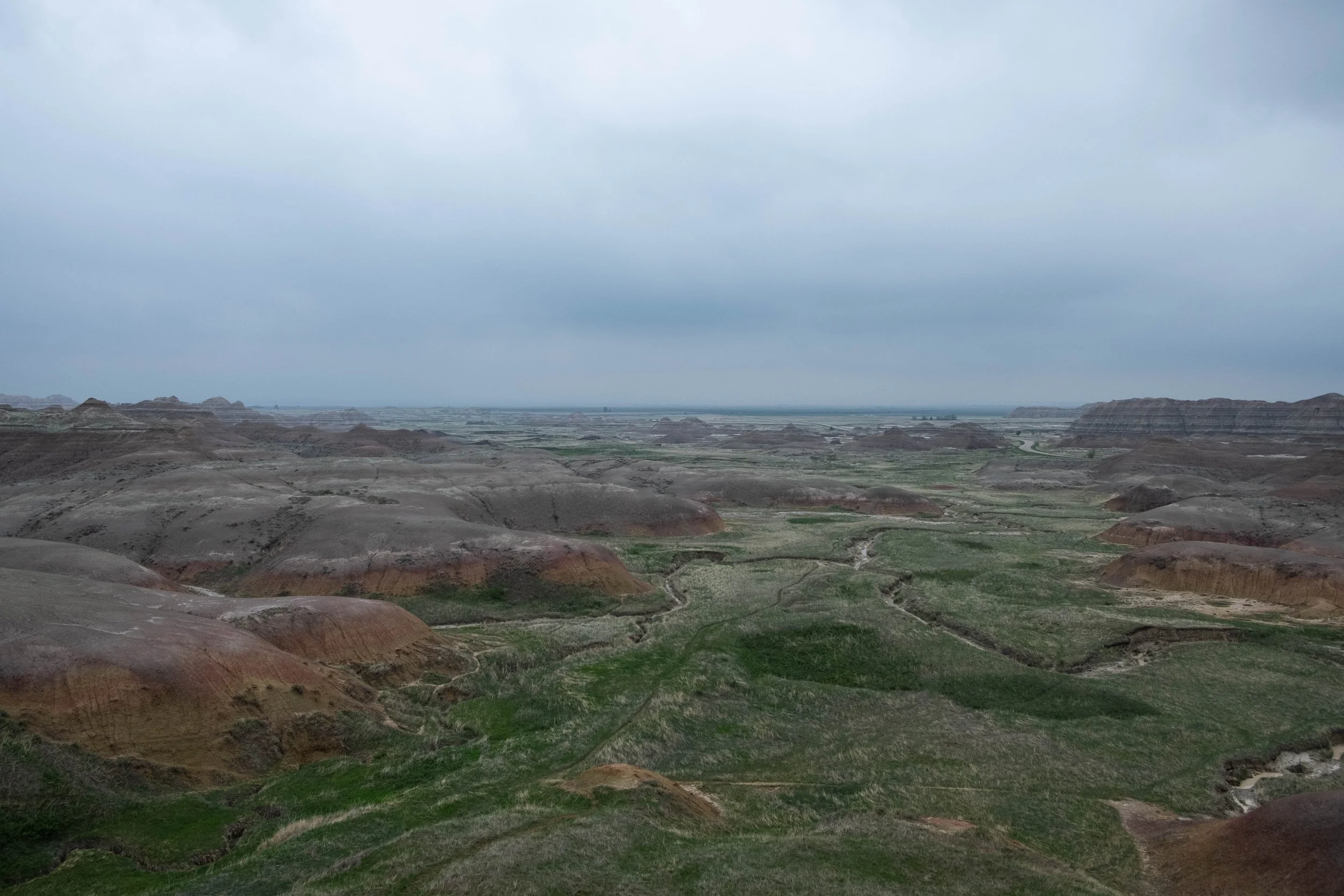
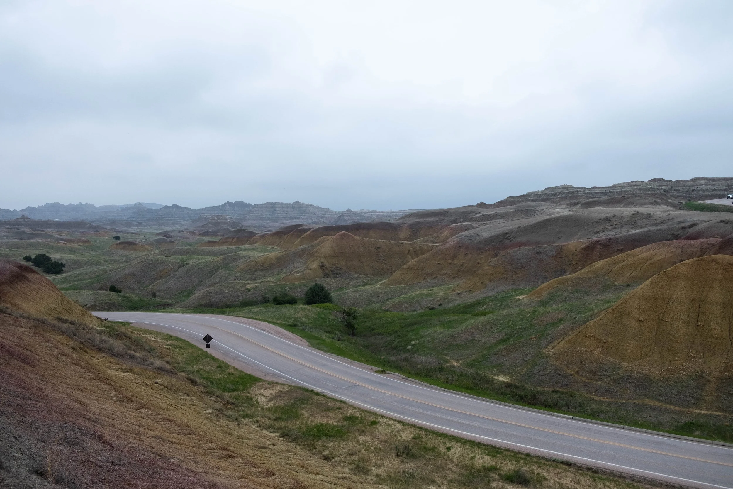
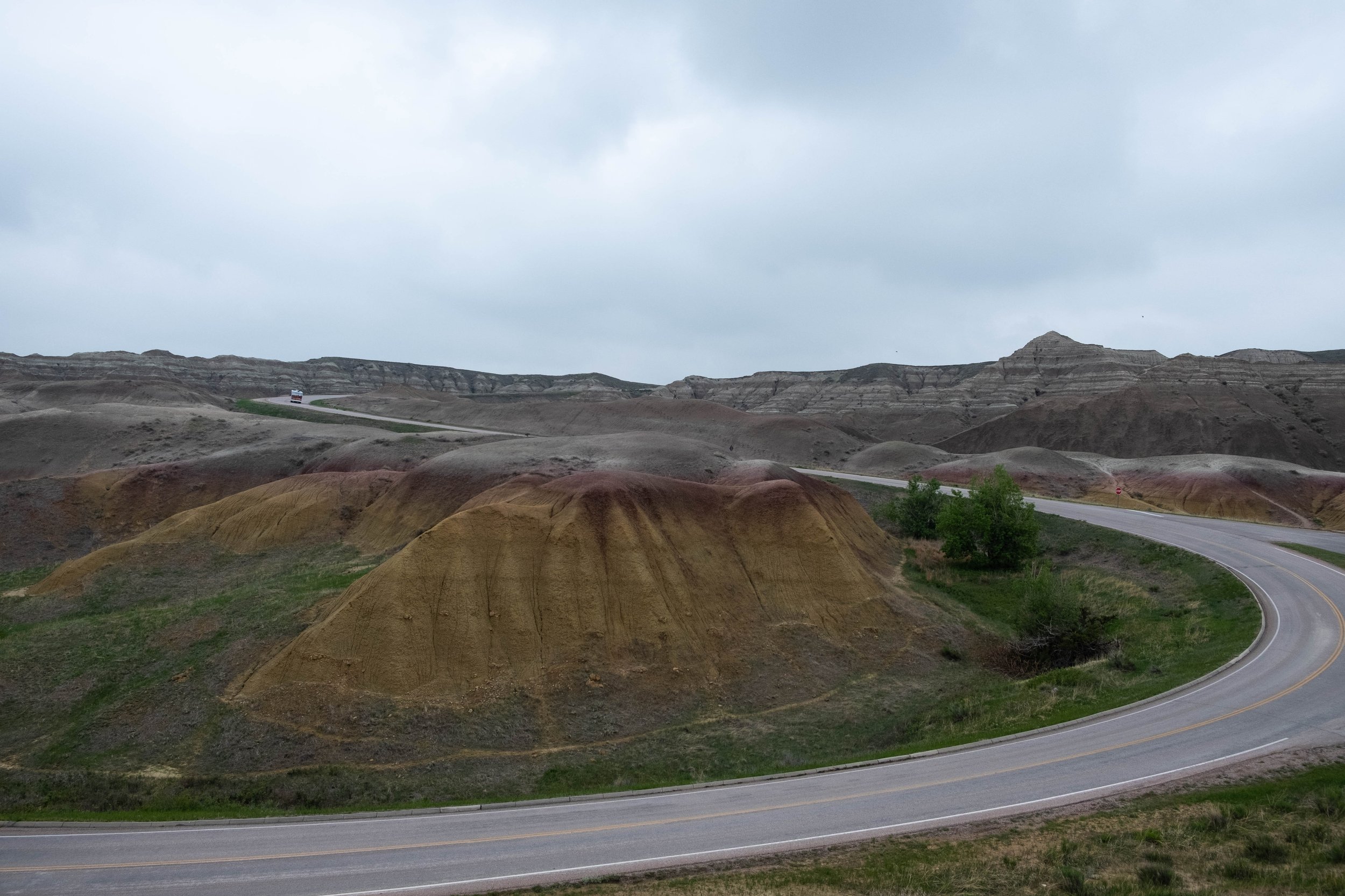
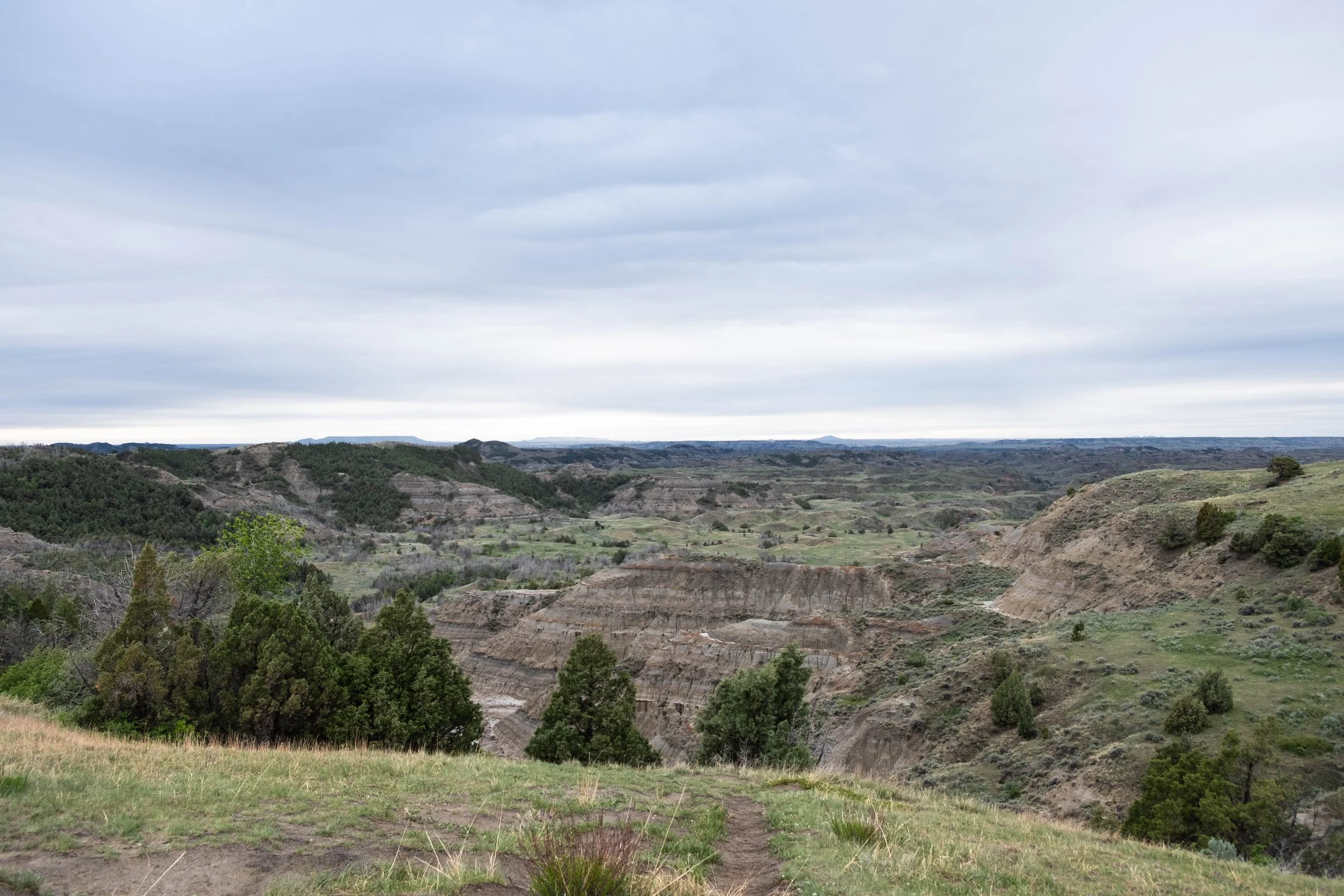
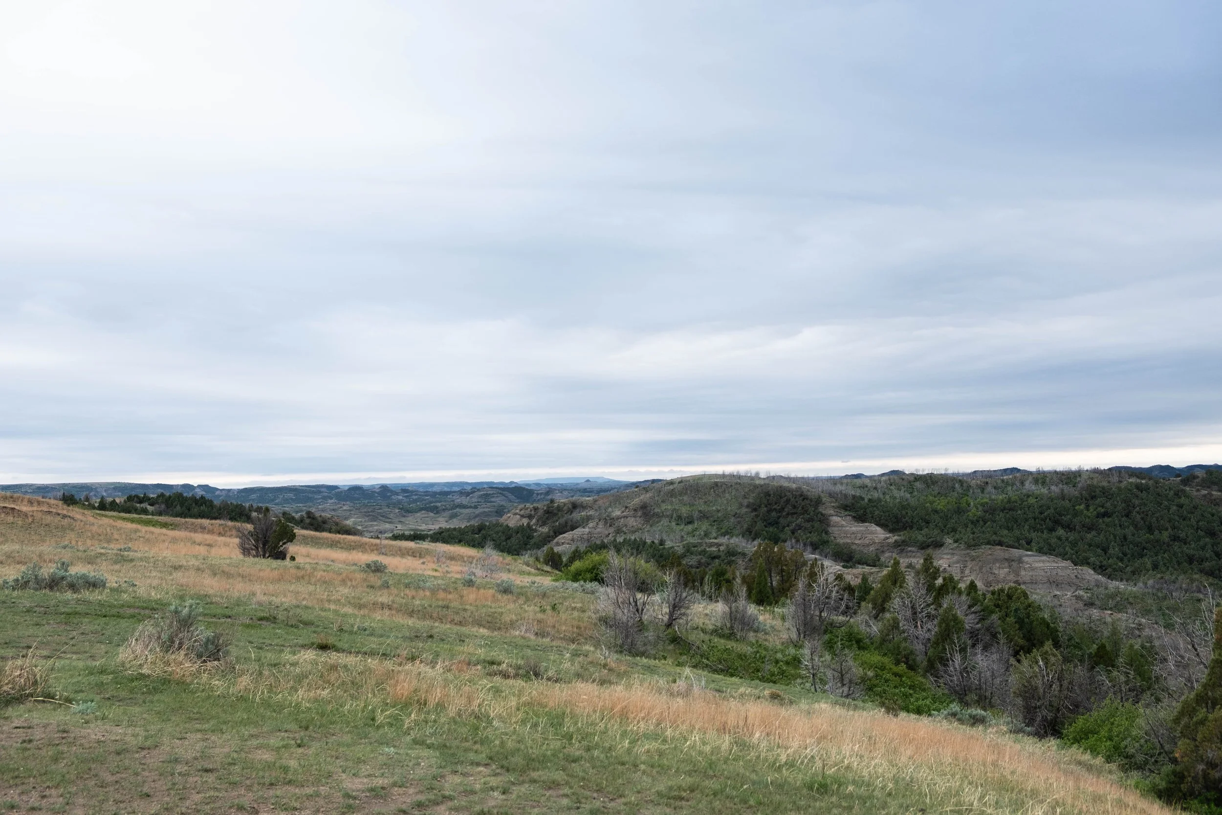
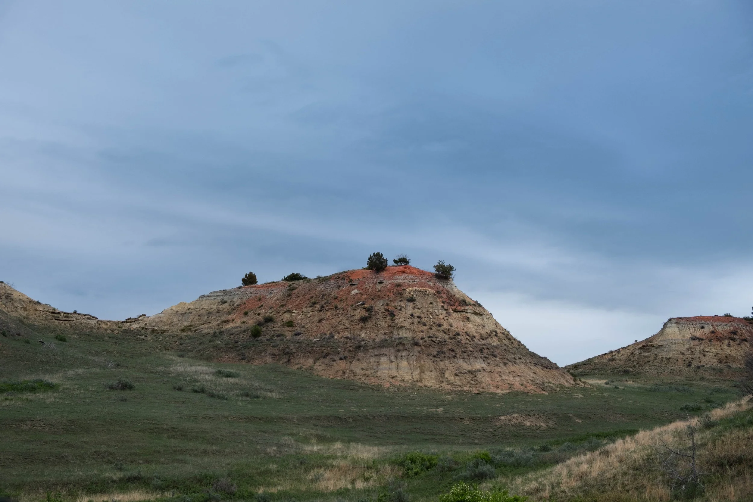
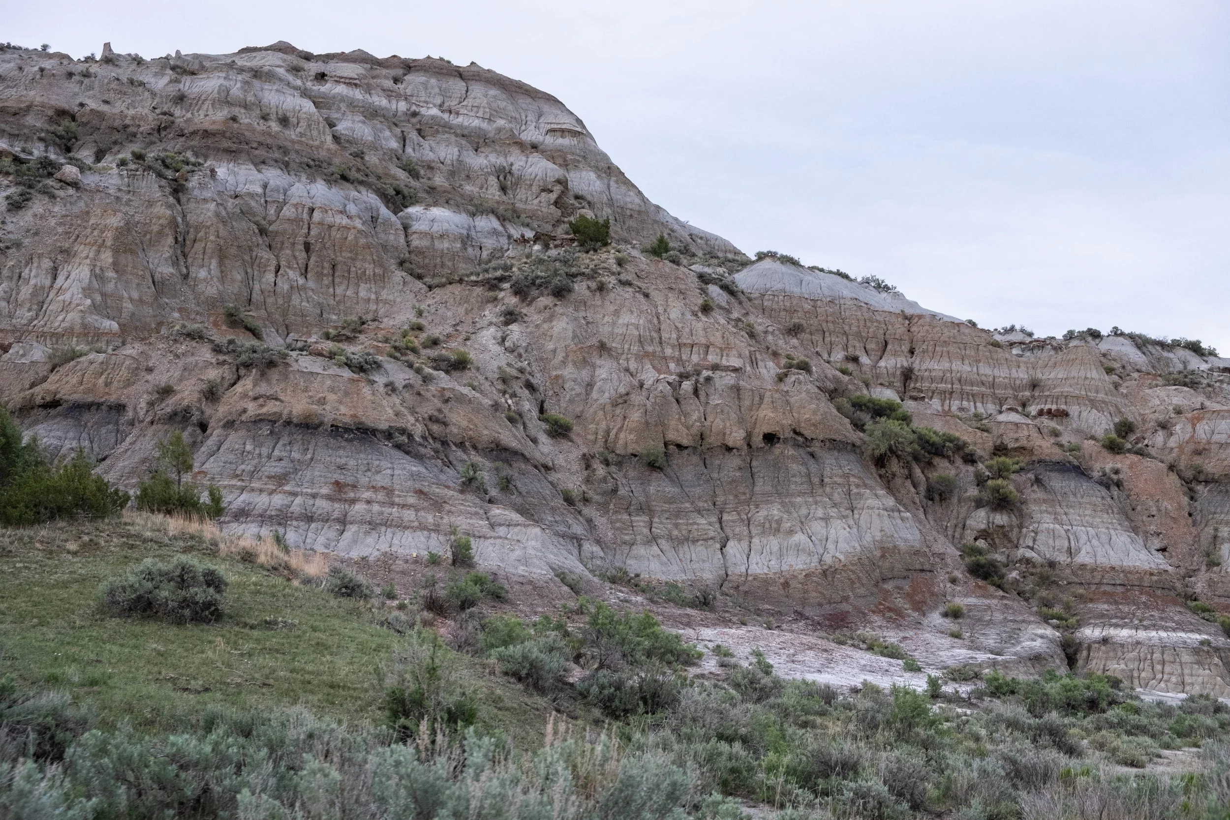
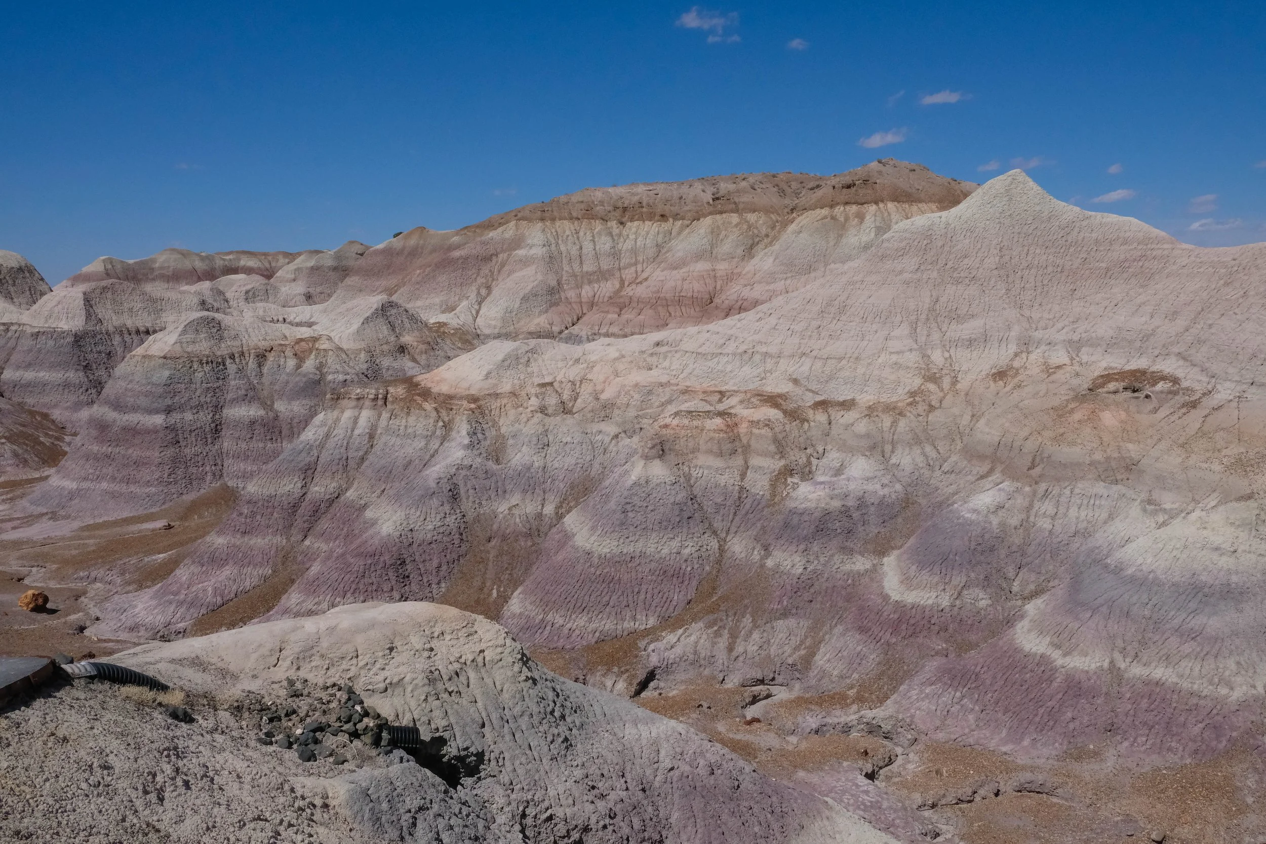
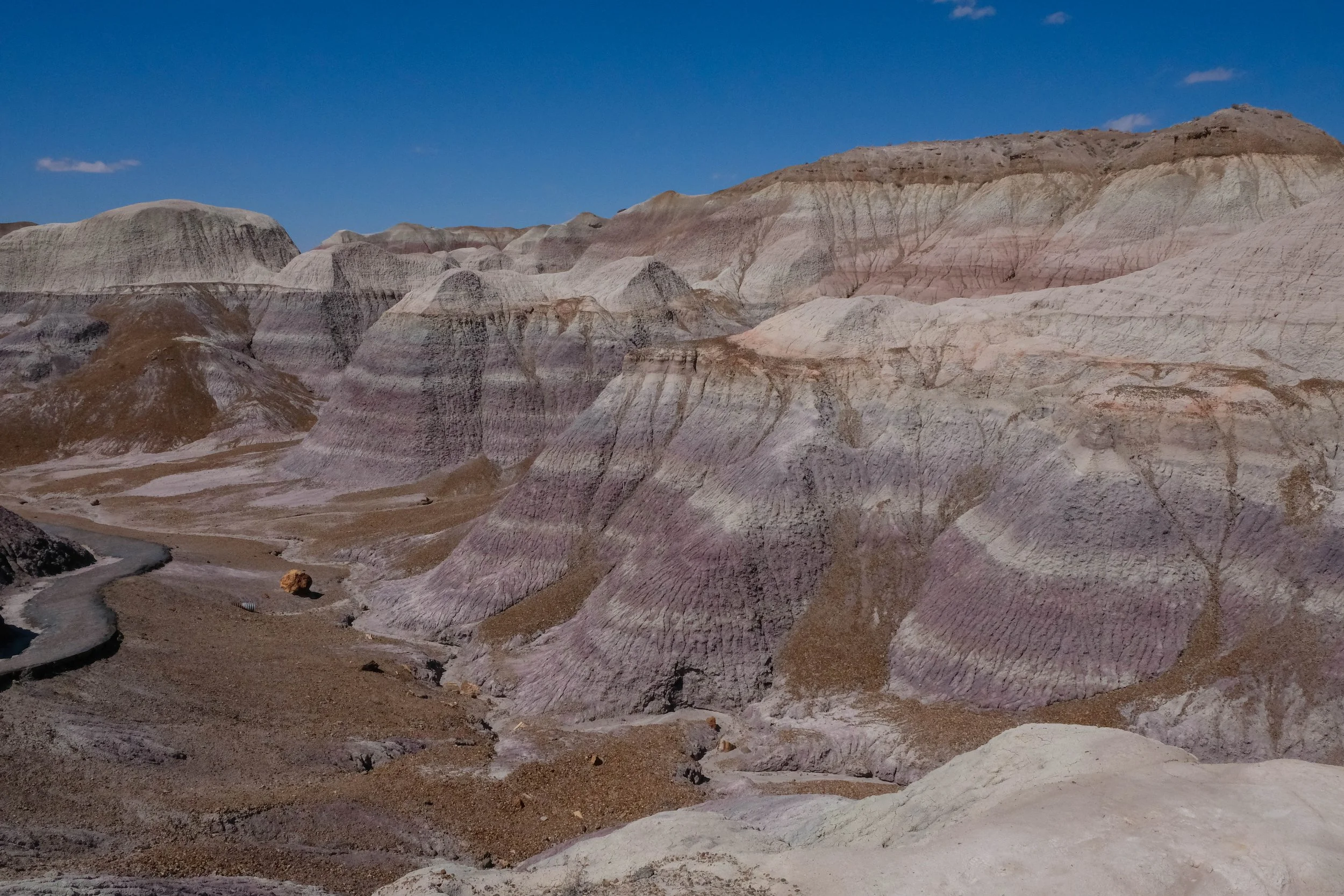
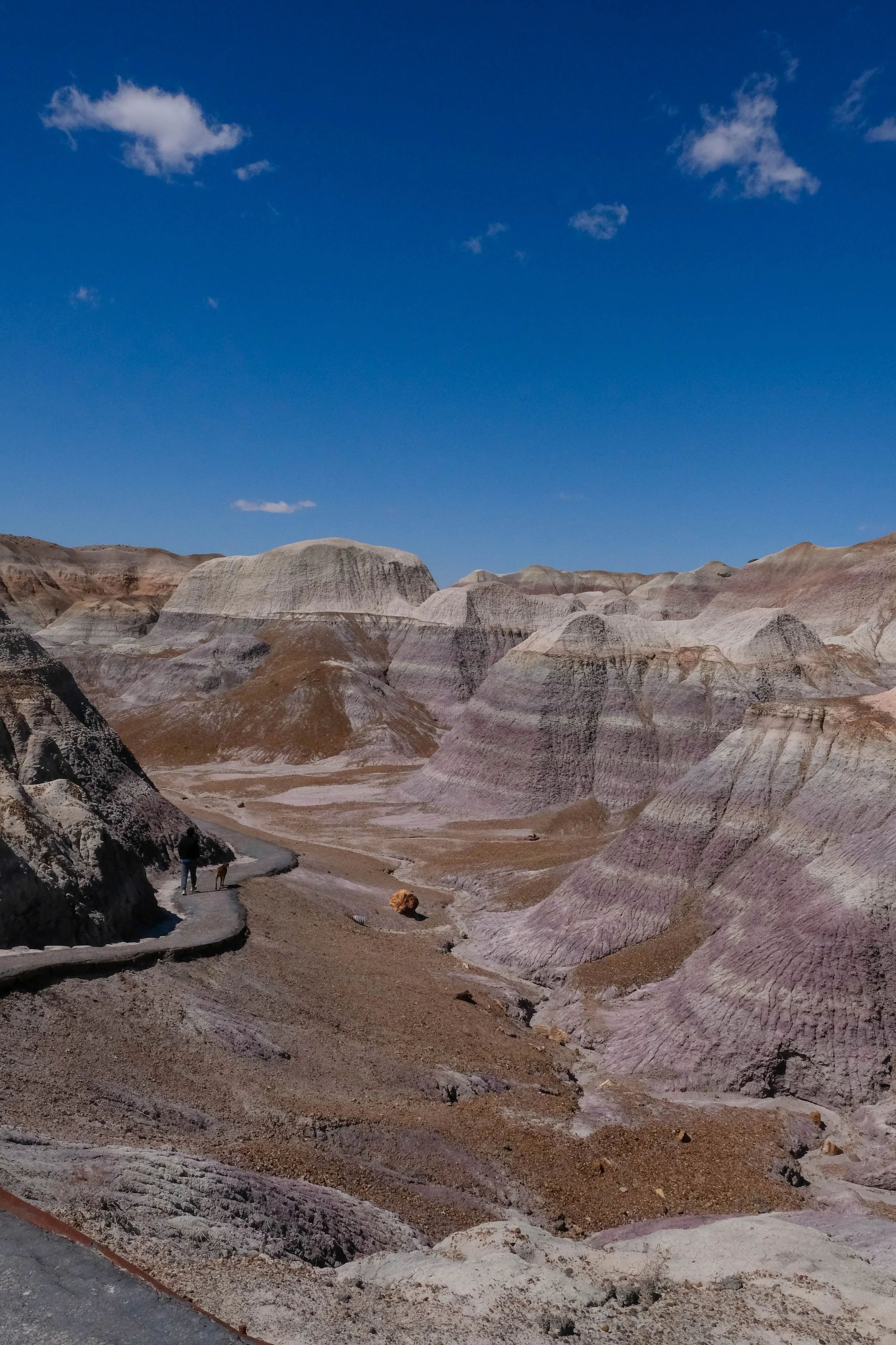
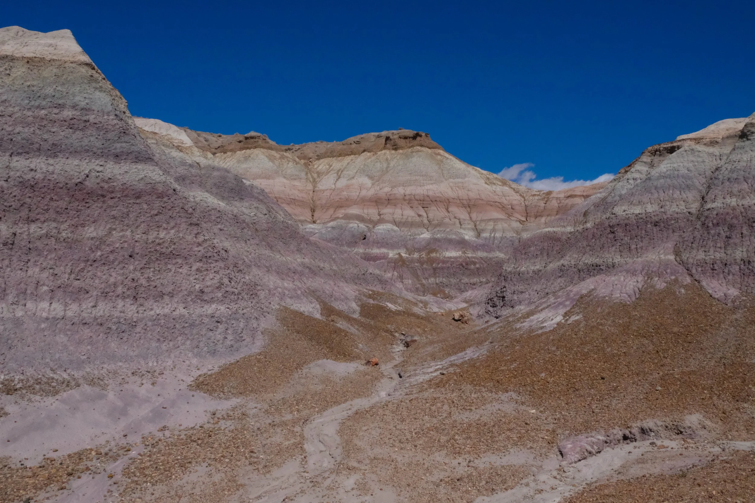
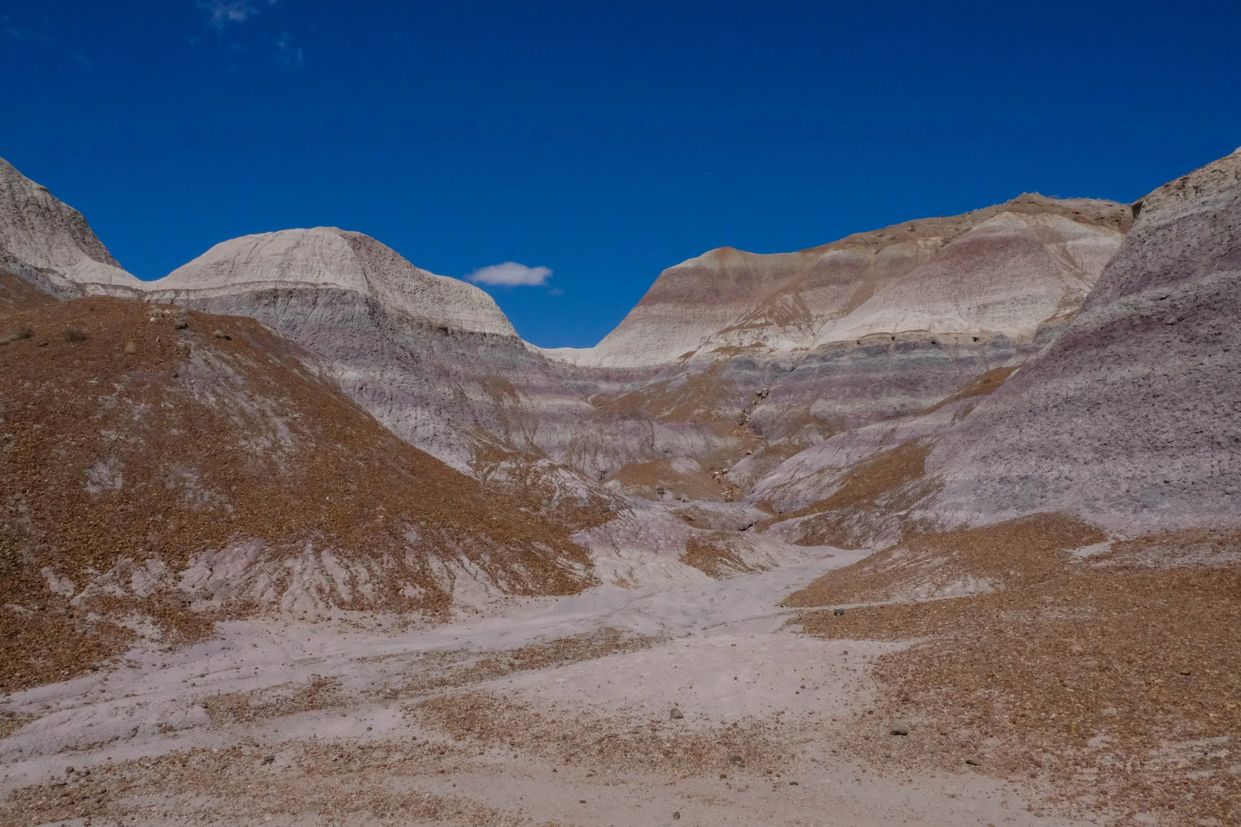
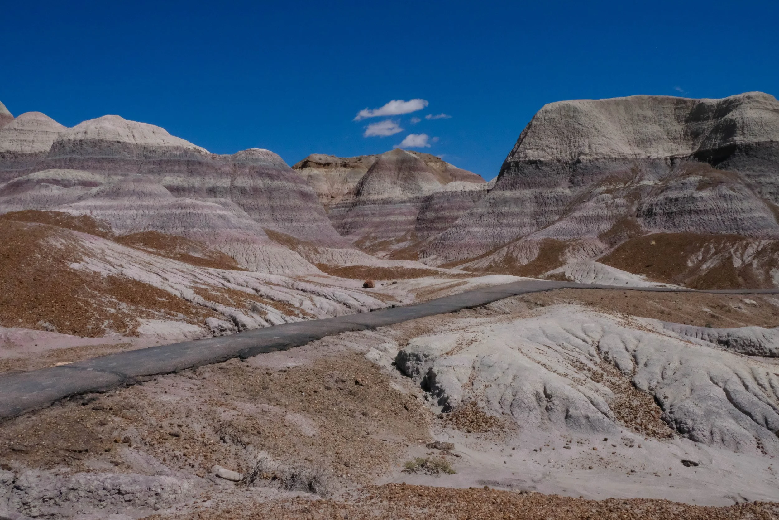
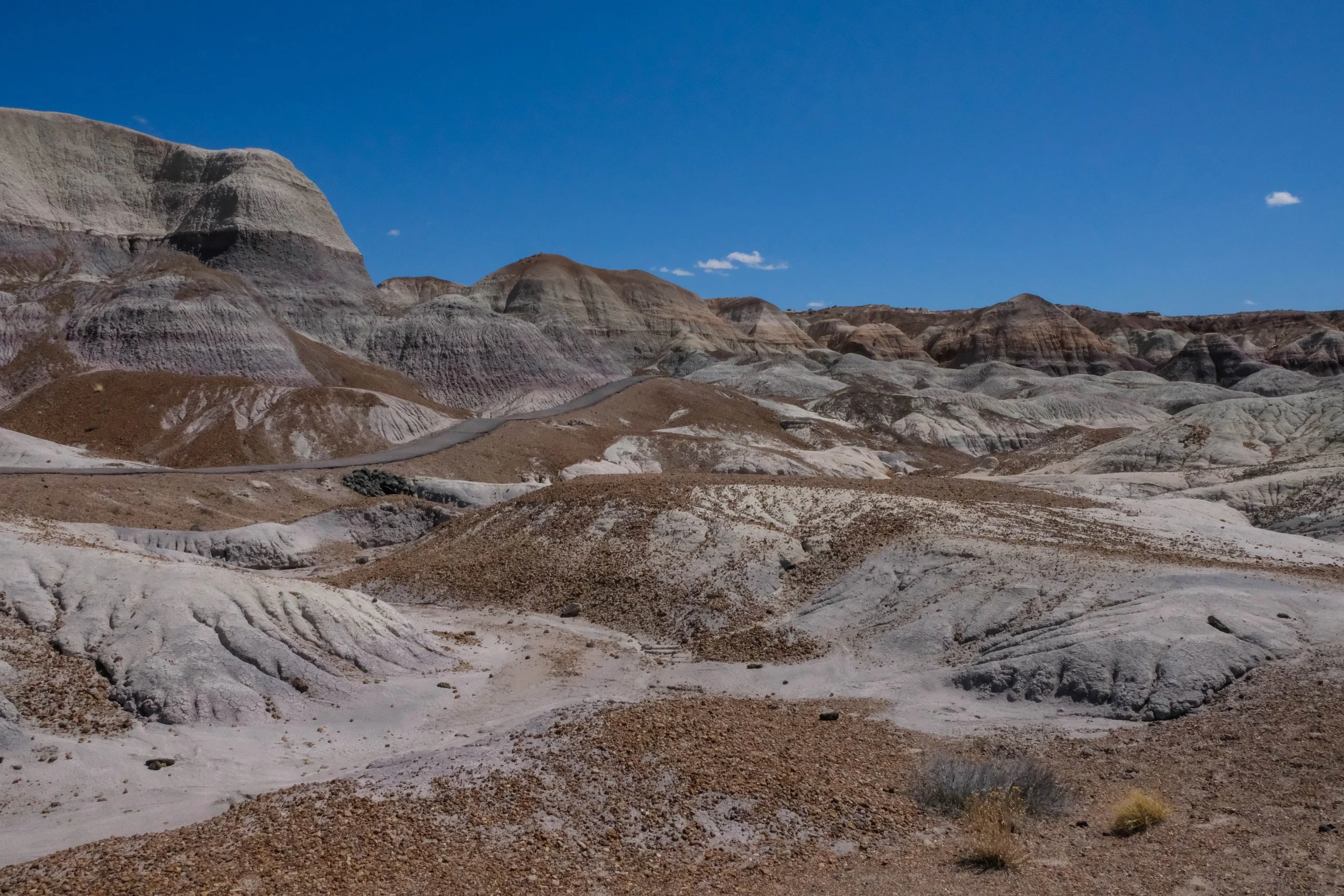
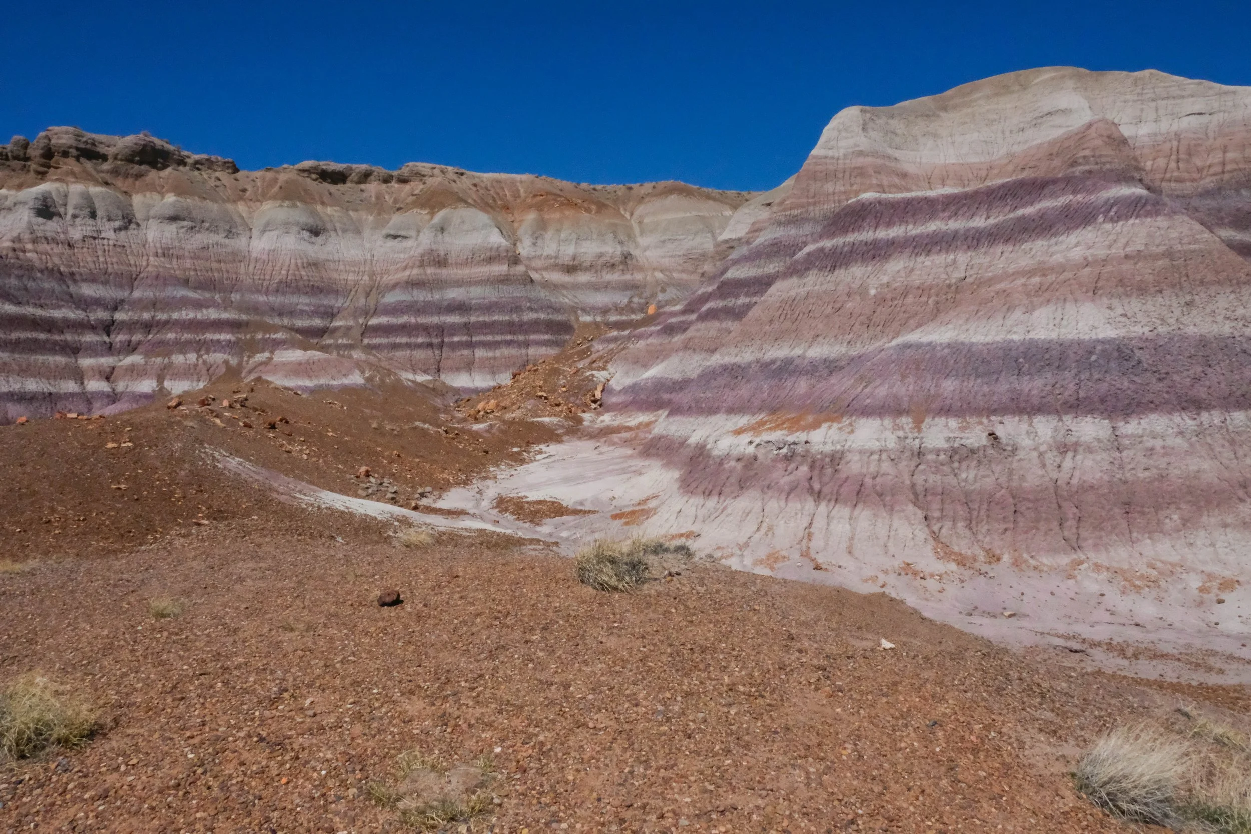
Badlands
Park 36 | May 2025
Part + Park 2 (of 3) of our Memorial Day road trip.
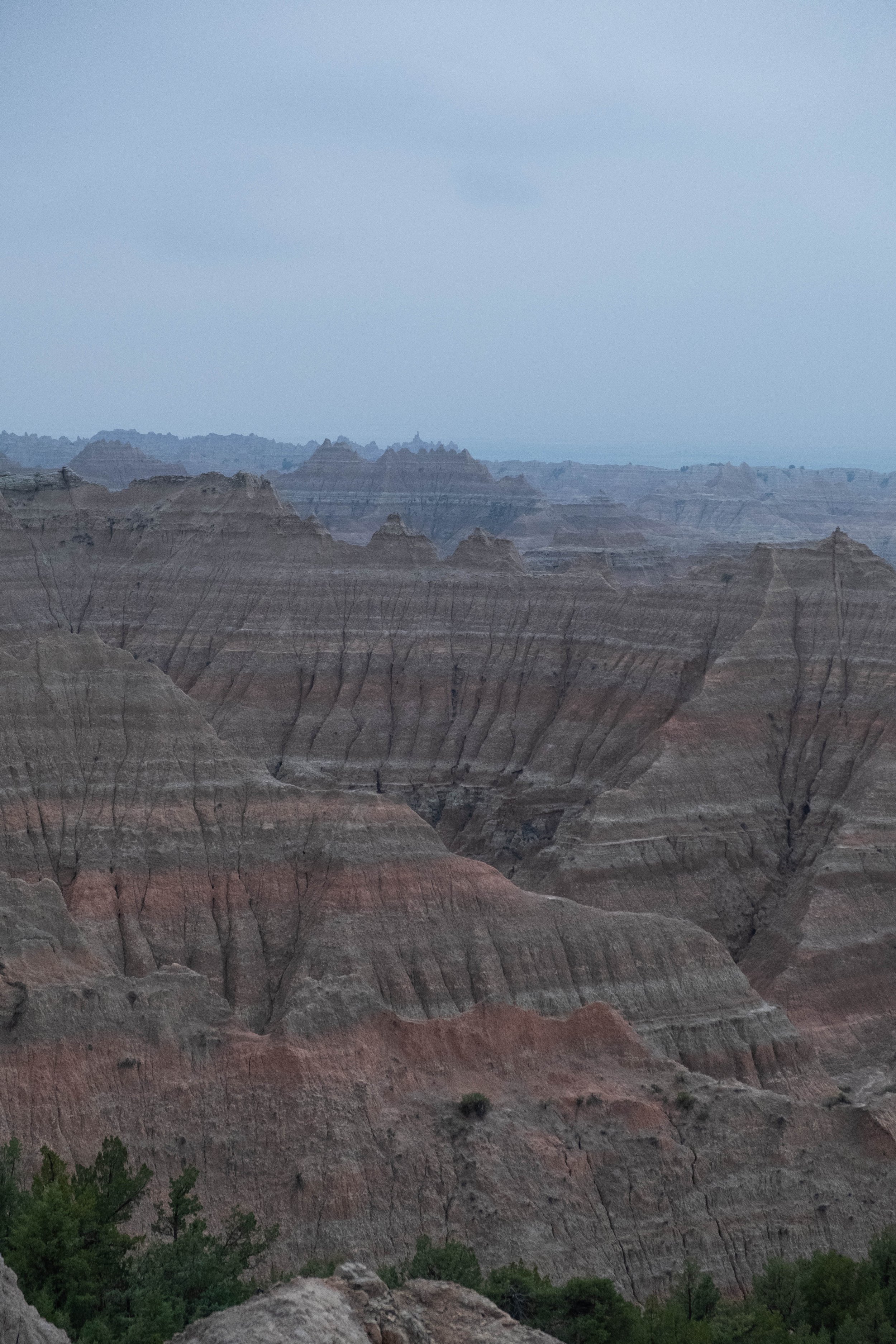
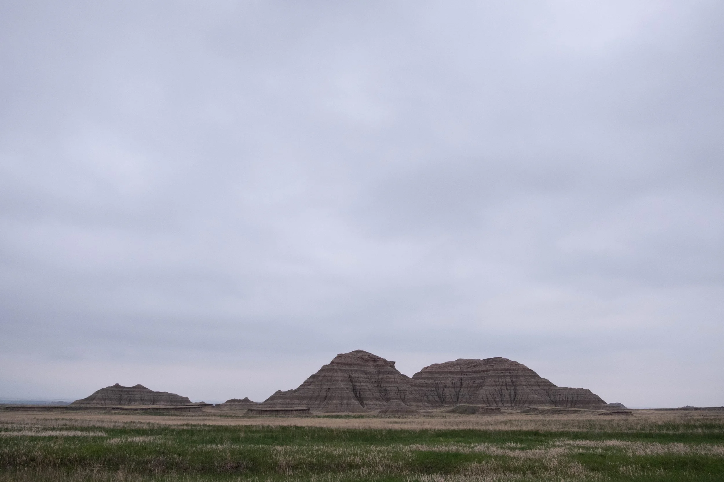
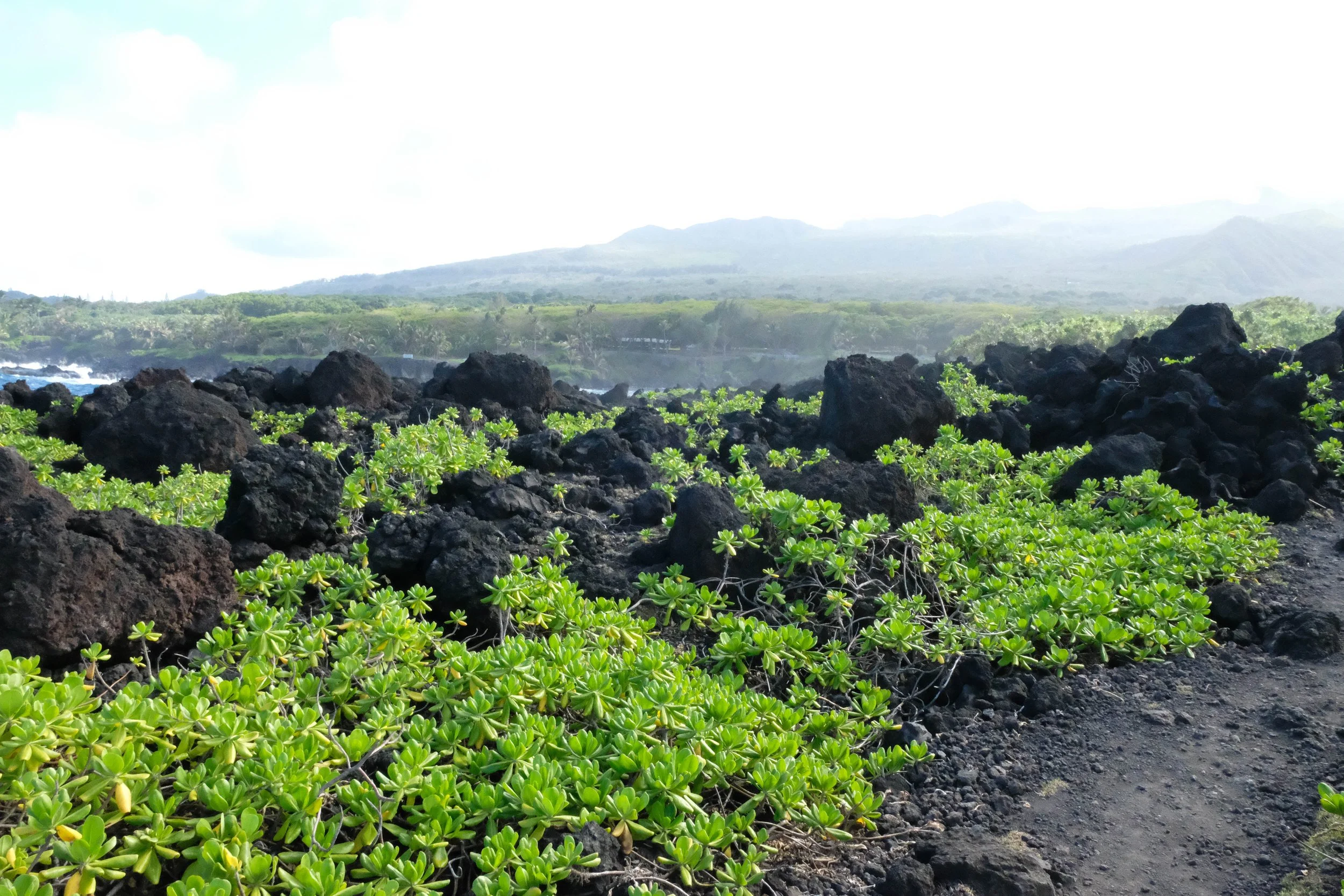
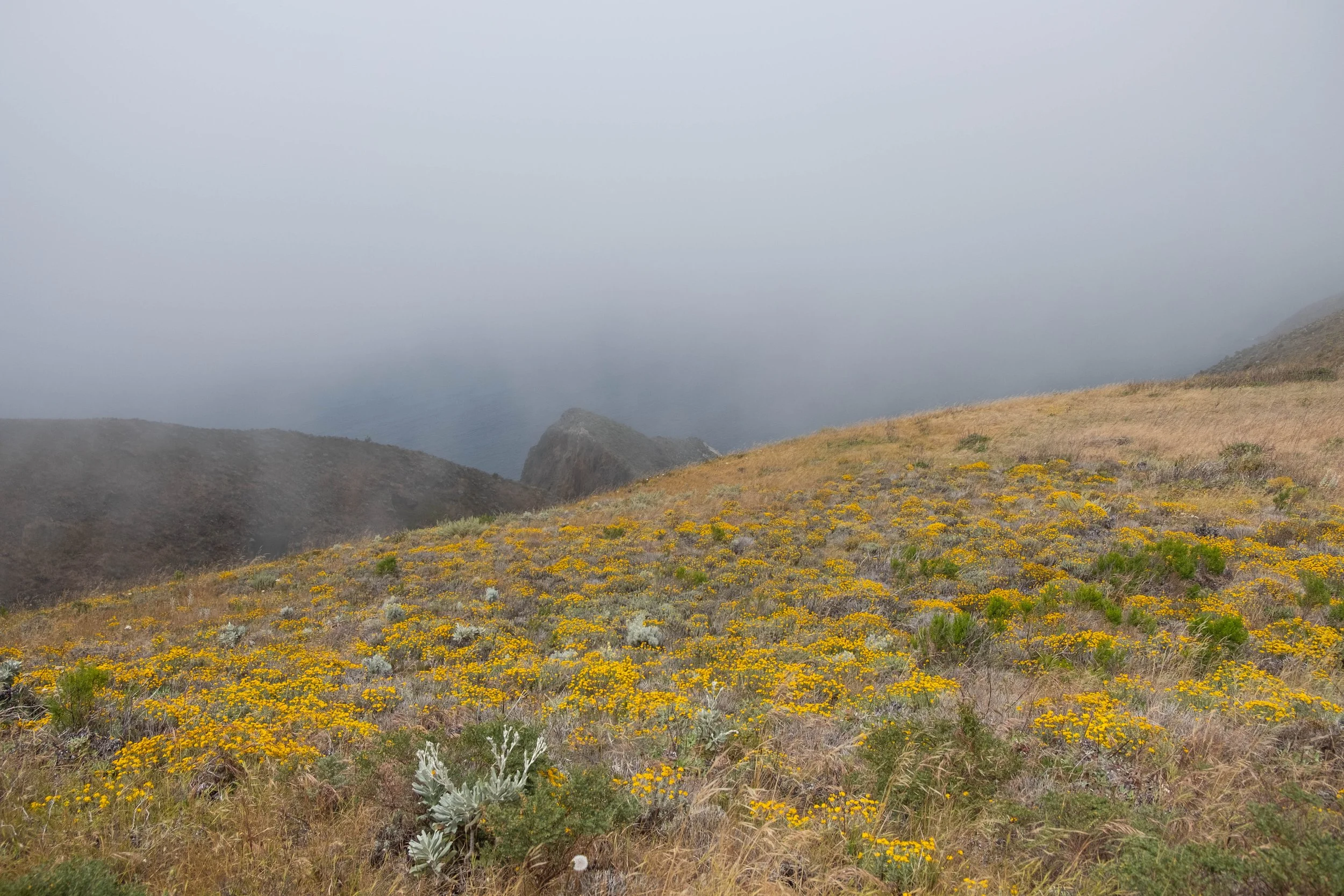
Although the low-hanging rainclouds never broke, which meant we didn’t get the see the colors of this place fully come alive, there was a haunting beauty that stuck with us as we wended our way through these ever-changing ridges and spires. The precipitation coated the wet clay pinnacles with a faint sheen, a subtle warning to take care when walking on and around these surprisingly soft and ever-shifting walls. We spent much of the windswept afternoon driving to different trailheads to explore the area and look for wildlife.
Once darkness began to fall, we drove toward the nearby town of Wall. Billboard after billboard announced that we were close to Wall Drug, a sprawling complex filled from floor to ceiling with knick-knacks and known for its restaurant serving doughnuts, ice cream, pie, and hotdogs. When we arrived, the tiny town was buzzing with crowds of tourists. We found a parking spot and briefly entered this self-proclaimed “souvenir destination” and “pure mid-western experience,” mostly in search of ibuprofen — although in full disclosure, J did also leave with both an ice cream cone and a doughnut.
Wall Drug is a true oddity, a place that sat uneasily with us. Its excessive Americana decor and unfettered celebration of a particular image of the American West felt gaudy, out-of-place, garish. The bright lights and frenzy of Wall Drug was thrown into even sharper relief after we left and drove past a small, dilapidated building just a couple blocks away, with a worn sign that read “The Story of Wounded Knee.” A quick Google revealed that this used to be a museum that told the story of the Wounded Knee Massacre, but it has been permanently closed since 2023. There are hopes to re-open the museum at some point in the nearby Black Hills, but no date has been announced as of when I’m writing this in early 2026.
Some of the content from the museum is available online, and visitor reviews from the last 20 years (many of which we read on Google and Travel Advisor) reveal how impactful the narrative-style exhibits were. According to the website, the museum “presents a carefully researched, thoroughly documented history of the flight of Big Foot’s band of Miniconjou Lakota through the wintry South Dakota landscape, their capture by the 7th Calvary, and the horrors of the morning of December 29, 1890, when up to 300 Lakota men, women, and children died in a hail of bullets from rifles and Hotchkiss guns.” The museum had intentionally been placed in Wall to make it easily accessible to people who were visiting Badlands National Park as well as the nearby site of the Wounded Knee Massacre.
We spent a lot of time on the drive back to the park reflecting on how very American this contrast felt: A underfunded museum that told a vitally important story about this land, the Lakota, and a heinous act of violence perpetrated, permitted, and protected by settler colonialism, now shuttered in the shadow of a behemoth tourist trap that does nothing but paper over history in ways that favor the victors. The Wall Drugs of the world transform places filled with moral reckoning and prairie grasses into sanitized gimmicks that prioritize comfort and pleasure over truth. Have a doughnut, buy a souvenir, eat some good ol’ American apple pie! The result is a little town in South Dakota that is known more for its kitsch than for its actual story: The horror and the beauty, the songbirds and the bison, the badlands and the ever-blowing winds, the stories that make it what it is.
The Badlands were Park 36 for us. Our goal to go to all the US national parks is somewhat arbitrary (aren’t most goals, to a certain extent?) and can even be problematic. We try to hold that lightly and use this imperfect medium to orient ourselves towards learning and growth. Having the excuse of visiting these parks has drawn us to corners of the country that we wouldn’t have sought out or visited otherwise. Witnessing the political and cultural differences, the way certain narratives are supported or suppressed, and the stunning natural variety across this country continues to broaden our knowledge and desire to understand the whole story of this deeply flawed place we were born in. There is always something new we come away with after each park and the Badlands were no exception.
Pictured below:
Our windswept, soon to be drenched, yet somehow still comfortable campsite.
Views from the drive between the NE Entrance to the Pinnacles Entrance.
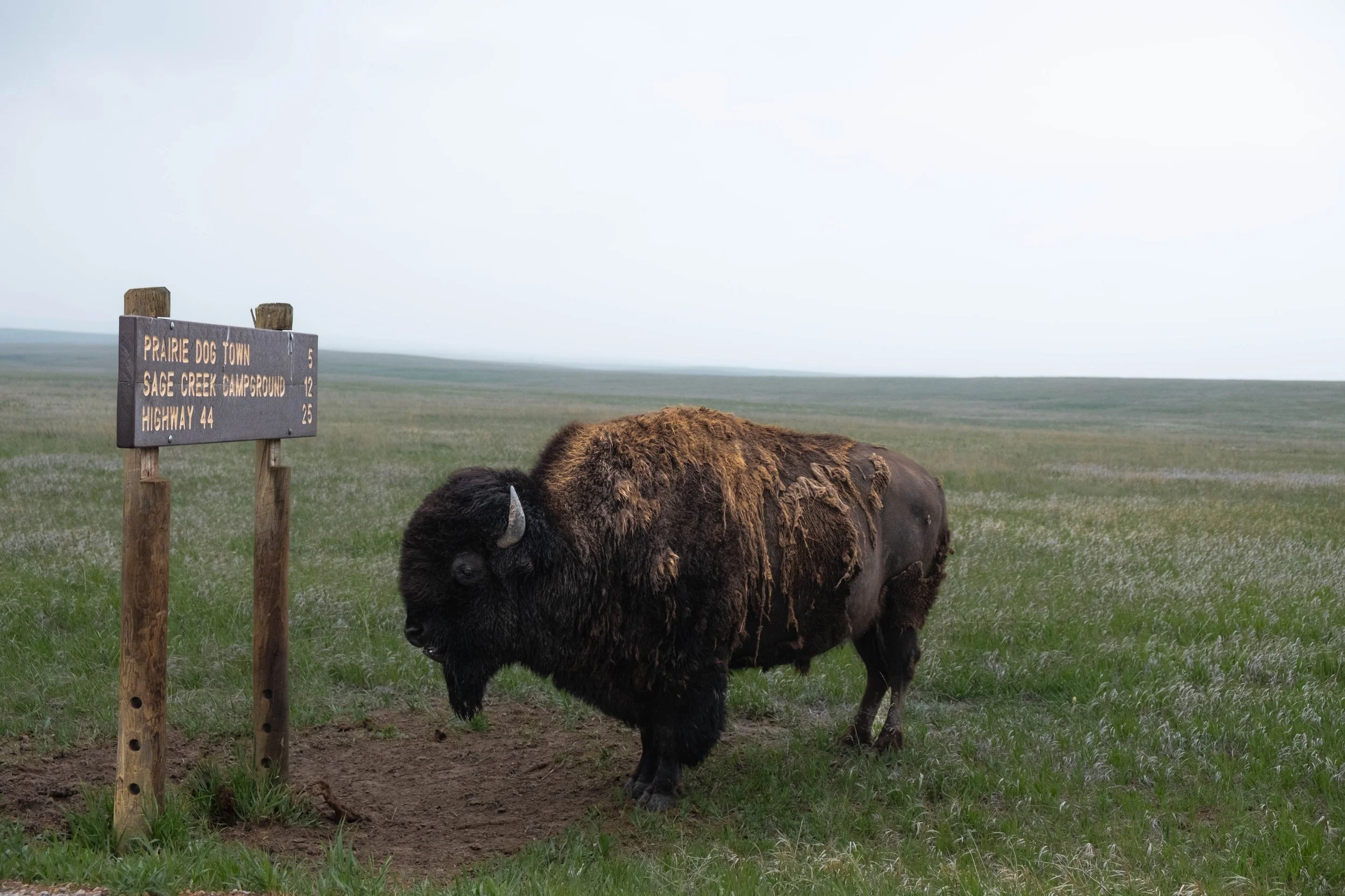
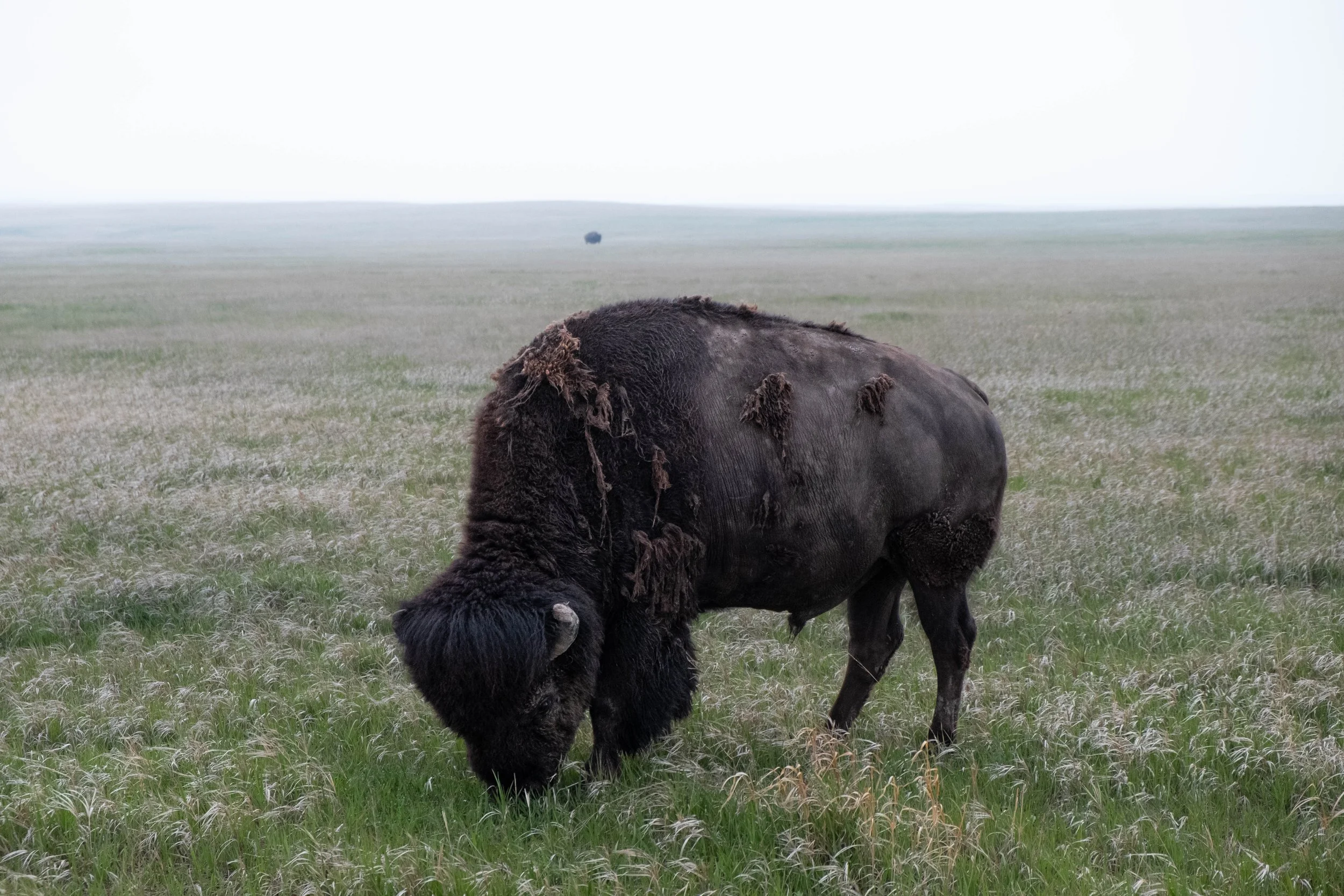
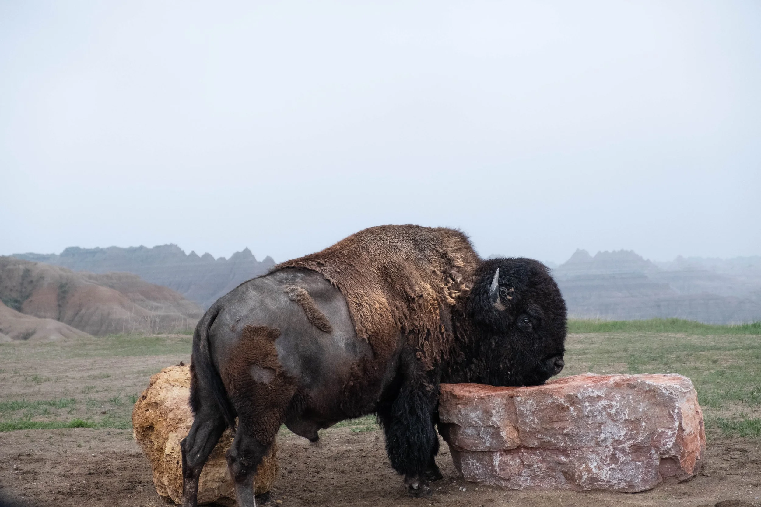
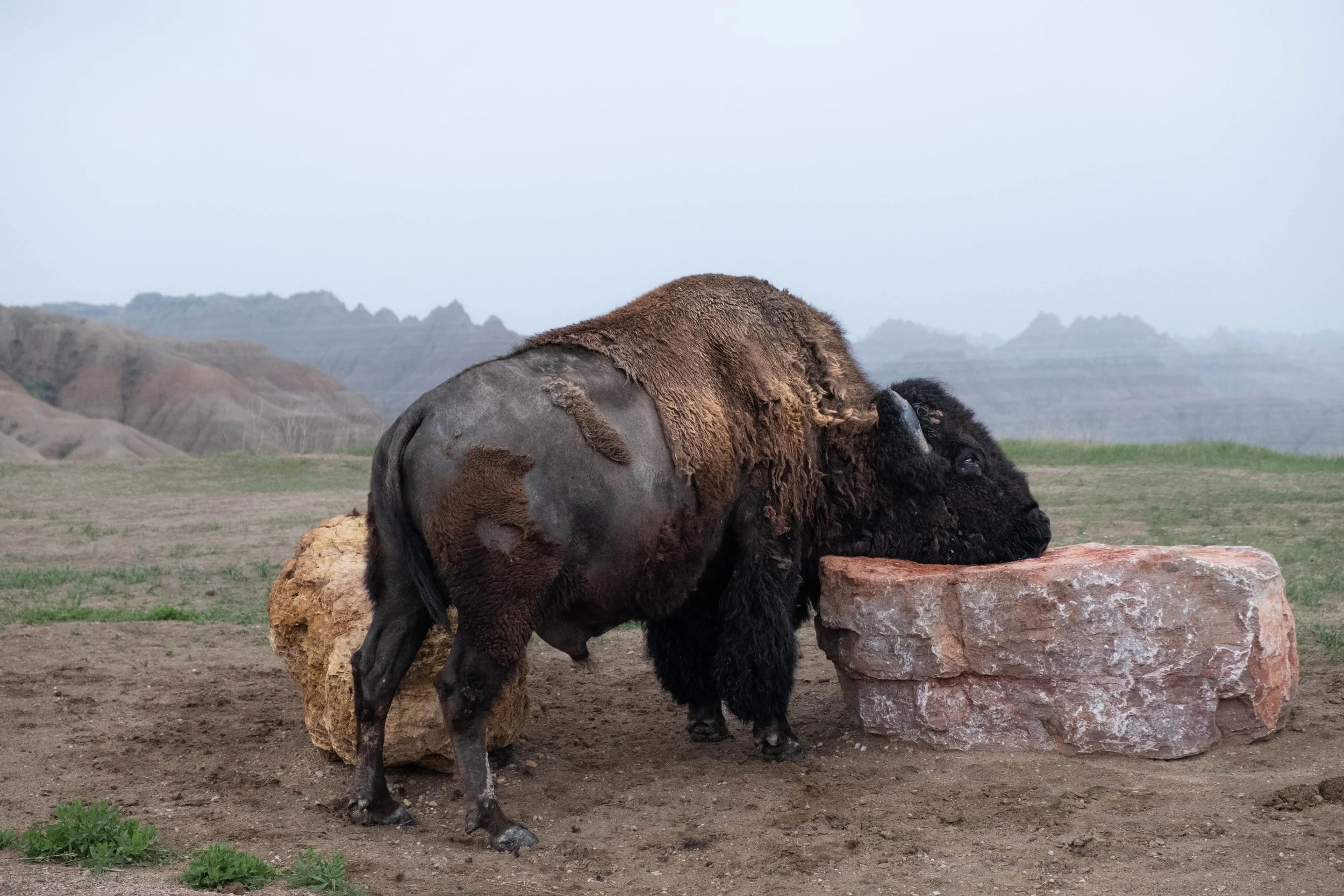
Bison, bison, and more bison — plus a few bighorn sheep.
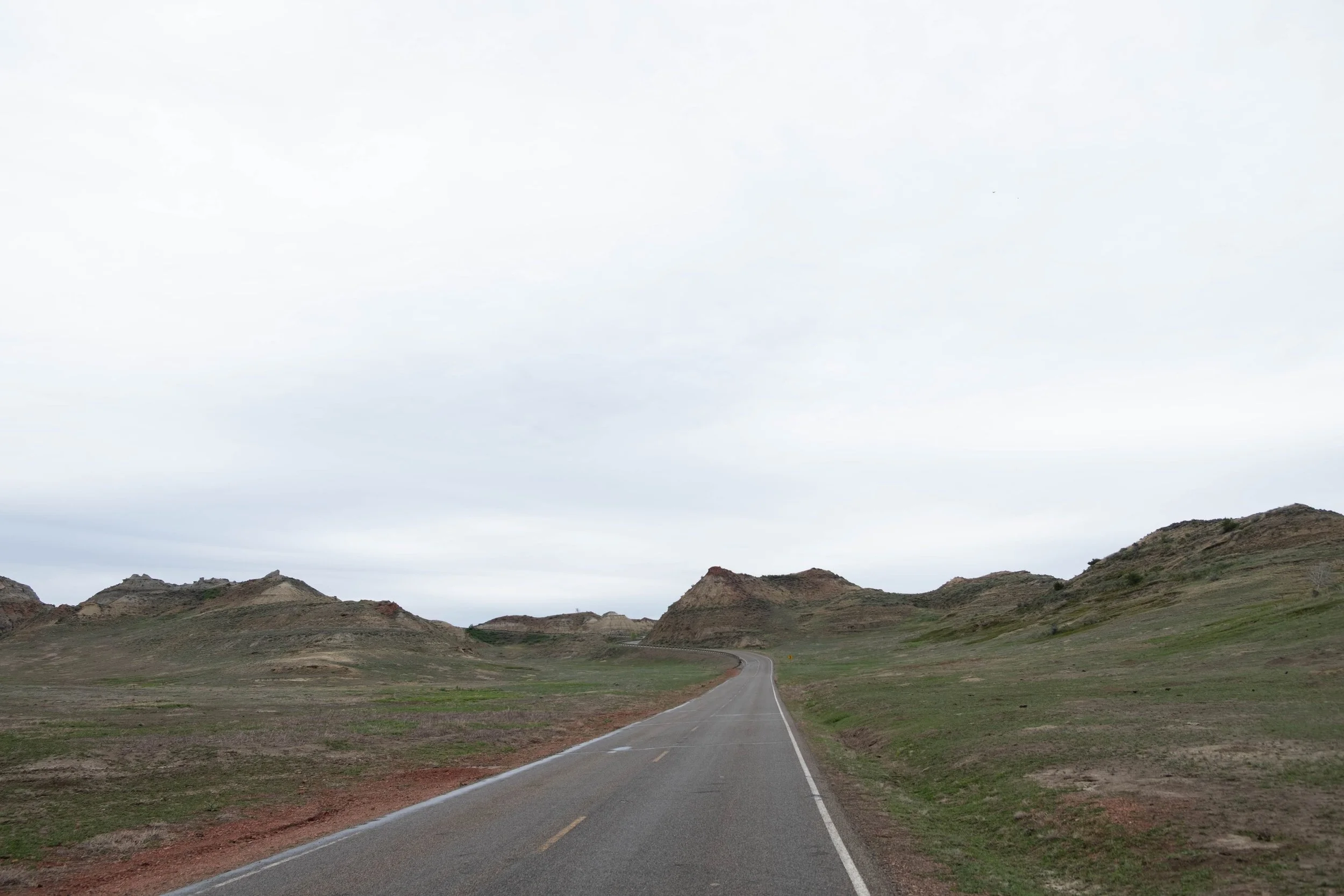
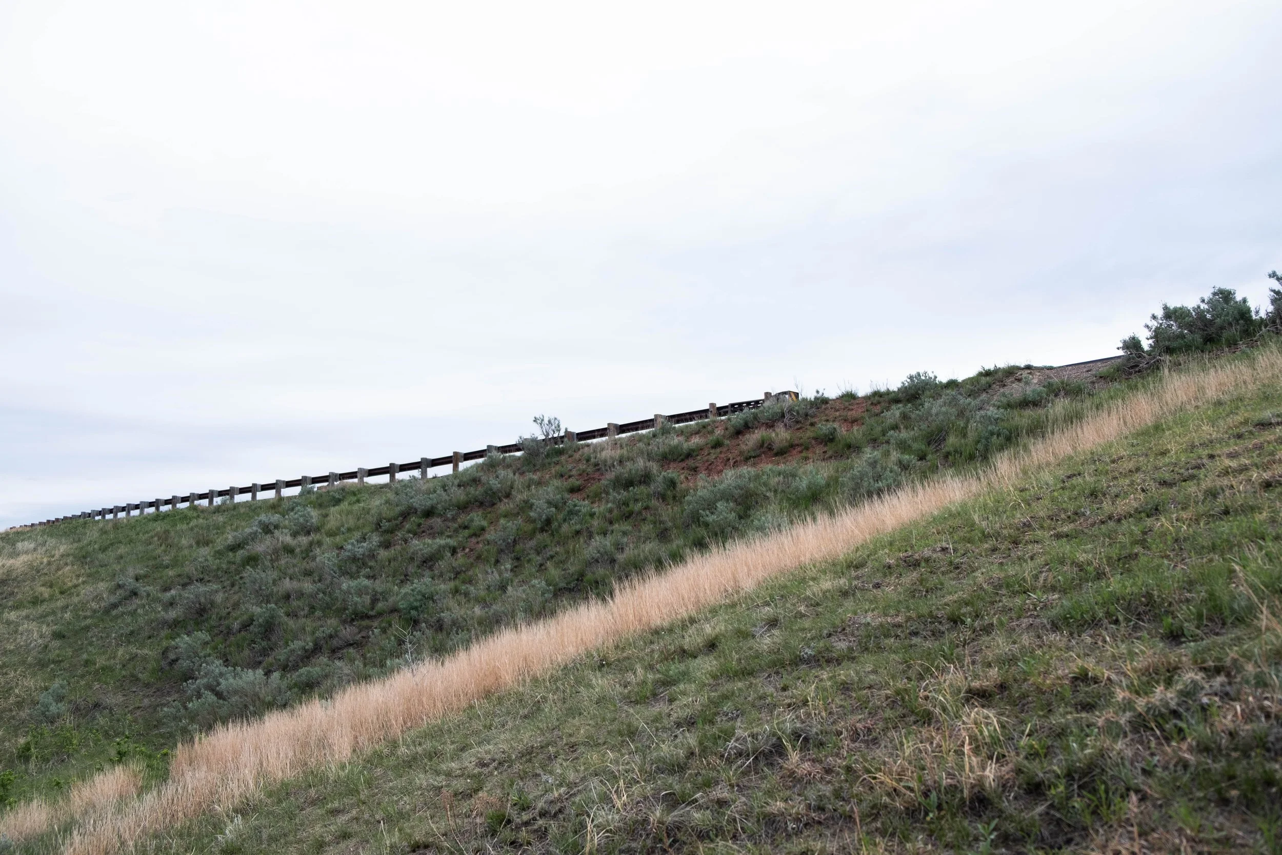
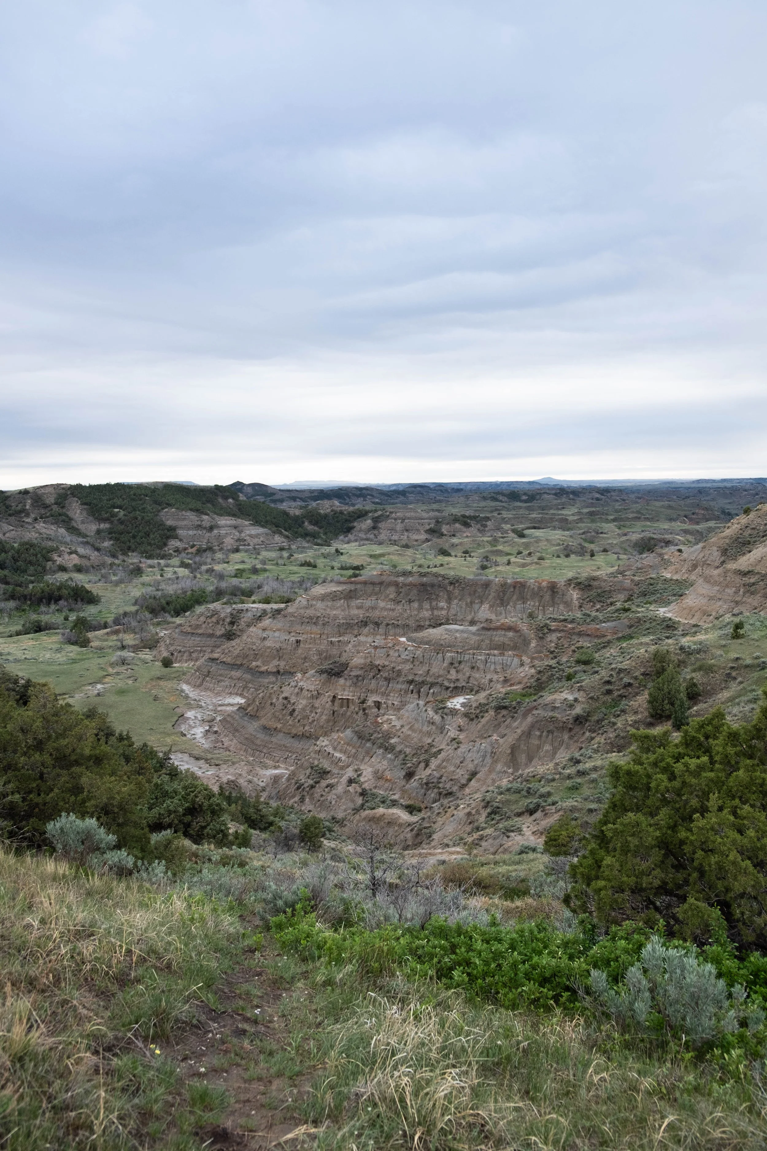
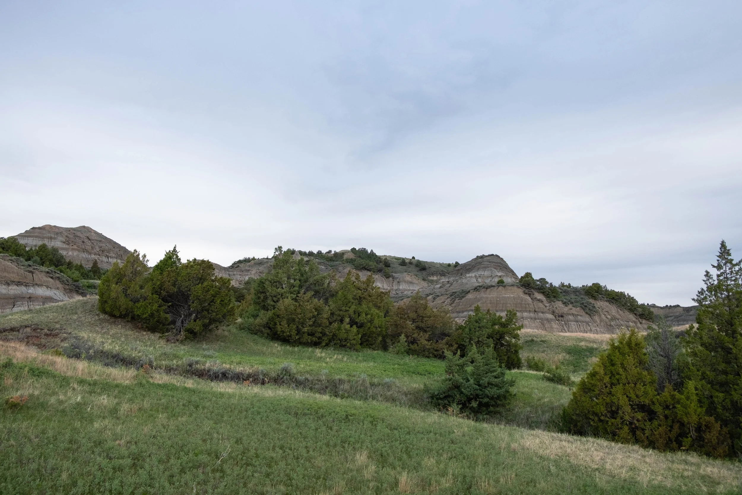
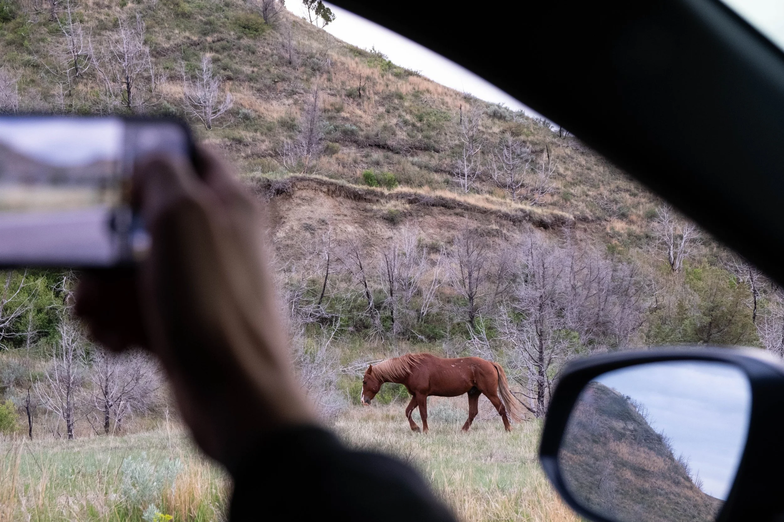
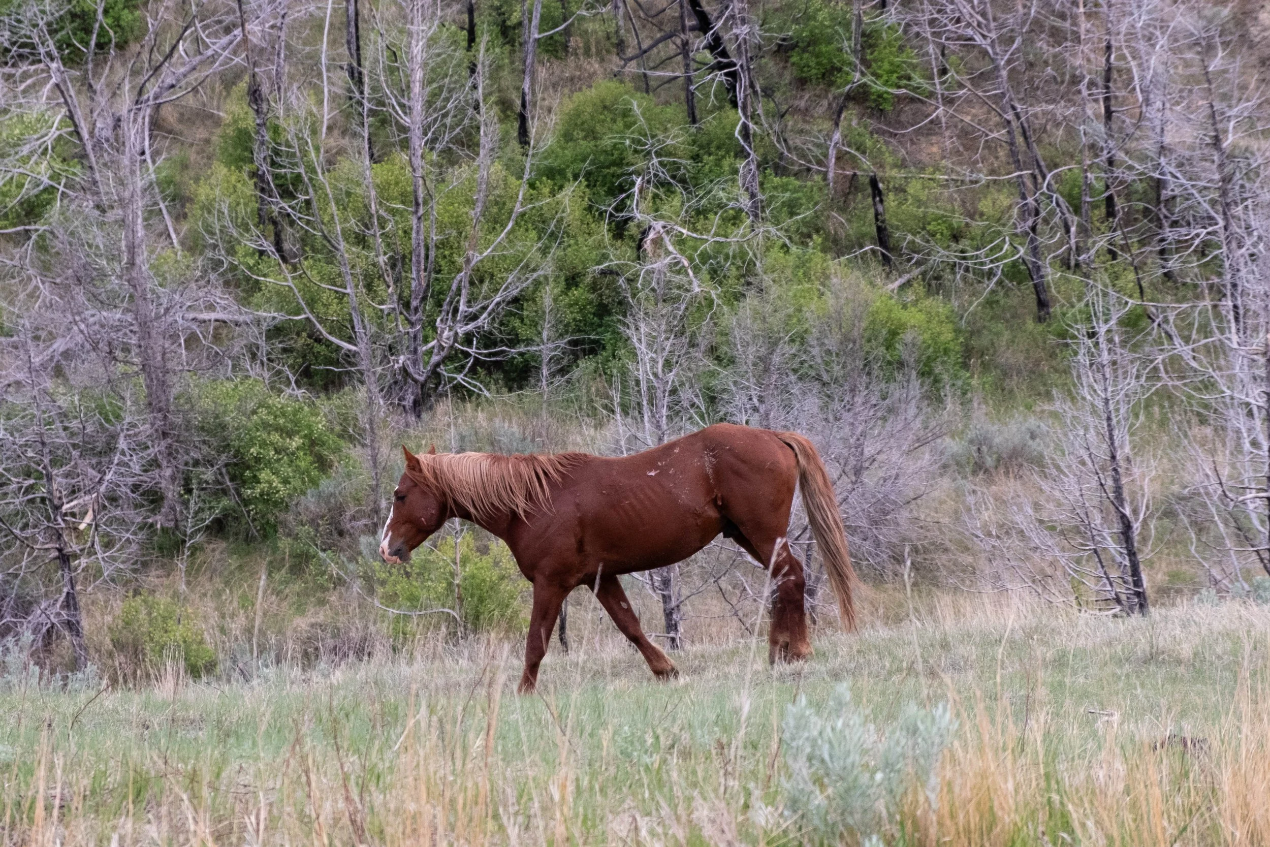
Theodore Roosevelt
Park 35 | May 2025
Part + Park 1 (of 3) in our Memorial Day weekend road trip, which ended up being characterized by one word: Rain.
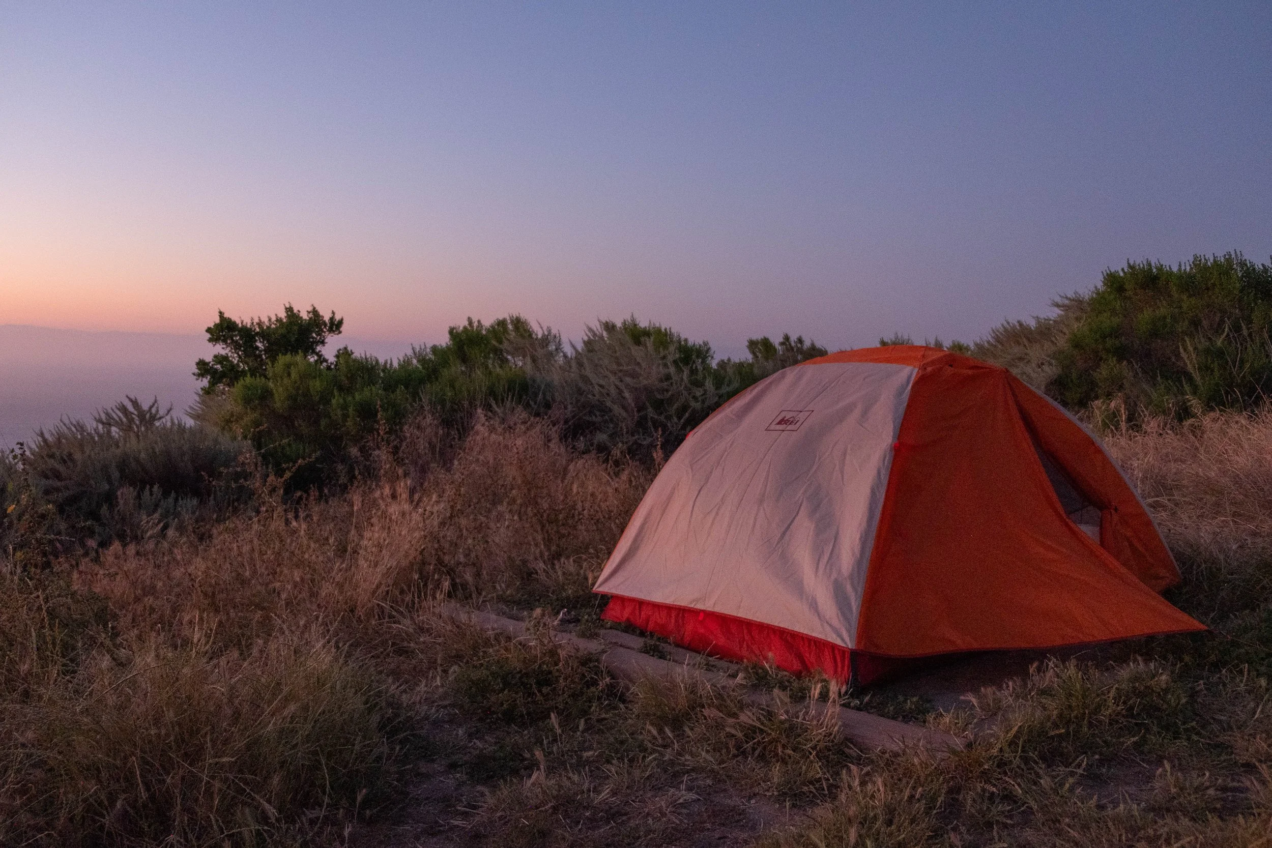
Theodore Roosevelt National Park is a 9-hour drive straight north of Denver, the highways running along the borders of Wyoming, South Dakota, Montana, and North Dakota. We decided to start this long weekend off at the park furthest from us, then work our way back to Colorado by way of the two South Dakota parks. Unfortunately, as the time grew closer for our trip, the developing forecast looked ominous: Heavy rain predicted from the moment our trip was to begin until the last day (after which there were to be clear skies and sunshine, naturally). Nevertheless, the campsites were booked and we had limited time off this year, so decided to go for it regardless.
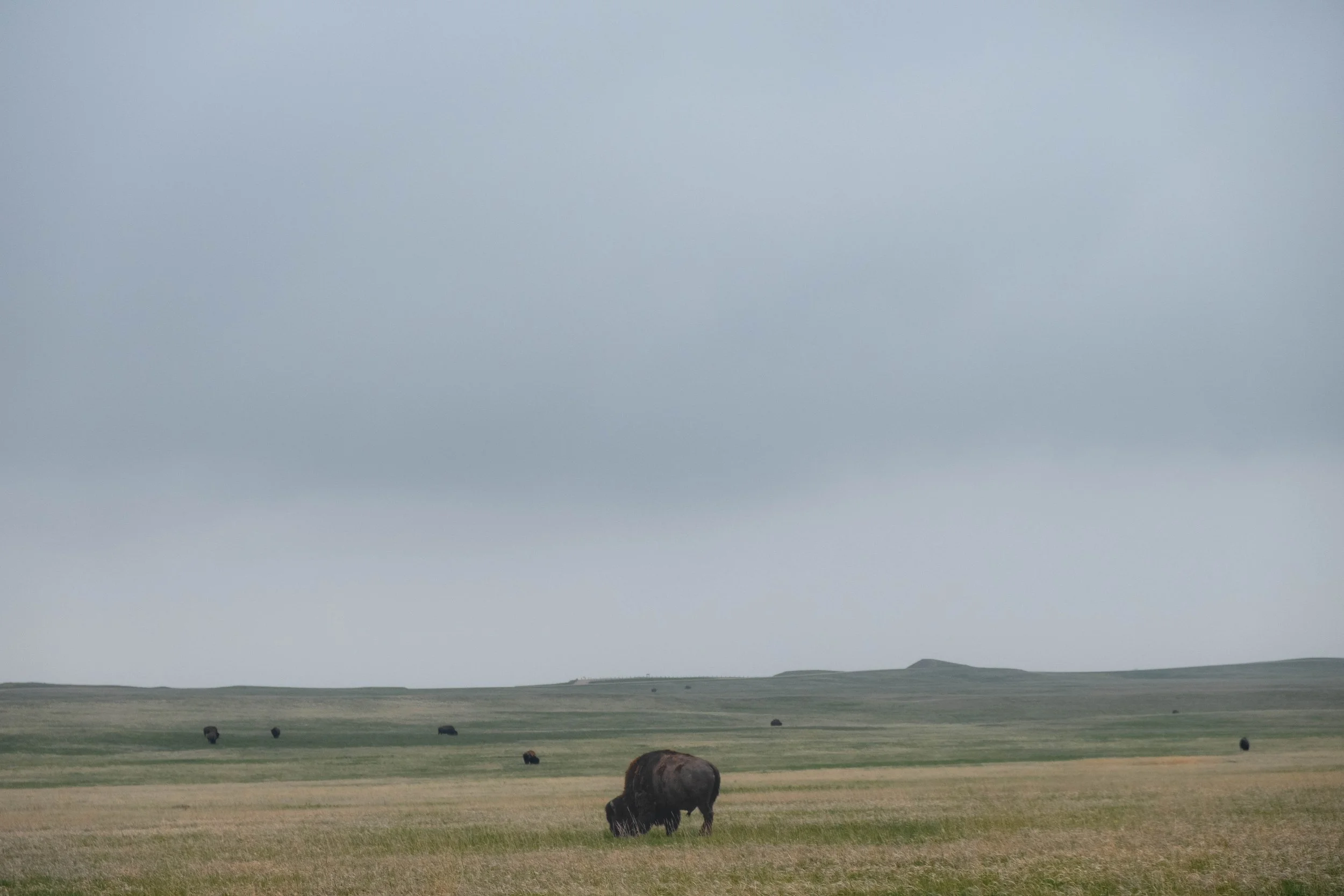
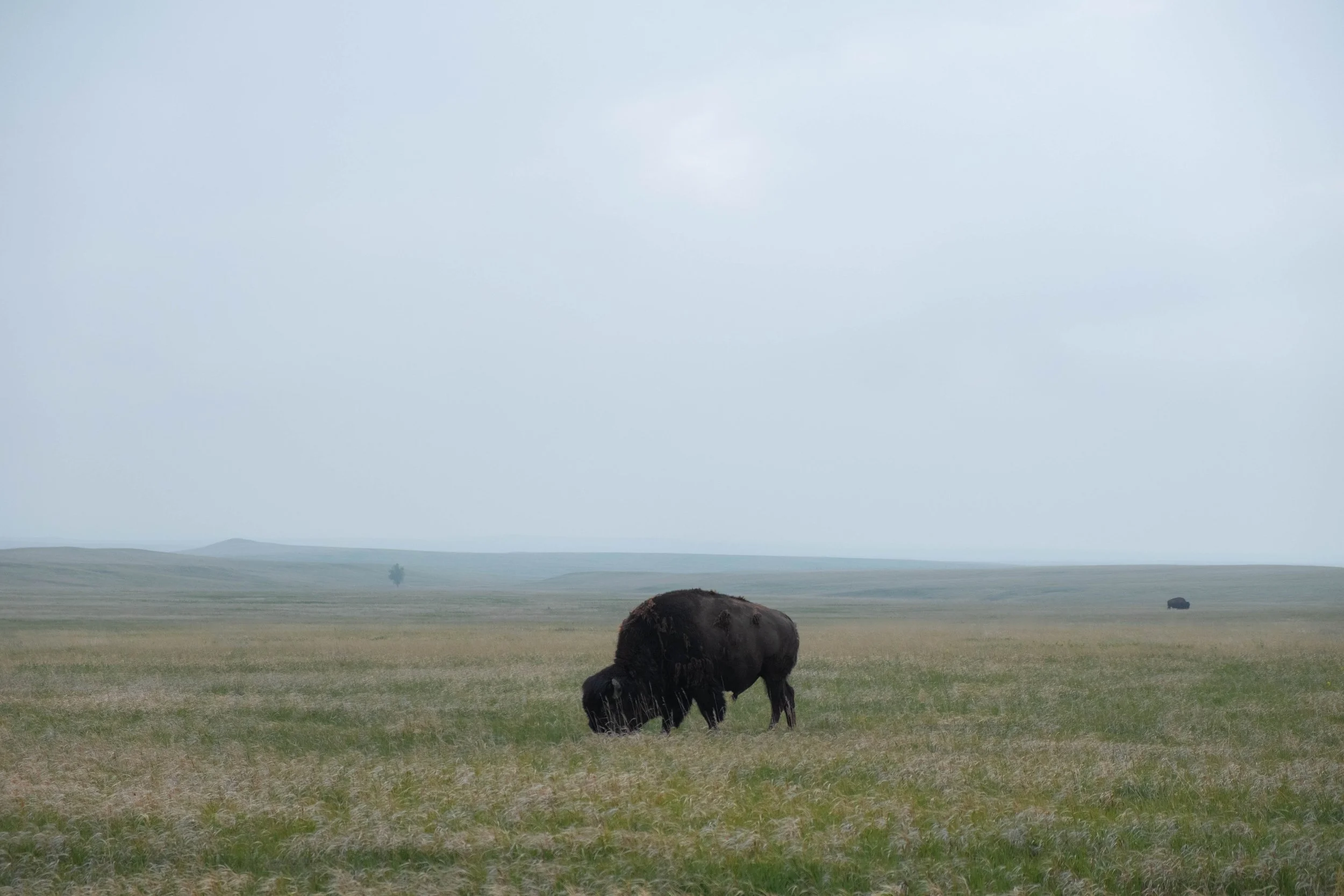
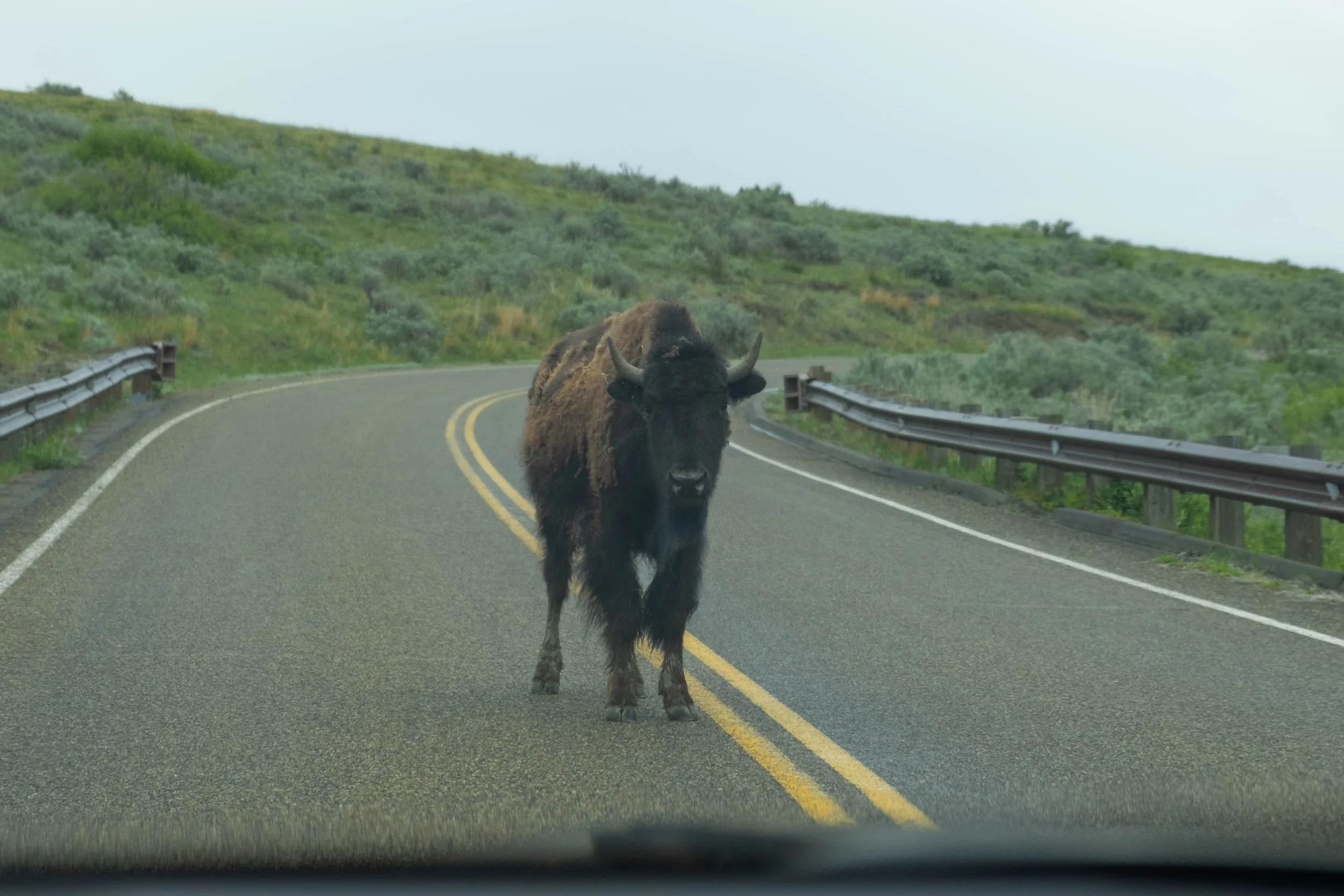
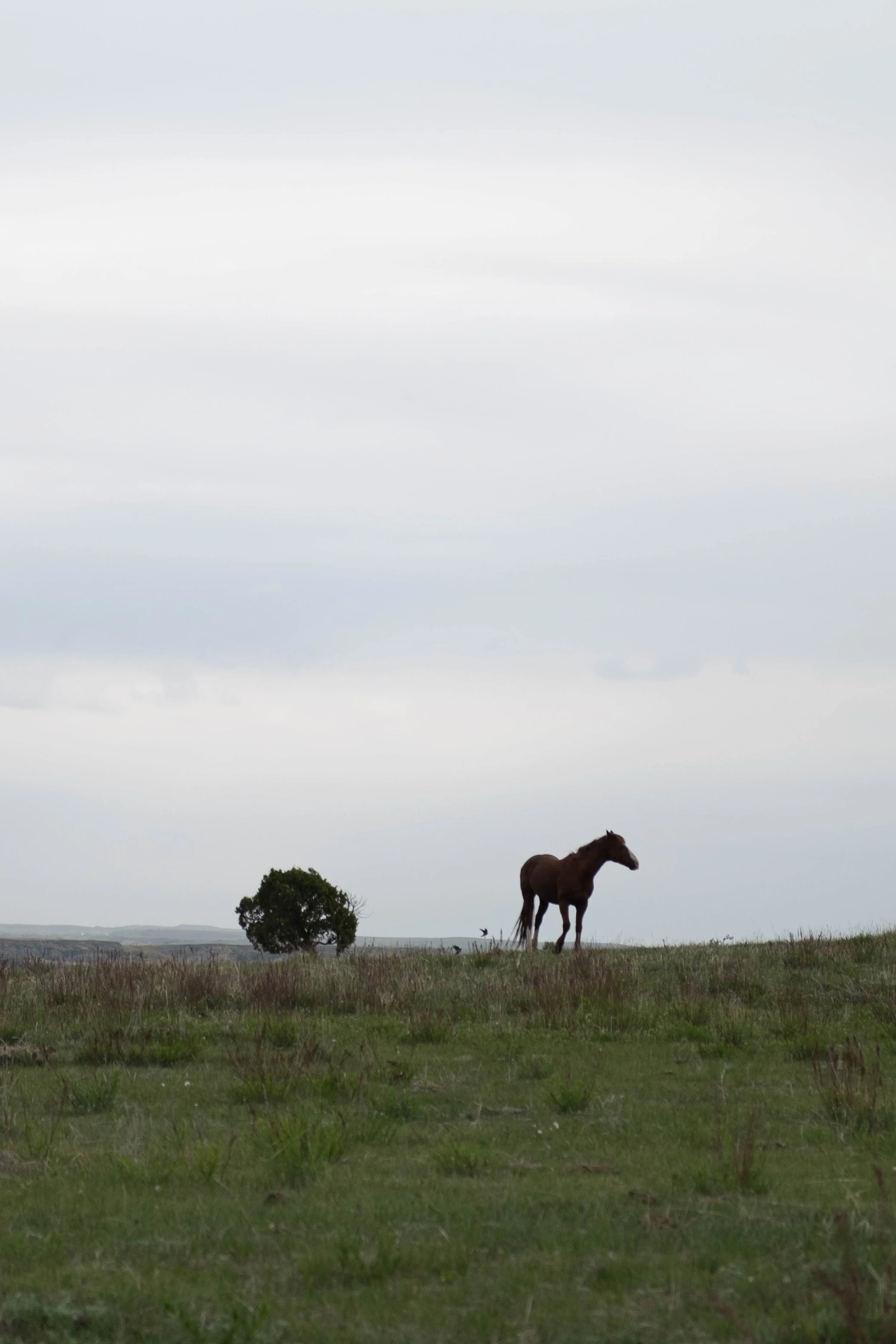
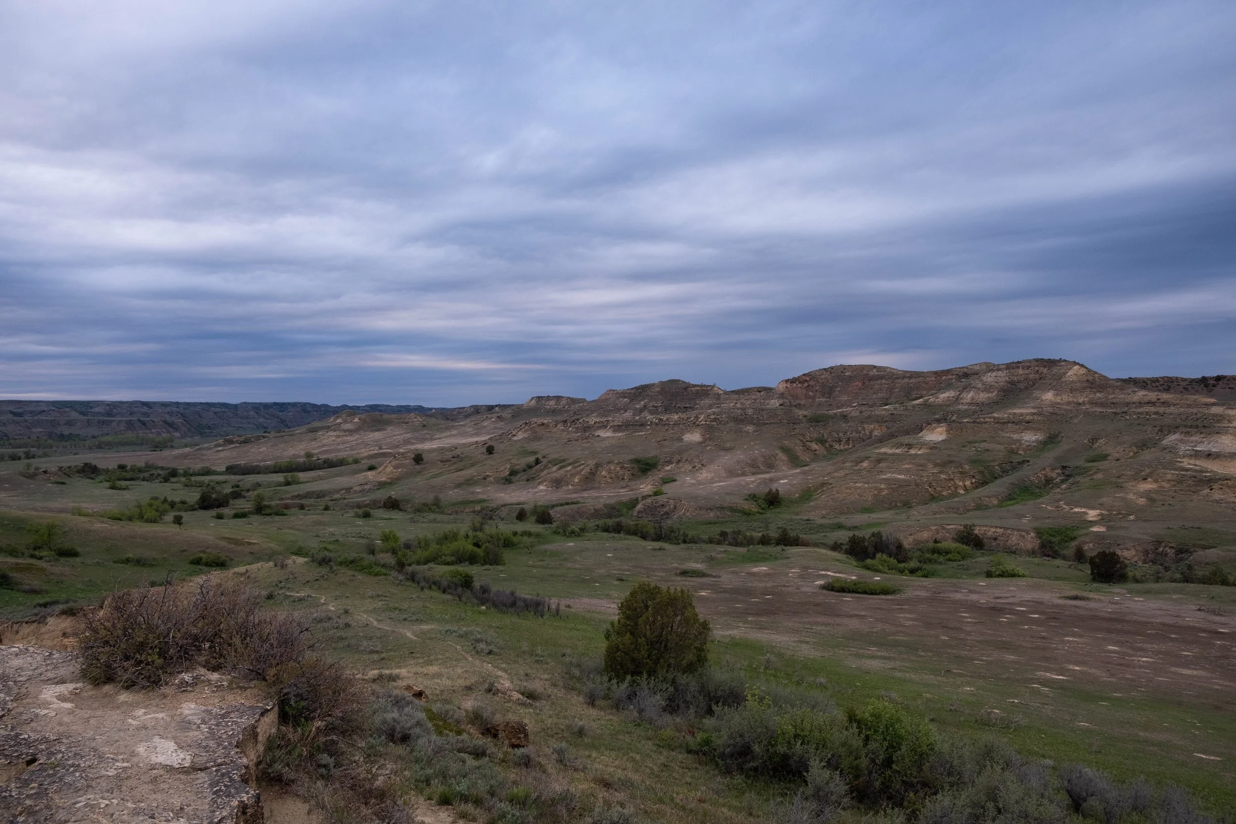
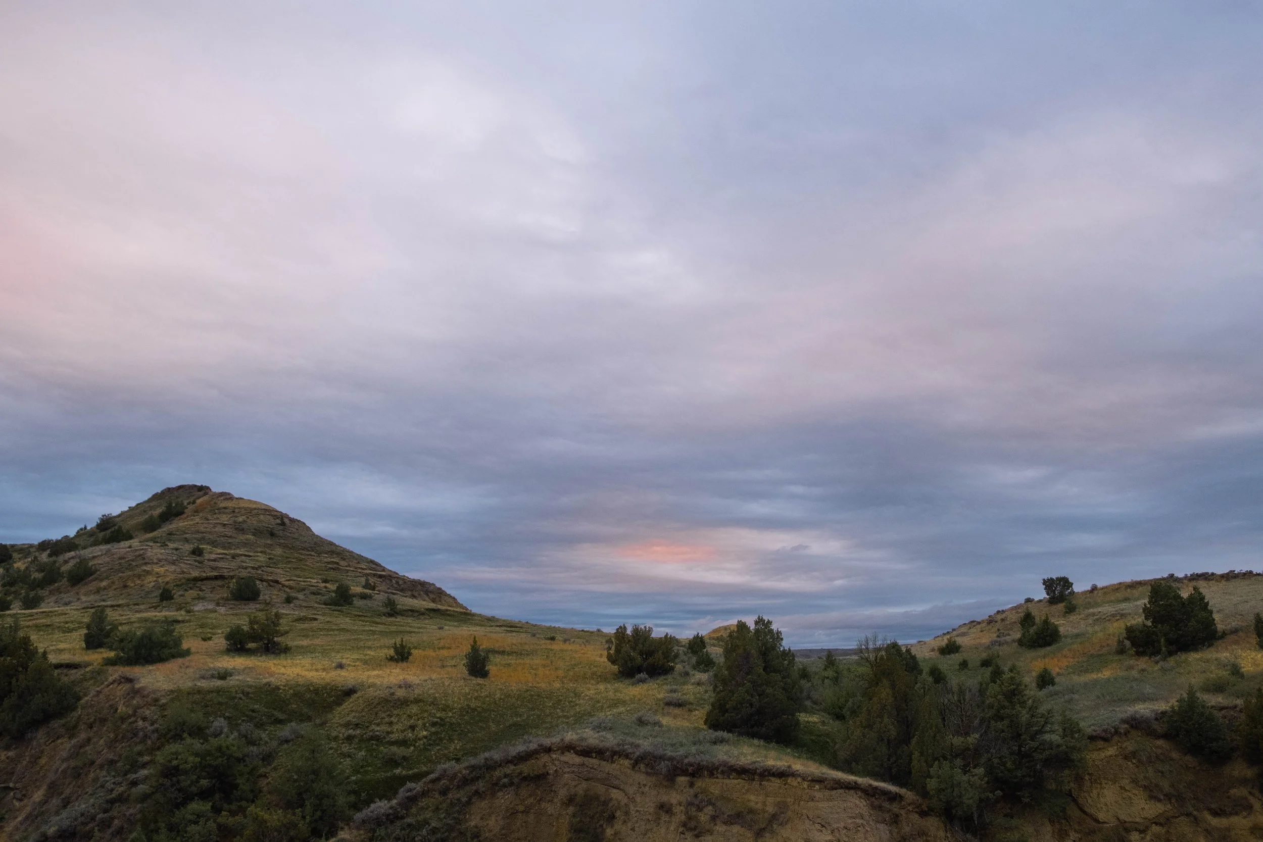
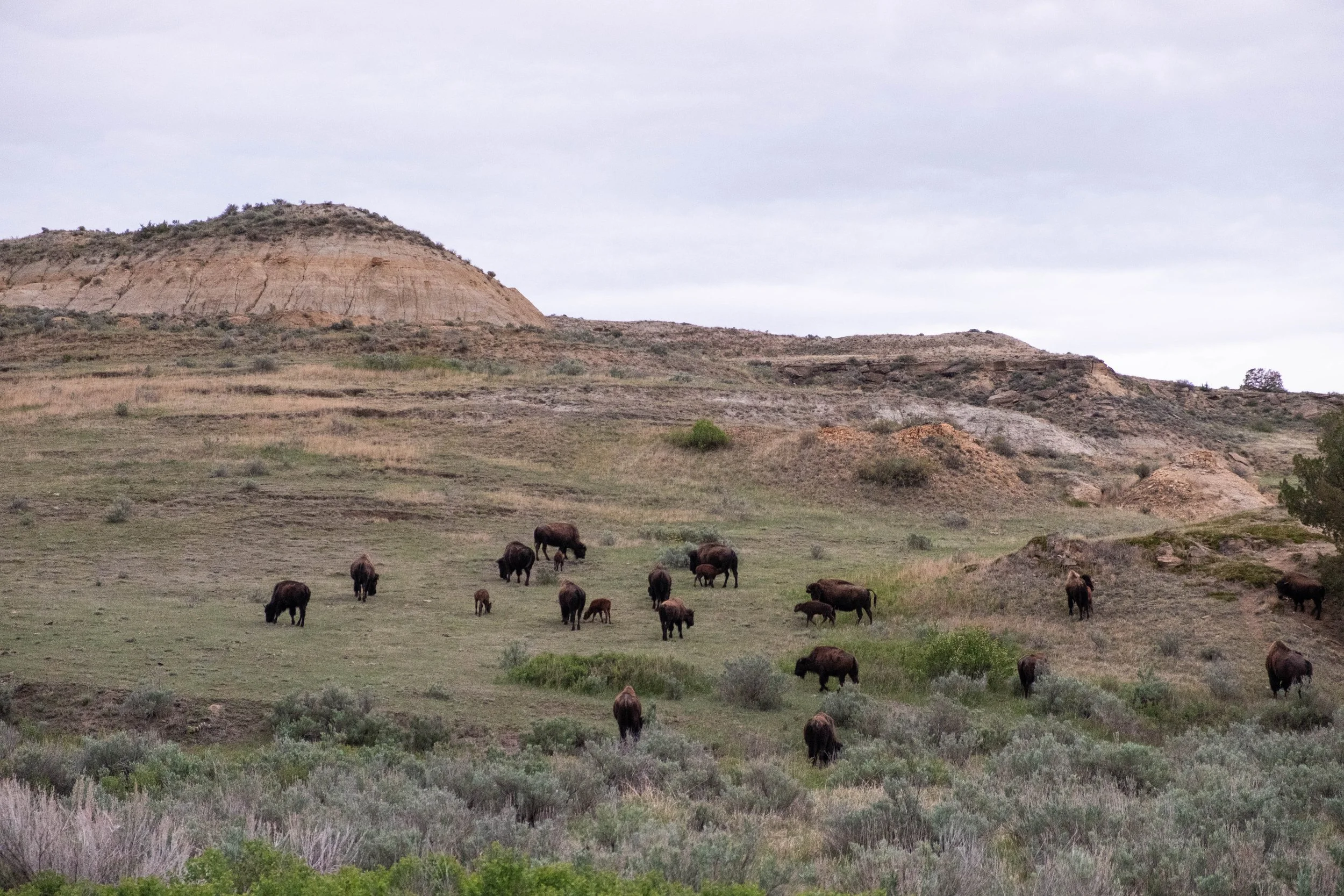
This first park emerged from the North Dakota landscape rather suddenly. After miles of flat, often treeless vistas, we came upon its rolling hills and plateaus dotted with bison, jagged gorges and swooping valleys, and the endless rustle of the wind fingering through the prairie grasses as the day stretched into the afternoon. We pitched our tent at the campground before hurrying off to explore as much of the Scenic Loop Drive as we could before darkness fell.
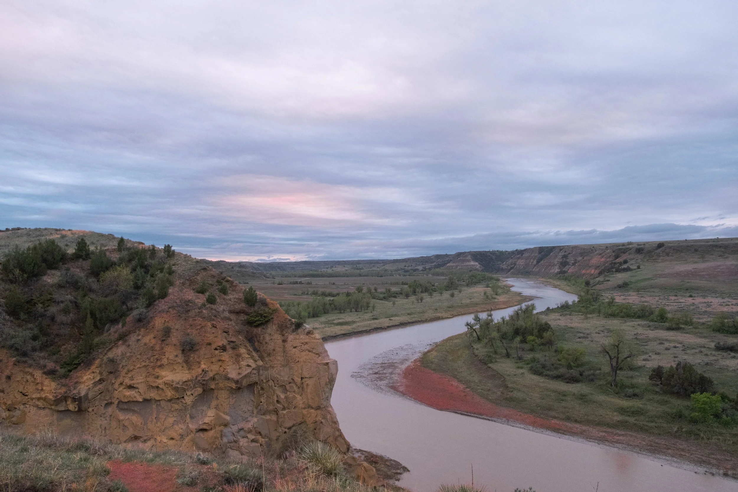
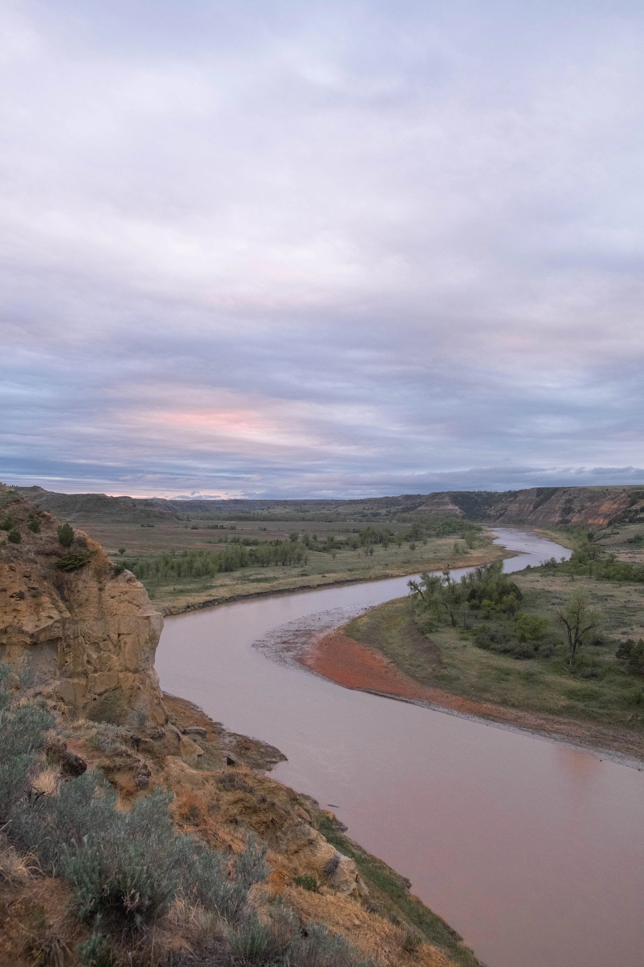
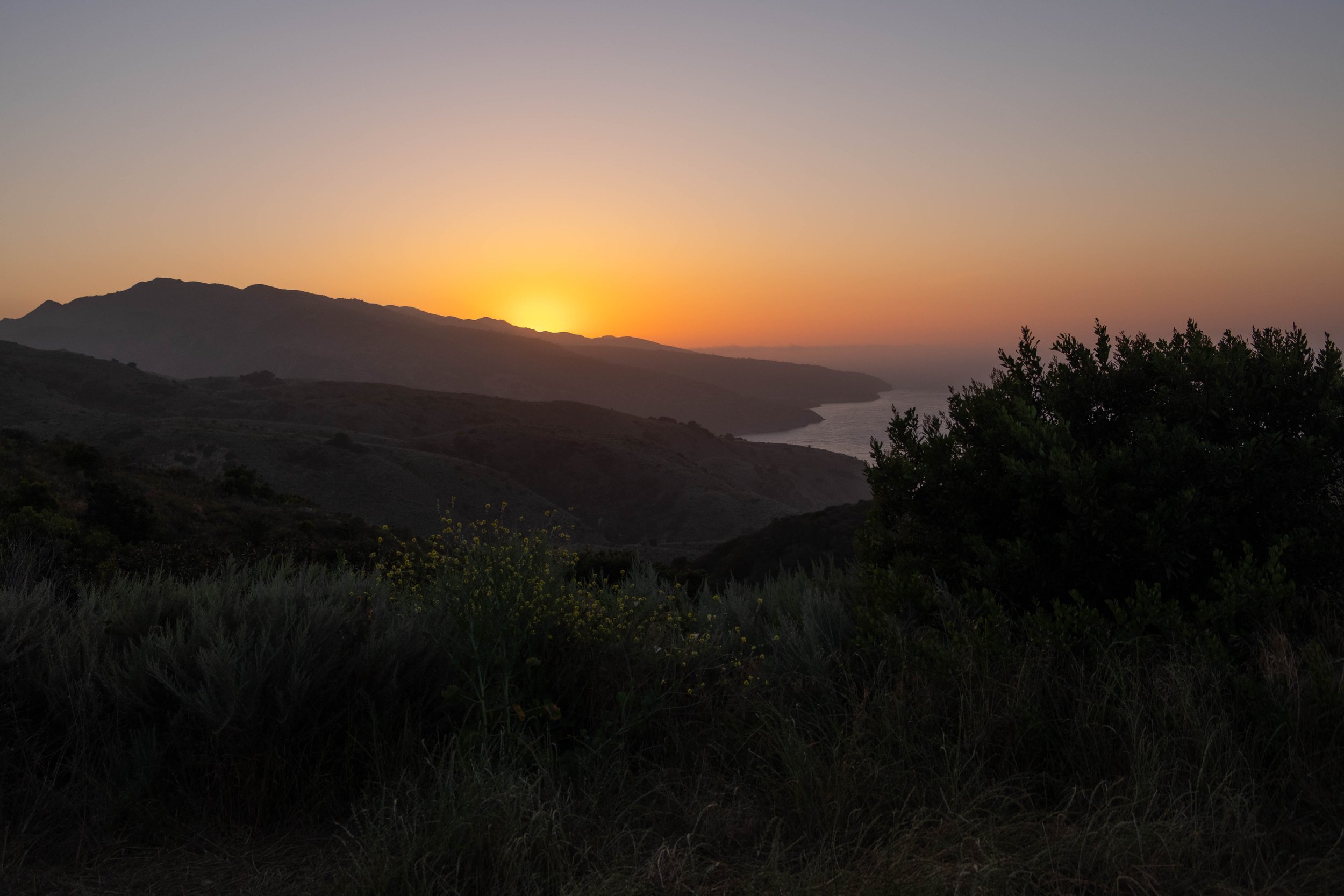
What ensued was an incredibly peaceful evening filled with more wildlife encounters than either of us had expected. Baby bison frolicked on the hills. Prairie dogs squealed as they stood straight and rigid on the stoop of their underground homes. Wild horses walked right past us. A coyote trotted across a meadow beneath us when we stopped at a trailhead, the song of its kin beginning to fill the air as daylight dimmed. We spent sunset — which was quite subtle, the low-hanging clouds tinted with the tiniest bits of pink and peach — at an overlook by the Little Missouri River. It was quiet. The wind sighed. The coyotes’ cries filled the lonely open spaces with speech we couldn’t apprehend but filled me with something like wistfulness.
This is the only national park that is named after a person. It’s clear the National Park Service wants to honor the memory of Theodore Roosevelt, who is often hailed as the “conservation president” following his formative experiences in this region that ultimately led him to formally protect large swathes of land across the United States. Some of these areas became national parks — Olympic, Crater Lake, Mesa Verde, the Grand Canyon — places which hold many beloved memories for me and countless others. Yet this protectionism and conservationism is inextricably bound to the forced removal, disenfranchisement, and displacement of countless Indigenous peoples, many of whom had (and have) intimate knowledge of and sacred connections with these lands.
Broadly speaking, (white-led) conservation views Nature as untouched “wilderness” in need of protection. In practice, while this may sometimes preserve land from things like fracking or widespread construction, it also contributes to a narrative that dismisses the Indigenous peoples and Sovereign Nations who first lived on and tended these lands. The very concept of wilderness implies that there never was human presence in these lands (or, if there was, it implies that they must be removed in order to preserve the land), thus contributing to the ongoing erasure of Native peoples from these lands and waters that are their home.
We gave the visitor center at this park lower marks because it did not present a nuanced portrayal of Theodore Roosevelt, the conservation movement, or the difficult but necessary truths about how the story of these parks is rooted in theft and violence, under the guise of protectionism. The result of these decisions is unspeakable injustice. And these decisions have yielded parks and monuments and memorials that I often find myself seeking out for respite, reflection and connection. Both things are somehow true at the same time and this is the ultimate tension of the NPS when we visit.
Final thoughts: One redeeming factor of this visitor center? If you sit and watch the 15-minute video introducing you to the park, it is voiced by none other than the great Terry Tempest Williams.
Pictured below:
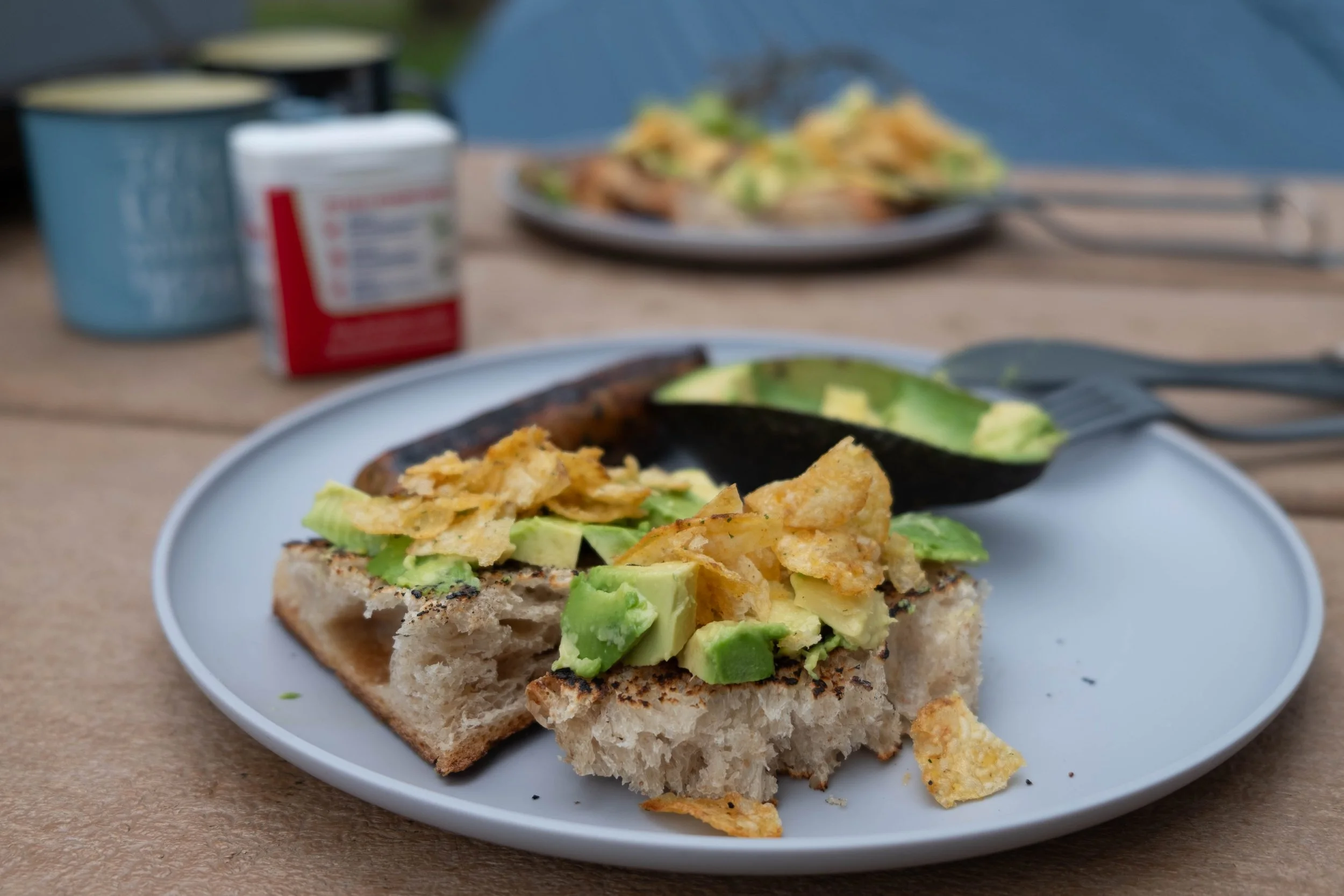
Our creative use of the jalepeño kettle chips on the avocado toast.
Views from the Scenic Drive of the South Unit — bison, wild horses(!), prairie dogs, and coyotes were all spotted (the coyotes sadly not pictured, but we enjoyed their evening songs).
Overlook of the Little Missouri River from Wind Canyon Trail.

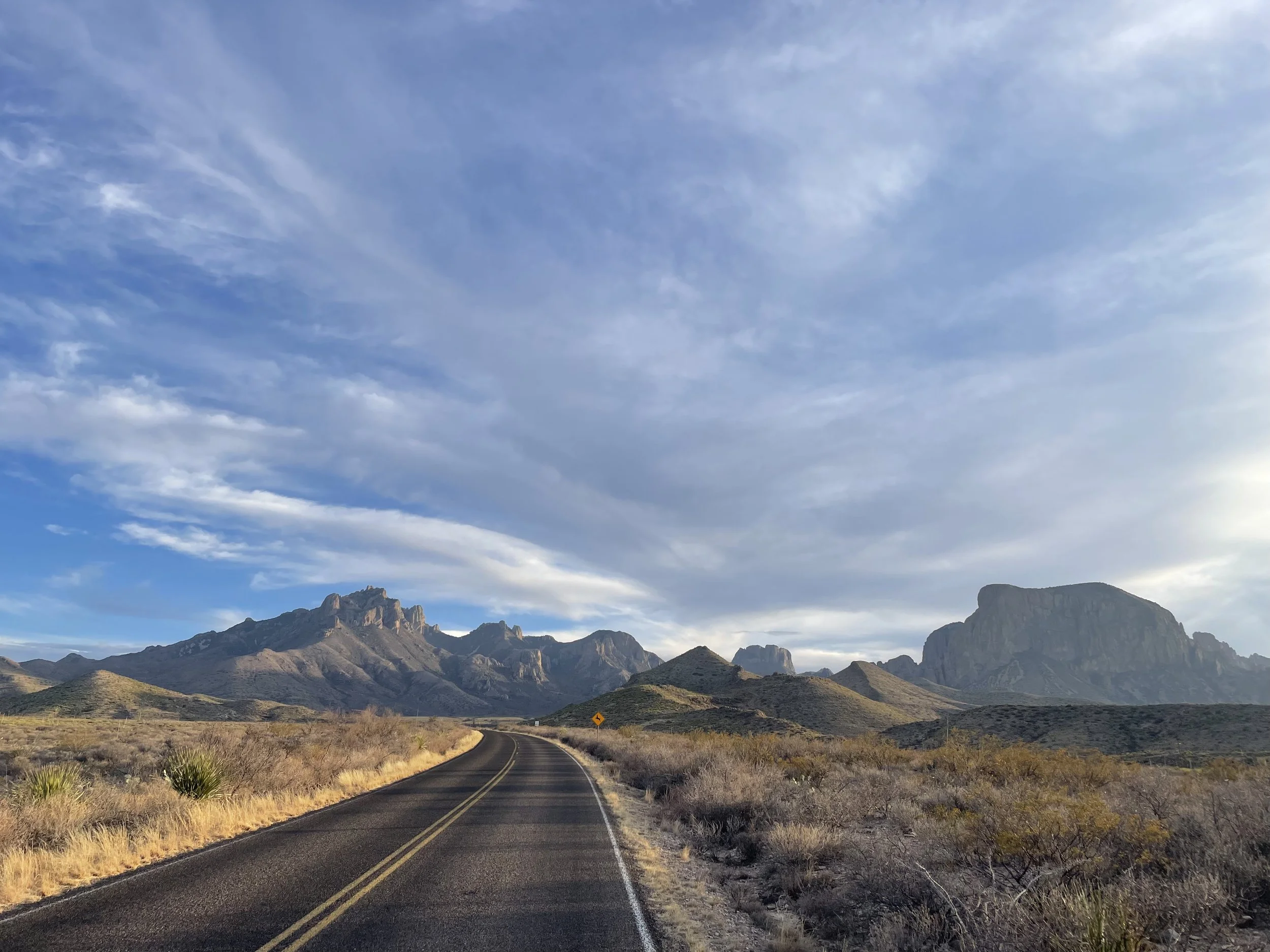
Big Bend
Park 34 | March 2025
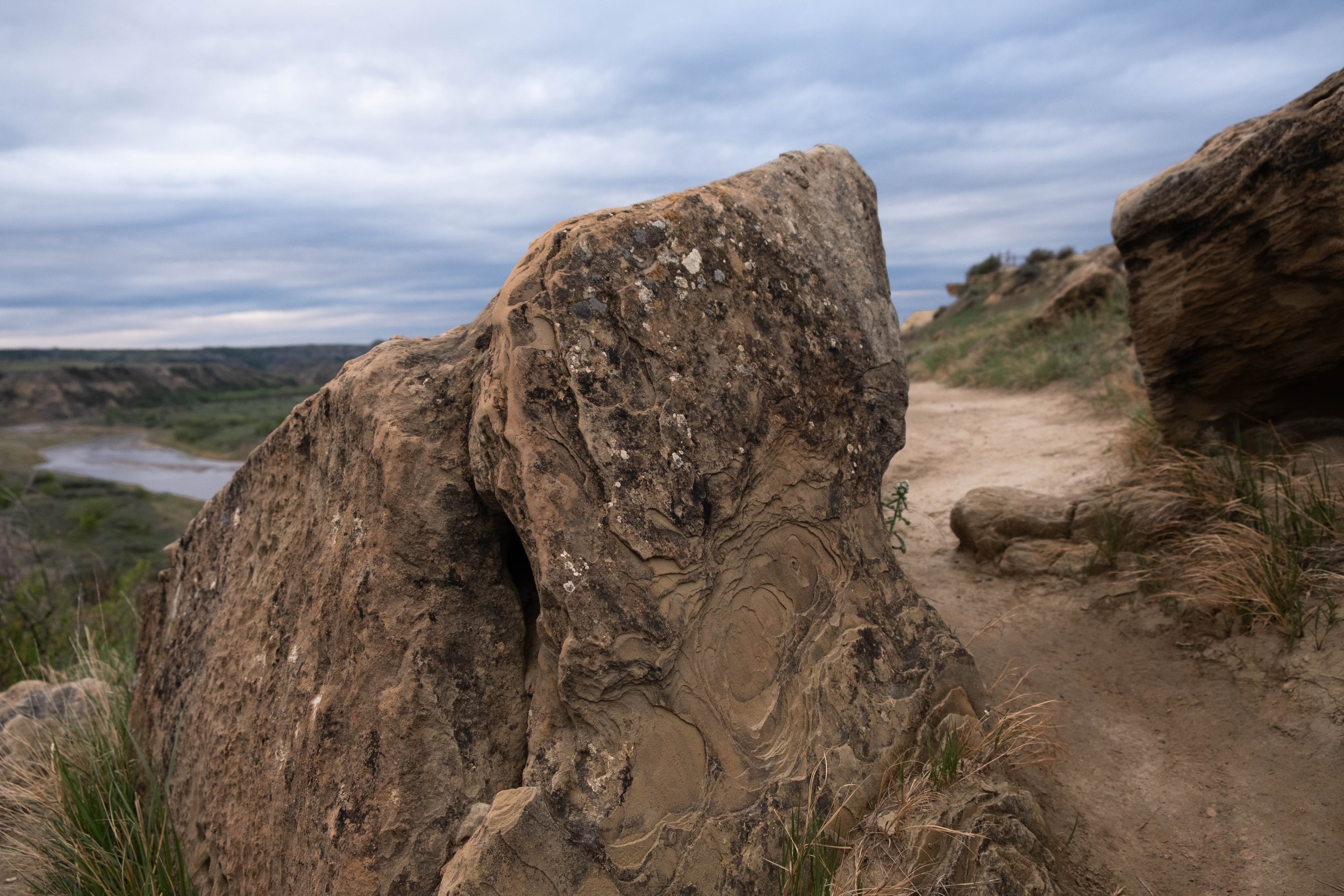
I’m sitting in Chisos Basin Campground at Big Bend National Park, a whisper of a breeze lifting strands of my hair across my face before I tuck them back behind my ears. The sun is warm on my back. A roadrunner tiptoes through a neighboring campsite, searching for food scraps under the picnic table. Overhead, turkey vultures endlessly circle; I idly wonder what they might be searching for.
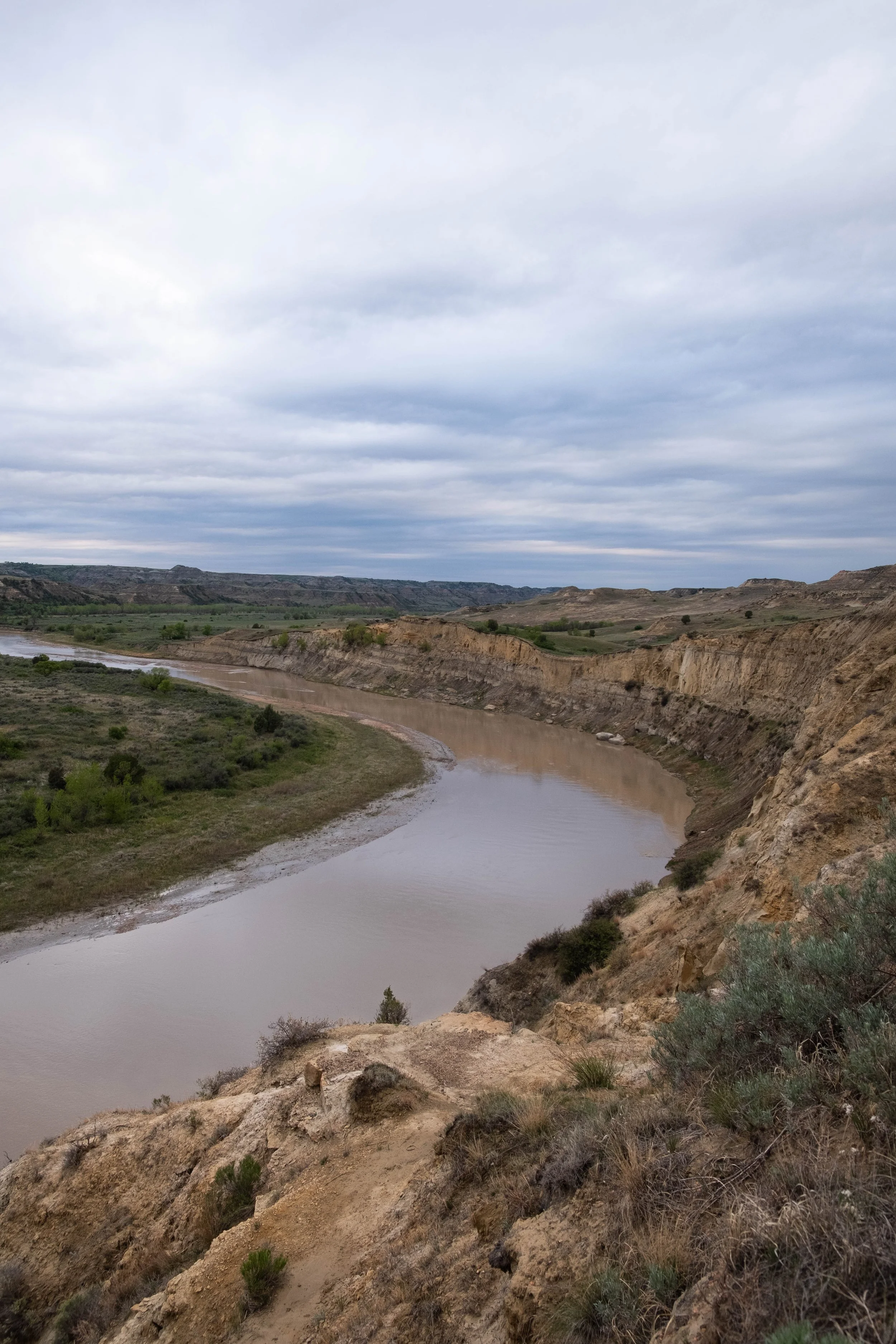
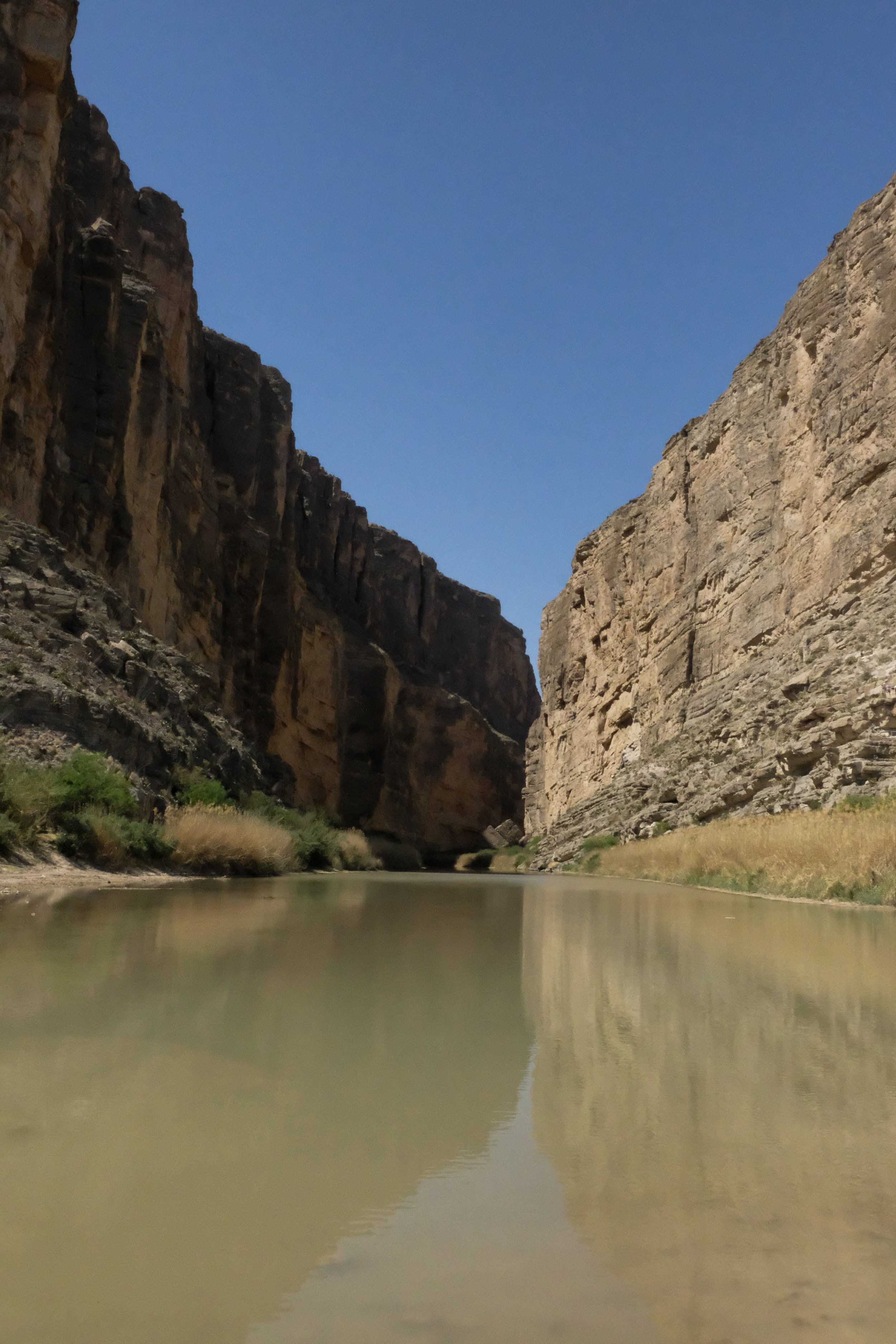
This is our thirty-fourth National Park and it’s unlike anywhere I’ve been. After driving hours through the windswept plains of West Texas — from Guadalupe Mountains National Park, where we woke and summited Guadalupe Peak, south through Van Horn and Marfa and Alpine — we reached the remote entrance to Big Bend, which is named very literally for an elongated curve of the Rio Grande River that runs along the southern edges of the park, drastically changing the course of the river from flowing southeastern to northeastern. The river, also known as Rio Bravo del Norte in Mexico (“the fierce river of the north”), marks the boundary between the United States and Mexico.
There are three main campgrounds in the park, but my initial research had quickly led me to Chisos Basin. Everything that is known of my ancestral line informs me that I come from Northern hemisphere mountain and ocean people. In other words, the opposite of the Chihuahuan Desert landscape we were driving into. Two of the campgrounds at Big Bend are located closer to the river, which is often a full twenty degrees Fahrenheit warmer than the third campground, which I had read is located in the Chisos Mountains. Say less. I’d managed to snag us a spot at Chisos Basin, but had no idea what to expect when we first entered the park a little before sunset. I was awed and a little giddy when the Chisos range came into view — a mountain oasis rising up out of the middle of the desert, burnished golden in the early evening light. A single road snakes up into the dramatic peaks, where soon the landscape becomes a little greener (the cooler temperatures might fool you, but it’s still part of a desert ecosystem) and there are signs for black bears and mountain lions and white-tailed deer. My mountain-loving heart feels at home and my heat-averse body breathes a sigh of relief.
The campground itself is nestled in a valley, almost completely encircled by a ring of arid mountain peaks that are studded with dull green creosote bushes, yellow yucca and sotol, purple prickly pear cacti and other flora that I don’t know but are known by this land. It’s 6:30 pm, and the sun is beginning its lazy descent across the sky, slowly inching toward “the Window” — a singular west-facing break in the circle of mountains that provides a perfect frame for sunset every night.
This natural feature delights me. One of my favorite experiences — while at national parks, while camping, while traveling, but also just during my regular walking around life, when I remember to pay attention — is seeing how I and other humans still seem to be awed by a sky streaked with color. What is it about this twice-daily phenomena that stirs us, calling us to stop or to wake early, inviting us to make the trek to a bench or a balcony or somewhere with a good view, and watch the sky?
I’m not sure, but it’s one of the things I find myself clinging to these days. It gives me a fleeting shot of hope that we’re not entirely numb, that technology hasn’t fully corrupted us, that we, as a species, still find ourselves responding to and situating ourselves within nature in ways that are simply appreciative and not destructive.
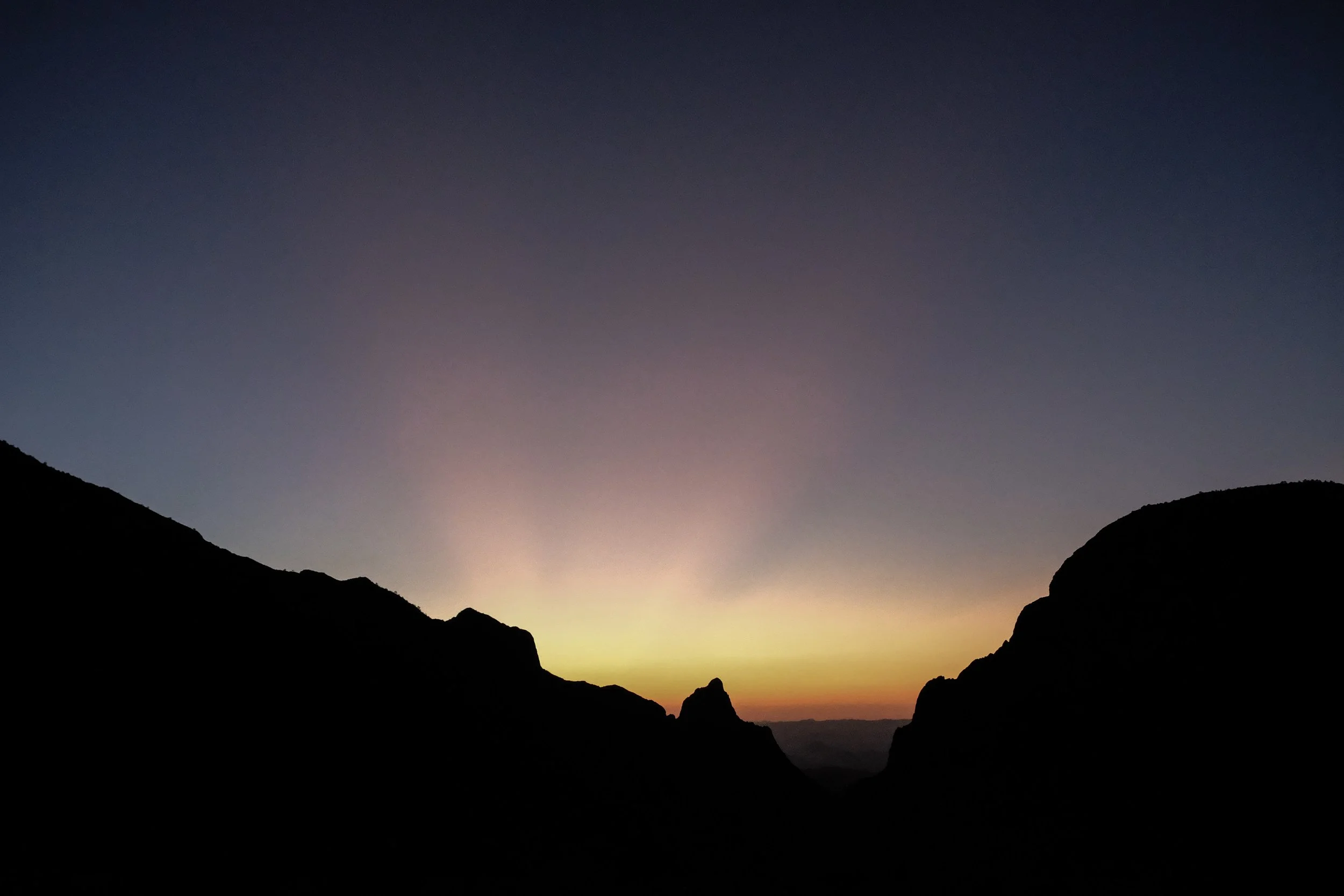
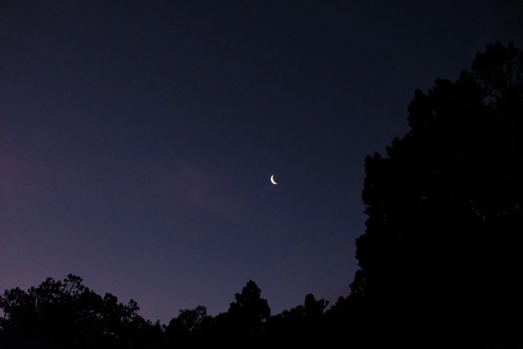
Hours later, the last of the vibrant sunset — a magnificent display of bold magenta and soft peach and lavender — fades behind the sliver of horizon that can be seen through the Window. One by one, the stars begin to blaze to life. They seem brighter and nearer and colder and more beautiful than ever, a perk of Big Bend having earned International Dark Sky Park recognition.
I wish I could stay awake all night and watch them, these pinpricks of light that are so far from us, yet make up such a recognizable part of our world. I’ve been finding the “easy” constellations — Orion’s Belt, the Big Dipper, the Little Dipper, and the steady glow of Polaris, the North Star — since I was a little girl. I think about wayfinders who have used these familiar points to guide their journeys for generations. I stare at the North Star and feel a luminous tether between me and the countless others throughout time who have also looked at that same light for guidance and direction. I’ll never know who they are, yet still feel a brief, profound sense of interconnectedness.
What would it be like if all the stars burned out and all we had was a night sky without these celestial lights? Such a thought experiment helps me identify the sense of piercing loss I would feel if such a thing were to occur. I’d miss the stars. I’d feel unmoored under this unfamiliar sky. I’d grieve. Sometimes it takes the idea of loss to remind you how much you care for something, how unmade you’d feel if it was gone.
My thoughts turn a little cynical. Might we also find that sense of care for the Monarch butterfly, honey bees, sea ice, and black rhinos? Might we all think a bit more seriously about what this world would be like without polar bears or Arctic terns or Salish Sea resident orca or salmon returning home? What happens when entire nations are displaced by rising tides — when our world becomes one in which Tuvalu or the Maldives or the Marshall Islands become nations without land? What happens when New York and Miami and New Orleans can’t hold the inexorable sea at bay any longer?
I don’t know the answers to any of these dark questions and won’t stay awake all night trying to. Eventually I fall asleep, watched over by a sky that for now still sparkles with these ancient, familiar lights.
Although Big Bend is best known for things like the Rio Grande, its starry skies, long expanses of the Chihuahuan Desert, and the Chisos Mountains, I found it hard to disentangle it from the current environmental and political context. I don’t think it can or should be separated from that, to be clear. Every time we are in a national park or forest or interacting with some kind of “protected” place, it is, first and foremost, stolen land. There has been a lot of excellent thinking and writing already done on the dissonance between the rhetoric and actions of the (generally white-led) conservation movement and Tribal sovereignty, including but not limited to the Land Back Movement. This is a tension that I believe should be understood and held in the forefront of one’s mind especially if you are a settler, as I am. It matters everywhere, including in Denver where I live and work. But I feel it even more acutely when on so-called public lands, which have invariably been taken from their original inhabitants, often with force, sometimes under the guise of environmental protection.
Beyond this foundational reality, there are other matters on my mind. I am trying to stay off my phone for the few days that we are away, and the cell service is pretty bad, so it hasn’t been too hard. But I know the headlines continue to roll in and the news they carry isn’t good. It’s an utter privilege to take time to “get away” and I feel guilty about it at times, even as I recognize the importance of building in rhythms of rest, recovery, and care for ourselves. This is important in order to continue engaging with the hard work that faces us, yes, but also just because ease and kindness and softness and joy are fundamentally beautiful things that I wish for all humans to experience and prioritize.
Staying off my phone has marginally helped, but this environment brings me right back to the political context I can’t leave behind. Both of the parks we visited on the trip were understaffed. Each visitor center was operating on reduced hours. Guadalupe Mountains had let go of all but one ranger in response to funding cuts from the federal government. A bright spot was the volunteers who had come out of the woodwork to continue emptying the trash, cleaning the bathrooms, and staffing the visitor centers.
Outside of the park boundaries, we passed at least half a dozen border patrol trucks on our drive to Big Bend; eye-catching white vehicles branded with the incongruous phrase “Honor First.” They crept down long dirt roads criss-crossing the land, red dust billowing up behind them into the azure sky. A statement. A reminder. A warning.
We visited a section of the park where the Rio Grande was barely flowing, much of it sitting in stinking pools overgrown with algae, an inglorious downstream reality of a river that has been forced to conform to human demands. Just a few weeks earlier, we’d been in Monte Vista, Colorado, relatively close to the Rio Grande’s headwaters in the San Juan Mountains. Between there and here, the river is heavily dammed and redirected and siphoned off mostly for agriculture across New Mexico and Texas. The result is that by the time it gets to this part of Big Bend, the Rio Grande looks like a terminally ill river. It has been listed as one of the ten most endangered rivers in the world by the World Wildlife Fund. I felt a mixture of ineffable sadness and deep worry when seeing this.
On the other side of the river bed was a family that had set up a shaded taco stand, presumably to entice park visitors in search of a snack. The handwritten sign reads: “Tacos — 10 pesos.” A child was throwing a football back and forth with one of the adults, directly across from us. When looking at things through a purely logistical lens, they could easily walk to us across the river bed, or we could walk to them. The one stream of flowing water was hardly knee-deep at its deepest point. Adding in the unavoidable political lens, we knew it wasn’t so simple.
It felt surreal that this somehow marked the end of our nation and the beginning of theirs. Humans have drawn lines on land and rivers and written laws and policies that require specific documentation to cross this otherwise invisible demarcation. Even more surreal was that we could see cows and dogs and birds and wildlife of all kinds freely moving from one side to the other. This is the border that we hear about on the news, this is the line that has caused so much political posturing and fear mongering, this is what the man currently occupying the White House has whipped so many people into a frenzy over and used as justification for his inhumane executive orders, deportation directives, and the flouting of international law.
It’s been said that the personal is political, or that “everything is political.” This feels even more apt a premise when traveling to a remote national park that is still not remote enough to avoid being the site of land theft (several times over), defunding, border politics, a fragile desert ecosystem that is only getting hotter, and a river on the verge of death. This is a truth, alongside the other truth of this place’s stark and harsh beauty: Those blazing stars, this mountain oasis, the tall terraced canyons that used to be ocean reefs, and the wide open skies.
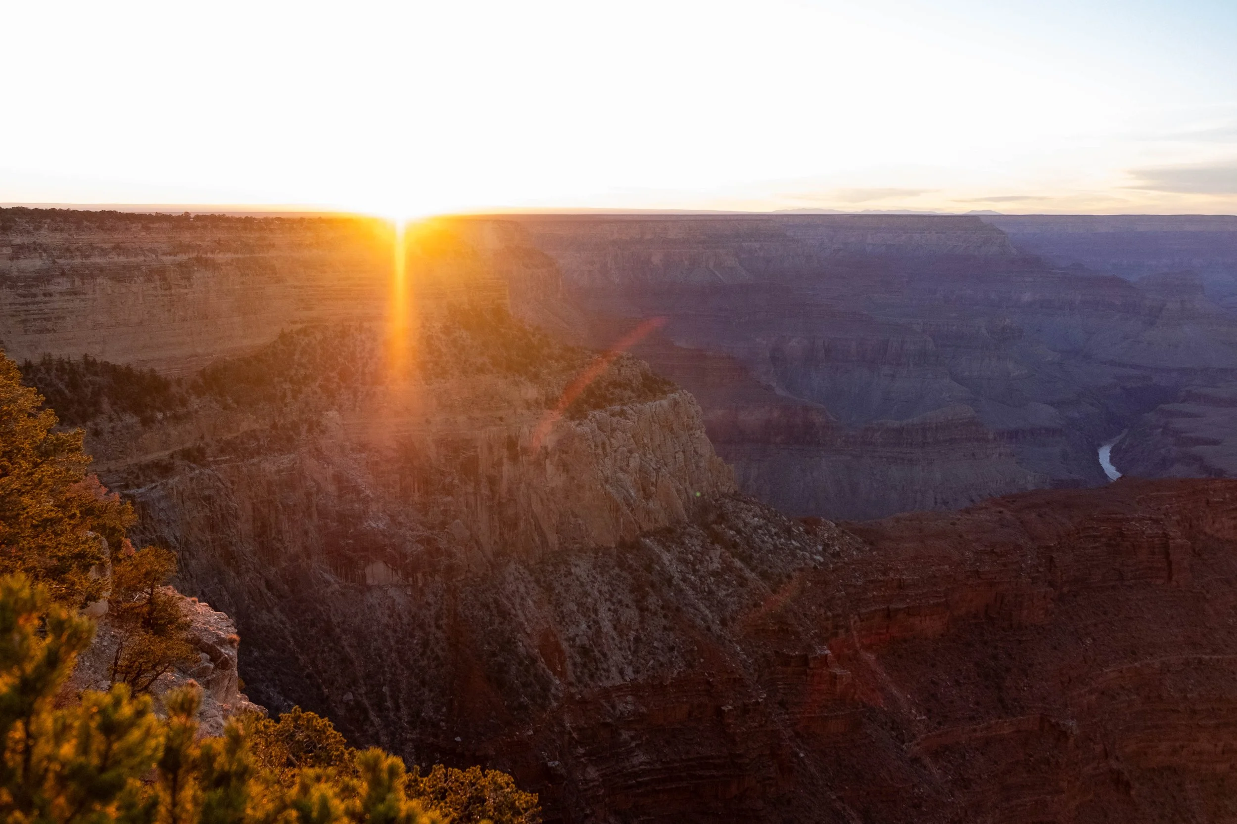
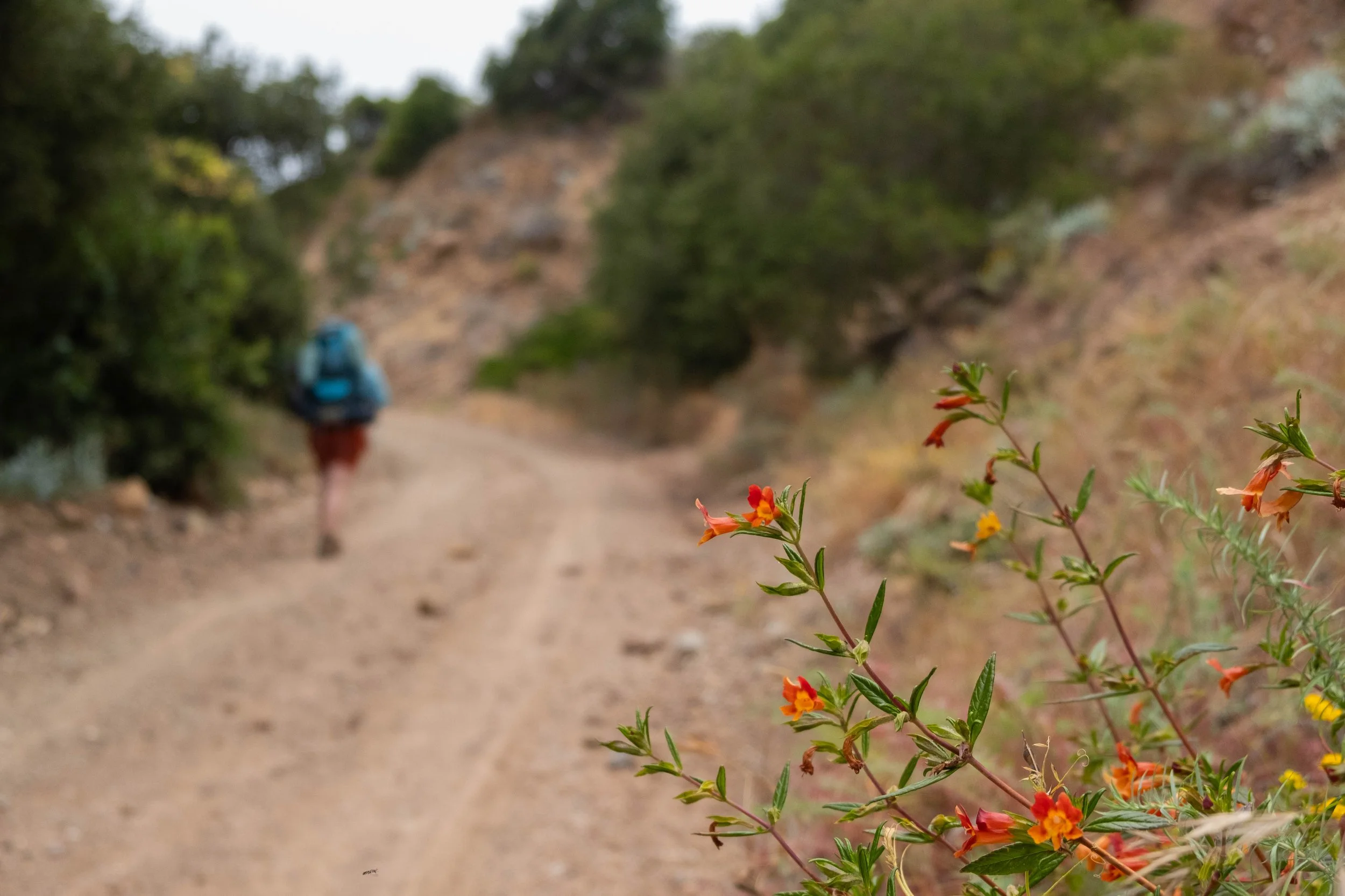
Our last morning in the park found us parked at the trailhead of Lost Mine Trail before sunrise. With only about twenty parking spots and epic views promised, this was one of those “early bird gets the worm” hikes. We also had vested interest in completing this hike early so we could squeeze in one more trail before it got too hot. J and I drank our coffee in the dark of the car before strapping on our packs and setting off up the trail as the horizon began to brighten.
There are few things that make me feel more alive than when I’m hiking. I love the feeling of my muscles warming up, breathing in the fresh air, the reward of wonder and joy when reaching a new viewpoint. This was one of those mornings. The sun was now shining, but we hiked in the shadow of the mountains for the majority of the time. Piñon jays flitted around in the trees, their feathers a bright spark of vibrant blue. White-tailed deer, which we’d learned are effectively marooned in these mountains along with the mountain lions and black bears since they rarely go below 4,500 feet of elevation, munched on brambles within thickets off the trail. We talked easily with each other, listing favorite memories from other camping trips we’d taken over the years, marveling at the passage of time.
When we reached the top, the sun’s rays touched us for the first time. Golden hues, warm like honey, washed over us. We traipsed across the smooth rocky ledge, a breeze picking up around us. Before us lay the undulating peaks of the Chisos Mountains, followed by endless desert as far as our eyes could see.
Deserts are not and may never be my preferred landscape, but these days spent in the heart of the Chihuahuan Desert left their mark. Just as it sometimes takes the thought of losing something to truly appreciate it, I departed Big Bend with a renewed recognition of the preciousness of water and a reminder of the precarious balance of life, human and more-than-human alike.
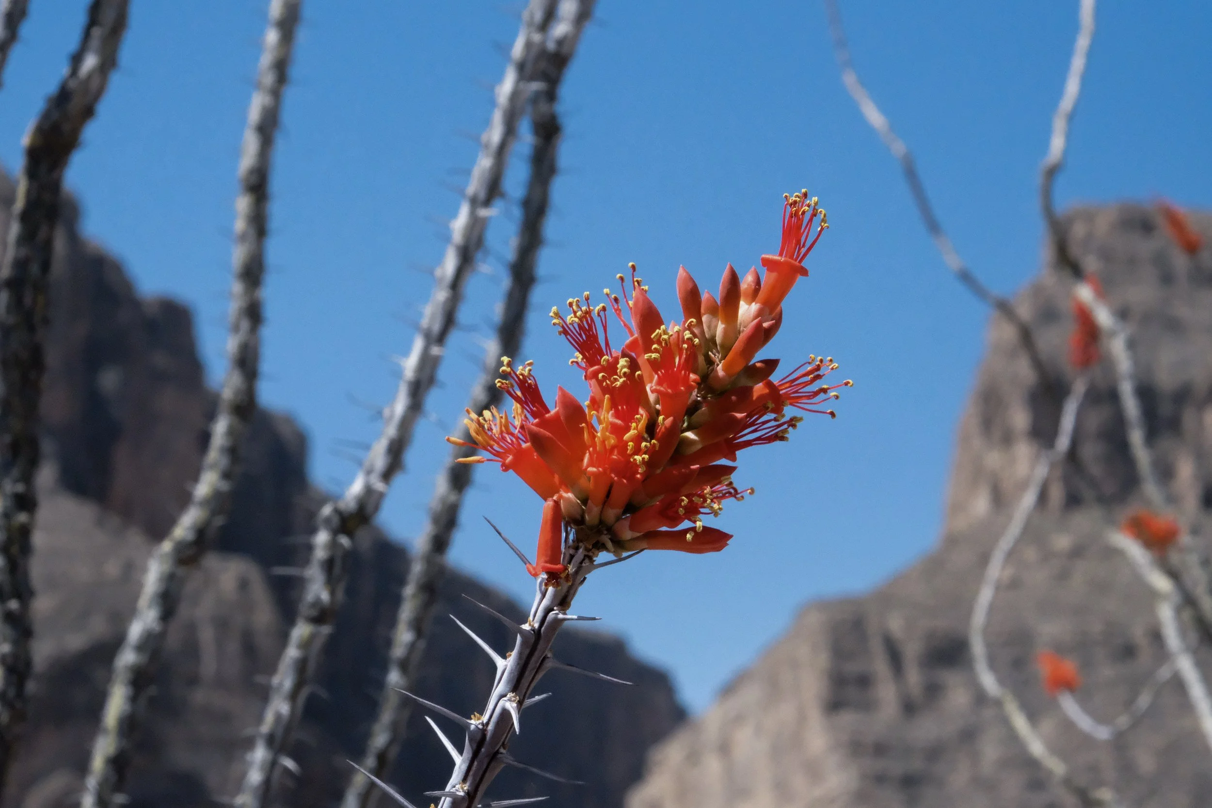
I find courage in the example of this land. The river runs drier than ever, yet trees are still greening up in the Rio Grande basin. Resources are scarce, so the roots of the plants sometimes dig more than 150 feet deep to find what they need to survive. And no matter the heat, no matter the water scarcity, every spiny, dead-looking plant bursts into vibrant color when springtime arrives. There are few images more strikingly beautiful than a blood-red ocotillo blooming defiantly against the brown desert landscape. There is such grace and defiance, resilience and fierceness in this harsh place.
These times are hard. Perhaps we too need to let our roots run deeper than ever before to find what we need in order to continue resisting—and envisioning something beyond what we are resisting. Perhaps we too must choose to bloom, to celebrate, to have joy, even when the days are dark. And maybe someday, this kind of fortitude and resilience and courage and vibrance sets us on a path toward a future we can only dream of now. Perhaps one with fewer dams and more free-flowing rivers. One with cleaner energy and kinder, more humane policies. One with salmon runs and clear starry skies and just economies and walkable cities and fresh food from the Earth to nourish us all. Perhaps.
We drank in the views from the summit, one last 360-degree panorama. A raven soared at eye-level with us, one black eye fixed upon us. I met the raven’s gaze and watched as he disappeared into the valley.
Following suit, we turned and began the long climb down.
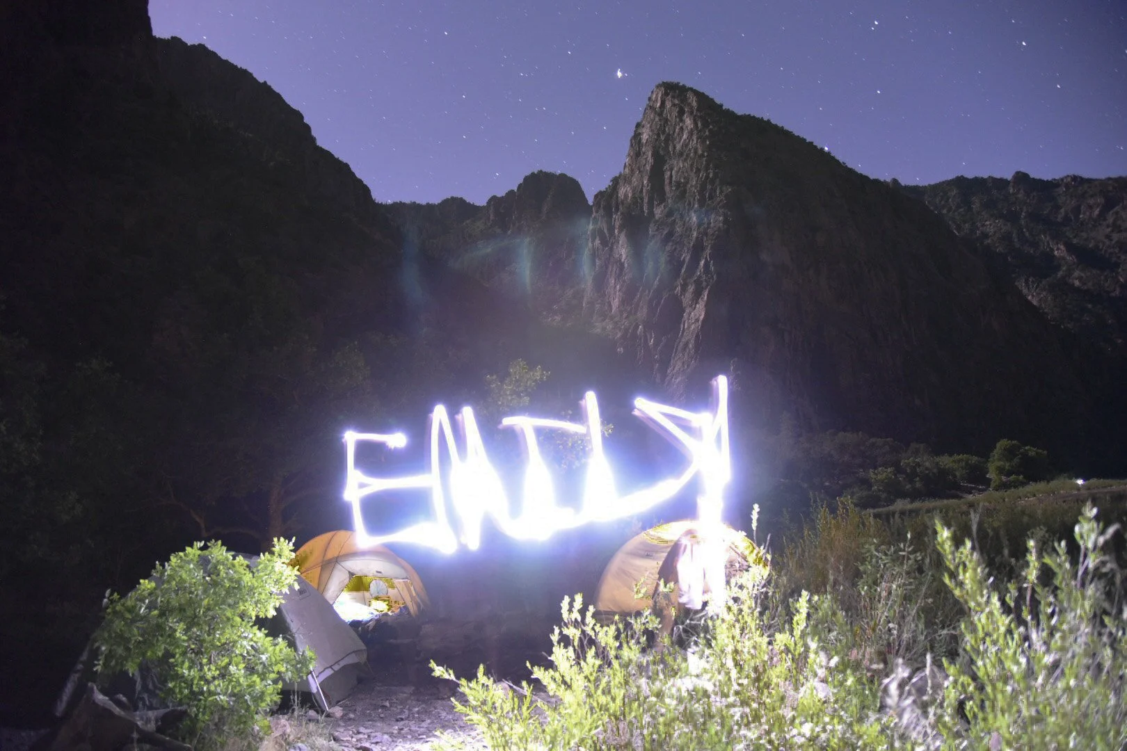
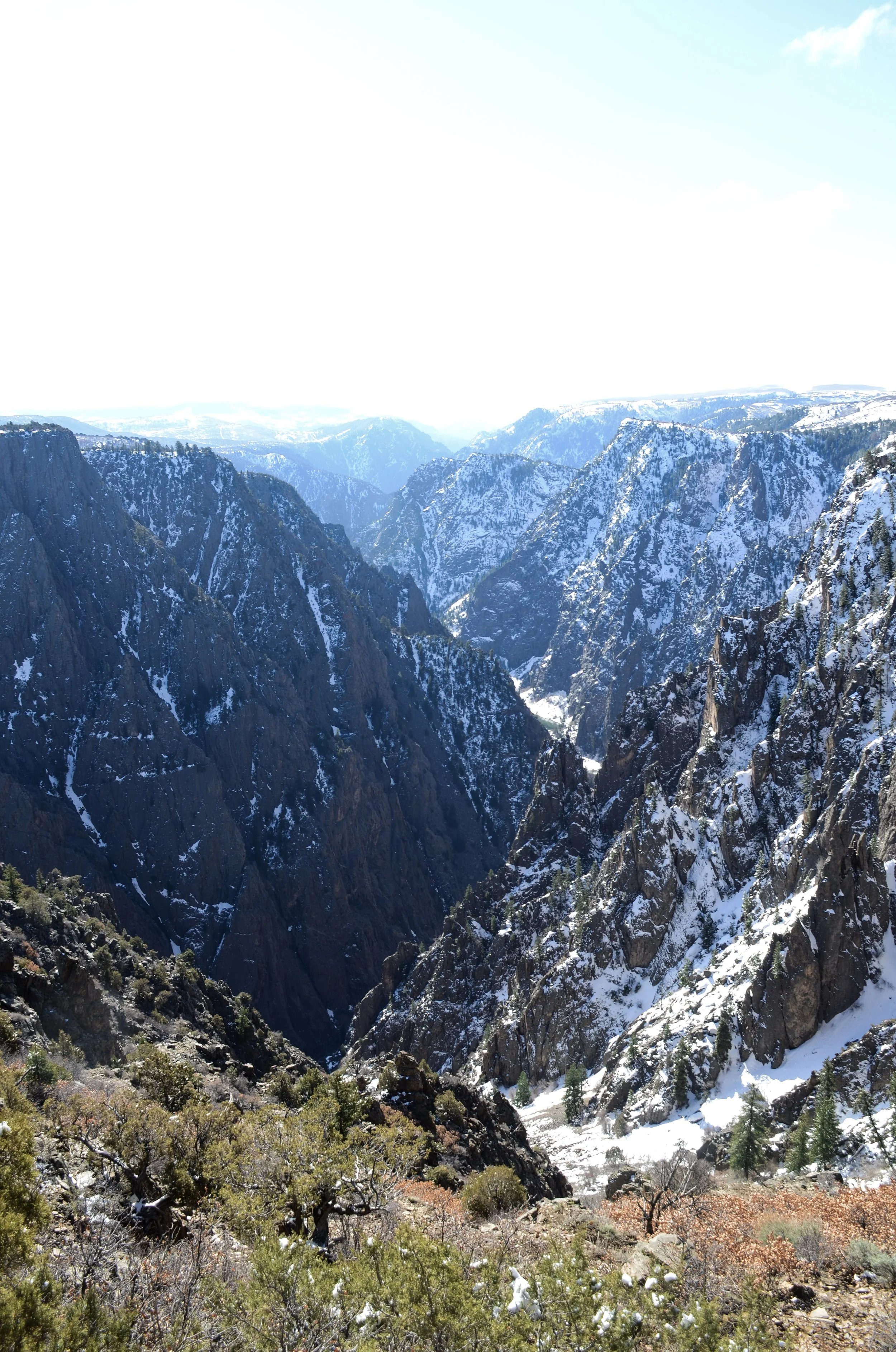
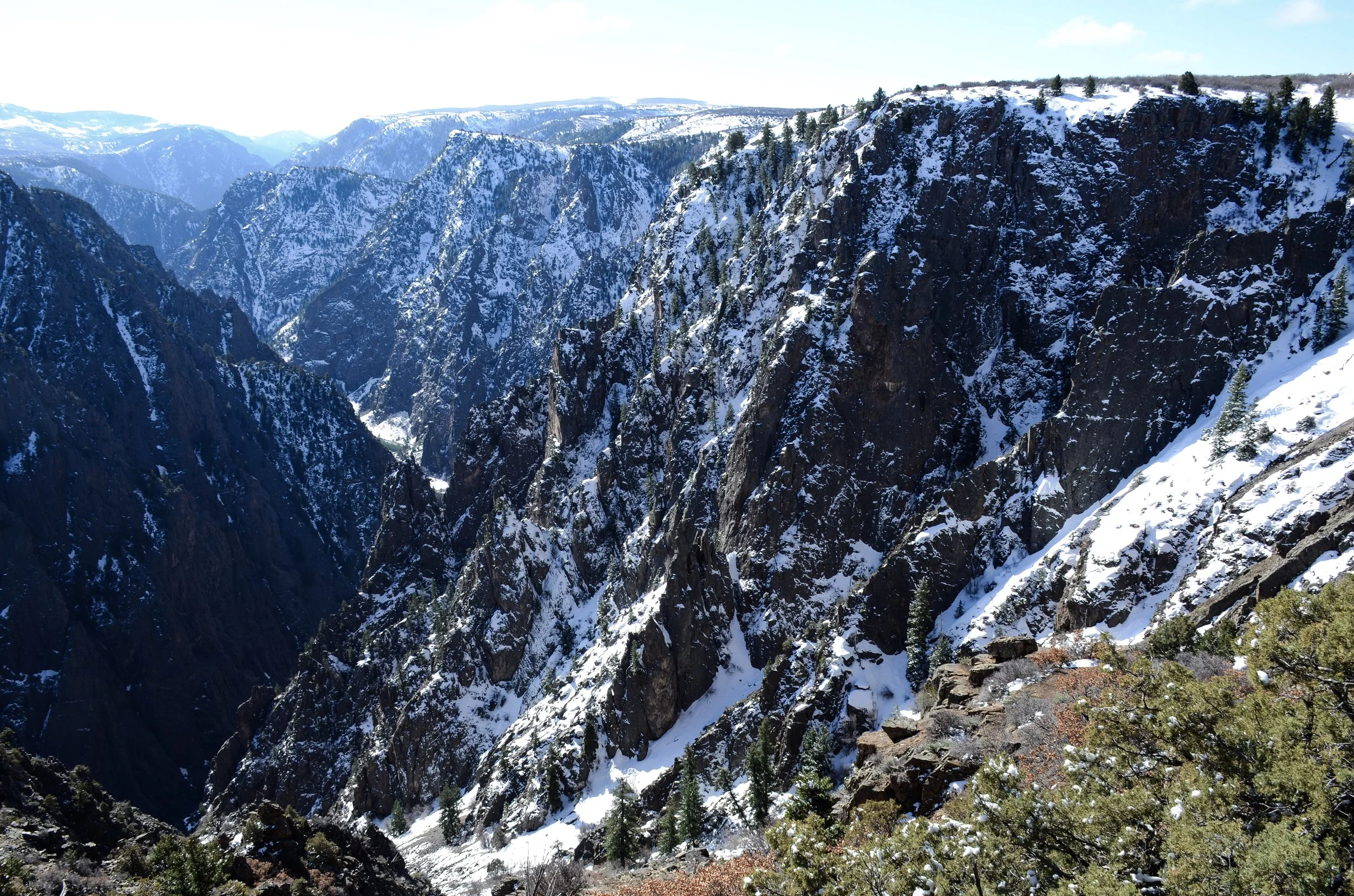
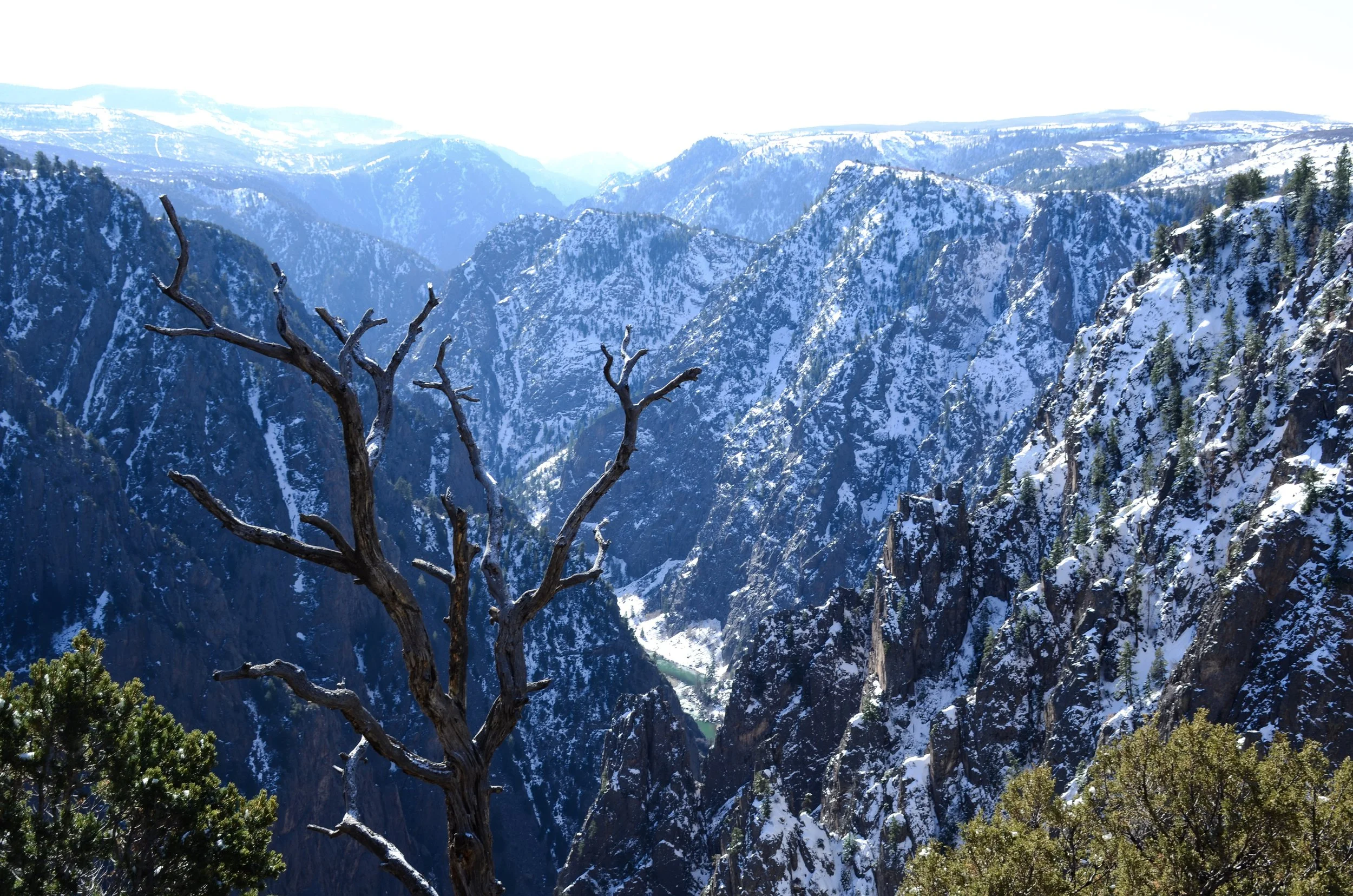
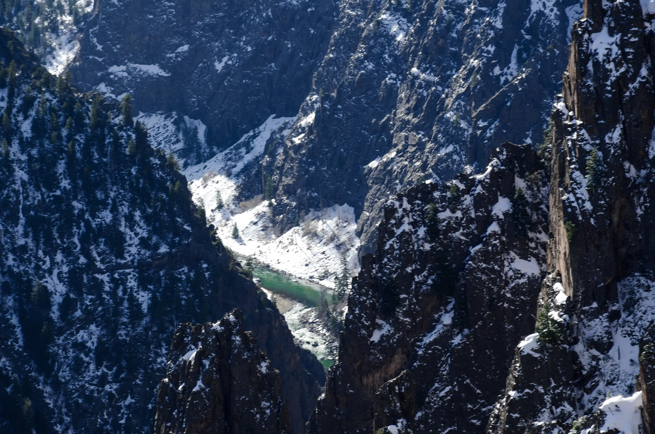
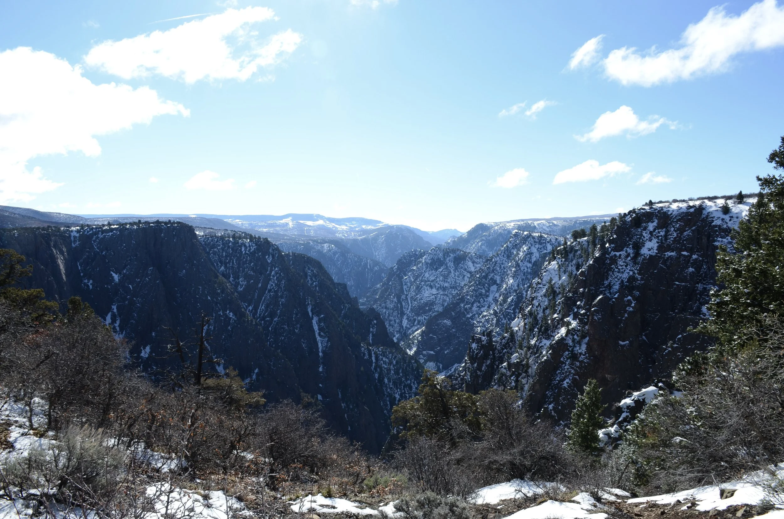
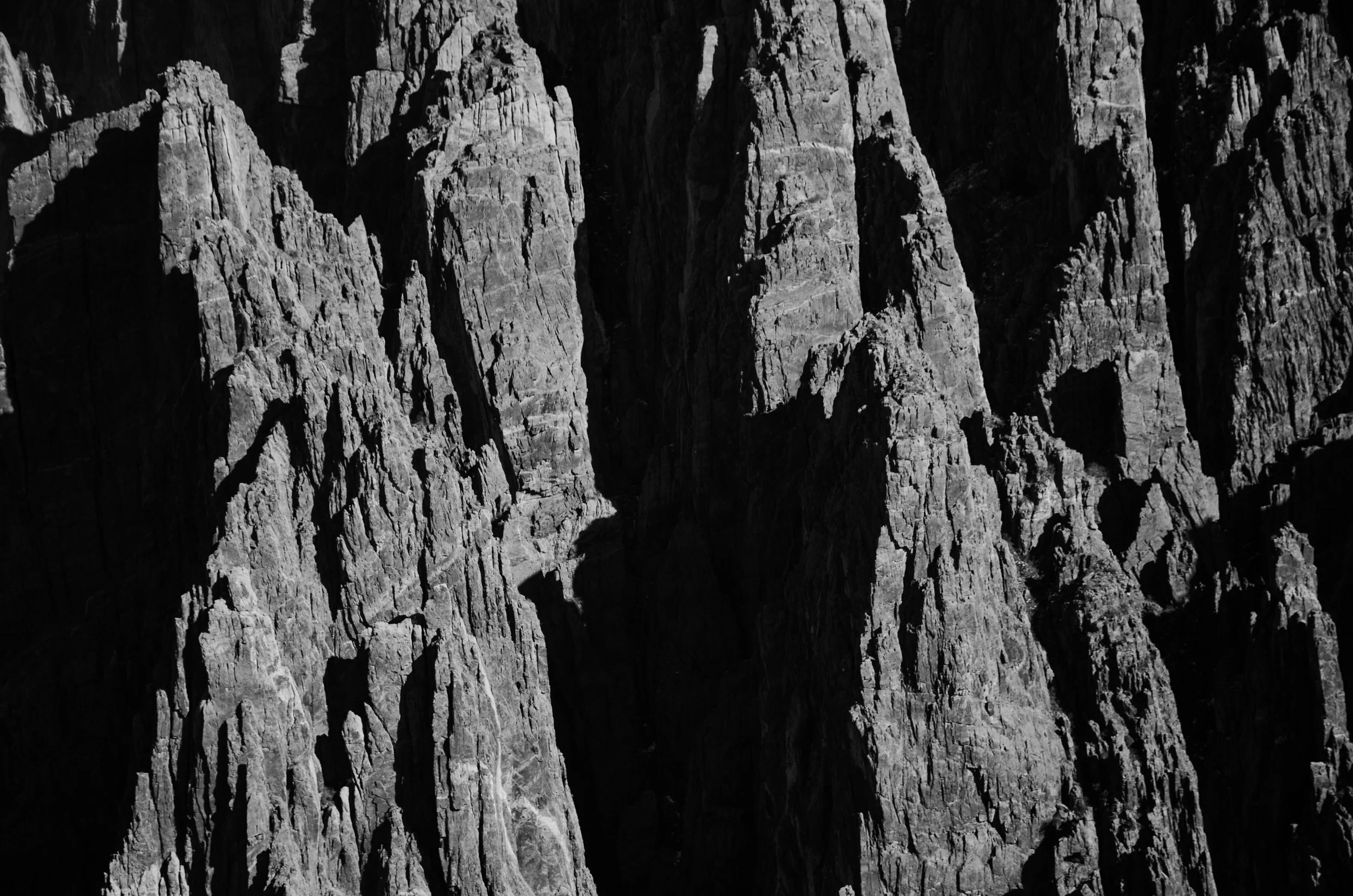
Black Canyon of the Gunnison
Park 33 | Separate
June 2016 | James
This picture was taken the summer I was in Nepal completing my grad school practicum. J and I started dating the day before I left for Kathmandu, so to say the relationship was fresh and fragile is, well, an understatement.
A couple weeks after I’d left, J went backpacking in the Black Canyon of the Gunnison with good friends of ours. They brought a camera and took dozens of photos that made me more than a little jealous to be missing out when I received the flood of text messages with pictures after they returned to cell reception. But this was the image that jumped out at me. They’d brought equipment to take night photos, including this one, where they spelled my name with flashlights during a long exposure shot. My heart warmed. I might be half the world away, but I’d been remembered.
This became the background on my computer for the next four months until I was back in Colorado to be reunited with J—marking the beginning of our in-person relationship. And the rest, as they say, is history.
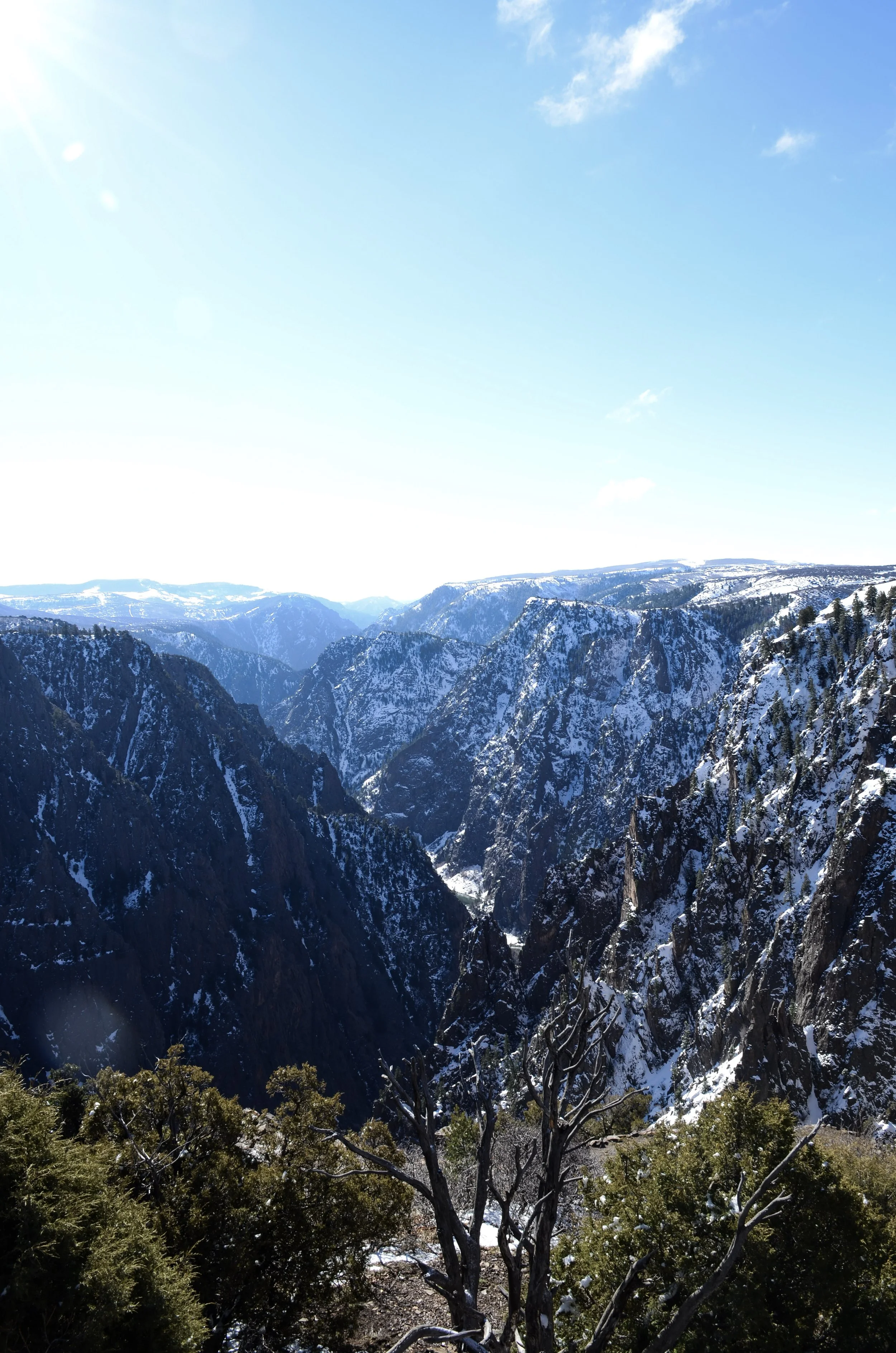
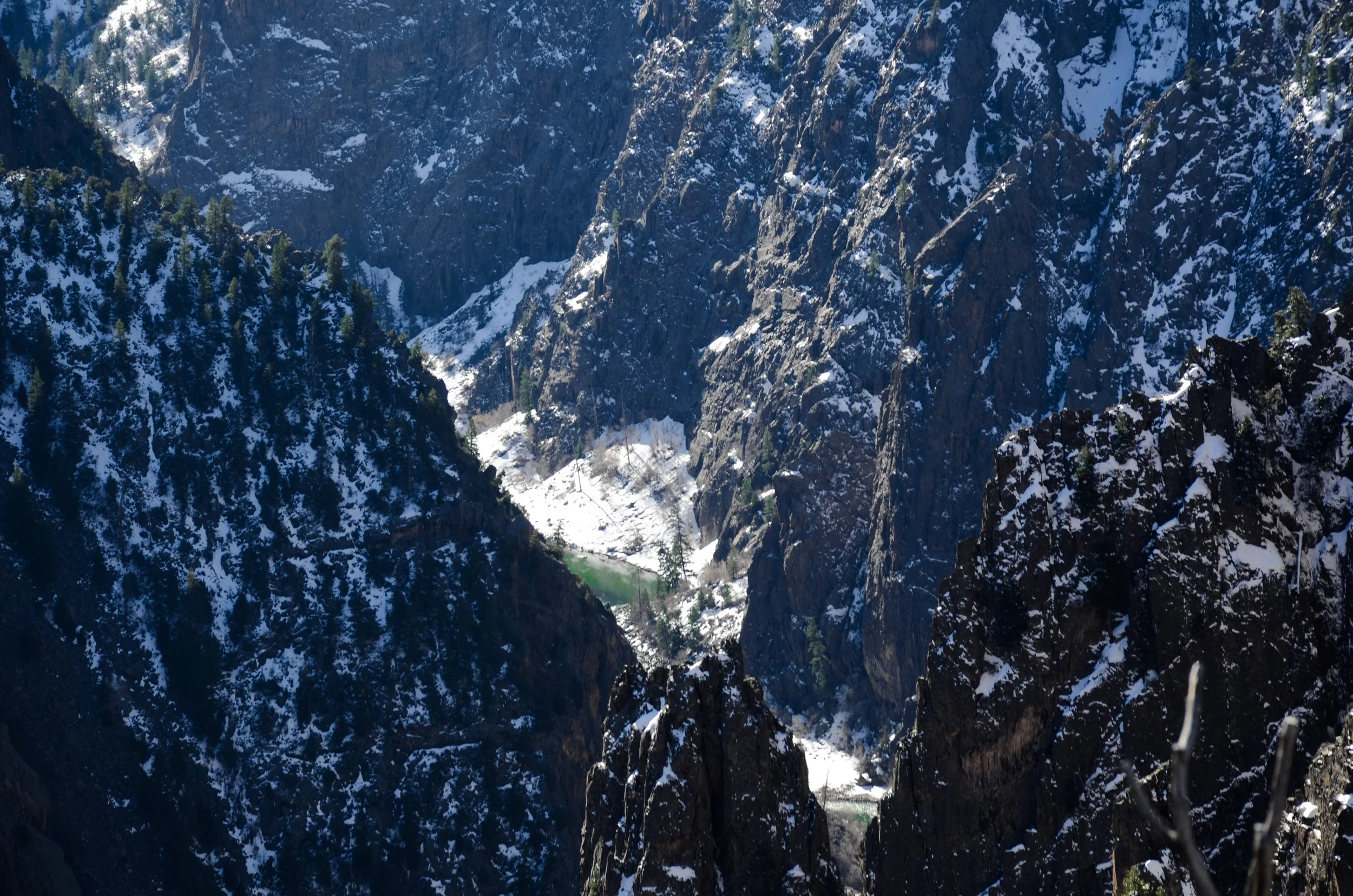
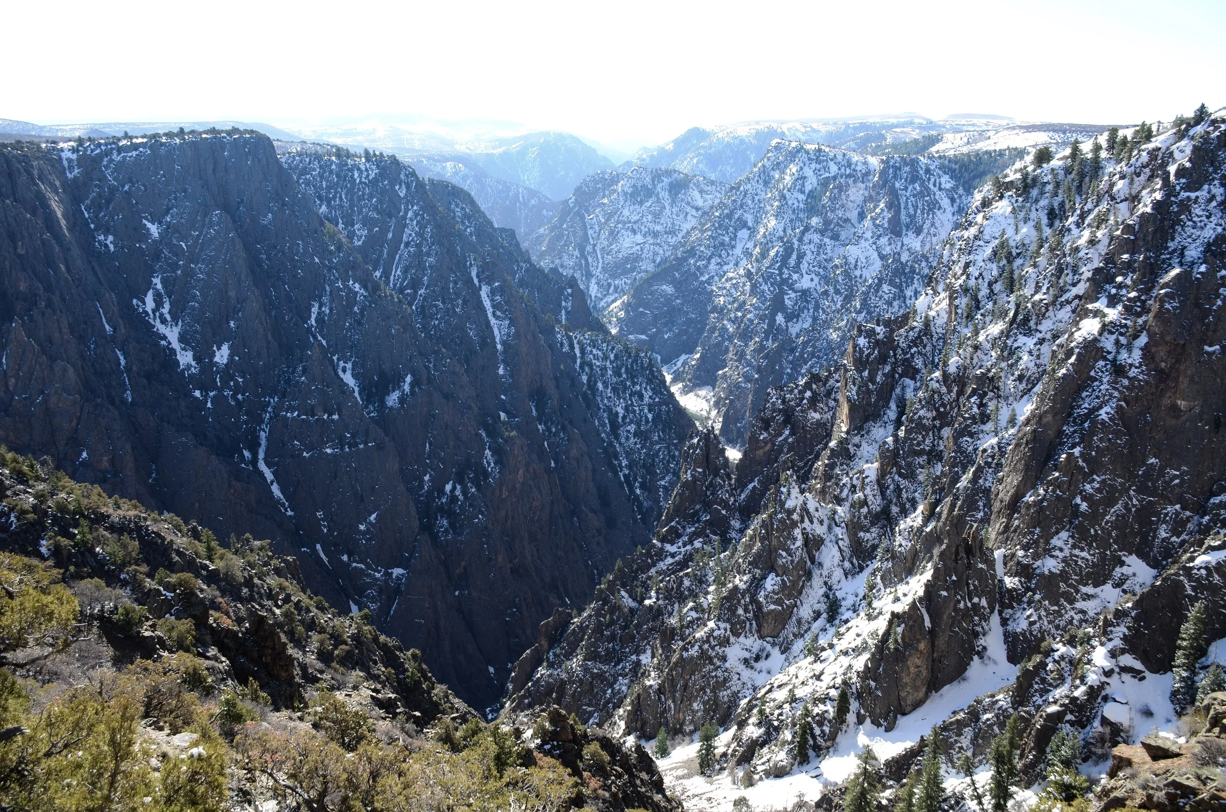
March 2016 | Emily
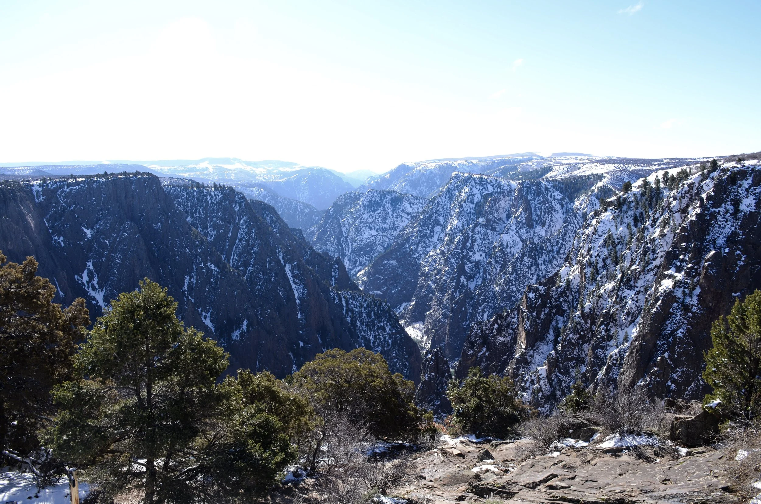
A whimsical, improbable day trip (for context, it’s over a four-hour drive, one-way, from Denver; so this was a long day) to the Black Canyon of the Gunnison with a friend. The weather was cold and clear and the park was completely deserted. Our hike along the upper edge of the canyon was stunning, but left me wanting more. We could just see the green ribbon of the Gunnison River from our vantage point as it wended its way through the gorge. Next time, I hope to be pitching a tent next to it.
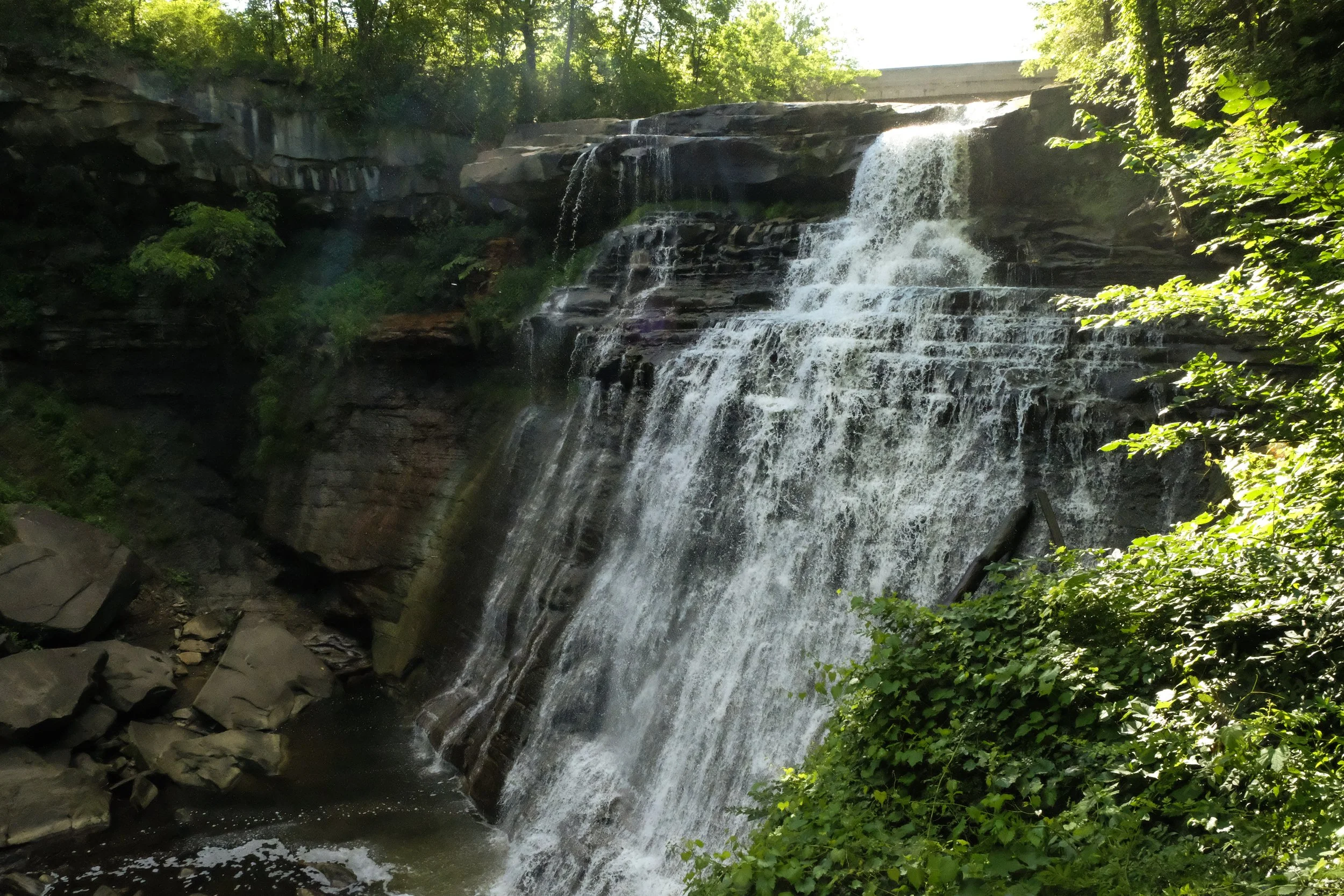
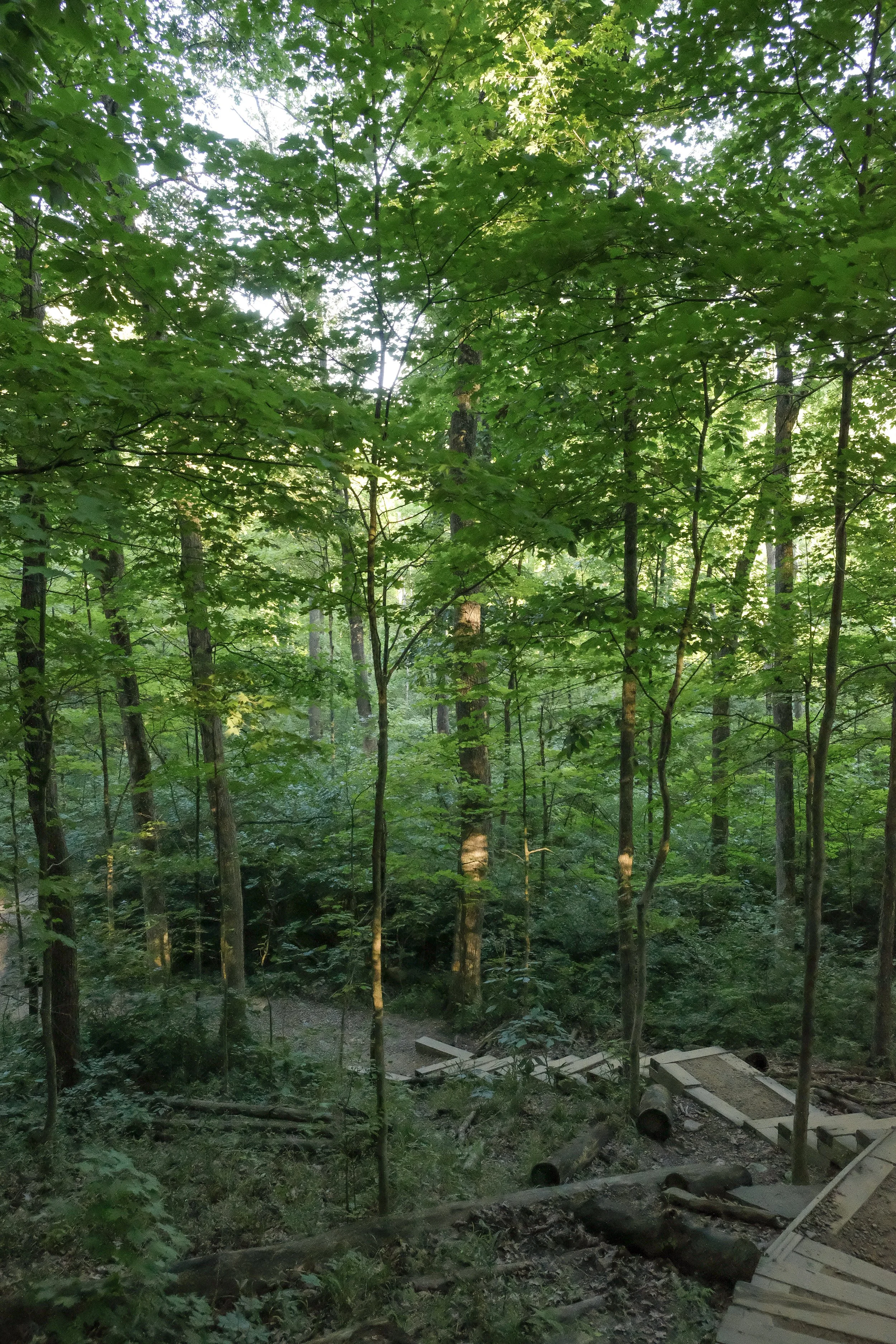
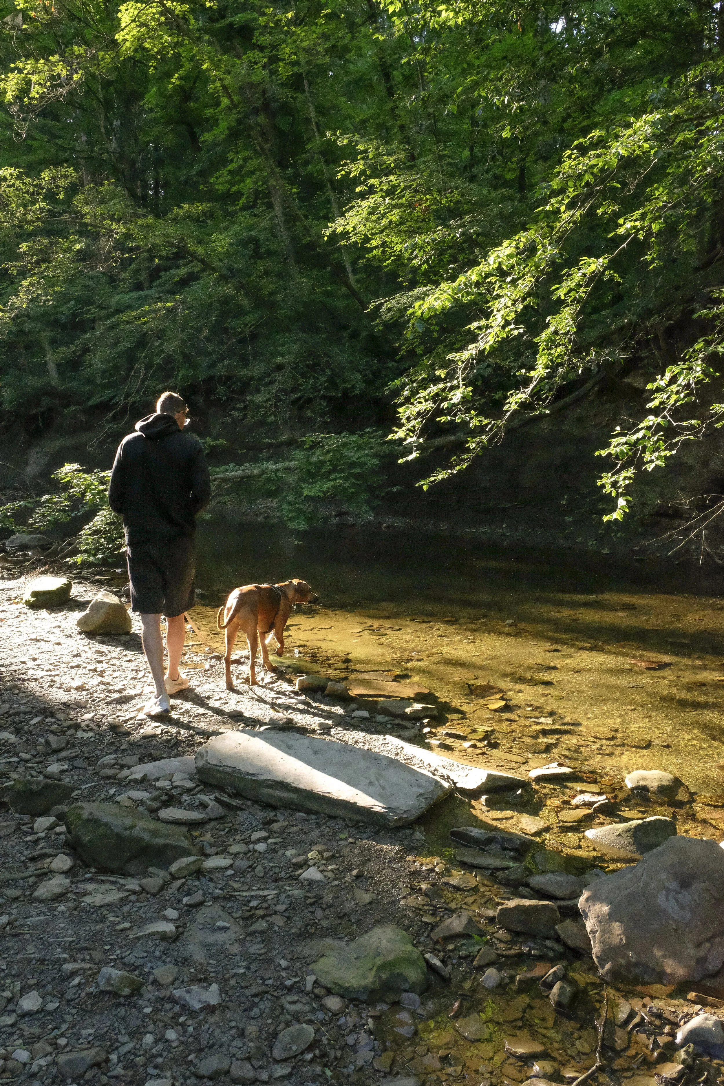
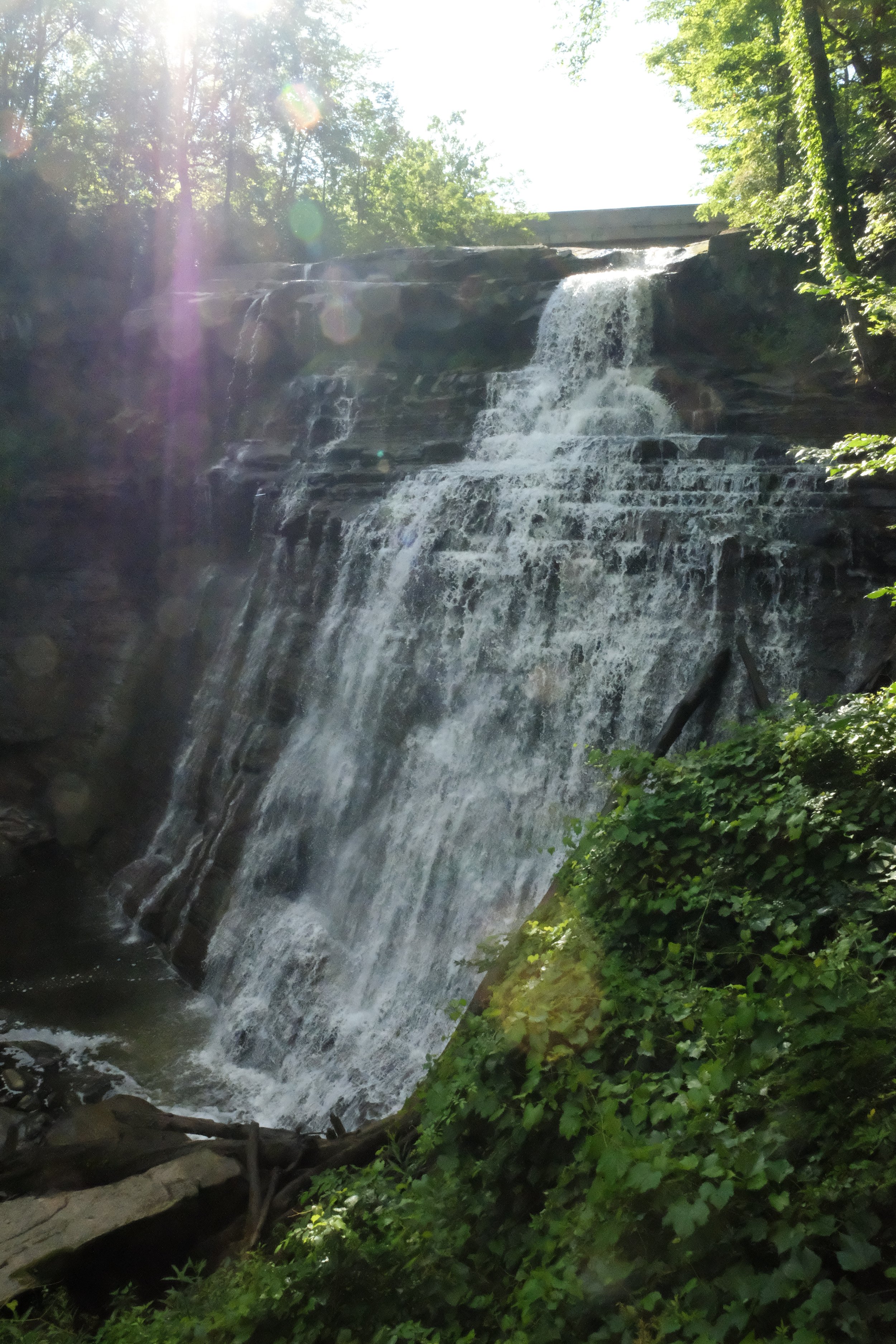
Cuyahoga Valley
Park 32 | July 2024
Part + Park 2 (of 2) on our Summer 2024 roadtrip through the Midwest.
After departing Michigan, we drove south to Cuyahoga Valley National Park. Situated between Cleveland and Akron, this is a quirky park in some ways, with many of the natural areas interspersed with houses and small businesses and no designated camping areas. We had done our research beforehand so had camping reservations on a nearby Christmas tree farm that had (wisely) deduced they could make some additional income by providing well-tended and private campsites in close proximity to the park.
Despite the irregularity of a few of these park features, I found myself genuinely enjoying our time on the trails, in the wetlands, and along the banks of the Cuyahoga River that flows through the heart of this protected area. We hiked the Brandywine Falls loop and visited Beaver Marsh, which has an incredible backstory of reclamation and restoration.
But what really made this park stand out for me is its role in what eventually grew into the modern-day environmental justice movement. The 1969 Cuyahoga River Fire became a symbol of all that was wrong with the environment: Inherently, rivers should not be on fire. This was very effectively elevated by Carl Stokes, the mayor of Cleveland at the time and someone who had long worked to demonstrate that environmental harm most often impacts communities of color and communities of lower wealth first and worst. During an era when landmark environmental wins were being won on the policy front, usually by white and/or affluent folks who did not proactively identify the intersection of environmental and social harm, Carl Stokes was unrelenting in his commitment to uplift and bring together policy solutions that would benefit people and the Earth.
J & I spent a hour in the visitor center, pouring over the maps and plaques and old photos. I was deeply moved by the story of this place. I found myself appreciating the clear, sparkling water of the Cuyahoga River in a different way when we exited the building and walked over the bridge back to our parked car. I paused for a moment to look down at the water, able to pick out fish lazily swimming against the river’s flow. It seemed impossible to imagine this river on fire; yet it had been, a mere 55 years earlier.
Between that and the inspiring history of the Beaver Marsh, I left CVNP with a spark of possibility, perhaps even hope. Nature can restore herself, and remarkably quickly, if we give her that chance. Rivers can run clear again. Junkyards can become thriving marshes. Humans and creatures can breathe clean air. With the right mixture of agitation, strategic messaging, policy expertise, and a vision for a better future, communities can become activated and change really can happen.
Wins feel hard to come by these days. I am thankful for the moments I was able to spend next to this now healthy river which has become a symbol once again: But this time, instead of typifying ecological dysfunction, it now flows as a living being through the heart of Ohio, a shimmering beacon to remind souls like mine of the enduring power of collective action.
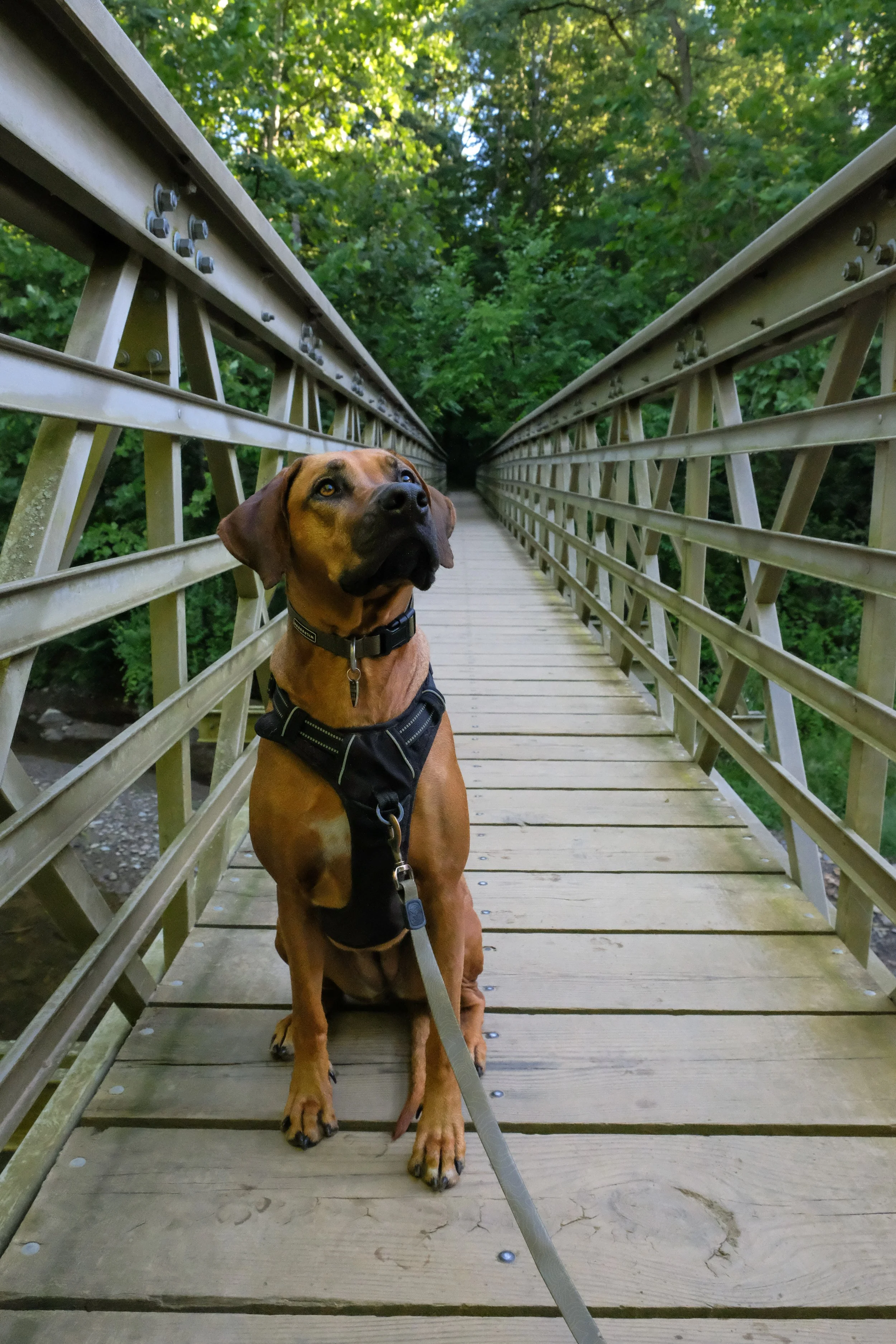
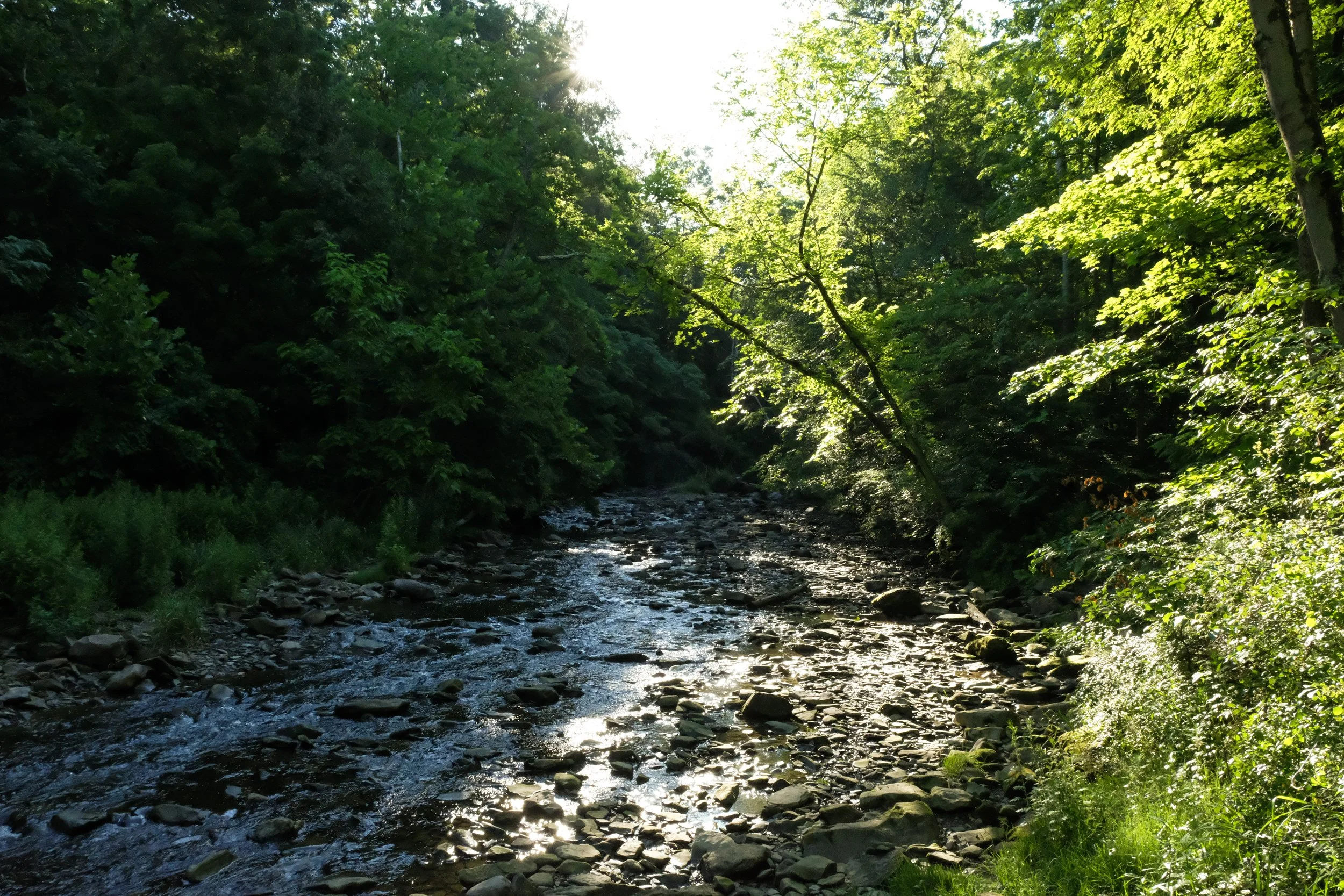
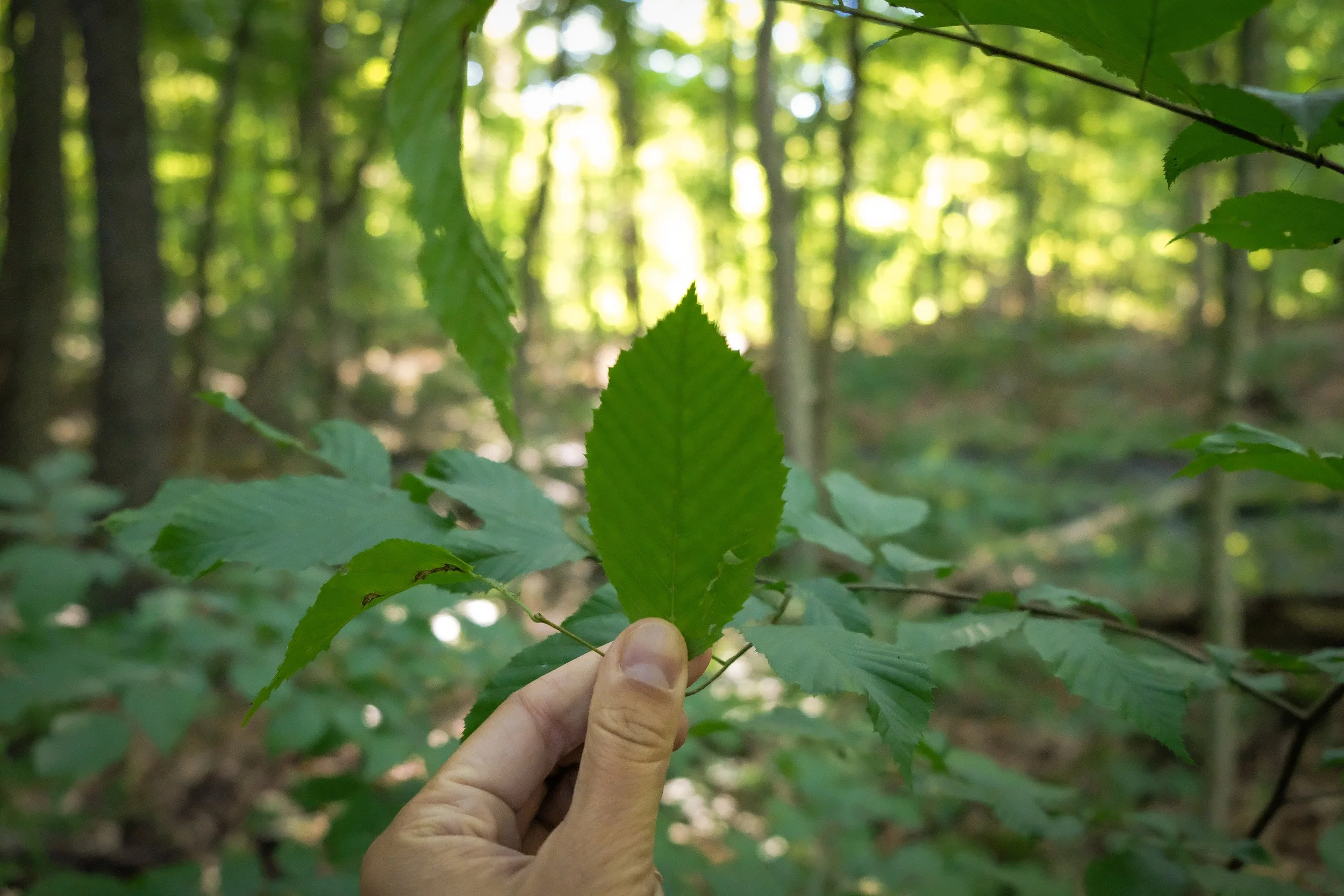
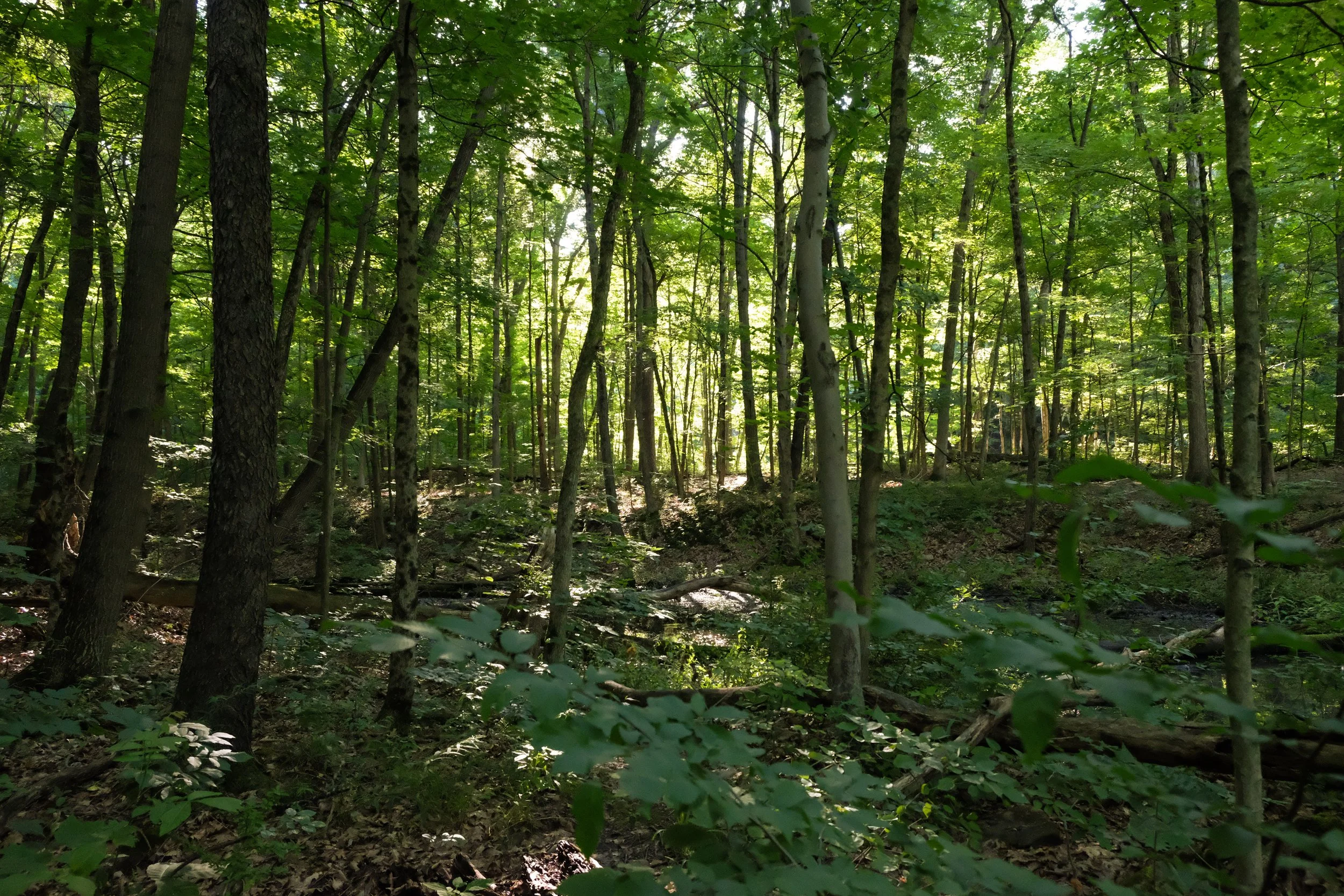
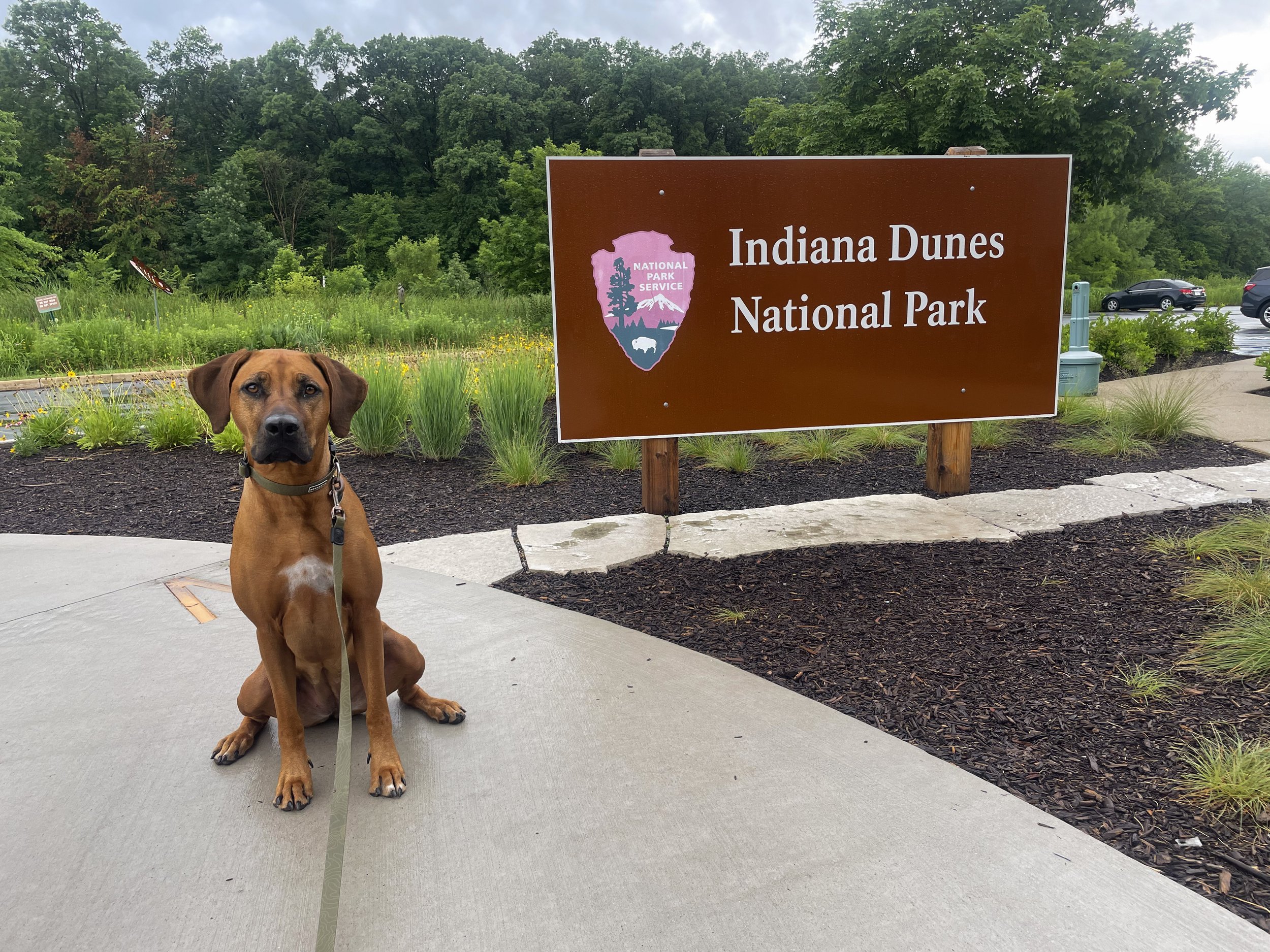
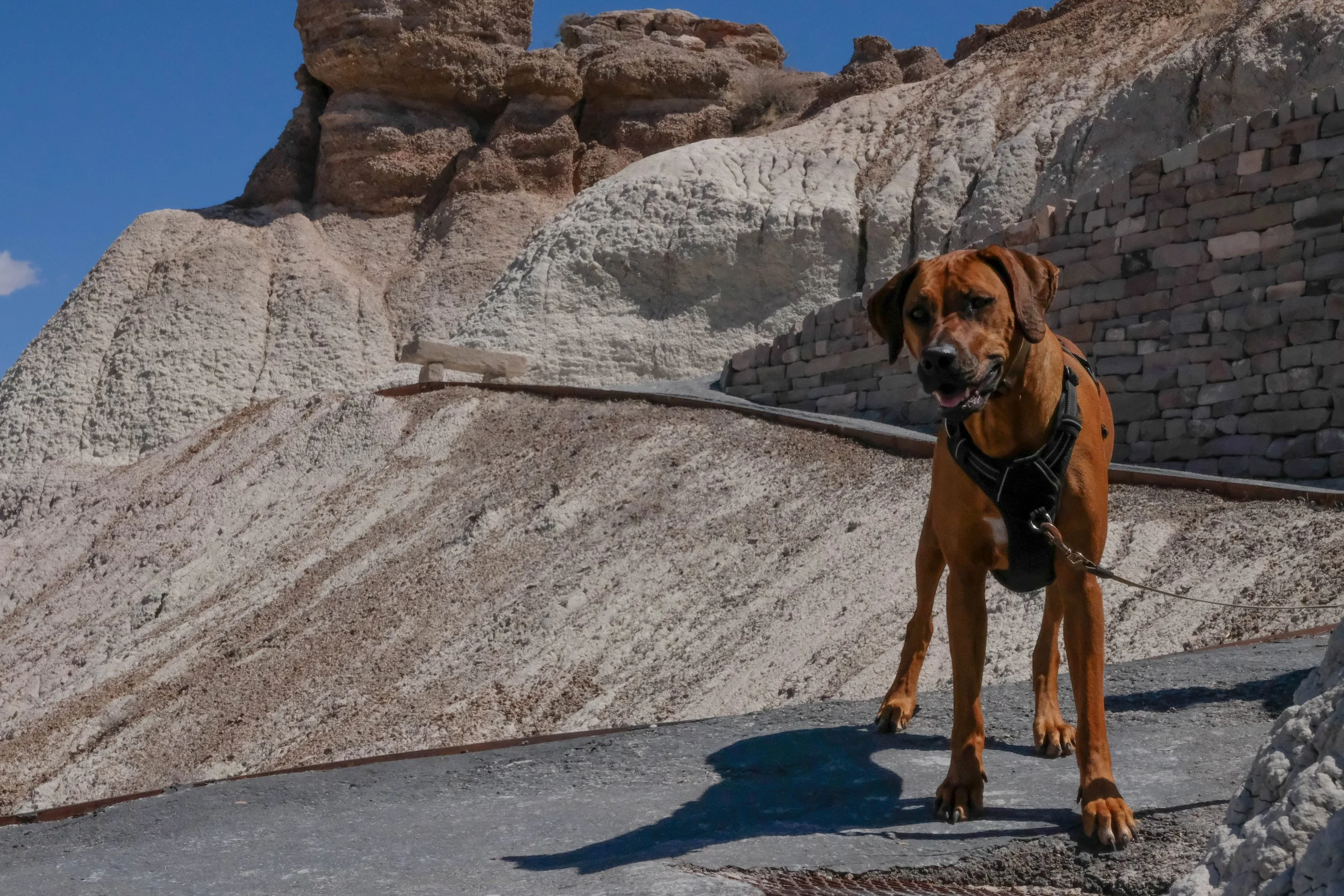
Indiana Sand Dunes
Park 31 | June 2024
Part + Park 1 (of 2) on our Summer 2024 roadtrip to the Midwest.
Before 2019, Indiana Sand Dunes National Park was designated a “national lakeshore.” When we first learned it was getting added to the National Park lineup, I wasn’t sure how we were going to figure out a good way to get there since Indiana hasn’t historically been part of our travel rotation or made our dream destinations list (…nor do we expect it to ever make that list, sorry, Indy). So when my mom announced she wanted to celebrate her 60th birthday in Michigan in the summer of 2024, we seized on the opportunity to convert it into a trip that included a couple nearby(ish) parks.
We opted to drive from Colorado and bring Kiya with us since both of the parks we aimed to visit on this trip were dog-friendly (plus, trips with our dog > trips without our dog). After a fun stopover day in Chicago, we met up with another sibling who had driven from Oregon and camped together at Dunewood Campground in the park. Pros of this campground? Beautiful trees and not too many close neighbors in the walk-in campsite section. Cons? Being almost eaten alive by mosquitos. Neutral, but worth noting? Beware the ninja-like raccoons who silently descend from the surrounding trees after dark, ready to raid each campsite for whatever scraps they can find.
We also spent a long afternoon on Lake View Beach, introducing Kiya to the largest body of water she’d yet seen and catching some sun rays. When I think of this park, those are my first and favorite memories. The following morning, we squeezed in a short rainy forest hike next to a wetland area and checked out the visitor center before hopping back in our car and continuing the drive north into West Michigan.
Pictured below:
Kiya at Lake View Beach and Dunewood Campground.
Views from our morning hike at the start of Cowles Bog Trail.
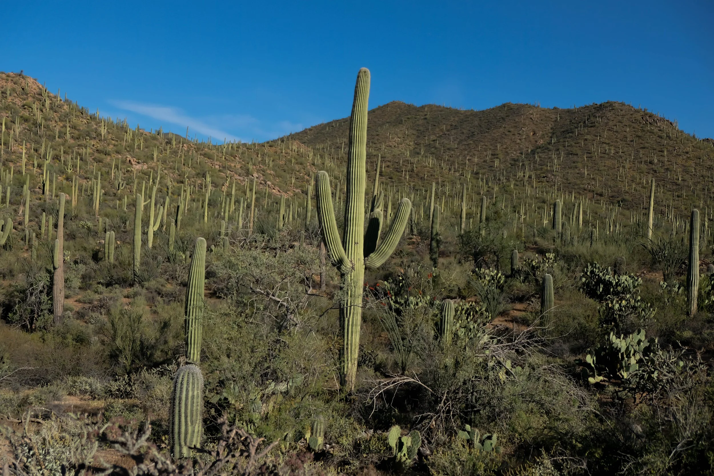
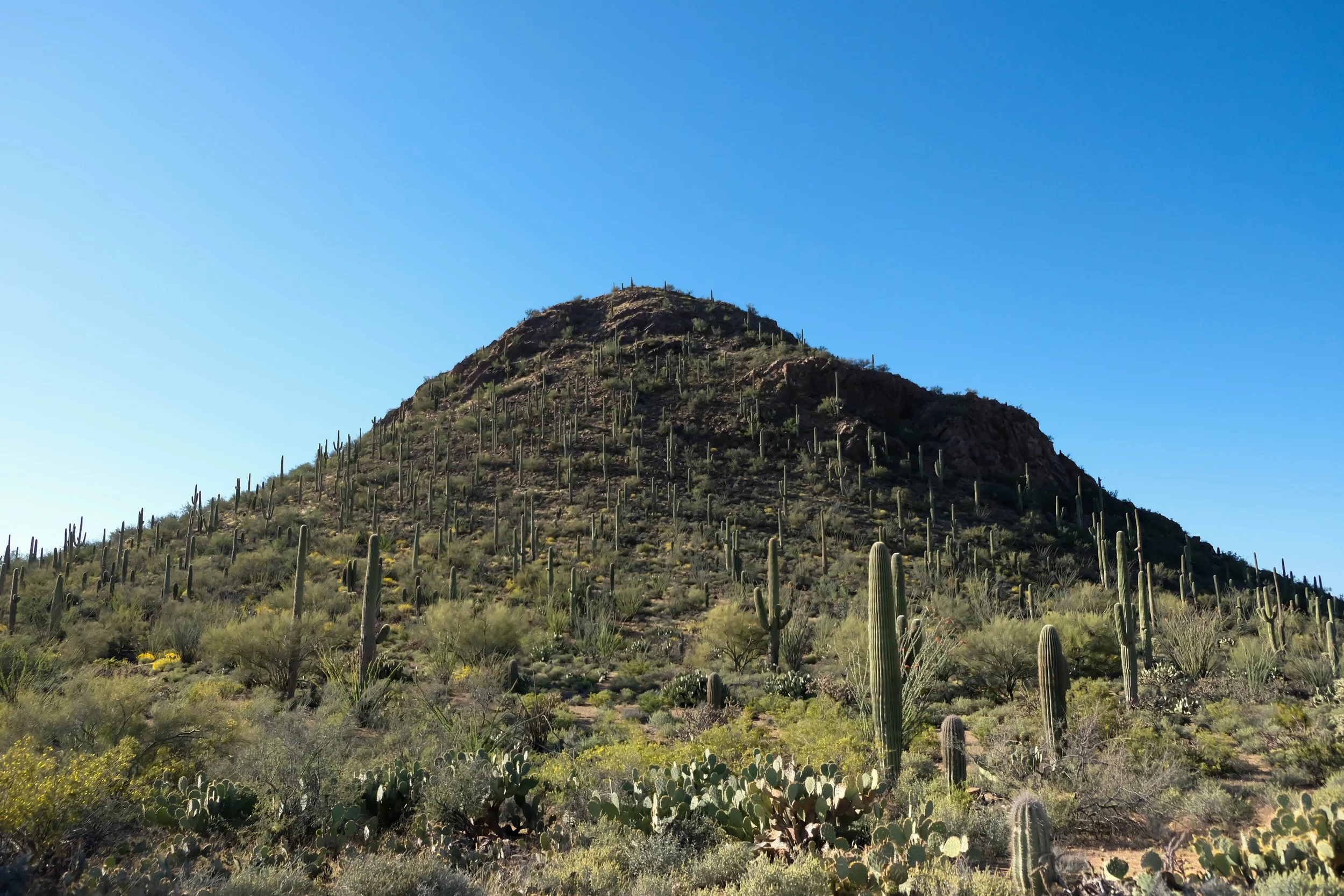
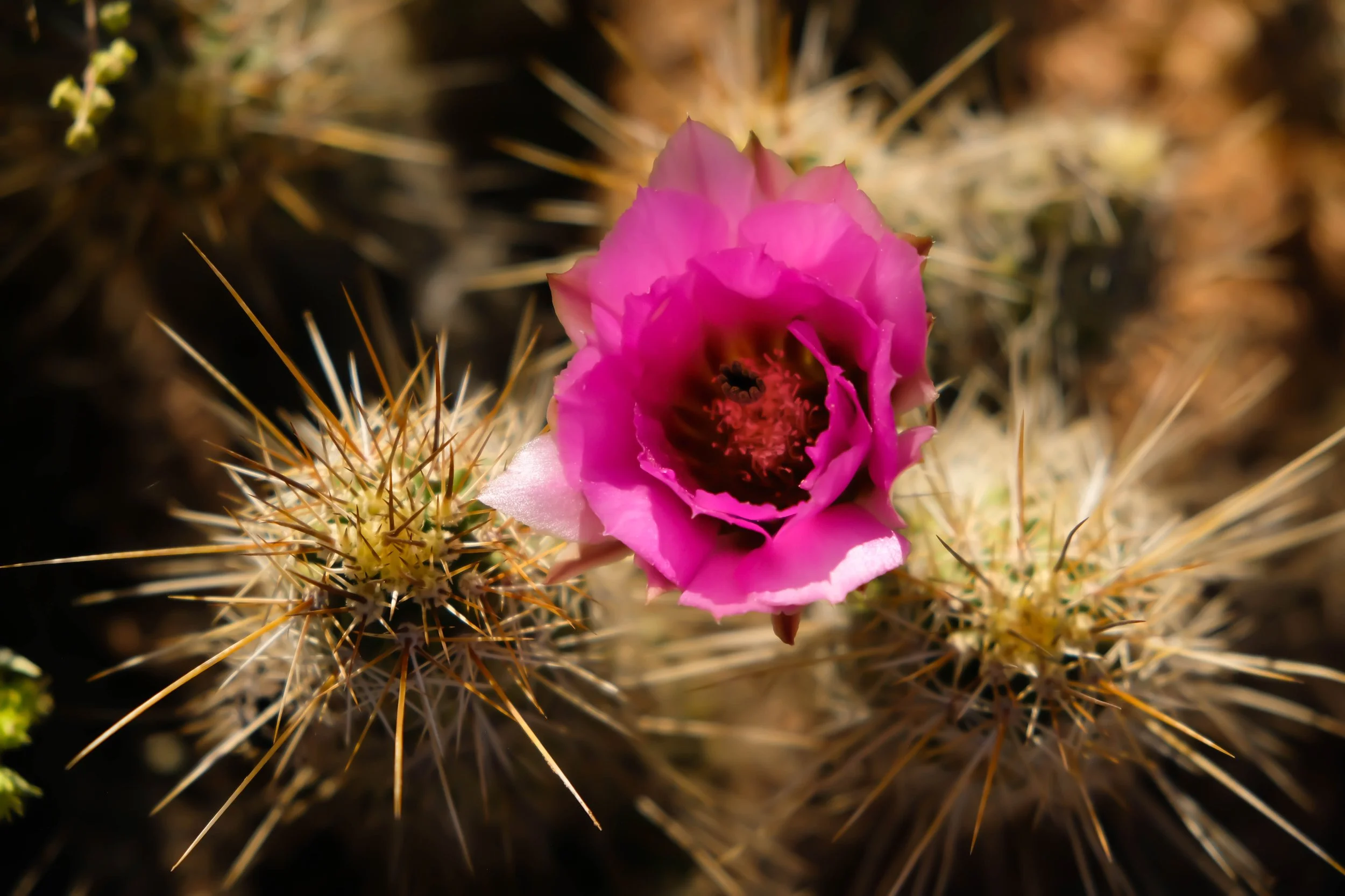
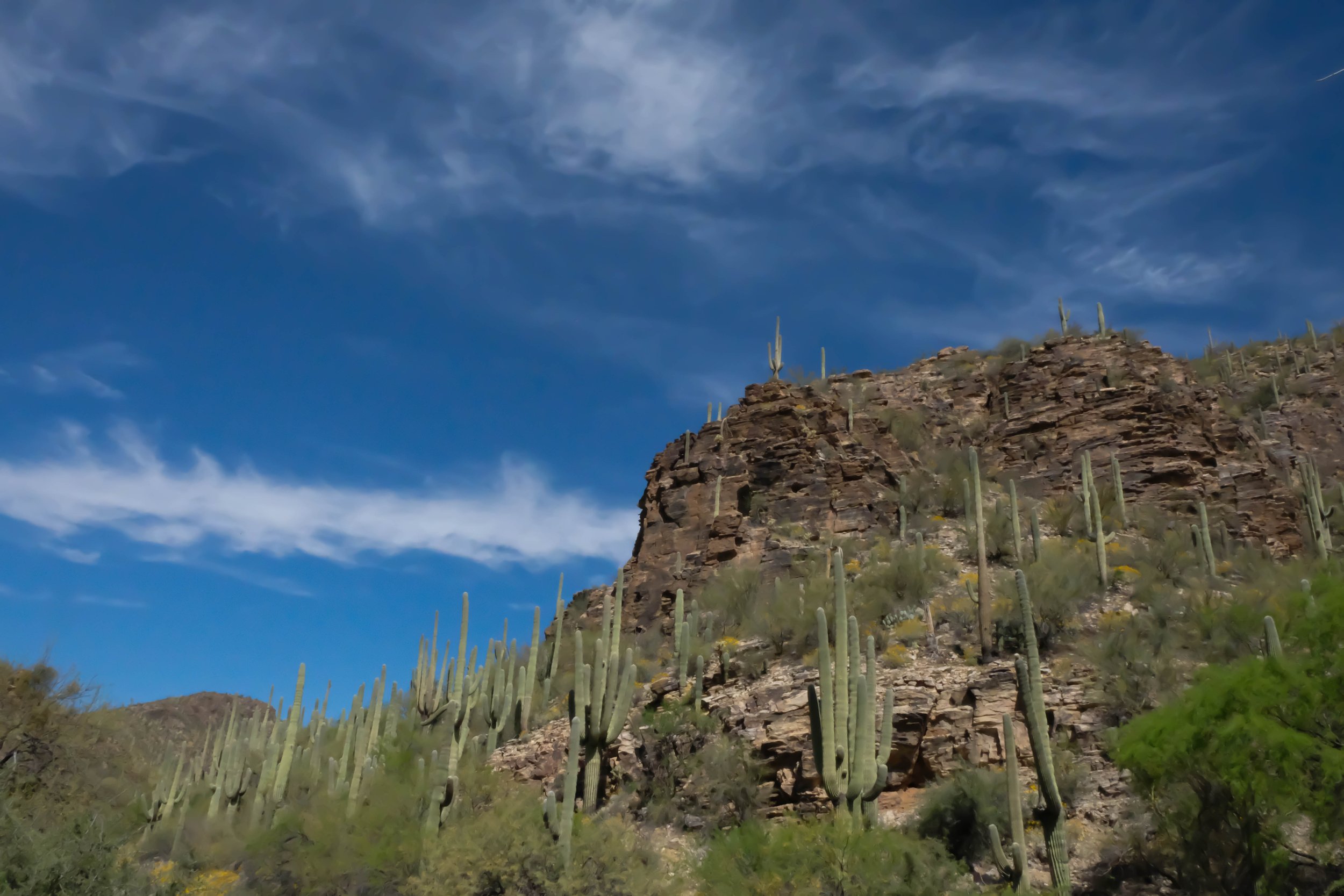
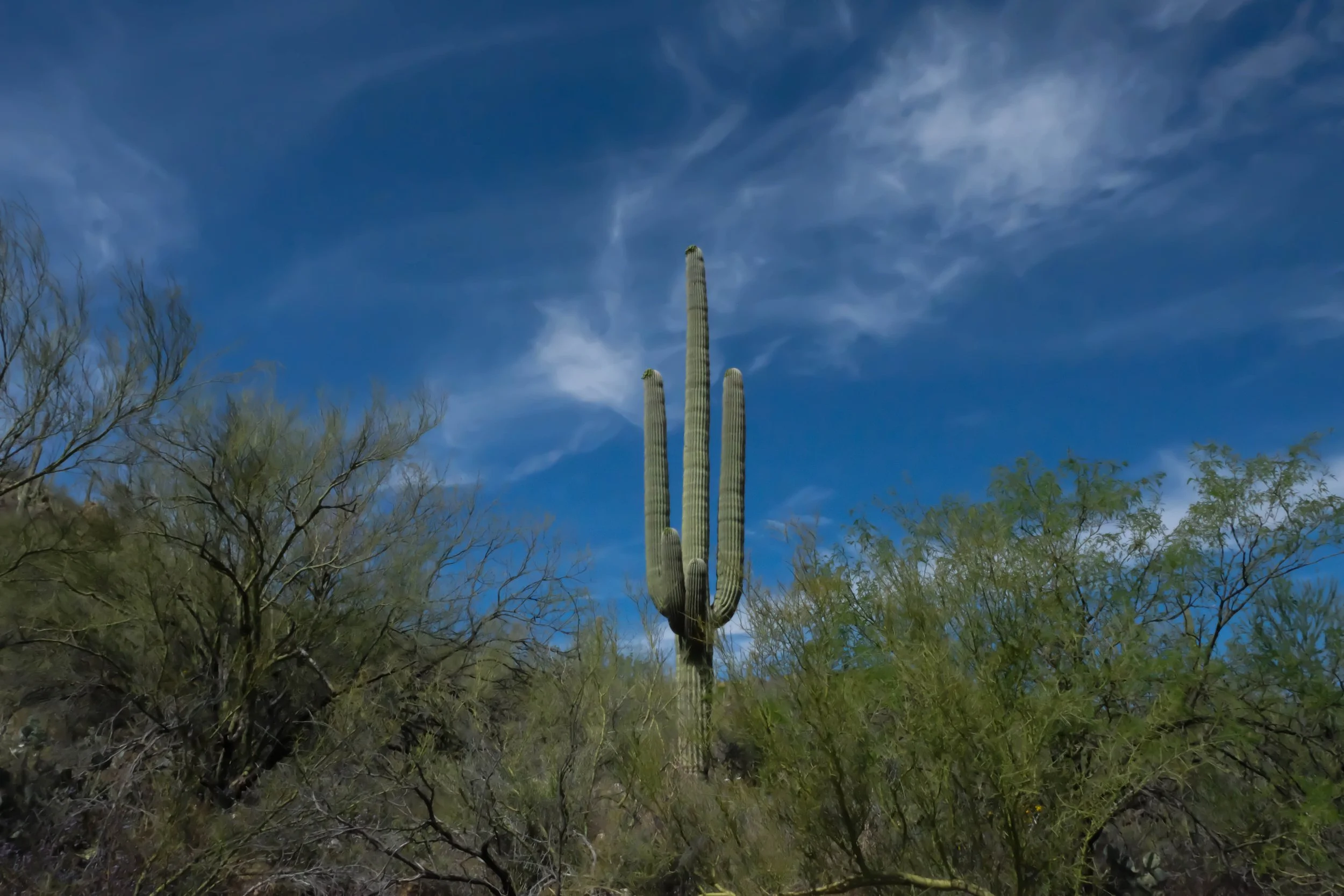
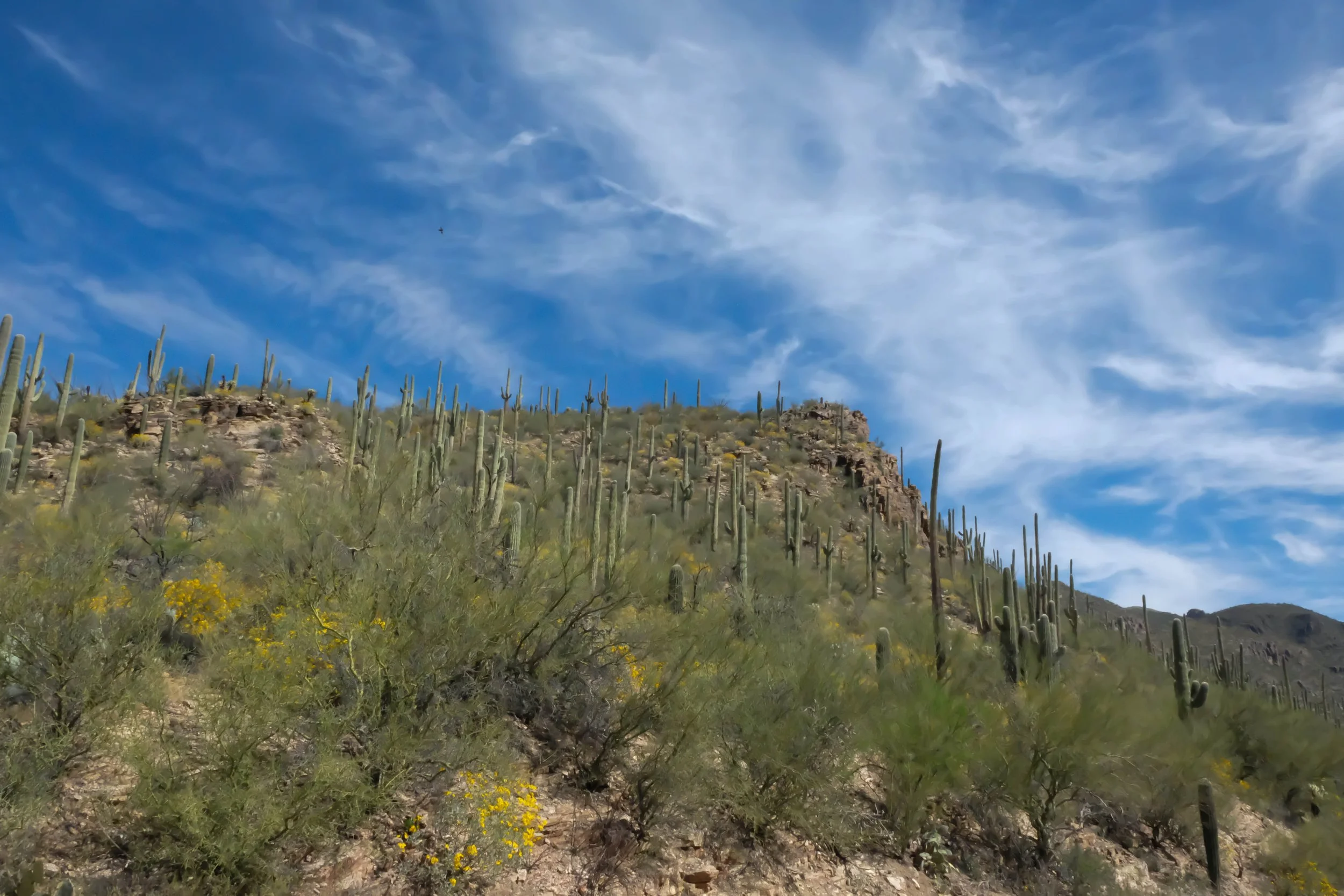
Saguaro
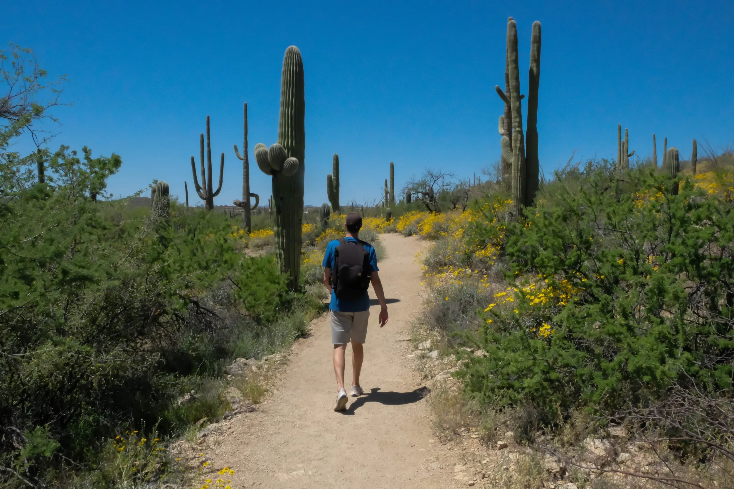
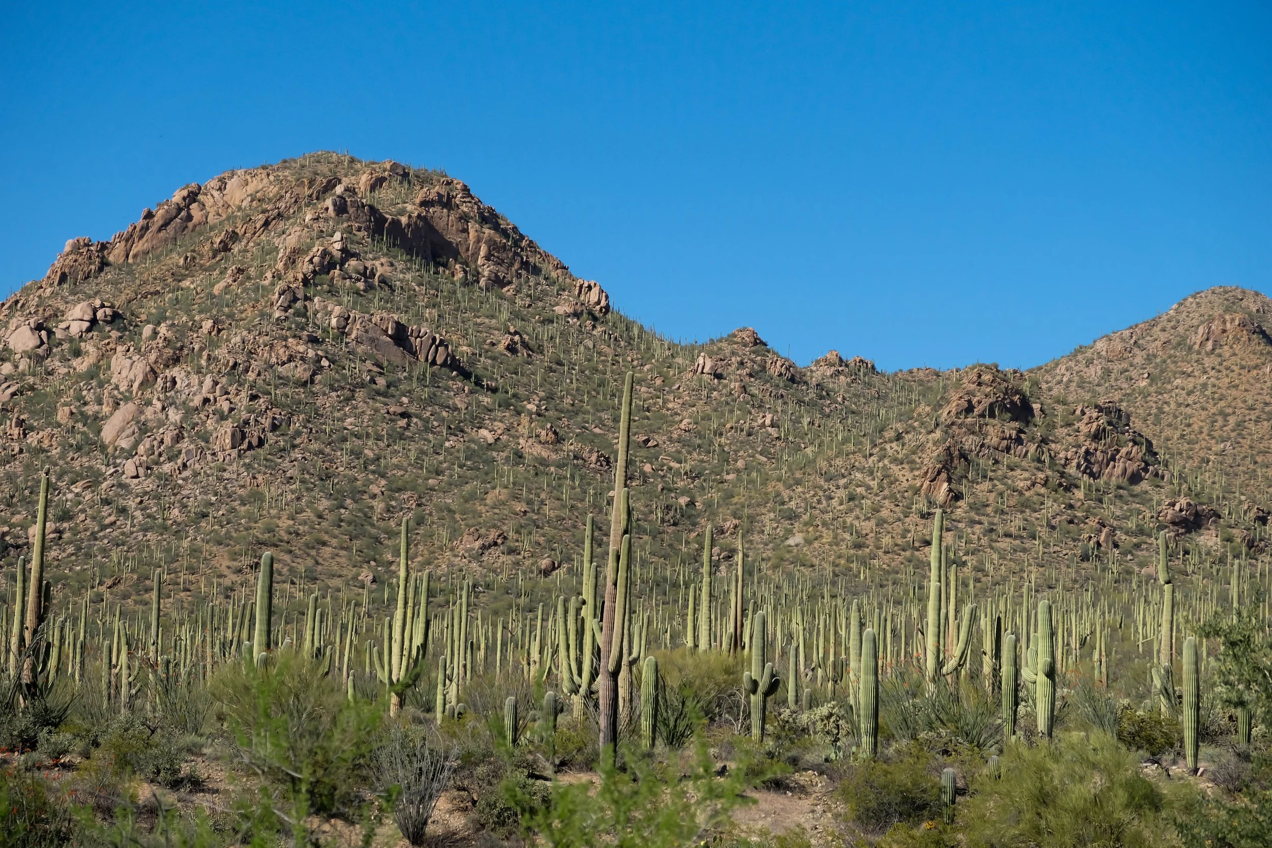
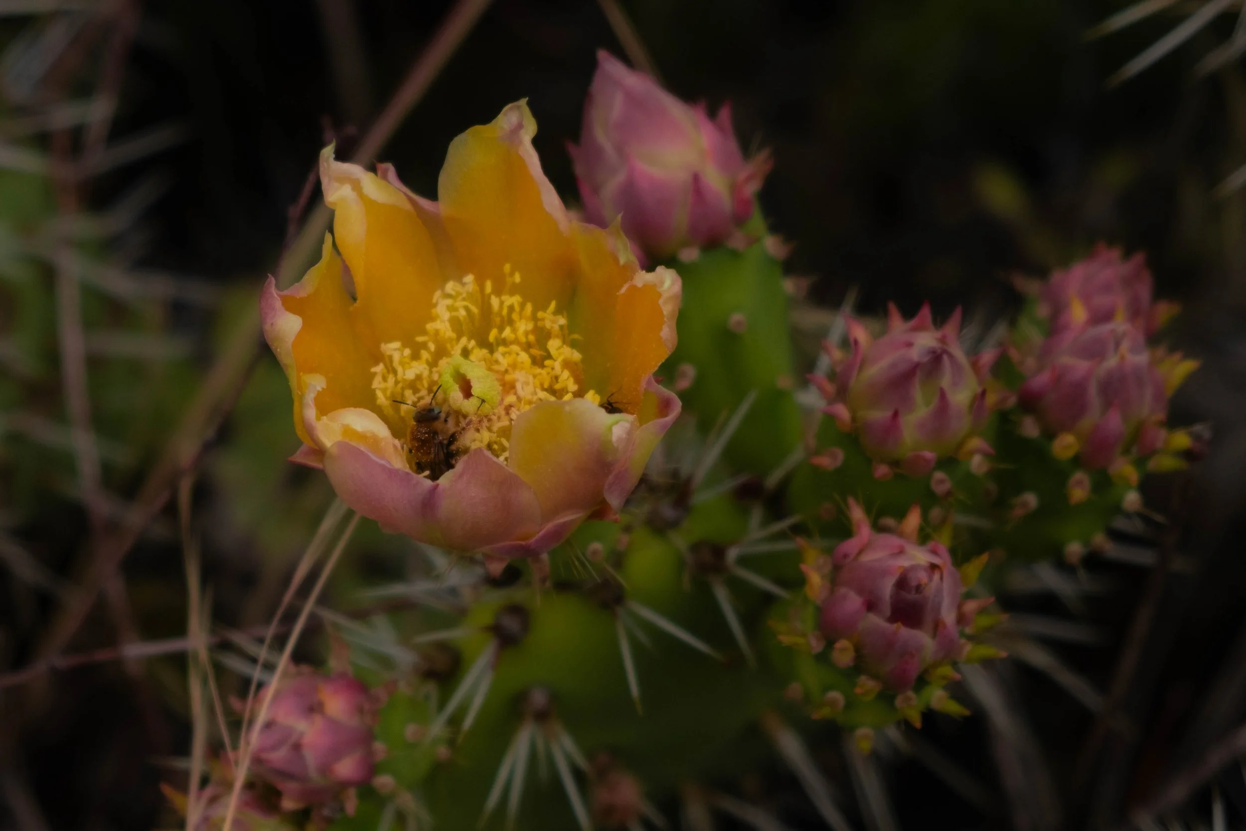
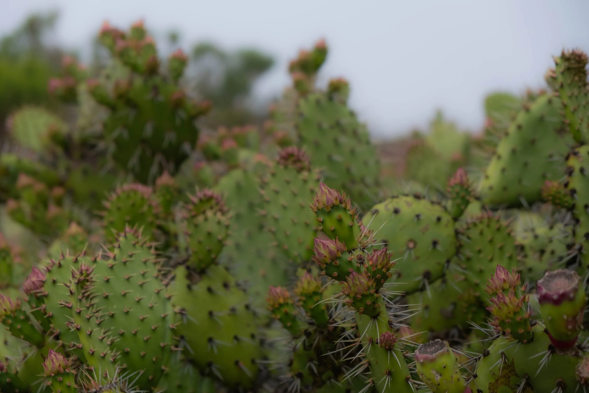
Park 30 | April 2024
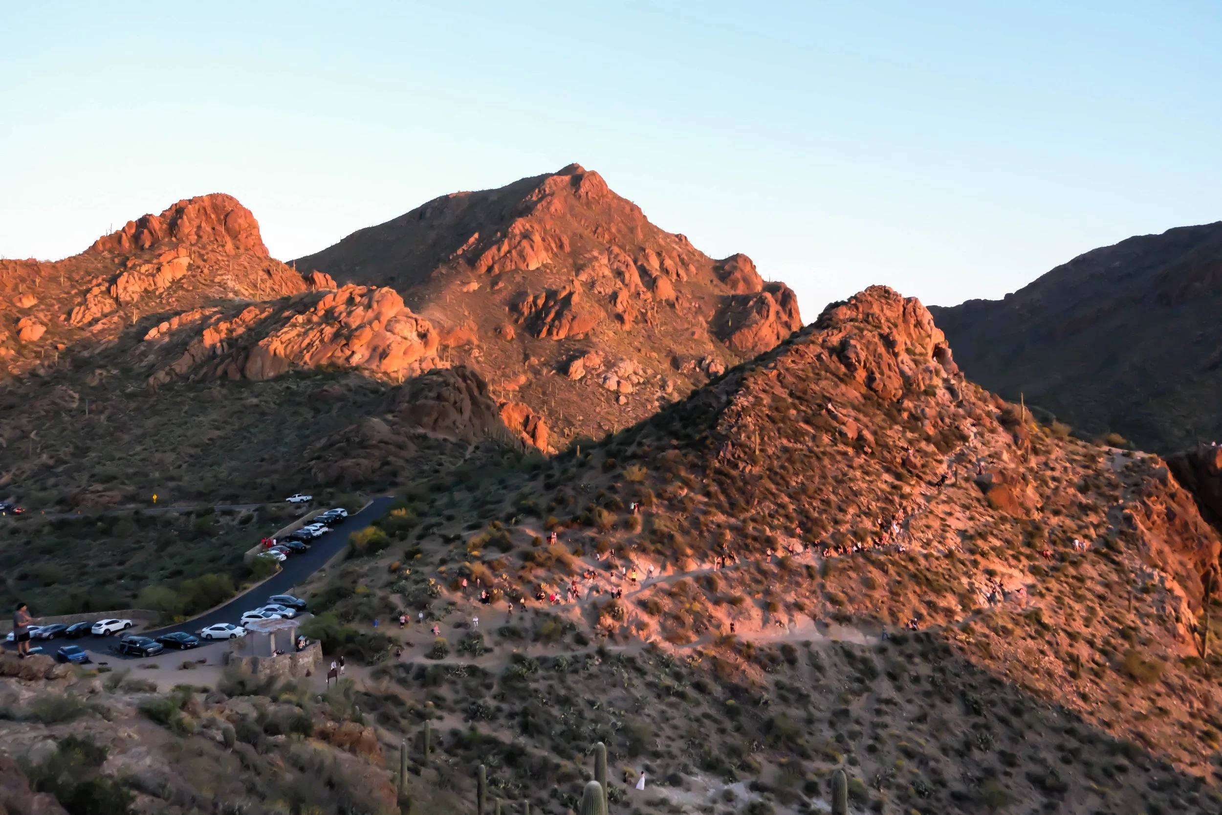
In April 2024, I attended a conference in Las Vegas followed by a conference in Phoenix the following week. Rather than flying back to Denver in-between, I flew from LV to Phoenix, met up with J there, we rented a car, and drove south to spend three days exploring the Tucson area and Saguaro National Park. It felt like the perfect way to break up a long work trip.
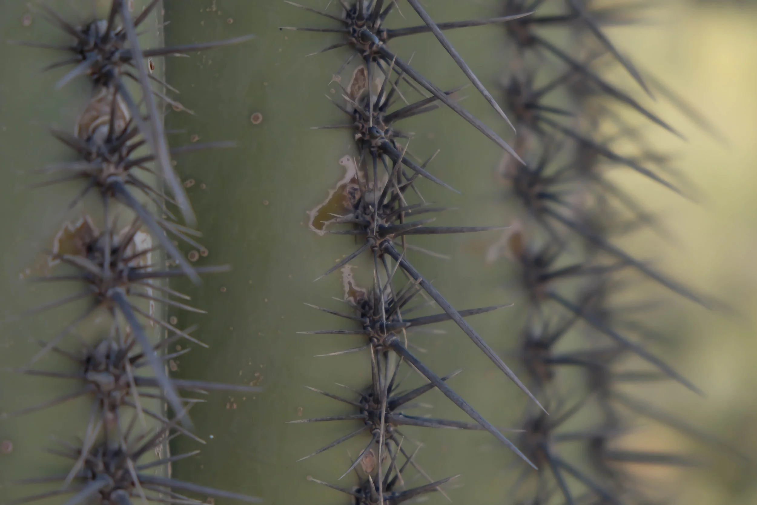
Tucson is a cute town and is filled with childhood memories for J from when the Colorado Rockies used to hold spring training at Hi Corbett Field. It is also situated roughly 20 minutes from the West section of the national park. On our first entrance to the park, we saw a rattlesnake and desert salamander living their best lives, prickly pear cacti with orange and pink blossoms, and majestic saguaros dotted liberally across the rocky hills and valleys. Saguaros, an iconic symbol of the American Southwest, are endemic to the Sonoran Desert. We were lucky enough to visit just as many of the plants and cacti were beginning to flower — which wreaks havoc if you have allergies (sorry, J) but is also spectacular: delicate blooms punctuating the desert landscape with vibrance and color. Life flourishes, even in what felt to me like a harsh ecosystem.
Some of my favorite memories were seeing the dozens of humans who made their way to Gates Pass to be awed by nature’s oldest spectacles, the sunset. Moments like these give me a shot of hope that we still have the ability, as a species, to slow down and savor a sky awash in colors, that we haven’t been wholly corrupted by little screens, and that perhaps we still have space within us to be profoundly moved by beauty.
The incredible thing about this particular kind of beauty is that it grounds me in the natural rhythms of the Earth: where diversity is not just celebrated but is necessary, where “ecosystem” isn’t just a fancy word but refers to a real system of interconnectedness that is mandatory for the continuation of life, and where kinship and collaboration and mutual aid are so often the path to survival.
“To pay attention, this is our endless and proper work.” —Mary Oliver
Pictured below:
Desert View Trail in Saguaro National Park (West).
Sunset from Gates Pass Trailhead.
Long hike into Sabino Canyon, which is not within the NP boundaries, but was another spot J used to visit as a child.
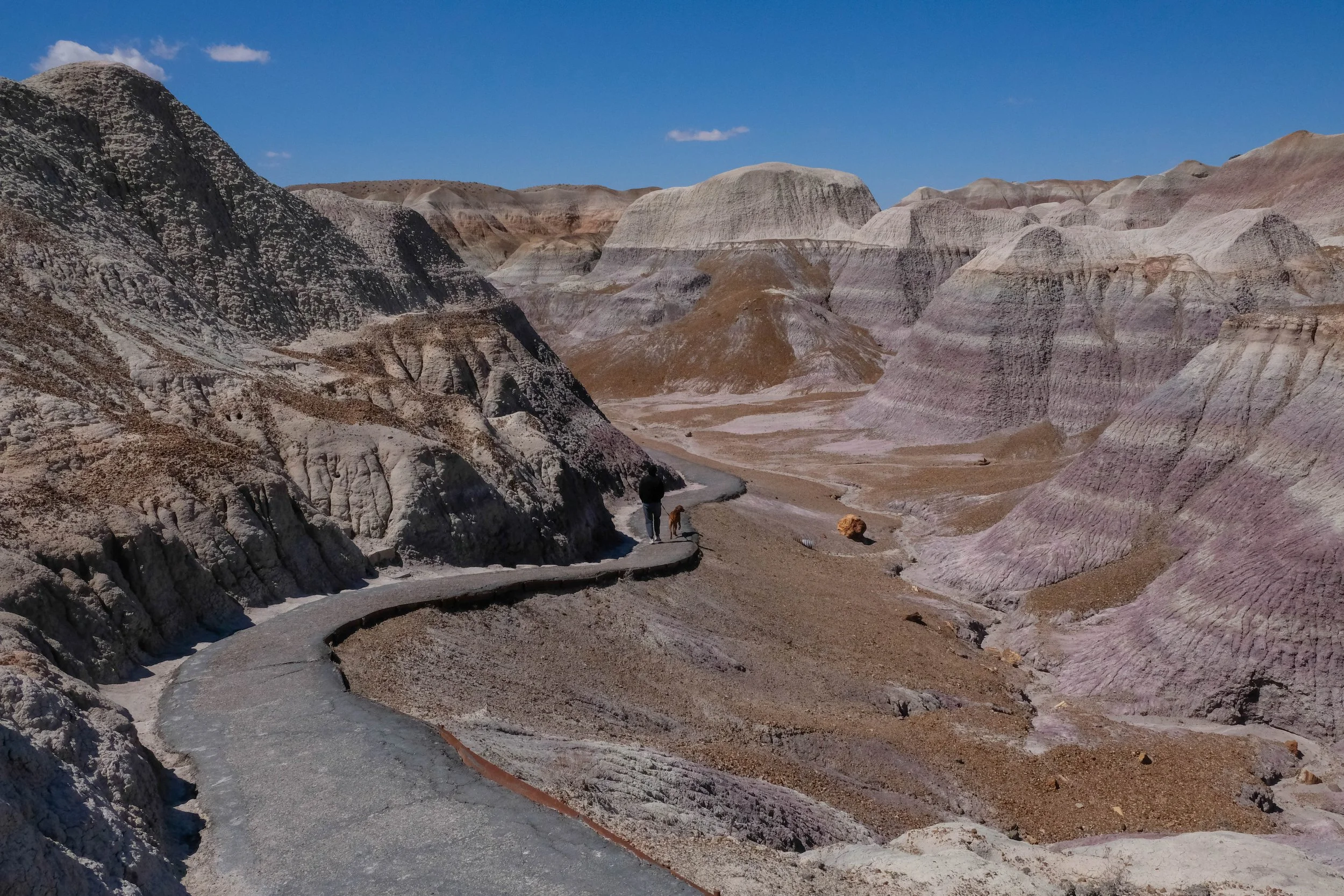
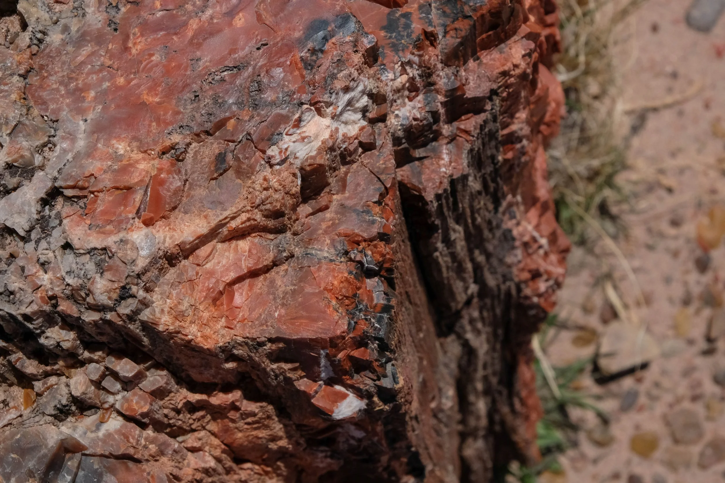
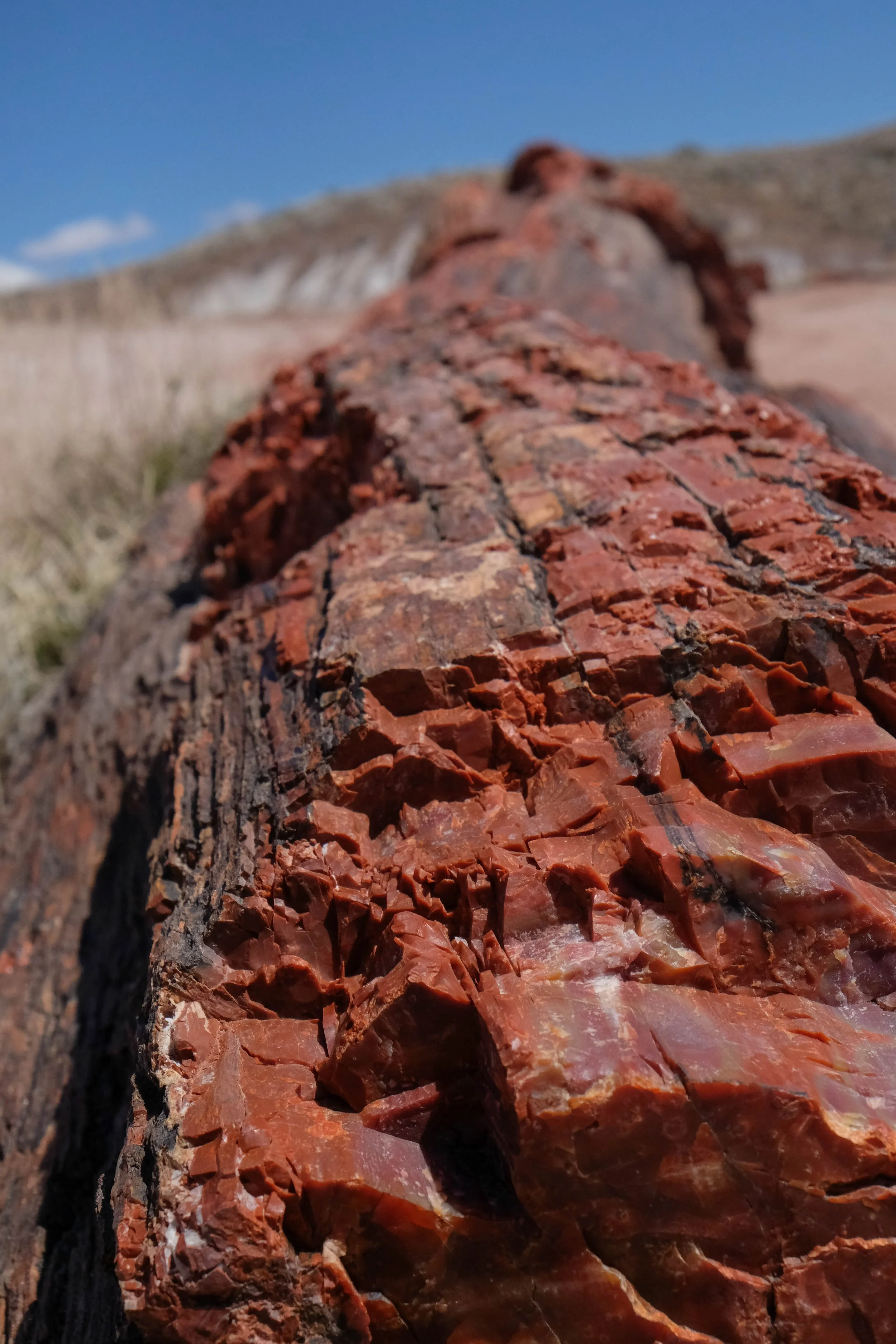
Petrified Forest
Park 29 | March 2024
We hiked and drove through this park during a five-day spring break trip to the Durango area. Having our base in the southwest corner of Colorado got us six hours closer to Arizona than we usually are in Denver, making the drive to PFNP a mere (ha) four hours each way. Cowboy Carter by Beyoncé had just dropped that morning and the southwestern scenery felt like the perfect backdrop as we took in the genius of that album. The hours slipped away and we made it to the Painted Desert Visitor Center before noon.
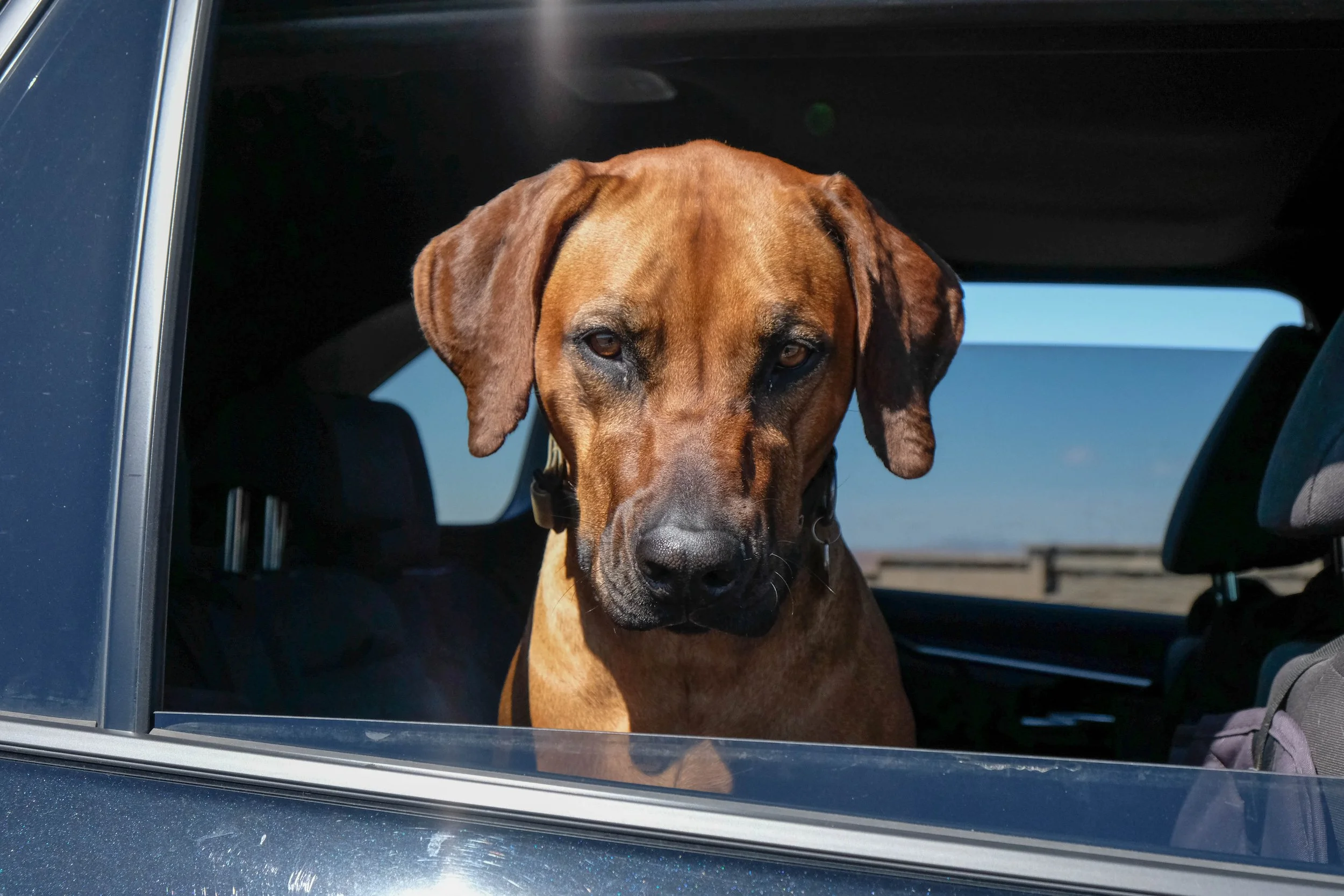
Driving south along the main road through the park, we stopped at a few overlooks on our way to the short and sweet Blue Mesa and Crystal Forest Trails that we’d determined we had enough time to complete. At Blue Mesa Trail (yes, we absolutely listened to Blue Mesas by Leon Bridges while driving there), I was surprised by the vibrance of color in the layered rock sediment as we trotted down the paved path and wove through the buttes. It was also nice to visit a dog-friendly park where Kiya could come along with us, which was the only reason we’d been able to add this park to our trip in the first place. After this we drove to Crystal Forest to see some impressively large petrified trees, before turning the car around and starting our journey back to Durango.
Petrified Forest felt barren and windswept but also beautiful in an understated way. We visited at midday when the sun is at its zenith, so my one regret is that we weren’t able to stay long enough for sunset, as I suspect it would transform the landscape. Nevertheless, still a park that exceeded my (admittedly rather low…) expectations.
Pictured below:
Kiya waiting with me while we each took turns going into Painted Desert Visitor Center.
Blue Mesa Trail.
Crystal Forest Trail.
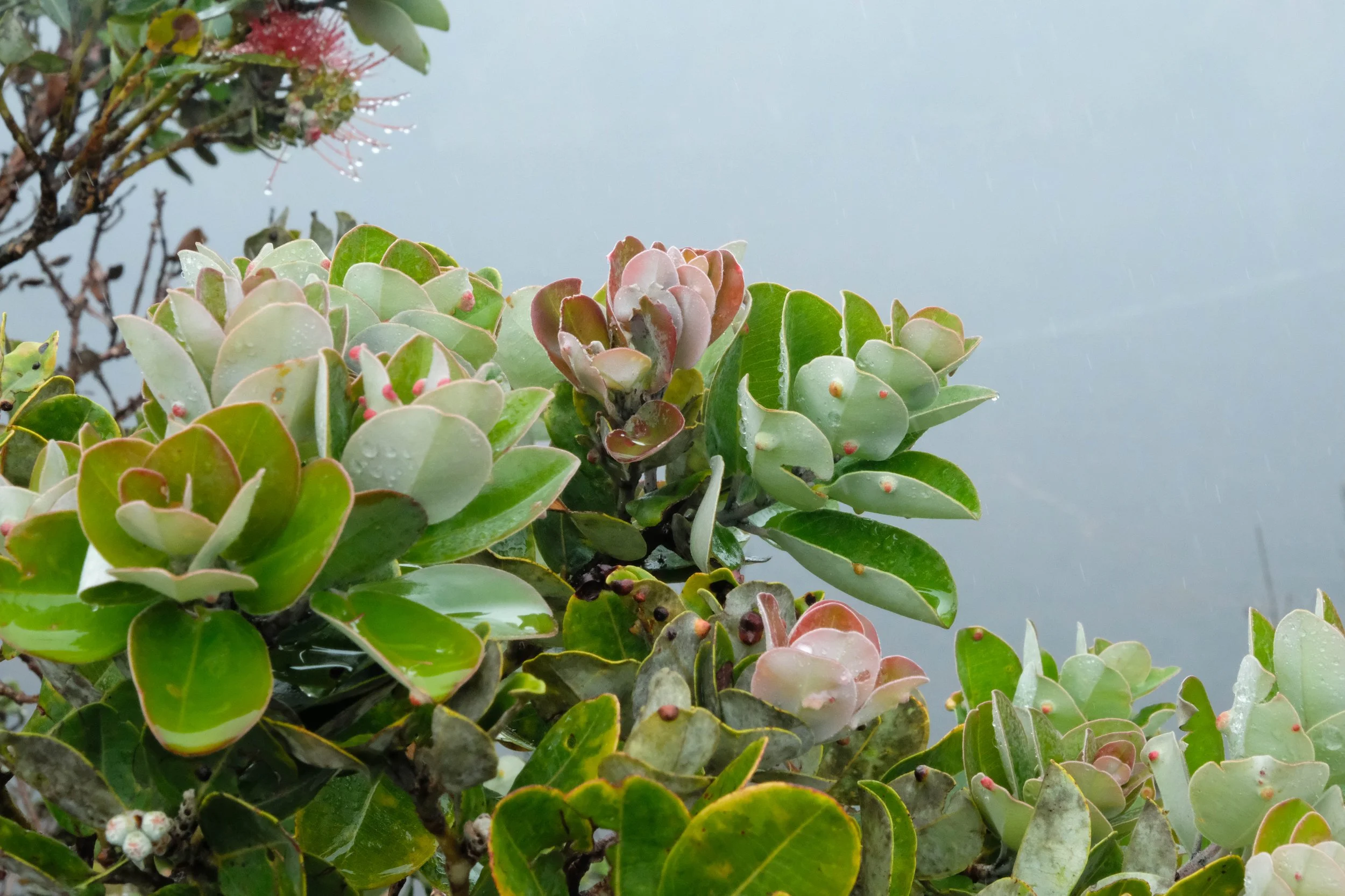
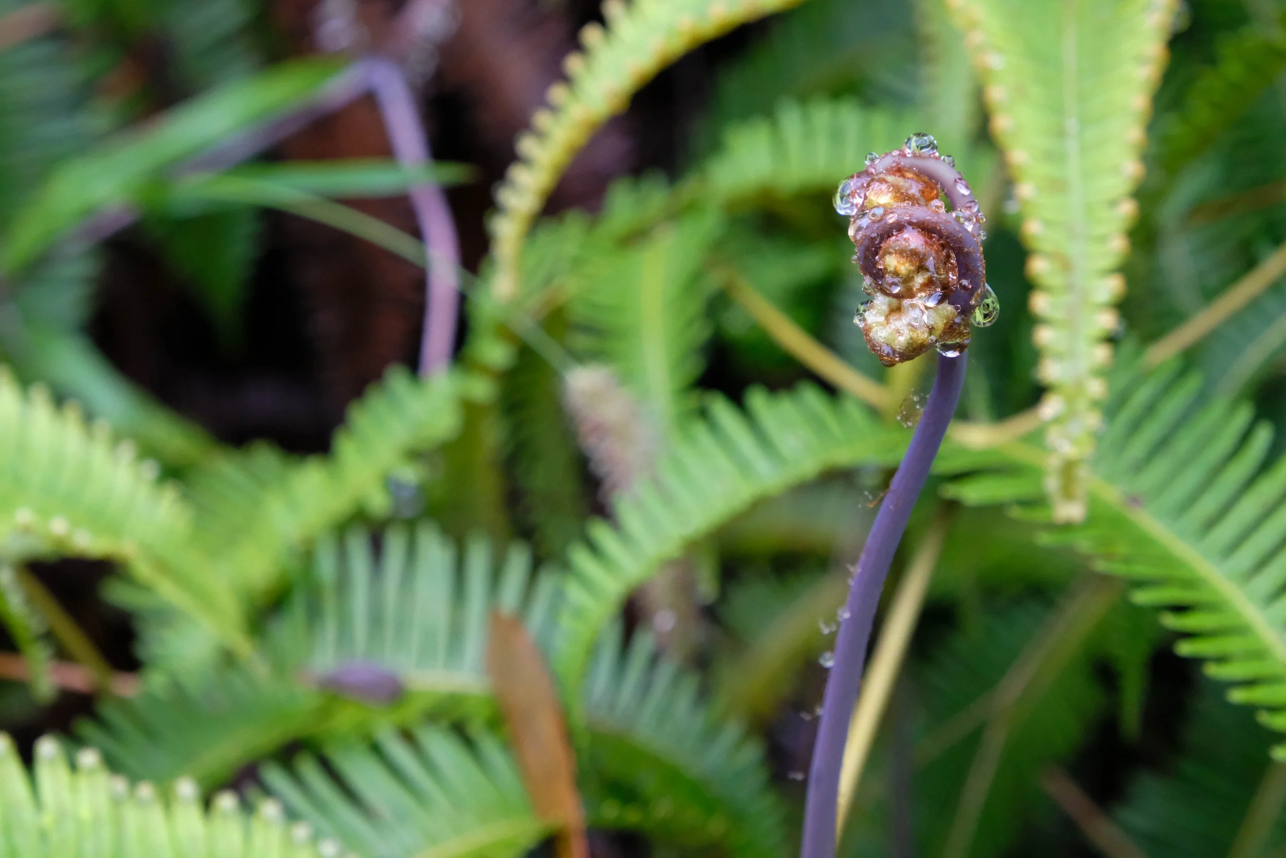
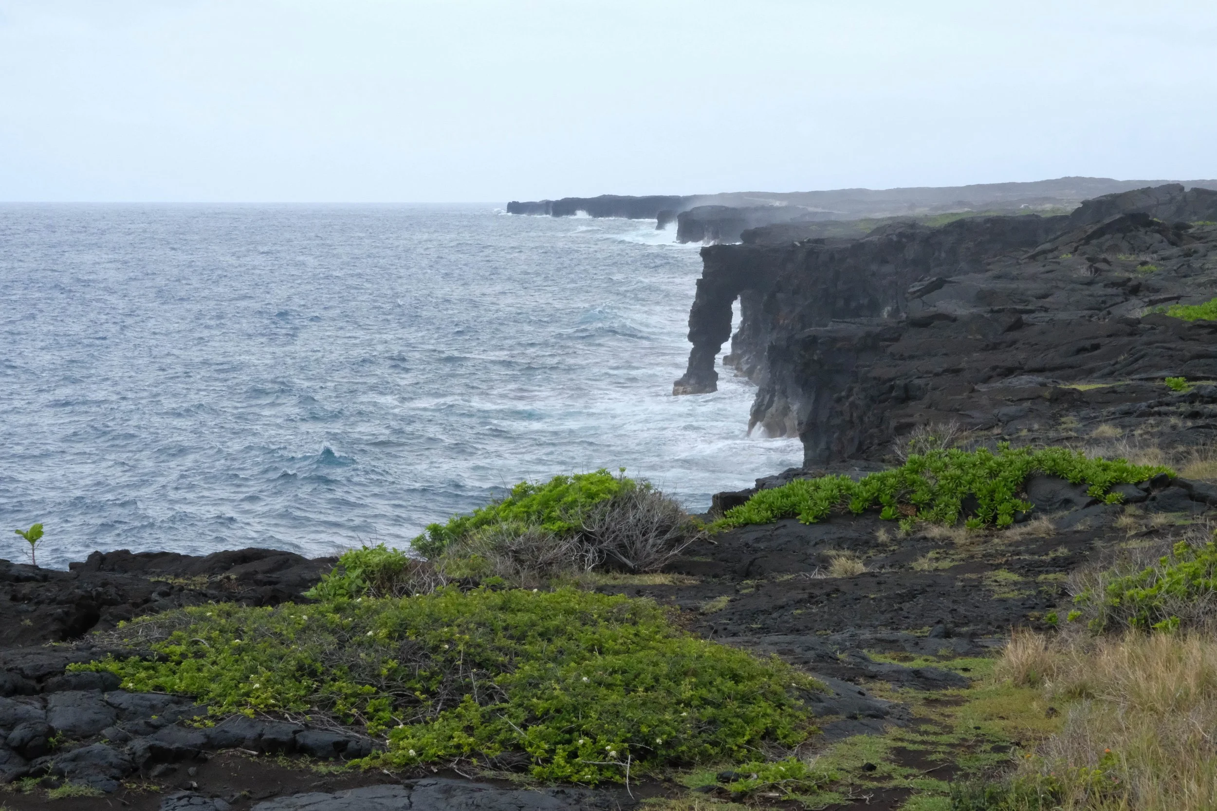
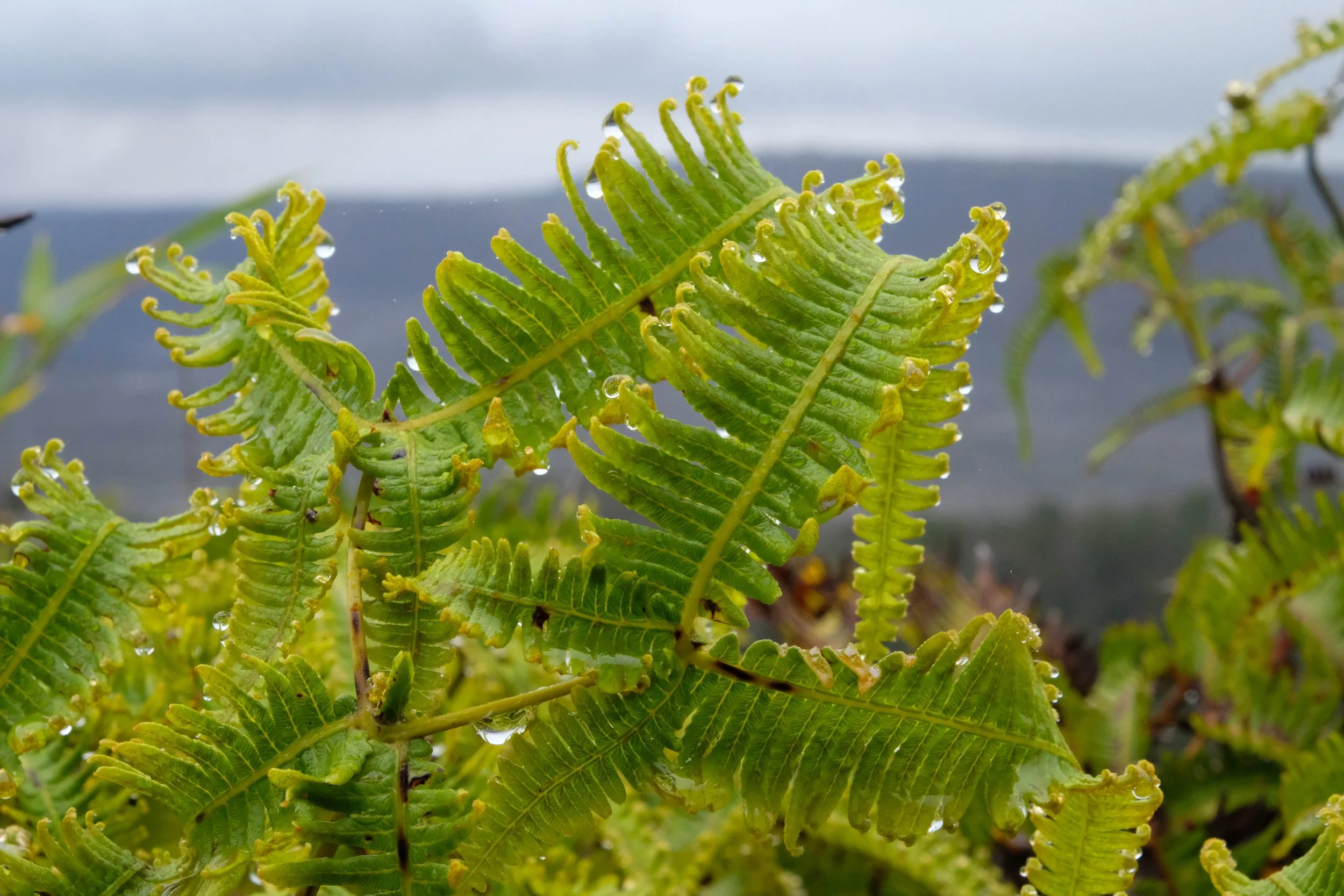
Hawai’i Volcanoes
Park 28 | March 2023
Part + Park 2 (of 2) on our fifth anniversary trip.
Whenever we look back on this trip, it’s generally followed by one of us sighing and saying: “Can we go back? Soon?”
And honestly, I’m feeling that now as I look back through these images and surface some of our memories. We spent eight blissful days hiking through rainforests and craters and subalpine shrublands. We camped on mountains and beaches. We snorkeled and continued falling deeper in love with the oceanic world. We saw mama and baby humpback whales, unexpectedly ran into a huge manta ray (almost literally…) which terrified us until we learned they’re completely harmless, I saw my first reef shark, we swam right next to ancient looking green sea turtles, and we were graced by the presence of a pod of spinner dolphins one morning while sea kayaking and snorkeling in Kealakekua Bay.
We spent the first half of the trip camping on Maui, which I’d do again in a heartbeat. But once we transitioned to Hawai’i, we gave in and reserved an “eco cabin” for two nights that were supposed to be camping nights and I must say, that first shower and night sleeping on a bed felt so good. This ushered in a part of the trip that also felt so restorative and necessary. We ate açai bowls and found an incredible hole-in-the-wall poke shop that has ruined all other poke for me ever since. We explored Hawai’i Volcanoes National Park and bought a print of a gorgeous art piece titled Pele Sleeps from Nelson Makua, a Native Hawaiian artist, which has been displayed in our living room ever since. We spent the last two nights in a little house next to a coffee farm in the hills above Kona, dining on fresh mangoes from the farmer’s market and wishing we could rewind the trip and start it all over again.
We left with gratitude in our hearts to these verdant lands, these smoking volcanoes, these waters teeming with life, and to the Native Hawaiians who have stewarded it since time immemorial. Mahalo.
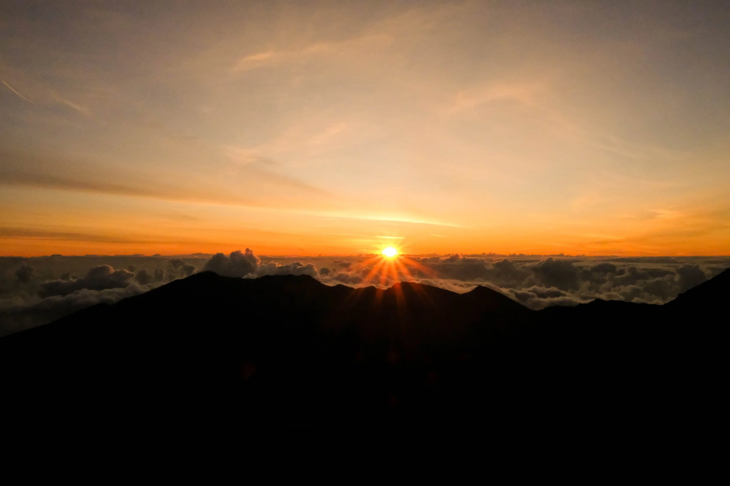
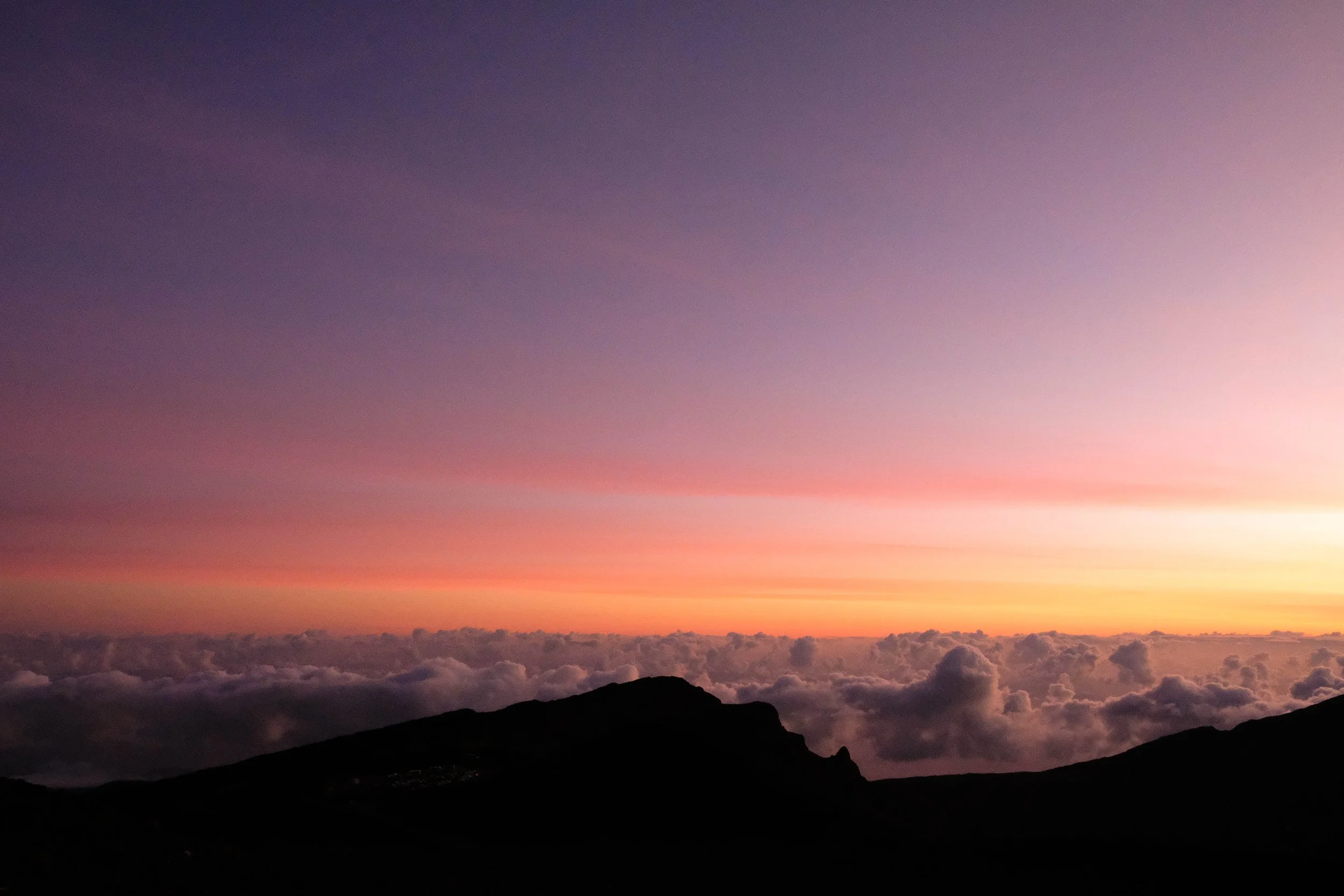
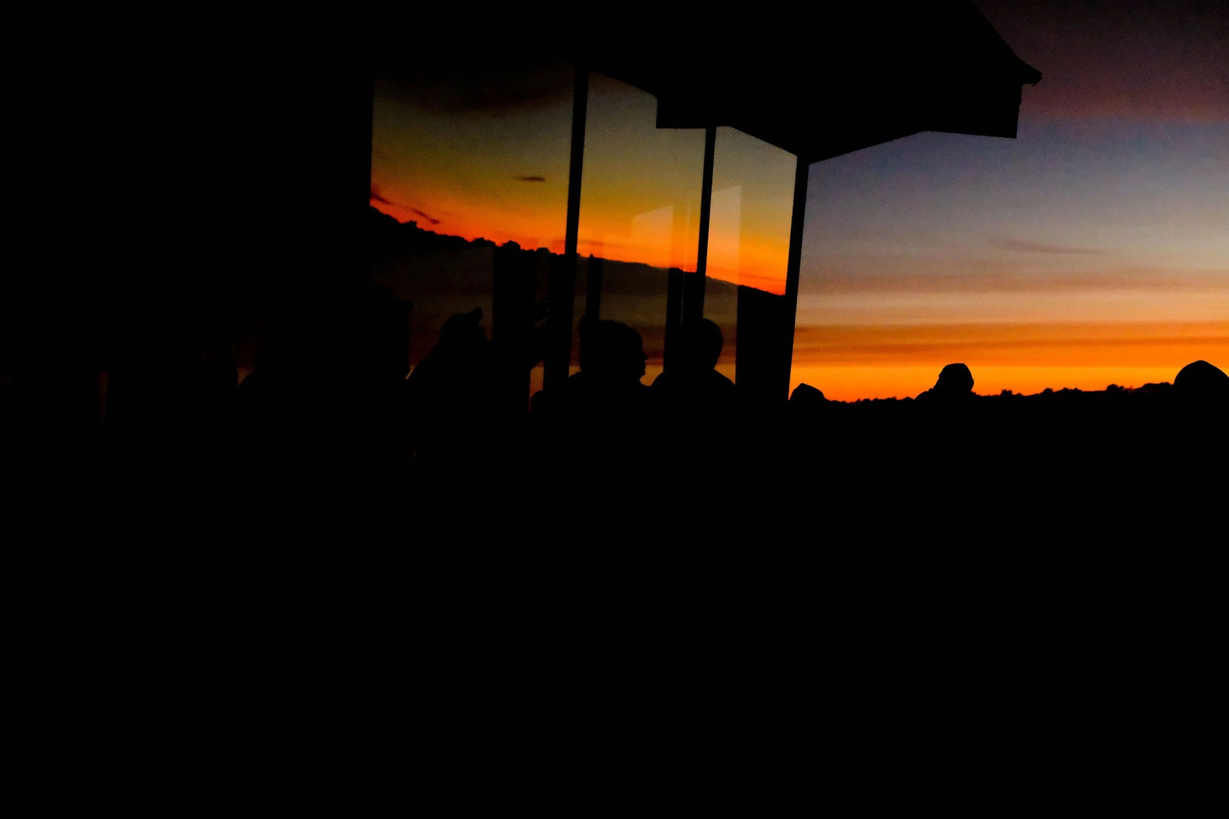
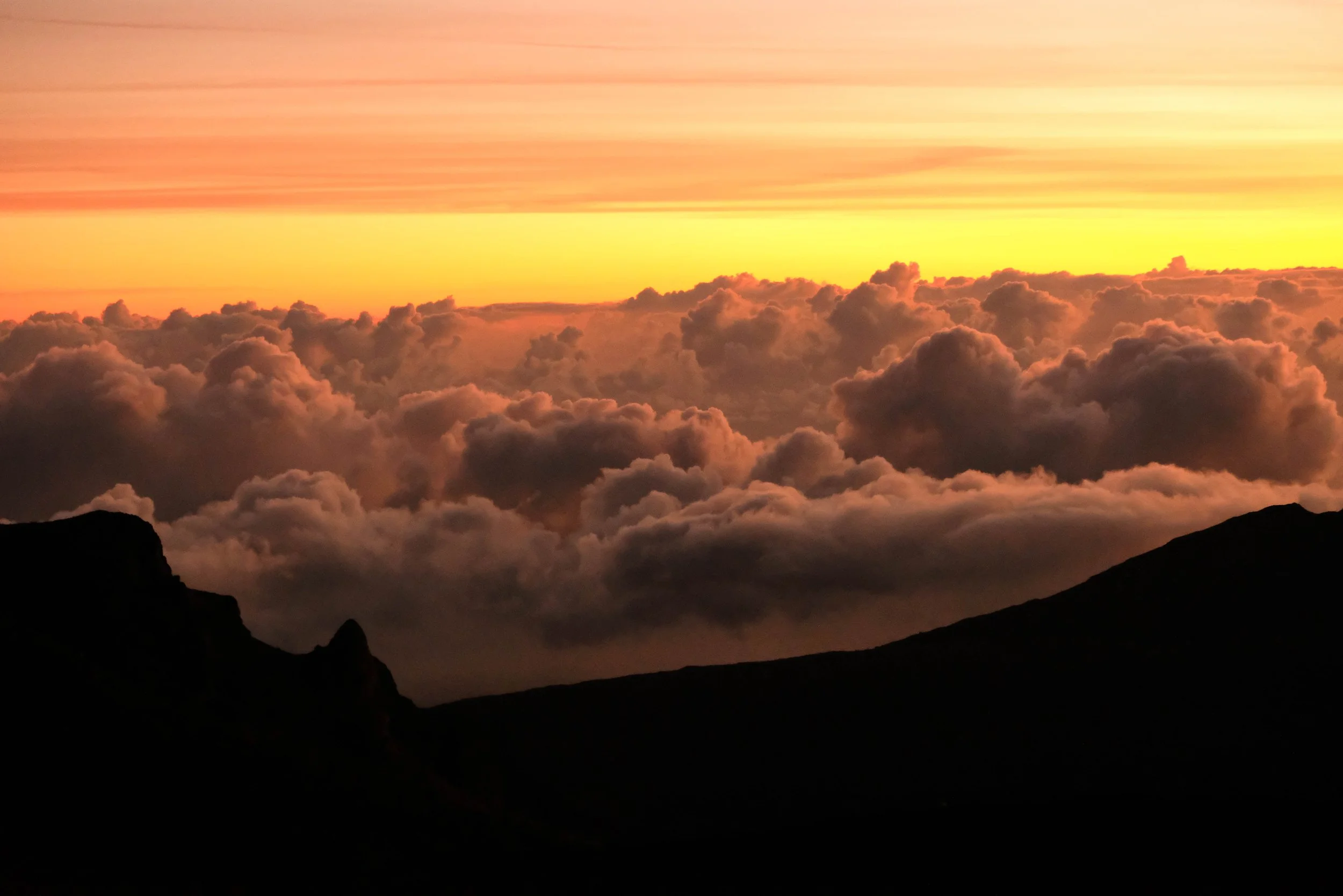
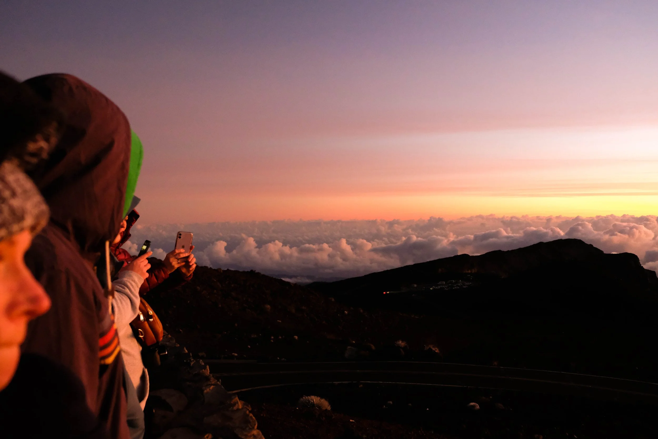
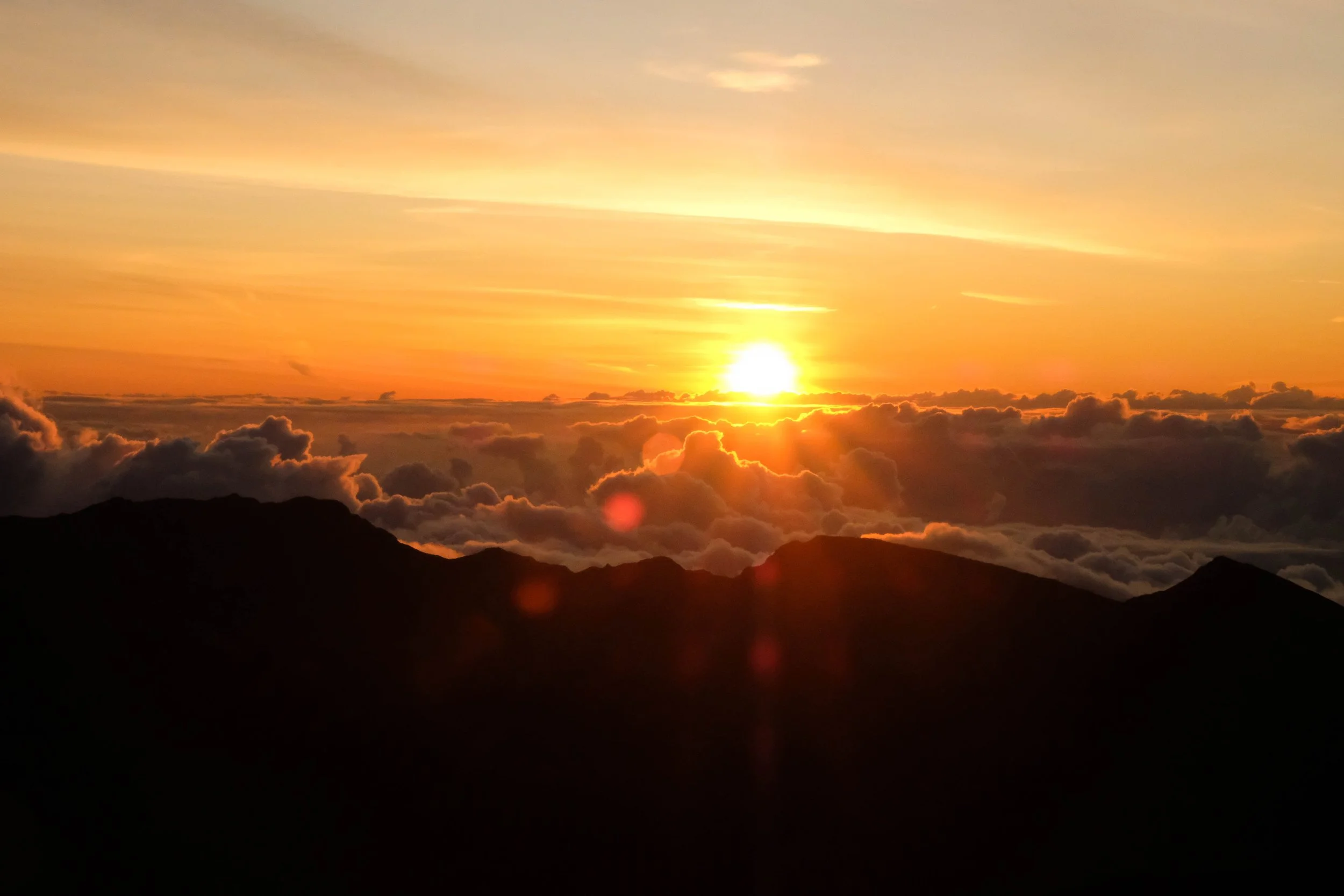
Haleakalā
Park 27 | March 2023
Part + Park 1 (of 2) on our fifth anniversary trip.
Haleakalā National Park
One of the most memorable moments on this trip came our first morning. We woke at 5am and left the Hosmer Grove Campground to and join a trickle of cars that turned into a trickle of headlamps bobbing up to the summit of Haleakalā — the name of both the mountain and the national park. The park ranger on site that morning was a Native Hawaiian man who greeted the small group of early morning arrivals with a reminder of the spiritual significance of this place, a place that is still used for ceremony by Native Hawaiians. He told us about a particular traditional song that is sung to welcome the light at the very moment the sun’s rays beam across the sky. Voices were kept low, the air was crisp and foggy with our breath, the sky slowly lightened as the sun approached the fluffy blanket of clouds spread across the horizon beneath us.
In one quiet instant, the light broke through. The park ranger immediately began to sing the song he’d told us about when we arrived. Tears trickled down my cheeks then — and are now as I remember the piercing quality and beauty of this moment.
We’ve reflected many times since how that experience set the framework for the rest of our time on the islands. No matter what you’ve read and learned before a trip, the embodied experiences you can have when you’re really there — feeling the cold mountain air, feeling the sun’s warmth touching your face, feeling yourself pierced to the core by a sacred song — can be transformative.
We walked, hiked, camped, swam, and kayaked softer on the earth and the water with these early morning moments alight and alive within us.
Pictured below:
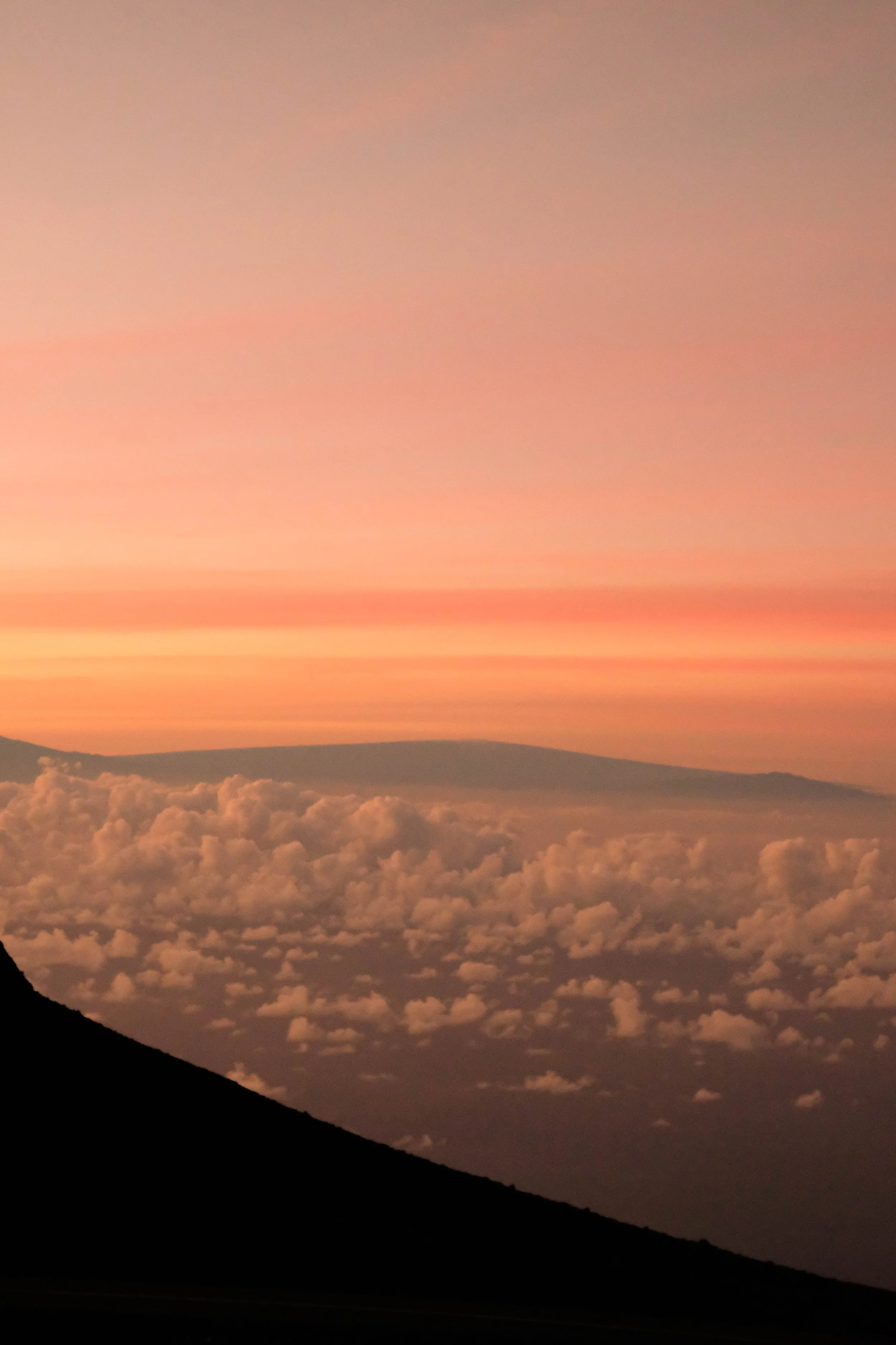
10,023 ft summit of Haleakalā, the “House of the Sun.”
Hike down into the crater.
Wai‘ānapanapa State Park.

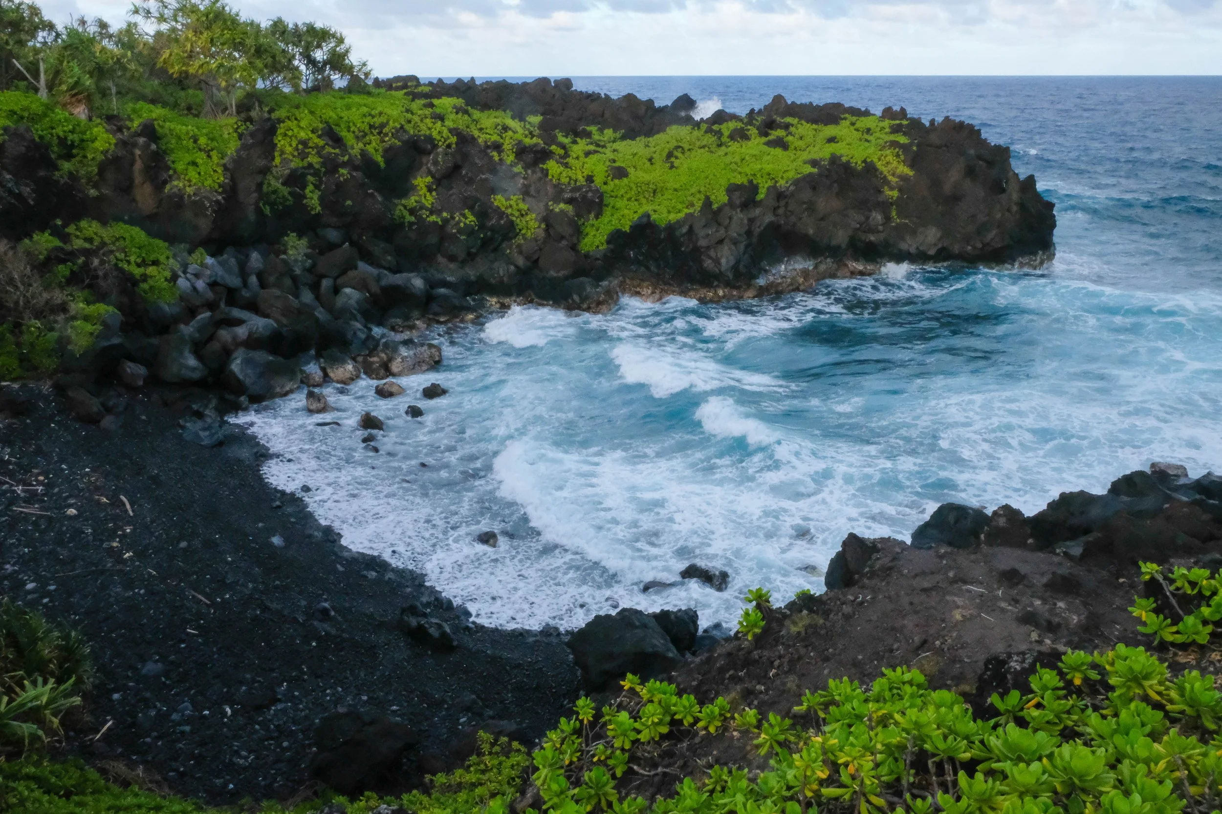
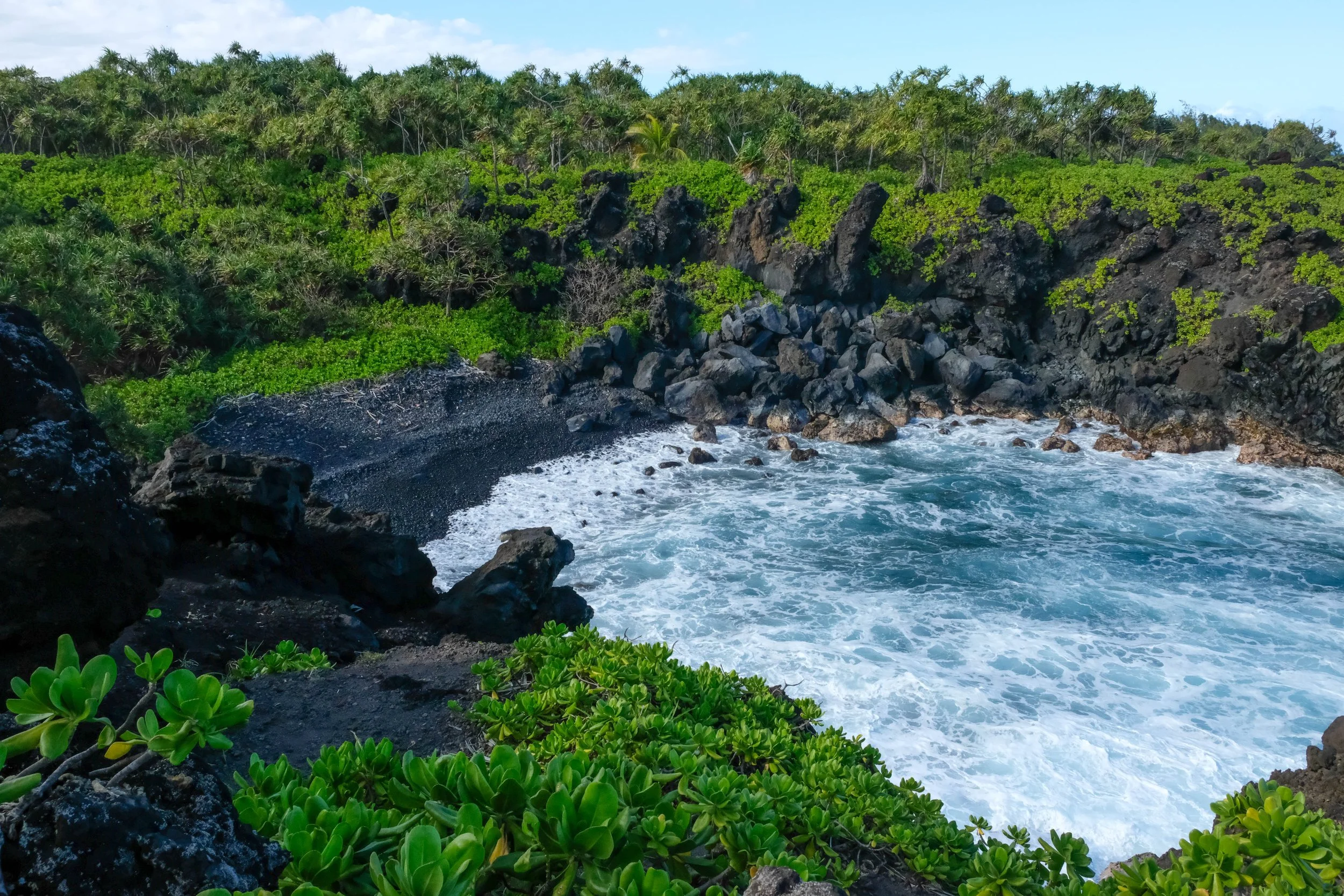
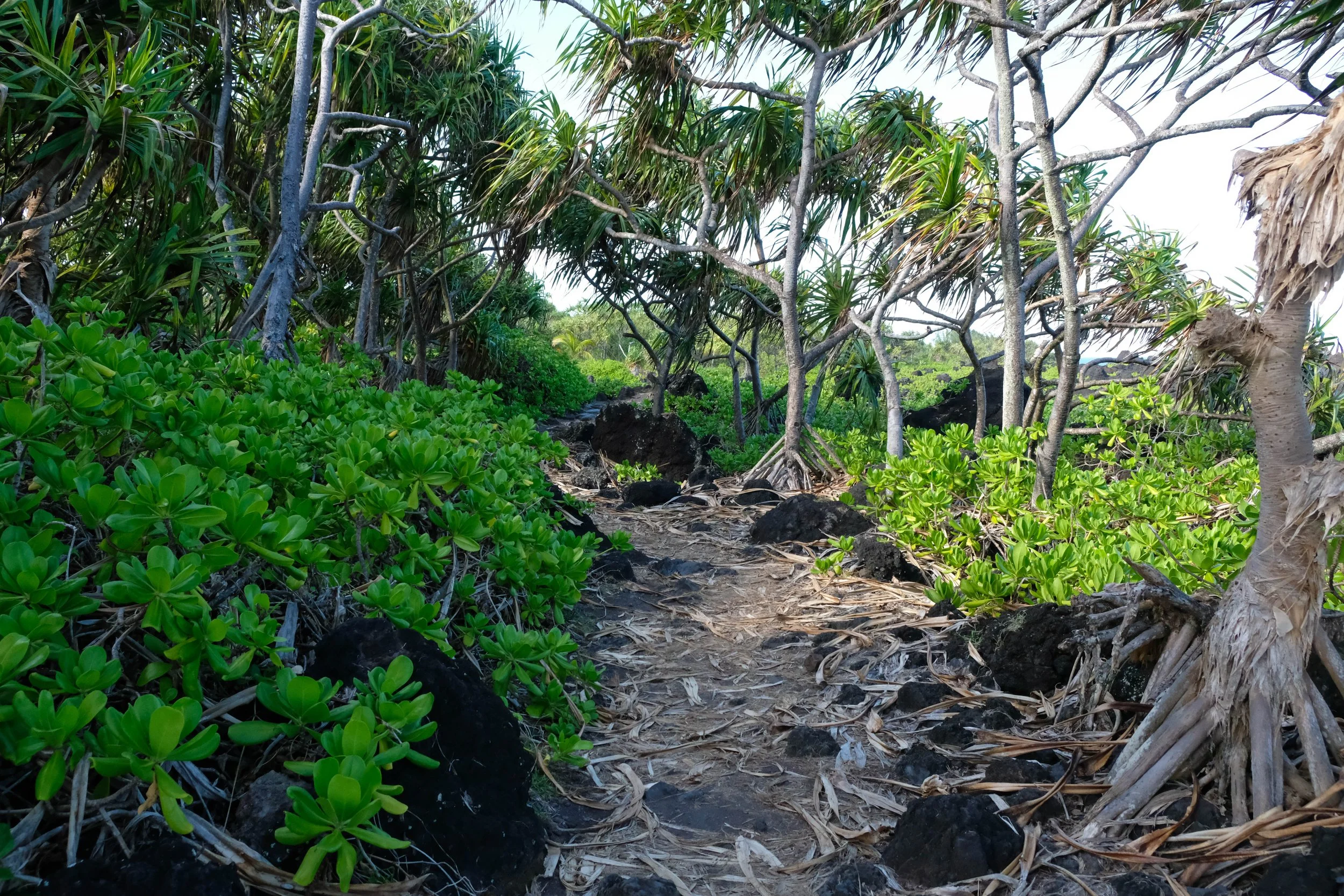
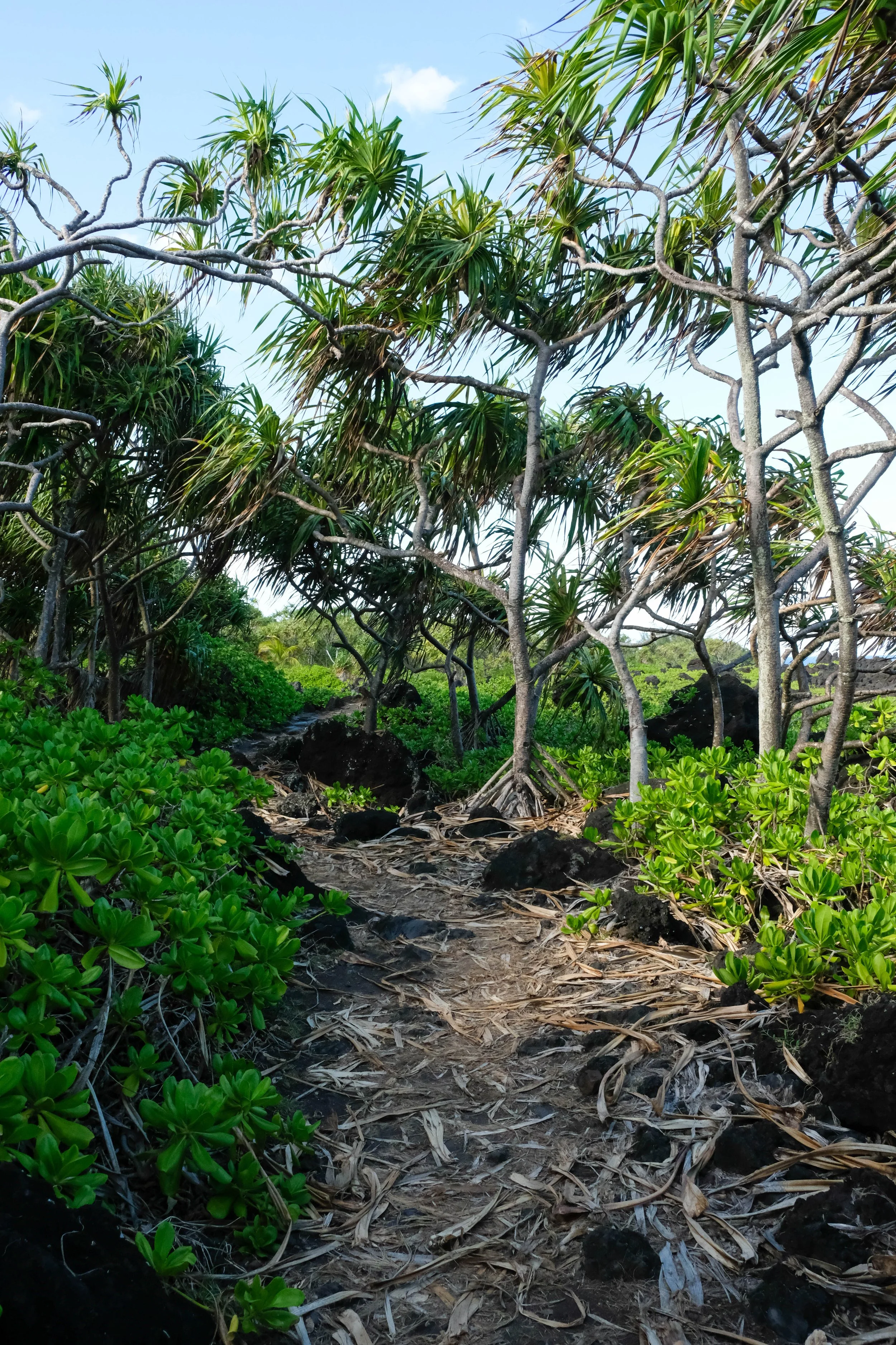
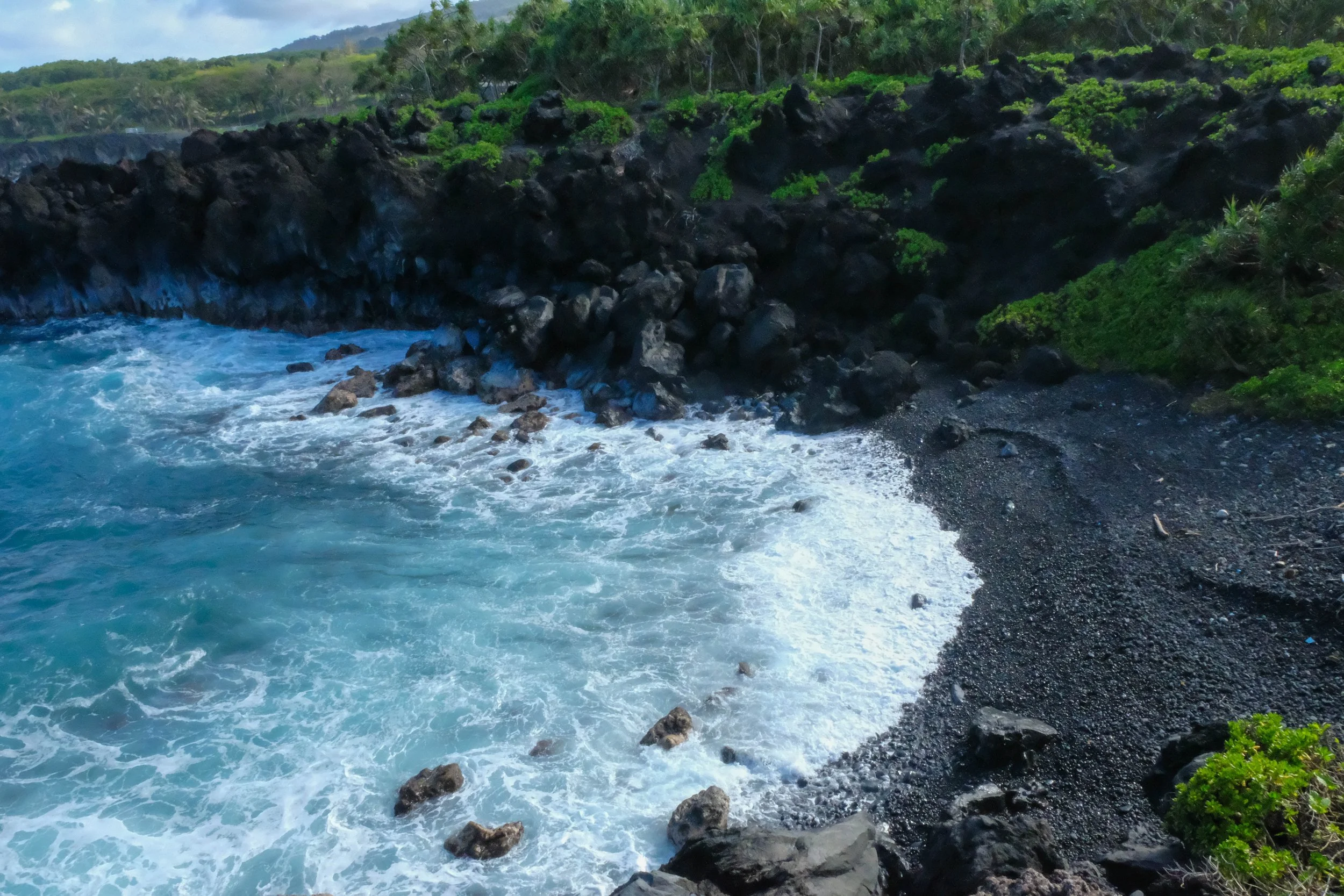
Wai‘ānapanapa State Park
We reached this gorgeous state park after traveling the famous Road to Hana—equal parts heavenly and harrowing with over 600 turns to navigate in about fifty miles. James’s top highlight was the banana bread stands scattered every few miles; I’m still dreaming of the matcha mint coconut ice cream I got at Coconut Glen’s, a quirky food truck perched around one of the hairpin turns.
I’m fairly sure I could look at this exact combination of greens, blues, volcanic black and foamy white every day and never tire of it. We hiked along the top of these volcanic cliffs for a few miles, joined for several of them by migrating humpback whales who swam and breathed on a parallel track just beneath us. (Hiking with whales? This is young Emily’s wildest dreams come true.)
Also of note: Thai food in Hana is unbelievably delicious.

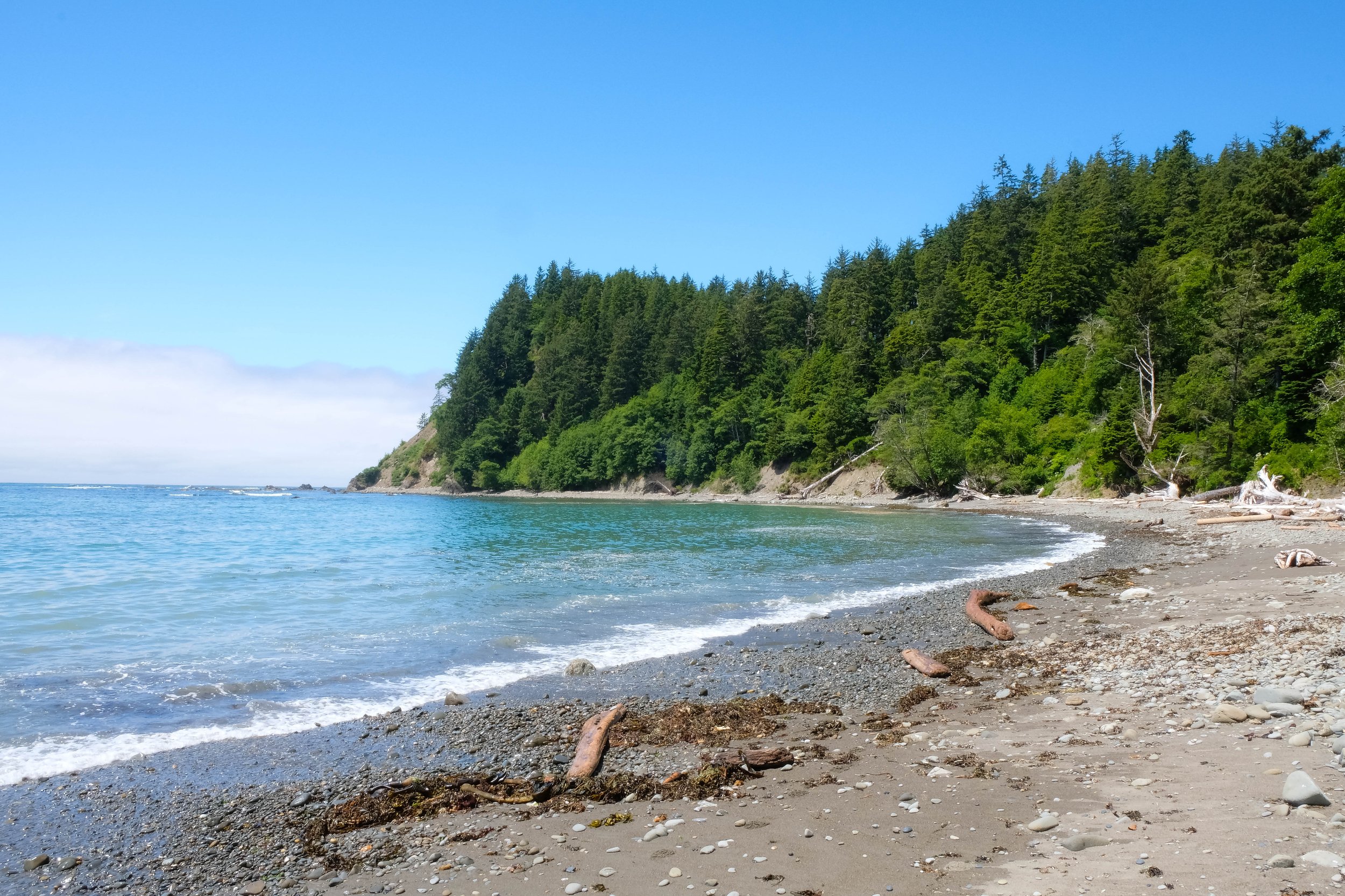
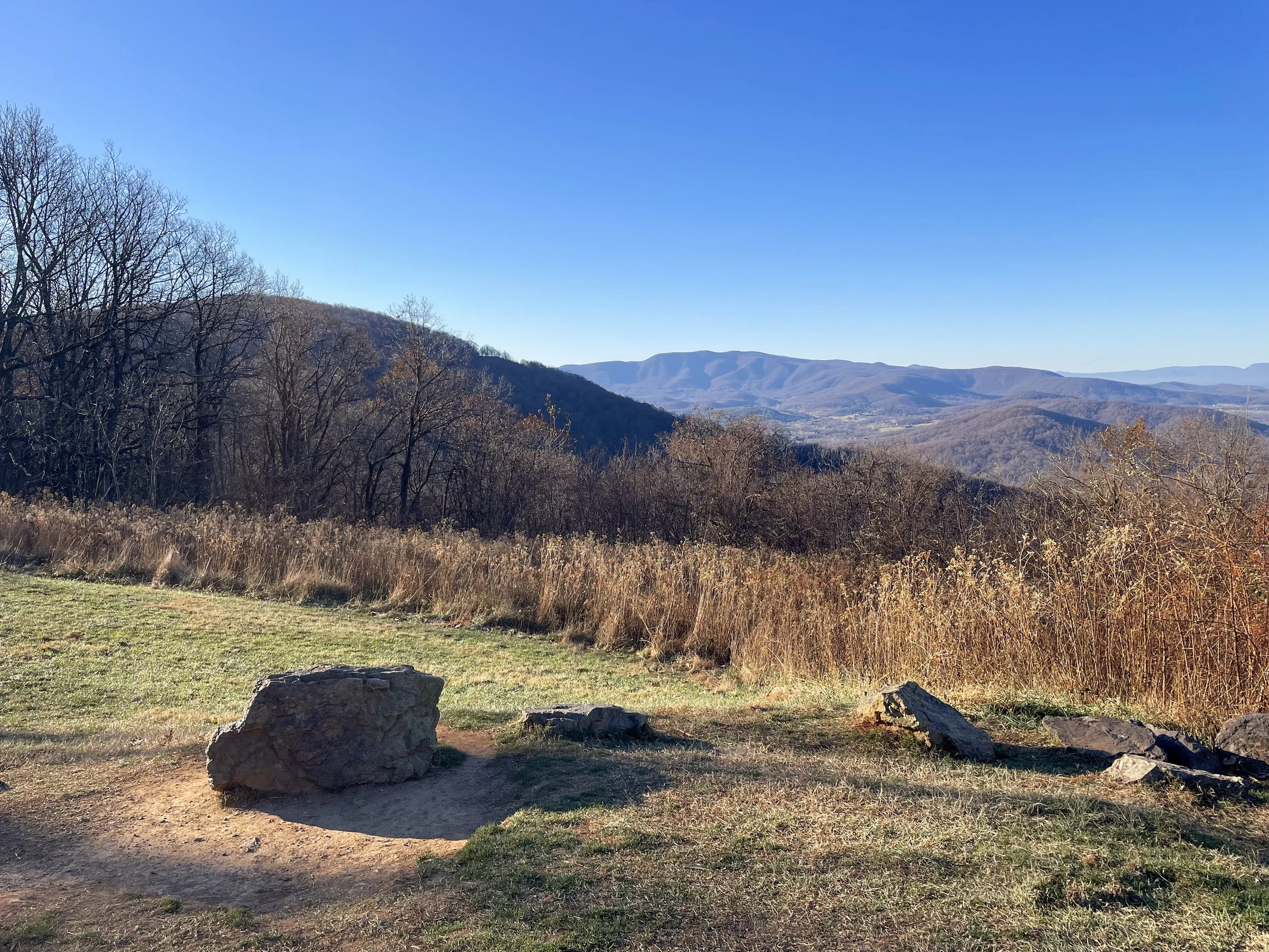
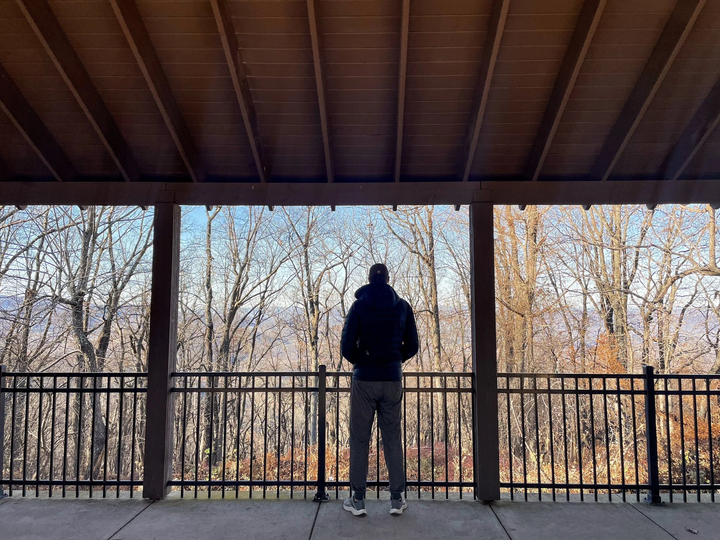
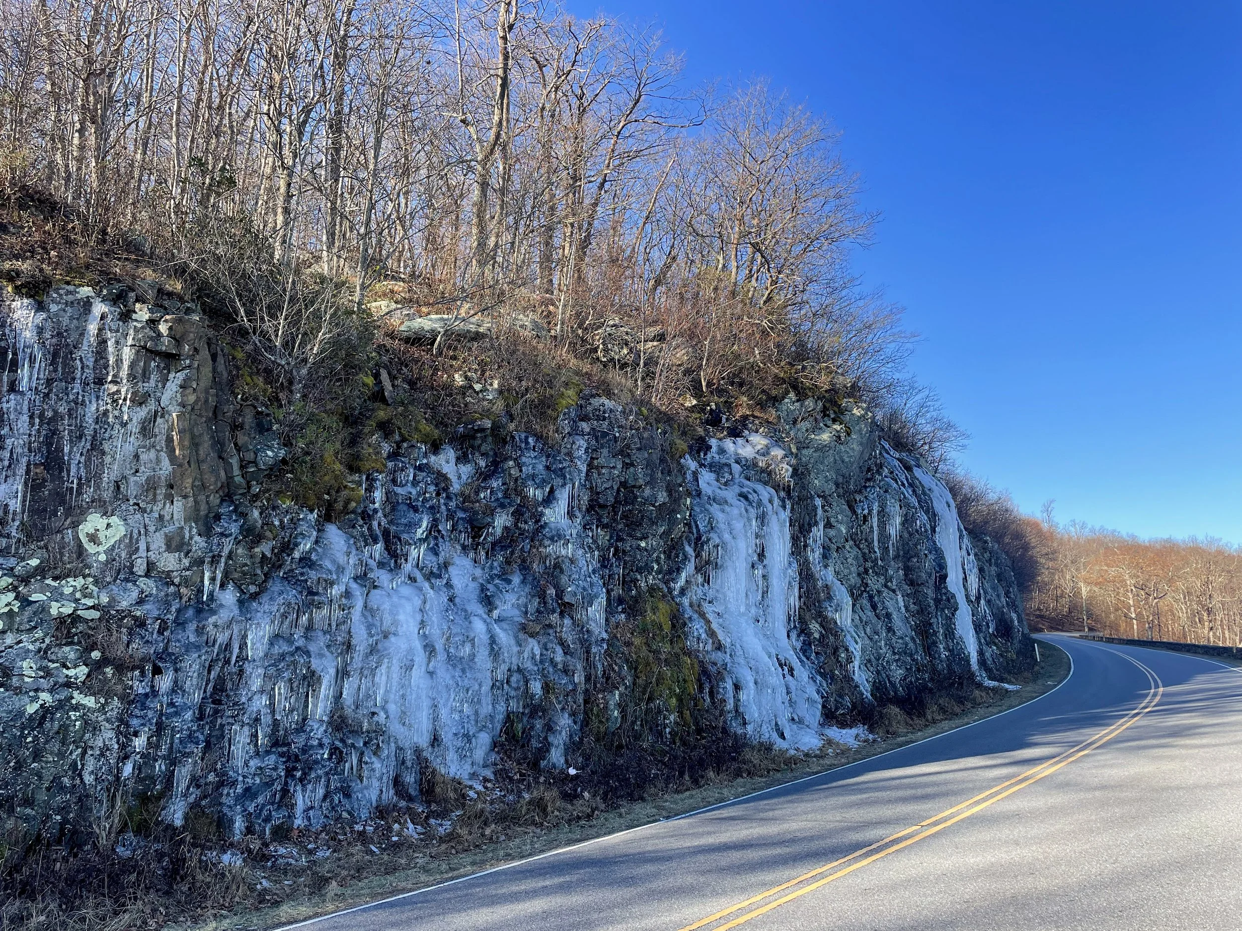
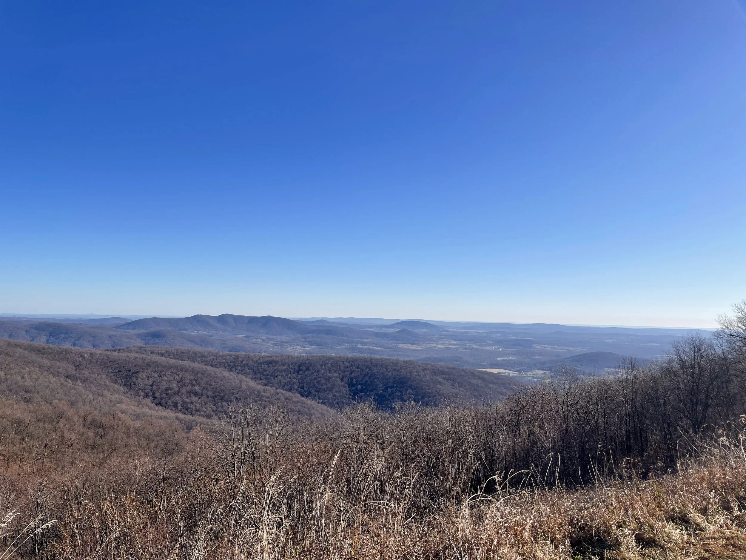
Shenandoah
Park 26 | Multiple visits
Planned Second Visit | August 2026
April 2026 update: An itinerary has been set and lodging has been secured! I’m (Emily) looking forward to (hopefully) exploring this park with more time, thoroughness and attention than the first time we visited — and at a very different time of year. I plan to spend a night at Big Meadows Lodge within the park and hike the iconic Old Rag Circuit over a weekend before I attend a work conference in DC and see friends in Maryland. Fingers crossed it all works out as currently planned!
First Visit | November 2022
We embarked on a day trip to Shenandoah during a visit to see friends in Maryland. It was cold, quiet, and a bit barren; it likely would have been more impressive if we’d visited a month earlier to see the trees ablaze with their autumn leaves. It was still pretty, but it felt we were missing some of the real beauty of this place. With over 500 miles of trails to explore, leading to countless waterfalls and views of the surrounding mountains, we could imagine this would be a much different place in another season.
In addition to not getting the best taste of this place from a natural beauty standpoint, we also found ourselves frustrated by the visitor center we stopped at on our way into the park from the north. When discussing human inhabitants of the park, it focused entirely on the displacement of coal mining communities that was undertaken in order to build the park. This is certainly a sobering bit of history, but there was no acknowledgement of the first inhabitants of this land or their displacement from the region, which felt like a big miss to us.
Would we go back? We’d be open to it, particularly at a different time of year, but wouldn’t plan an entire trip around a visit.
Pictured below:
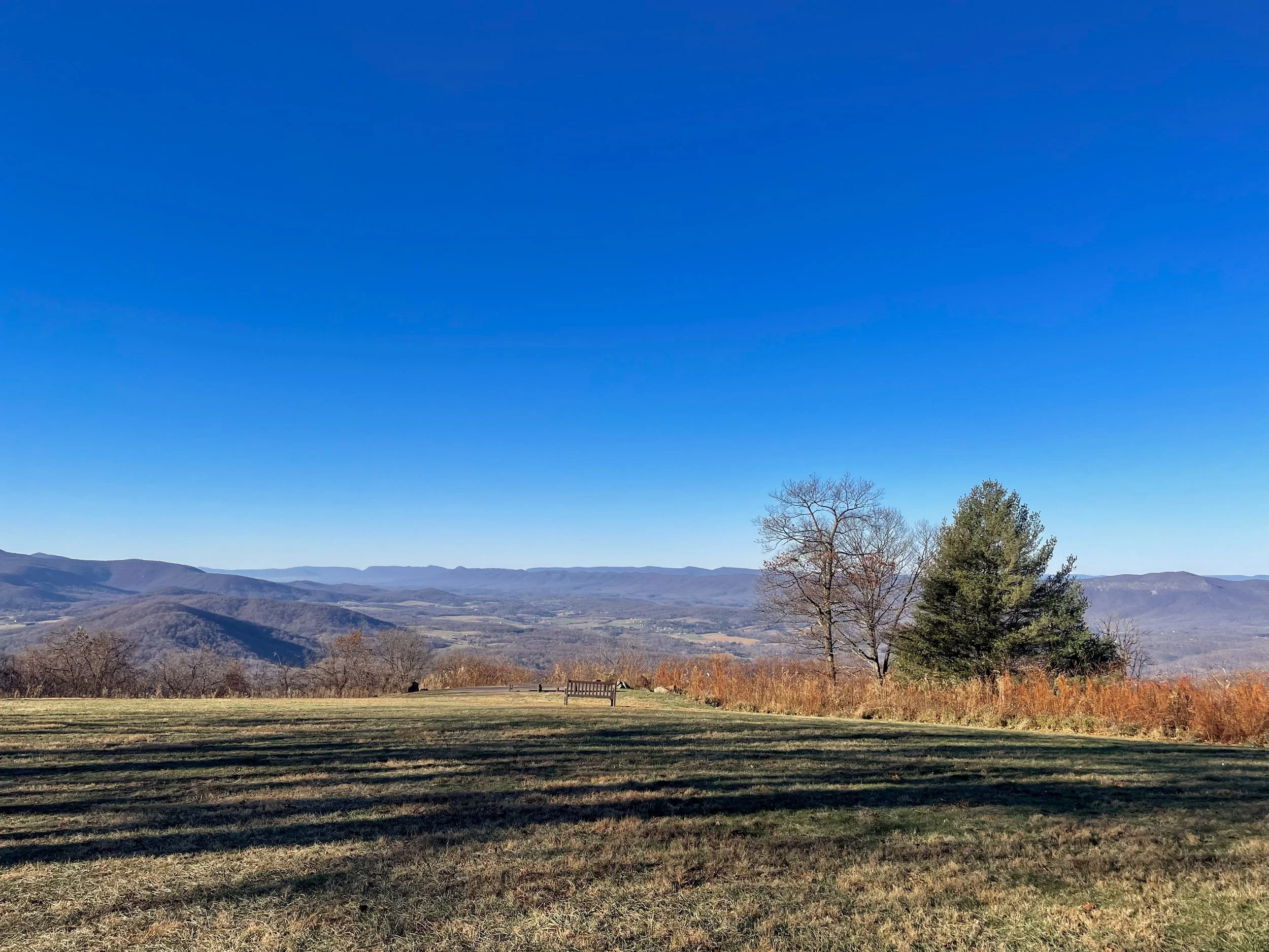
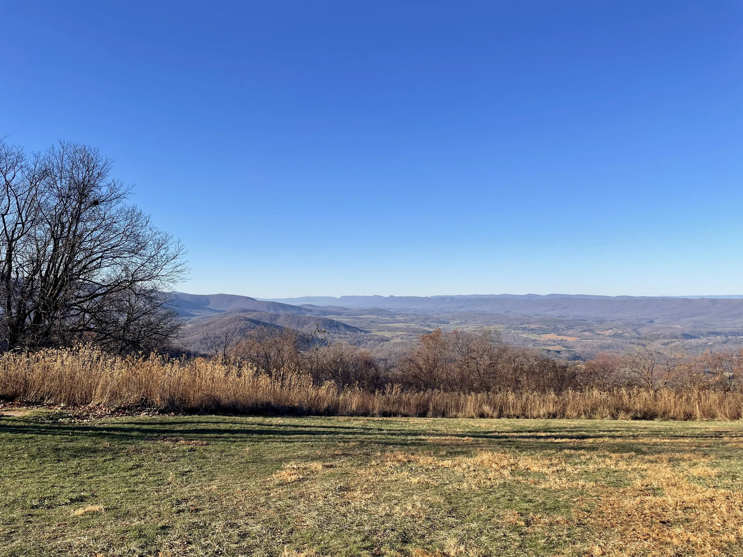
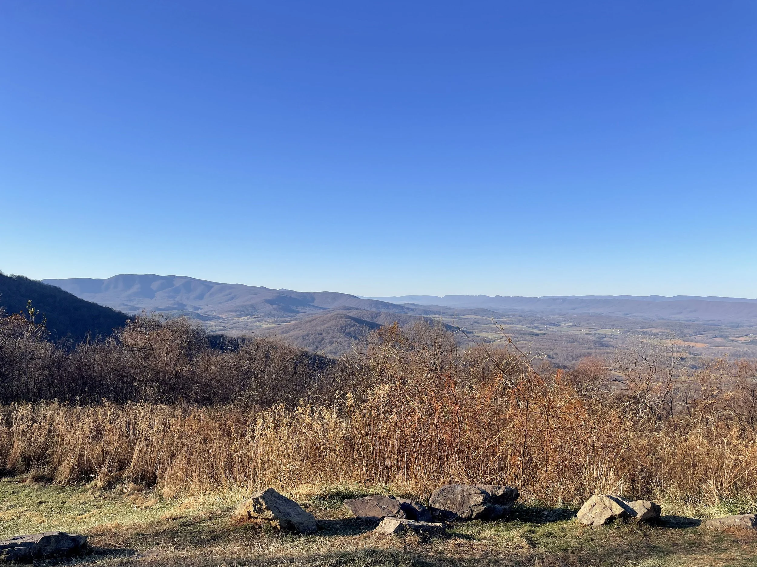
Views from overlooks along Skyline Drive, the main road that snakes through the 105-mile length of the park.

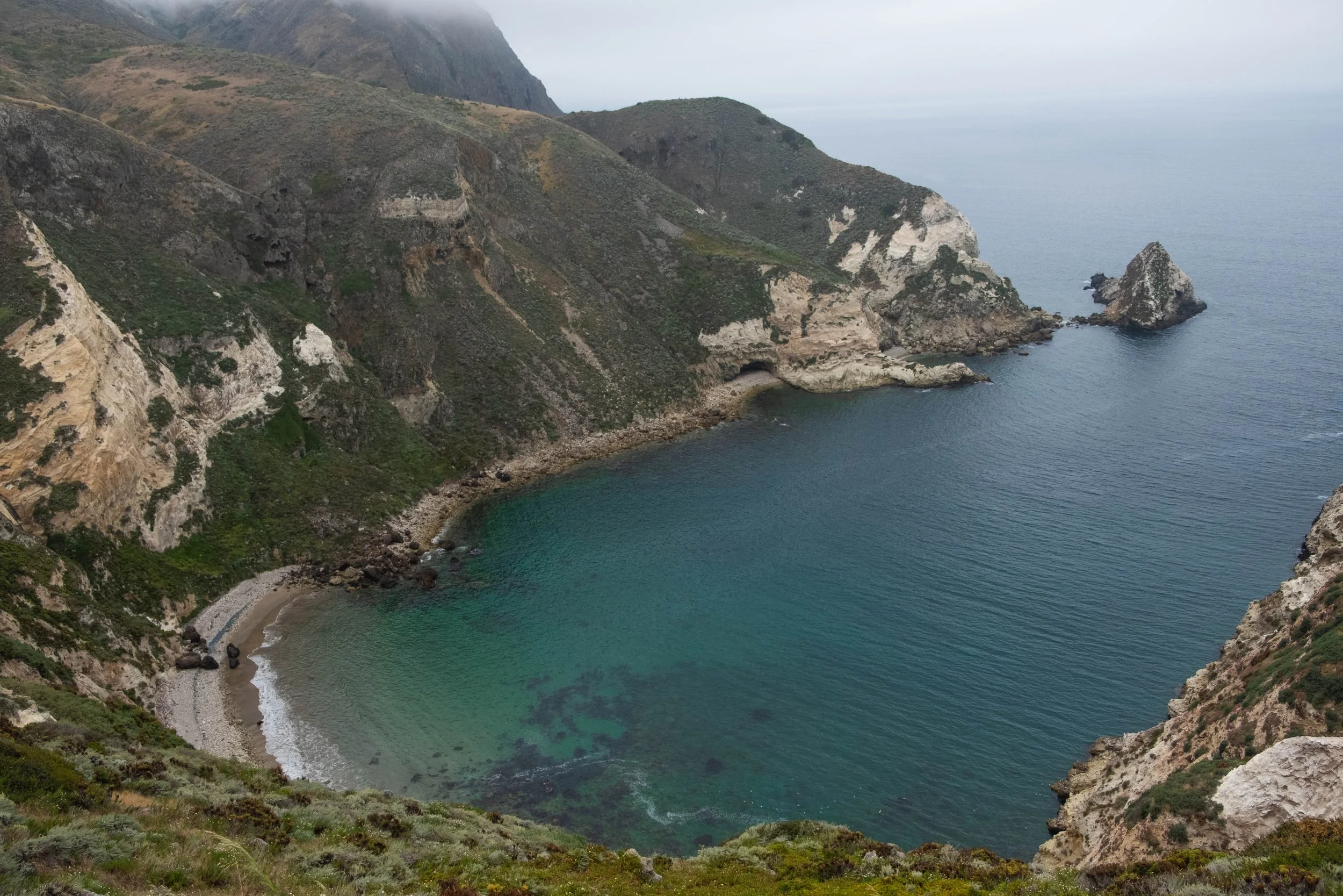
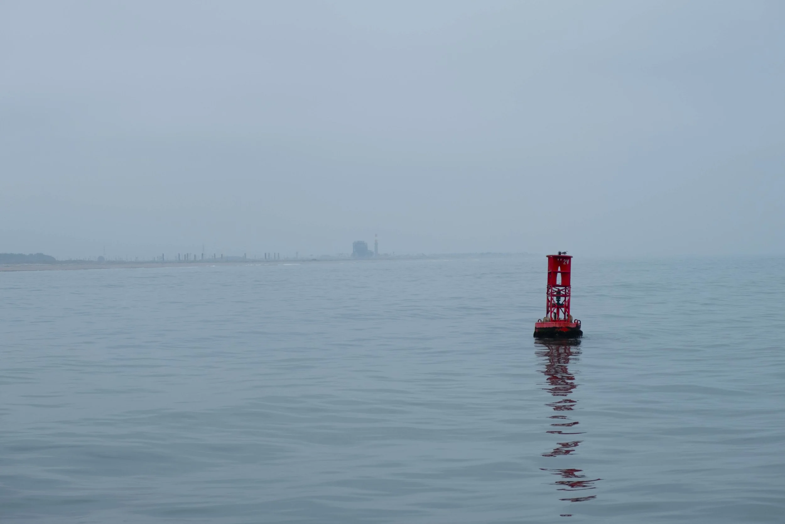
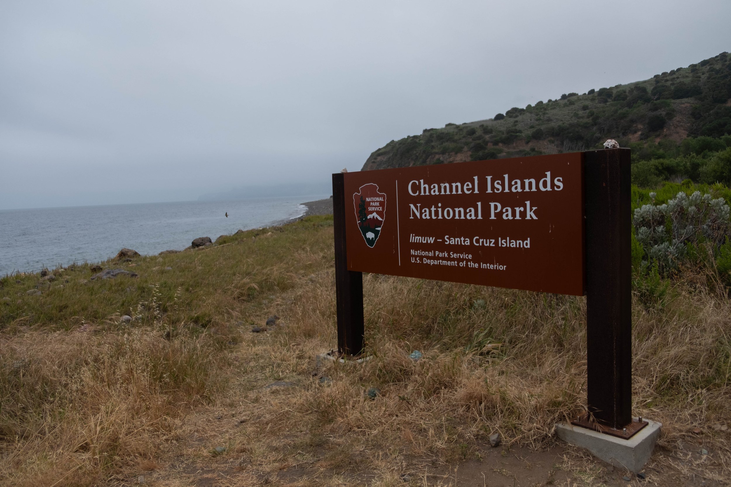
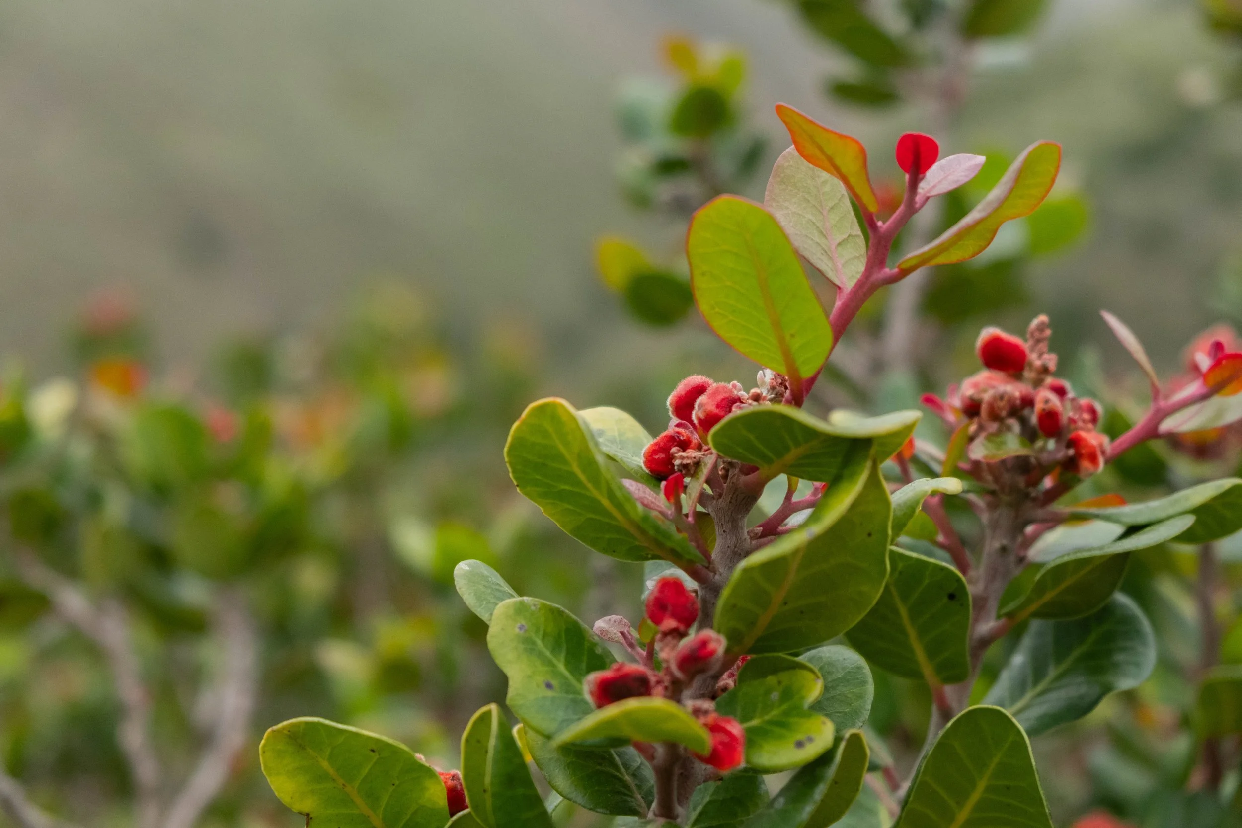
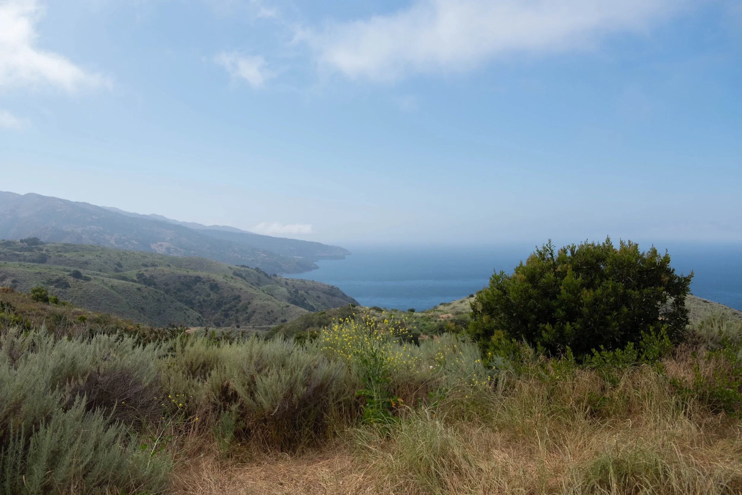
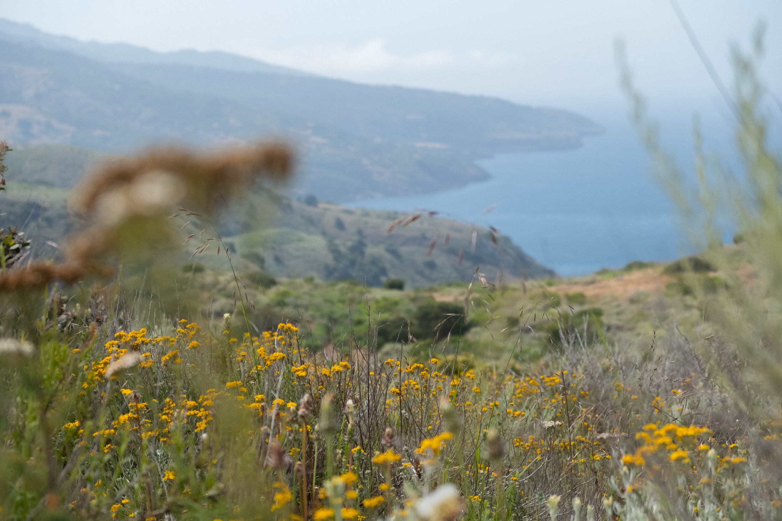
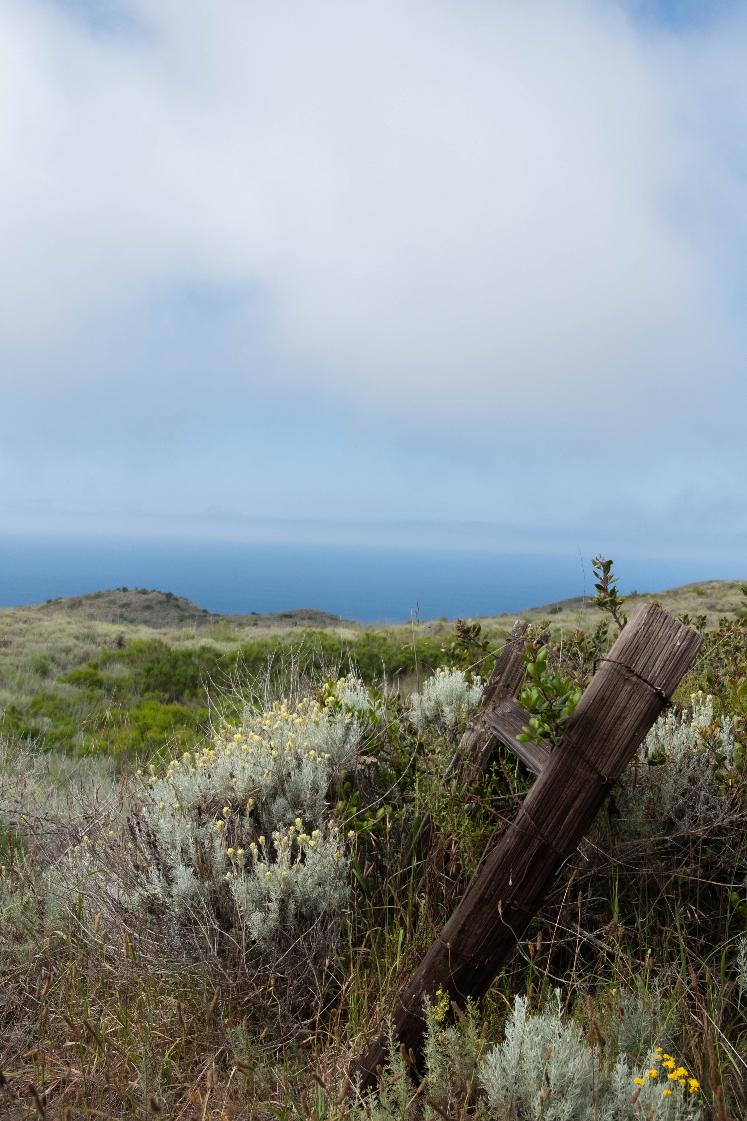
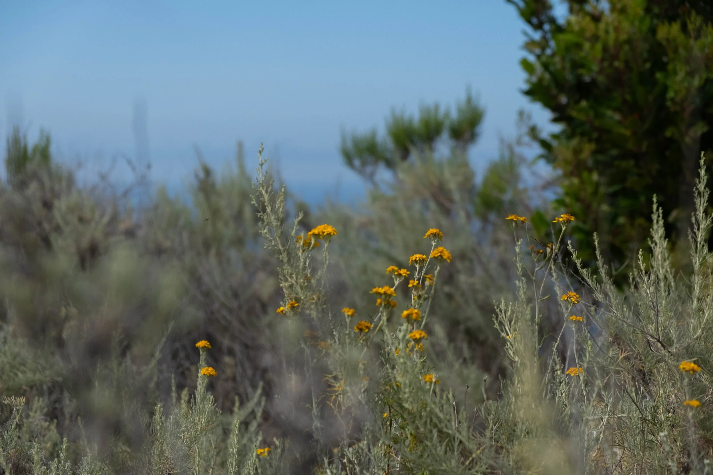
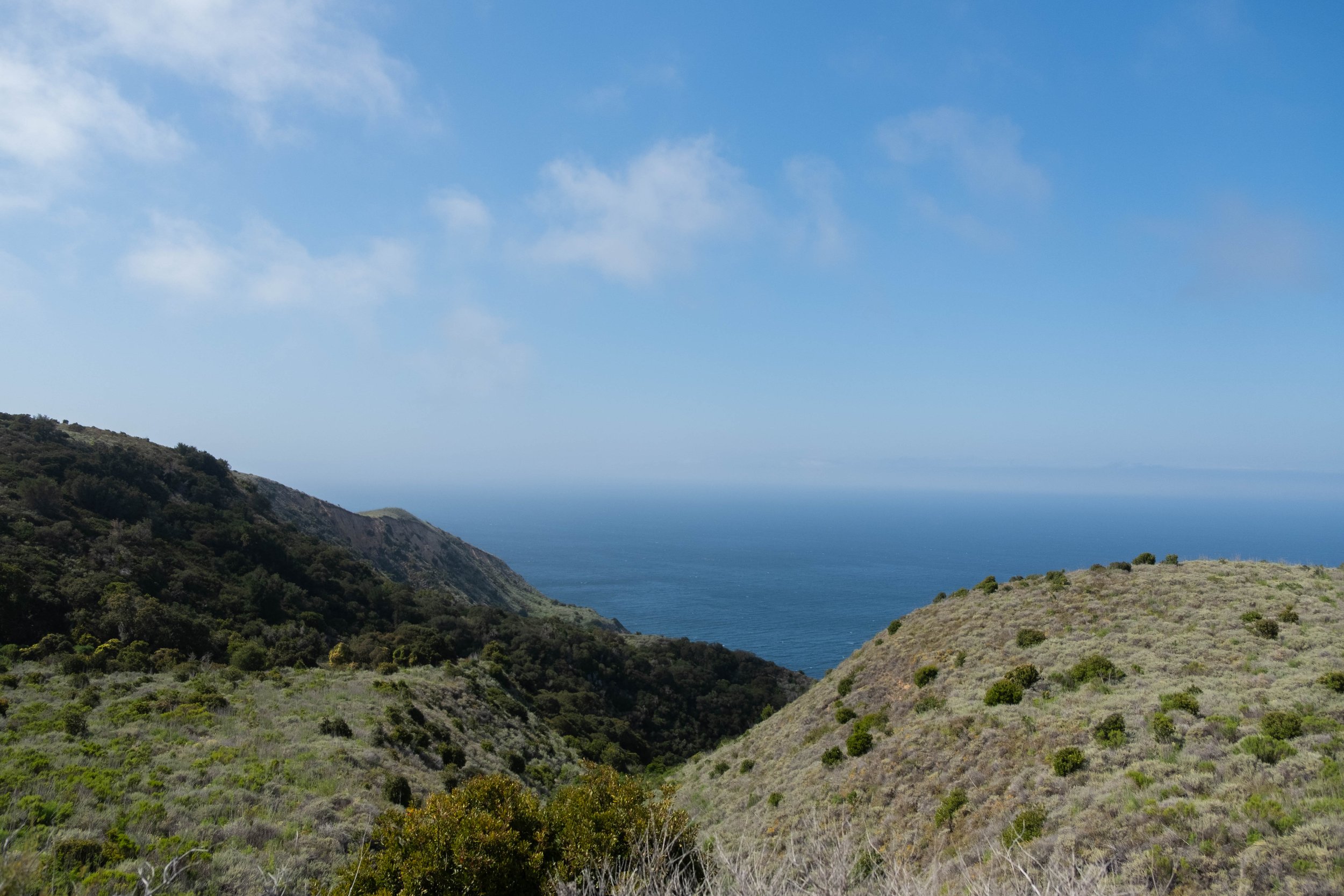
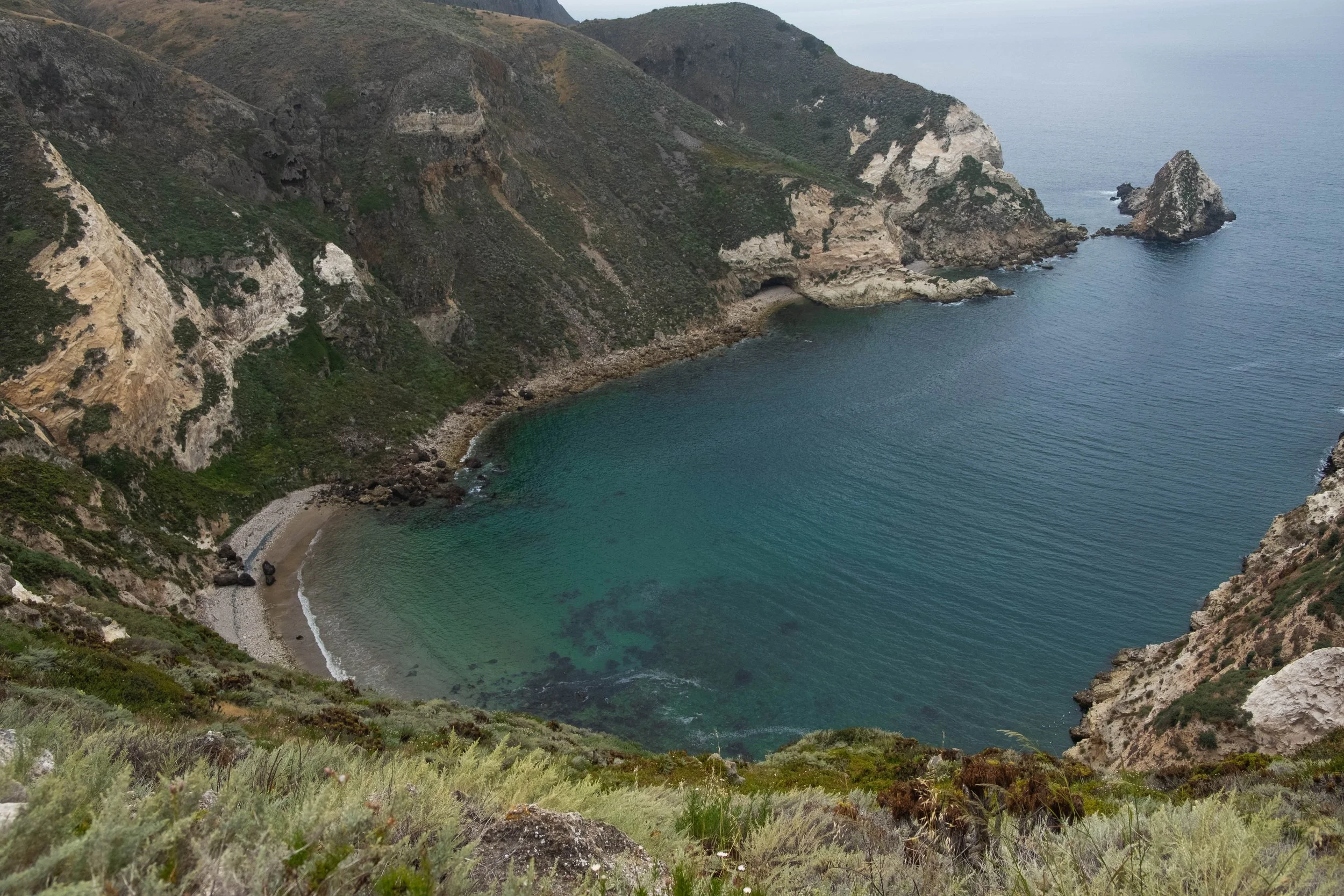
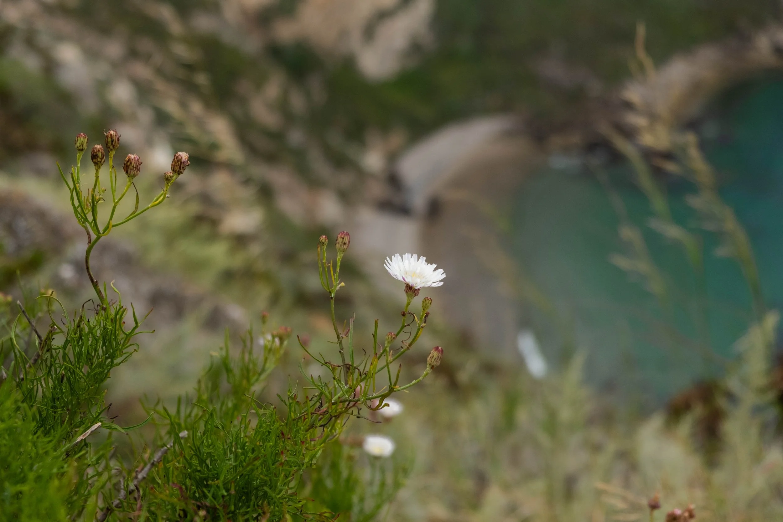
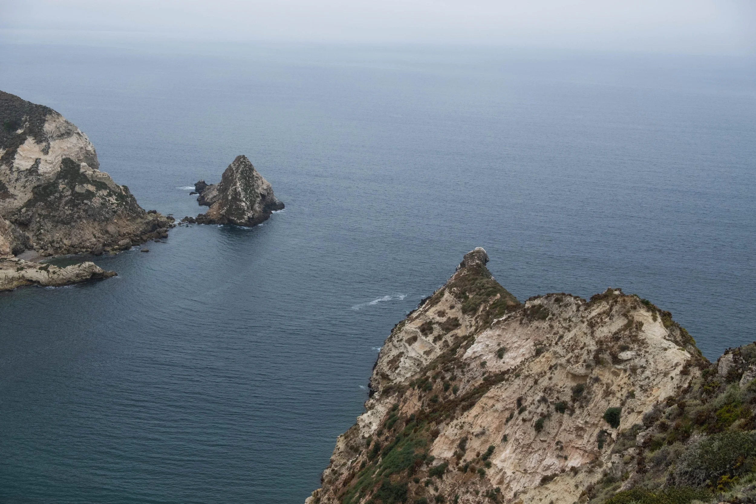
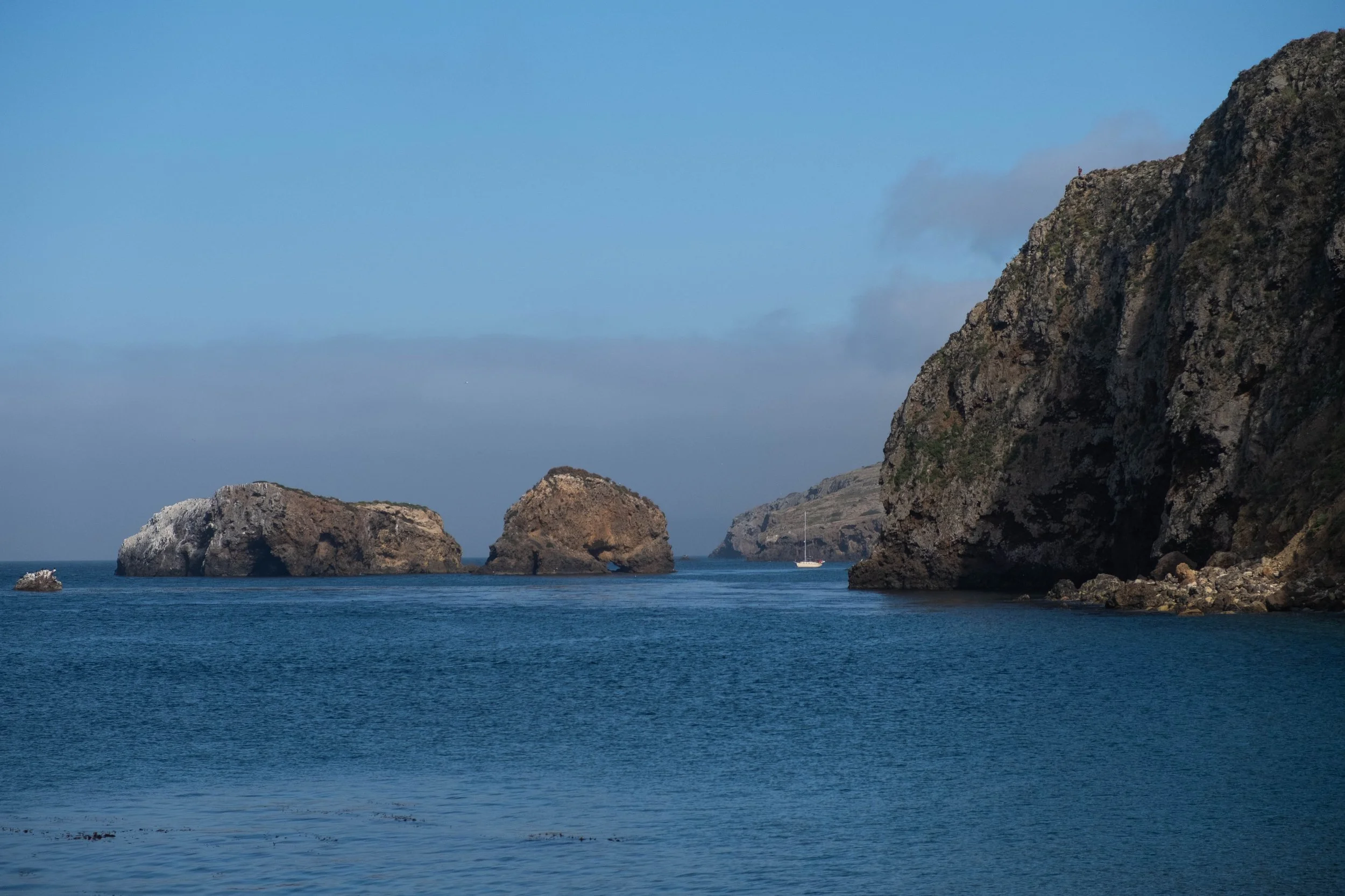
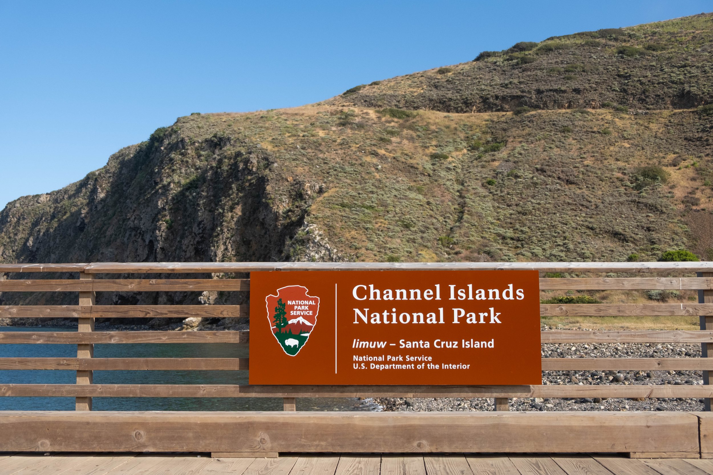
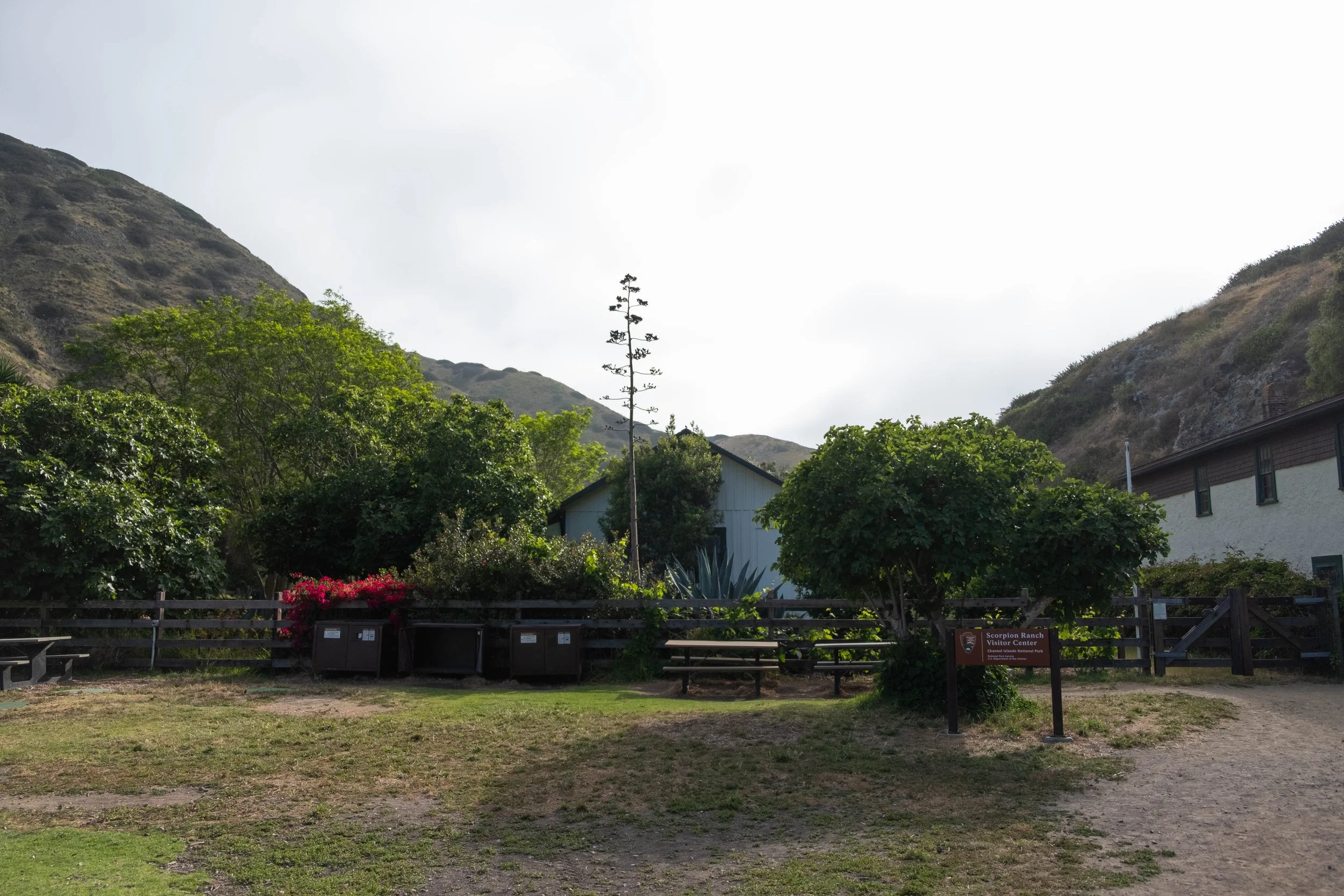
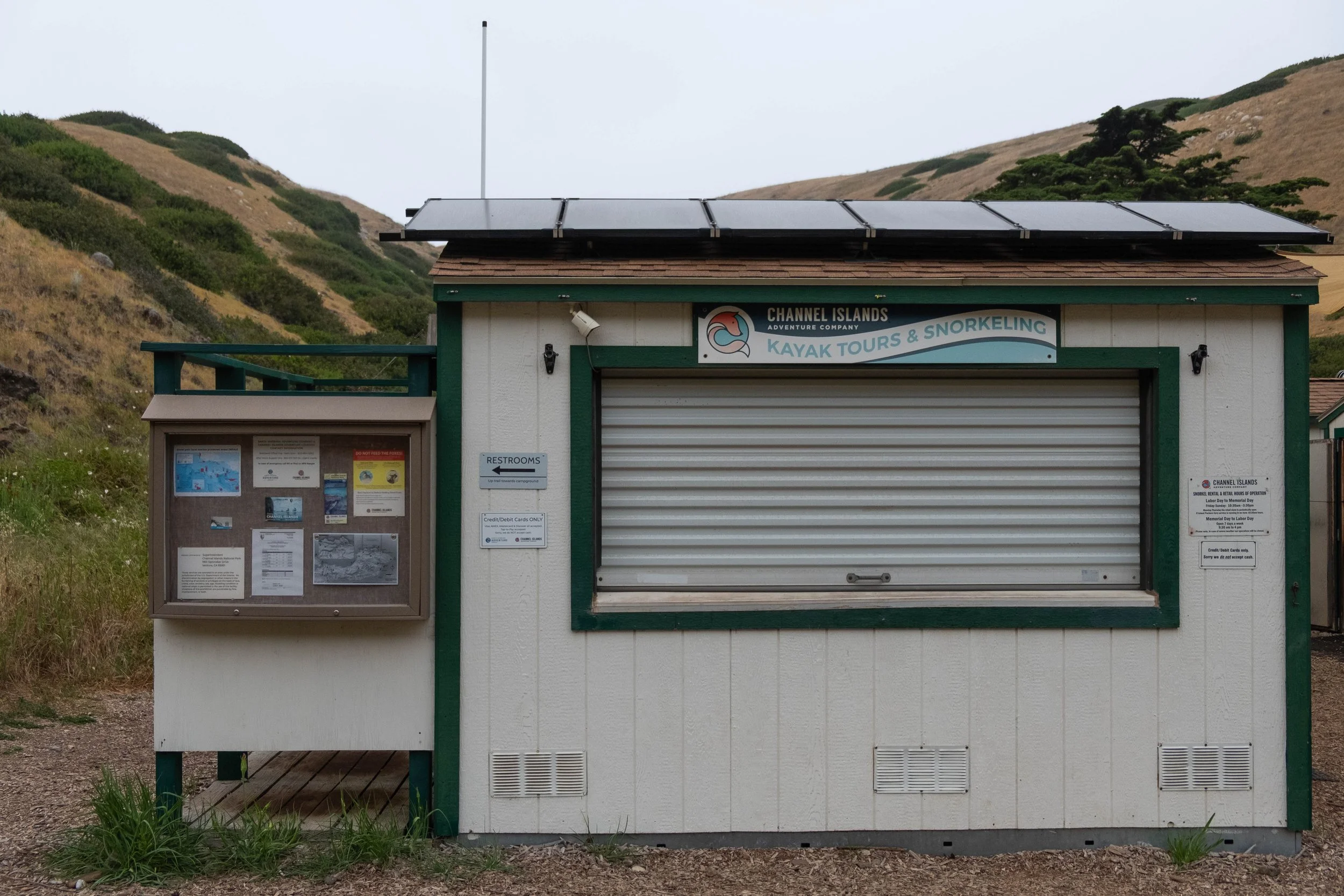
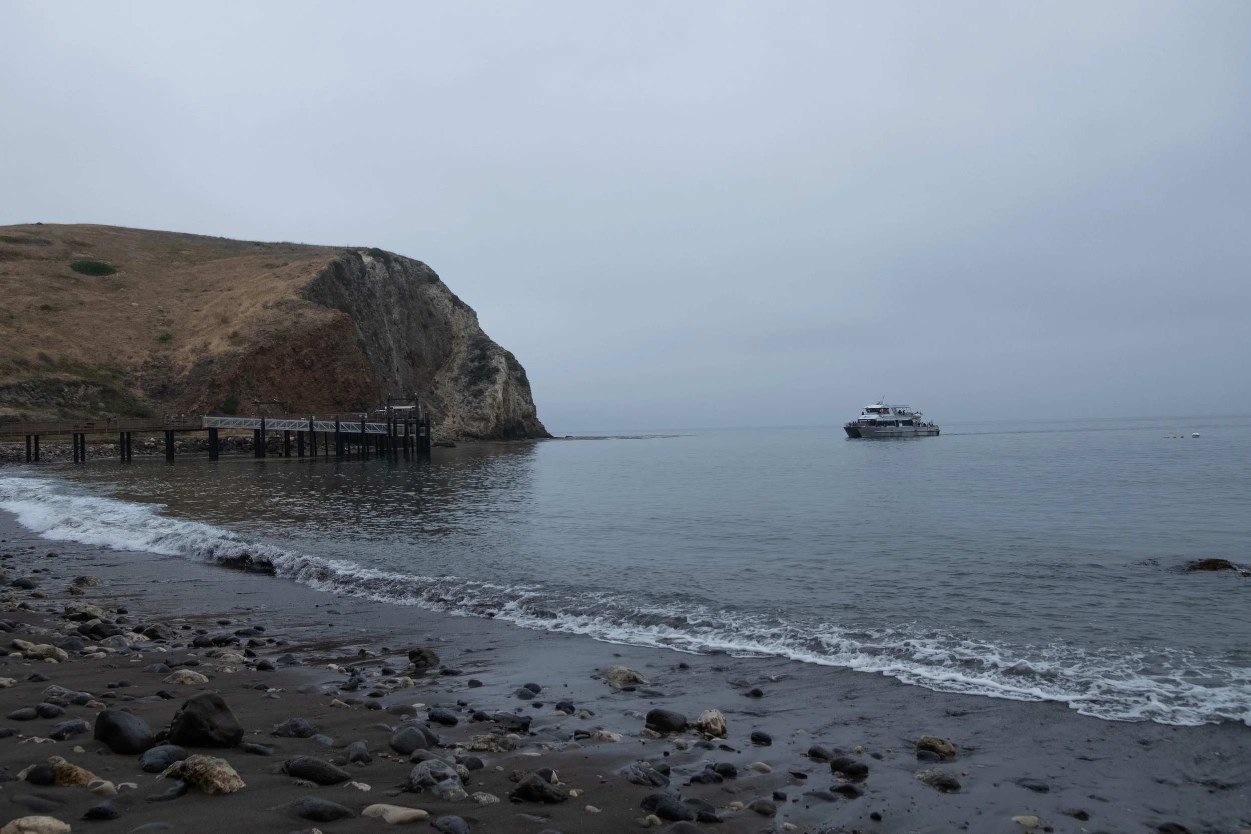
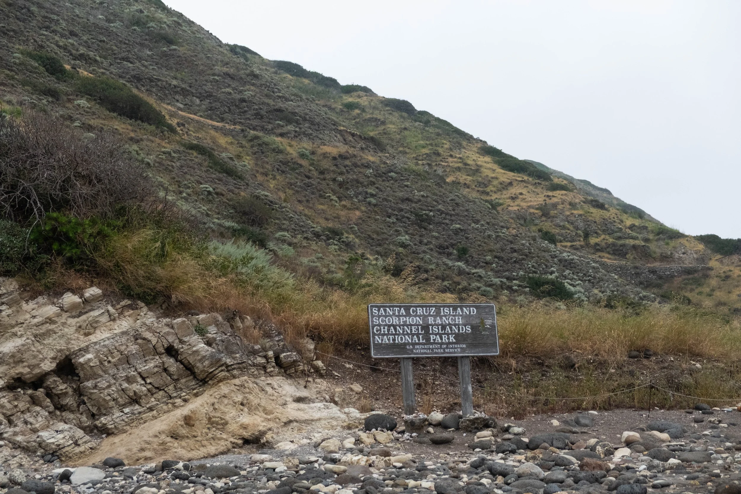
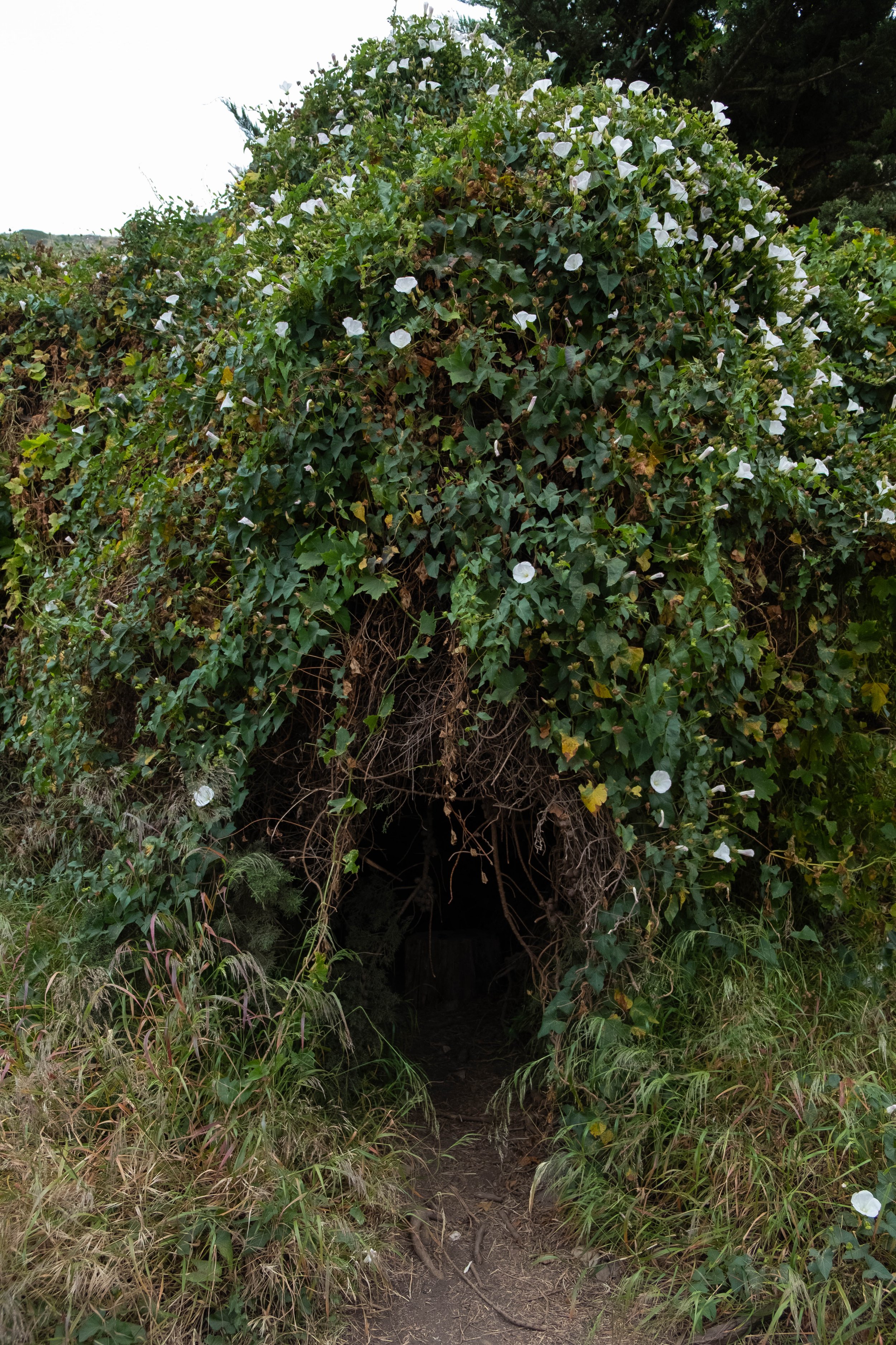
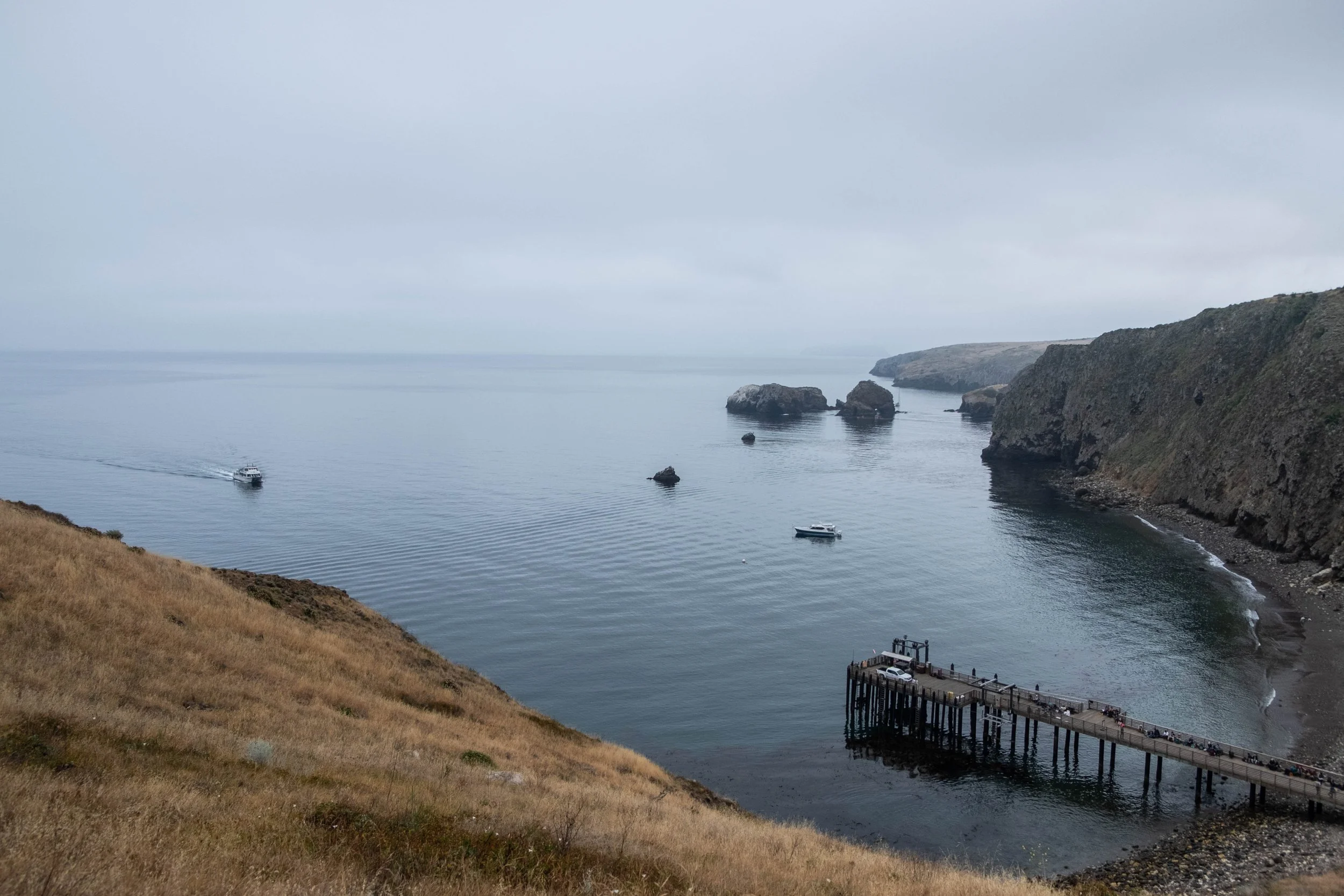
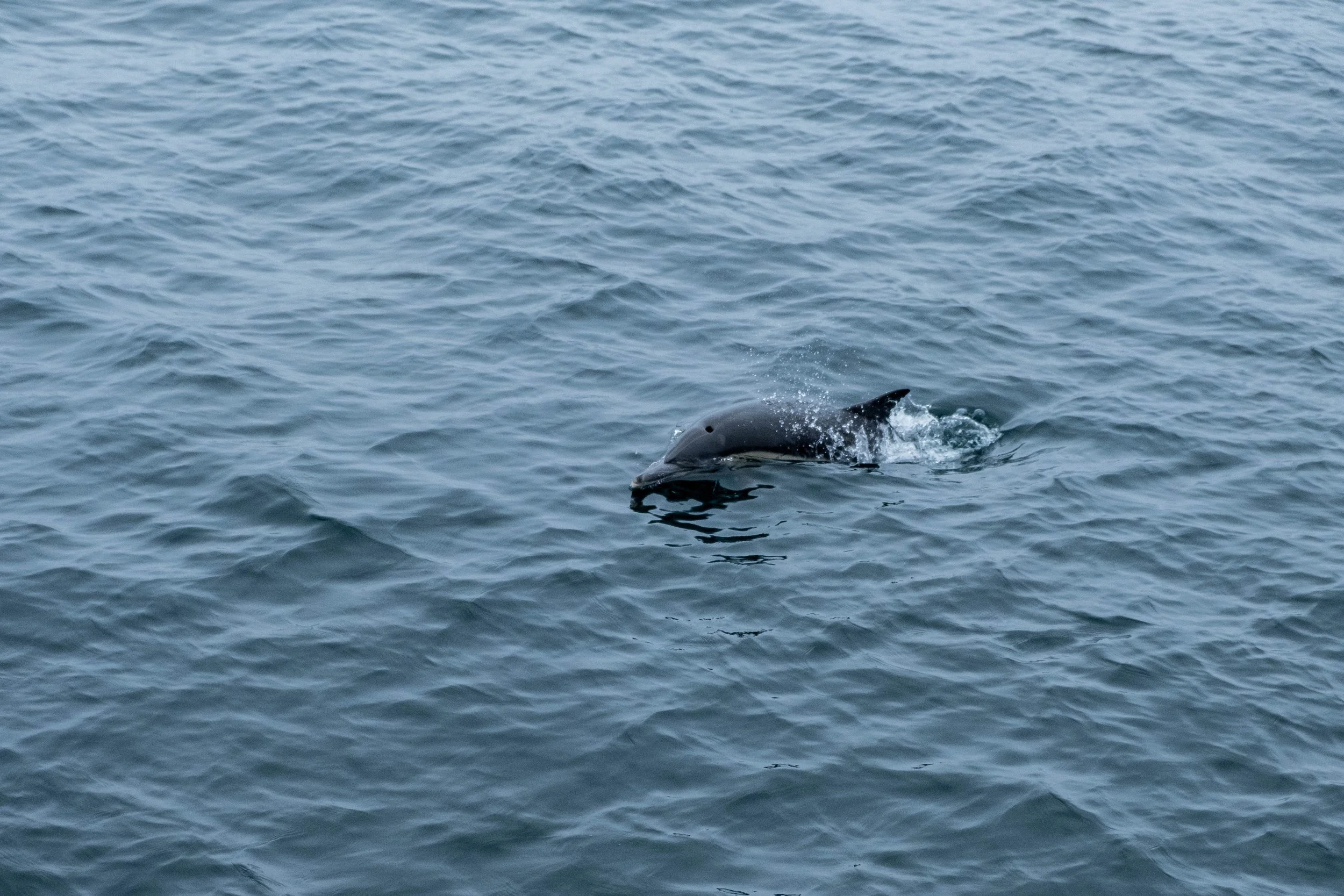
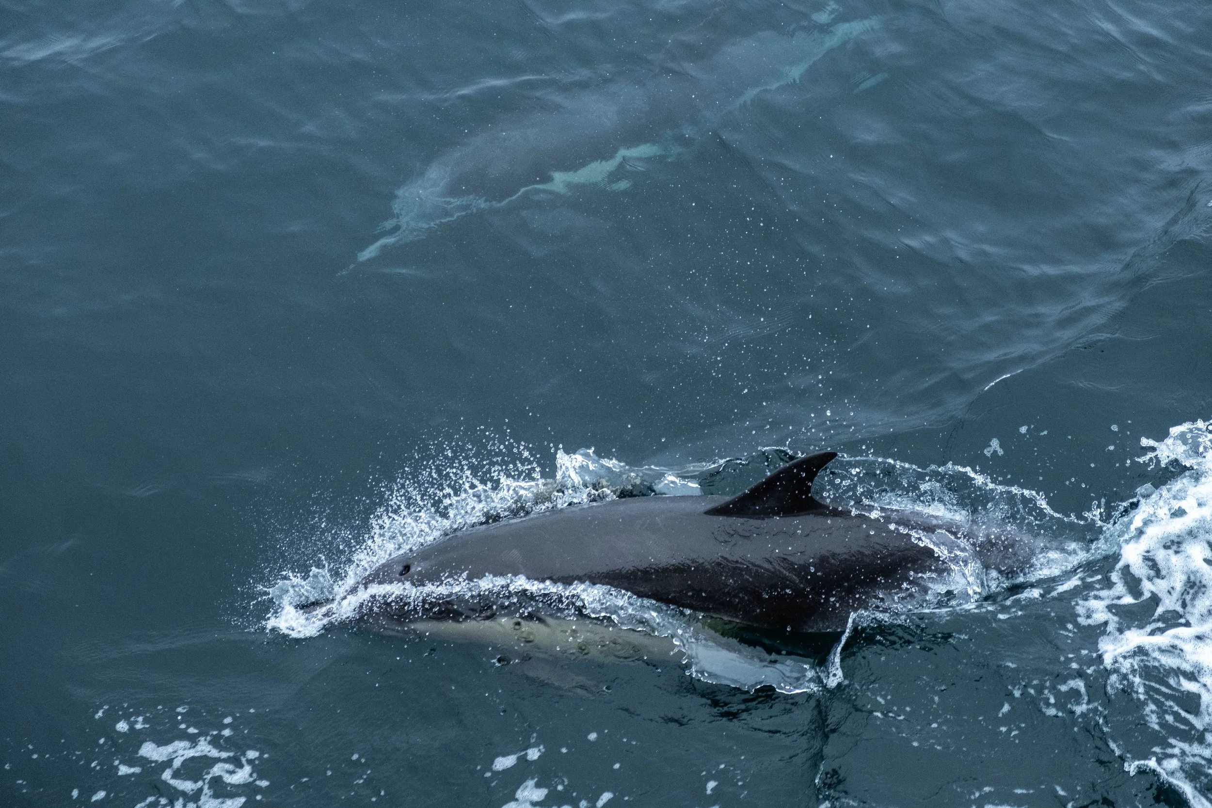
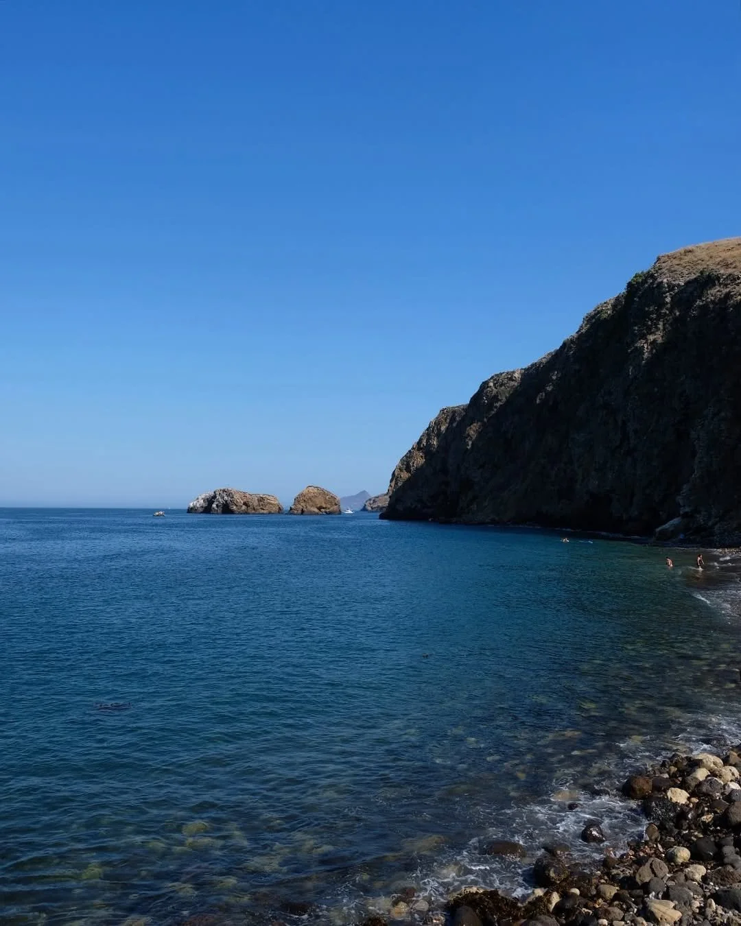
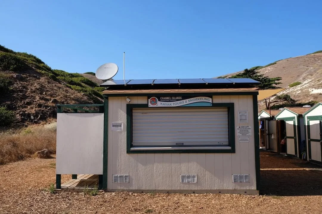
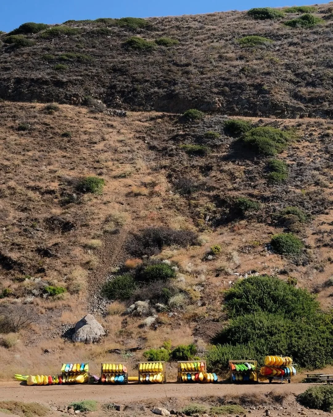
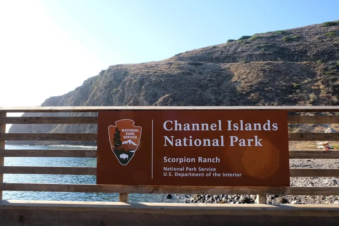
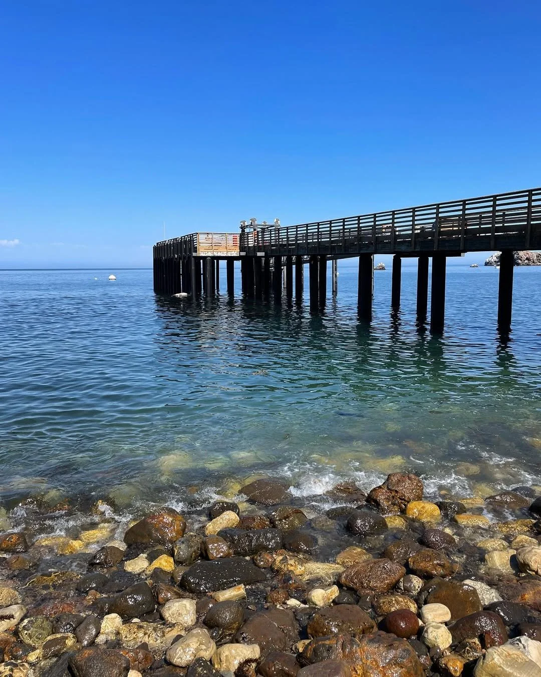
Channel Islands
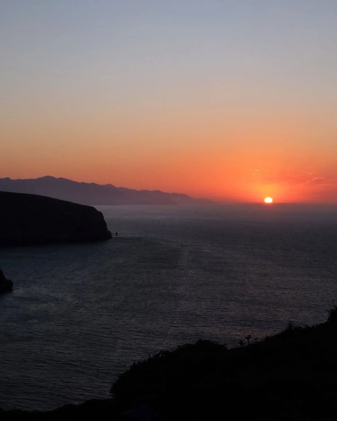
Park 25 | September 2022 & May 2026
Second Visit | May 2026
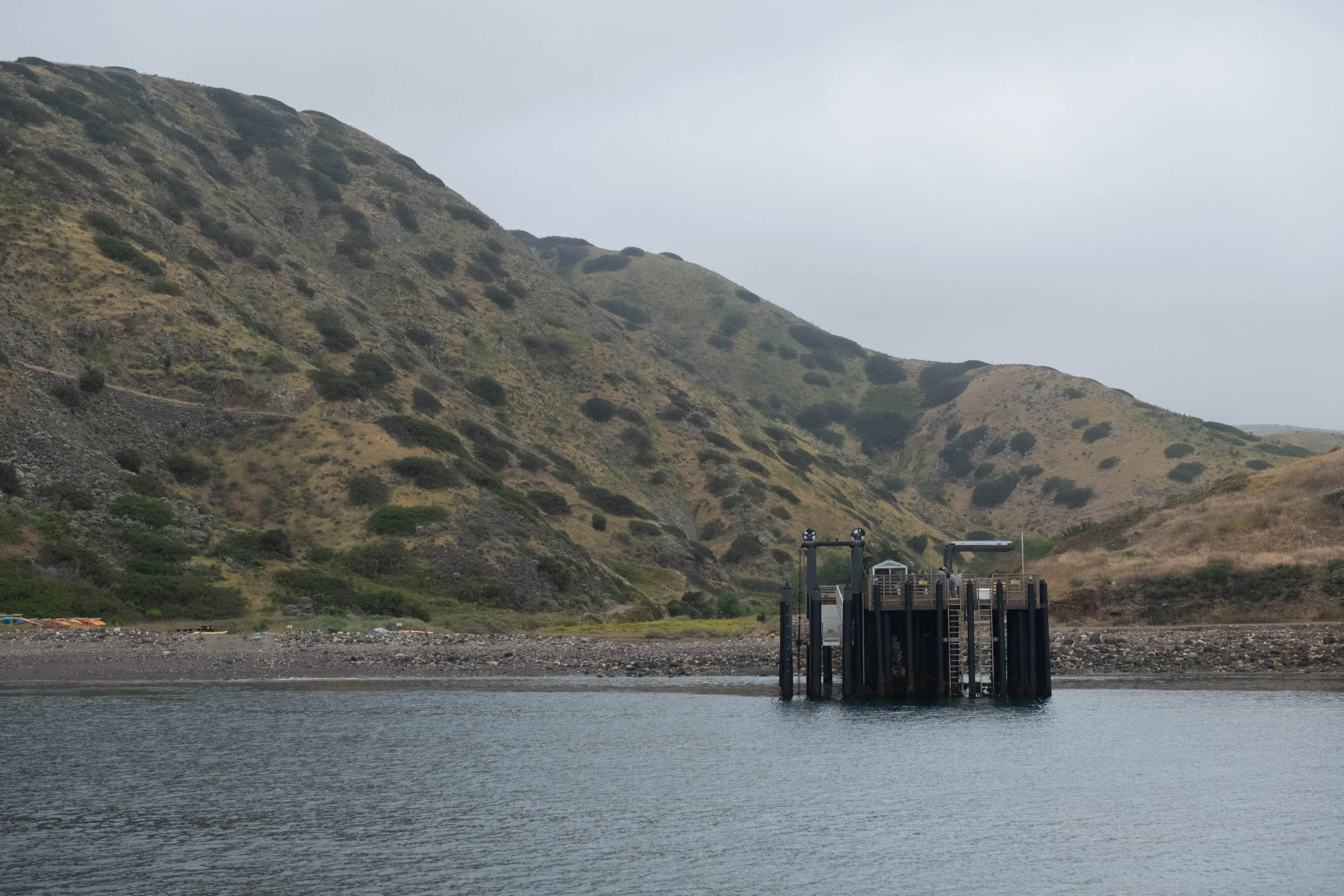
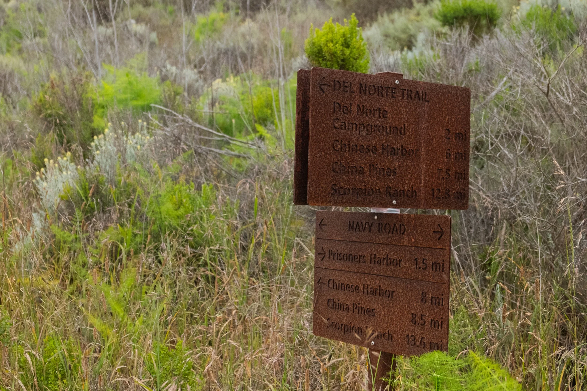
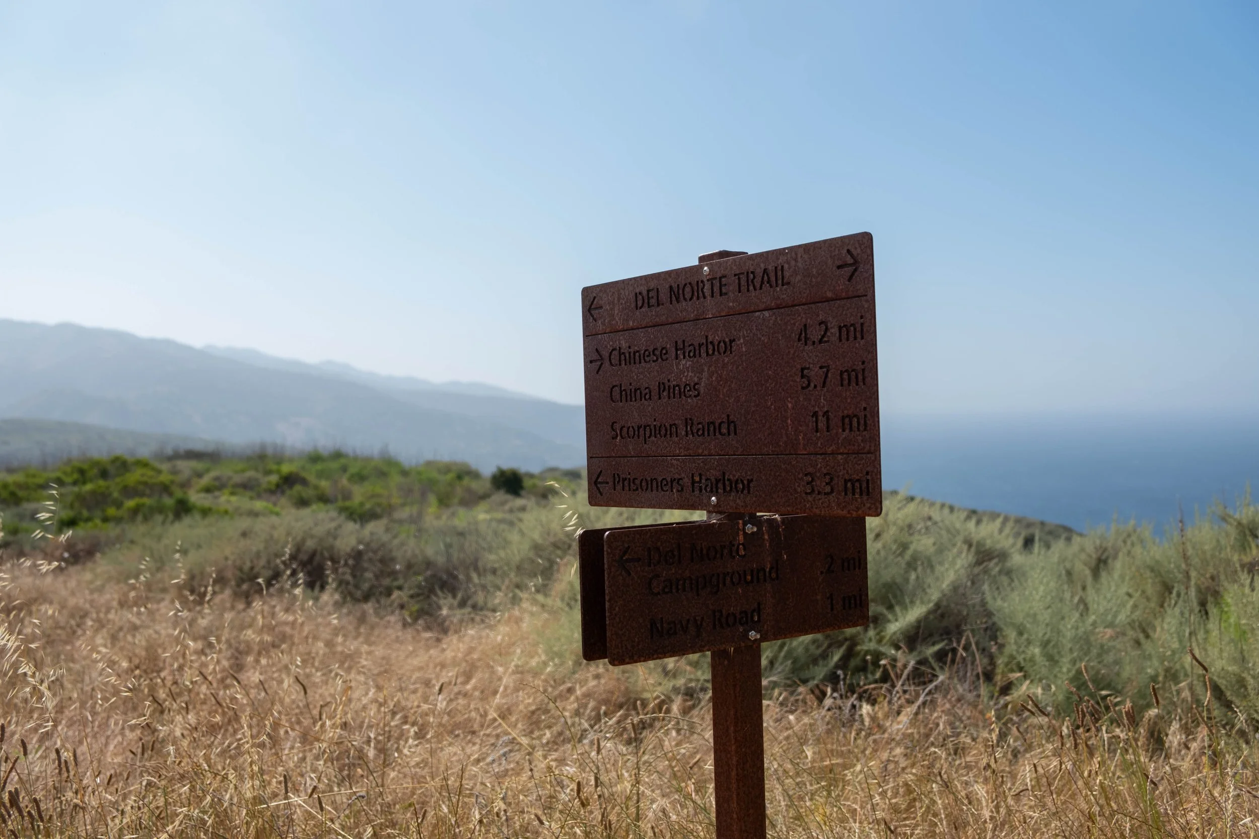
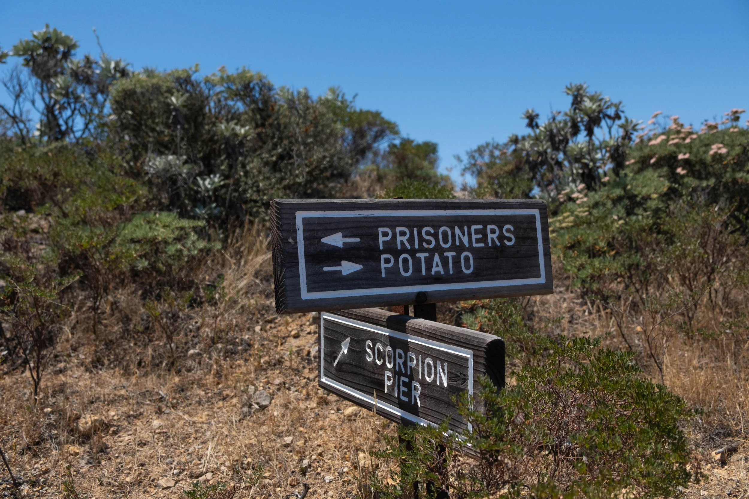
Day 1 | Prisoner’s Harbor to Del Norte Campground
Distance: 3.5 miles | Elevation gain/loss: +1,090 ft/-500 ft
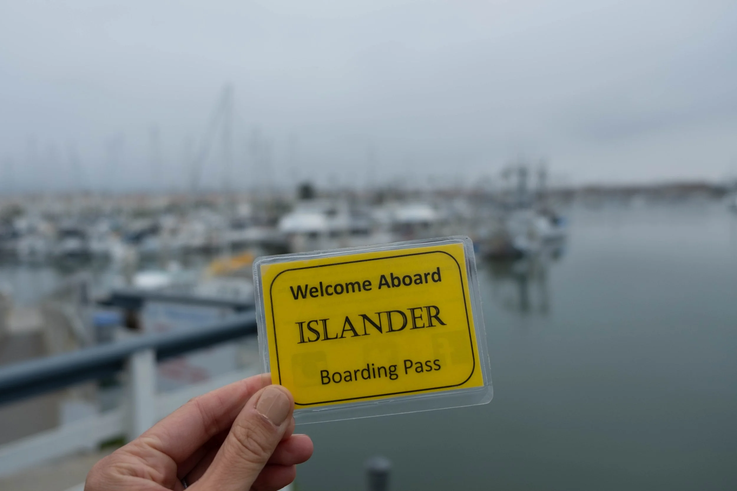
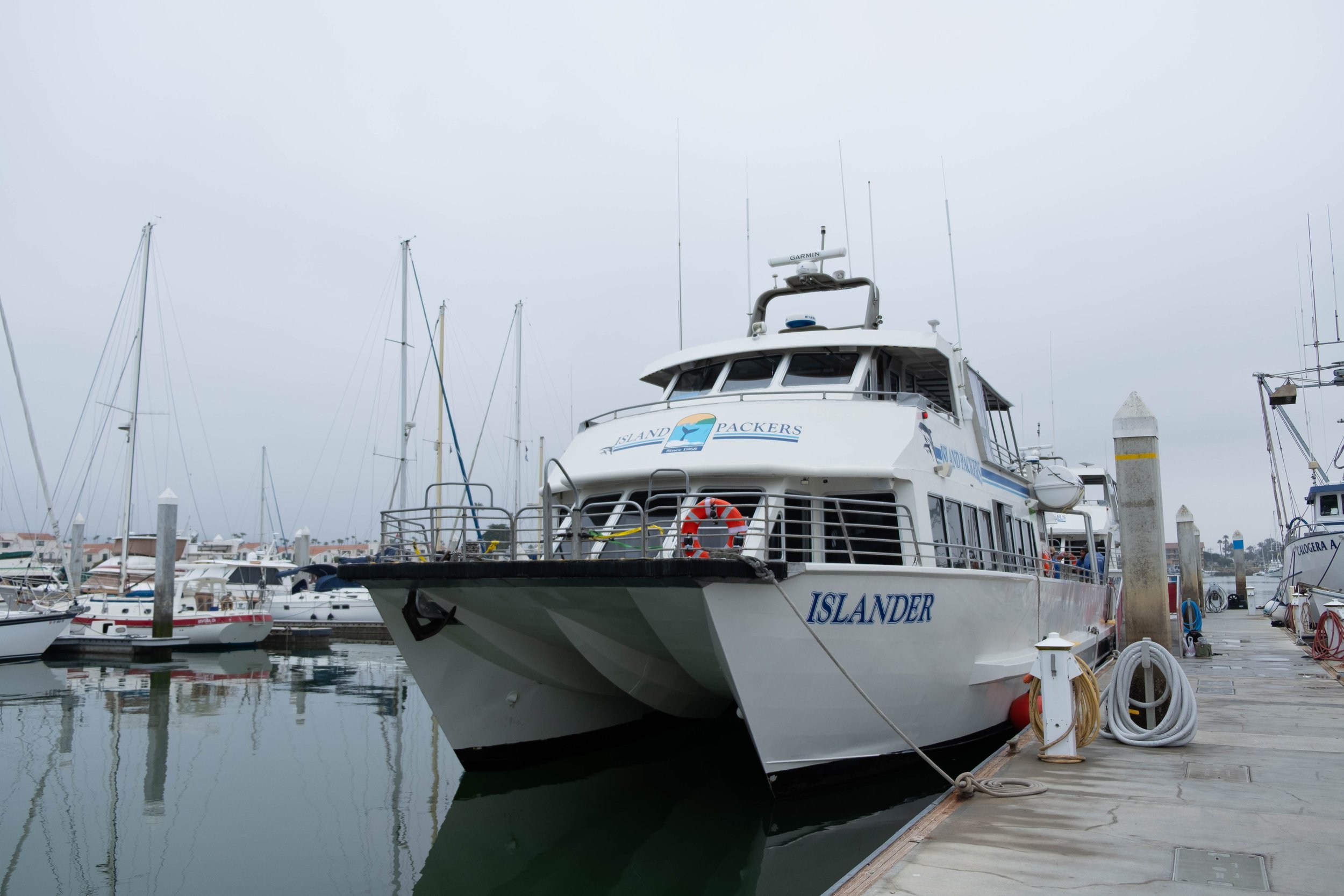
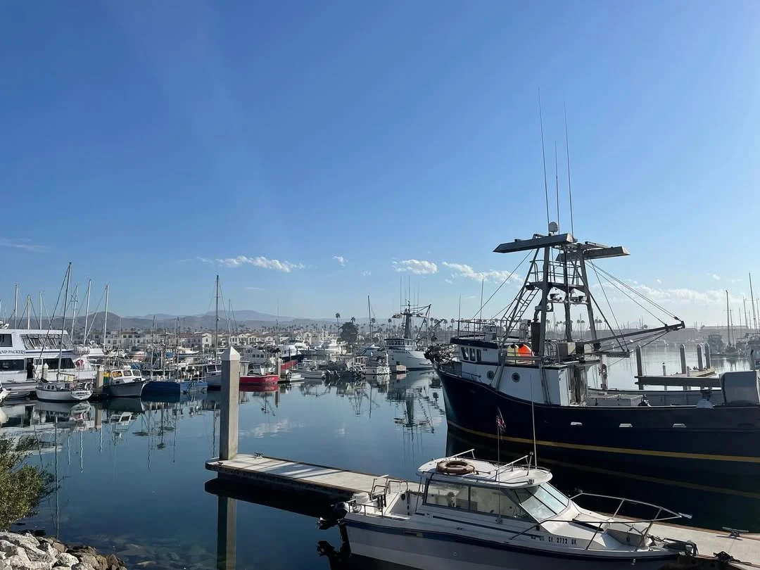
Our first day dawned cool and grey, the thick marine layer resting over the land and the sea as we drove from Camarillo to the harbor in Ventura. Although J couldn’t come on this trip, I was delighted to be returning to Santa Cruz Island with the same friend who accompanied us on our first trip back in September 2022. After checking in for our 9am ferry, we grabbed coffee and matcha at the adjacent coffee shop and walked around the marina until it was time for us to board.
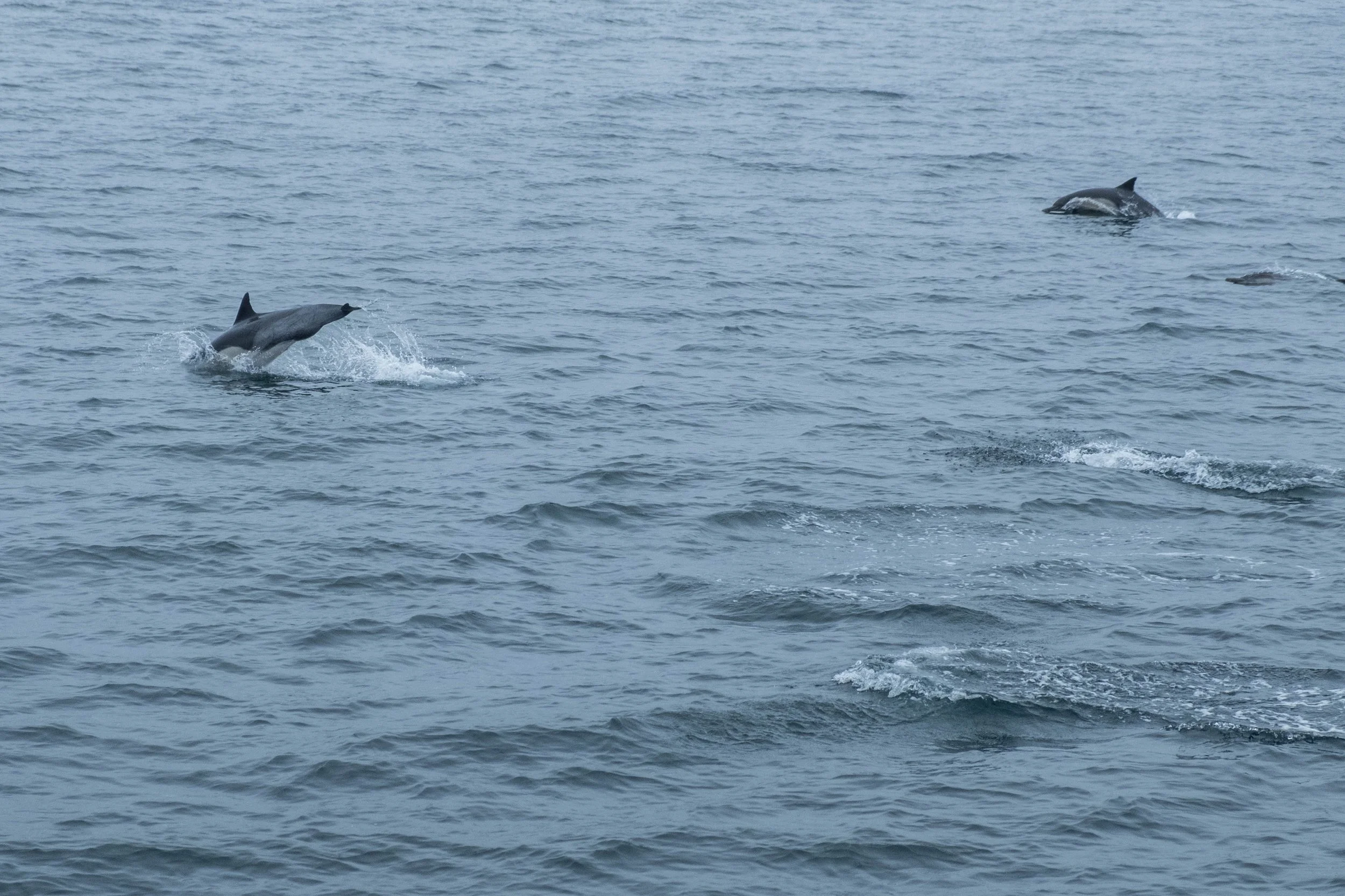
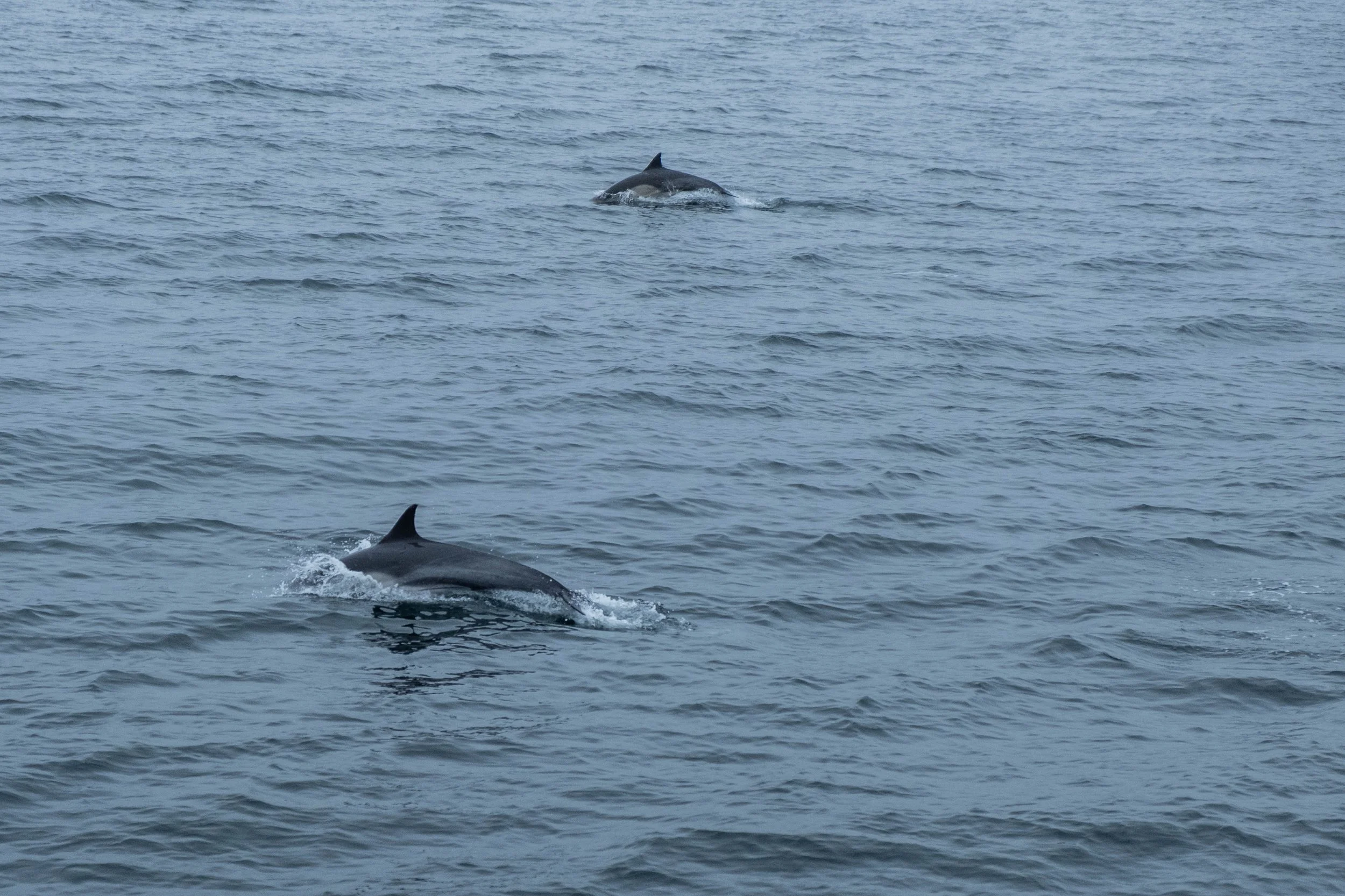
The ferry ride was cold, which was quite a contrast to the clear skies and blazing 100-degree heat wave I recalled from our last visit. The crew warned that these conditions were likely to induce seasickness; we were grateful to make it through the whole ride with no symptoms. We spent the hour-long crossing watching pods of dolphins and even spotting a humpback whale from distance, the sharp wind whipping against our faces and tangling our hair. The ferry first stopped at Scorpion Anchorage, then continued on for another 45 minutes around the north edge of the island toward Prisoner’s Harbor, where our backpacking adventure was to begin.
After disembarking (by climbing a ladder up the pier, which was a fun way to start) and receiving our backpacks from the hold of the ferry, we made our way to a set of picnic tables nestled under large trees. We enjoyed pre-made chicken, hummus, and veggie wraps before repacking our bags with our copious amounts of water — 11 liters between the two of us — strapping them on, and setting off on the trail.
The trail itself is not particularly challenging in terms of distance (15 miles over two days) or elevation profile (less than 3,000 ft up and down total), but it is logistically challenging in that there is no water along the route. Thus, we needed to carry enough for our first day of hiking to the Del Norte backcountry site, the evening and morning there, and then the remaining miles between Del Norte and Scorpion Campground, where water was plentiful. I’ve never carried so much water on any trip before, and the added weight absolutely adds to the difficulty of the trail. We encouraged ourselves regularly by vocalizing how we would slowly shed close to 15 pounds from our packs over the course of the next two days simply by drinking our water and eating our food!
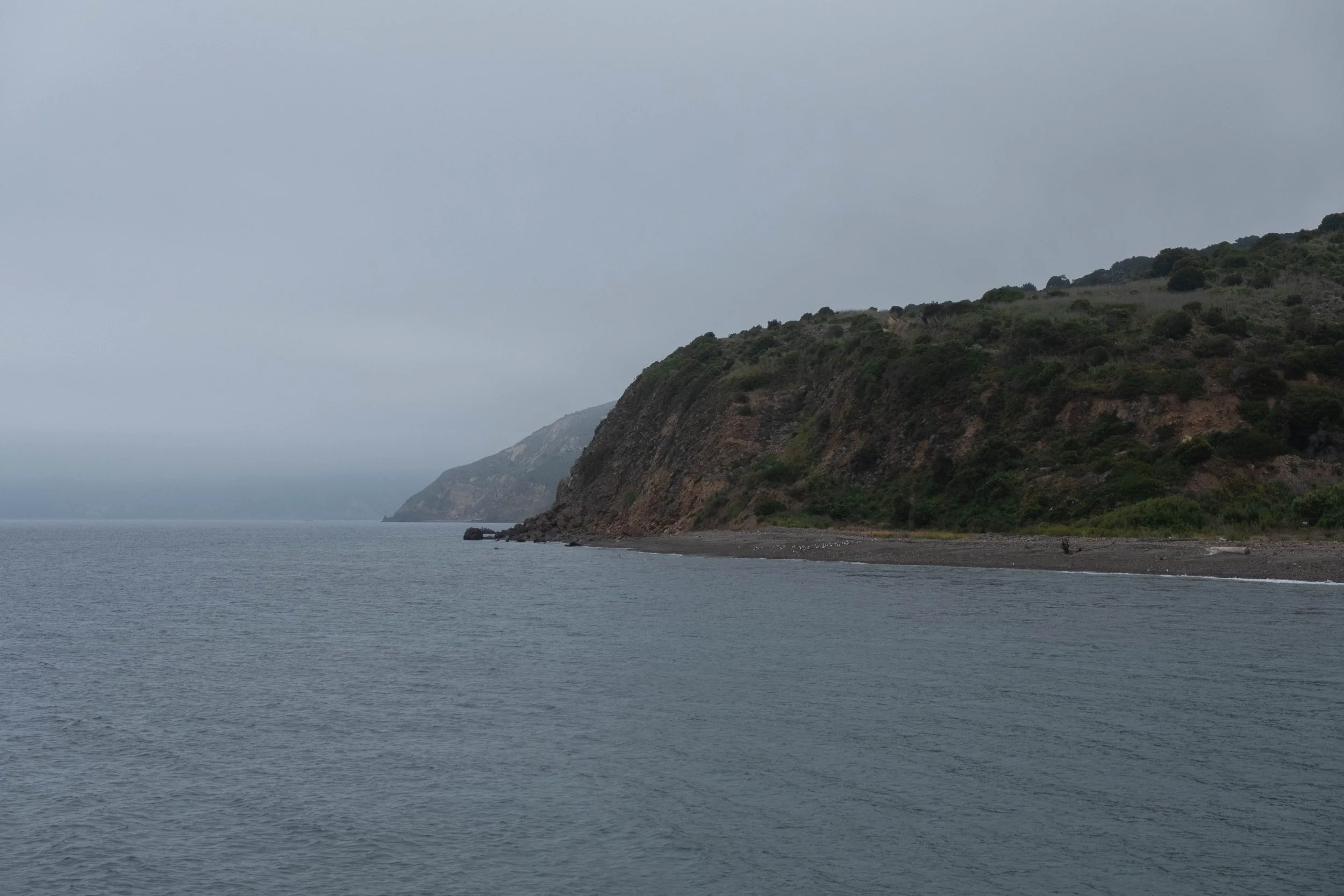
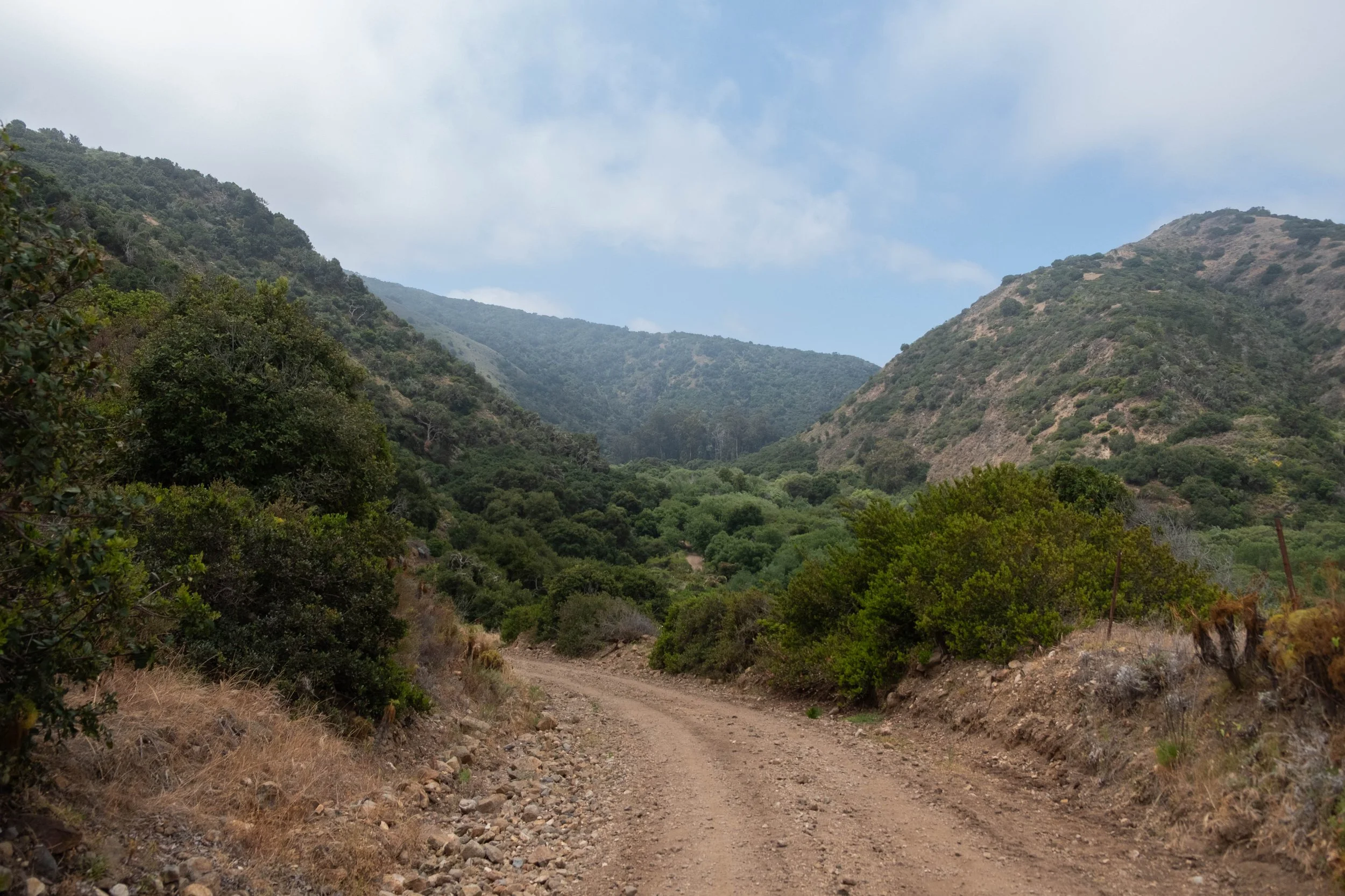
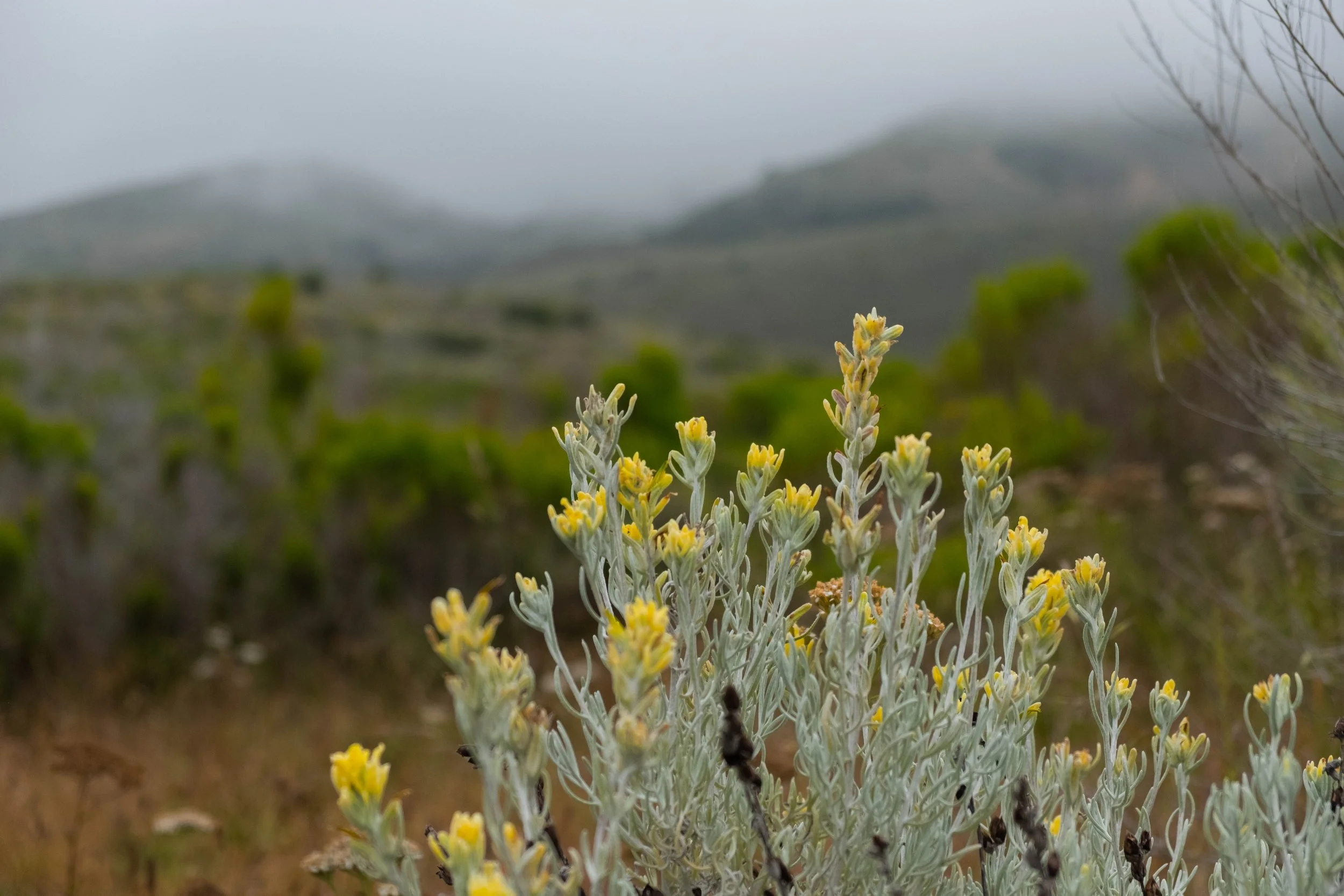
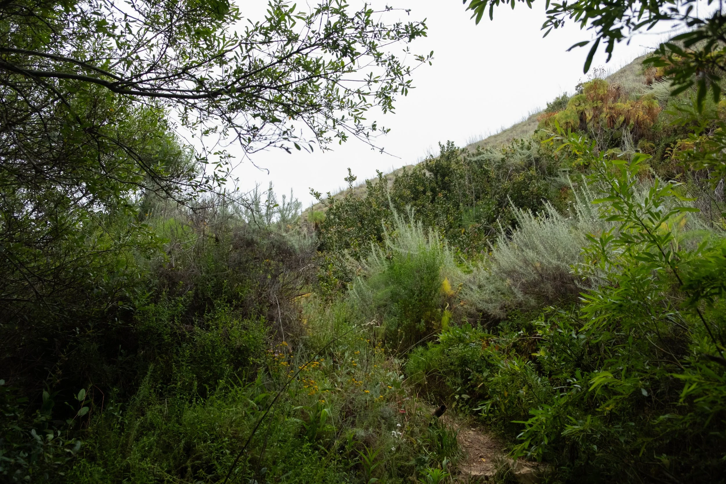
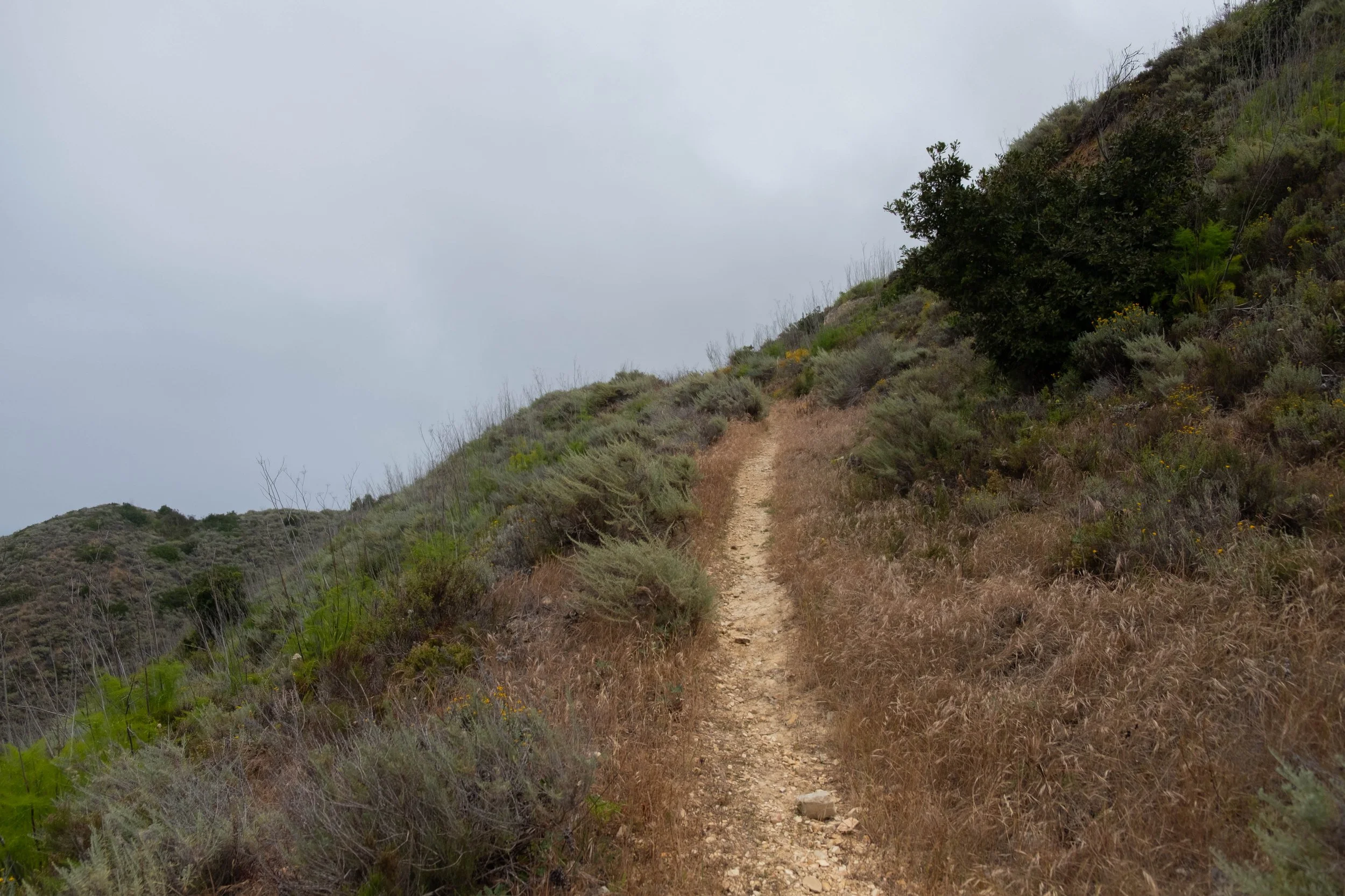
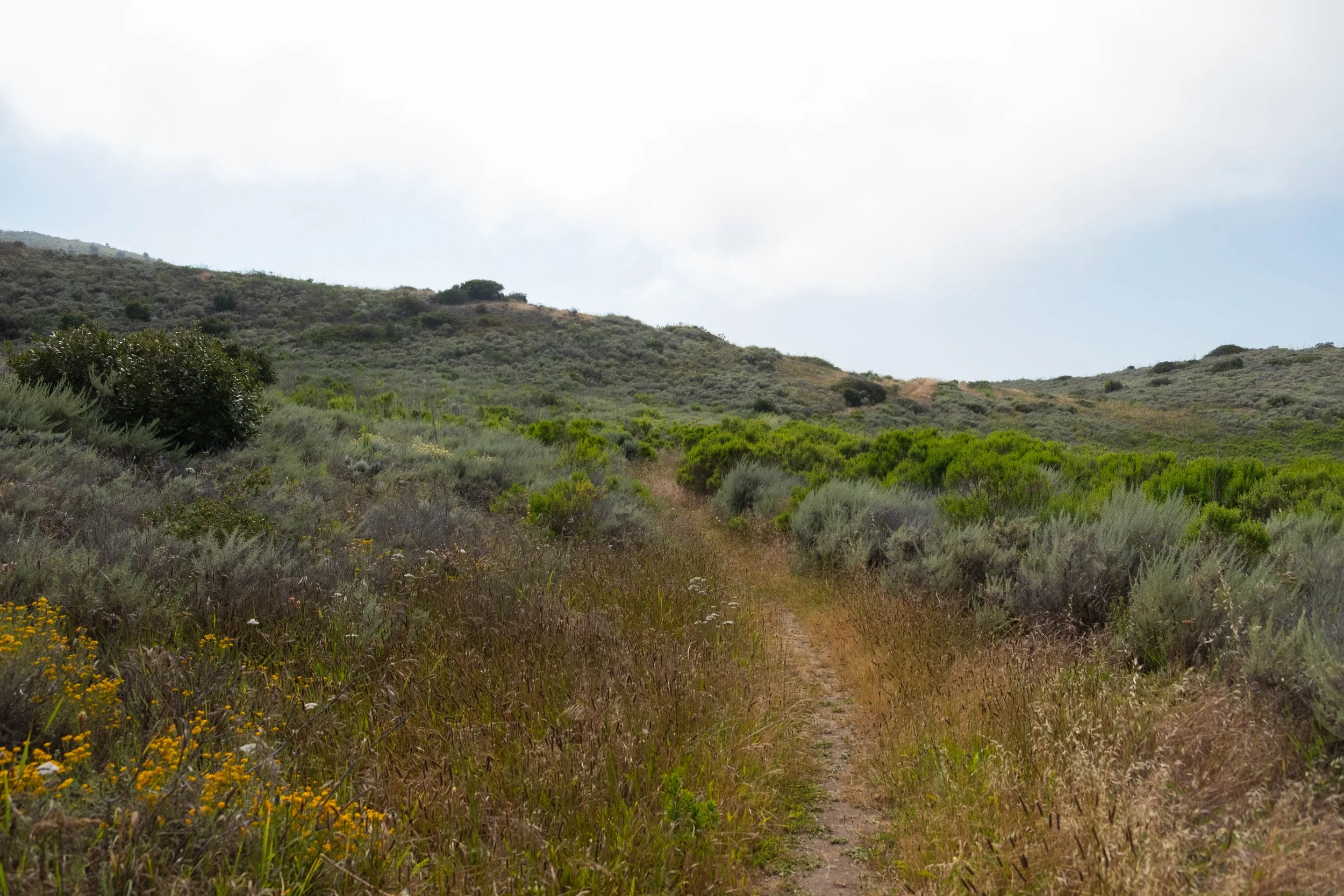
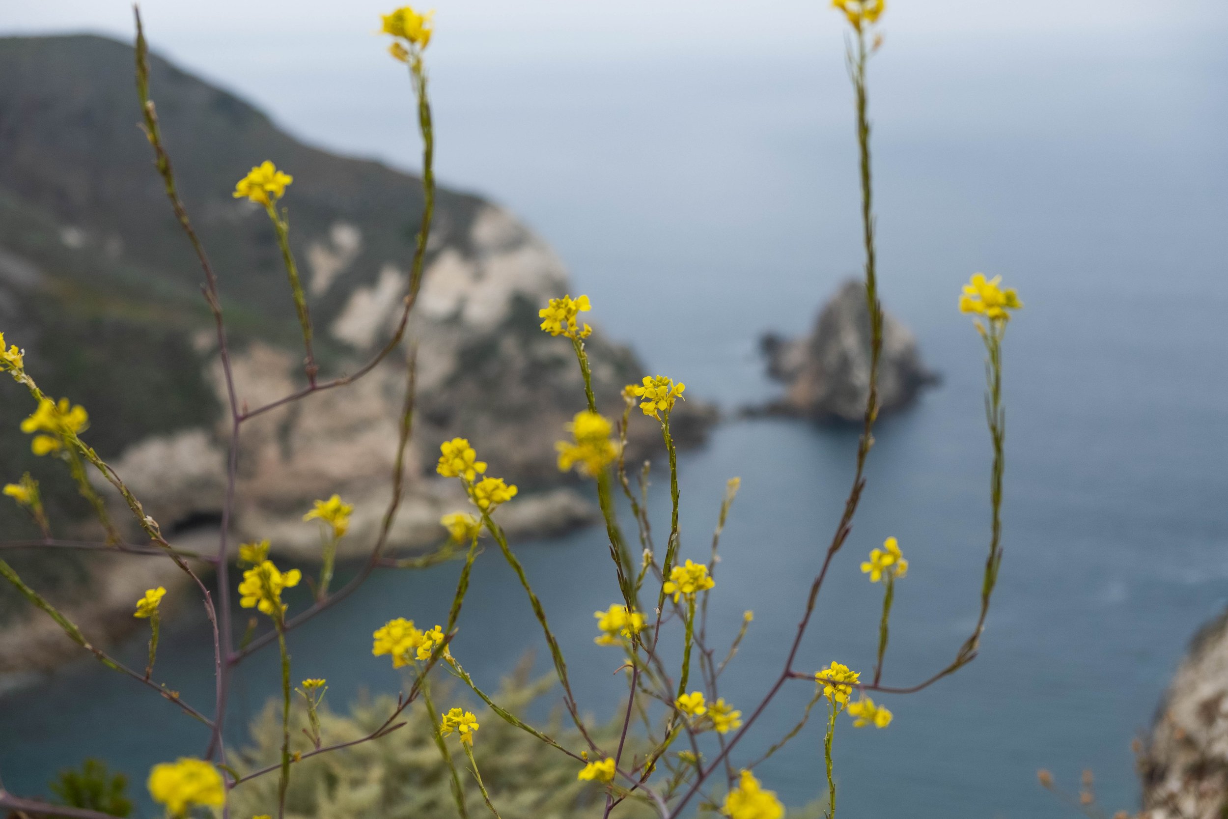
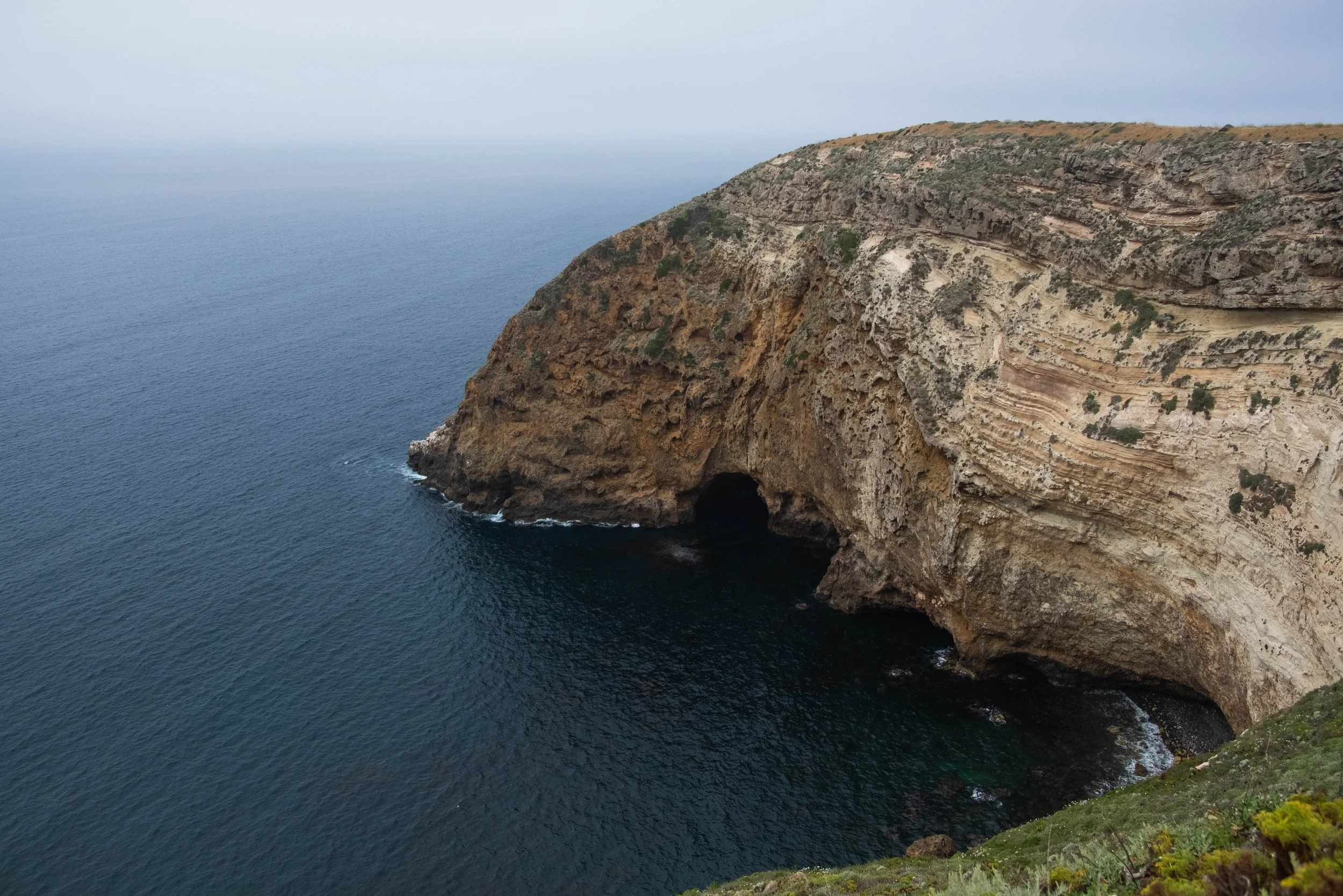
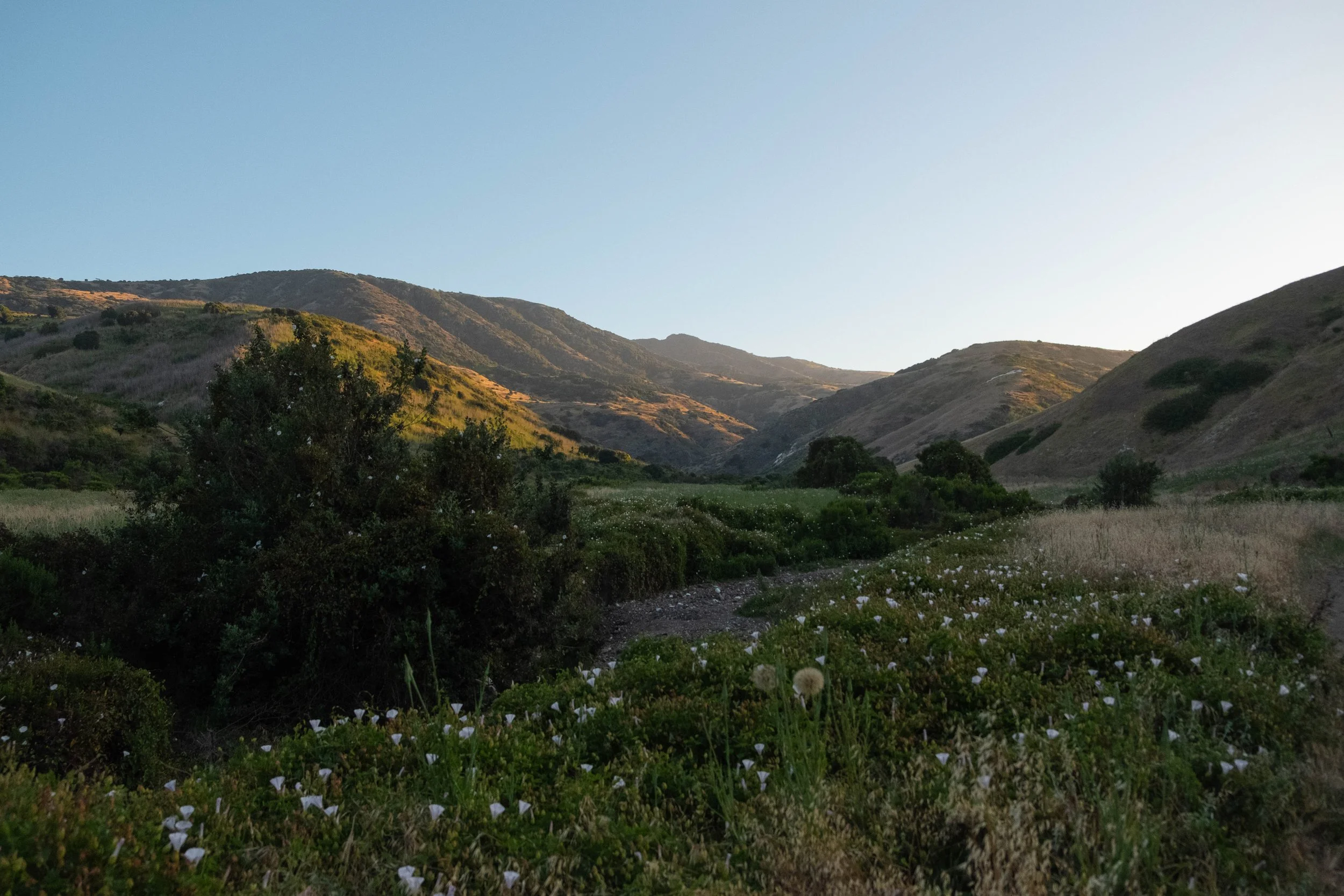
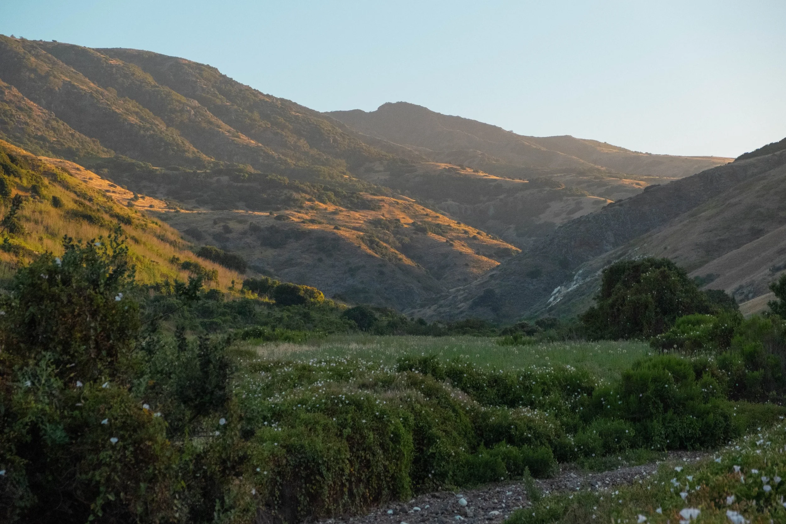
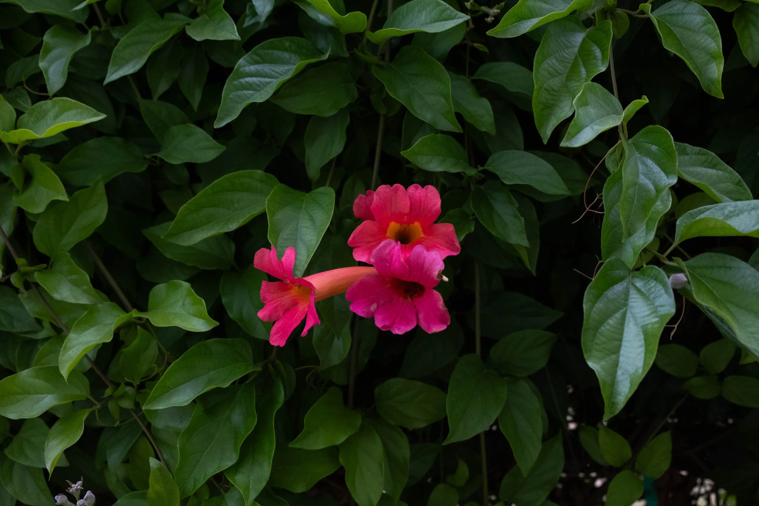
We settled into a steady pace, regularly pausing to admire the incredible beauty of the island: a veritable explosion of colorful island paintbrush, monkeyflower, and prickly pear cactus, air that smelled both sweet from the herbaceous plants and salty from the sea, hummingbirds that flitted around us and birds trilling from the bushes. The first 1.5 miles were on the Navy Road, a dirt road that climbs the initial 600 feet of elevation gain, before we turned on the (very) unmaintained Del Norte Trail. This overgrown trail undulated through two small valleys before our final burst up a hill toward our campground for the evening.
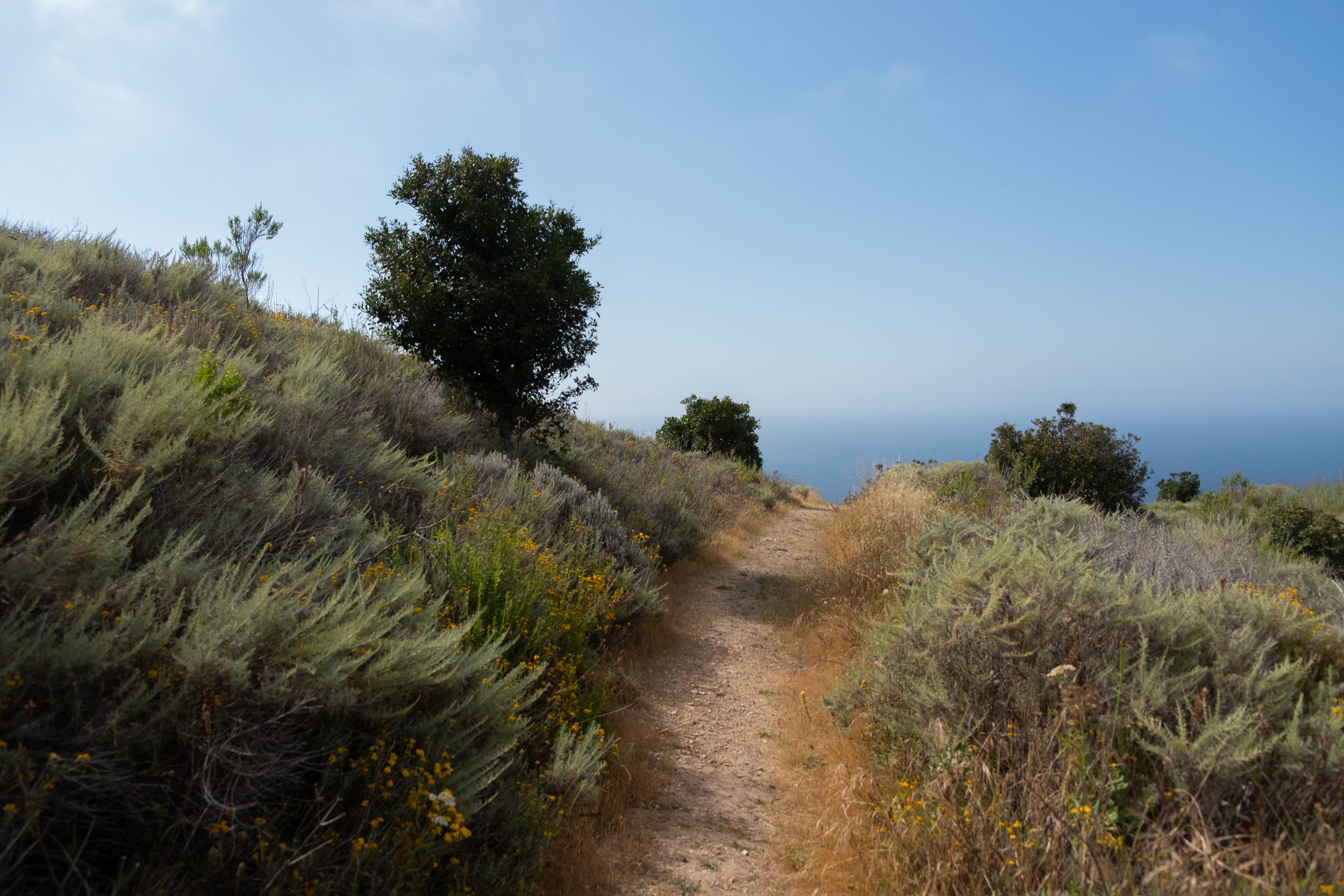
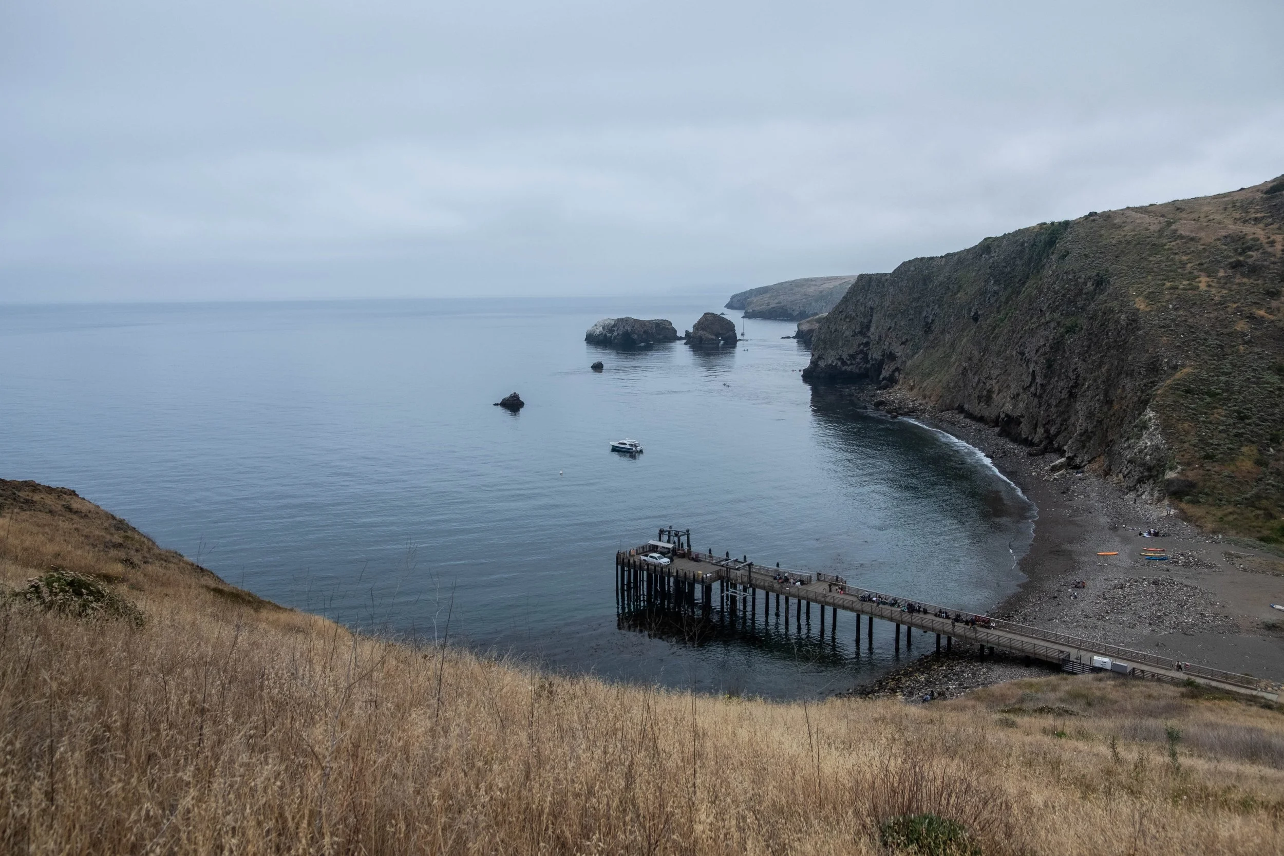
By the time we reached Del Norte, the sun had fully burned through the morning fog and we were treated to our first glimpse of the views we would enjoy all evening. Del Norte has four sites and is the only area visitors are allowed to sleep in the backcountry of the park. Shockingly to me, although all the sites were reserved online, there was only one other site occupied while we stayed there, so it felt very isolated and quiet in the best way (but seriously, please cancel your site if you’re not going to use it so somebody else has a chance). We had reserved Site 1 which, while unshaded, offered the best views of the coastline. We pitched our tent, organized our gear, and meandered further down the trail (blissfully backpack-free!) to explore a bit more before settling in to our campground for the evening.
We had prioritized water-light meals for our first dinner and breakfast, so dined on simple wraps filled with chicken packets and leftover veggies that still tasted incredible after our afternoon of hiking. We splurged with our water resources to make a hot cup of tea for each of us as the evening breeze turned cooler, and wrapped ourselves in my quilt while watching the sun lazily descend across the sky. The sunset was spectacular, so much so that we stayed out until the very end, despite getting chilled to our cores. After the sun slipped behind the hills we hurried to put everything in the animal-proof box (or “fox box” as they’re called on Santa Cruz) and crawled into our tent to warm up, soon drifting off into a surprisingly deep sleep.


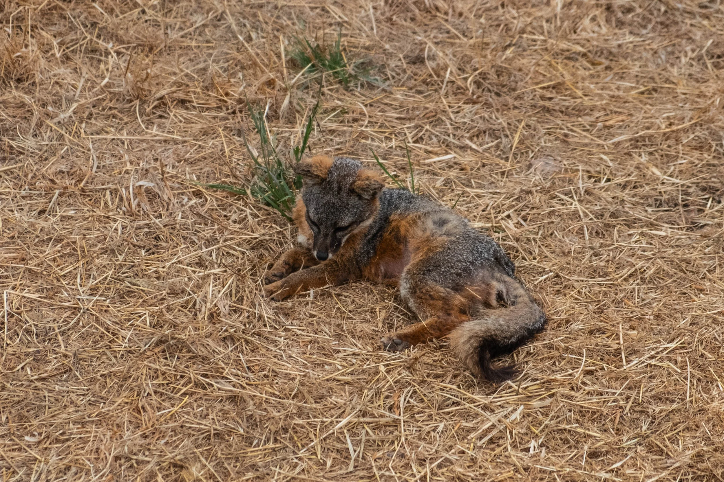
Day 2 | Del Norte Campground to Lower Scorpion Campground via Potato Harbor
Distance: 11.5 miles | Elevation gain/loss: +1,700 ft/-1600 ft
We both woke in a natural, unforced way at 5:30am, eager to start the big hike up the ridge. We emerged from the tent to find ourselves socked in by the same grey fog that we’d experienced the previous morning. While this erased the views we’d enjoyed the night before, it was the perfect conditions for the hike we were able to tackle. We enjoyed our hot cups of coffee and choked down a breakfast that we swore to never repeat: Breakfast wraps filled with peanut butter and banana. The nutritional balance for our pending activity? Good. The taste profile? Decent. The texture? Abysmal.
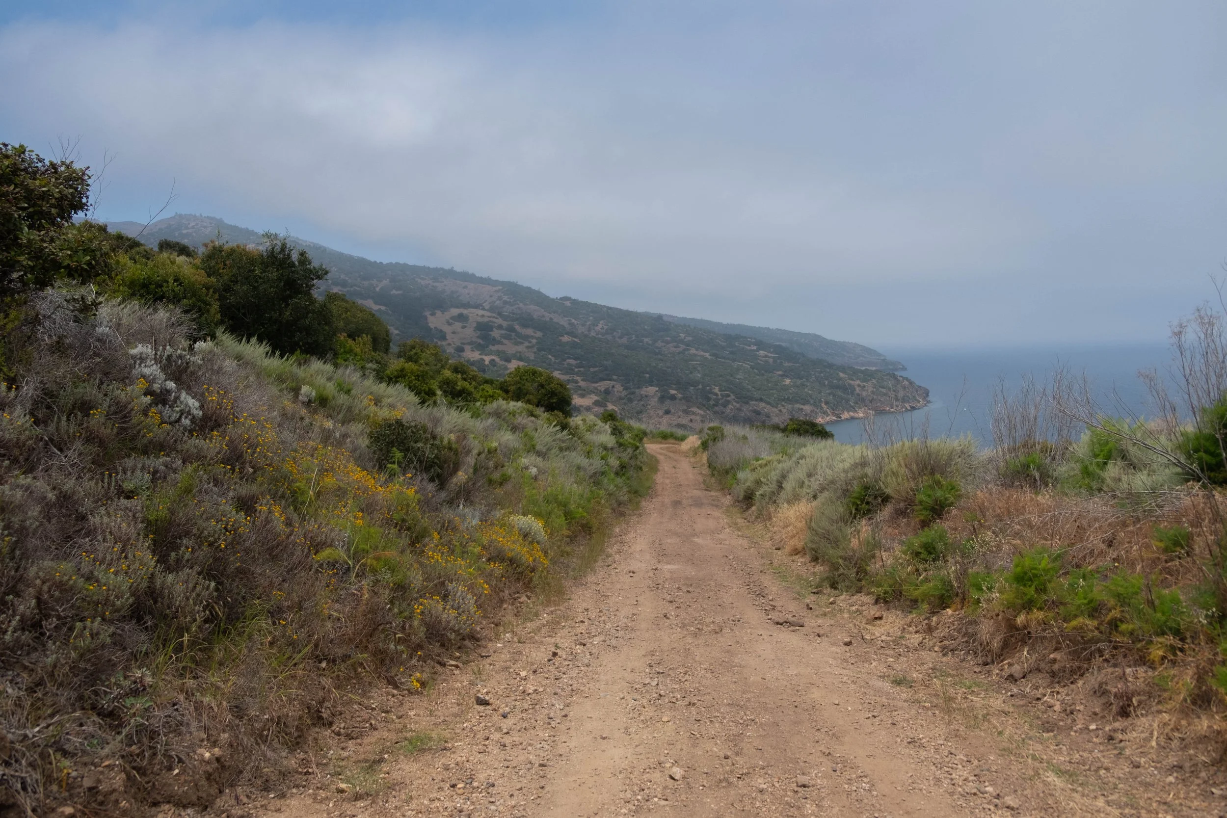
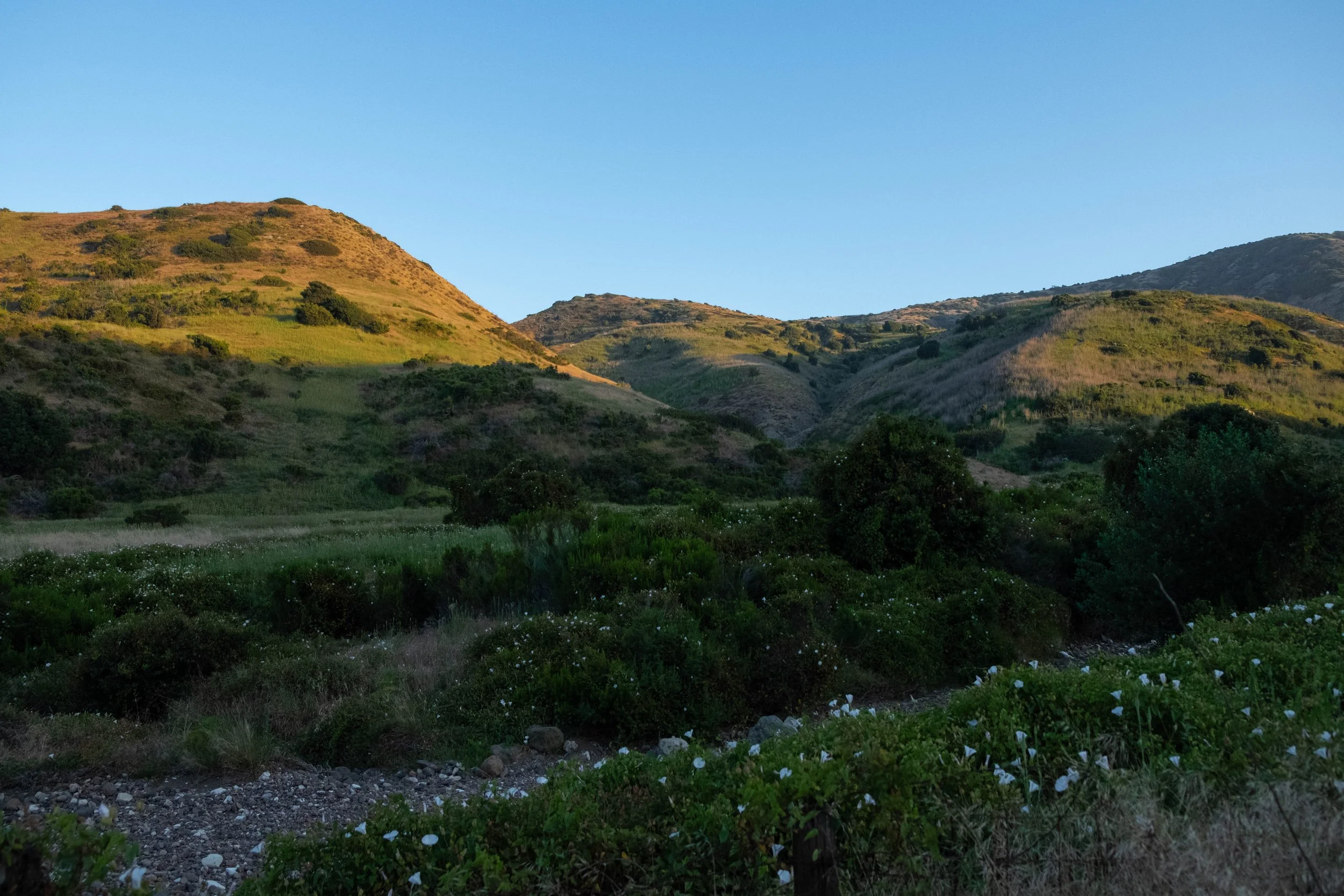
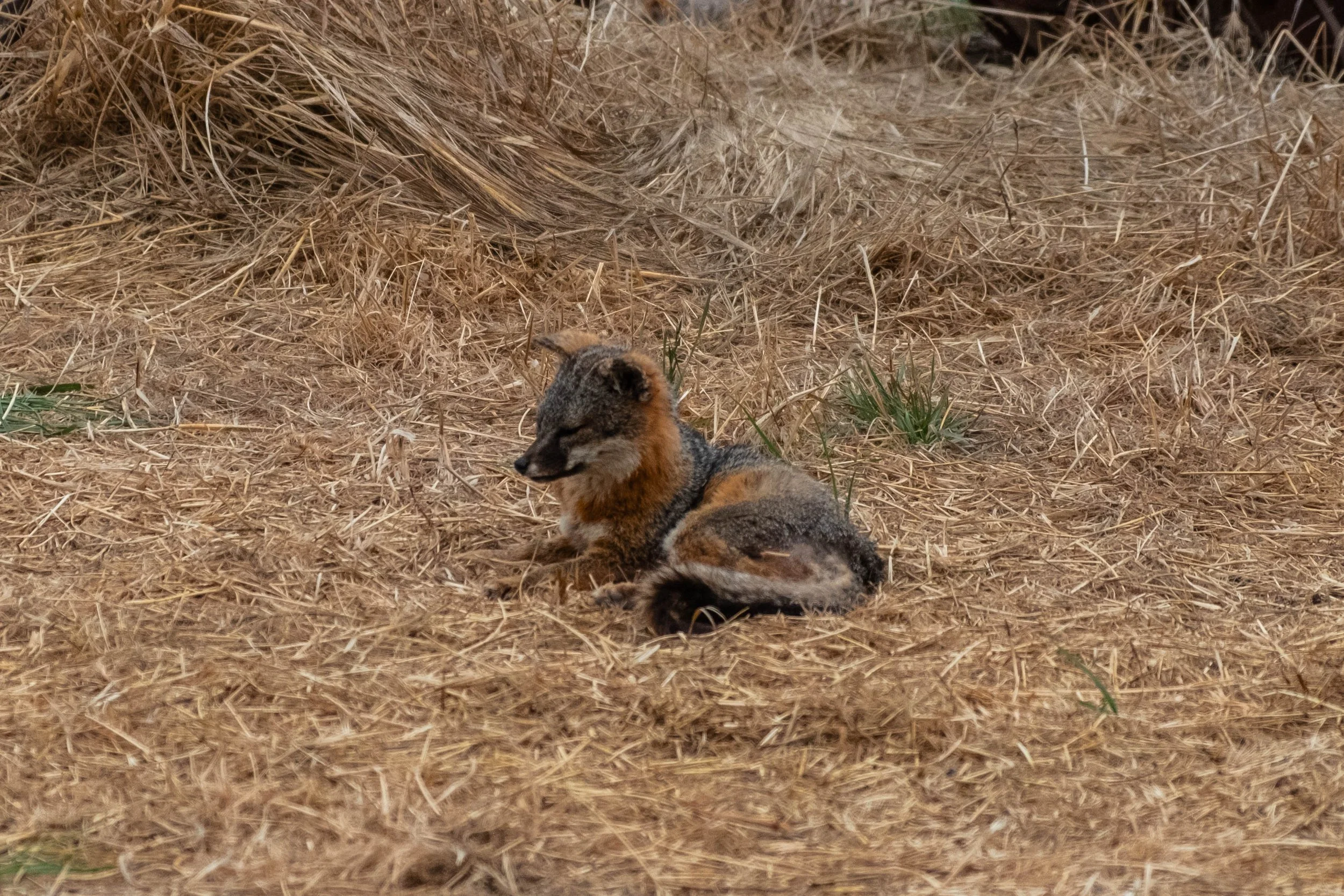
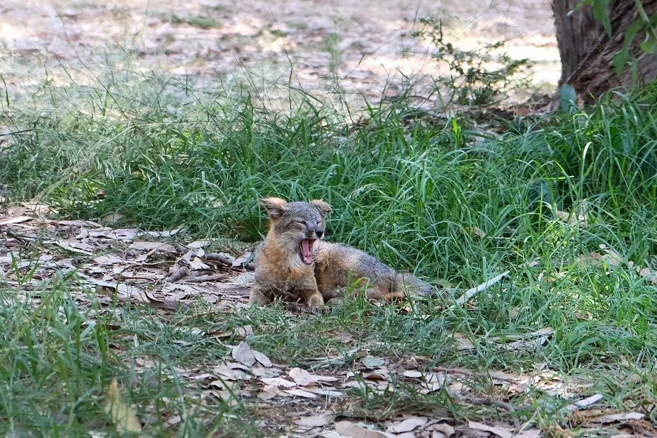
After packing up the tent, which was soaked both from morning dew and the heavy marine layer, we strapped our packs back on to begin the 11.5 mile trek across the remainder of the island. The first couple of miles were peaceful and generally flat as we wended our way through quiet meadows towards Chinese Harbor. We spotted our first tiny island fox on the trail ahead of us, the adorable endemic species that has very little fear of humans and is no larger than a house cat. Eventually, we connected back with the Navy Road and followed this as we slowly wound our way higher and higher. While we couldn’t see far due to the fog, I was surprised by the lush landscape directly around us. It reminded me a little of Volcanoes National Park in Hawai’i with so many gorgeous succulents and hardy vines and wind-twisted bushes and short trees intertwined with each other in nature’s perfectly balanced landscaping.
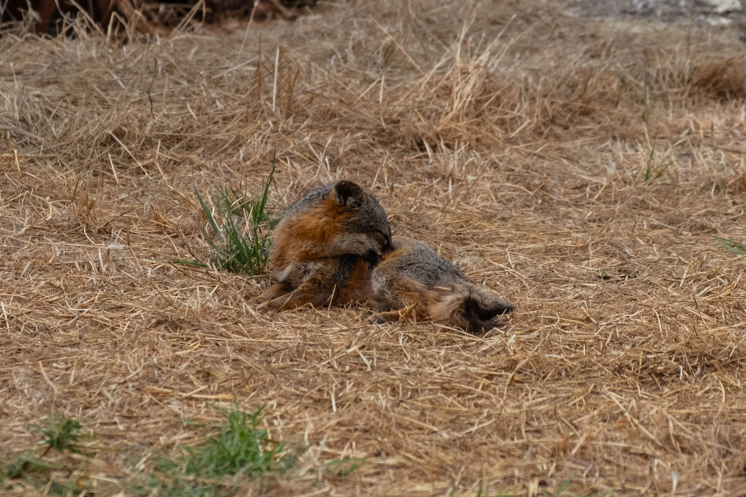
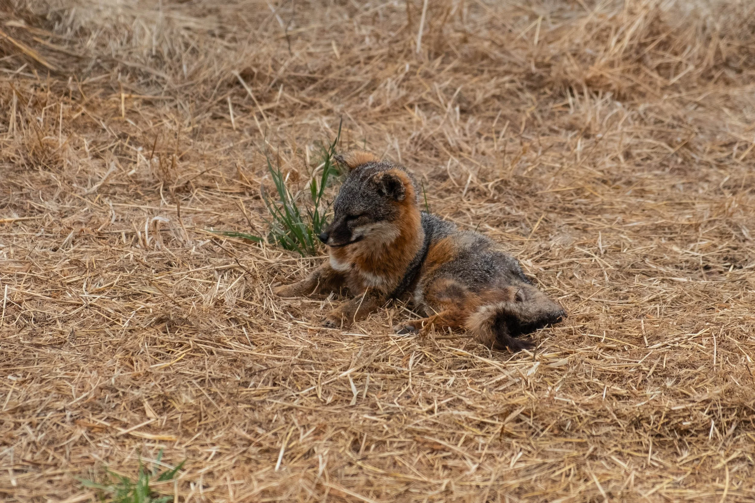
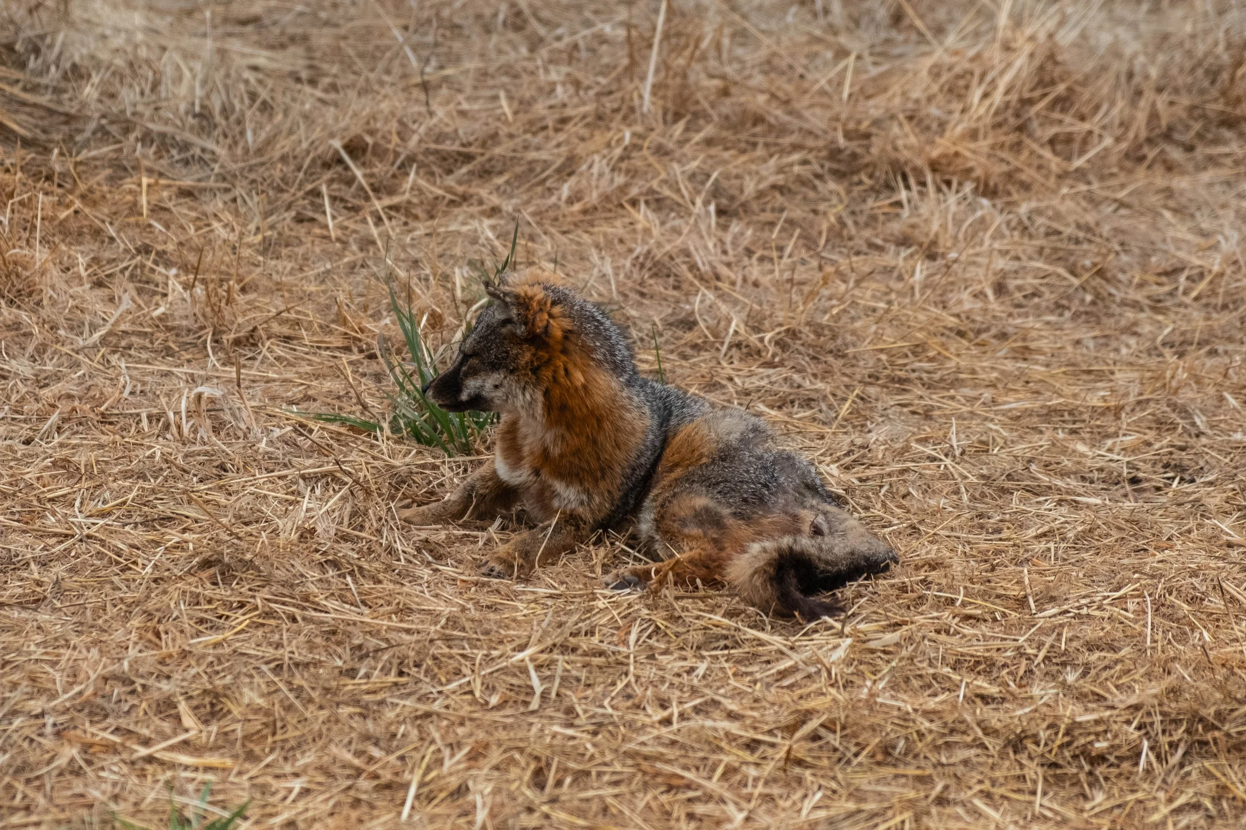
As we approached the halfway point, we were stopped in our tracks by loud noises ahead of us. The squealing and growling grew louder, and we could see lots of jabbering birds following along some commotion in the bushes. At first we were afraid it was a dying (or rabid) island fox; as it turned out, it was two island foxes who were in the middle of a very vocal dispute. All of a sudden they tumbled out of the bushes ahead of us, one a distinct reddish brown hue, the other a fine smoky grey that matched the marine layer. We clapped loudly to alert them to our presence, which ended up effectively breaking up the fight. The two of them immediately ran off, silenced at the sight of us.
We stopped at a severely bowed picnic table located just before the last big climb up the ridge and enjoyed a snack and rest. After this break, we noticed the fog beginning to roll back. It was perfect timing to reveal the gorgeous arid peaks rising around us, so different from the verdant area we’d finished hiking through earlier in the morning. The narrow trail snaked to the left, rising ahead of us to the highest peak on the island. We took our time on the way up; eventually, I stashed my poles so my hands were free for the couple sections where some light scrambling was required. Almost before we knew it, we found ourselves on the final ascent to the top, high fiving each other at the accomplishment.
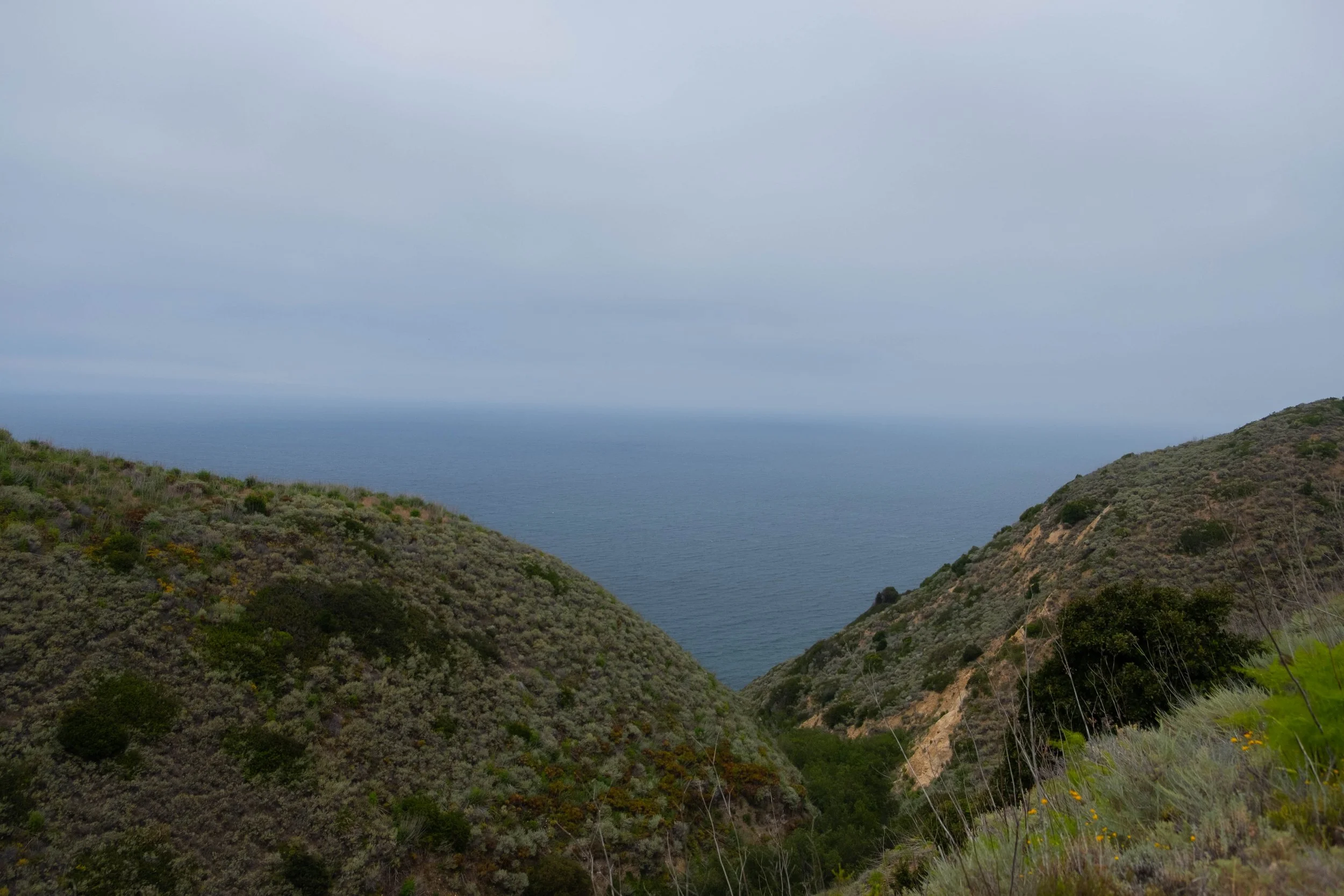
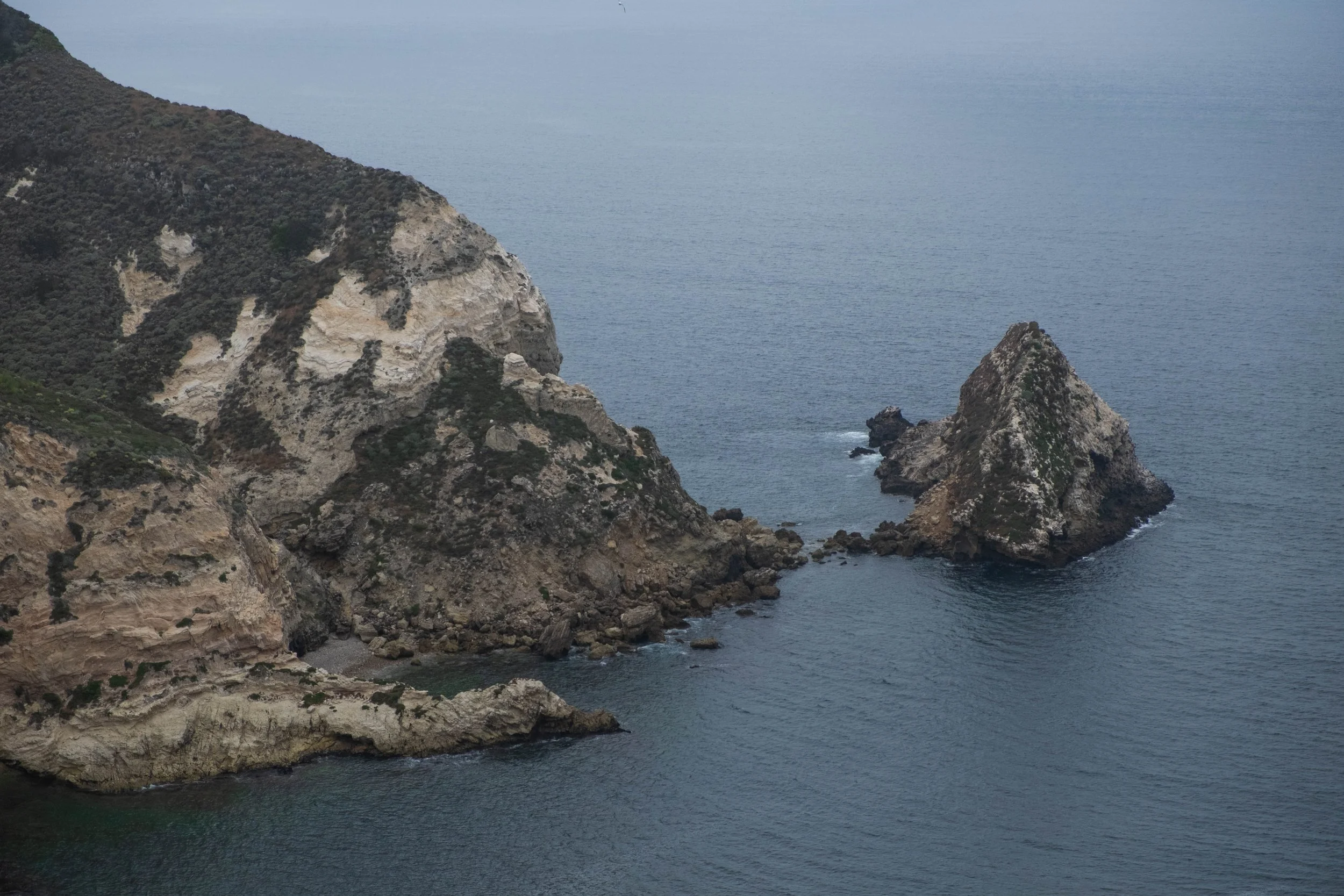
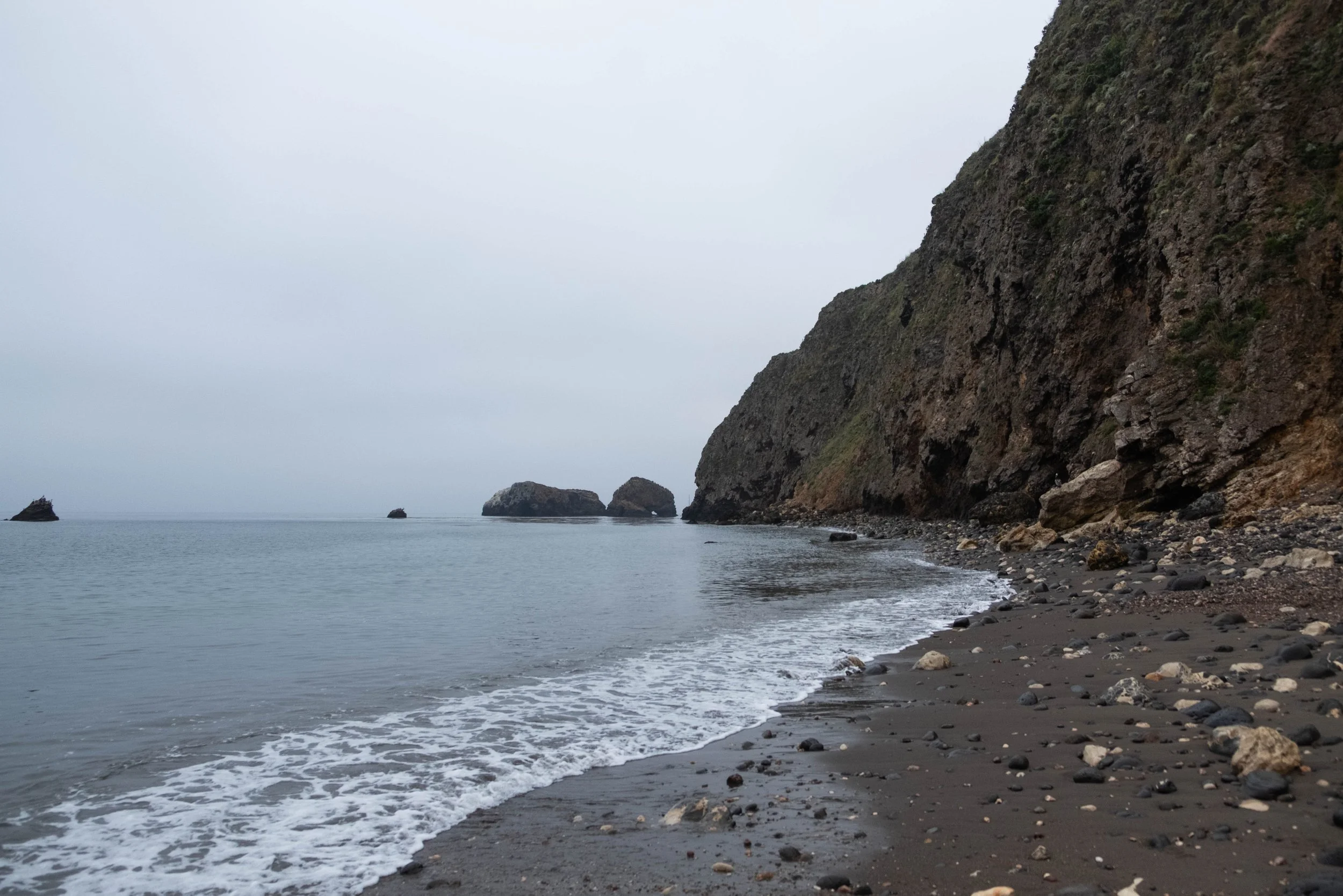
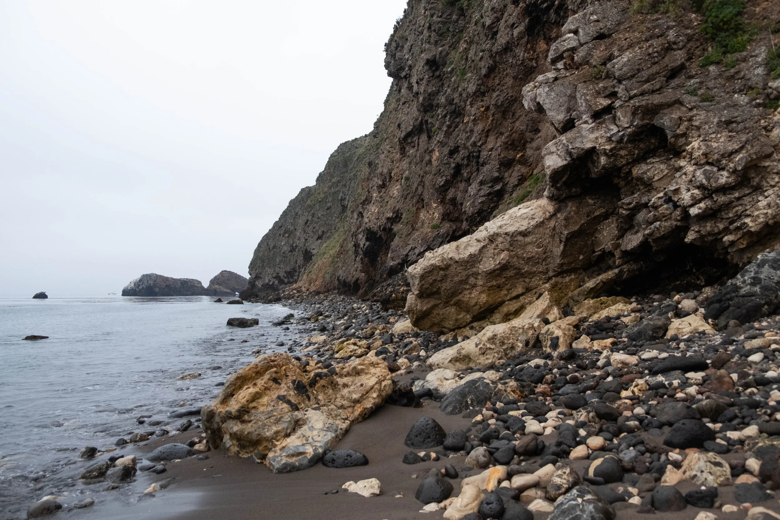
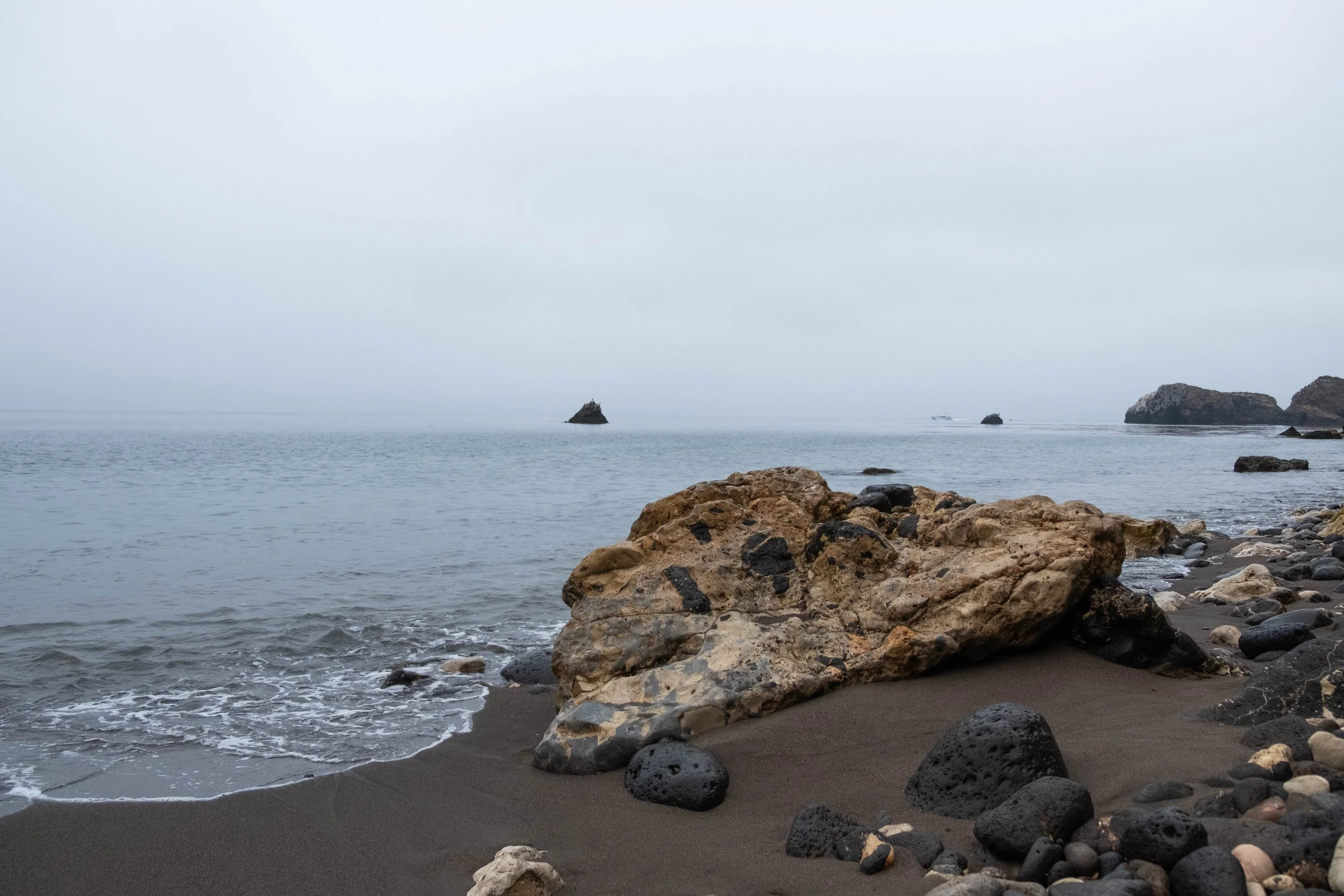
From there, we had two options for our descent: The first was a direct trail down through Scorpion Canyon to the campground, the second was a slightly longer route that followed the ridge line a bit further before dipping down and reconnecting with the coastal cliffs. Option 2 also allowed hikers to intersect with Potato Harbor, a scenic cove that we’d heard was well worth the trip. When we reached the fork in the trail, we checked in with each other on our preferences for the descent based on current energy and water level and decided to tackle the longer route to see Potato Harbor.
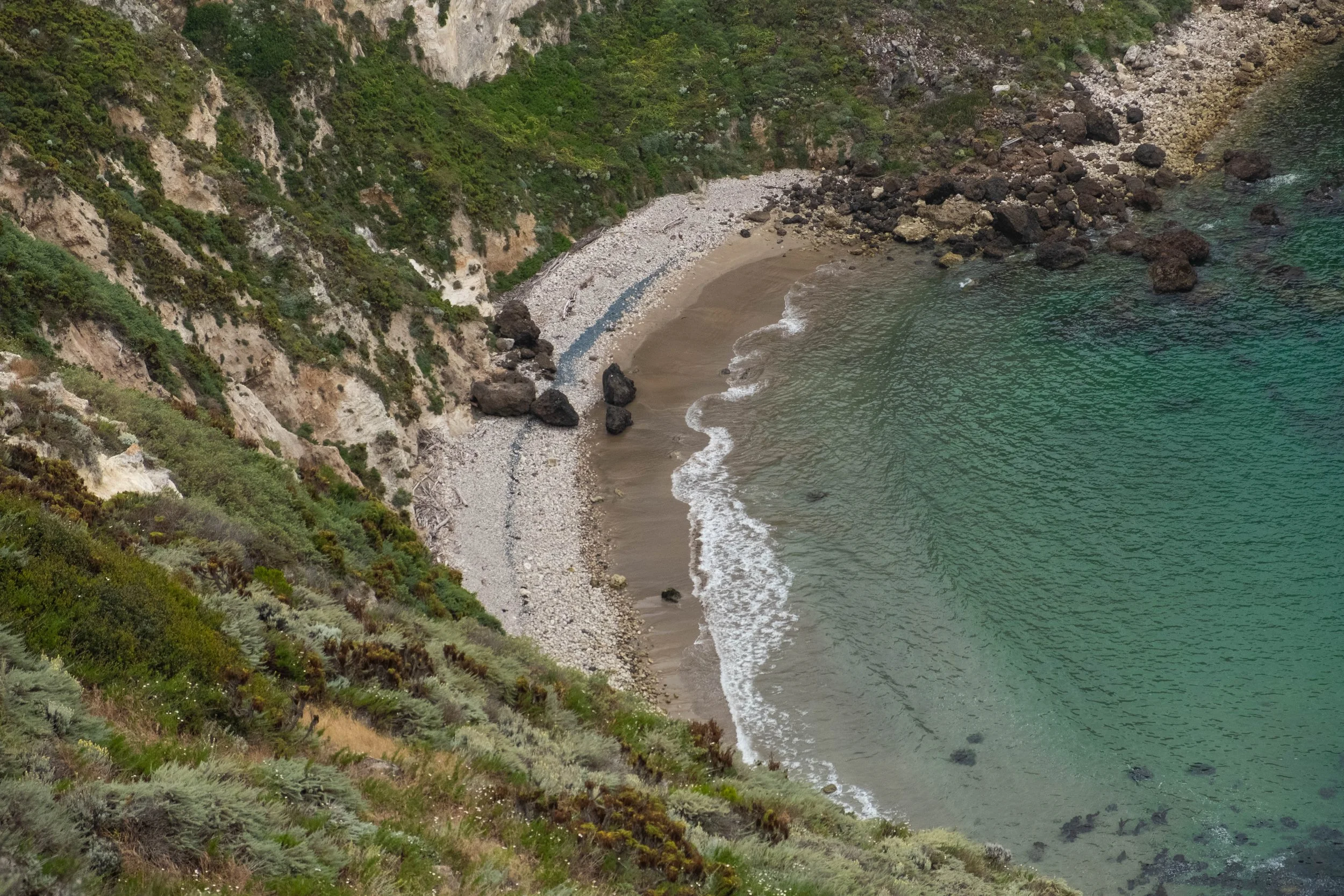
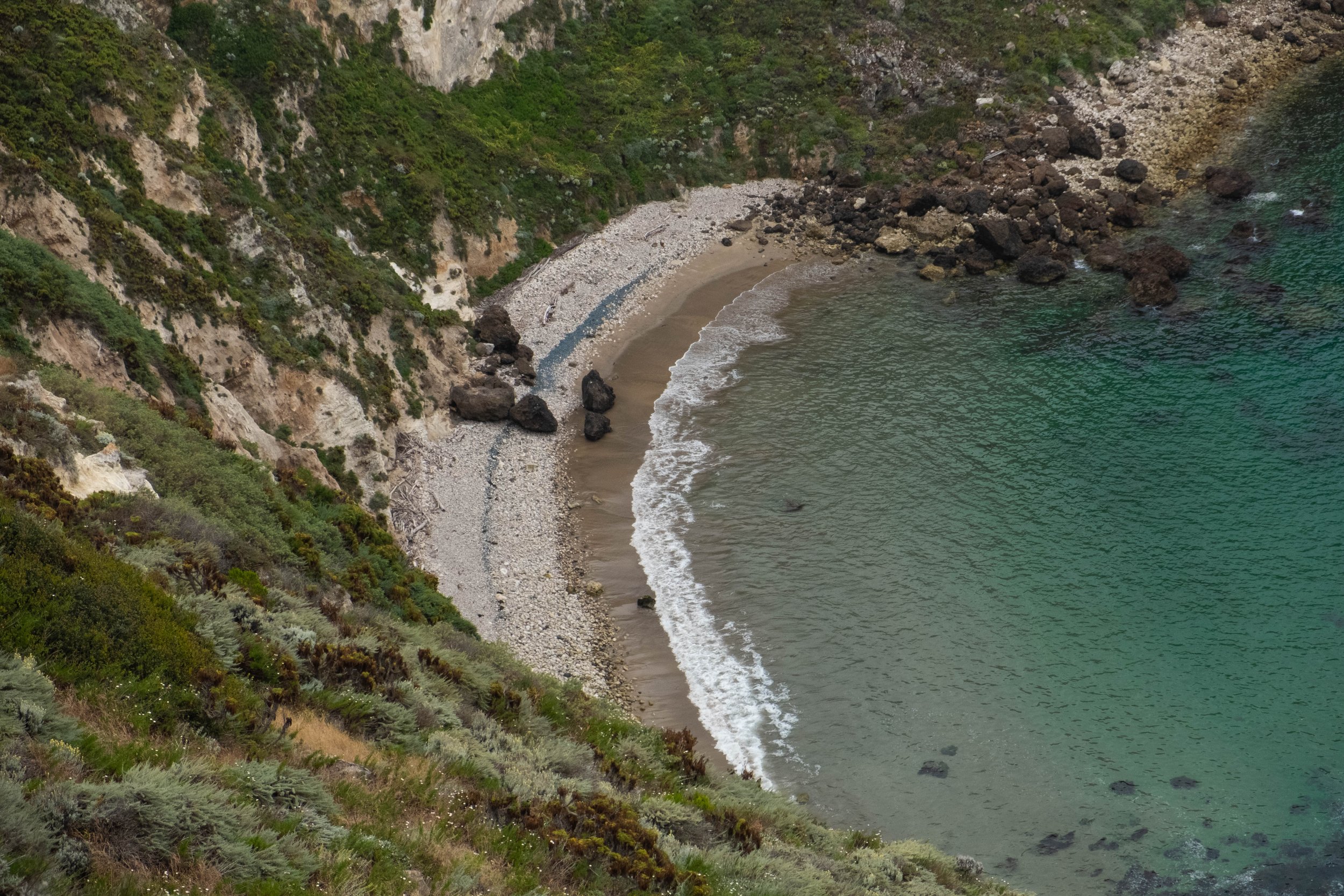
I couldn’t recommend this route more! After a bit more time on the ridge, we left the clear conditions up at the summit and descended into a beautiful foggy meadow filled with wispy (and sadly, invasive) yellow mustard. Once at Potato Harbor, it cleared up just enough for us to see the gorgeous harbor below us. The striking white cliffs contrasted with the blue-green water, the wildflowers bobbing in the wind, and the green shrubs and grasses. A sea lion could be heard barking far below us as we sat and relished the view.
From there, it was a quick final push to Scorpion Campground. We spent the remainder of the afternoon and evening walking by the water in Scorpion Anchorage; exploring a mile or so up Scorpion Canyon, which was very whimsical in the evening light; and delighting in having access to unlimited water and a warm freeze-dried meal for dinner. We ended the evening with two cups of tea to counter the chilly evening wind and a few wedges of ube macadamia coconut cream chocolate that my friend had been saving to share since her visit to Maui in February. We went to bed feeling tired in the best ways and filled with gratitude for what the day had held.


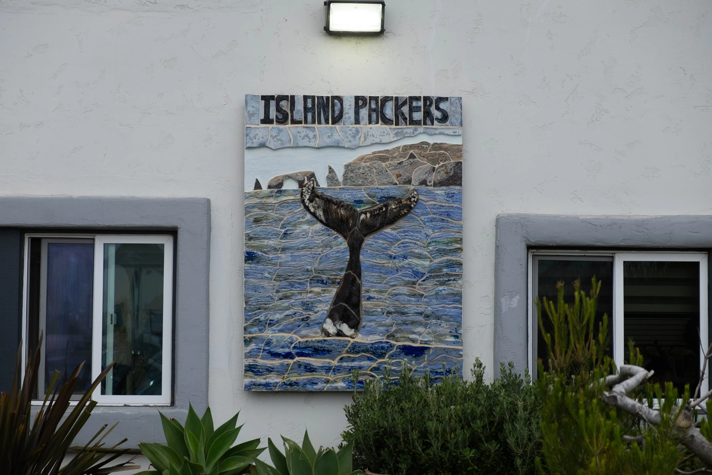
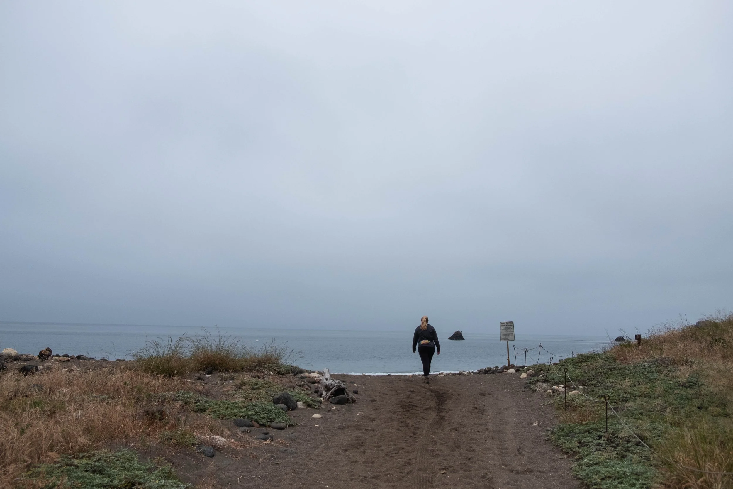
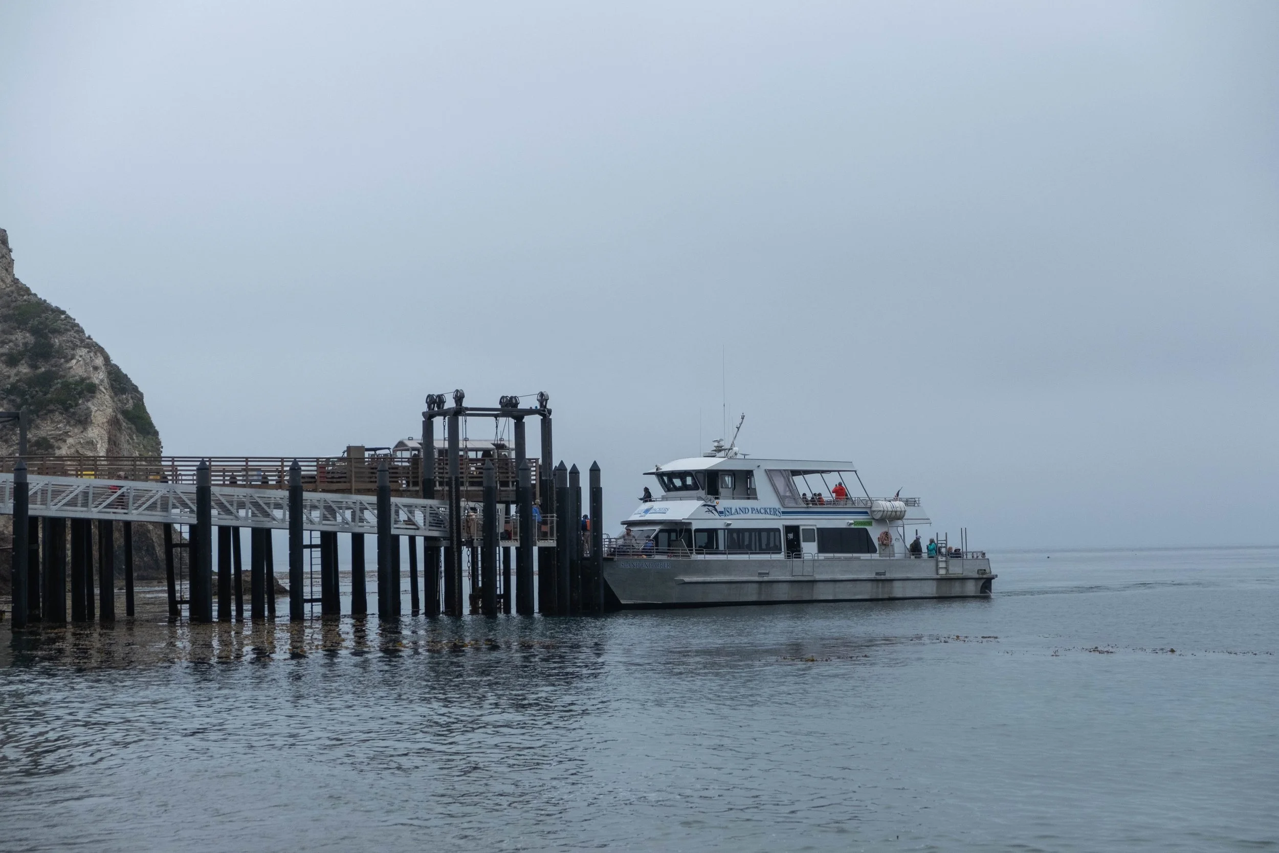
Day 3 | Scorpion Ranch to Ventura via Island Packers Ferry
Morning dawned quiet, cool, and predictably foggy, without a whisper of wind. After preparing oatmeal and coffee for breakfast, we walked back down to the rocky beach to watch the first two ferries of the day arrive with day trippers. On our way, we were treated to seeing an island fox hunting (and catching) a mouse.
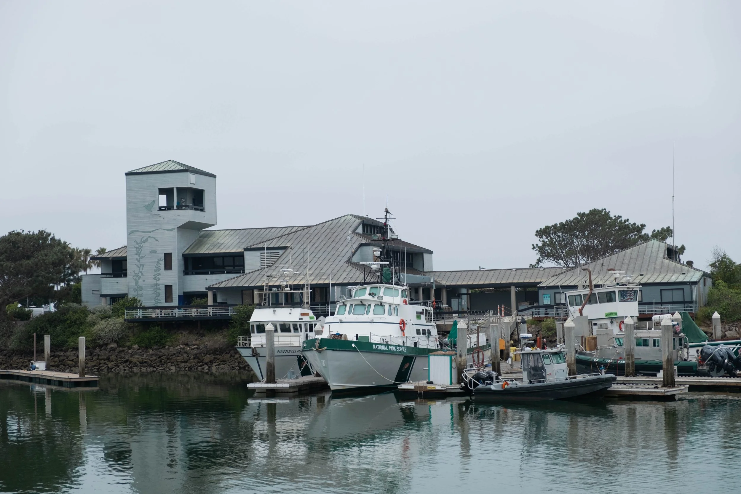
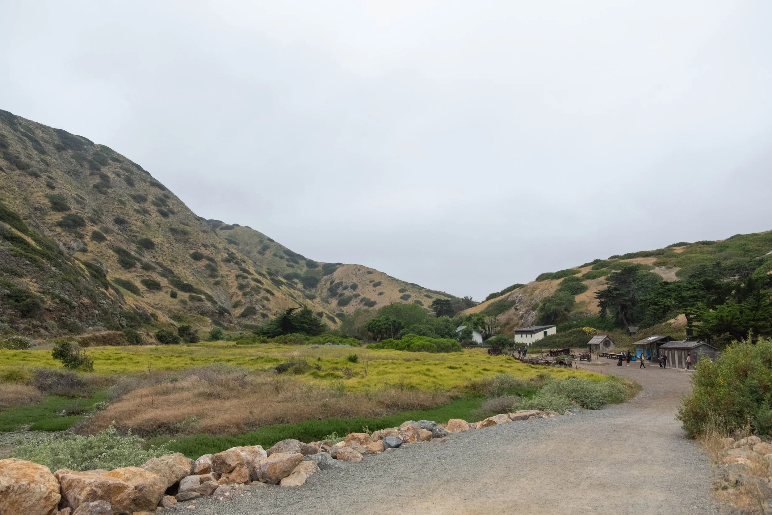
We took our time going through the small visitor center, both of us focusing especially on the recordings from Chumash leaders on the historical and current relationship between the Chumash and Santa Cruz Island. I learned from the oral history that the Chumash of SCI view the dolphins in the surrounding channel as their brothers and sisters; something that made our subsequent sightings of dolphins feel even more meaningful.
As we waited for our ferry to arrive a bit before noon, I squeezed in one last short hike up the bluff near the pier to say my goodbyes to this special place. Once I saw our ferry approaching, I descended and joined the rest of the campers who were on their way back to Ventura.
The trip back felt quick and included entertainment from playful dolphins and spotting a fin whale from afar. After we docked and collected our gear, we swung by the visitor center to pick up a few obligatory stickers and a magnet, feeling torn between our desire for a shower and holding on to the last vestiges of what had been a wonderful trip. Eventually, showers won. We took our leave, grateful for what our days on the island had held and the ways we had been changed by what we did and saw there.

First Visit | September 2022
This is a sad one — as I undertook the task of tracking down and organizing thousands of photos from the last 10 years, I eventually came to the sad realization that somehow, someway, my pictures of our trip to the Channel Islands in 2022 had been lost. Below are low-res downloads of the couple photos I had saved on Instagram.
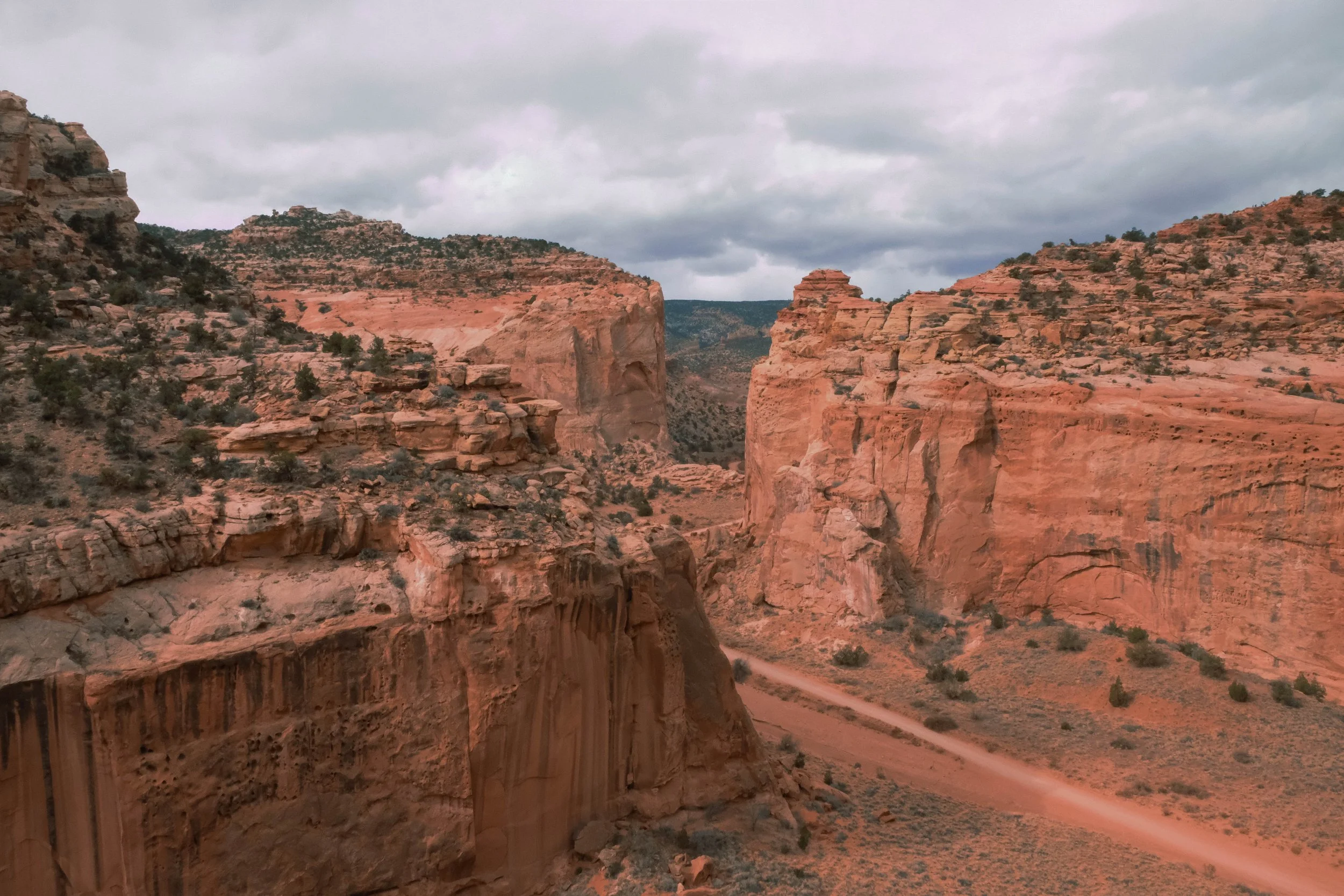
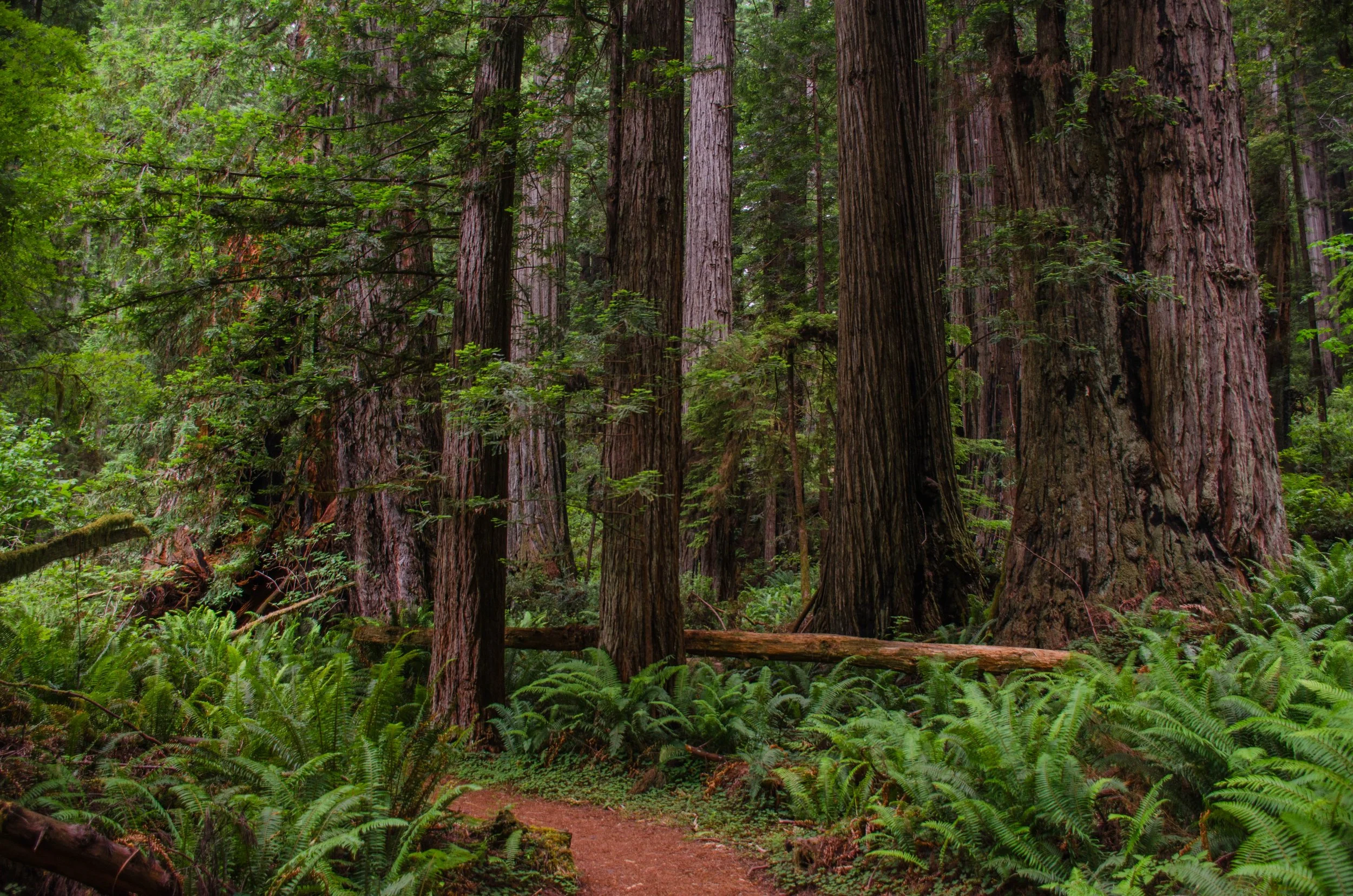
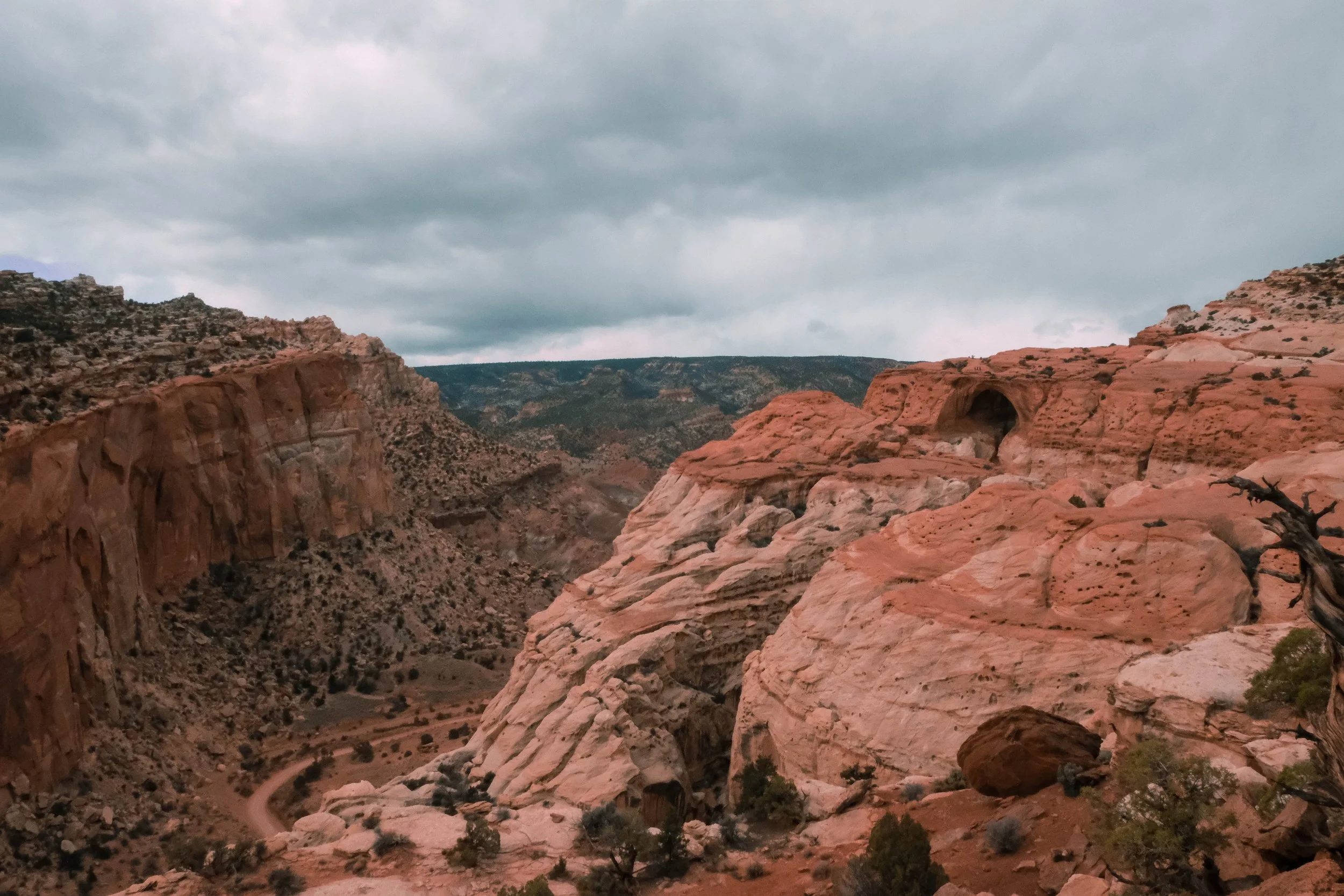
Capitol Reef
Park 24 | March 2023
Part + Park 3 (of 3) on our spring break road trip.
It’s trippy to hike, drive, and sleep in places that used to be covered by the salty water of a shallow sea. There were many times during our days in this park that I wondered if I was sleeping where a whale used to swim past. How wild that the rocks around us used to be part of a watery ecosystem and now make up a hot, dry desert landscape.
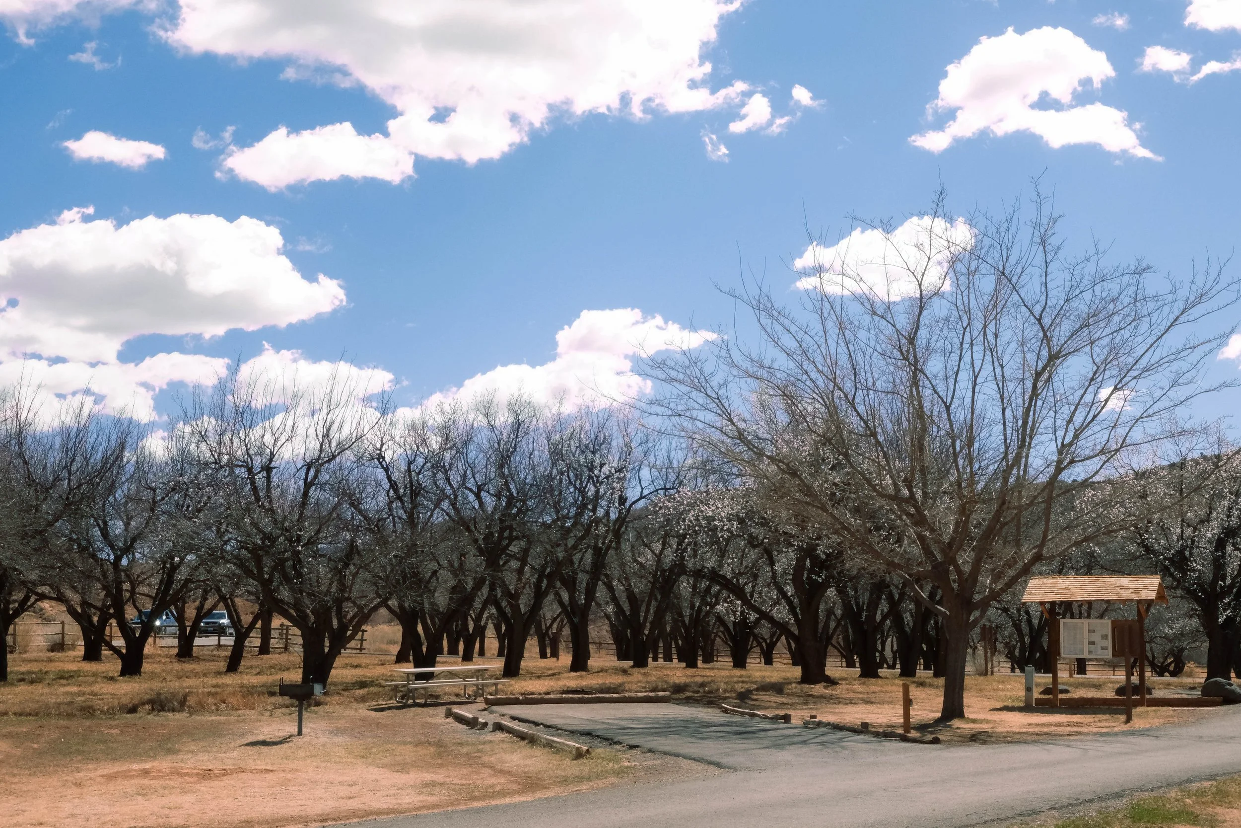
Capitol Reef is brimming with adventures and as the least-visited Utah national park, there are fewer humans to contend with for parking at trailheads or campsites. We explored slot canyons and completed miles upon miles of hiking, paired with the kind of deep conversation that emerges after days together on the road and out on the trail. We saw petroglyphs from the ancient Fremont Culture. Some of the darkest skies in North America coaxed us out of our tent at 4am to be astonished by the Milky Way shimmering down — more luminous and bright than I could recall having seen before. Springtime orchards, a remnant of the small Mormon settlement first established near Fruita Campground in the 1860s, bloom in the desert and act as a shelter for local deer. Pancakes sizzled in our pan during the cool of the morning while we sipped mugs of hot coffee. And we found ourselves driving over an hour to buy campfire wood from a gas station that is literally carved into the side of a red rock mountain. Utah is such a unique mixture of odd quirks and breathtaking vistas.
J would come back here in a heartbeat; he loves the stillness and peace of the desert and the clear nighttime skies. I still prefer a little more greenery and water than Capitol Reef can offer, but would be hard-pressed not to return if the opportunity arose.
Pictured below:
Fruita Campground.
Cassidy Arch hike.
Grand Wash hike.

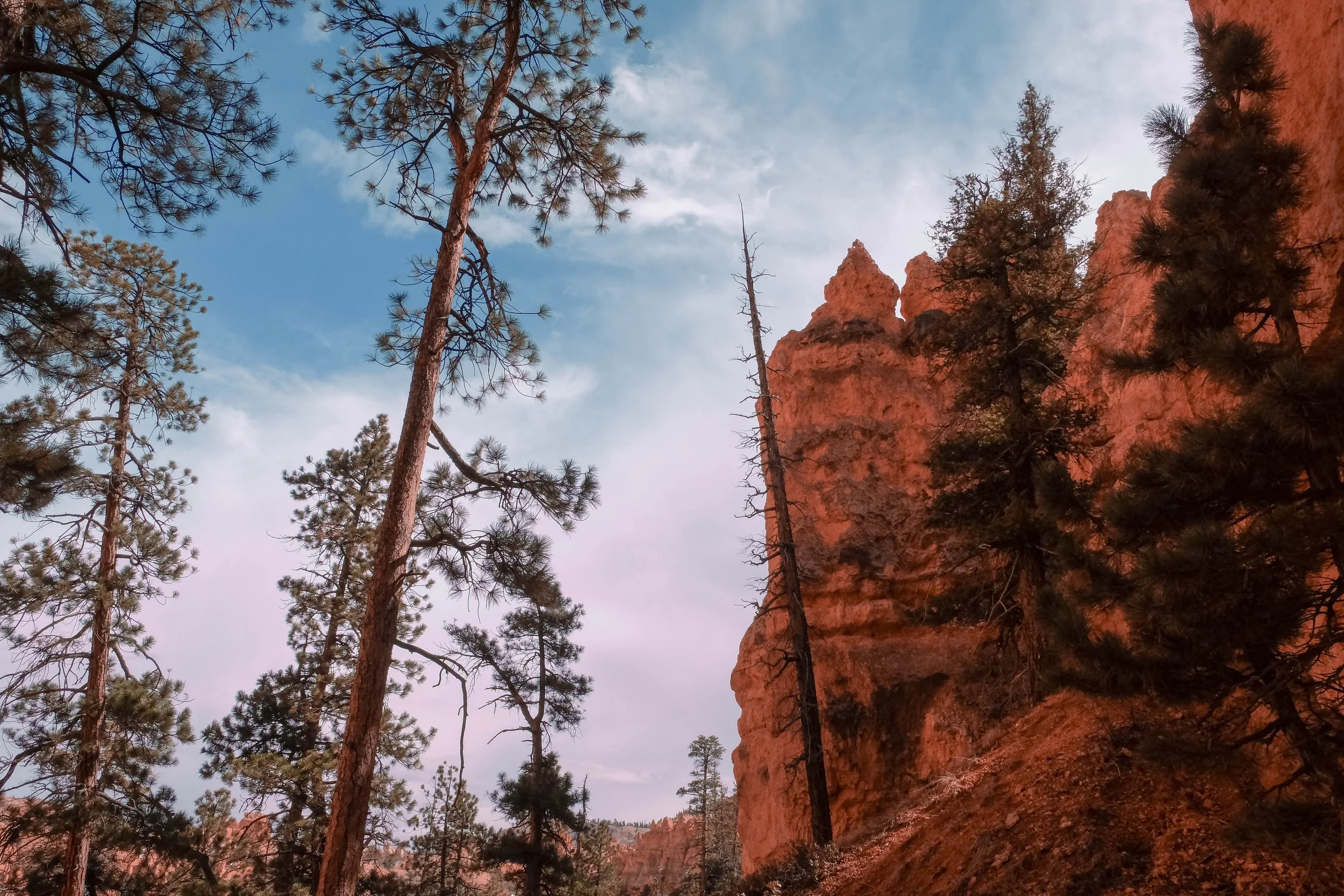
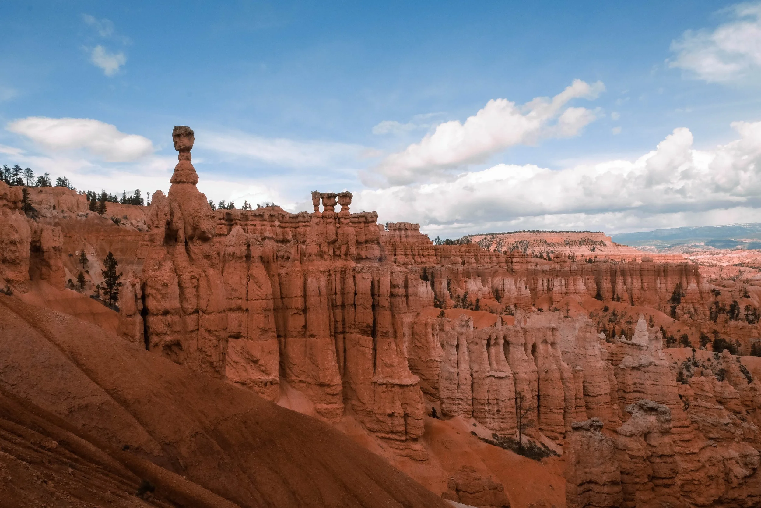
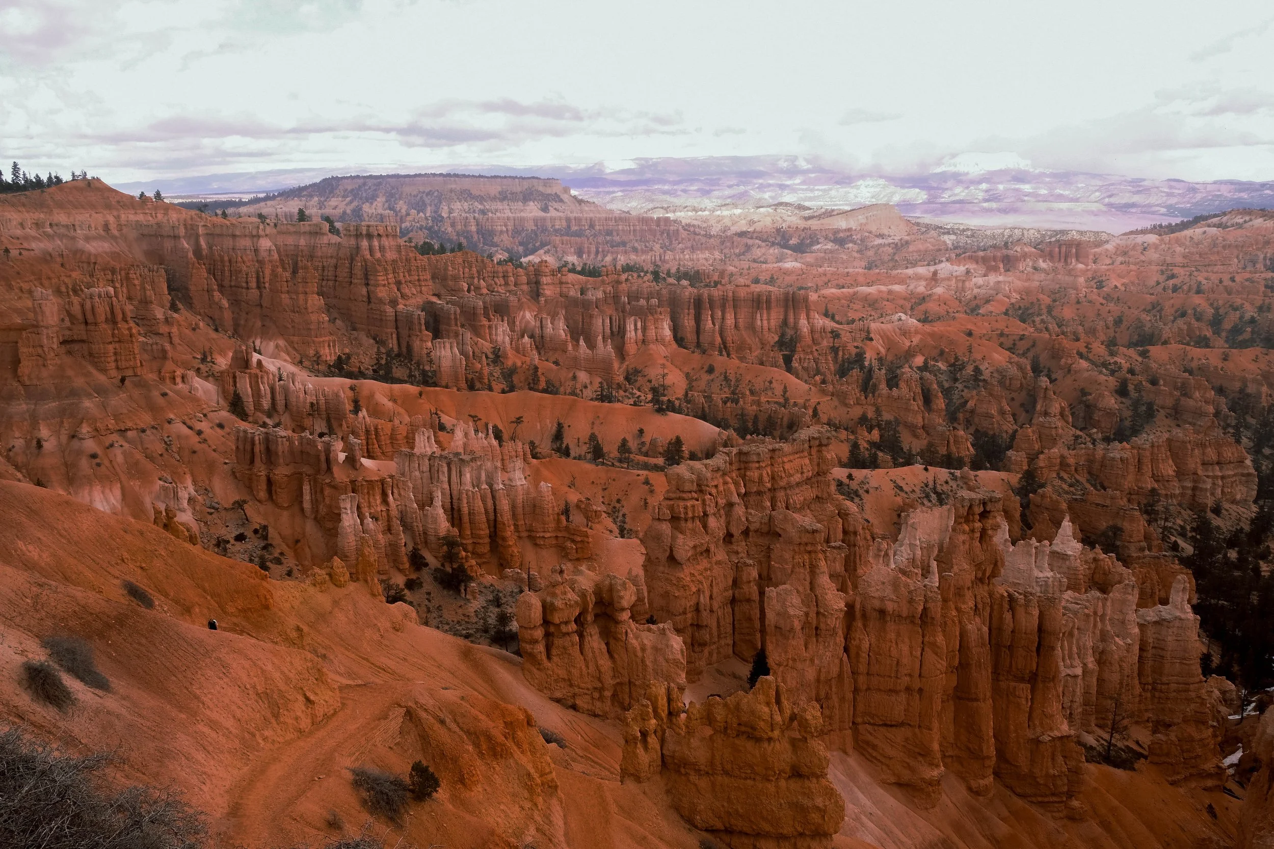
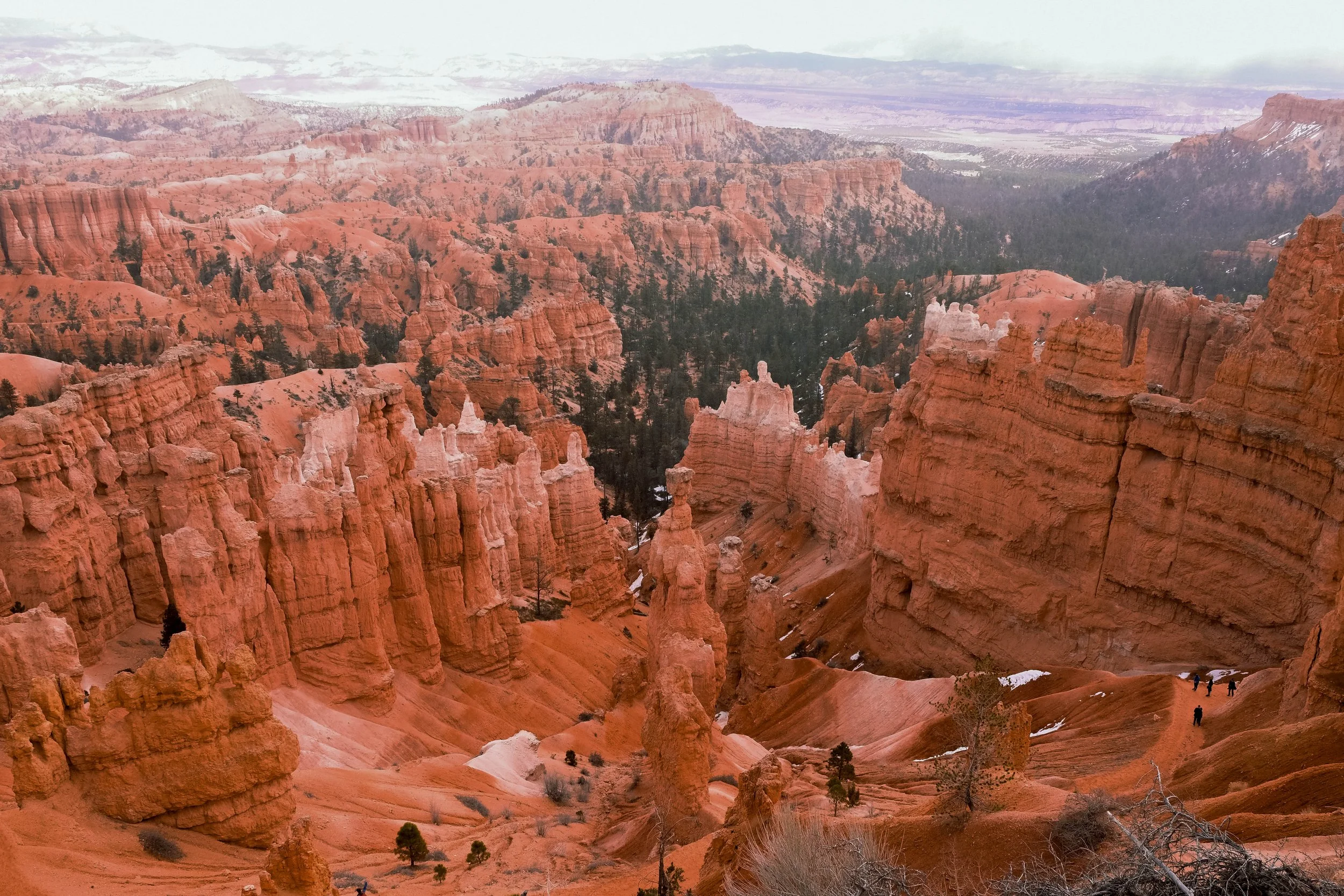
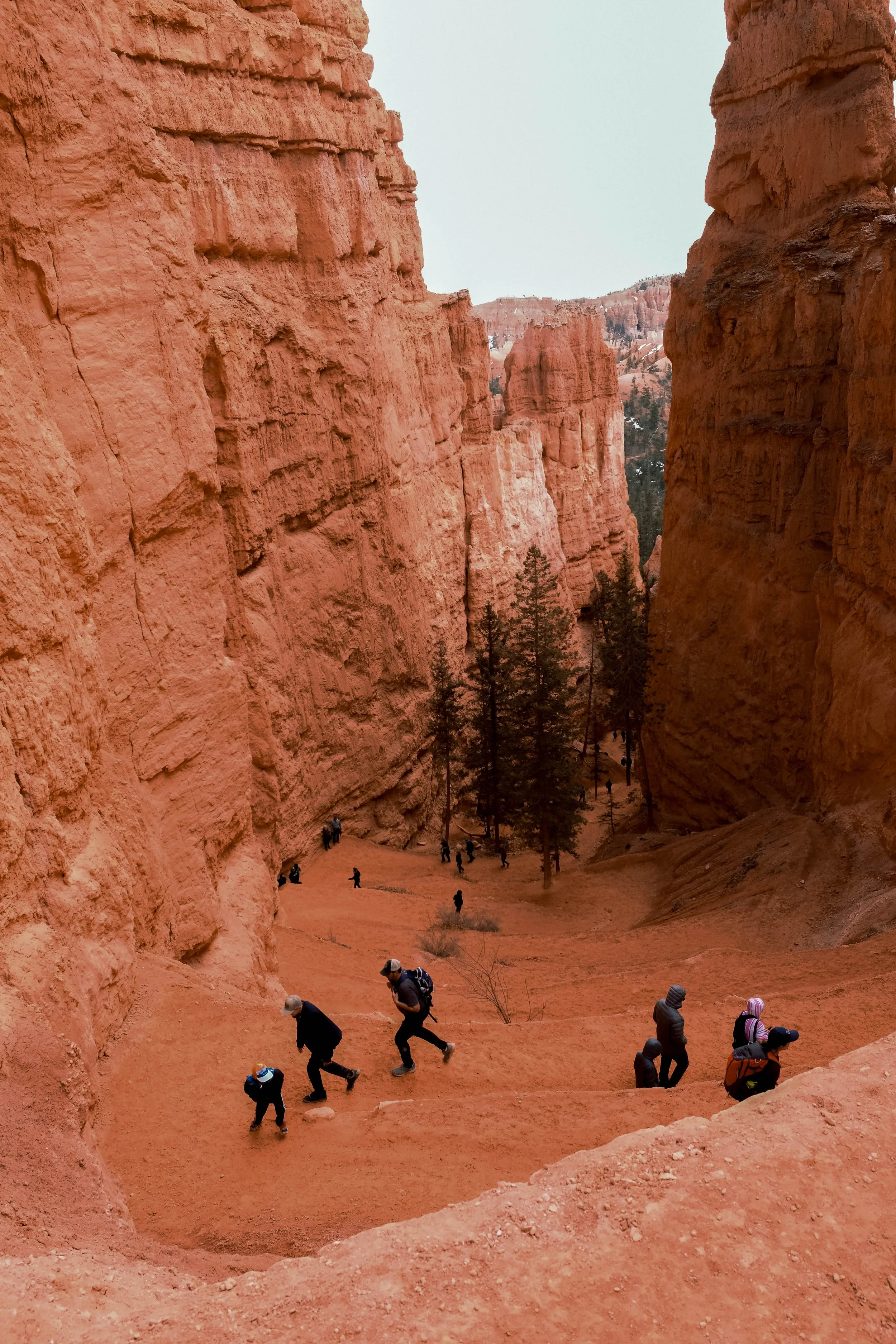
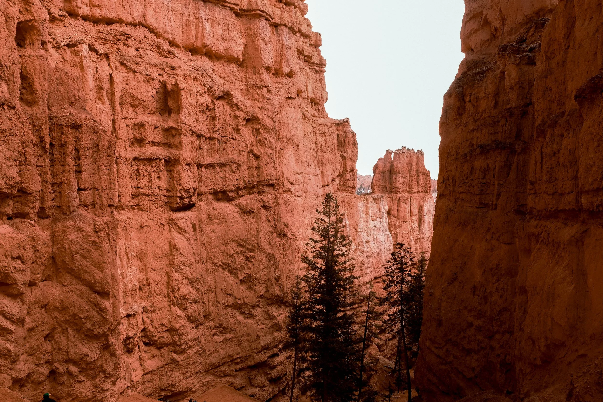
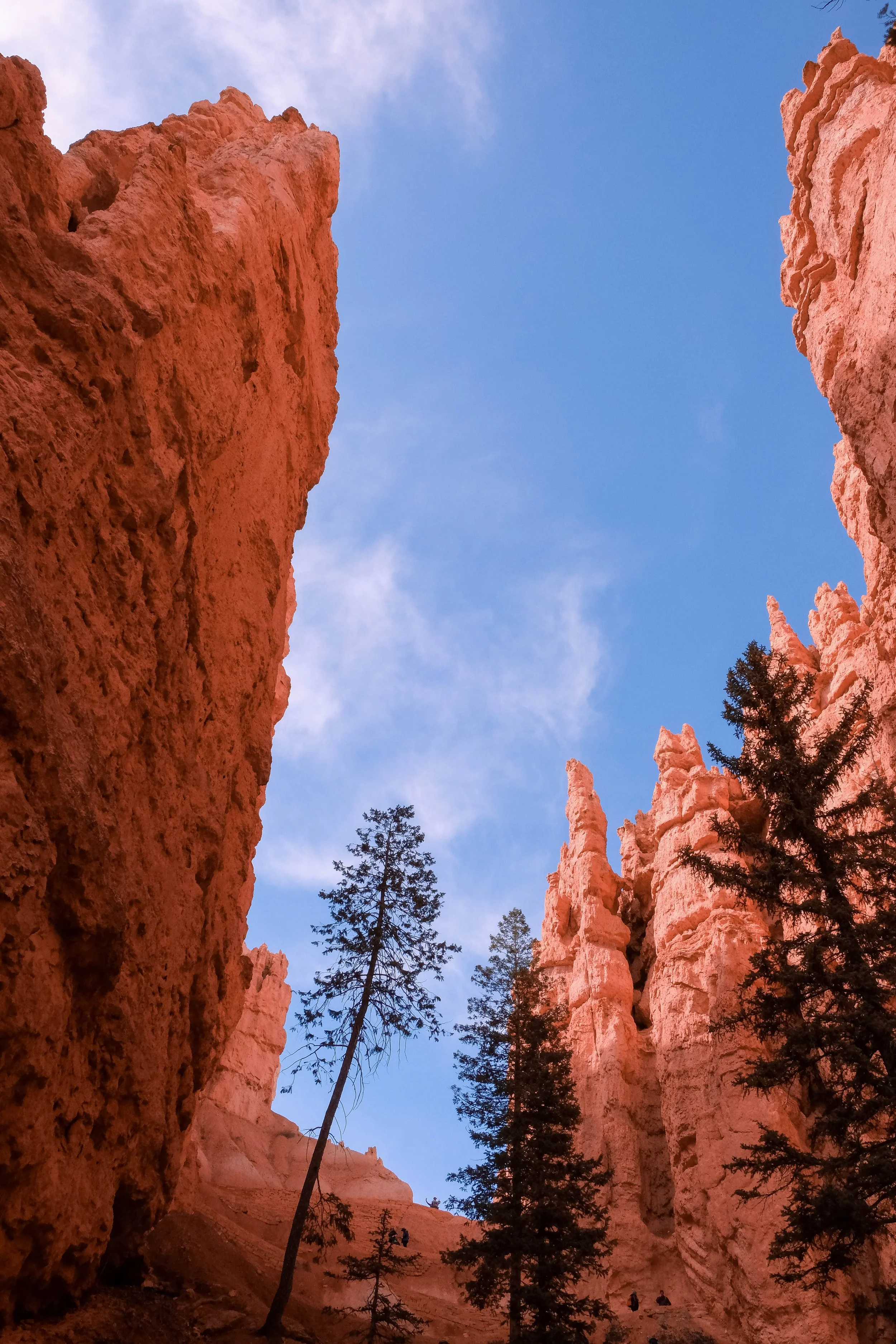
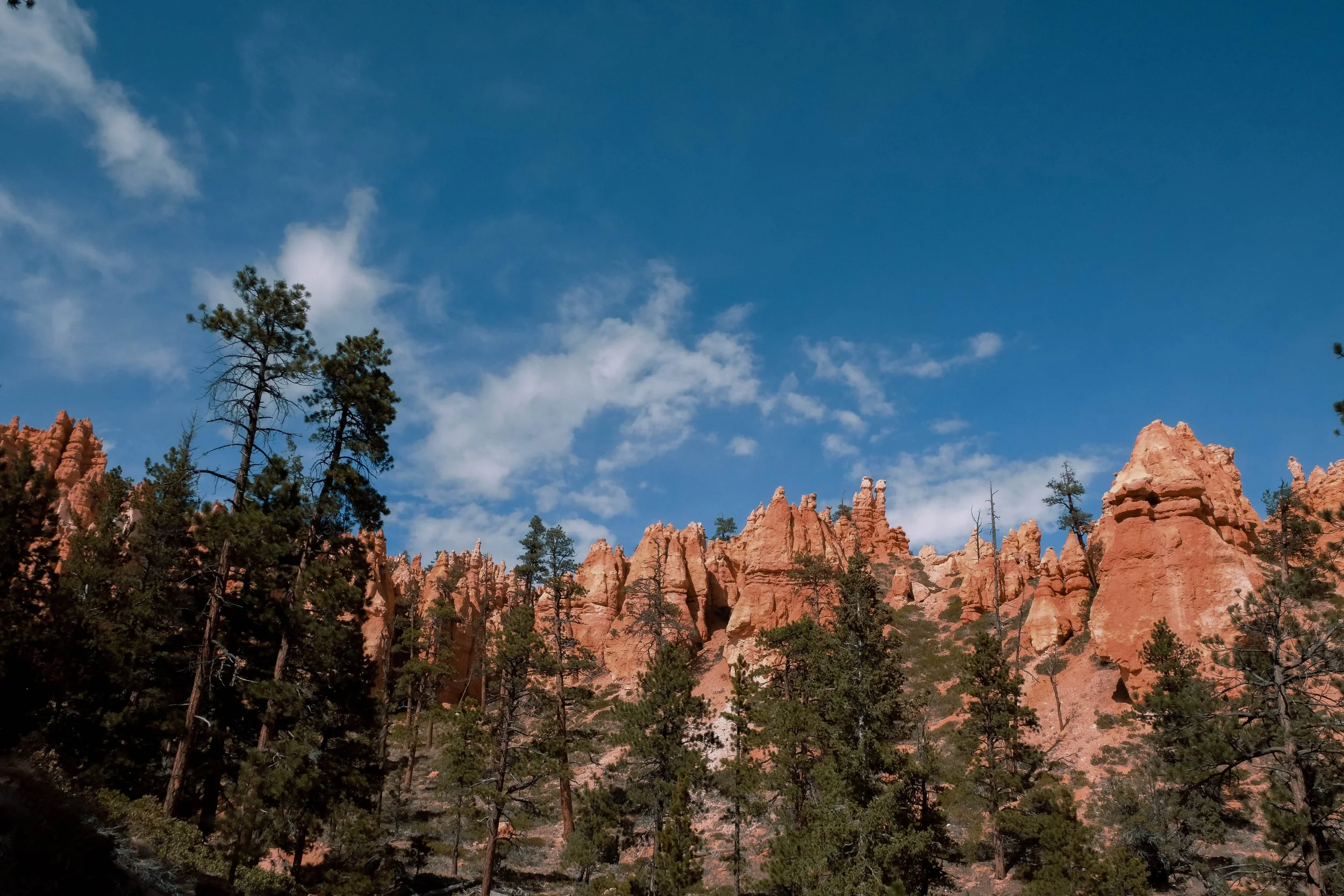
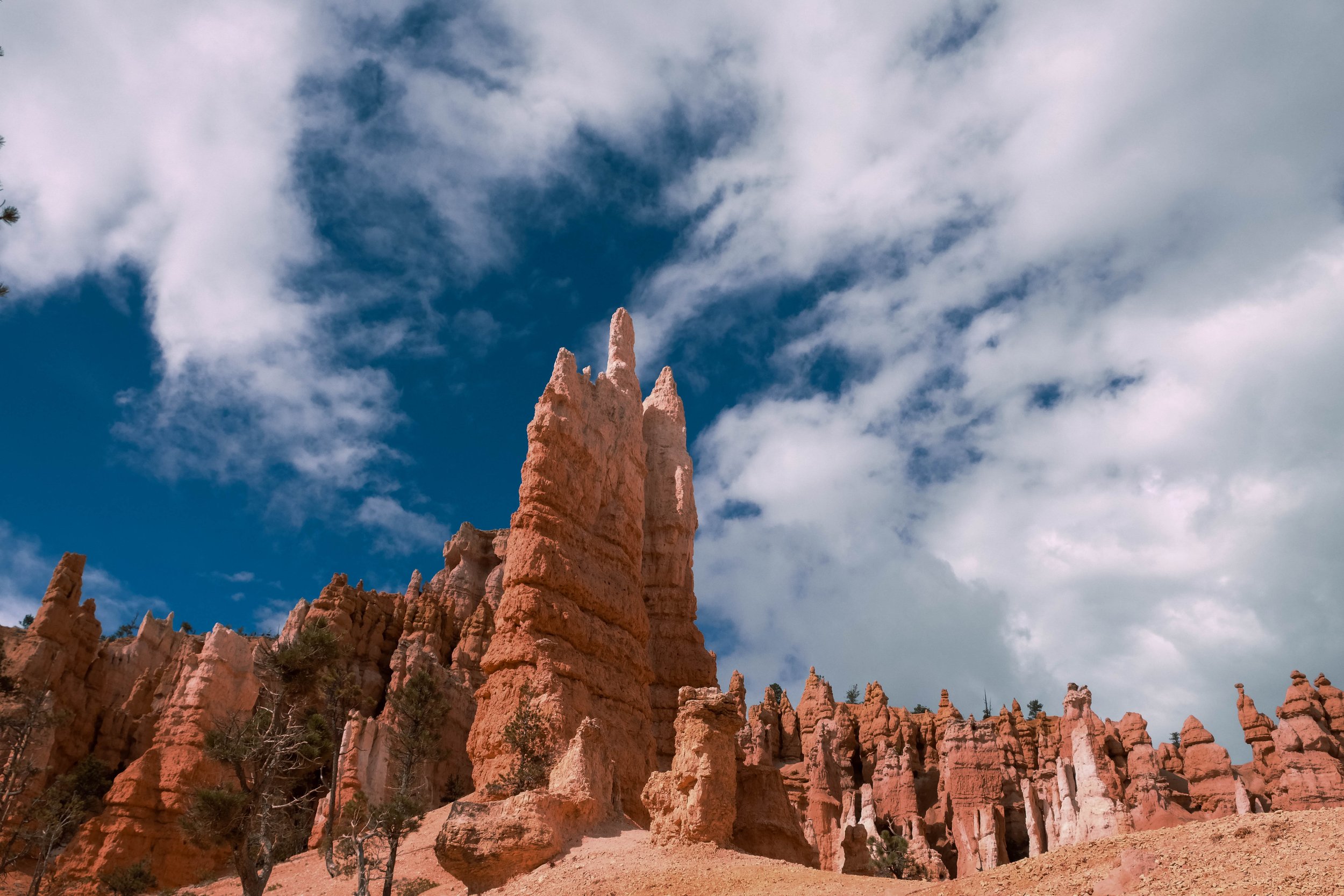
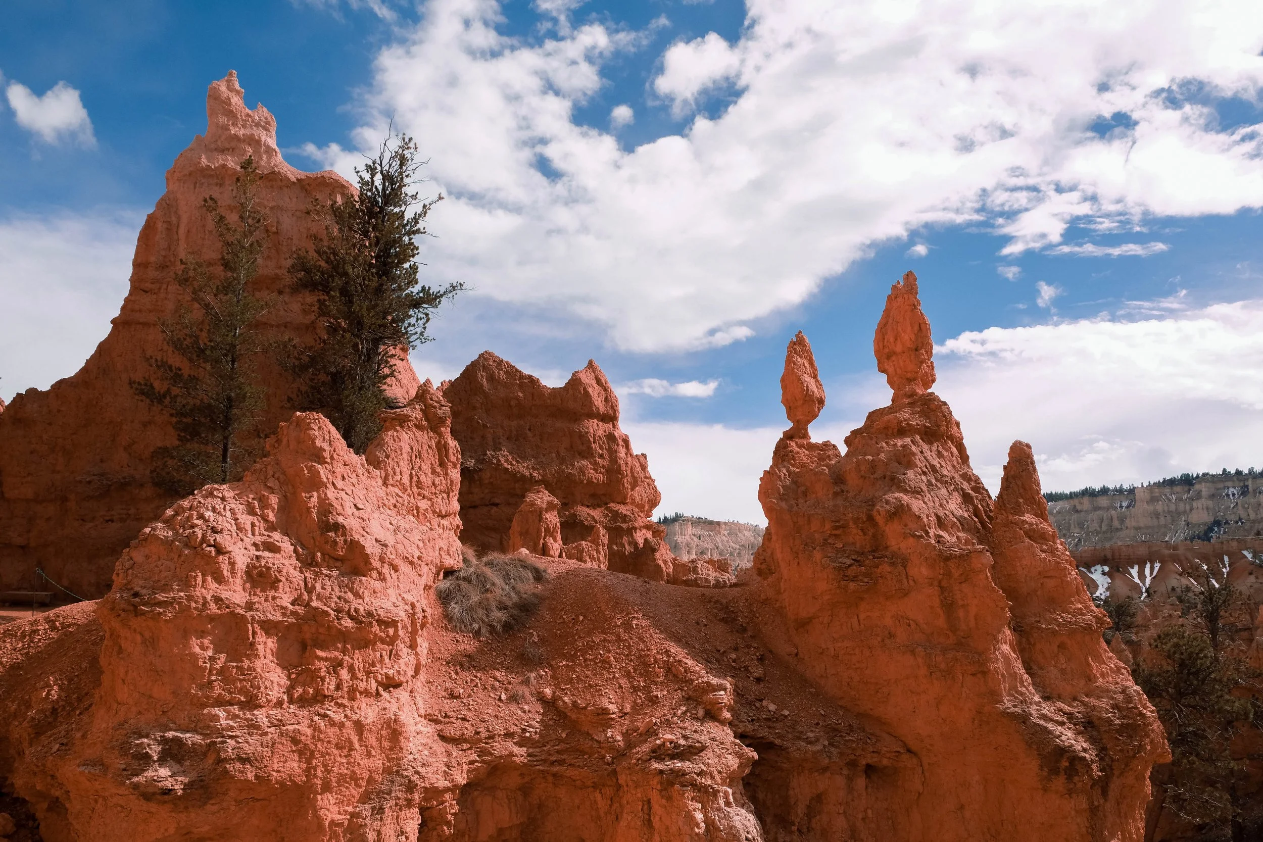
Bryce Canyon
Park 23 | March 2022
Part + Park 2 (of 3) on our spring break road trip.
Bryce Canyon National Park in the early spring was a place of stillness. Snowflakes drifting down from the sky while standing at Sunrise Point followed by sunshine so warm and intense at the bottom that we shed our layers down to our tee-shirts.
Bryce Canyon earned its name from Ebenezer Bryce, a Scottish immigrant Mormon who originally moved to the region at the behest of the Mormon Church and raised cattle in the area. Although we found it tiresome that the national park was officially associated with him (we couldn’t come up with a name honoring the landscape? or gained permission to use one of the names applied to this place since time immemorial from any of the many Indigenous peoples who live(d) and hold ceremony in this area?) we did find Bryce’s famous quote about the canyon to be hilarious: “Hell of a place to lose a cow.”
The park contains the world’s largest concentration of hoodoos, the tall thin rock spires that it is best known for. Overall, our takeaway from our day spent here — in the visitor center, on the rim, down beneath the shadow of the hoodoos — was that the land here feels heavy with meaning. It is, as we learned, a place with great cultural and spiritual significance to many Indigenous Peoples including the Southern Paiute, Hopi, Zuni, Ute, and Navajo. This guided us to walk softer and view our time spent here with reverence, gratitude, and care.
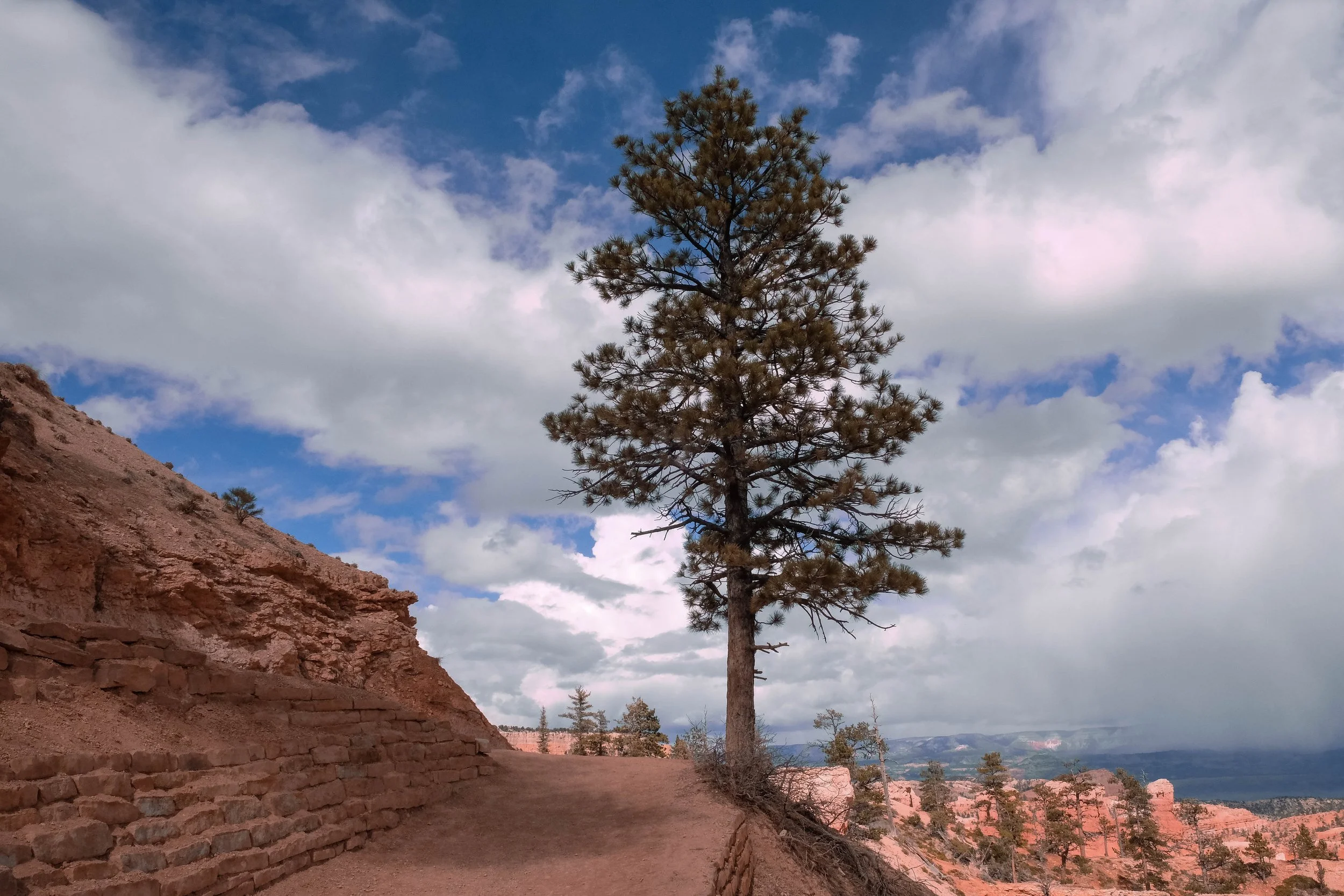
Pictured below:
Sunset to Sunrise Point.
Rim Trail and Peek-a-boo Loop Trail.
North Campground.
Zion
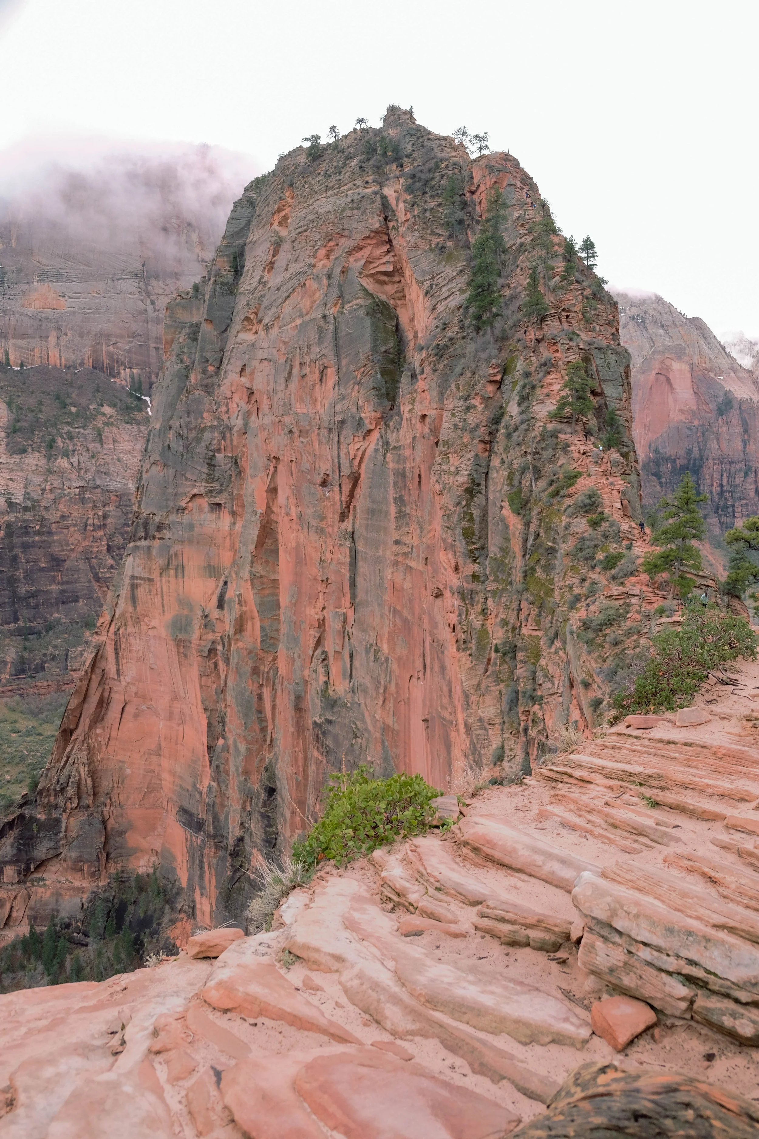
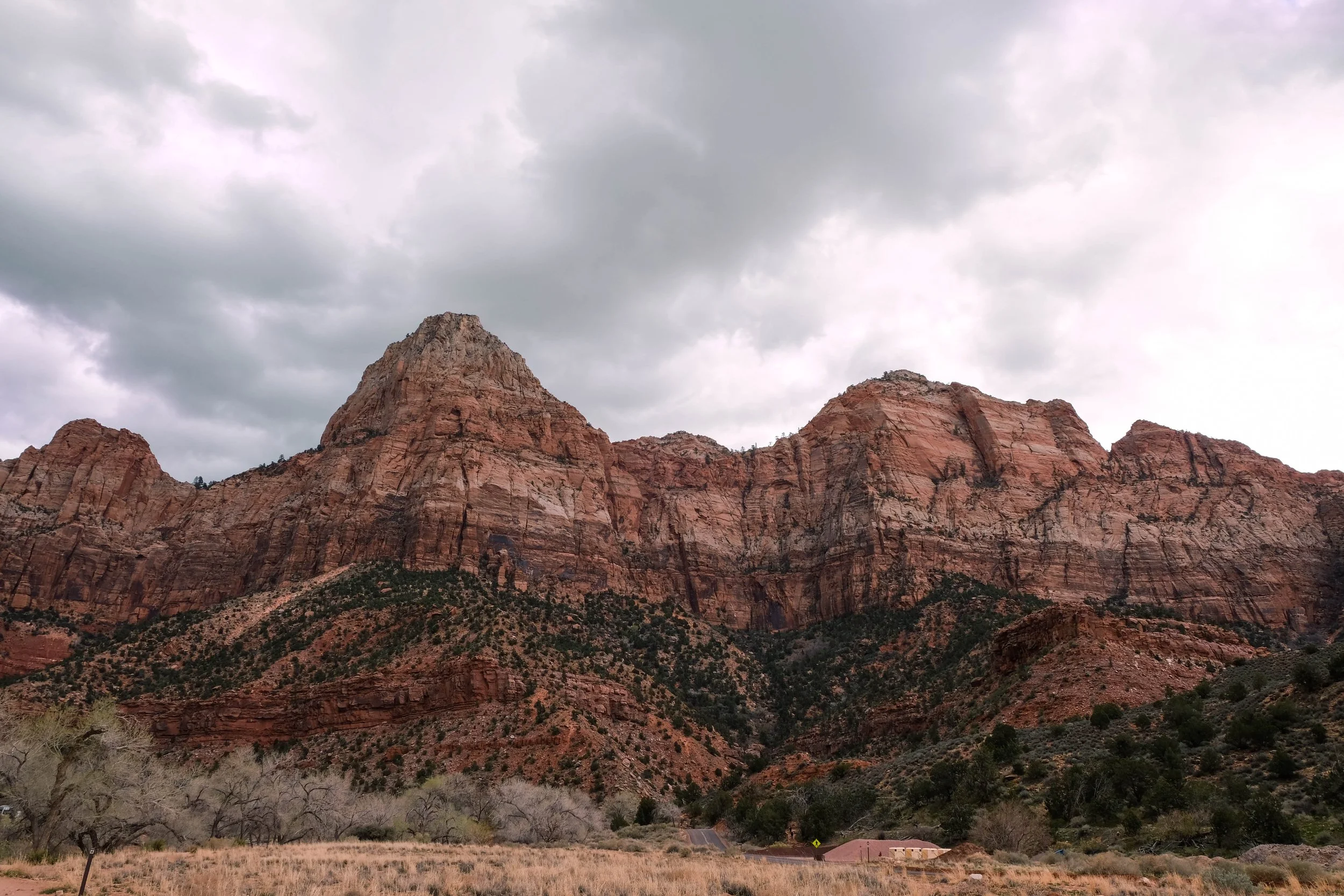
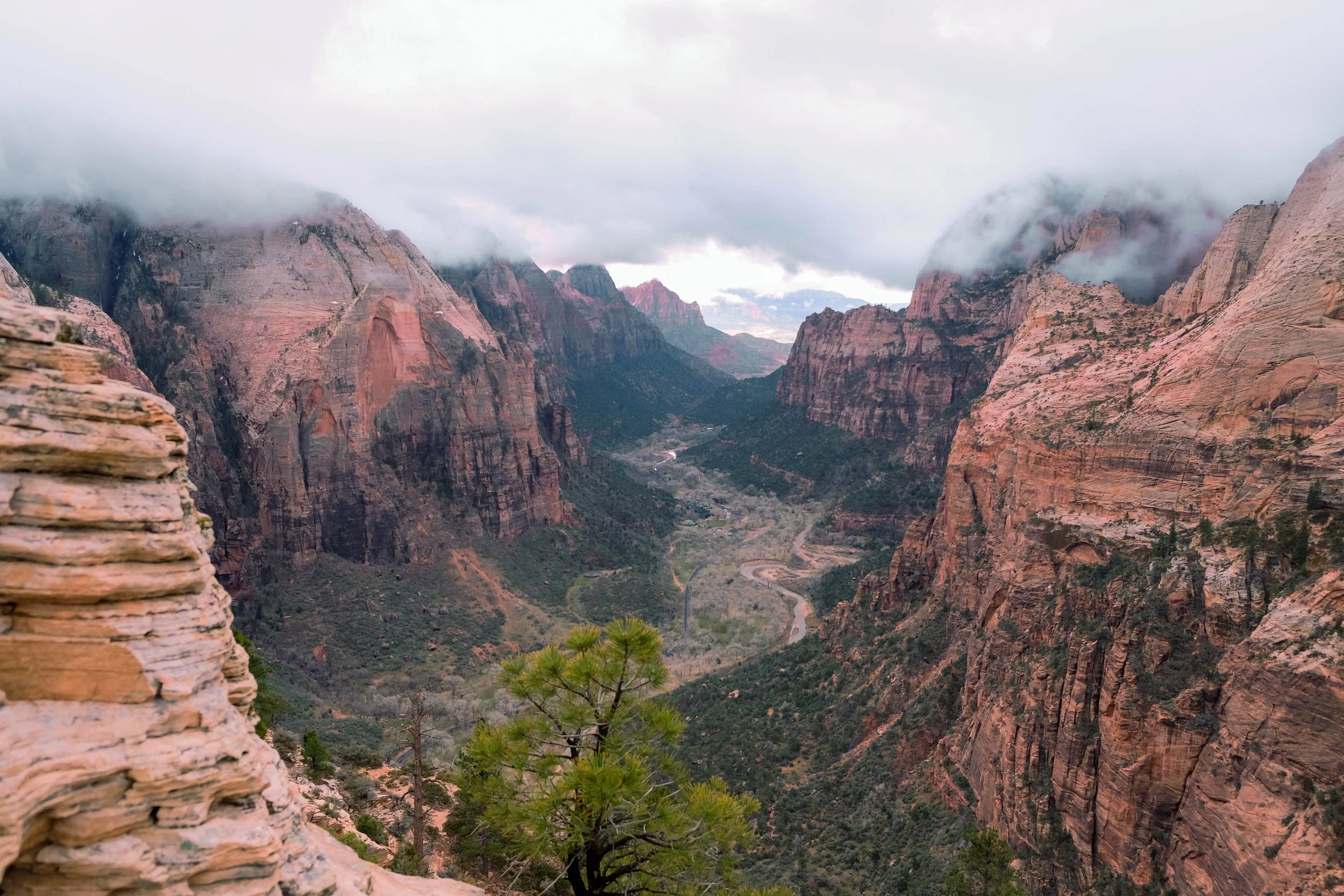
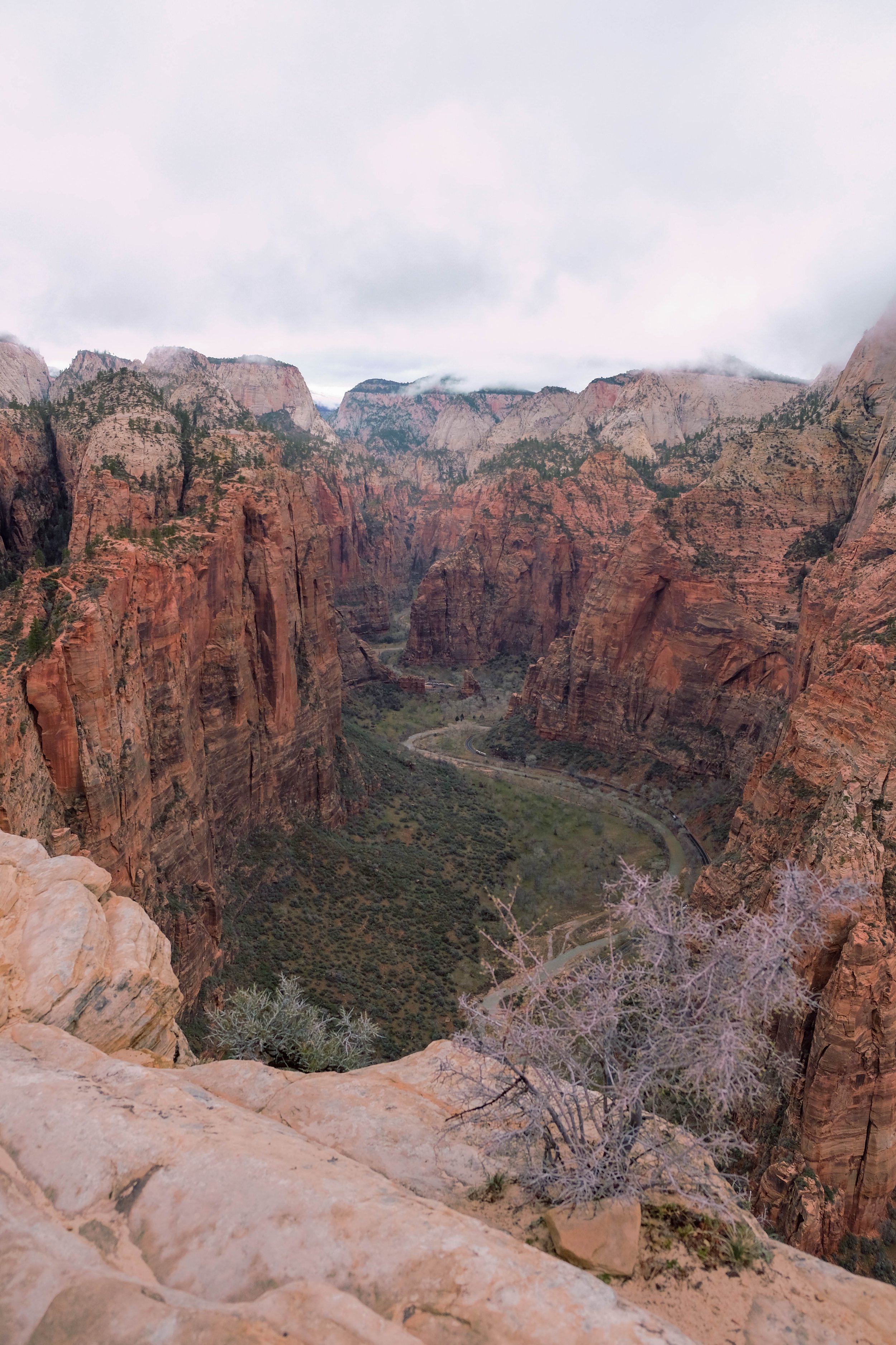
Park 22 | March 2022
Part + Park 1 (of 3) from a spring break trip to Utah.
24 jam-packed hours just weren’t enough for this extraordinary place. Zion is a stunner.
Top things we remember for our time here: The hummingbirds zipping along beside us on Watchman Trail. Climbing up, up, up into the grey morning clouds as we ascended Angel’s Landing while gripping a cold, slippery chain and paying exquisite care to the placement of every step. Quite possibly the world’s best chicken curry made on the camping stove (I borrowed my sister-in-law’s camping stove and planned five days of delicious camping meals as part of my campaign to convince James we also needed to get a stove; all it took was that curry stir fry on the first night and he was sold). And the way the wind blew long and cool and haunting through the canyon.
Zion definitely lives up to the hype.
Pictured below:
Sunset views from Watchman Trail.
Early morning hike up Angel’s Landing.
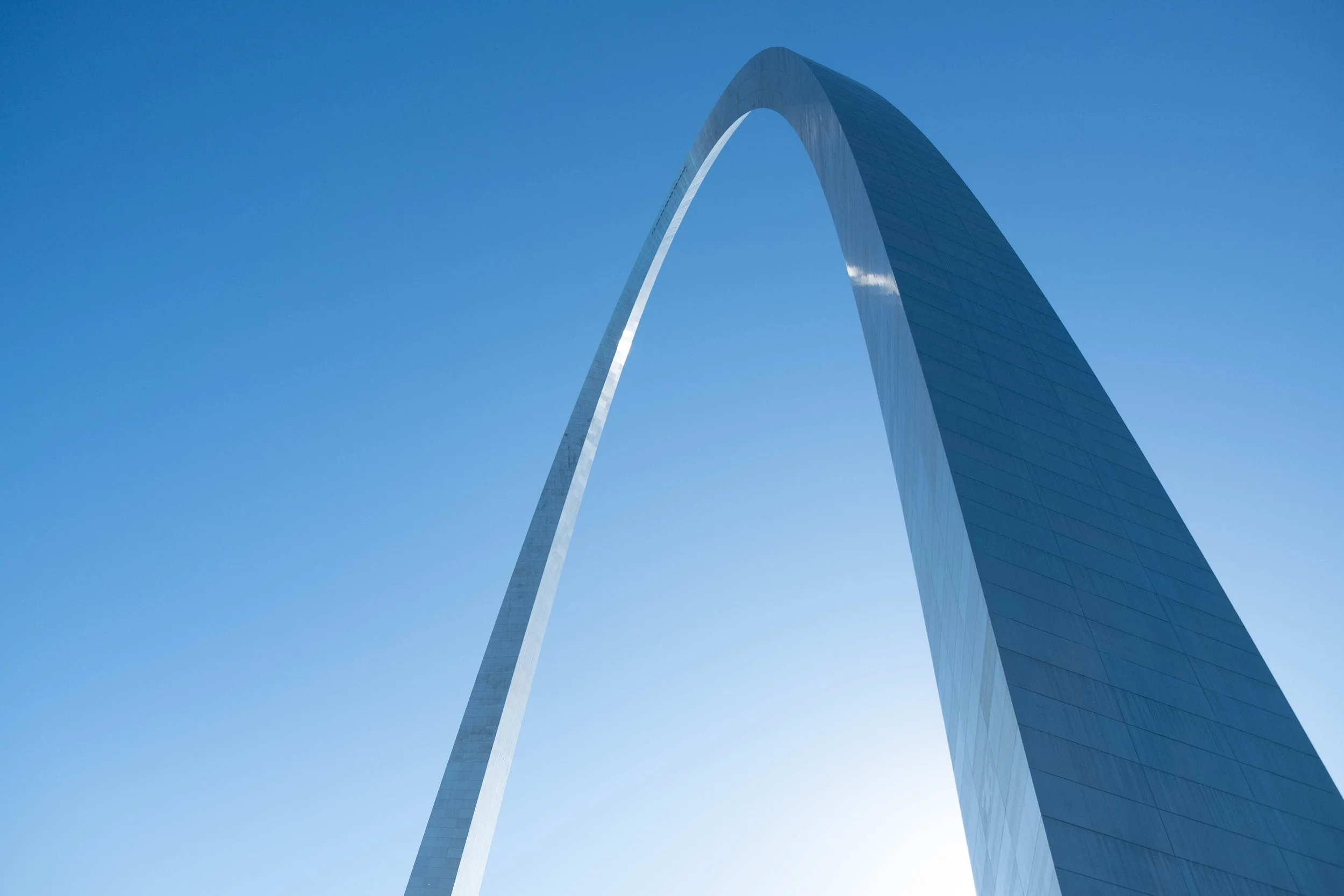
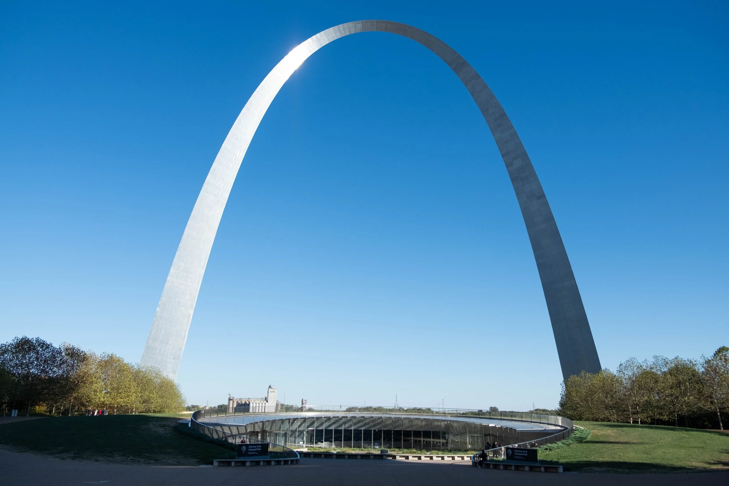
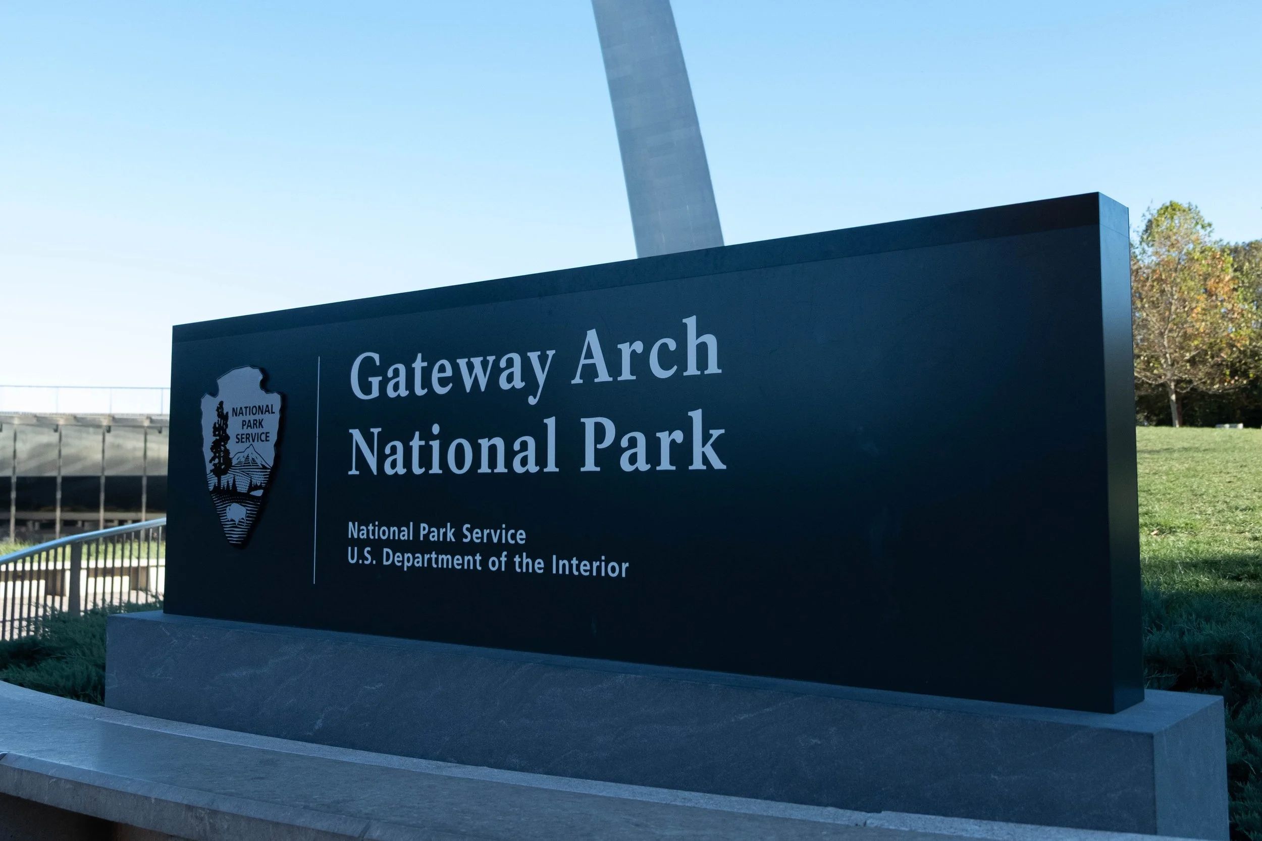
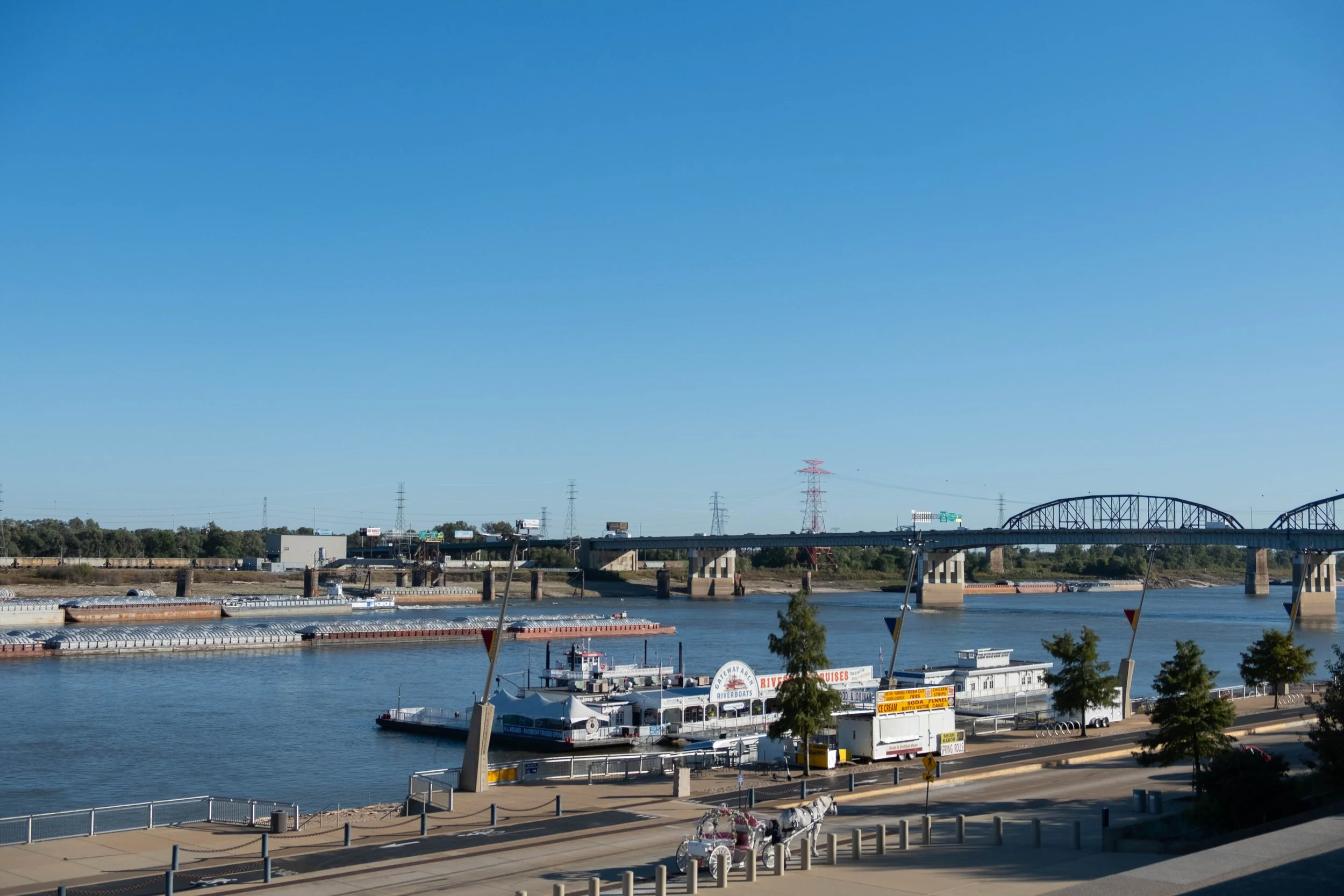
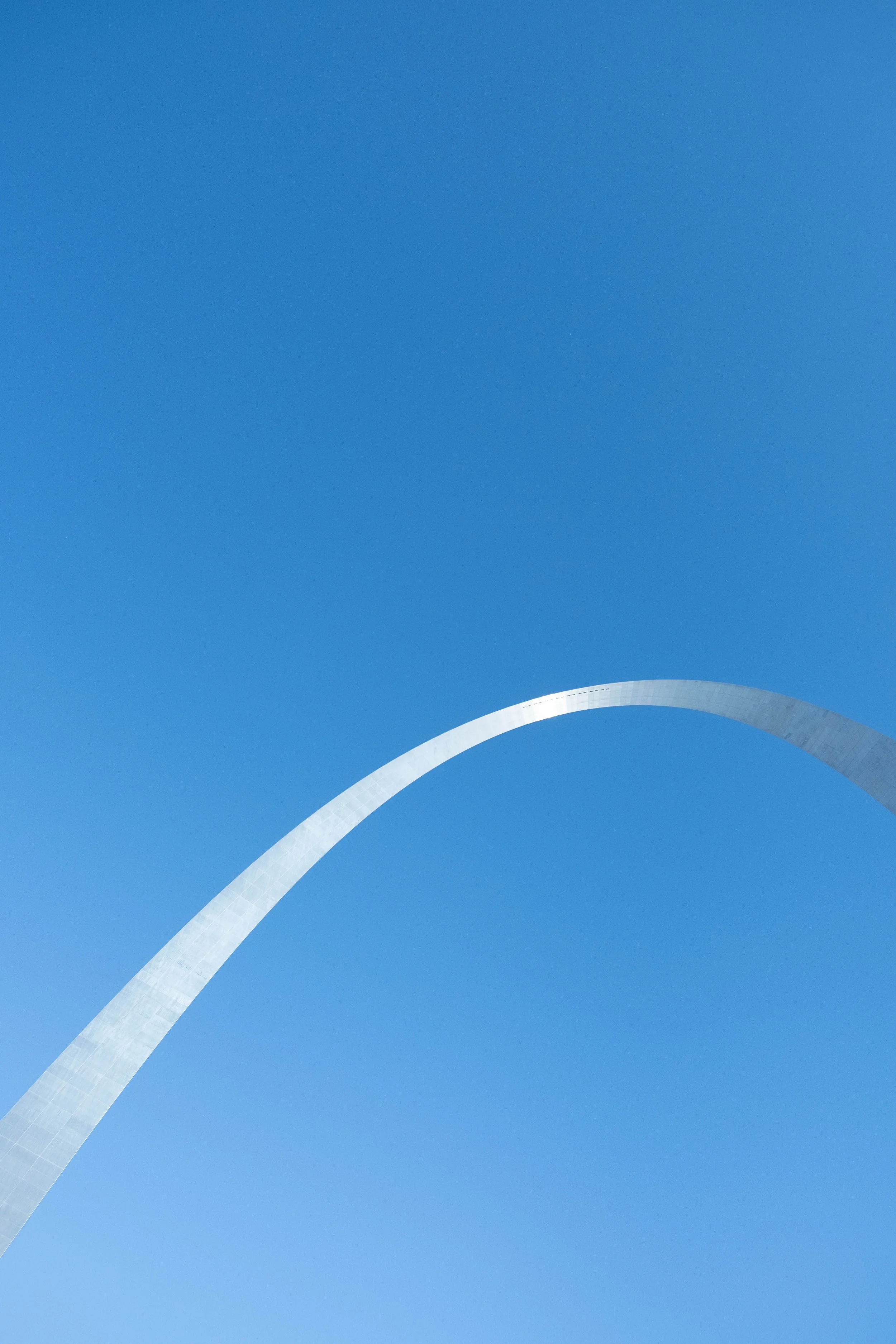
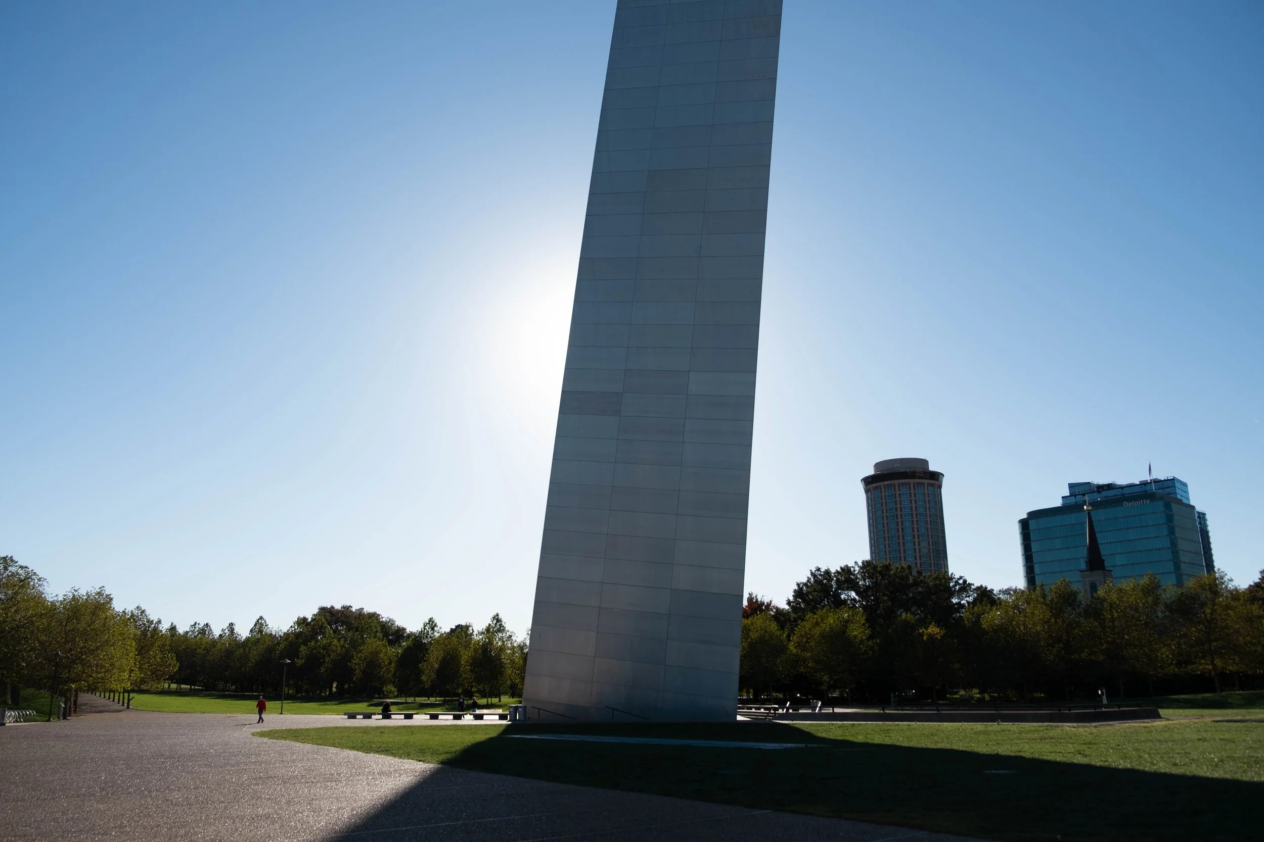
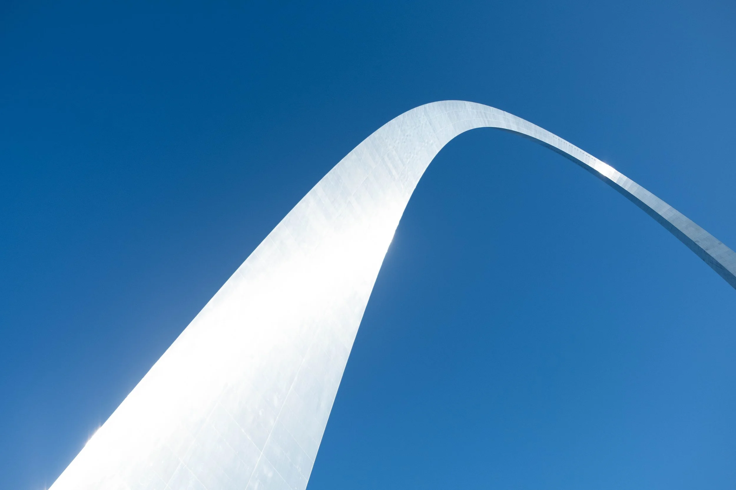
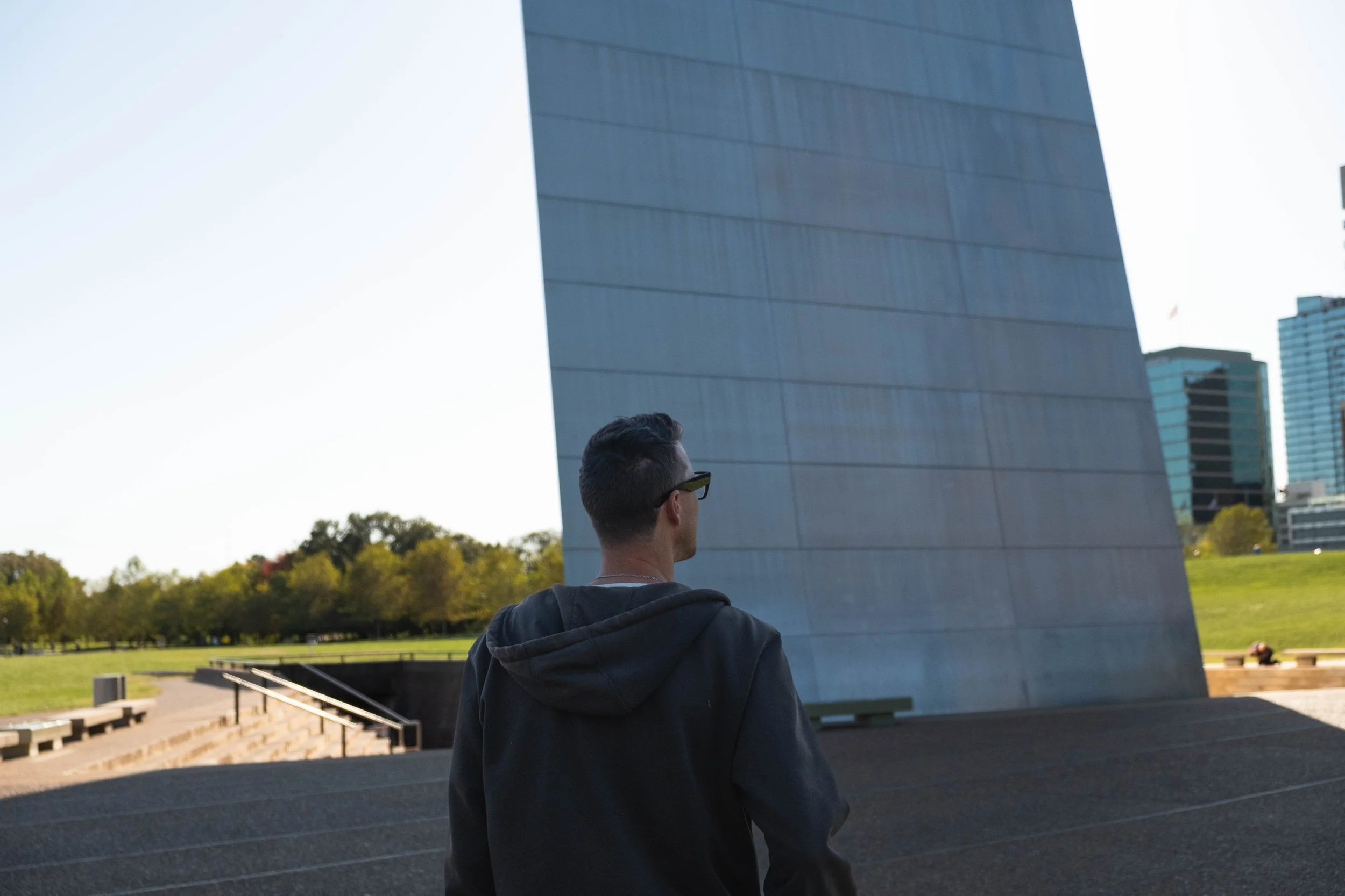
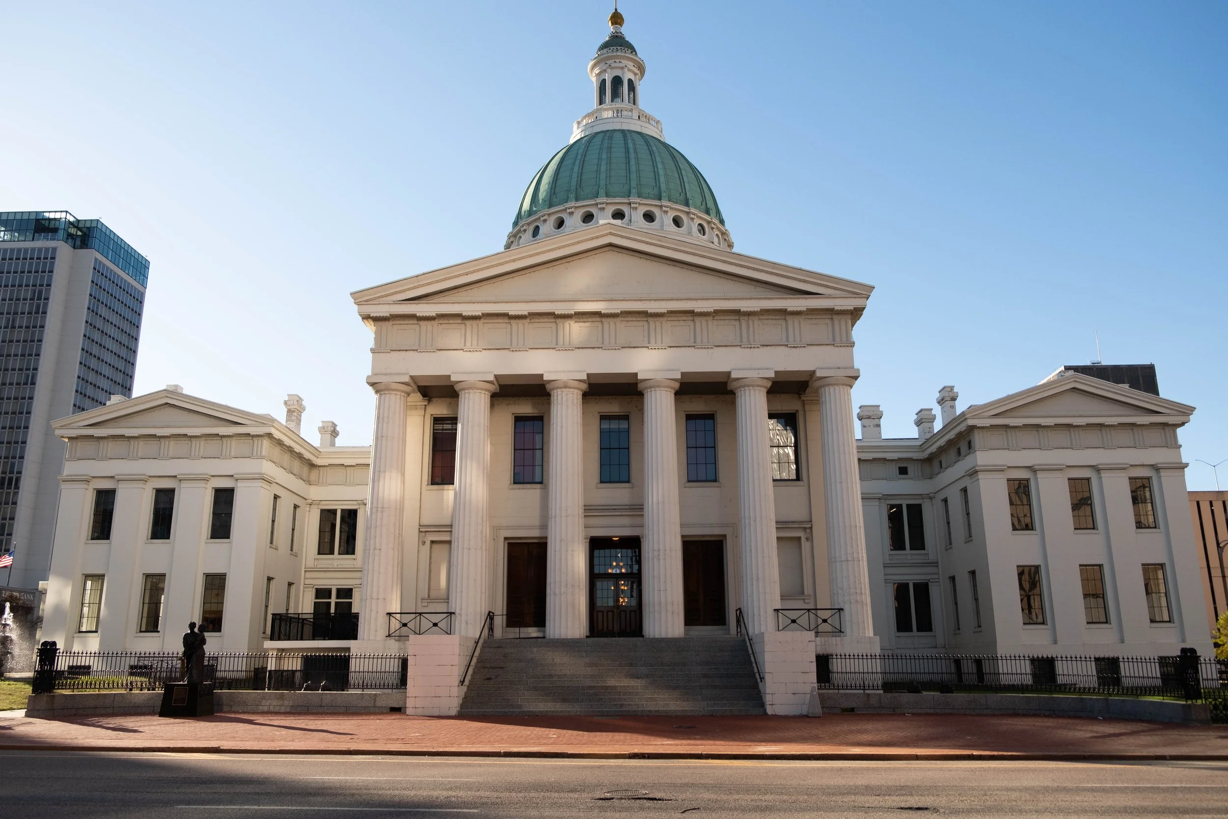
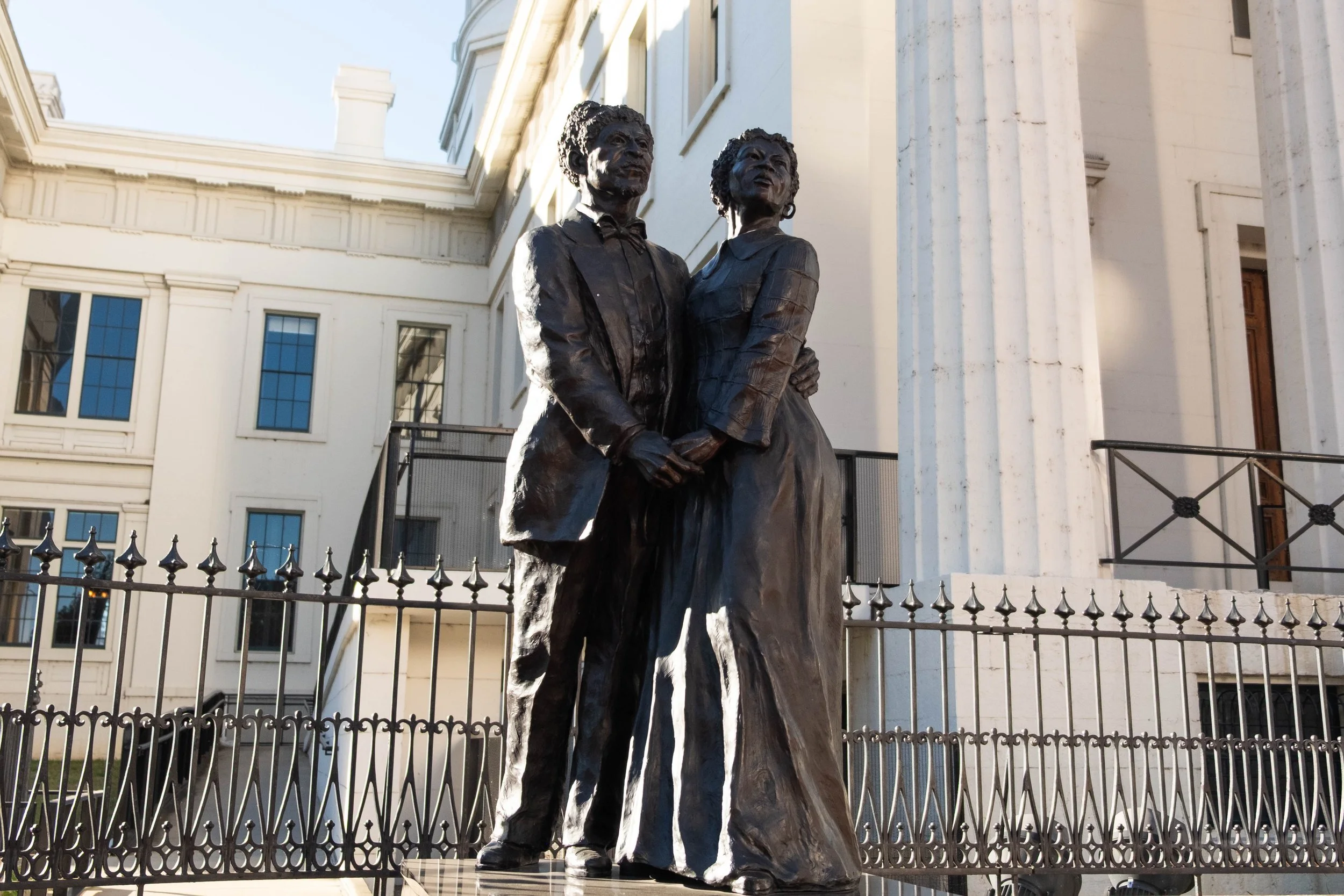
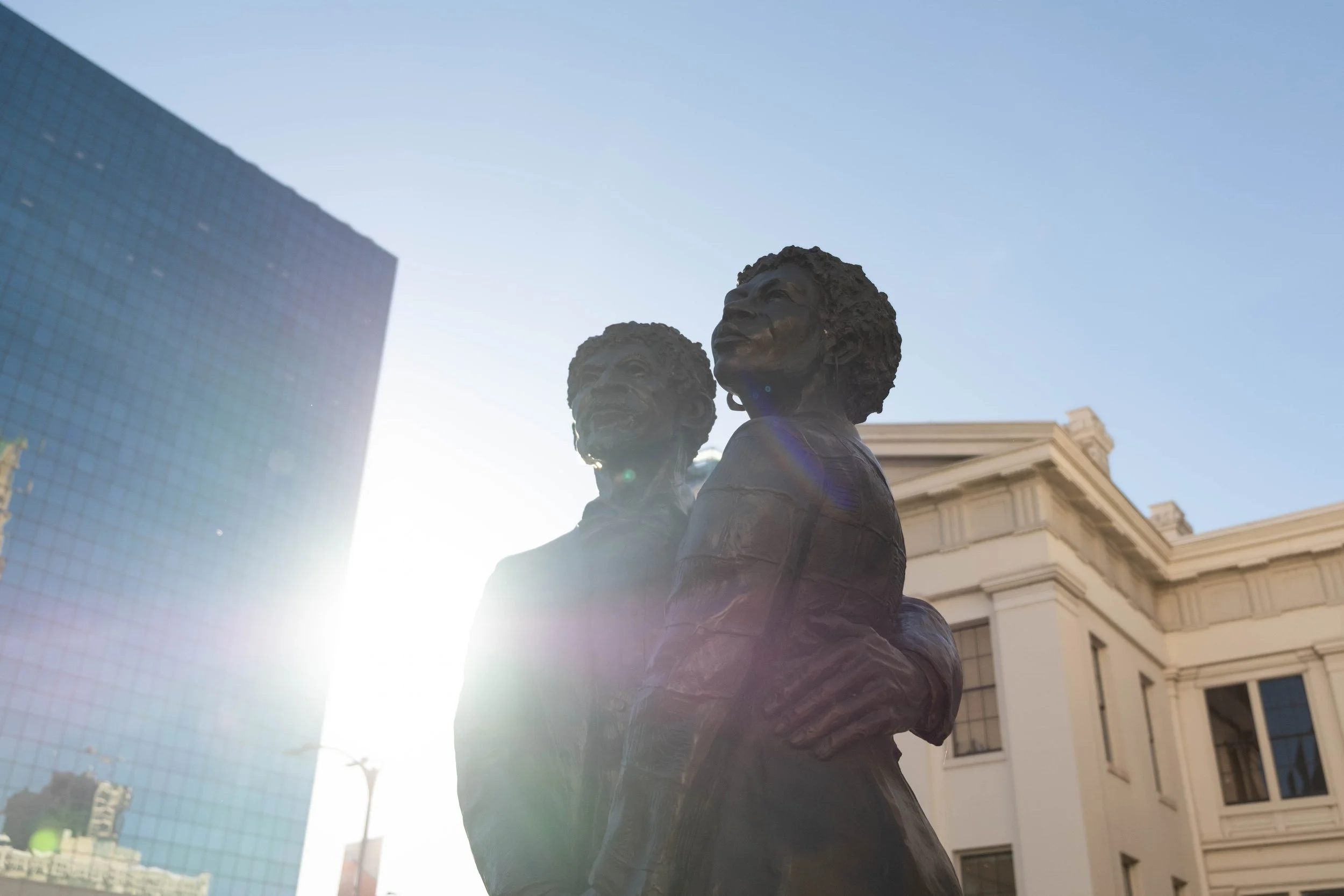
Gateway Arch
Park 21 | May 2021
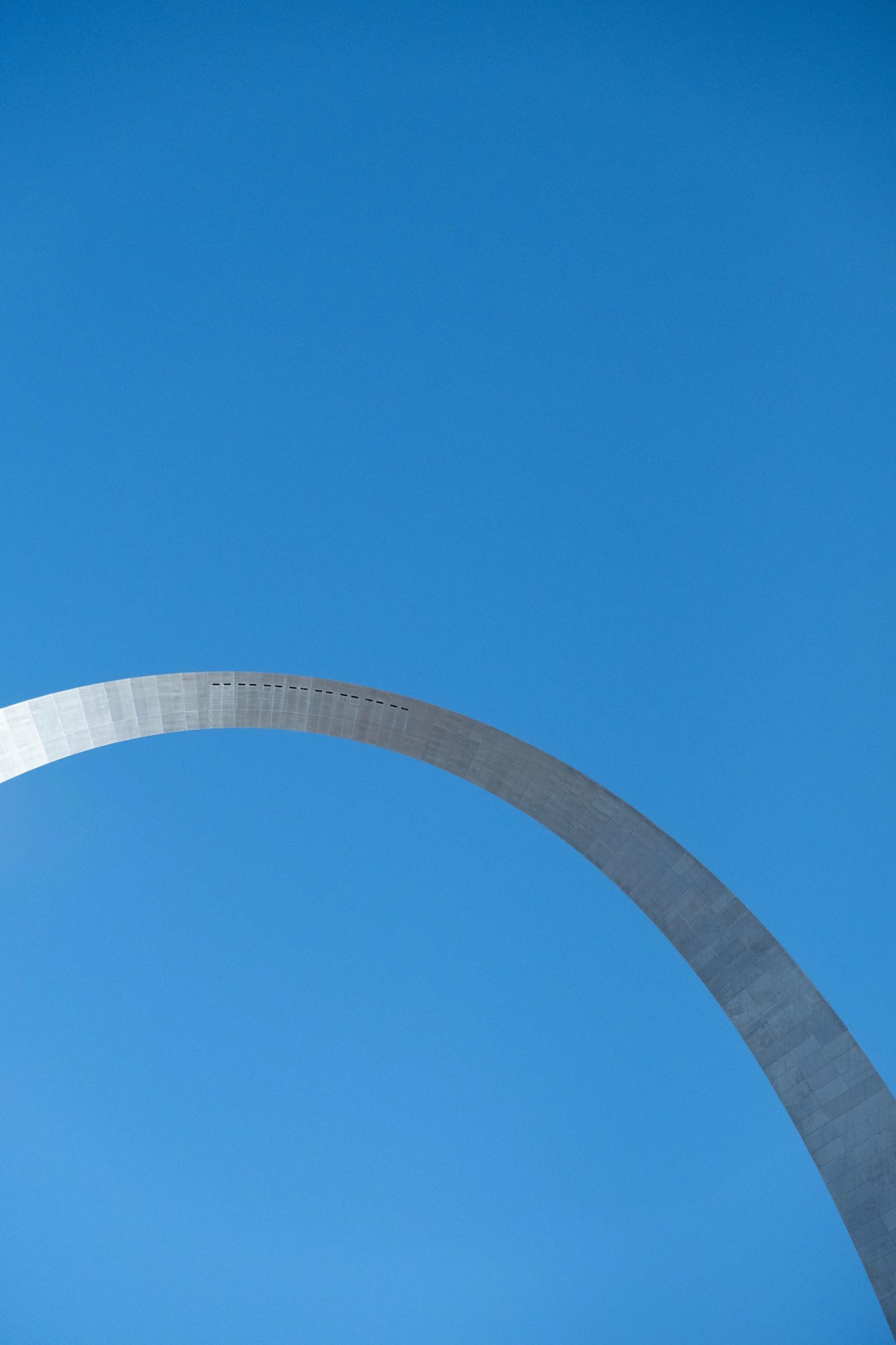
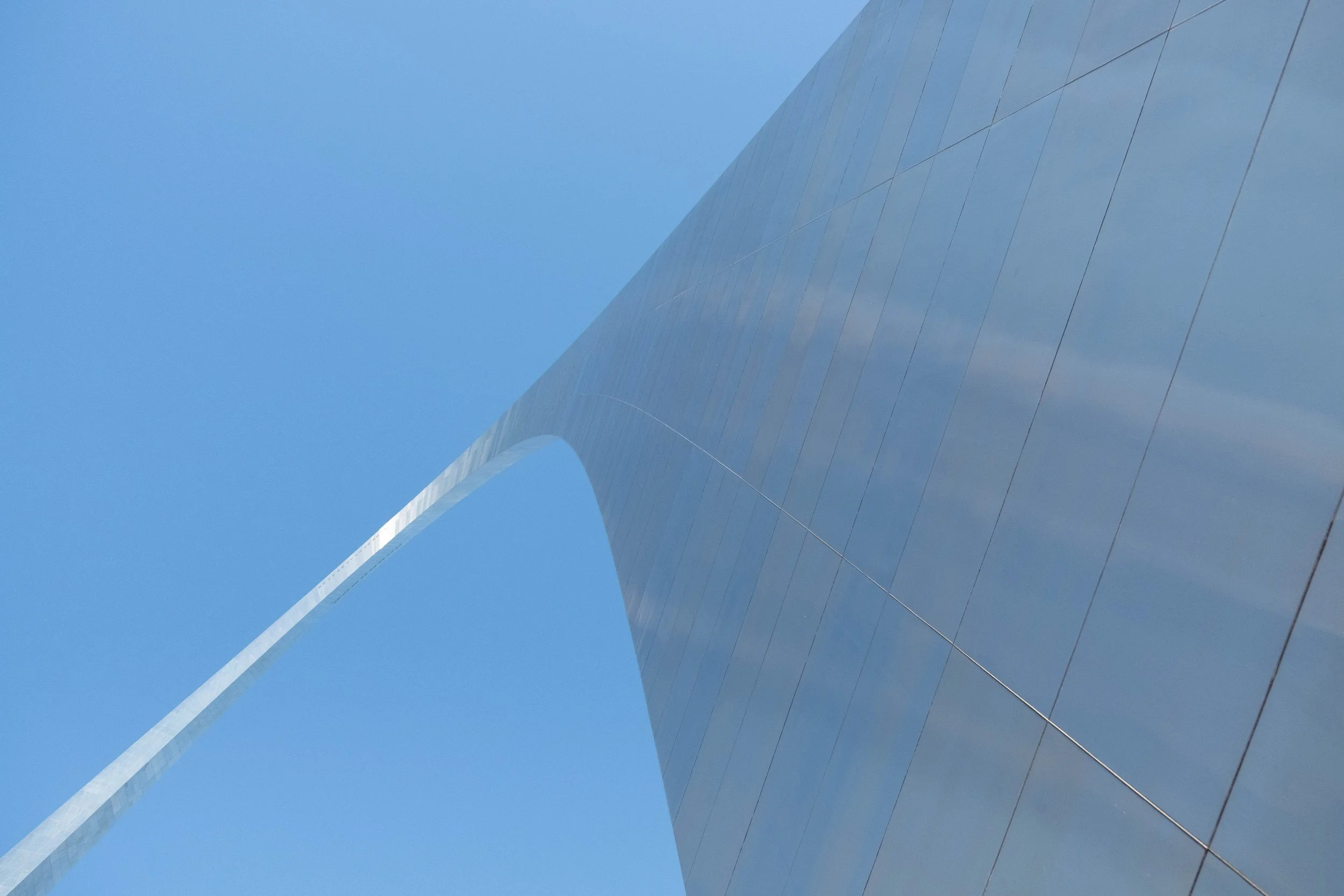
Of all the National Parks we’ve visited, trying to describe Gateway Arch is one of the most frustrating.
As I’ve said in other posts, every park in the National Park Service (NPS) system is on stolen land. Forced removals of Indigenous peoples and subsequent land theft through illegal settlement is the foundational story of the United States of America. This is something J & I strive to hold front and center not only for each National Park we may find ourselves in, but also for the neighborhoods we walk every day and the city and state we call home.
Alongside this history of violence and colonization, we also hold another tension when visiting the parks. These humanmade designations — national parks, monuments, refuges, memorials — are fundamentally rooted in injustice; and they hold the possibility of acting as a layer of protection for natural spaces in our country, shielding them from exploitation via drilling, mining, building infrastructure like roads and cities, and more. (To be clear, as of my writing this in late 2025, we have far too many examples of how this layer of protection is often thin and insufficient. Case study #1: See how we are blatantly ignoring the demands of the Gwich’in and Iñupiat people by opening the Arctic National Wildlife Refuge to oil and gas development.) However, earning a designation within the NPS can be a tool to preserve space for all kinds of diverse life forms in our country and to conserve plants and animals and rivers and other fragile ecosystems.
This is one of the many reasons why we found ourselves deeply frustrated when this steel edifice in St. Louis earned the esteemed status of “national park” in 2018. Not only is this 91-acre plot situated in the middle of a city, with scarce natural resources it can boast of protecting, it is quite literally a monument erected to celebrate westward expansion. “Westward expansion” is an intentionally innocuous phrase, but it is referring to the movement of mostly people of European descent into the American West that led to the very dehumanization, displacement, and killing of Native and Indigenous peoples of the Plains, the Southwest, the Mountain West, and the Pacific Northwest that I reference above. There is actually a section within the visitor center that tries (I’d say rather poorly) to explain the concept of Manifest Destiny in terms that children would understand. I suppose it’s better that the term and concept made it into the visitor center at all, rather than glossing over this reality, but it further highlights the problematic nature of this park to begin with.
As Bryan Stevenson of the Equal Justice Institute has persuasively demostrated for years, memorialization matters and it is critical that we in the US begin and continue to consider how to publicly honor people, events, and spaces deliberately, truthfully, and humbly. To me, Gateway Arch National Park is an example of memorializing a symbolic and literal gateway to extraordinary pain and injustice, particularly for Native and Indigenous peoples. Sanitizing it with romanticized tales of pioneers and the Oregon Trail are nothing but damaging to our country’s collective psyche and represents a setback to a more truthful engagement with the history of this land.
One point of redemption: We appreciated the inclusion of the Old Courthouse in the park. This historic building is where Dred and Harriet Scott filed suit for their freedom in 1846. This eventually led to the infamous Dred Scott decision from the US Supreme Court in 1857, which ruled that Black people could not become citizens of the United States. This decision is viewed as having significant impact in accelerating the country into the Civil War — and establishing enslavement, not states’ rights, as the central issue at hand in that conflict.
I don’t anticipate wanting to return to this park in the future, and I maintain my opposition to its inclusion with the other 62 national parks in the first place. But if nothing else, perhaps bestowing the designation “national park” on this place can stimulate more productive reflection for us all about what is worth memorializing, which stories we center and celebrate, and the myths and narratives that undergird the story of the United States.
Pictured below:
Gateway Arch.
The Mississippi River.
The Old Courthouse, with a statue of Dred and Harriet Scott out front.